Future of Airspace & Airspace Link Coverage

August 11, 2025
Ever looked up and thought, what if we could fly routes the way we drive them? No roads, no traffic. Just a drone, following a clean path through the sky to deliver a package, inspect a substation, or support a rescue team.
Drones are no longer just toys. They’re essential tools in construction, inspection, mining, logistics, public safety, and so much more.
But with more and more commercial drones in the air, the need for an organized, connected airspace has never been more pressing.
Right now, most drone pilots are still using fragmented systems, separate tools for monitoring airspace and mission planning. These disconnected systems tend to slow operations down and often create chaos.
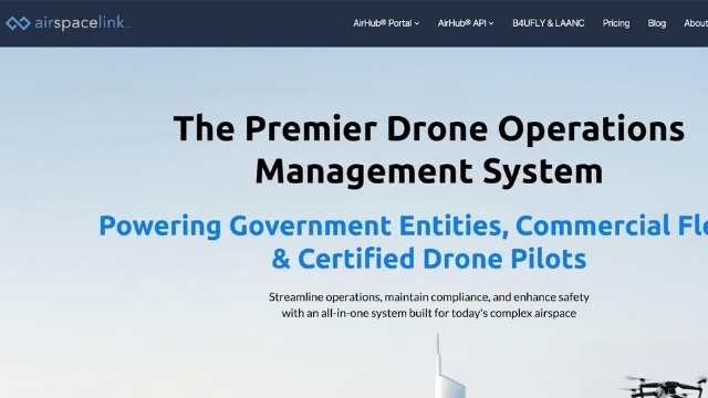
That’s where Airspace Link comes in.
Airspace Link is building a digital pathway to guide drones, air taxis, and autonomous aircraft safely in the sky.
In this article, we’ll look at what that infrastructure looks like, how Airspace Link is building it, and what it means for drone operators.
Let’s get started.
Autonomous drones are advanced, but the systems guiding them are antiquated. From flight planning to real-time coordination, operators are still using fragmented tools that slow down even the simplest missions.
To plan a simple drone flight today, you have to check an LAANC-enabled app, review NOTAMs, and sometimes request waivers or authorizations. This is time-consuming and prone to human error. For commercial or public safety operators managing multiple drones, this is difficult to scale and can quickly become limiting.
Even when all protocols are followed, there is no centralized way to manage airspace in real time.
If a delivery drone needs to reroute because of a nearby police drone, there is no system in place to notify either party. This lack of shared visibility makes coordination between public agencies and commercial pilots impossible at scale.
Airspace Link is building the missing digital infrastructure for drones. The platform connects drone pilots, flight planners, regulatory bodies, and public agencies in one system. This allows for real-time coordination and data sharing.
Instead of using separate tools and manual approvals, Airspace Link offers integrated services that manage airspace rules, flight paths, and situational awareness all in one place. The result is a safer, more predictable environment for drone operators and public stakeholders.
With this kind of infrastructure in place, multiple operators can coordinate drone flights in the same region without conflict.
For example, emergency response drones and commercial delivery drones can fly in the same region with full visibility into each other’s flight paths.
This shared airspace model enables large-scale operations and future growth in sectors like logistics, healthcare delivery, infrastructure inspection, and public safety.
By modernizing how drones access and use airspace, Airspace Link is laying the foundation for a scalable and connected drone ecosystem. And with the recent release of the Part 108 NPRM, this is going to be essentially a requirement for more complex missions. Particularly those that include BVLOS operations.
How Airspace Link Helps
Airspace Link functions like an internet service provider – only for drones. It connects individual drone flights to a broader digital infrastructure that manages compliance, coordinates traffic, and improves airspace safety.
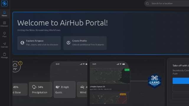
At the center of this system is AirHub, a platform with regulatory tools, live airspace data, and integration capabilities.
Instead of building complex internal systems, drone operators can use AirHub for a faster, safer, and more efficient flight experience.
Here’s how Airspace Link works across three operational layers: compliance, live mission management, and integrations.
Drone operators often spend more time managing regulations than flying. The AirHub Portal changes that by combining all compliance tools into one dashboard.
Instead of jumping between FAA websites, submitting repetitive forms, or manually tracking approvals, users can manage everything in one place. The portal handles flight authorizations, pilot certifications, risk assessments, and regulatory changes in real time.
When you plan a mission, the system checks your proposed flight path, validates it against current restrictions, and confirms your pilot’s credentials. If a regulation changes, your parameters update automatically. If you’re missing a permit, the portal walks you through the application and tracks its status.
Over time, AirHub gets smarter. It learns your flight history, preferred regions, and common workflows, making future planning faster and more efficient.
Once a drone mission is active, the Operations Center becomes your control tower. This dashboard provides live visibility into drone flights, crewed aircraft, weather conditions, and no-fly zones in a single unified interface.
The system displays:
Public agencies and private operators can coordinate in real time. If a medevac helicopter enters the area, the system sends an immediate alert so you can adjust or pause your flight.
This live infrastructure transforms unstructured airspace into a manageable, coordinated system, ultimately reducing risks and delays during complex operations.
Airspace Link’s third layer is the Partner Integration Stack, which connects external tools and services to AirHub.
Through the AirHub Marketplace, drone operators can access pre-integrated services tailored to specific locations. It functions like an app store for drone workflows. Once added, partner tools sync with your dashboard and handle billing, contracts, and data flow automatically.
The API Stack simplifies development. Partners only need to build an integration once to connect with the entire Airspace Link network. This removes the need for custom work each time a new service is introduced.
For hardware manufacturers, software providers, and drone service companies, this shared infrastructure supports collaboration without technical complexity. Each company can focus on its strengths while delivering seamless user experiences to customers.
As drone operations move into infrastructure inspection, emergency response, and delivery, data security becomes key. Airspace Link gets this and has security protocols throughout the platform. All data, including real-time video feeds, telemetry, and pilot credentials, is encrypted in transit and at rest to prevent unauthorized access.
The system is enterprise-grade and compliant with industry standards, SOC 2 Type II and ISO 27001, where applicable. Role-based access controls, audit trails, and strict authentication protocols allow agencies and operators to control who can access mission data.
Public agencies can define their own data sharing policies within the AirHub platform so sensitive information is only retained as needed and never shared with third parties without consent. Continuous system monitoring and timely patching reduce vulnerabilities and help protect against emerging threats.
By building compliance and security into every layer of the infrastructure, Airspace Link provides a trusted foundation for cities, operators, and developers. So they can scale drone operations with confidence, without compromising data integrity, privacy, or regulatory requirements.
Airspace Link-Data Infrastructure Layer
Every mission starts with one thing: data. Before you take off, you need to know where you can fly, what altitude is allowed, and what airspace rules apply.
Today, that means checking a patchwork of systems, including LAANC, NOTAMs, B4UFLY, UAS Facility Maps, and city-specific restrictions that may not even be published online.
Airspace Link brings all of that together into one data layer that simplifies pre-flight planning and supports real-time decision making.
The platform combines FAA-approved sources like LAANC, NOTAMs, and B4UFLY with local restrictions from state and municipal governments.
It layers in live ADS-B aircraft data, weather feeds, obstacle databases, and dynamic geofences to give you complete situational awareness in one place.
No more switching between multiple systems and no more chance of error or non-compliance.
Airspace Link predicts conflicts and congestion before they happen. The system models airspace use and highlights areas of overlap so you can adjust your flight path proactively.
This is especially useful for multi-drone operations or shared airspace with manned aircraft.
With automated alerts and built-in rulesets, the platform supports regulatory compliance throughout the planning process. If a proposed flight enters restricted airspace or exceeds altitude limits, the system flags it and offers options such as alternate routes or permit workflows.
By turning scattered data into one single source of truth, Airspace Link removes complexity from the flight planning process. It gives both private operators and public agencies a smarter way to manage the skies.
How Airspace Link Enables BVLOS Drone Operations
Most drone operations in the U.S. are limited to Visual Line of Sight or VLOS. This means the pilot must always keep the drone within view. While it’s a safety requirement, it severely limits what drones can do.
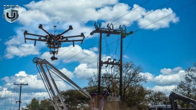
Whether you want to inspect 20 miles of power lines, deliver emergency supplies across a city, or run a search and rescue operation in a challenging environment, none of it is possible if you’re limited to VLOS.
To gain access to these capabilities, operators need Beyond Visual Line of Sight (BVLOS). With BVLOS, drones can fly autonomously for longer durations and cover more areas.
To run safe BVLOS flights, you need more than just FAA waivers. You need infrastructure.
This is where Airspace Link makes the difference.
Airspace Link makes BVLOS operations practical and scalable by creating a digital airspace apt for safe missions.
Their platform combines FAA data with live drone telemetry, weather, NOTAMs, and local geofences. Its Uncrewed Traffic Management(UTM) tools provide real-time conflict detection and separation of overlapping routes, even in crowded and fast-changing environments.
Instead of proving safety for every flight, you can use the automated network to show that your flights are coordinated, monitored in real-time, and operating within safety parameters.
As a result, adding new routes, new aircraft, or new operational corridors becomes simple.
The platform can automatically adjust your flight plans in response to weather changes or temporary restrictions. In emergencies, it prioritizes medical or government operations in real time, without any human input.
For drone operators, the system offers a unique advantage where they can provide drone services that their customers want.
Airspace Link proved this with BVLOS pilot programs in cities like Detroit. It coordinated with local agencies, the FAA, and drone operators to test safe, BVLOS corridor-based missions over real neighborhoods.
Airspace Link is not just a concept or a future roadmap. Several cities across the U.S. are already using Airspace Link to plan and monitor scalable drone operations.
Each city shows how digital airspace tools support different needs, from public safety and delivery to smarter flight approvals.
Detroit served as the first major test city for Airspace Link’s corridor-based BVLOS operations. Working with local agencies and the FAA, it supported long-range flights over populated neighborhoods. This proves that cities can host scalable drone infrastructure without affecting public safety or airspace integrity.
Las Vegas launched the FLYSAFE program using Airspace Link to build a dynamic airspace planning system. City officials can now upload local zoning laws, event restrictions, and no-fly zones directly into the AirHub Portal.
This helps them control when and where drones can operate. This approach opens the door to new drone opportunities like emergency response, infrastructure inspection, and event monitoring.
Airspace Link partnered with the City of Ontario to help design the safest and efficient drone delivery routes.
Local agencies can now define safe zones, track drone activities in real-time, and respond faster during emergencies. This collaboration highlights how public safety teams can integrate drone operations without adding more manual work.
Together, these cities show that the vision of a connected airspace is real, and it’s the local governments that make it possible.
North Dakota is yet another leader in BVLOS drone operations. Airspace Link supports the state’s efforts by integrating its tools into North Dakota’s statewide UAS network known as Vantis. Thanks to this, North Dakota can now coordinate long-distance drone flights across rural and urban areas. These missions include infrastructure monitoring, emergency response, and environmental surveys.
Airspace Link is not only improving how drones operate today, but it’s actively shaping the future of low-altitude airspace. It proves that drone operations can be managed more efficiently in shared environments.
By connecting pilots, planners, and public agencies through one digital ecosystem, it proves that large-scale drone operations can run smoothly, even in busy urban skies.
And this is just the beginning.
As urban air mobility expands, Airspace Link lays the groundwork for a world where drones, air taxis, and autonomous aircraft move safely through the shared skyways.
Cities can now manage air traffic just like roads, and adjust for real-time events. They can coordinate everything from emergency flights to package deliveries with a few clicks.
This is the future of airspace: connected, automated, and built to scale.
Want to fly confidently in this ever-changing airspace?
Join Drone U for hands-on training in airspace awareness, BVLOS readiness, and real-world flight planning.
