What LiDAR Systems Are NDAA Compliant?
September 19, 2025
Imagine this: you just spent $55,000 on a top-of-the-line LiDAR system. You’ve mounted, calibrated, and prepped your sensor for flight. Then the news hits, your sensor isn’t NDAA compliant.
Suddenly, you lose access to federal contracts. Even worse, state and local jobs tied to federal funding are off-limits, too.
That expensive gear? It may not qualify for half the work you’re planning to do.
This isn’t a hypothetical. By 2026, it could be a reality for a lot of drone pilots and LiDAR surveying teams.
The National Defense Authorization Act (NDAA) outlines what technology federal agencies can legally purchase or work with.
And with Section 164 of the 2024 NDAA, those rules just tightened, especially for LiDAR.
Systems built with components from certain foreign countries are now banned from Department of Defense (DoD) projects. But this change goes far beyond military contracts.
Many civilian infrastructure projects (bridges, roads, utilities) rely on DoD or other federal funding sources. If your sensor isn’t on the approved list, you’re out of the running.
That’s why NDAA compliance matters more than ever.
In this article, we’ll explain what NDAA compliance actually means. You’ll see why it affects more than just defense contractors.
We’ll also cover which LiDAR systems meet the current standards and which ones don’t.
Most importantly, you’ll learn how to protect your investment as the rules continue to evolve.
Before we dive into specific LiDAR systems, let’s understand what NDAA compliance actually means.
NDAA stands for the National Defense Authorization Act. It’s a U.S. law that sets the budget and policies for the Department of Defense every year. However, it also includes rules governing the types of technology that federal agencies can purchase and utilize.
In recent years, the NDAA has placed strict restrictions on equipment that includes components from certain foreign countries, mainly China.
To be NDAA-compliant, a LiDAR system must not contain any banned parts or subcomponents from those restricted countries. That applies to everything: the sensor, the camera, the GPS module, and even the internal chips.
The focus isn’t just on where the system is assembled. It’s on where each component is manufactured. Even if your LiDAR unit is built in the U.S. or Europe, using parts from restricted suppliers can make it non-compliant.
The goal of the NDAA is to eliminate cybersecurity risks tied to foreign-made tech. So compliance is mostly about supply chain transparency and national security.
Federal procurement agencies strictly enforce these compliance rules. Manufacturers must provide documentation showing that their systems are fully NDAA-compliant.
Without this certification, federal agencies won’t approve the product for use on funded projects.
So when someone says a LiDAR system is “NDAA compliant,” they mean it’s been verified to meet these sourcing and security requirements.
Now, let’s understand what actually changed.
Until recently, the NDAA mostly focused on broad categories of banned tech—things like Chinese-made drones, telecom equipment, and surveillance hardware. But in 2024, Congress passed Section 164 as part of the updated NDAA. And this time, regulators targeted LiDAR systems directly.
This is a big shift.
LiDAR is now seen as a potential security threat. It’s grouped with other sensitive tech that could be used for surveillance or data collection. That puts it under much tighter restrictions.
Starting June 30, 2026, the Department of Defense and other federal agencies cannot use any LiDAR system that:
And it’s not just about the complete system. Even individual parts matter. If your LiDAR uses a GPS board, chip, or firmware from a restricted country, it won’t be compliant.
To make things crystal clear, Congress didn’t leave it vague. They named companies directly. At the top of that list is Hesai Technology.
Section 164 expressly prohibits LiDAR developed by Hesai Technology, headquartered in Shanghai, China, a leading manufacturer of LiDAR sensors that are used in both commercial self-driving cars and Chinese autonomous warfare systems.
Hesai is one of the most popular LiDAR manufacturers worldwide. Many drone service providers use sensors like the XT32 because they’re affordable and reliable. But starting in 2026, any LiDAR using Hesai hardware will be banned from DoD-related projects.
Is there a way around it? Technically, yes.
There is a waiver process for special situations. The Secretary of Defense can grant a waiver to certain institutions. But to do that, they must certify to Congress that the waiver is in the national interest of the United States.
In reality, the process is slow and uncertain.
Watch this video to learn more about NDAA-compliant LiDAR systems:
What LiDAR systems are NDAA-compliant?
With this, let’s explore the available LiDAR options.
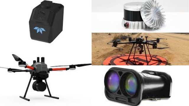
Top NDAA-Compliant LiDAR Systems
Choosing a LiDAR system isn’t just about range, resolution, or price anymore. It’s about compliance.
Here are some top NDAA-compliant LiDAR options, and why they cut:
Ouster’s OS series is a popular digital LiDAR solution for mapping and infrastructure inspection. These sensors are listed on the Blue UAS Framework, making them pre-approved for DoD and government-related contracts.
These sensors offer sharp, high-resolution point clouds and perform well in harsh environments.
A good all-around choice for mapping and inspection flights.
LightWare provides lightweight LiDAR sensors that integrate easily with small UAVs. Their LW20/C and SF20/C models are NDAA-compliant and ideal for obstacle avoidance, compact mapping missions, or smaller drone platforms.
These sensors are particularly attractive to pilots who want an affordable, low-weight LiDAR solution without compromising on security requirements.
The LIBERTY 64 is a full LiDAR scanning system. It’s NDAA-compliant when paired with a U.S.-made drone. It is well-suited for survey-grade missions where accuracy and end-to-end compliance matter.
The EchoONE is a lightweight UAV LiDAR system built with security in mind. Its combination of precision, compact size, and secure supply chain makes it a popular option for mapping operations.
Microdrones NEW EasyOneLiDAR NDAA offers complete, ready-to-fly NDAA-compliant packages, including drone, LiDAR sensor, GNSS/IMU, and datalink. These turnkey solutions are perfect for teams that want to avoid the hassle of sourcing and integrating separate components.
Perfect if you want to skip the hassle of integrating different parts.
Here’s how to properly verify that your LiDAR system meets NDAA standards before it costs you a project.
Start by checking if your LiDAR system is listed under the Blue UAS Framework or included in the DIU (Defense Innovation Unit) cleared components. These lists are curated by the U.S. Department of Defense and represent the most reliable source of NDAA-vetted hardware.
Reputable vendors provide a formal statement confirming NDAA compliance. This should include:
NDAA compliance isn’t just about the final sensor. It also covers where the components come from.
Some compliant manufacturers are already providing this by default.
Compliance also includes data protection and system integrity. Verify that your LiDAR system supports:
If the system lacks these features, it may pass today but fail a future audit.
Even a compliant system can become non-compliant if you update it using untrusted networks. Ask:
This protects you against future disqualification due to hidden changes.
When bidding for federal contracts, you’ll need to provide proof of compliance. Set up a dedicated folder and save:
You may need this documentation when bidding on DoD or federally funded projects.
This file could make or break your eligibility in a competitive bid.
NDAA compliance is your responsibility, not the vendor’s. So, do the work now, document everything, and you’ll avoid expensive problems down the line.
Made it this far?
Understanding NDAA compliance is just the beginning.
Take your drone skills to the next level with our specialized drone training. Explore our drone courses here.
If you’re now searching for the best LiDAR drones, be sure to check out this article: Best LiDAR Drones for Surveying & Mapping.

