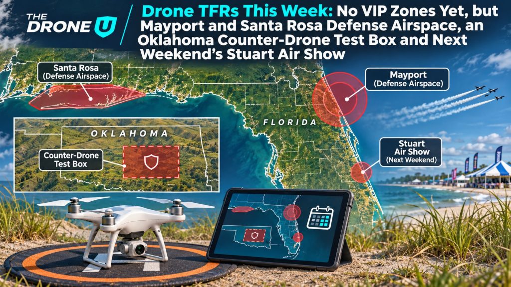
The FAA’s temporary flight restriction list is quieter than it has been in weeks. As of early Monday, November 9, no VIP TFRs are posted for this week. Defense airspace closures cover Florida’s Panhandle and Jacksonville coast, Oklahoma has a counter-drone test box, a cluster of hazard TFRs covers Mississippi, and fires out West have their own restrictions. Drone-only rings are also already posted for next weekend in Orlando and Raleigh.
Here is what we pulled from the FAA’s TFR list and NOTAM detail files at about [5:15] AM Mountain time. Times are local unless noted. Check again before every flight, because the FAA posts new TFRs, especially VIP ones, on short notice.
National defense airspace in Florida and Hawaii
- Mayport, Florida (FDC 6/6299): A layered “national defense airspace” TFR around Naval Station Mayport and the nearby coast is active daily from 8 AM to 2 AM EST, Monday, November 9 through early Wednesday, November 11. The inner piece starts at the surface and runs to 2,500 feet MSL, so it covers every altitude a Part 107 pilot can fly. Under the NOTAM, pilots who don’t comply can be intercepted, detained and interviewed.
- Santa Rosa Island, Florida (FDC 6/5999): This replacement for an earlier Eglin-area NOTAM covers two areas from the surface to FL250. The windows are 5 to [10:30] AM CST today and 7 AM to [12:20] PM CST Tuesday.
- Kaneohe, Hawaii (FDC 6/6282): An area off windward Oahu is closed from the surface to 17,999 feet MSL from 1 to 7 PM HST today.
A counter-drone test box in Oklahoma
Near Atoka, Oklahoma, FDC 6/6253 sets a 2 NM radius from the surface to 4,000 feet AGL for counter-UAS testing run by the Department of Homeland Security. It is active daily from [7:30] AM to [5:30] PM CST through Sunday, November 15. Only aircraft working under DHS direction are allowed inside. Keep in mind that a counter-drone test site is the last place you want your aircraft to turn up as an unexpected target.
Hazard and fire TFRs
- Mississippi (FDC 6/6502 through 6/6507): Six small hazard TFRs, each 1 to 2 NM wide and topping out at 1,200 or 1,800 feet, are spread near Hillsboro/G.V. Montgomery, Louisville and Oxford. All of them are coordinated by the Mississippi Interagency Coordination Center. Most run from 8 AM to 8 PM CST today. Their listed end time is 0200Z Tuesday, which works out to 8 PM CST Monday.
- Foot Creek Fire, west of Buffalo, Wyoming (FDC 6/6323): A 4 NM fire TFR from the surface to 9,500 feet is active daily from 8 AM to 7 PM MST through November 20.
- California: An incident TFR west of Redding (FDC 6/6327, surface to 3,000 feet) runs through Tuesday evening. A 1 NM CAL FIRE TFR northeast of Santa Maria (FDC 6/6524) is in effect today.
- Still on the board: The Pagosa Springs, Colorado flood-response TFR (6/5538) runs through Tuesday, the New Hampshire fire TFR southeast of Berlin (6/5156) through Wednesday, and the hazard area northeast of Fountain, Florida (6/5052) is listed for today.
Already posted for next weekend
- Stuart Air Show, Florida (FDC 6/6283): No flying within 5 NM from the surface to 15,000 feet MSL. Hours are 11 AM to 8 PM EST Friday, November 13, then 11 AM to [5:30] PM EST Saturday and Sunday.
- Raleigh, North Carolina (FDC 6/6536): A drone-only ring of 0.8 NM, surface to 400 feet AGL, is set for the NC State vs. Syracuse tailgate from 7 to 11 AM EST Saturday, November 14.
- Orlando, Florida (FDC 6/6537): A drone-only ring of 0.5 NM, surface to 400 feet AGL, covers the Vans Warped Tour from 11 AM EST Saturday, November 14 through [11:59] PM EST Sunday.
What this means for drone pilots
A week without VIP TFRs is a good week for paid work, but the restrictions that are up can cost you just as much if you ignore them. Defense airspace TFRs under 14 CFR 99.7 carry the harshest penalties, including interception, certificate action and possible criminal charges. Hazard and fire TFRs exist because crewed aircraft fly low inside them. Before every flight, check the FAA TFR map, your LAANC app and B4UFLY, and recheck on the morning of the job.
Reading NOTAMs, converting Zulu time and understanding special-use airspace are all on the Part 107 knowledge test. If you’re getting certified, Drone U’s Part 107 test prep course covers those topics, and students have been known to finish the online course in 3 days and pass the test.
Sources: FAA TFR list and NOTAM detail pages for 6/6299, 6/5999, 6/6282, 6/6253, 6/6323, 6/6283, 6/6536 and 6/6537.
 0