
Best Drone LiDAR: Why the DJI Zenmuse L3 Wins

October 5, 2026
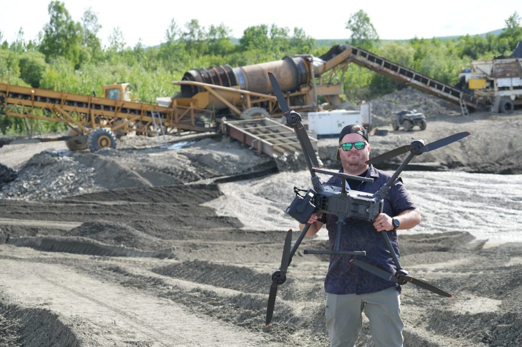
If you’re shopping for the best drone lidar in 2026, start with the DJI Zenmuse L3. For most commercial mapping work, no other payload comes close on the combination of range, returns, dual mapping cameras, oblique scan geometry and street price.
However, that claim needs an honest caveat up front. Chinese-made aircraft and sensors face growing limits for federal work and many critical-infrastructure clients. We’ll cover that plainly below. Still, if you’re evaluating what the Zenmuse L3 can actually do in the field—and what it costs compared with survey-grade American and European stacks—the gap is hard to ignore.
We’ve flown the L3 on real jobs, including mapping a gold mine in Alaska. Below is the practical breakdown: verified specs, the Star pattern that matters most, how it stacks up against a RIEGL VUX-class sensor, and who should (and shouldn’t) buy it.
The official product name is the DJI Zenmuse L3. It’s DJI’s long-range aerial LiDAR payload for the Matrice 400, with an integrated high-precision POS (position and orientation system) and a three-axis gimbal. According to DJI’s published specs, the LiDAR uses a 1535 nm laser and ships as a compact unit at about 1.60 kg without the single-gimbal connector.
U.S. retailers commonly list the Zenmuse L3 around $17,400 for the payload. That figure matters because survey-grade Western systems in the same conversation often land in six figures once you add IMU, GNSS, cameras, integration and software. Price alone doesn’t make the best drone lidar—but price-to-capability is the reason teams keep asking about the L3.
Key published numbers from DJI:
Those dual cameras aren’t a side feature. They support true-color point clouds and photogrammetry in the same mission profile, which is why mapping teams treat the L3 as a LiDAR-plus-RGB system rather than a bare scanner.
Admittedly, marketing copy loves absolute claims. Even so, the honest version is still strong.
At up to 2 million pulses per second, the Zenmuse L3 can build dense point clouds quickly when you choose a high pulse rate and fly appropriately low. At lower pulse rates, DJI rates longer detection ranges and allows more returns per pulse—up to 16. That multi-return behavior is what helps pulses find gaps through canopy and still hit ground or understory structure.
DJI describes Star-Shaped mode as balancing accuracy with multiple scan angles and penetration, and calls it well-suited for forests or dense urban environments. In our experience, that matches what we see in the field: stronger ground sampling under vegetation than earlier DJI LiDAR generations, and cleaner reconstruction on complex sites. We would not promise it “penetrates any vegetation every time.” Canopy density, leaf-on conditions, flight altitude, speed and pulse settings still decide the result. In short, plan the mission like a surveyor, not like a brochure.
In practice, that same discipline is what we teach in our comprehensive mapping course and related mapping training—settings follow the site, not the other way around.
If we had to pick one reason the Zenmuse L3 feels like the best drone lidar for hard sites, it’s the Star-Shaped scanning mode.
DJI publishes Star-Shaped FOV as 80° horizontal by 80° vertical. By contrast, Linear mode is much flatter (80° horizontal by 3° vertical) and suits high-accuracy terrain work with even point distribution. Non-Repetitive mode also uses an 80° × 80° FOV and is positioned for complex structures such as transmission towers.
Star mode is different in practice because those wide vertical angles put more energy on oblique surfaces—trunks, berms, pit walls, building faces, equipment and cut slopes—not just the tops of things. Nadir-heavy patterns are excellent for bare-earth DEMs. However, they are weaker when the geometry you care about is vertical or steeply angled.
That’s why Star matters on mining, forestry edges, industrial yards and anything with façades. As a result, you get more look angles without flying a second, fully side-looking mission just to fill holes.
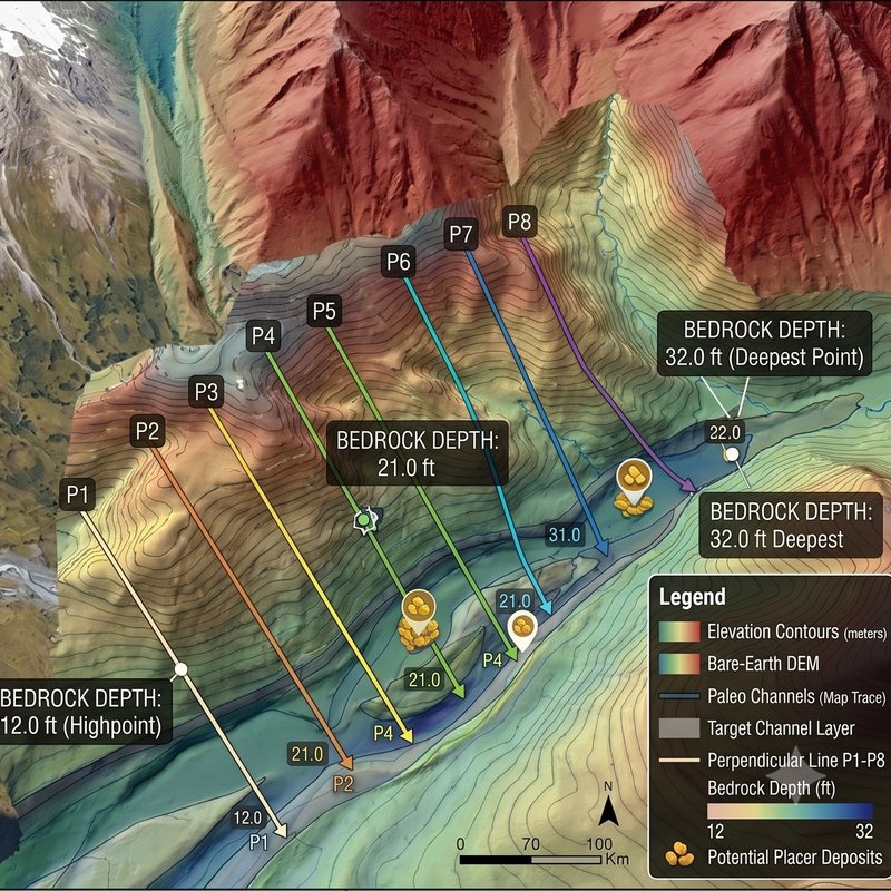
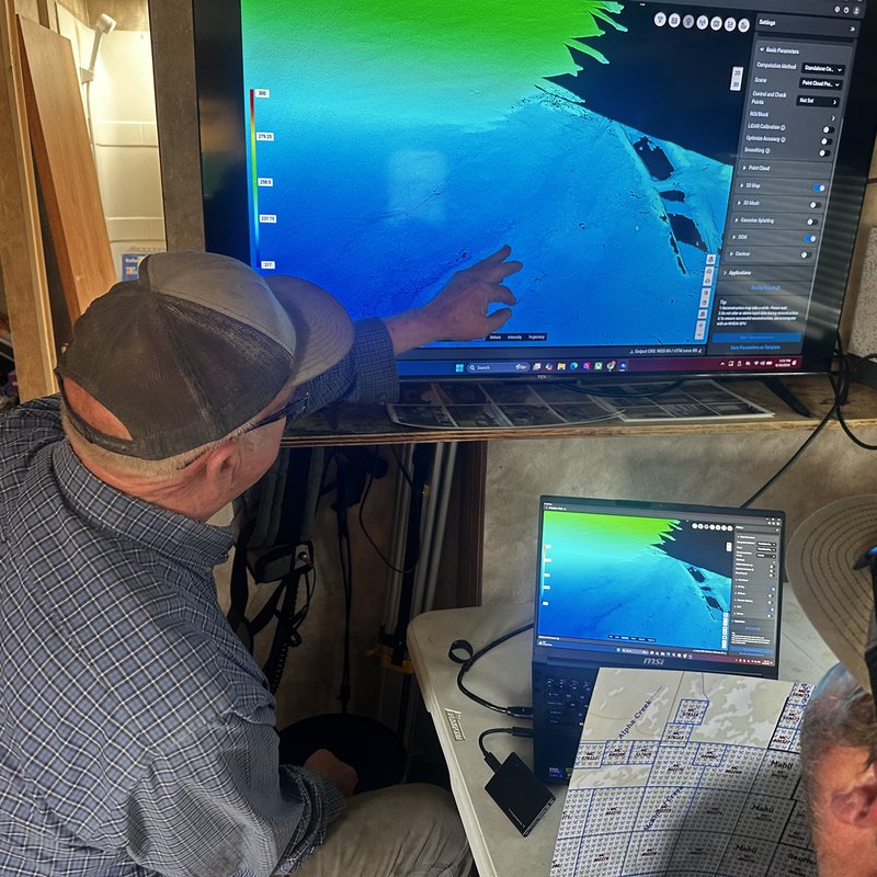
We’ve used the L3 in Alaska to map a gold mine. Cold, remote and operationally unforgiving is a useful stress test. On that kind of site you care less about brochure range and more about whether the point cloud holds together on pit walls, stockpiles, access roads and vegetated edges in one workable dataset.
The Star pattern earned its keep there. Specifically, oblique pulses helped us capture faces and structure that a mostly nadir scan would thin out. In addition, dual RGB helped us leave with usable imagery alongside the cloud, which clients almost always want when they’re making cut-and-fill or progress decisions.
We’re not saying every mine should standardize on one sensor forever. We are saying the L3 punched far above its price class on a job where failure is expensive.
When operators ask what American or European option comes closest, the conversation usually lands on a RIEGL VUX-class UAV scanner—especially the RIEGL VUX-120-23.
To be clear, RIEGL is a serious survey-grade brand. The VUX-120-23 publishes a laser pulse repetition rate up to 2.4 MHz, measurement rates up to 2 million measurements per second, accuracy/precision on the order of 10 mm / 5 mm, and a sophisticated NFB (Nadir/Forward/Backward) pattern. RIEGL’s own description says the beam alternates from nadir to +10° forward and ?10° backward, which improves completeness on vertical surfaces and narrow canyons compared with a pure nadir line scanner.
That ±10° NFB pattern is real oblique content. It is not, however, the same thing as the L3’s Star mode spanning an 80° × 80° FOV. Put simply, ten degrees forward and back is a useful multi-look trick. It is not a full wide-angle oblique star.
Price is the other half of the honest take. RIEGL does not publish a public MSRP for the VUX-120-23 the way consumer electronics brands do. Integrated UAV LiDAR stacks in that class—scanner, IMU/GNSS, cameras, mounting, software and support—commonly land well into six figures. In our market conversations, comparable Western systems are often discussed around the mid–six-figure range once the full stack is quoted. Meanwhile, the Zenmuse L3 payload is widely listed near $17,400 and drops into the DJI Matrice 400 / Pilot 2 / Terra workflow many teams already know.
| Factor | DJI Zenmuse L3 | RIEGL VUX-120-23 (typical stack) |
|---|---|---|
| Published max pulse / PRR | Up to 2,000 kHz (2M pulses/s) | Up to 2.4 MHz PRR |
| Oblique / multi-look pattern | Star-Shaped 80° × 80° FOV | NFB: nadir, +10°, ?10° |
| RGB mapping cameras | Dual 100 MP integrated | Optional external cameras (up to 2 interfaces) |
| Returns (published) | Up to 16 (at lower PRR) | Up to 32 (at lower PRR) |
| Typical buy-in | About $17,400 payload (retail listings) | Quote-based; full stacks often six figures |
| Ecosystem | Matrice 400 + DJI Pilot 2 / Terra | Flexible integration; more setup overhead |
So yes—RIEGL can win on pedigree, published ranging precision and certain high-end corridor specs. That said, for most commercial drone mapping businesses, the Zenmuse L3 still looks like the best drone lidar buy because you get dual mapping cameras, a true wide Star pattern and dense multi-return performance without a quarter-million-dollar quote.
Of course, capability is only half the purchase decision in the United States right now.
Federal rules already restrict covered foreign-made UAS for government procurement and many federally funded uses under the American Security Drone Act framework and related FAR updates. Separately, the FCC’s Covered List process has tightened what foreign-produced drones and critical components can be newly authorized—and proposals have targeted further import and marketing limits on categories that include LiDAR-equipped UAS. For a plain-English timeline, see our FCC Covered List explainer.
Beyond that, critical-infrastructure operators often go further than the minimum. Utilities, energy sites, ports and other sensitive facilities may simply refuse Chinese aircraft or payloads as policy, even when a private commercial flight would be legal under the FAA. If your customers are in that world, you need an NDAA-minded path as well. We’ve covered options in our guide to NDAA-compliant LiDAR systems.
Here’s the balanced conclusion we give teams:
Buy the L3 if you:
Look elsewhere—or run a dual-fleet strategy—if you:
Granted, that second list is real. It just doesn’t erase what the L3 does when you’re allowed to fly it.
Finally, put the pieces together. Dual 100 MP mapping cameras. Up to 2 million pulses per second. Up to 16 returns. Star-Shaped scanning across an 80° × 80° FOV. Retail pricing around $17,400. And field results—including our Alaska gold-mine work—that match the brochure more often than not when you fly the sensor correctly.
Compare that with a RIEGL VUX-120-23 style system that publishes excellent specs and a ±10° NFB oblique pattern, then arrives as a quote-based six-figure stack. For capability at a price most mapping businesses can actually finance, we still call the Zenmuse L3 the best drone lidar on the market.
Admittedly, restrictions on Chinese systems are part of the planning conversation. Performance is the other half. On performance and price, nothing we’ve flown comes nearly as close.
Ultimately, hardware only gets you halfway. The teams that win treat LiDAR as a workflow: site assessment, flight parameters, QC, deliverables and client communication.
If you’re building that system for a company, start with our Enterprise Drone Programs, or book a consultation and we’ll help you match sensors, training and SOPs to the jobs you actually fly.
For individual pilots leveling up mapping skills, these courses are the practical next step:
We don’t teach hype. We teach what works—because we fly it ourselves.
Paul Aitken
Sources
 2