

Drone Photogrammetry: How It Works, Accuracy, Software, and Uses (2026)

June 22, 2026
Quick Answer: What is Drone Photogrammetry?Drone photogrammetry uses overlapping aerial photos to create accurate 3D models and maps. It is used for construction, mining, agriculture, archaeology, and urban planning. How accurate: Down to 1 to 2 cm with RTK/PPK GPS (centimeter-level GPS accuracy) and ground control points How it works: A drone captures hundreds of overlapping images; software stitches them into a 3D point cloud or orthomosaic map Key software: Pix4D, Agisoft Metashape, DJI Terra, and DroneDeploy vs LiDAR: Photogrammetry captures color and texture; LiDAR is better for dense vegetation and night work Who needs it: Surveyors, construction managers, mining operators, archaeologists, and precision agriculture specialists Cost to start: A capable setup runs $3,000 to $15,000 depending on drone, camera, and software |
Drone photogrammetry uses aerial images to build accurate 3D models of objects, structures, and landscapes.
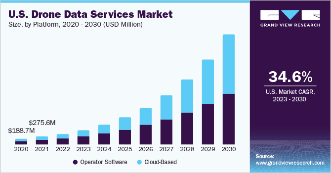
According to Grand View Research, the global drone data services market was valued at $1.05 billion in 2022 and is projected to grow at a CAGR of 39% from 2023 to 2030, driven by increasing demand for automated mapping, surveying, and volumetric analysis.
This guide covers how drone photogrammetry works, the types, required equipment, and where it is used across industries in 2026.
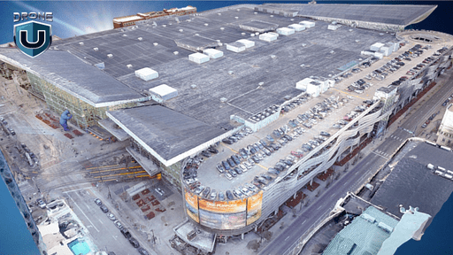
Drone photogrammetry, a subset of aerial mapping, involves capturing a series of overlapping aerial images and using them to create three-dimensional models.
The process involves taking overlapping photographs from multiple angles. Afterward, photos are stitched together using specialized software to create detailed 3D models or maps of objects, structures, or landscapes.
The science behind drone photogrammetry lies in the principles of trigonometry and computer vision. By analyzing the position and orientation of each image, the software can determine the location and elevation of various points on the Earth’s surface.
Photogrammetry and LiDAR are two powerful technologies, but they can be confusing to tell apart.
Here is how they differ.
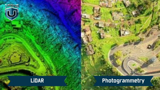
Photogrammetry and LiDAR are both useful 3D mapping and photogrammetry techniques. However, they have some key differences in their approaches:
|
Photogrammetry |
LiDAR |
| Photogrammetry relies on photographs taken from different angles to triangulate the position of points on the object’s surface and reconstruct its 3D geometry. | LiDAR uses lasers, actively pulsing light and measuring its reflection to build a 3D point cloud. |
| Photogrammetry shines in capturing textures and colors, producing visually rich models. | LiDAR excels at capturing precise measurements and dense point clouds, making it ideal for highly accurate work. |
| Photogrammetry struggles with dense foliage, potentially missing details hidden by leaves and branches. | LiDAR can see through some vegetation, revealing the ground beneath. |
| Photogrammetry is best for Capturing textures and colors (e.g., building facades, and historical preservation). | LiDAR excels at Precise Measurements (e.g., stockpile volumes, building dimensions) and Mapping through Vegetation (e.g., forestry, flood plain analysis). |
| Photogrammetry can be more cost-effective, especially for large-scale mapping projects, as it relies on widely available cameras and software. | LiDAR systems are typically more expensive to acquire and operate due to specialized equipment and processing requirements. |
While both LiDAR and photogrammetry are valuable tools for 3D mapping and modeling, their suitability depends on factors such as accuracy requirements, cost constraints, and the nature of the environment being surveyed.
Here are the main types of photogrammetry used in drone work.
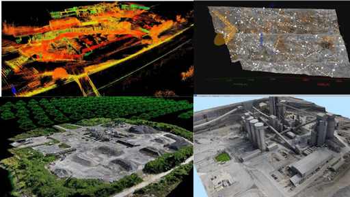
The main two types of photogrammetry technology – Aerial Photogrammetry and Terrestrial Photogrammetry, are distinguished by the position of the camera capturing the images:
| Feature | Aerial Photogrammetry | Terrestrial Photogrammetry |
| Camera Position | Airborne (planes, drones) | Ground-based (fixed/handheld) |
| Area Coverage | Large areas (landscapes, cities) | Smaller objects (buildings, artifacts) |
| Application Examples | Mapping, 3D city models, construction monitoring, etc. | Architectural modeling, cultural heritage preservation, accident scene documentation, etc. |
| Advantages | Covers large areas efficiently, good for capturing an overview. | Captures fine details, flexible for close-up work |
| Disadvantages | Requires specialized equipment, weather dependent. | Time-consuming for complex objects, and may require more images. |
However, some additional and less common types of photogrammetry include:
This is a subset of terrestrial photogrammetry. In this photogrammetry, the camera gets very close to the subject, often less than 300 meters, capturing highly detailed models of small objects. It’s used in product design, quality control, and forensic investigations.
It is a photogrammetric technique that uses overlapping images to create 3D models of a subject. It combines elements from both aerial and terrestrial methods.
It is widely used in archaeology, geology, forestry, and any field requiring detailed 3D models of objects or landscapes. Moreover, SfM software can process images from any camera and does not require specialized photogrammetry equipment.
As the name suggests, this technique utilizes multiple cameras positioned at different locations to capture an object or scene simultaneously. This can be particularly useful for complex structures or situations where traditional photogrammetry approaches might struggle.
Here is why drone photogrammetry is widely adopted across industries.
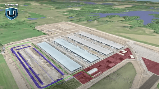
Drone photogrammetry gives surveyors, engineers, and scientists a faster way to capture spatial data.
Here’s where drone photogrammetry shines:
Exploring dangerous environments like unstable structures or remote terrain carries serious risk. Drone photogrammetry removes that risk by capturing high-quality images remotely.
The traditional surveying methods require extensive manpower and time. Whereas drone photogrammetry reduces both costs and the time spent for data collecting data. Buying a drone and software might seem expensive at first, but it’s affordable in the long run. This makes it possible for small businesses and individuals to use this technology too.
Time is of the essence in many situations. When monitoring construction progress, for instance, drone photogrammetry offers unparalleled speed and efficiency.
Large areas can be mapped rapidly compared to ground-based methods, saving substantial time and labor costs. This allows for faster decision-making and quicker responses.
Drone photogrammetry applies across a wide range of industries. From construction and mining to archaeology and environmental monitoring, this technology is transforming various fields. It facilitates detailed volume calculations, progress tracking, and meticulous documentation, opening doors to innovative solutions and improved efficiency across different sectors.
The world has become increasingly reliant on 3D data and visualization. Consequently, drone photogrammetry is poised to play a critical role in shaping the future. By capturing detailed spatial information and creating immersive 3D models, it enables better decision-making, improved planning, and enhanced understanding of our environment.
Here is the equipment needed for a drone photogrammetry mission.
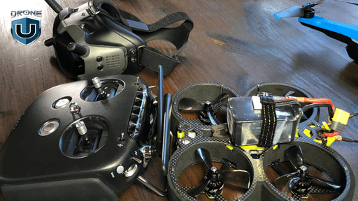
To unlock the full potential of drone photogrammetry, it’s essential to have the right equipment.
Here are the key components you’ll need to get started:
The drone is the primary tool for capturing aerial images. Choose a drone that is stable, reliable, and capable of carrying the necessary payload, including the camera. Consider factors such as flight time, range, and maneuverability when selecting a drone for photogrammetry.
The camera is the most critical component for capturing high-quality images. Choose a camera with a high-resolution sensor, capable of capturing detailed imagery. Look for features such as adjustable aperture, manual control options, and the ability to shoot in RAW format.
The lens plays a crucial role in determining the image quality and field of view. Consider using a lens with a wide-angle focal length to capture a larger area in each image. Look for lenses that offer low distortion and excellent optical performance.
A GPS receiver is essential for accurate positioning and georeferencing of the images. It allows the software to accurately calculate the position and orientation of each image, resulting in precise mapping and measurements.
Ground control points are physical markers placed on the ground to facilitate accurate georeferencing. They serve as reference points for aligning the aerial images with real-world coordinates. GCPs can be simple markers or targets with known coordinates.
A powerful computer and specialized software are required for processing the captured images and generating the final map or model. Look for software that offers advanced photogrammetry capabilities, such as image alignment, feature extraction, and point cloud generation.
By investing in the right equipment, you can ensure high-quality data capture and processing, leading to accurate and reliable maps or models.
Here is the photogrammetry process from start to finish.
The drone photogrammetry process consists of several key steps, each crucial to the overall accuracy and quality of the final map or model:
Before you take flight, conduct a thorough site assessment. Understand the area you want to capture, including its size, complexity, and any potential obstacles. Additionally, select a drone equipped with a high-resolution camera suitable for your project’s needs.
You must meticulously plan your flight path to chart your drone’s course. This ensures the flight path covers the entire area with sufficient overlap between images.
For enhanced accuracy, consider placing ground control points (GCPs) within the capture area. These are physical markers with known locations that help the software refine the 3D model’s positioning.
Before each flight, conduct a thorough pre-flight checklist to ensure the drone’s functionality and safety. Check weather conditions, battery levels, and any airspace restrictions.
With meticulous control, fly your drone along the pre-planned path, capturing images according to the set parameters. Maintain a consistent altitude and speed for optimal image quality and overlap. Moreover, It’s crucial to ensure proper overlap between images to facilitate accurate image processing.
Keep a close eye on the drone’s performance and battery life throughout the flight. Be prepared to adjust the flight path or land safely if necessary.
Once you’ve landed safely, download the captured images from the drone’s storage.
Select photogrammetry software that suits your needs and expertise level. Import the images into your chosen software and initiate the processing. The software will process the images, identify common points, and generate a 3D point cloud representing the captured object or landscape.
The 3D model can be imported into other software for in-depth analysis. This includes various analyses and measurements, such as volumetric calculations, cross-sectional profiles, and feature extraction. The level of analysis depends on the specific requirements of the project.
Finally, based on the project requirements, generate the final deliverables. This may include orthomosaic maps, 3D models, contour maps, cross-sections, volumetric reports, and other derived products.
These models are used for topographic mapping, surveying, conservation, mining, agriculture, infrastructure inspection, and more.
Here are the key advantages and limitations of drone photogrammetry.
Here are some of the benefits and limitations of drone photogrammetry:
|
Advantages |
Disadvantages |
| Drones allow economic surveys from small local sites up to hundreds of acres regionally. | Photogrammetry processing software requires extensive computing power, time, and expertise. Especially for high-resolution 3D models. |
| Photogrammetry processing results in highly accurate 3D point clouds, with precision down to a few centimeters. | Capturing consistent texture and color across all photos in varying light can be tricky. This can result in inaccuracies or artifacts in the 3D model. |
| Drone photogrammetry is versatile. It can be applied to topographic mapping, architecture, mining, agriculture, inspection, construction, heritage preservation, and more. | Shiny, reflective, transparent, or water surfaces are challenging to reconstruct accurately. The reflected imagery distorts the model. |
| Drones with automated flight planning and image capture capabilities can simplify mapping missions. | Most consumer drones have short battery lives, limiting flight time. This can make it difficult to fully map larger areas in one flight. |
Here are the main applications of drone photogrammetry.
Drone photogrammetry is opening up new avenues and spurring innovation in a variety of fields. This facilitates you in better decision-making and effective resource management. Here are the main industries where drone photogrammetry is used.
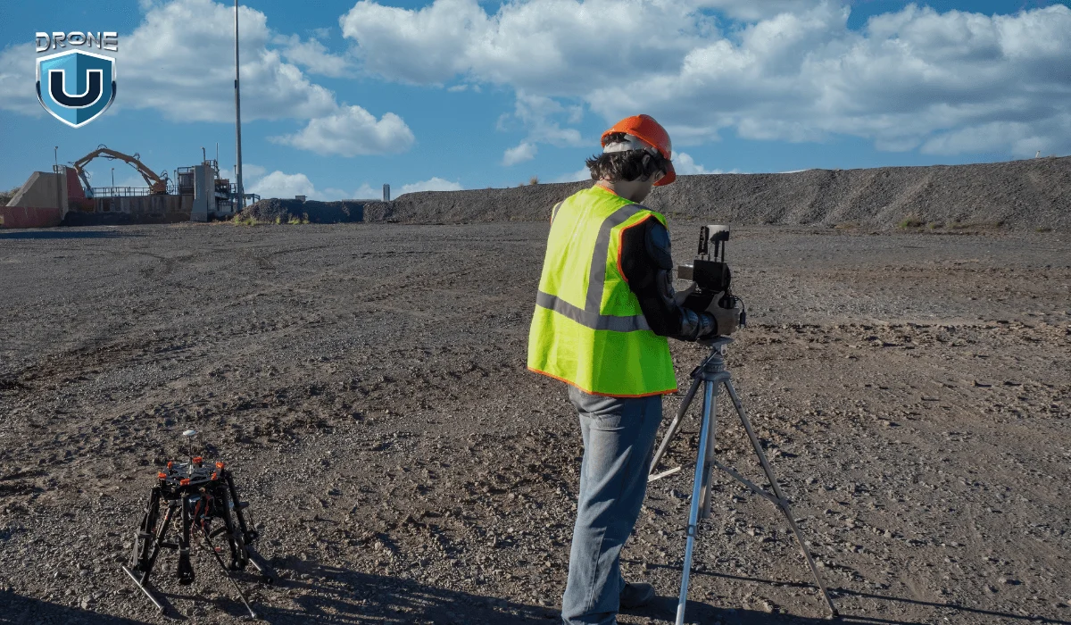
The mining and quarrying industry has embraced drone photogrammetry for stockpile volume calculations. You can measure the volume of stockpiles of materials such as coal, sand, or grain. This information is essential for tracking inventory levels and ensuring efficient resource allocation.
It is possible to monitor the volume of extracted materials and optimize mining operations. You can also calculate the volume of waste generated and ensure proper disposal.
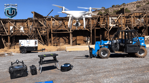
Drones can capture detailed aerial images of construction sites. This enables the creation of accurate 3D models using photogrammetry. Thus, you can track the progress of construction projects and identify any potential delays or issues. This facilitates better planning and coordination between different teams working on the project.
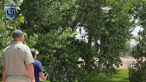
Drone photogrammetry offers tremendous benefits to environmental monitoring. You can generate orthomosaic maps and 3D terrain models of fields, orchards, and forests. Hence, identify areas of illegal logging and implement conservation measures.
You can also monitor the health of forests and identify potential threats, such as disease or pests.
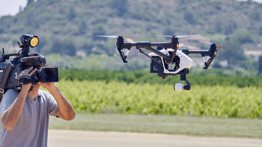 Source: Robot Report
The filmmaking and visual effects industry has adopted drone photogrammetry for location scouting. You can use it for pre-visualization, set extensions, digital set creation, camera tracking, and motion capture.
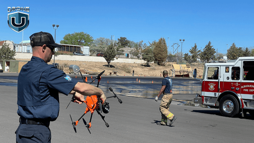
Photogrammetry is used for rapid mapping of disaster-affected areas. Emergency response and disaster management teams also depend on it for various uses. This includes building and infrastructure damage assessments, search and rescue operations, and monitoring natural disasters like wildfires or floods.
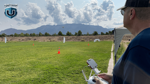
Agriculture and forestry have significantly benefited from the ability of drone photogrammetry. Multispectral and hyperspectral imaging provide valuable insights into crop health and soil conditions. Thus, enabling precision agriculture practices, and water management.
Moreover, detailed 3D models of forests and plantations can aid in resource management. In return, you can modify the conservation efforts and wildfire risk assessment.
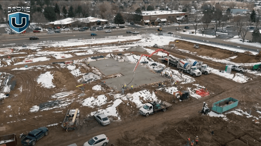
Drone photogrammetry data can be integrated with IoT (Internet of Things) sensors and smart city infrastructure. Hence, enabling real-time monitoring, predictive maintenance, and optimized resource management. This integration creates a digital twin of the physical environment, facilitating data-driven decision-making and efficient urban planning.
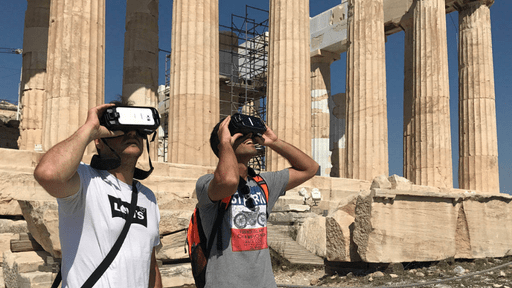 Source: Biblical Archaeological Society
Drone photogrammetry has revolutionized the way we see historical landmarks and monuments. This technology allows us to create incredibly detailed 3D models, opening doors to exciting new possibilities.
One major benefit is the creation of virtual tourism experiences. You can explore these sites from anywhere in the world, fostering a sense of wonder and appreciation for cultural heritage.
However, the benefits go beyond tourism. These 3D models also play a vital role in cultural heritage preservation. They provide researchers and conservators with accurate data to monitor for damage and plan restoration efforts.
In short, drone photogrammetry offers a powerful tool for both education and preservation, ensuring our cultural and natural heritage continues to inspire future generations.
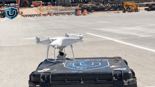
Planning is a crucial aspect of any drone photogrammetry mission. It ensures that the data collected is accurate, relevant, and meets the requirements of the project.
Check out this video for expert photogrammetry tips:
Here are some key considerations when planning a successful drone photogrammetry mission:
1. Define the Objectives: Clearly define the goals and objectives of the mapping project. Determine what specific features or areas need to be captured and analyzed. This will help in selecting the appropriate drone, camera, and flight parameters.
2. Select the Right Equipment: Choosing the right equipment is essential for a successful mission. Consider factors such as camera resolution, drone stability, and flight time. Ensure that the equipment is capable of capturing high-quality images and has the necessary features for precision mapping.
3. Check for Legal and Safety Requirements: Before taking a flight, it’s important to check for any legal or safety requirements. Ensure that you have the necessary permits or permissions to fly in the designated area. Familiarize yourself with local regulations and restrictions to avoid any legal issues.
4. Perform a Site Survey: Conduct a thorough site survey to identify any potential obstacles or hazards. This includes assessing the terrain, vegetation, and weather conditions. Identifying potential challenges beforehand allows for better mission planning and mitigates any risks.
5. Consider Lighting and Weather Conditions: Lighting and weather conditions play a crucial role in capturing high-quality images. Choose the time of day when lighting conditions are optimal, such as during the golden hour. Avoid flying in unfavorable weather conditions, as they can affect image quality and flight stability.
6. Establish Ground Control Points: Ground control points (GCPs) are physical markers on the ground that serve as reference points for accurate georeferencing. Placing GCPs at strategic locations helps in improving the accuracy of the final map or model. Ensure that the GCPs are easily identifiable and accessible.
7. Plan for Data Storage and Backup: As data collection can generate a large amount of data, it’s crucial to plan for storage and backup. Ensure that you have enough storage capacity for the images and processed data. Have a backup strategy in place to prevent data loss in case of any technical issues.
By carefully planning each aspect of the mission, you can ensure a successful drone photogrammetry project that meets the desired objectives and delivers accurate and reliable results.
The future of drone photogrammetry holds immense potential, with several emerging developments. These advancements will completely change how we capture, process, and use 3D data of our surroundings. The scope and possibilities of this technology are vast, spanning various industries.
As of 2026, several of these advances are already in commercial use: DJI’s Mavic 4 Pro shoots 100MP stills, AI-automated processing in DroneDeploy and Pix4D significantly reduces manual processing time, with most workflows now completing in hours rather than days, and multi-drone mapping operations are commercially available through providers like senseFly.
Ultra-high resolution cameras and multispectral sensors are two of the most significant advances in drone photogrammetry. With cameras packing over 100 megapixels, we can create 3D models with exceptional detail. They are opening up new possibilities in fields like archaeology, construction, and urban planning.
Multispectral and hyperspectral sensors on drones will give us valuable data for precision agriculture. Hence, conservationists can keep a closer eye on the health of our forests and ecosystems.
LiDAR sensors combined with cameras will produce incredibly accurate 3D point clouds. Thus, allowing us to analyze terrain, structures, and vegetation in exceptional detail.
Artificial intelligence is now automating the entire photogrammetric processing workflow. This reduces manual processing time significantly.
Groups of drones can now work together to map large areas simultaneously, sharing data and making decisions in real time.
With swarm technologies like mesh networks and collective intelligence. These drones can optimize their mapping efficiency, sharing data and making collaborative decisions in real time.
With the 3D models, you can virtually navigate, inspect, collaborate, and even annotate ultra-realistic 3D environments. It’s like being there in person but without the need to travel.
You can seamlessly integrate the 3D models into the real world with augmented reality (AR) and virtual reality (VR) technologies. This will enhance your decision-making and communication capabilities.
Can AI change the future of photogrammetry? Watch this video to know the answer:
Drone photogrammetry is now a standard tool across construction, mining, agriculture, and heritage preservation. As AI processing, higher-resolution sensors, and drone swarm capabilities mature, its accuracy and speed will continue to improve.
 1
1
Add Your Comment