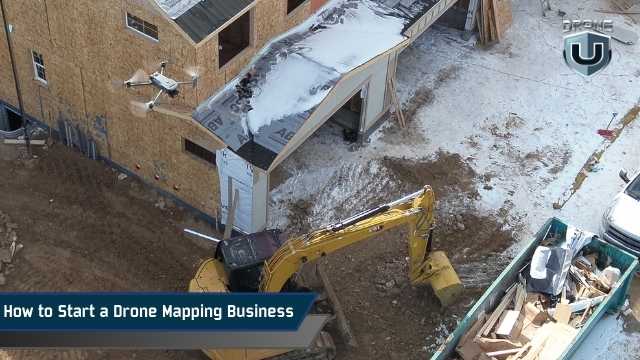
How to Start a Drone Mapping Business in the USA (2025 Guide)
September 3, 2025
| Disclaimer: Any reference to “surveying” or “survey” work in this article is for general informational purposes only. Surveying is a regulated profession, and requirements vary by state. Any work that legally constitutes surveying must be performed or approved by a licensed professional surveyor, in accordance with applicable state laws. |
Drone mapping is one of the most profitable niches in the drone services industry. But starting a drone mapping business is more than just technical skills.
It requires a plan, a defined market focus, and a professional approach that builds trust with clients who need accurate data.
This guide is for drone pilots who already have a basic understanding of mapping and want to take the next step: a profitable drone mapping business.
Instead of going into the mapping workflows (we’ve covered this in this drone mapping guide), this article will focus on the business-building essentials.
We’ll cover how to choose the right niche, meet industry expectations, invest wisely, and position yourself as a trusted service provider.
Let’s get started.
Drone mapping involves capturing aerial images and converting them into georeferenced datasets, such as orthomosaics, 2D site maps, digital elevation models, and 3D reconstructions.
These deliverables are used by industries that need spatial data for planning, monitoring, and documentation.
From a business perspective, mapping is a service, not just a set of images or models. Clients don’t pay for drone flights; they pay for actionable, accurate data that solves specific problems.
This creates real demand across industries like:
However, knowing how to fly isn’t enough.
One of the biggest gaps in this space is that drone operators often jump in without understanding the data accuracy standards of the industries they’re trying to serve.
A project manager doesn’t just want a map; they want confidence in that map’s precision and compliance with workflows they already trust.
Before launching your drone business, take time to understand how professionals in your chosen vertical use mapping data. Learn how accuracy is measured and what deliverables they expect.
This is the foundation of becoming a drone mapping service provider.
One of the fastest ways to fail in drone mapping is trying to offer everything to everyone. Standing out requires focusing on a specific industry niche.
This could be land surveying, agriculture, or construction. Every sector has different expectations, standards, and workflows – choose a sector and commit.
For instance, Land Surveying is a precision-driven field. You’ll likely need to work with RTK or PPK workflows and understand how to meet sub-inch accuracy standards.
This is where many new drone business owners fall short.
It’s not hard to teach a licensed surveyor how to fly a drone, but it’s very hard to teach a drone pilot how to meet the data expectations of a surveyor.
Clients don’t care how good your drone is; they care whether your data fits into their existing processes and meets their accuracy standards.
You don’t need the most expensive drone or top-tier survey equipment to get started, but you do need the right gear for the work you plan to do.
Choose a drone that fits your niche and has consistent image quality and flight stability. You don’t need RTK from day one unless your clients require survey-grade deliverables.
Focus on a mapping-capable drone that produces sharp imagery, has automated flight, and good battery life.
What’s more important at the beginning is learning how to fly missions with repeatable results.
For most beginners, something like the DJI Air 2S, Phantom 4 Pro, or Mavic 3E is a good starting point.
As your business grows (or your target industry demands higher accuracy), you can invest in:
Use GCPs when accuracy is critical, like construction, engineering, surveying, or agriculture. They’re physical markers placed on the ground, measured with a GPS receiver, and manually marked in your software to “anchor” the map to real-world coordinates.
Good for: Jobs that require sub-inch to centimeter-level accuracy.
RTK drones receive correction data during the flight, usually from a base station or a network (like NTRIP). This allows them to geo-tag each image with much higher accuracy.
Good for: Real-time, accurate data collection on sites with cell service or access to a base station.
PPK is similar to RTK, but corrections are applied after the flight. This is useful when you’re flying in remote areas without a stable cellular connection.
Good for: Rural mapping jobs or locations with weak signals.
A base station is used with RTK/PPK to log correction data. You’ll need one if your RTK drone doesn’t have access to a local correction network.
Recommended tools: DJI D-RTK 2, Emlid Reach RS2
Quick Tip: GCPs still outperform RTK in many scenarios, especially when clients expect survey-grade results. Some professionals even use both RTK and GCPs together to reduce errors and cover their bases.
If you’re just starting and working on general construction or land development projects (not tied to legal boundaries), you may not need GCPs or RTK on day one.
You can still offer valuable visual maps and measurements while you build experience.
If you’re using a Mac, be aware that most drone mapping software is Windows-based. If you’re on a MacBook, here are a few practical options:
a. Start with Cloud Platforms
The easiest option is to use web-based tools like DroneDeploy or Pix4Dcloud. These run in your browser and don’t require any installation, great for early projects or simple workflows.
b. Run Windows on Your Mac
If you need full desktop software like Pix4Dmapper, you’ll need Windows. Here’s how:
Both options work, but processing can be slow without the right hardware.
c. Upgrade Your Specs if Needed
If you’re using virtualization (like Parallels), performance matters. For smoother processing:
Before choosing your software or setup, check compatibility with your preferred apps. Some tools only run on Windows, and not all features work through virtualization.
In terms of mapping, one of your company’s biggest selling points should and always will be accuracy, so don’t cut corners.
A business plan doesn’t have to be complicated, but it does need to help you make smart decisions, communicate with clients, and stay profitable.
Start by defining exactly what services you’re offering. Since we’re talking about drone mapping, don’t get distracted with general aerial photography or videography. Stay in your lane.
Your deliverables might include:
The more specific you are, the easier it is to explain your value to potential clients.
Now identify which industries need those deliverables. For example, a construction company may want monthly maps of its site to track progress.
A mining operation may need volume measurements of stockpiles, and a solar developer may require terrain and elevation data for planning purposes.
Your plan should match your services to real-world, ongoing problems that companies are already spending money to solve.
Pick one or two and learn what they really need. That’s where your opportunity lies.
Pricing is another key part of your business plan. Too many drone pilots underprice their services because they only think about flight time.
Mapping is more technical; it includes planning, travel, setup, flying, processing data, exporting deliverables, revising them, and communicating results.
Every project has overhead. Your plan should reflect this by setting minimum project rates that actually cover your time and tools.
Lastly, prepare the materials you’ll use to communicate with clients. This includes a short, well-designed proposal that outlines what you’ll deliver, along with a clear contract that protects both parties.
You should also have a standardized report format that professionally presents your maps and models.
These assets don’t just make you look more credible; they also save you time with each new client.
These foundational tools and documents will help you present your services professionally and win your first few clients with confidence.
But beyond appearances, your plan needs to function; it should guide your decisions, keep you focused, and make sure you’re solving real problems for paying clients.
To test whether your plan is actually practical, ask yourself the following five questions:
Once you have clear answers to these, your business plan is already ahead of 90% of new drone operators.
Mini Case Study: What Does Success Look Like? 42 Acres | Construction Site | Colorado During one 35-minute flight, a Drone U™ pilot used a Mavic 3 Enterprise with RTK and 8 ground control points (GCPs) to capture detailed aerial images at 2.4 cm per pixel. The data was processed and quality-checked using 12 control shots, then delivered to the client within 36 hours. Revenue: $2,400 base fee + add-ons for volumes and web viewer. The Takeaway: You don’t need a $30K drone or a full survey crew. With the right process and positioning, you can deliver high-value results that clients trust. Want to Deliver Results Like This? Get the free Drone Mapping Startup Kit (PDF). It includes gear tiers, a sample proposal, an onboarding checklist, and workflow tips to help you go from zero to mapped. |
Here’s a practical overview of the end-to-end workflow every mapping-focused drone business should understand from day one.
Start with smart flight planning.
For 3D modeling or as-built construction documentation projects, consider double-grid or oblique flight paths to capture better facade detail.
This makes sure that you’re collecting the right data from the start, something most underprepared pilots learn the hard way.
Fly with intention, which means using automated flight apps where possible to ensure consistency, especially for larger or recurring jobs.
Whether you’re flying over a construction site or farmland, clean, sharp, and well-overlapped imagery is the foundation of every map or model.
Now comes the turning point, processing your imagery into maps, models, and measurable data.
If you’re going after clients who require precision (like surveyors or construction firms), your processing method matters more than you think.
Pix4D is often preferred for high-accuracy work because it gives you full control over geo-referencing and Ground Control Point (GCP) placement.
DroneDeploy is a popular and easy-to-use cloud-based tool that works well for basic 2D outputs like orthomosaics and volume estimates. But it can fall short when handling advanced 3D workflows or merging complex flight plans.
Another important takeaway: never rely on auto-marking GCPs, regardless of what platform you use. Manual marking is still the only way to reduce reprojection error and maintain integrity in your data.
If you’re on a Mac and concerned about software compatibility, some pilots use Parallels or Boot Camp to run Pix4D’s desktop version. This allows them to set up and geo-reference projects locally, then upload the final processing steps to the cloud.
It’s a bit of a workaround, but for many it’s a practical stepping stone until they can invest in a full Windows workstation.
Your final deliverables will depend on what your client actually needs, not just what your software can create. Most drone mapping clients expect:
Starting a drone mapping business isn’t about having the most expensive drone or the flashiest gear.
It’s about understanding your client’s problems and providing data that solves them.
If you want long-term success, invest more in learning the right workflows and industry standards than in chasing the latest hardware.
Don’t get stuck thinking you need to spend thousands to get started. You don’t.
Start with one good drone, a clear niche, and a solid understanding of your workflow.
Use cloud-based processing tools when you’re on a budget and focus on building relationships by delivering what clients actually need, not just what your software can output.
As you gain experience, scale your skills, upgrade your gear, and keep learning. That’s how real drone mapping businesses grow.
Join Drone U to become a confident pilot and start your own drone mapping business.
You May Like Reading:
| Disclaimer: Any reference to “surveying” or “survey” work in this article is for general informational purposes only. Surveying is a regulated profession, and requirements vary by state. Any work that legally constitutes surveying must be performed or approved by a licensed professional surveyor, in accordance with applicable state laws. |

