Mavic 3 Mapping is Possible

December 3, 2021
After testing the new Mavic 3, mapping is possible with Pix4d. However, pilots will have to fly autonomous missions…manually….to do so.
Testing the Mavic 3 drone has brought about many disappointments, but with a simple hack… mapping IS possible. Many drone pilots were excited for this new Mavic 3 drone. Yet, Youtube is littered with angry videos showcasing how much the Mavic 3 is a downgrade from a Mavic 2 Pro. While our review will be published soon, DJI may be pranking the drone industry. DJI has had a history of unlocking many features from a drone, after the launch of the new product.
Drone pilots globally have been touting a new firmware upgrade coming in January (2022). Pilots state this new firmware upgrade would unlock many of the features we have all become accustomed to. With the lack luster flight performance, missing intelligent flight modes and cheap remote, pilots are expecting a whole lot from this firmware upgrade. Rumors have even swirled that DJI would open up the SDK. This would allow 3rd party applications control of the drone. These applications are what pilots use to run autonomous mapping missions to capture mapping imagery.
With a 3rd party application, the idea is the Mavic 3 would be capable of flying autonomous missions. The assumption continues that if the Mavic 3 can fly autonomous missions, pilots would be able to use the drone for mapping. We set out to see if mapping with the Mavic 3 was possible. After extensively testing the drone, we have figured out a way to create maps, models and orthomosaics with the Mavic 3. We could only get it to work with Pix4D.
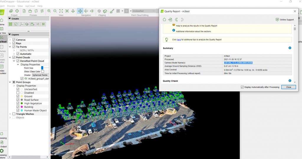
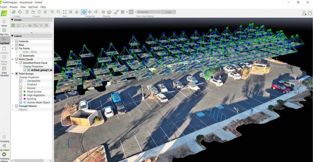
To clarify, there is still no 3rd party application that can control the Mavic 3. There is no drone deploy, no Pix4d Capture, no Measure, no DJI Pilot or GS Pro. Nothing. Many drone mappers would be stopped by the lack of autonomous flight missions. With a little bit of OCD and some manual flying, we were able to fly a single grid mapping mission. That means we were manually flying the drone. No software. We flew our parking lot at Drone U HQ to see if we could create an orthomosaic with the Mavic 3. Much to our surprise, mapping with the Mavic 3 is possible.
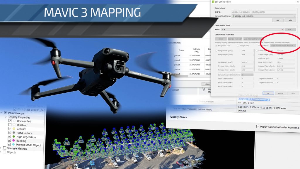
We also discovered a very important indicator. Many pilots have been deeply disappointed by this drone and the specs. Great camera, but the drone flies like a blind geriatric driving down the highway. Its actually the least amount of fun we have ever had with a new drone. Our hopes were high on this drone as we were expecting a value filled aircraft. In the initial leaked specifications, the drone showcased a mechanical shutter up to a certain shutter speed. Albeit the released specs do not showcase a mechanical shutter. DJI used a pre-existing Hasselblad camera sensor. A camera sensor that just happens to be in the Pix4D camera library. Who knows how, but it is there.
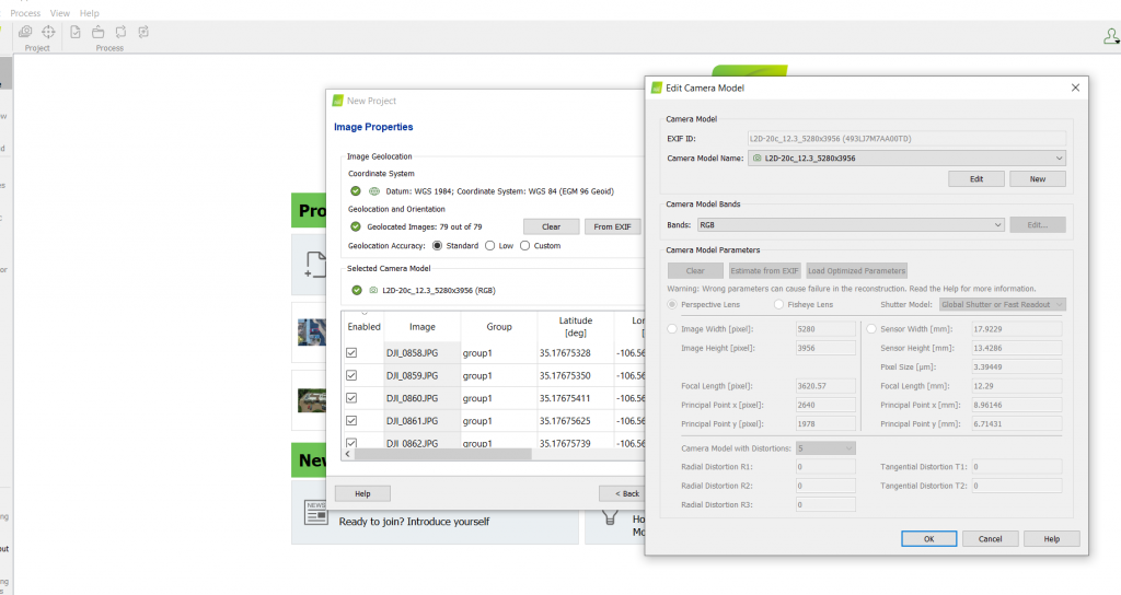
Going into the pre-defined camera parameters, drone pilots may find a bombshell that flips the entire Mavic 3 narrative on its head. Pix4D classifies the camera as a global shutter. Yup, you heard that right. Pix4D pulls up the camera in the same classification as a Phantom 4 Pro. The parameter reads “global shutter or fast readout.” Boom. You can map with the drone.
Drone U flight crew ran an experiment with the drone, flying it manually. The experiment continued in that we tried processing the images to create a map inside Pix4D. Guess what… It worked. Point Cloud… Produced. Check out the images to showcase that it did work. We will fly a double grid later and see how the 3d quality comes out.
Does this mean that the Mavic 3 is actually a mapping drone? The Mavic 2 Pro had to use Linear rolling shutter correction, making the aircraft useless for professional drone mappers and modelers. The Mavic 3 seems completely capable of drone mapping, if you can manually fly a grid with the right overlap! Will DJI launch mapping software for the drone, cutting out the very 3rd party vendors that made DJI into mapping drones? Who knows but it seems something is up.
Perhaps this January’s firmware update could dramatically change the face of the drone we thought we knew.

Add Your Comment