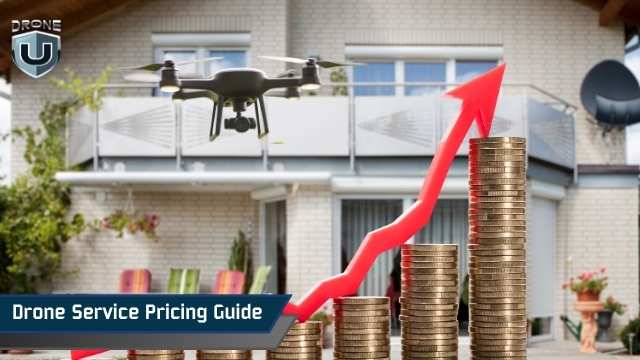
Drone Service Pricing Guide: How Much Drone Services Cost in 2026

May 30, 2026
Quick Answer: How Much Do Drone Services Cost in 2026?Drone service costs vary by service type. Here are the typical 2026 ranges:
These are typical ranges. Final pricing depends on location, equipment, deliverables, pilot experience, and project complexity. |
Drone services in the United States typically cost $150 to $700 per hour depending on the service type, equipment required, and pilot experience. Aerial photography starts at $150 per hour. Thermal inspections and LiDAR mapping command $300 to $700 per hour.
This guide covers how these rates are calculated, what drives pricing up or down, and how to set rates that cover your costs and reflect the value you deliver.
Here’s a quick snapshot of typical drone service pricing, organized by service type and complexity. These are average ranges; actual rates vary by location, client, and project scope.
| Service Type | Typical 2026 Pricing Range | What This Usually Includes |
| Aerial Photography | $150–$400 per hour | Includes editing and basic post-processing. Higher in cities or specialized shoots. |
| Construction / Surveying | $250–$600 per hour | Requires mapping software, multiple flights, and precise measurements. |
| Roof & Building Inspections | $200–$500 per hour | Complexity, height, and safety gear impact cost. |
| Thermal / Infrared Inspections | $300–$700 per hour | Specialized sensors and analysis increase the price |
| Event Coverage | $150–$350 per hour | Influenced by duration, travel, and editing requirements |
| Recurring Contracts | Custom | Discounts may apply for long-term agreements. |
Here is why pricing strategy matters.
Pricing is more than picking a number. It shows clients how professional you are, and could affect your income and ability to run a sustainable business. Good pricing covers your costs, lets you invest in better equipment, and helps you attract clients who value your work.
Many new pilots make the mistake of charging too little to win jobs. While this may work as a tactic when starting, it should not become a habit. Clients start expecting more for less. You end up working harder without earning enough.
When your pricing is clear and consistent, clients understand the value they are getting. They are less likely to question your rates.
Pricing also communicates your experience and quality. It sets expectations and builds trust. With the right strategy, you can go beyond gigs and build a sustainable business that can grow.
For example, you might charge $150 for a quick real estate shoot but forget to include your drive time, software costs, and editing work. After those expenses, you could end up keeping only about $40 without realizing it.
Several factors influence how much you should charge and why pricing varies from project to project. The next section covers each factor in detail.
When clients ask why drone services cost what they do, these are the factors that shape your final rate.
A basic camera drone is inexpensive to operate, while a thermal sensor, zoom payload, or LiDAR (Light Detection and Ranging) unit increases both your investment and your rate. Clients do not need the technical details. They just need to understand that advanced sensors deliver data a standard drone cannot.
Examples:
Some projects require multiple flights, long travel distances between sites, or extra batteries you must carry and manage. Each of these adds to both time and operational cost.
Simple rule: More time in the field = higher project cost.
Terrain, flight restrictions, obstacles, and safety requirements all influence pricing. Jobs near airports, power plants, highways, or construction sites demand more planning and risk management.
Complex mission = more prep, more safety checks, higher rate.
Editing photos, generating maps, stitching 3D models, cleaning thermal data, or creating reports often takes longer than the flight itself.
The more detailed the deliverable, the higher the price.
Use this section as your baseline, so you avoid repeating “include editing” or “include post-processing” in every service description.
Travel fees vary by region. Some pilots charge per mile; others apply a flat on-site fee. Travel time, lodging, site access procedures, and weather delays all impact your final rate.
Commercial insurance premiums, Part 107 compliance, waivers, and local permits are all baked into your overhead. Clients just need to understand that regulatory requirements contribute to pricing, especially in larger markets.
Higher compliance burden = higher operating cost.
Pilots with a strong portfolio, specialized training, or certifications (thermal, tower inspections, mapping) can and should charge more. Expertise directly influences data quality and project reliability.
Add all the above costs and divide by the number of hours you work. The result should give you a ballpark for your minimum hourly rate. You can use this as a baseline to build a project or come up with ‘per-acre’ pricing.
Here is how each pricing model works.
There are several ways to price drone services. Choosing the right model depends on the type of job, your costs, and client expectations.
You charge for the time you spend on-site or processing. This fits short tasks, simple deliverables, and situations where the scope may change, such as events, small shoots, or quick inspections.
Example: A 2-hour roof inspection at $150/hour = $300.
Most commercial clients still prefer fixed project pricing, but hourly rates are useful when you can’t predict the workload.
Some projects run long or require setup time, travel, and partial processing. A single daily rate simplifies billing and makes planning easier for both sides.
Example: A full-day event coverage at $800/day, regardless of hours flown.
Flat project rates give clients one clear cost upfront. You total labor, equipment use, software, and travel, then add your profit margin. This works well when the workflow is predictable.
The formula can be applied to roof inspections, real estate shoots, or small mapping assignments where you already know the steps and deliverables.
Example: A real estate video package at $600 for editing, flying, and delivery.
This is common in agriculture, large mapping areas, construction earthworks, and industrial sites, where the area determines the workload. You charge based on the size of the site or acreage covered, flight time, processing, and outputs.
Example: Mapping 50 acres at $20 per acre = $1,000.
Instead of charging for time or area, you bill for each final output like a 3D model, orthomosaic, set of edited photos, or a finished video. This type of pricing is common in construction documentation, surveying, and marketing.
Example: One orthomosaic map at $250.
Here, pricing reflects the business impact, not your operational cost. When your work prevents downtime, improves efficiency, or provides insights that save money, clients will pay more.
This fits scenarios like reducing construction rework, enabling predictive maintenance, or improving asset management.
Example: Thermal inspection priced at $1,200 because it prevents a $5,000 equipment failure.
Some projects mix predictable and unpredictable elements. You combine models, such as a base fee plus a per-acre rate, or an hourly setup plus per-deliverable editing.
This works well for construction jobs, inspections, and multi-location shoots.
Example: $500 base project fee + $10 per acre after the first 20 acres.
Here is how pricing applies to each service type.
Every drone service comes with a different workflow, level of risk, time commitment, and client expectation. Because of that, each service type benefits from its own pricing logic rather than a single catch-all rate. The goal is to match your price to the actual effort involved and the business problem you’re helping your client solve.
Real estate jobs usually involve photos, videos, or virtual tours. Include flight planning, image capture, and post-processing in your quote. Offering optional add-ons like virtual tours or quick-turn delivery can increase your revenue.
Real estate projects follow a predictable workflow, which makes them well-suited for fixed project pricing. You can charge for a quick on-site session, editing time, and a fast turnaround.
Example: A property package that includes twenty edited photos and a short marketing video might be priced at $300.
Roof inspections involve a clear set of photos required for insurance documentation or homeowner reports. Because the scope rarely changes, many pilots use flat fees.
Example: A standard residential roof inspection could be billed at $250 for high-resolution imagery and a basic report.
Construction clients often need regular site updates. Include both the flight and post-processing time in your pricing. Pricing depends on site size, visit frequency, and required outputs.
Bundling visits as a recurring package can make your rates more appealing while ensuring consistent income.
Example: A pilot charging a flat $300 per progress flight realized that each visit required 20 minutes of waiting for site clearance. Once he added that time to his pricing, his rate increased to $450 without any pushback.
Mapping and surveying involve systematic flight planning and data processing. Prices vary based on acreage, accuracy requirements, and deliverables like orthomosaics (georeferenced aerial maps) or 3D models.
Charging per deliverable rather than just per flight ensures you are compensated for the full effort.
Example: Mapping a 50-acre site at a hypothetical rate of $15 per acre would total $750.
Thermal inspections require specialized sensors and interpretation skills. Include sensor operation, image analysis, and reporting in your pricing. Highlight the value of risk reduction and safety for clients when quoting these services.
Example: Inspecting a medium-sized solar installation can be quoted at $800 for thermal imagery and a summary of hotspots.
Industrial inspections follow asset-based workflows, since each tower, stack, or line segment requires its own flight path and safety procedures. These are high-risk and technical operations.
Include travel, safety measures, and detailed reporting in your calculations. Make sure clients understand the complexity involved, which justifies your rates.
Agricultural clients may request per-acre or seasonal pricing for repeated flights during the growing season. It usually involves multispectral or NDVI (Normalized Difference Vegetation Index) imaging.
Your pricing should include flight, data processing, and interpretation, as well as factor in larger sites, repeat visits, or seasonal monitoring.
Example: A 100-acre NDVI scan priced at an illustrative $10 per acre would total $1,000.
Creative shoots require skill, pre-planning, and editing. Include storyboarding, flight, post-production, and licensing in your quote. Emphasize the production value and unique visuals clients are paying for.
Events are dynamic and typically involve waiting periods, multiple takes, and variable lighting. Because of that, pilots often use half-day or full-day examples to demonstrate pricing.
Example: A half-day event shoot that includes a short highlight edit can be presented at $500.
Emergency missions are specialized, often on-call tasks. Include rapid deployment, specialized equipment, and night operations in your pricing. Clear communication about urgency and risk can justify premium rates.
Example: A nighttime missing-person search could be presented at $700, depending on mobilization and mission duration.
Note: Drone service rates vary by location, project complexity, equipment, and client needs. The prices mentioned are illustrative examples only to show how different pricing models work. They are not industry standards or recommended rates.
The next section covers your Minimum Viable Rate and how to calculate it.
To avoid undercharging, it’s important to know your minimum viable rate (MVR). This is the lowest amount you can charge while covering costs and still making a profit.
Calculating your MVR ensures that each project is profitable and helps you quote confidently. You can also compare your drone service pricing to the average drone pilot salary to check whether your pricing matches common industry earnings.
Include all direct and indirect costs:
Add up all hours typically spent on a project, including pre-flight planning, flying, post-processing, reporting or delivery, and client communication.
Divide your total costs by the total hours worked. This gives your minimum hourly rate. Multiply this by the estimated project hours to establish a baseline project rate.
Add a margin to cover profit, risk, and the value your expertise provides. Consider the client type and the complexity of the service when adjusting your final price.
A simple spreadsheet or online tool can help organize your costs, hours, desired profit margin, and optional add-ons like travel or rush jobs. This ensures your pricing is consistent and avoids undercharging.
By focusing on MVR and structured cost calculations, you can confidently set rates that cover expenses and reflect the value of your services without delving into proposals, contracts, or negotiation tactics.
Here are the key pricing trends shaping rates in 2026.
Drone service pricing is constantly influenced by technology, client demand, and industry practices. Understanding these trends helps you set competitive and profitable rates.
Software that automates mapping, editing, and analysis is increasingly common. While it reduces post-processing time, clients may expect faster delivery. As such, your price should account for both speed and quality when pricing.
If your software cuts your editing time from 3 hours to 30 minutes, you don’t need to lower your price. You’re selling results, not minutes.
High-end sensors like thermal, LiDAR, or multispectral cameras are becoming more accessible but remain expensive. The cost, maintenance, and specialized skills required still justify premium rates. Clients pay for your expertise, not just the equipment.
Large companies often have strict procurement rules. They expect detailed proposals, insurance proof, and compliance with Federal Aviation Administration (FAA) or local regulations. Meeting these requirements adds effort and can justify higher minimum project rates.
Construction, real estate, and agriculture remain high-demand sectors, but rates vary by region. Monitor which sectors pay premium rates and adjust your pricing strategy accordingly.
Prices vary by region. Major cities like Los Angeles, Miami, and New York support higher rates because of travel time, demand, and compliance requirements. Rural areas may have fewer opportunities, but allow for travel surcharges.
When construction demand dips, you can often add mapping bundles or video deliverables to maintain revenue.
New FAA rules, local restrictions, or airspace requirements can increase operational costs.
Factor these into pricing:
These rules add planning and compliance efforts in your quotes to ensure you don’t undercharge.
Monitoring these trends allows pilots to remain competitive, price services fairly, and protect their profit margins in a changing market.
Setting drone services pricing requires balancing costs, client expectations, and the value your services deliver. You need to understand your costs, the value you provide, and the market you serve. A strong pricing strategy ensures you stay profitable, competitive, and professional.
Start by using your MVR as a baseline. Factor in equipment, labor, software, travel, and insurance. This ensures you cover expenses and add a margin for your expertise and market value.
Ultimately, pricing is about communicating value. When clients understand the effort, expertise, and outcomes behind your services, they are more likely to accept your rates without pushback. Use this guide to structure your pricing, stay competitive, and grow a sustainable drone business.
Ready to build a profitable drone business? Explore DroneU’s courses on pricing, sales, and drone business strategy at thedroneu.com.
