DJI M30T Drone Review: Best Enterprise Drone of DJI Matrice Series

February 6, 2023
Are you looking for a drone platform with enterprise capabilities minus the size and complexity? If so, the DJI Matrice 30T drone from the DJI Matrice 30 series – The best drone for the money, might have caught your attention.
The DJI M30T has created a buzz in the enterprise world. Its compact design, powerful performance, and versatility have got everyone excited.
But is this drone really true to its promise?
Well..we conducted a series of maneuvers and test flights to find out the truth.
In this article, I am going to talk about my experience flying this bird. So you can determine if it’s the right platform for your needs. We will also take a closer look at the features and capabilities of the DJI M30T and see what it has in store for discerning drone pilots.
The DJI M30T is a part of the DJI Matrice 30 series.
Unlike the DJI M300, which is bulky and heavy, the DJI M30T offers a powerful payload in a foldable package.
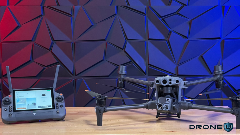
With the Matrice 30T, DJI offers unmatched dual-vision and ToF sensors, a robust remote controller, and even a docking station for truly remote operations.
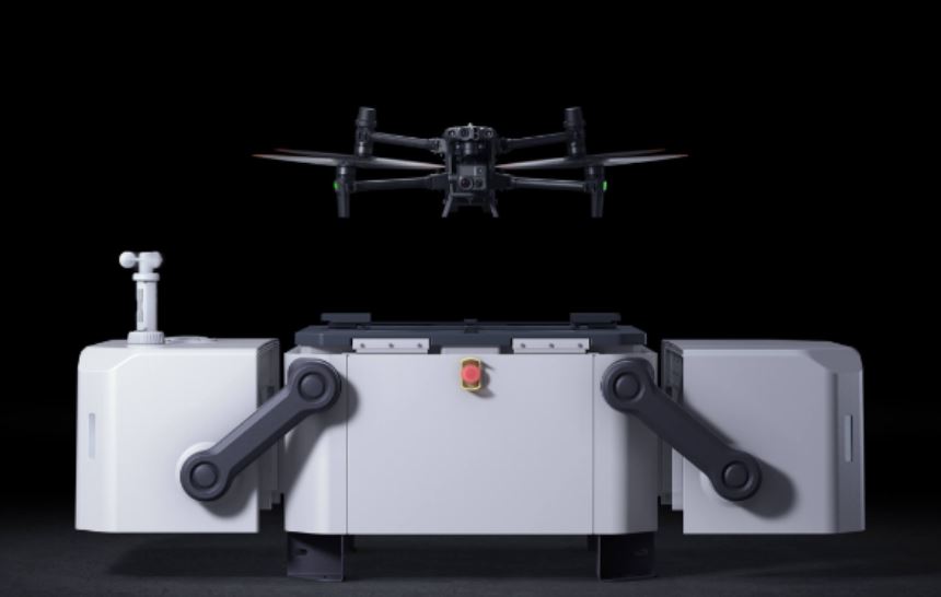 DJI M30T with Dock Station | Source: DJI
So before we go any further, let us take a look at the price and variants.
The Worry-Free Plus Combo of DJI Matrice 30T costs USD 14,700 and the Basic Combo costs USD 13,999.
The DJI Matrice 30 series (M30 or M30T) core package includes a DJI RC Plus, two TB30 Intelligent Flight Batteries, one BS30 Intelligent Battery Station, and a storage case for the aircraft.
This little powerhouse DJI M30T is like a Mini Me to the M300, delivering the ultimate camera payload for your inspection needs.
When we evaluated the DJI Matrice 30T, the following factors were on top of our minds:
Now, let’s delve into the specifications of the Matrice 30T to see how it measures up.
The DJI Matrice 30 Series (M30 or M30T) is an advanced enterprise drone with a suite of advanced features and specifications.
Let’s take a sneak peek into the performance and capabilities of the DJI M30 Series:
The aircraft offers so many upgrades to every aspect of the traditional quadcopter that it is difficult to succinctly state the insane value this drone offers.
The wide camera can be used to capture color-rich video and be used for autonomous mapping missions. The zoom camera offers 16x optical zoom but allows the user to zoom in 200x on the remote…with digital zoom. The key difference between other DJI enterprise drones and the M30t, is the ability for the M30t to record all 4 cameras at once.
The new remote and DJI Pilot 2 app offers programmable flight modes, a laser rangefinder, pinpoint drop, and even integrated checklists.
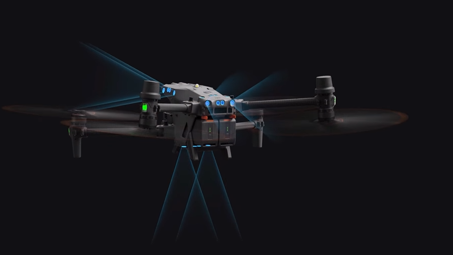
The aircraft has 360-degree obstacle avoidance which displays on the screen in a useful, yet simple interface.
At times, the DJI Matric M30 can make you feel like a fighter pilot with boots on the ground.
 Source: DJI
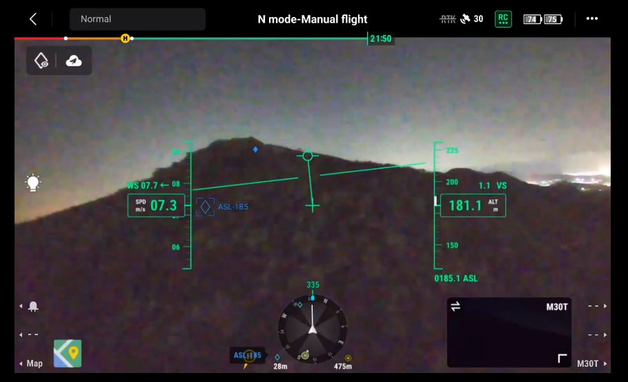
Flying this drone leaves you amazed by its stability and agility. The heads-up display puts all the necessary information right at your fingertips.
The programmable flight modes allow pilots to switch to attitude mode to avoid emergencies or fly in difficult situations.
The DJI Matrice 30T offers features to empower drone teams and programs. Multiple users can set up remote customization and save them in the remote. Thereby making aircraft sharing easy and convenient.
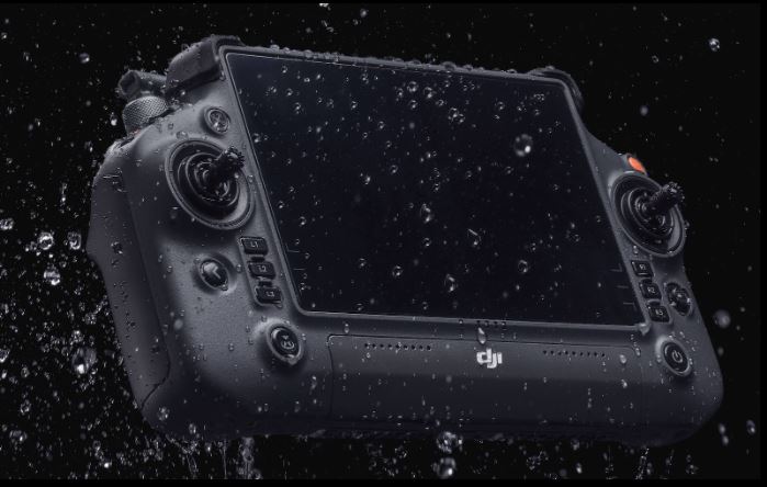
The new remote is nothing like the “Smart Controller,” offered with the DJI M300. The DJI M30T remote offers numerous methodologies for completing the same tasks. This remote makes it easy to switch between cameras, drop pins or even measure distances or temperatures.
 Dual-vision and ToF sensors in Matrice 30 Series | Source: DJI
Battery maintenance has always been an issue in the enterprise environment. Since multiple hands use the aircraft, it often results in greater wear and tear. The good news is – DJI’s new battery charger makes battery maintenance easy.
The charger offers 3 distinct modes for charging batteries and storing them.
DJI even included expanded instructions for deep cycling the battery. These features will help programs and departments maintain batteries over a longer time. It also allows you to maintain mission readiness with the aircraft.
Probably yes.
Here are a few reasons why the DJI Matrice 30T is the best inspection drone on the market:
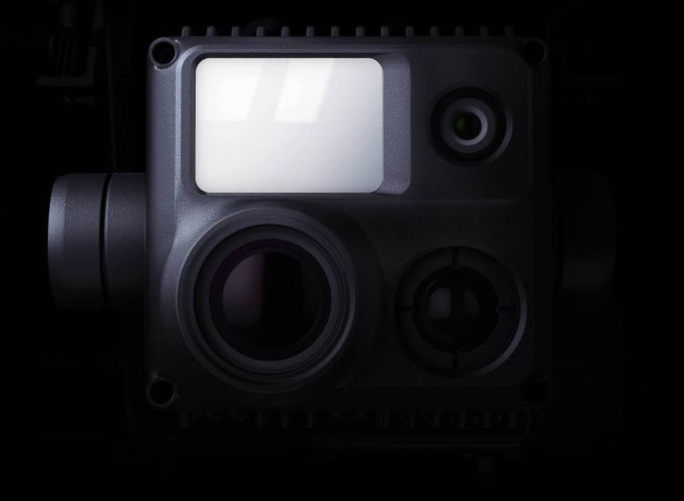 Wide Camera, Zoom Camera, Thermal Imaging Camera, and Laser Rangefinder | Source: DJI
As mentioned earlier, the M30T’s triple camera payload includes a high-resolution 48MP main camera, a thermal camera, and a 12 mp wide-angle lens camera. This allows the M30T to capture a wide range of images and video footage, including thermal imagery, which is essential for many inspection tasks.
When capturing numerous perspectives, allows drone pilots to choose the best-looking video after the flight.
With a flight time of up to 41 minutes, the M30T can cover large areas and complete inspections efficiently. This is particularly useful for inspections of large structures such as bridges or buildings, where a long flight time is essential.
 Water and Dustproof Design of Matrice 30T | Source: DJI
The M30T has enterprise environmental adaptability, featuring a robust, weather-resistant frame. This enhances its reliability for inspections in challenging conditions, such as high winds or inclement weather, making it ideal for harsh environments.
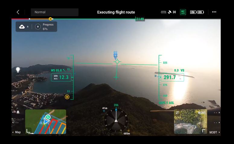
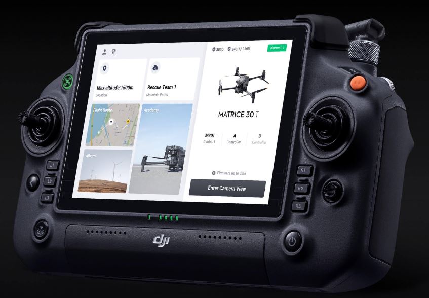 Flight Interface in DJI Pilot 2 | Source: DJI
The advanced software inside M30T allows you to perform autonomous flights and follow pre-programmed inspection routes. This helps ensure that inspections are thorough and consistent, and allows operators to focus on other tasks while the M30T is in the air.
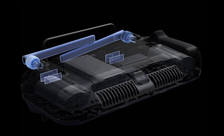 Four Antenna OcuSync 3 Enterprise | Source: DJI
The enterprise drone Matrice 30T is equipped with four built-in antennas that support OcuSync 3 Enterprise, allowing for triple-channel 1080p video transmission and the ability to seamlessly swap between input feeds even in challenging environments.
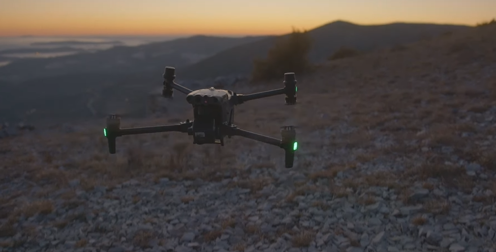
 Night Flight Mode | Source: DJI
The FPV camera is optimized for low-light conditions. This ensures clear visibility of the ground and skyline, even at night.
While the Mavic 3 Enterprise drone may be a better solution for Mapping Missions, the M30T offers the ultimate camera payload suite to service just about any drone job. At 1/4 the size of the DJI M300, the DJI M30T offers better camera sensors at half the price.
In conclusion, the DJI Matrice 30T is the best drone for the money for inspection professionals. Its advanced camera payload, long flight time, rugged design, and advanced software make it a reliable choice for demanding inspection jobs.
The DJI Matrice 30T drone is a game-changer for the enterprise industry, providing an innovative solution for various inspection tasks.
 Entreprise Drone from DJI Matrice 30 Series | Source: DJI
Whether you are conducting infrastructure inspections, search and rescue missions, or other industrial applications, the DJI M30T drone offers a range of benefits that set it apart from other enterprise drones in its class.
Summarizing the features of DJI M30T
So if you’re searching for a drone that can handle tough conditions and provide excellent results, the M30T is definitely worth considering.
Despite its impressive capabilities and being the best drone for the money today, the DJI M30T is not without its limitations. Understanding these limitations is crucial for enterprise professionals who are considering incorporating the DJI M30T into their operations:
 DJI M30 Series | Source: DJI
The DJI Matrice 30 series consists of two models: the M30, equipped with a gimbal and camera featuring three sensors (wide-angle, zoom, and laser rangefinder), and the M30T is the best drone for the money with a gimbal and camera featuring four sensors (wide-angle, zoom, laser rangefinder, and thermal imaging).
The M30 provides 41 minutes of flight time and can reach a maximum flight speed of 23 m/s.
The DJI Matrice 30 offers higher operational efficiency with a wind resistance of 15 m/s, a max tilt descent speed of 7 m/s, and a maximum speed of 23 m/s.
The DJI Matrice 30 is an excellent drone suitable for search and rescue, inspection, and safety applications. Among enterprise drones, the DJI M30T stands out as the best option so far.
The DJI Dock (M30 Series Dock Version 5) boasts flagship-level performance, featuring a maximum operation range of 7 km.
Transform Your Drone Operations with the DJI M30T Series and Our Exclusive “Don’t Crash” Course! Get the most out of your investment, sharpen your skills, and elevate your performance to new heights. Click here to enroll.

Add Your Comment