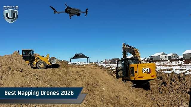
Best Mapping Drones 2026 (Buyer’s Guide)
December 23, 2025
Choosing the best mapping drones is no longer a simple hardware decision. You’re selecting a system that affects data accuracy, project timelines, and the reliability of every map you deliver. The wrong choice can slow down fieldwork, complicate processing, and introduce errors. These errors may not be detected until long after the flight is over.
Mapping demands more than sharp photos. You need accurate positioning, clean image capture, and software workflows that turn raw data into usable maps. That’s why drones built for mapping differ meaningfully from general-purpose drones.
This buyer’s guide explains what distinguishes true mapping drones from standard drones. We’ll also explore the key features that matter most, so you can choose a platform that fits your projects and scales with your operations.
Let’s first understand what qualifies a drone for mapping work.
A mapping drone in 2026 does more than capture photos. It collects data you can measure and trust. Accurate positioning is the foundation. RTK or PPK is now a standard feature on serious mapping drones, as it improves location accuracy and reduces reliance on ground markers.
Sensors matter just as much. Mechanical-shutter cameras help keep images sharp and distortion-free. Higher resolution only helps when it improves ground detail at safe flying heights. Multispectral and LiDAR sensors are also becoming more common for complex terrain and vegetation.
Software ties everything together. A true mapping drone integrates seamlessly with tools such as Pix4D, DroneDeploy, DJI Terra, or ArcGIS Reality. When the drone and software operate as one system, mapping becomes faster, more consistent, and easier to scale.
Next, let’s explore the features that directly affect accuracy, efficiency, and long-term value.
Before comparing models, it helps to understand what separates strong mapping drones from basic aerial platforms. Accuracy type, camera design, flight efficiency, and software compatibility all affect the quality of your final maps.
Accuracy should be your starting point. If you deliver high-accuracy mapping data, you need centimeter-level positioning. That usually means RTK or PPK. RTK gives you real-time corrections in the field and accelerates data collection. PPK offers greater flexibility and often performs better under varying signal conditions. Standard GPS is suitable for basic planning or relative measurements, but you must accept its limits before choosing it.
The camera directly affects map quality. Mechanical-shutter cameras still matter because they reduce motion blur during flight. This becomes important when you fly faster or cover larger areas. Resolution only helps when it improves ground sampling distance at safe altitudes. A higher megapixel count alone does not guarantee better maps. Multispectral and LiDAR sensors add value when you map vegetation, terrain, or complex sites. If your projects don’t require that data, those sensors increase cost without clear returns.
Flight efficiency determines how much work you complete in a day. You should think in acres per flight, not just minutes in the air. Longer endurance reduces battery swaps and downtime. Multirotor drones perform well on small or complex sites where control matters. Fixed-wing and VTOL drones make more sense when you map large areas or long corridors and need maximum coverage.
Software ties your entire mapping workflow together. Your drone should work cleanly with industry-standard mapping and GIS software. Strong integration reduces processing time and limits manual fixes after each flight. You should treat software compatibility as a core buying requirement, not an afterthought.
Next, let’s group mapping drones by how they are used in real projects.
Mapping drones are built to solve different problems. Each category exists for a reason. When you understand these categories, choosing the right drone becomes much easier.
These drones are most effective for large projects. You use them for long corridors and wide areas. Mapping teams, utilities, and government agencies rely on them.
Most models include RTK or PPK as standard. Many support LiDAR and high-end RGB sensors. They cost more up front, but they save time in the field. They also reduce re-flights and data issues. If you map highways, transmission lines, or large developments, this category makes sense.
This category covers most everyday mapping work. You use these drones on construction sites and GIS mapping projects. They balance accuracy, portability, and speed.
RTK support is common. Setup is quick. You can move from site to site without hassle. These drones work well for volume calculations, site plans, and progress tracking. If your team flies frequently, this category typically offers the best value.
Entry-level mapping drones make it easier to get started. You use them for basic planning and internal maps. They work well when budgets are limited.
Some models include RTK. Others rely on standard photogrammetry. These drones have clear limits. When used correctly, they help small teams build mapping skills without high upfront costs.
These drones focus on coverage. They stay in the air longer and cover more ground per flight. You use them for agriculture, mining, and corridor mapping.
They need more space and planning to operate. In return, they reduce field time on large jobs. If you map hundreds or thousands of acres, this category is worth serious attention.
With these categories in mind, let’s look at the best mapping drones you can buy in 2026.
The best mapping drones are those that align with your fieldwork process. Some are built to cover very large areas. Others focus on repeat site mapping or progress tracking. A few aim to make mapping more accessible for smaller teams. This section highlights the top mapping drones for 2026 based on real-world use, not marketing claims.
Each drone below follows the same structure, so you can easily compare them and decide which platform fits your projects.
These drones are built for large jobs where accuracy and reliability matter. You choose them when mapping errors are costly, and repeat flights are not an option.
The DJI Matrice 350 RTK is a strong choice for enterprise mapping in 2026. You use it when you need flexibility and consistent results. It includes RTK for high positioning accuracy and supports advanced cameras and sensors. This allows you to create detailed maps and 3D models from the air.
The M350 RTK performs well on large construction sites, utility work, and infrastructure projects. It handles wind and weather better than smaller drones and is designed for frequent use. It is not small or quick to deploy, but it delivers consistent results when scale and precision matter.
This drone is suitable for teams that fly often and need predictable performance.
The WingtraOne GEN II is designed to map large areas efficiently. Its vertical takeoff and landing design lets you fly like a fixed-wing drone without needing a runway. This design enables it to cover more ground per flight than most multirotor drones.
You cover large areas in fewer flights, which saves time and battery cycles. The drone uses PPK processing to improve positioning accuracy after the flight. This reduces reliance on live RTK connections in the field.
WingtraOne GEN II is well-suited for wide-area mapping where speed and coverage matter more than tight spaces. It is not ideal for confined sites or short flights, but it excels when you need to map hundreds of acres efficiently.
This drone is ideal for teams that prioritize coverage and clean data workflows.
The Trinity F90+ offers another VTOL option for enterprise mapping. It combines long endurance with stable flight and PPK-based positioning.
You use this drone when you need efficient coverage and consistent data collection over large areas. It excels in environmental mapping, land monitoring, and large infrastructure projects.
The platform prioritizes efficiency over a compact design. Setup takes more time, and transport requires planning. In return, you get long flight times and reliable mapping output.
This drone works best for teams managing repeated large-area mapping missions.
These drones are built for everyday mapping work. You can use these drones on construction sites, land development projects, and to repeat progress checks. They balance accuracy, portability, and ease of use, which makes them practical for teams that fly often.
The Mavic 3 Enterprise series is popular for delivering strong mapping results in a small package. You can carry it easily and deploy it in minutes. RTK support improves positioning accuracy, reducing the need for later manual corrections.
The standard Mavic 3 Enterprise is well-suited for visual mapping and 3D models. The Mavic 3M adds a multispectral sensor, which helps when you need plant or land health data. Both models integrate well with common mapping software.
These drones are not ideal for very large areas or heavy sensor setups, but they perform well for regular site mapping.
The Phantom 4 RTK remains a reliable choice for accurate mapping. It includes built-in RTK and a mechanical shutter camera, which helps reduce image distortion during flight.
This drone helps create repeatable mapping results with minimal setup time. The built-in RTK system and mechanical shutter camera reduce image distortion and alignment errors. That means fewer corrections during processing and more consistent outputs across flights. The drone is larger and harder to transport than newer folding models.
It’s a good option when you value predictable performance over compact design.
The Autel EVO II Enterprise RTK (V3) offers an alternative to DJI platforms. It includes RTK support and a high-resolution camera in a compact design. You can deploy it quickly and move between sites with minimal setup.
This drone is suitable for teams that want flexibility beyond the DJI ecosystem. It handles regular mapping tasks and produces clean data when paired with compatible software.
Software support is not as broad as DJI’s. You should confirm workflow compatibility before committing to this platform.
When choosing a mapping drone, seeing key specs and capabilities at a glance helps you make faster, smarter decisions. This comparison highlights how today’s best mapping drones differ in accuracy, coverage, and ideal use. It gives you a clear view of which platforms are best suited to small sites, large areas, or long-range mapping work.
| Drones | RTK/PPK | Camera Type | Flight Time | Typical Coverage | Ideal Use Case | Price Range |
| DJI Matrice $4,000 – $8,000 350 RTK | RTK | Interchangeable RGB / LiDAR | 55 minutes | 500+ acres | Large construction sites, utilities, and infrastructure | $11,129 |
| WingtraOne GEN II | PPK | High-end RGB | 55 minutes | 800+ acres | Large-area mapping, open terrains | $19,900 |
| Quantum Systems Trinity F90+ | PPK | RGB / LiDAR | 90 minutes | 1,000+ acres | Agriculture, mining, and long corridor mapping | Not specified |
| DJI Mavic 3 Enterprise / Mavic 3M | Optional RTK | Medium-format RGB | 45 minutes | 150–200 acres | Small to medium sites, portable mapping | $4,509 |
| DJI Phantom 4 RTK | RTK | 20MP RGB | 30 minutes | 100–150 acres | Small to medium projects, progress tracking | $4,499 |
| Autel EVO II Enterprise RTK (V3) | RTK | 48MP RGB | 38 minutes | 150–200 acres | Entry to medium mapping, site documentation | $5,799 |
Next, analyze a simple decision framework to help you choose the best mapping drone for your projects.
Choosing the best mapping drones can seem simple once you break down the decision process into a few clear steps. Instead of starting with brands or price, you start with your real-world work and build from there.
Accuracy is the foundation of every mapping project. Some jobs require precise location data that aligns cleanly with design files or GIS layers. In these cases, you want a drone that supports RTK or PPK. These systems improve location accuracy by correcting GPS data during or after the flight.
For general planning, visual maps, or progress tracking, standard GPS or optional RTK is often enough.
Project size changes the type of drone that makes sense. Smaller sites benefit from compact multirotor drones. They are easy to carry, quick to launch, and simple to repeat flights over time.
Larger areas favor drones with longer flight times or fixed-wing designs. These platforms cover more ground in fewer flights. They reduce battery swaps and speed up data collection when you work across long corridors or wide open land.
The drone itself is only part of the cost. You also need to think about positioning tools, software licenses, training time, and ongoing support. A lower-priced drone can become expensive if it requires limited software or adds extra manual work.
A well-matched drone saves time on every project. It fits cleanly into your workflow and reduces re-flights, data cleanup, and processing delays. That long-term efficiency matters more than the upfront number.
In the U.S., you operate under FAA Part 107. That affects how you fly, where you fly, and how you document missions. Some enterprise drones make compliance easier with built-in tracking, Remote ID support, and team management tools.
You should also consider who will fly the drone. Simple controls and repeatable flight planning reduce training time and lower the risk of mistakes. A drone that your whole team can use confidently delivers better results over time.
Next, let’s examine how mapping software directly affects which mapping drone is best suited to your workflow.
Mapping software plays a direct role in choosing the best mapping drones. The drone you select must work smoothly with the tools you use to process images and create maps. Poor software support can slow your workflow, increase costs, and limit the value of your data.
Most professional mapping drones support leading photogrammetry and GIS platforms, but the level of integration varies by manufacturer. The difference is how easily they integrate. Some drones work best with native software, while others give you the flexibility to choose third-party tools. This matters because software controls flight planning, data processing speed, and output quality.
For larger areas, software performance becomes even more important. You need tools that handle large datasets, support batch processing, and clean exports without extra manual steps. Before buying a drone, confirm it fits your current software workflow and scales with your projects tomorrow.
Think of software as part of the hardware decision. When both align, mapping becomes faster, simpler, and more repeatable.
Choosing the best mapping drones comes down to matching the drone to the work you actually do. There is no single “best” option for everyone, but there is a best fit for each type of use case.
If you want the best overall mapping drone, the DJI Matrice 350 RTK stands out. It delivers strong accuracy, long flight time, and flexible sensor support. It works well for teams handling complex sites, repeat projects, and demanding workflows.
If your focus is large-area mapping, fixed-wing and VTOL platforms such as the WingtraOne GEN II and Quantum Systems Trinity F90+ make more sense. These drones cover far more ground per flight and reduce total mission time.
If you need high-accuracy results without enterprise complexity, drones like the DJI Phantom 4 RTK and Mavic 3 Enterprise offer a practical balance. They provide consistent positioning, simple setup, and smooth integration with popular mapping software. They suit teams that want dependable outputs without heavy infrastructure.
For smaller teams or growing businesses, the best mapping drone is often the one that fits your workflow today and scales with your business. Portable platforms with optional RTK support give you flexibility while keeping costs under control.
If you’re building or refining a mapping program, focus on accuracy requirements first, then match the drone to your project size and software stack. Hardware alone won’t define your results. Your processing tools, data handling, and operational setup matter just as much as the drone itself.
Are you still unsure which mapping drone fits your needs?
Join DroneU courses & training to get expert guidance, hands-on mapping education, and unbiased advice on the best mapping drones.

