Discover How Fixed-Wing Drones Deliver Real Results
Fixed-wing drones cover large areas efficiently, but their true value comes from turning flight data into actionable insights. Learn how professionals plan, execute, and deliver large-area missions that clients can actually use.
Thank you!
Thank you. You will now be redirected to your requested resources.
Fixed-wing drones are UAVs designed like airplanes. They generate lift by moving forward through the air, not by spinning rotors. This makes them far more efficient than quadcopters for long-range missions. A single charge can cover 500 to 2,000 acres at flight times of 60 to 210 minutes.
They are the standard platform for large-area mapping, agricultural surveys, corridor inspections, and search and rescue over wide terrain.
The best professional fixed-wing drones in 2026: Wingtra One Gen II (best for precision mapping), Trinity F90+ (best for endurance), JOUAV CW-25E (longest flight time at 210 minutes), and SenseFly eBee X (best established mapping platform).
Not the right tool for: hovering, close-range inspections, confined spaces, or urban environments. Use a multirotor for those missions.
Fixed-wing drones are UAVs built like small airplanes. They generate lift by moving forward through the air rather than spinning rotors. This design makes them far more efficient than quadcopters, capable of staying airborne for 60 to 210 minutes and covering thousands of acres on a single charge.
In this article, we’ll explore 8 of the most impressive fixed-wing drones, from professional-grade mapping machines to rugged, field-ready fliers.
Before we dive into our top picks, let’s understand what makes fixed-wing drones different.
What are Fixed Wing Drones?
Fixed-wing drones, as the name suggests, have a fixed-wing structure, similar to a traditional airplane. Unlike quadcopters, they do not rely on spinning rotors to stay in the air.
Instead of hovering, fixed-wing drones generate lift by moving forward. As air flows over and under the wings, the drone stays airborne with far less energy.
Because of this design, fixed-wing UAVs typically offer longer flight times, greater coverage per battery charge, and higher cruising speeds than their multi-rotor counterparts.
This makes fixed-wing drones ideal for mapping large areas, agricultural field analysis, or conducting search-and-rescue operations.
In short, fixed-wing drones are designed for coverage, endurance, and efficiency, not close-up inspections or cinematic flying.
Next, let’s understand the difference between fixed-wing and rotary-wing drones.
Rotary Wing Drone vs Fixed-Wing UAV
Fixed-wing UAVs and rotary-wing drones (like quadcopters) are built for completely different jobs.
Fixed-wing drones are better for long-range mapping and endurance missions, while rotary-wing drones excel at hovering, inspections, and close-range imaging. Choosing the right one comes down to what you’re trying to accomplish.
Here’s a side-by-side breakdown to help you make a confident call:
Feature
Fixed-Wing Drone
Rotary-Wing Drone (Quadcopter)
Flight Time
60-120 minutes (more efficient)
20–30 minutes (limited by power draw)
Maneuverability
Requires forward motion; can’t hover
Can hover, rotate, and fly in tight spaces
Range
Long-range
Short-range
Speed
Fast cruising
Slower
Payload Capacity
Usually high, suited for mapping gear
Moderate; limited by power and space
Launch/Recovery
Needs space to take off and land
Vertical takeoff/landing; fly from anywhere
Ease of Use
Steeper learning curve
Beginner-friendly
Best For
Mapping, surveying, agriculture, and long-range missions
Photography, inspections, and indoor flights
Choose a Fixed-Wing Drone When…
You’re mapping large areas like farmland, forests, or mine sites
Endurance matters more than hovering
You want consistent data over a long distance
You’re working in open areas where takeoff/landing isn’t a problem
Example: Mapping hundreds of acres of farmland in a single flight.
Use a Rotary-Wing Drone When…
You need to hover, circle, or fly low and slow
You’re capturing video footage or real estate photography
You’re inspecting infrastructure like towers, roofs, or bridges
You’re flying in urban or confined spaces
Example: Shooting a cinematic flyover of a building or inspecting a roof up close.
In short, fixed-wing drones are built for coverage and efficiency, whereas, rotary-wing drones are built for control and precision.
Understanding this difference makes it much easier to choose the right platform for your work.
Let’s discover the top 8 fixed-wing drones.
8 Best Fixed-Wing Drones with Cameras
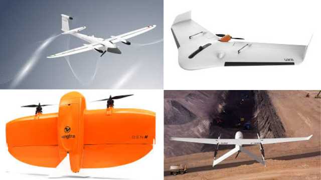
To provide you with a quick overview, here are the names of the best 8 fixed-wing drones with cameras:
Wingtra One Gen II: The Mapping Maverick
Trinity F90+: The Endurance Expert
JOUAV CW-25E: Long Endurance
eBee X: The Reputable Rival
Autel Dragonfish Pro: The Endurance Extraordinaire
Bramore C4 Eye: The Unrivaled King
Delair UX11: The Precision Mapping Professional
Boeing ScanEagle: The Endurance Legend
1. Wingtra One Gen II
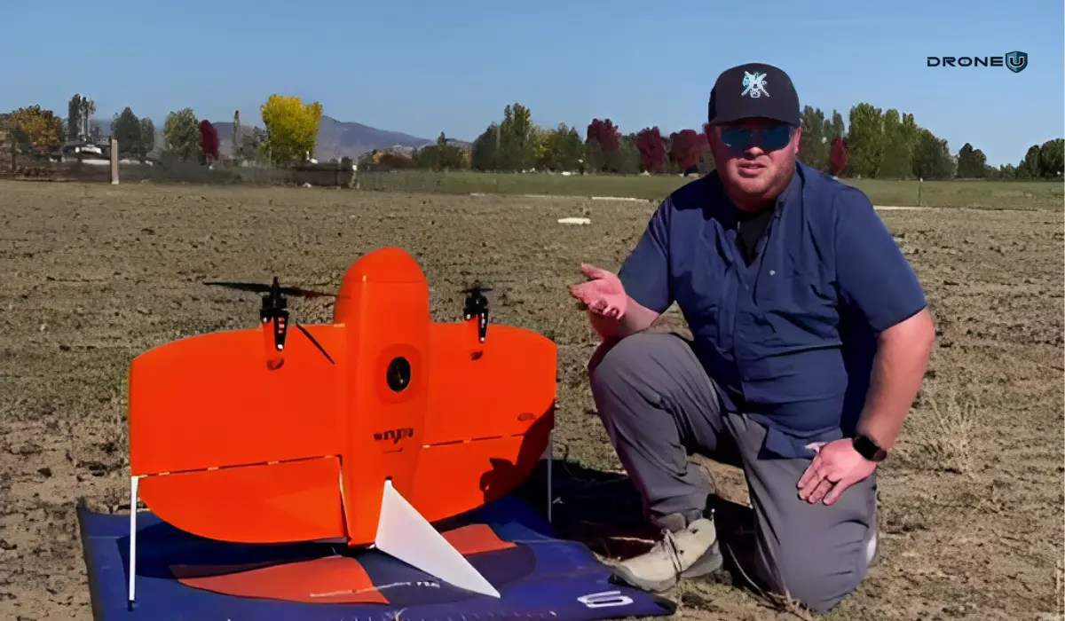
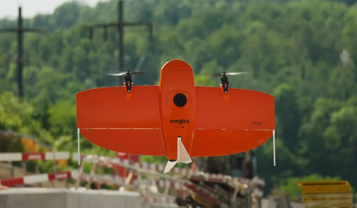
The Wingtra One Gen II is the NDAA (National Defense Authorization Act) approved professional mapping drone that leads this list.
This is the top professional mapping drone on this list. Not only does it carry a full-frame camera, but it also includes the Wingtra Hub software.
This software geo-tags photos with PPK (Post-Processed Kinematic) precision.
If you’re in the business of mapping, this is the drone that dreams are made of. Not only does it carry a full-frame camera, but it also boasts the Wingtra Hub software.
With this capability, the Wingtra One Gen II delivers fast georeferenced orthomosaics when paired with Pix4D React software.
This drone is equipped with a range of payloads to cater to your mapping needs, from multispectral to the latest addition, the lidar system.
However, the oblique camera is not recommended for most mapping missions
Here are the full specifications:
Features of Wingtra One Gen II
Feature
Wingtra One Gen II
Weight
3.7 kg (8.1 lb)
Max. payload weight
800 g (1.8 lb)
Wingspan
125 cm (4.1 ft)
Battery capacity
Two 99 Wh batteries
Radio link
Bi-directional 10 km (6 mi) in direct line of sight
Flight planning & mission control software
WingtraPilot
Flight speed
16 m/s (35.8 mph)
Maximum flight time
Up to 59 min
Min. space for take-off and landing
2 m × 2 m (6.6 ft × 6.6 ft)
Temperature range
-10 to +40 °C (14 to 104 °F)
Weather resistance
IP54, not recommended to fly in fog, rain, or snow.
Transmission Distance
10 Kilometers
Thanks to the newest partnership, we can help users acquire the Wingtra One Gen 2 and get a discount on our mapping class with their purchase. Email me: [email protected].
2. Trinity F90+
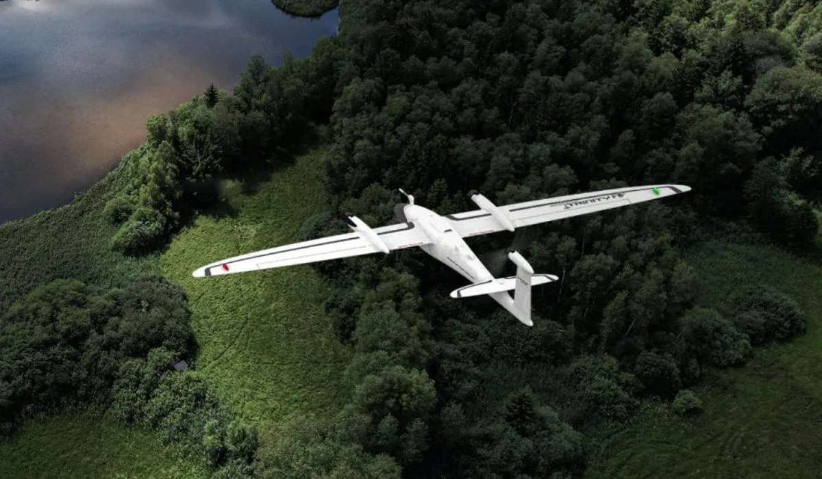
The Trinity F90+ has one of the longest flight times on this list.
But the F90+ doesn’t just go the distance; it also offers a respectable 15-kilometer range.
When it comes to covering vast areas, the Trinity F90+ outperforms most multicopters and other fixed-wing drones.
Its significantly longer flight time allows it to cover up to 20 times larger areas, making it the go-to choice for those who need to map extensive landscapes.
With a flight time exceeding 90 minutes and the most extensive range of payload options available, the Trinity F90+ suits demanding commercial mapping missions. It comes equipped with PPK (Post-Processed Kinematic) technology, supported by the Quantum-System iBase Ground Reference Station powered by u-blox, ensuring pinpoint accuracy in every mission.
It also supports visual (RGB) and multispectral dual payload options.
The Trinity F90+ has powerful motors that maintain performance in challenging wind conditions.
With Live Air Traffic (ADS-B (Automatic Dependent Surveillance-Broadcast) ) and QBase Mission Planning, you’re in full control of your flights, ensuring safety and efficiency.
The 2.4 GHz telemetry has a range of up to 7.5 kilometers. Plus, the optional ADS-B Mode-S out further enhances your situational awareness and safety.
For large-area mapping and surveying that demands precision and endurance, the Trinity F90+ is the top choice.
Features of Trinity F90+
Feature
Trinity F90+
Weight
5.5 kg (12.13 lbs)
Max. payload weight
700 g (1.5 lb)
Wingspan
2.394 m (7.85 ft)
Battery capacity
Two 100 Wh batteries
Flight planning & mission control software
QBase 3D
Flight speed
17 m/s
Wind resistance
Max sustained wind: 12 m/s Max wind gusts: 18 m/s
Maximum flight time
90 min (subject to export regulation)
Min. space for take-off and landing
3 m × 3 m (9.8 ft × 9.8 ft)
Temperature range
-12 °C to 50 °C (10.4 °F to 122 °F)
3. JOUAV CW-25E
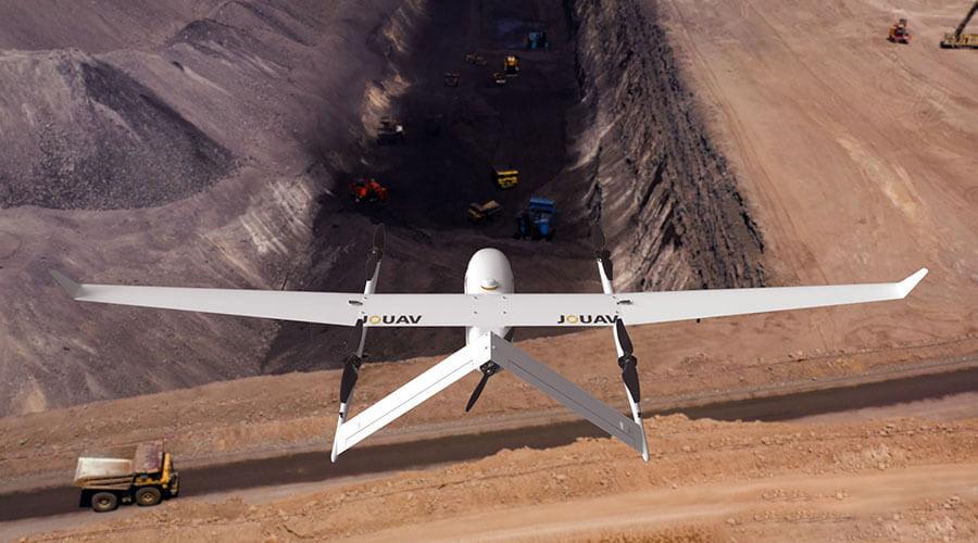
JOUAV’s CW series is another strong contender, known for its versatility and affordability compared to some other VTOL options.
Its CW-25E is a long-endurance electric fixed-wing VTOL drone. It boasts a long flight time, with estimates ranging from 150 minutes to 210 minutes depending on the payload. This allows it to cover large areas and complete missions without needing to recharge or refuel as often.
With a service ceiling of up to 6,000 meters, the CW-25E can operate at high altitudes, which can be useful for tasks like aerial surveillance, search and rescue in mountainous areas, and meteorological data collection.
Overall, the CW-25E seems like a capable fixed-wing drone that offers a good combination of long flight time, high altitude capability, versatility, ease of use, and durability.
Features of JOUAV CW-25E
Feature
JOUAV CW-25E
Max Flight Time
210 minutes
Cruising Speed
70km/h
Max Service Ceiling
6000m
Max Payload
6kg
GPS
Yes
Anti-vibration Capability
Yes
Auto-Return
Yes
4. SenseFly eBee X
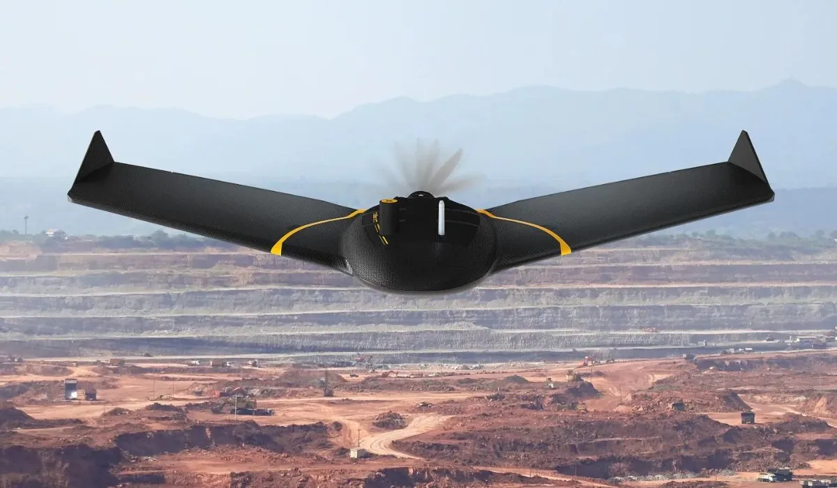
Before the Wingtra became the leading mapping drone, the eBee X held that position. The eBee X still holds up well, with a 90-minute flight time that matches newer competitors.
The NDAA-approved Sensefly eBee X, undoubtedly one of the most popular fixed-wing drones on the market, has earned its reputation as an agricultural mapping workhorse.
The eBee X requires more space and more pilot skill to land than most drones on this list. It requires a skilled pilot and open space to land correctly.
However, its popularity speaks for itself.
With a choice of six different payloads, this drone handles agricultural mapping well. The SenseFly eBee X is well-equipped to meet the precise demands of any project. Its unique Endurance Extension pushes the envelope, offering a staggering maximum flight time of 90 minutes, allowing you to cover vast expanses of up to 1,235 acres at 400 feet above ground level (AGL).
The eBee X offers a 10-kilometer range, making it a reliable long-range option for large-area surveys.
Additional RTK (Real-Time Kinematic) activation lets you achieve pinpoint accuracy down to 3 centimeters (1.2 inches), all without the need for Ground Control Points.
The Autel Dragonfish Pro is a tilt-rotor VTOL fixed-wing drone with 158 minutes of flight time and a 15-kilometer range. Its tilt-rotor design allows vertical takeoff and landing while maintaining fixed-wing efficiency in cruise.
Unlike mission-locked platforms, it can be flown manually like a standard drone, which adds operational flexibility. It supports modular payloads and includes AI tracking capabilities out of the box.
Features of Autel Dragonfish Pro
Feature
Autel Dragonfish Pro
Weight
8.5 kg (18.7 lbs)
Max. payload weight
1.8 kg (4 lbs)
Wingspan
1.6 m (5.25 ft)
Battery capacity
Four 174 Wh batteries
Radio link
Bi-directional 30 km (18.6 mi) in direct line of sight
Flight planning & mission control software
Autel Voyager
Flight speed
108 km/h (67 mph)
Maximum flight time
180 min
Min. space for take-off and landing
3 m × 3 m (9.8 ft × 9.8 ft)
Temperature range
-20 to +50 °C (-4 to +122 °F)
6. Bramore C4 Eye
The Bramor C4EYE is C-Astral’s long-endurance fixed-wing platform.
If you thought the Dragonfish Pro’s flight time was impressive, the Bramor C4EYE has a flight time of 3.5 hours, the longest of any electric fixed-wing drone on this list.
These industry-leading unmanned aircraft systems are electrically powered, boasting superior stability and endurance, thanks to their unique advanced Blended Wing Body airframe aerodynamics.
The Bramor offers an array of impressive payload combinations, ensuring that every byte of data, from digital to thermal/IR, is collected with utmost precision.
If you’re engaged in serious fixed-wing drone applications, whether for mapping, surveillance, or any other task that demands uncompromising endurance, the Bramor is a strong choice for mapping, surveillance, and endurance missions.
Features of Bramor C4EYE
Feature
C-Astral’s Bramor C4EYE
Weight
4.7 kg (10 lb)
Max. payload weight
1 kg (2.2 lb)
Wingspan
2.3 m (7.7 ft)
Battery capacity
Two 93 Wh batteries
Radio link
Standard: 40 km (25 mi) LOS Extended: 150 km (93 mi)
Flight planning & mission control software
Bramor GCS
Tablet supplied
Rugged tablet with 10.1-inch screen
Flight speed
20 m/s (45 mph)
Wind resistance
Max sustained wind: 30 knots (35 mph)
Maximum flight time
3.5 hours
Min. space for take-off and landing
2 m × 2 m (6.6 ft × 6.6 ft)
Temperature range
-20 to +50 °C (-4 to +122 °F)
7. Delair UX11
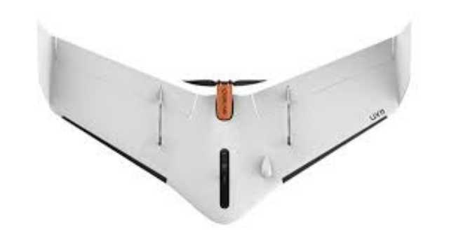
The Delair UX11 is one of the most widely used fixed-wing drones in commercial mapping.
This UAV is built from the ground up for precision aerial mapping and professional data capture.
The UX11 covers up to 300 acres with 80 minutes of flight endurance, capturing high-resolution imagery that surveyors and geospatial professionals depend on.
Easy-to-deploy and reliable in the field, it’s trusted for accurate photogrammetry, consistent data quality, and seamless BVLOS (Beyond Visual Line of Sight) operations where permitted.
Whether you’re mapping farmland, construction sites, or terrain for GIS (Geographic Information System) projects, the UX11 delivers reliable results with minimal setup time.
Features of Delair UX11
Feature
Delair UX11
Weight (With payload)
1.6 kg (3.5 lb)
Wingspan
1.2 m
Maximum flight time
Up to 80 minutes
Cruise speed
54 km/h (34 mph)
Coverage per flight
300+ acres (120+ ha)
Camera payload
Integrated high-res RGB & PPK GNSS
Launch & recovery
Hand-launch / belly landing
Connectivity
Radio + 3G/4G cellular
8. Boeing ScanEagle
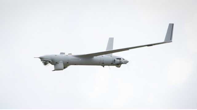
The Boeing ScanEagle is a proven long-endurance fixed-wing drone with years of real-world operational history.
ScanEagle is designed for missions where staying airborne is more important than anything else. With endurance measured in hours, not minutes, it operates far beyond the limits of most commercial UAVs.
Its launch and recovery system sets it apart. No runway required. No VTOL complexity.
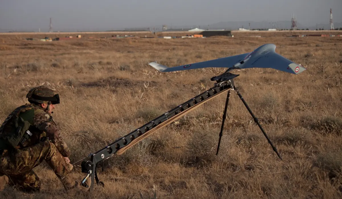
Instead, a catapult launch and precision SkyHook recovery enable operations from ships, remote outposts, and confined environments.
Equipped with stabilized EO/IR (Electro-Optical/Infrared) camera systems, it delivers continuous surveillance, wide-area monitoring, and long-duration reconnaissance with remarkable stability. This is why it is a trusted choice for military, maritime, border security, and large-scale environmental missions worldwide.
If your mission demands eyes in the sky for extended periods, without compromise, this is the platform built for it.
Features of Boeing ScanEagle
Feature
Boeing ScanEagle
Weight
28 kg (62 lb)
Maximum payload weight
8 kg (17 lb)
Wingspan
3.1 m (10.2 ft)
Propulsion
Gas-powered
Radio Link
Long-range encrypted datalink
Camera payloads
EO/IR, stabilized ISR (Intelligence, Surveillance, and Reconnaissance) sensors
Flight speed
110 km/h (68 mph)
Maximum flight time
18+ hours
Launch method
Pneumatic catapult
Recovery method
SkyHook system
Best for
ISR, surveillance, maritime patrol
With that understanding, let’s take a look at how fixed-wing drones work.
How Does a Fixed-Wing Drone Work?
Fixed-wing drones fly using the same basic principles as airplanes: lift, thrust, and forward motion. It might sound technical, but once you break it down, it’s easy to understand.
Let’s walk through it step by step.
Step 1: Lift
The wings are the star of the show. As the drone moves forward, air flows faster over the curved top of the wing and slower underneath. This creates a pressure difference. The wings literally pull the drone upward and keep it airborne.
This is why fixed-wing drones can glide so smoothly; they’re not relying on propellers to push them up every second as a quadcopter does.
Step 2: Thrust
Fixed-wing drones usually have a single motor with a propeller, either at the front (puller) or back (pusher). The motor creates thrust, which propels the drone forward. Once it picks up speed, the wings generate lift, and the drone climbs into flight.
Since the drone doesn’t need to fight gravity every second, it uses way less energy to stay airborne.
Step 3: Control Systems
Just like any drone, fixed-wing UAVs come with a range of flight control options:
Manual Mode: You control everything: pitch, yaw, roll, throttle. This requires skill and is usually for experienced flyers or hobbyists who enjoy full control.
Stabilized Mode: The drone assists with keeping itself balanced. You still fly manually, but it won’t let you stall or spiral out.
Autonomous Mode: This is where things get exciting. You pre-program a flight path using mapping software, and the drone follows it on its own. This is common in surveying, agriculture, and environmental monitoring. It’s the mode professionals use to cover hundreds of acres in a single flight.
For example, if you’re flying a mapping mission, you’d upload a grid pattern to the drone using software like Pix4Dcapture, press “Start,” and the drone takes care of the rest: takeoff, flight path, and return-to-home.
But, how’s this different from the basic drone design?
The basic rotary drones stay in the air by constantly spinning their propellers to generate lift. They’re great at hovering, maneuvering in tight spaces, and capturing steady aerial footage. But all that lifting takes a toll on the battery.
Fixed-wing drones, on the other hand, don’t hover. They need to keep moving. But that forward flight makes them far more energy-efficient. That’s why they’re used for long-range missions where hovering isn’t required.
Now that you know how fixed-wing drones fly, let’s break down the real-world pros and cons to decide if they’re a good fit for your flying goals.
Benefits of Fixed-Wing Drones
Fixed-wing drones offer a completely different flying experience compared to traditional drones. Let’s take a closer look at their real-world benefits.
1. Longer Flight Times
Fixed-wing drones are built for endurance. Once airborne, they glide efficiently instead of fighting gravity. That means the motor can work less, and the battery lasts longer. Many fixed-wing UAVs can fly for 60-120 minutes on a single charge, compared to the 20–30 minutes you get from a traditional rotary drone.
2. Greater Range and Speed
Because of their aerodynamic design, fixed-wing drones can travel much farther. Some models can cover 400–500 acres in one flight. These drones are designed to move forward, fast. While most quadcopters cruise at around 15–20 mph, fixed-wing drones can hit 50 mph or more. For large sites, this is a major advantage.
3. Higher Energy Efficiency
Flying forward is simply more efficient than hovering. That’s why fixed-wing drones are the go-to choice for mapping large areas, surveying long corridors like pipelines or roads, or conducting agricultural scans. They deliver more coverage with less power.
4. Ideal for Large-Area Mapping
If your goal is to map farmland, forests, or construction sites, fixed-wing drones will save you time and effort. Their consistent altitude and smooth flight path also make them perfect for collecting high-quality imagery for orthomosaics and 3D models.
Master Large-Area Drone Missions Like a Pro
Capturing large areas is only one part of the job. The key is to structure, process, and deliver data in a way that clients can use immediately.
Plan mapping missions efficiently
Capture consistent, high-quality data
Deliver client-ready outputs
Avoid costly mistakes in real projects
Thank you!
Thank you. You will now be redirected to your requested resources.
Limitations of Fixed-Wing Drones
1. No Hovering Ability
Fixed-wing drones can’t hover in place. They must keep moving to stay airborne. So if you need to fly around a structure slowly, inspect a roof, or shoot cinematic video, a quadcopter is still the better choice.
2. Requires More Space for Takeoff and Landing
Most fixed-wing drones need a smooth area, like an open field or wide dirt road, for launch and recovery. Some require hand-launching or a catapult. Landing usually involves gliding to a stop, which can be tricky in tight environments.
3. Higher Upfront Cost
Fixed-wing drones tend to be more expensive than quadcopters, especially those built for commercial work. If you’re just flying for fun, the cost might feel steep. But if you’re mapping or surveying professionally, the return on investment can be well worth it.
4. Steeper Learning Curve
As fixed-wing drones don’t hover, they require more planning and situational awareness. You’ll need to map your launch and landing zones carefully and monitor weather and wind direction more closely than you would with a quadcopter.
Conclusion
Fixed-wing drones are purpose-built tools. They are not meant to replace quadcopters. They’re built to solve a specific problem: covering large areas efficiently and consistently.
If your mission involves mapping, surveying, agriculture, or long-range monitoring, a fixed-wing drone can save time, reduce battery swaps, and streamline data collection.
However, fixed-wing drones also require a bit more planning.
You’ll need to think about your takeoff and landing zones. You’ll need to prep your flight path. And if you’re new to fixed-wing flight, it’s worth taking the time to learn the fundamentals properly.
And that’s where training comes in.
If you’re serious about flying fixed-wing drones safely and professionally, check out our Drone U Training Courses. You’ll get hands-on drone flight instruction, real-world mapping workflows, and support from a supportive community of pilots.
Deploy Fixed-Wing Drones with Confidence
Flying is easy; delivering usable data isn’t.
Understanding the full project pipeline helps you:
Decide if fixed-wing suits your mission
Set realistic expectations for large-area capture
Align outputs with client needs
Reduce costly rework
Thank you!
Thank you. You will now be redirected to your requested resources.
4
FAQs
1. What are VTOL aircraft, and how do they differ from traditional fixed-wing drones?
VTOL drones can take off and land vertically like a quadcopter, then transition into efficient fixed-wing flight. They combine runway-free operation with longer range and endurance.
2. Are there legal regulations for operating a fixed-wing drone?
Yes. Fixed-wing drones must follow local drone laws, including registration, pilot certification, airspace restrictions, and operational rules.
3. Are fixed-wing drones more challenging to operate than quadcopters?
Usually, yes. Fixed-wing drones require more space, flight planning, and awareness because they cannot hover. However, modern autonomous flight modes make them easier to operate.
4. What is the range of a fixed-wing drone?
Fixed-wing drone range depends on the platform. Small models may fly under 10 km, while professional long-range drones can cover hundreds of kilometers.
5. Does DJI make fixed-wing drones?
No. DJI currently focuses on multirotor drones and does not manufacture fixed-wing UAVs.
6. How Much Does a Fixed-Wing Drone Cost?
Professional fixed-wing drones typically cost between $5,000 and $30,000 depending on payload, endurance, and mapping capabilities. Hobby models are available for much less.
Paul Aitken is a Certified Part 107 drone pilot and a Certified Pix4D Trainer. He is a pioneer in drone training and co-founder of Drone U. He created the industry’s first Part 107 Study Guide and co-authored Livin’ the Drone Life.
Paul is passionate about helping students fly drones safely and effectively. With over a decade of experience, he has led complex UAS projects for federal agencies and Fortune 500 clients such as Netflix, NBC, the NTSB, and the New York Power Authority.
Add Your Comment
Related Articles
The Top 36 Drone Companies in 2025
How to Choose the Best Drone for Cinematic Filmmaking





Add Your Comment