How to Use Drones for Powerline Inspections

October 30, 2025
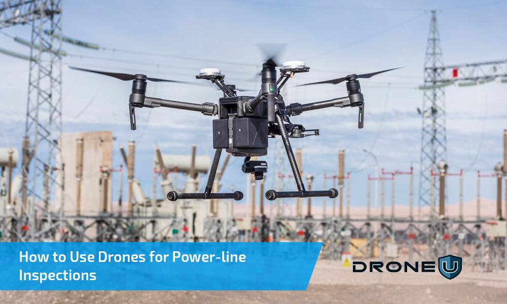
Drones have the potential to revolutionize the way we inspect our power lines and transmission towers. Studies and industry reports show utilities can cut inspection costs by up to 70% while improving data accuracy and worker safety.
From rural cooperatives to large-scale utilities, drones are now a routine part of inspection and maintenance workflows. They’re faster, safer, and deliver data that traditional inspection teams can’t match.
In this article, you’ll learn how drones are used for powerline inspections, what equipment professionals use, and the challenges of flying near high-voltage lines. We’ll also cover key safety and compliance standards that every operator should be aware of.
Let’s first understand why drones have become such an important part of powerline inspections.
Every year, power outages cost U.S. utilities billions of dollars. The Department of Energy reports that nationwide outage losses now exceed $150–200 billion annually, driven by extreme weather and ageing infrastructure.
Traditional inspection methods which use helicopters, climbing crews, and manual reporting are slow, expensive, and often hazardous.
That’s where drones come in.
Modern inspection fleets use AI-assisted flight planning and BVLOS (Beyond Visual Line of Sight) operations to cover hundreds of miles in a single mission.
They enable predictive maintenance instead of reactive repairs, helping utilities prevent outages before they happen.
By combining thermal, LiDAR, and visual data, utilities can now build digital twins of their transmission systems to identify faults and weak spots weeks in advance.
Many utilities have already seen major improvements. For instance, Dominion Energy in Virginia uses BVLOS drones for regular inspections, reducing the need for manual fieldwork. Similarly, PG&E in California uses LiDAR and thermal drones to monitor wildfire-prone lines and detect faults early.
While drones make inspections faster and safer, flying close to high-voltage infrastructure brings its own set of challenges. Here’s what operators need to watch out for.
A small error near high-voltage infrastructure can damage your equipment, cause accidents, or worse.
Flying close to live powerlines is one of the most difficult operations for any drone pilot. Even minor issues like GPS drift, magnetic interference, or temporary signal loss can quickly escalate.
Think of it like Wi-Fi interference: the closer you get to the power line, the stronger the electromagnetic interference (EMI). Ultra High Voltage (UHV) lines exceeding 765 kV can disrupt compass readings, GNSS signals, and flight controllers, even in advanced drones.
Modern inspection drones, such as the DJI Matrice 350 RTK, Skydio X10, or Autel Dragonfish, feature EMI shielding, redundant navigation systems, and visual navigation backups.
Despite these protections, flight planning is still essential.
Consumer drones without ferromagnetic protection can malfunction near power lines. Retrofitting shielding or using Faraday-style housings can reduce interference. Some operators also map EMI zones using spectrum analyzers or heatmaps before autonomous flights.
Where you fly makes a big difference.
Always fly above or beside powerlines, not between them. Maintain at least 100–150 feet of horizontal clearance and 50 feet of vertical distance.
Before launching, run pre-flight simulations and set fail-safes like “Return-to-Home” or “Hover-on-Loss-of-Signal.”
Before every grid flight, ensure you:
These steps keep your operations safe, compliant, and professional.
Having the right drone is just the start. The right tools, sensors, and support gear make all the difference in successful inspections.
Let’s explore this in the next section.
With high-voltage interference and long-distance flight paths, standard drones often struggle to perform reliably. That’s why professional inspections require industrial-grade drones built for superior stability, long endurance, and precise data capture.
Leading inspection drones like the DJI Matrice 350 RTK, Skydio X10, and Autel Dragonfish dominate utility inspections in 2025. These platforms support multi-sensor payloads that capture thermal, LiDAR, and RGB data simultaneously.
For larger transmission networks, hybrid or fixed-wing drones like the Autel Dragonfish or Xer X8 Hybrid offer longer flight times and broader coverage. Automated systems such as the DJI Dock 3 enable remote or fully autonomous BVLOS inspections.
Payloads convert flight data into meaningful insights. Dual-sensor cameras like the Zenmuse H30T or FLIR Vue TZ20-R combine thermal and visual imaging to detect overheating components or structural faults.
LiDAR sensors are increasingly used to create 3D models of power corridors. They help identify vegetation encroachment and measure line sag, which can be difficult to spot visually.
Supporting tools are just as important as the drone itself.
Once data is captured, most inspection teams now rely on AI-driven post-processing to reduce manual review time.
Platforms like DroneDeploy, Pix4D, and Sharper Shape can automatically detect anomalies, such as flagging thermal hotspots, corrosion, and vegetation encroachment.
Utilities integrate this data into GIS systems and digital twins of transmission corridors to prioritize maintenance and optimize budgets.
For example, PG&E uses drone-based 3D mapping to identify and monitor high-risk lines in wildfire-prone regions, which has become an industry best practice.
Even with the best gear, compliance is non-negotiable. Let’s examine the key rules that ensure your power-line inspections are safe and legal.
Line-of-sight restrictions remain a key challenge for drone-based power-line inspections. Since 2023, the FAA has steadily approved BVLOS waivers for qualified operators.
Regulations now emphasize risk-based safety cases using Detect-and-Avoid (DAA) systems and Remote ID compliance.
Utility contractors looking to expand their drone operations can refer to the ASTM F3548-21 standard for UAS traffic management and operational safety. They can also stay updated on the FAA’s proposed Part 108 BVLOS rule, which outlines new requirements for BVLOS operations.
Always verify local restrictions when operating near critical energy infrastructure or protected corridors. Fines and legal penalties for violations can be severe.
Beyond flying and equipment, your success depends on how well you manage contracts and risk.
Before taking on utility work, ensure you:
Standardized deliverables such as thermal anomaly reports, orthomosaic maps, and defect summaries help clients integrate your results into their asset management systems.
Pro Tip: When bidding for contracts, always list your drone platforms and payload capabilities. Many utilities now require proof of RTK-enabled, EMI-shielded, and thermal radiometric systems, along with pilot certification and insurance coverage.
Conducting powerline inspections with drones is like walking on a fine wire. You CANNOT afford to make a mistake. One wrong move can have costly consequences.
Before you start, ask yourself if you have the right skills, equipment, and safeguards in place.
Read every contract carefully and make sure your interests are protected.
But the opportunity has never been greater. As the industry shifts toward AI-powered and BVLOS-enabled inspections, skilled drone pilots who can combine flight expertise with data analysis are in high demand.
Ready to specialize in powerline inspections?
Become a Drone U Member.
Do not forget to subscribe and listen to Ask Drone U, the #1 drone podcast on iTunes!
Industrial drones like the DJI Matrice 350 RTK, Skydio X10, and Autel Dragonfish are ideal. These drones offer long flight times, strong EMI resistance, and support multiple payloads, including thermal, LiDAR, and visual cameras.
No, it is not recommended to use regular consumer drones. Consumer drones often lack shielding against electromagnetic interference and lack the endurance or precision needed for utility work. Industrial-grade drones are built for these conditions and comply with FAA and utility standards.
Yes. BVLOS (Beyond Visual Line of Sight) operations require FAA waivers or authorization under the proposed Part 108 rule. Operators must also follow ASTM F3548-21 standards for safety and traffic management.
Utilities use drone data to create 3D models, detect faults, and schedule maintenance before issues lead to outages. AI-powered software helps identify vegetation encroachment, corrosion, and thermal anomalies more efficiently than manual inspections.

Add Your Comment