Thermal drones are UAVs fitted with infrared cameras that detect heat instead of light. They see through smoke, darkness, and dense foliage, making them essential for search and rescue, firefighting, inspections, and agriculture.
The best thermal drone for most professional users is the DJI Matrice 4T (~$7,289), NDAA-compliant, with a 46-minute flight time and a reliable 640×512 sensor. For the best value, the Autel EVO II Dual 640T V3 (~$4,799) delivers the same thermal resolution at a lower cost.
For government and defense use, the Parrot Anafi USA (~$7,000) is the top NDAA-compliant option. For maximum autonomy, the Skydio X10 (~$21,000) leads with AI-driven obstacle avoidance and GPS-denied navigation.
While every thermal drone works on the same principle, the right choice depends on your mission. Here is what you need to know before spending thousands.
Imagine a team of firefighters searching for a missing person in a smoky, dense forest. The situation feels hopeless until a thermal drone flies up above the chaos. Its thermal camera cuts through the smoke, revealing a faint heat signature hidden beneath the trees. In seconds, what seemed impossible turns into a life-saving rescue.
From finding a lost hiker in the woods to identifying crop problems before they become visible, thermal drones are revolutionizing the way we observe and interact with the world.
In this comprehensive guide, we’ll explorethe best thermal drones to buy and help you choose the right one based on your specific needs and challenges.
What are Thermal Drones?
Thermal drones are UAVs fitted with infrared sensors that detect heat instead of visible light.
The thermal cameras on these drones pick up infrared signals and convert them into a visual image, creating a “heat map”. This heat map depicts the temperature distribution across objects or the landscape below.
This quality makes thermal drones useful for a variety of applications, such as:
Search and Rescue: Thermal drones help in locating lost individuals in challenging conditions, such as at night, in dense forests, or after a disaster. Their ability to detect heat signatures can help rescue teams find survivors much faster than traditional search methods.
Firefighting: Thermal drones identify hotspots within a fire, allowing firefighters to target their efforts more effectively and locate people who may be trapped in a burning building.
Inspections: Thermal drones inspect buildings and infrastructure for heat loss, detect potential equipment failures, or identify damage after a storm. They can also be employed in agriculture to monitor crop health and irrigation needs.
While thermal drones are still relatively new, they’re already making a big impact across industries due to their versatility and effectiveness. To learn more about real-world use cases in our detailed guide to the top 10 thermal drone applications.
Understand What Actually Matters
Get free training to learn the fundamentals and see how thermal technology works in real operations — so you can use it correctly.
Key Points:
Pros and cons of different thermal drone platforms
EO vs radiometric cameras — what the differences mean for jobs
How thermal sensors measure heat in real environments
Mistakes that lead to unusable data
Thank you!
Thank you. You will now be redirected to your requested resource.
Now that you know what thermal drones can do, here is what to look for when choosing one.
Factors to Consider While Choosing a Thermal Drone
While evaluating thermal drones, we considered key factors such as sensor resolution, image quality, flight time, control range, and overall ease of use:
Sensor Resolution: This refers to the detail and sharpness of the thermal images you capture. Higher resolution means you’ll see smaller temperature differences and get a clearer picture.
Image Quality: This goes beyond just resolution and considers factors like how well the camera handles different temperatures and variations in light. A good thermal camera will produce clear, accurate images even in challenging conditions.
Flight Time: This indicates how long the drone can stay in the air on a single charge. If you need to cover large areas or complete long inspections, you need a drone with a longer flight time.
Control Range: The distance you can operate the drone from before the signal weakens. This is important for maintaining control and safety during flights.
Ease of Use: This means how easy it is for you to fly and operate the drone. Consider your piloting experience and look for a drone with intuitive controls and features that make data collection efficient.
With these criteria in mind, here are the seven best thermal drones available in 2026.
The Best Thermal Drones Comparison
While there are over a dozen thermal drones available in the market, we found these 7 to be the best of the lot.
AI autonomy, IP55 rating, modular payloads, 360° obstacle avoidance
1. Autel Robotics Evo Max 4T XE: Best Overall Enterprise Thermal Drone
Source: Autel Robotics
The Autel Robotics Evo Max 4T XEis the next-generation successor to the original EVO Max 4T, released in early 2025. It packs a host of upgrades that make it one of the most advanced enterprise thermal drones available today.
The Evo Max 4T XE has four cameras: a 640×512 thermal camera, a wide camera, a 10x optical zoom camera (160x hybrid maximum), and a laser rangefinder. With this versatility, you can capture clear visual images and thermal data at the same time. This is useful in search and rescue missions, inspections, and firefighting.
Autonomy is where the XE shines. It can navigate using SLAM mapping, even in environments with no GPS. The improved A-Mesh networking system allows multiple drones to work together without losing communication.
The Evo Max 4T XE comes with a 720-degree obstacle avoidance system that combines special vision with radar technology. This allows it to detect and avoid obstacles even in low-light conditions or when the GPS signal is weak.
The XE can stay in the air for up to 42 minutes on a single battery. It is more rugged than the older version with better low-light performance and weather resistance. It suits professionals working in demanding conditions.
Features of Autel Robotics Evo Max 4T XE
Weight
1640 grams
Dimensions
576 x 660 x 149 mm (with propellers)
Max Flight Time
Up to 42 minutes
Operating Temperature
-20°C to 50°C
GNSS
GPS, Galileo, BeiDou, GLONASS
Zoom Camera
1/2″ CMOS, Effective pixels: 48M
Wide Camera
1/1.28 CMOS, Effective pixels: 50M, Night mode: 12.50M
Thermal Camera Resolution
640 x 512 px
Thermal Imager
Uncooled VOx Microbolometer
Temperature Measurement Range
-20°C to 150°C, 0 to 550°C
Obstacle Avoidance
720°
Remote Controller
Autel SkyLink 3.0
Pros
Handles complex, high-risk missions with a multi-sensor payload.
720° obstacle avoidance increases safety in cluttered spaces.
Works reliably in GPS-denied or low-signal environments.
Long flight time supports extended inspections or search missions.
Rugged build withstands dust, light rain, and temperature extremes.
Cons
High cost (~$8,999) puts it out of reach for casual operators.
Heavier and bulkier than portable thermal drones like the DJI Mavic 3T.
Advanced features (SLAM, mesh networking) require skilled operators.
Not NDAA-compliant, which may be an issue for U.S. government buyers.
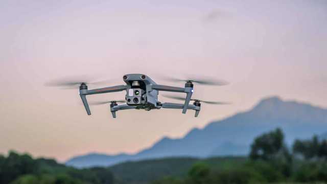
2. DJI Matrice 4T: Best Enterprise Mid-Tier Thermal Drone
Source: DJI
The DJI Matrice 4T is a compact enterprise thermal drone. It has a 12 MP thermal camera with 640×512 resolution. This is ideal for inspections, monitoring infrastructure, and detecting heat patterns. The drone can measure point and area temperatures. It also provides high-temperature alerts and isotherms.
The Matrice 4T has advanced obstacle avoidance and precise GNSS navigation. It is lightweight and easy to carry.
Features of DJI Matrice 4T
Weight
1219 grams
Dimensions (Folded, Without Propellers)
260.6×113.7×138.4 mm
Max Flight Time
46 minutes
GNSS
GPS, Galileo, BeiDou, GLONASS
Operating Temperature
-10°C to 45°C
Wide Camera
1/1.3-inch CMOS, Effective pixels: 48 MP
Tele Camera
1/1.5-inch CMOS, Effective pixels: 48 MP
Thermal Camera Resolution
640 x 512 px
Thermal Imager
Radiometric VOx Microbolometer
Temperature Measurement Range
-20°C to 150°C
Obstacle Avoidance
Omnidirectional
Remote Controller
DJI RC Pro Enterprise
Pros
Portable and easy to deploy.
Reliable 640×512 thermal sensor.
Long 46-minute flight time.
Accurate navigation and obstacle avoidance.
Cons
Lower zoom than full-size enterprise drones.
Not weather-sealed (no IP rating).
Limited payload options compared to Matrice 350 RTK.
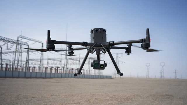
The DJI Matrice 350 RTK with H30T is a high-end drone for enterprise use. It has a 1280×1024 thermal camera. This is ideal for fire, power line inspections, and search and rescue operations. The drone can measure point and area temperatures. It also gives high-temperature alerts.
The H30T payload has a 20 MP wide camera and a 30× zoom telecamera. The drone has RTK GNSS for accurate positioning. It is weather-resistant (IP54/55) and can fly for 55 minutes.
Features of DJI Matrice 350 RTK + H30T
Weight
960 g (with payload)
Dimensions (Folded)
430 × 420 × 430 mm
Max Flight Time
55 minutes
GNSS
GPS, Galileo, BeiDou, GLONASS
Operating Temperature
-20°C to 50°C
Thermal Camera Resolution
1280 × 1024 px
Thermal Imager
Radiometric VOx Microbolometer
Temperature Measurement Range
-40°C to 550°C
Obstacle Avoidance
Omnidirectional
Weather Resistance
IP55
Remote Controller
DJI RC Plus Enterprise
Pros
High-resolution thermal camera.
20 MP wide camera + 30× zoom telecamera.
RTK GNSS for precise navigation.
Weather-resistant and rugged.
Cons
Heavy and less portable.
Expensive.
Requires training to use all features.
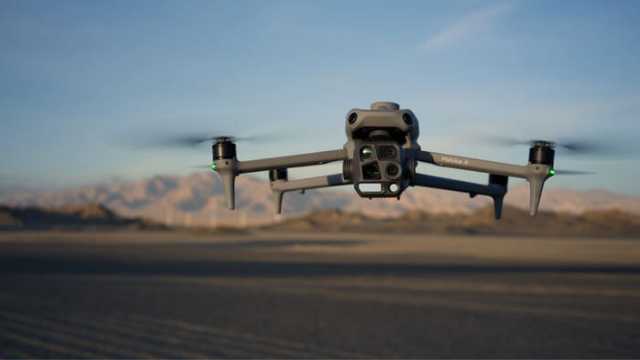
4. Autel EVO II Dual 640T V3: Best Value for Professionals
Source: Autel Robotics
The Autel EVO II Dual 640T V3is a versatile and more budget-friendly option compared to larger enterprise drones.
It combines a 50MP visual camera with a 640×512 thermal sensor. This lets you capture regular and thermal images at the same time, which is useful in search and rescue or inspection scenarios.
The V3 upgrade also delivers good image quality. The thermal sensor’s high resolution and good sensitivity translate to capturing detailed thermal images even in low-light conditions.
An additional perk is the 360-degree obstacle avoidance system, which helps prevent crashes in tight environments. With a maximum of 38 minutes of flight time, it gives you solid coverage for mid-sized missions without frequent battery swaps.
The 640T V3 suits professionals who want strong imaging without paying enterprise prices.
Features of Autel EVO II Dual 640T V3
Weight
1209 grams
Dimensions (Folded)
230 x 130 x 108 mm
Max Flight Time
38 minutes
GNSS
GPS, Galileo, BeiDou, GLONASS
Operating Temperature
-10°C to 40°C
Camera
1/1.28″(0.8″) CMOS; 50 MP
Thermal Camera Resolution
640 x 512 px
Thermal Imager
Uncooled VOx Microbolometer
Temperature Measurement Range
-20°C to 150°C, 0°C to 550°C
Obstacle Avoidance
Omnidirectional
Remote Controller
Autel Smart Controller V3
Pros:
Dual-camera system makes it easy to capture thermal and visual data in one flight.
Thermal resolution (640×512) is strong for its price class.
360° obstacle avoidance provides safer flying for less experienced pilots.
Lighter and more portable than heavier enterprise drones.
Cons:
Shorter flight time (38 minutes) compared to premium enterprise drones.
Fewer advanced autonomy features than flagship models.
Better suited for small-to-mid inspections, not for large-scale industrial projects.
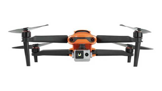
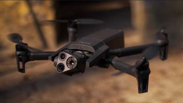
5. Parrot Anafi USA: Best NDAA-Compliant Thermal Drone
Source: Parrot
The Parrot Anafi USA steps in as the successor to the discontinued Anafi Thermal. It is built to meet both professional and government needs.
It has an FLIR Boson 320×256 thermal camera and two 21MP cameras. The telephoto option reaches 32x zoom. You can capture thermal and visual data in a single flight.
The FLIR Boson sensor detects temperature differences with precision, making it valuable for search-and-rescue, building inspections, and environmental monitoring. With compatible software, you can also generate thermal maps of the surveyed area for analysis.
The Anafi USA is lightweight and compact. You can fold it up and carry it easily, making it perfect for teams that need to deploy quickly. It’s widely used by first responders, inspection crews, and defense organizations.
With a flight time of up to 32 minutes, it balances portability with reliable performance. While it doesn’t have the same ruggedness as larger enterprise drones, it remains a solid option for fast, mobile missions.
Features of Parrot Anafi USA
Weight
500 grams
Dimensions (Folded)
252 x 104 x 84 mm
Max Flight Time
32 minutes
GNSS
GPS, GLONASS, GALILEO
Operating Temperature
-10°C to 40°C
Camera
CMOS 1/2.4″, 21MP
Thermal Camera Resolution
320 x 256 px
Thermal Imager
9 Hz FLIR Boson Microbolometer
Temperature Measurement Range
-40°C to 150°C
Remote Controller
Parrot Skycontroller 4 or the optional Skycontroller USA
Pros:
NDAA-compliant and secure for government and defense work.
Portable and lightweight; very easy to transport.
Dual 21 MP cameras with up to 32× zoom.
Quick setup and user-friendly operation.
Trusted FLIR thermal sensor for reliable heat detection.
Cons:
Lower thermal resolution (320×256) compared to Autel and DJI competitors.
Average flight time (32 minutes).
Limited weather resistance (not built for harsh rain or dust).
Better suited for fast deployments than large-scale industrial projects.
6. Skydio X2E Color/Thermal: Best Color/Thermal Hybrid Drone
Source: Skydio
The Skydio X2E Color/Thermal can take search and rescue missions to the next level, thanks to its revolutionary Autonomy Enterprise technology.
The X2E is built around autonomous flight. Its AI flight engine provides 360-degree obstacle avoidance. The drone handles complex environments without constant pilot input. It tracks targets automatically and navigates without GPS.
It is smart and built to last. The foldable frame handles tough conditions. Strobe lights in visible and infrared, let you fly day or night.
Equipped with a dual sensor payload, the X2E combines a high-resolution 12MP color camera and a FLIR® 320×256 thermal imager. It also gives you the flexibility to seamlessly switch between visual and thermal imaging, providing a comprehensive view of any situation.
Features of Skydio X2E Color/Thermal
Weight
1325 grams
Dimensions (Unfolded)
66 x 56 x 20 cm
Max Flight Time
Up to 35 minutes
Operational Temperature Range
-10°C to 43°C
Camera
Sony IMX577 1/2.3” CMOS; 12.3MP
Thermal Camera Resolution
320×256 px
Thermal Imager
FLIR Uncooled VOx Microbolometer
Obstacle Avoidance
Omnidirectional
Remote Controller
Skydio X2 Controller
Pros:
Exceptional autonomous navigation. Flies safely even without GPS.
AI-driven obstacle avoidance in 360°.
Rugged design with night flight lights for all-day missions.
Portable, foldable design for quick deployment.
Reliable dual-sensor setup for thermal + visual data.
Cons:
Thermal resolution (320×256) is lower than that of Autel or DJI competitors.
Flight time (35 minutes) is decent but not class-leading.
More expensive than drones with similar thermal specs.
Note: The Skydio X2E is no longer sold to individual buyers. It is available only through Skydio’s enterprise and government channels. Consider the Skydio X10 as the current replacement.
7. Skydio X10 (Thermal): Best Autonomous Thermal Drone
Source: Skydio
The Skydio X10 is the next-generation replacement for the X2E. It’s built for enterprise and public safety missions where autonomy, imaging, and ruggedness are critical.
The X10 can be equipped with a dual thermal/visual payload. It carries a 640×512 thermal sensor (an upgrade over the X2E’s 320×256) and high-resolution RGB cameras. The system also supports zoom options, giving operators both detailed thermal imaging and sharp color video in one flight.
Like its predecessor, the X10 uses Skydio Autonomy, an advanced AI engine that allows full 360° obstacle avoidance, subject tracking, and GPS-denied navigation. But the X10 packs faster processing, stronger low-light sensing, and more accurate object detection.
The X10 is rugged and field-ready. It features IP55 weather resistance, strobe lighting for night flights, and foldable arms for portability. With around 40 minutes of flight time, it’s designed for long missions in search-and-rescue, inspection, and defense work.
Features of Skydio X10 (Thermal)
Weight
2.11 Kg
Dimensions (Folded)
35.05 cm × 16.51 cm × 11.94 cm
Max Flight Time
Up to 40 minutes
GNSS
GPS, GLONASS, Galileo, BeiDou
Operating Temperature
-20°C to 45° C
Camera
Samsung 1/2.8″ 32MP color CMOS
Thermal Camera Resolution
640 × 512 px
Thermal Imager
Radiometric FLIR Boson+
Temperature Measurement Range
–40 °C to 350 °C,-40° C to 150° C
Obstacle Avoidance
Omnidirectional
Remote Controller
6.6″ Dynamic AMOLED touchscreen controller
Pros:
Radiometric FLIR Boson+ thermal sensor for precise temperature mapping.
Upgraded autonomy with AI-driven 360° obstacle avoidance.
Rugged IP55 build. Handles rain, dust, and wind up to 28 mph.
Long flight time (~ 40 min) and quick deployment (< 40 s).
Modular payloads (VT300-Z) great for inspections or public safety.
Secure, encrypted comms and NDAA-compliant.
Cons:
Weight (~2.1 kg) makes it heavier than many foldable drones.
Premium price. Enterprise-grade cost and availability.
Advanced modular system may need operator training and integration planning.
Radiometric thermal payload adds cost compared to simpler configurations.
With all seven drones covered, here is how to match the right one to your specific mission.
Choosing the Right Thermal Drone for Your Specific Application
Choosing the right thermal drone depends largely on your needs, experience, and budget. Whether you’re just getting started or managing complex operations, there’s a drone designed to fit your mission.
Let’s break down some of the top thermal drones we’ve covered in this article:
For hobbyists or those on a budget: The Autel EVO II Dual 640T V3 is the best fit. It delivers true 640×512 thermal imaging at a lower cost and covers most inspection and survey needs without enterprise complexity.
For portability and balanced performance: The Parrot Anafi USA (latest version) stands out. It is lightweight, easy to deploy, and NDAA-compliant. It’s a good choice for teams that need secure thermal imaging in a compact platform.
For advanced professional use: The DJI Matrice 4T and Autel Evo Max 4T XE work well here. Both offer longer flight times, reliable thermal sensors, and tools designed for routine enterprise and public safety missions.
For advanced autonomy and industrial work: The DJI Matrice 350 RTK with Zenmuse H30T and Skydio X10 stand out. They handle complex environments, support autonomous operations, and meet the demands of large-scale industrial and emergency response work. The Skydio X10 shines in challenging environments where advanced autonomy and rugged design are critical.
Choosing the right drone is only the first step. Software compatibility, payload flexibility, and reliable warranty support are just as important for long-term success.
With the options in this guide, you can confidently pick a thermal drone that matches both your mission needs and your budget.
Choosing a thermal drone is only part of the job. Knowing how to use it matters just as much. Join DroneU today to learn both.
Build the Foundation to Add Thermal to Your Services
Develop the foundation to add thermal capability to your drone work with the confidence to choose equipment and apply it in real projects.
Key Points:
Know when thermal should be used
Evaluate technology before investing
Understand how professionals approach missions
Prepare to expand into higher-value services
Thank you!
Thank you. You will now be redirected to your requested resource.
4
FAQs
1. What is the best thermal drone for inspections?
For budget inspections, choose the Autel EVO II Dual 640T V3. For professional inspections, the DJI Matrice 4T offers better flight time and enterprise tools. For large industrial inspections, the DJI Matrice 350 RTK with Zenmuse H30T delivers the highest thermal detail and reliability.
2. Are thermal drones legal for commercial use?
Yes. Thermal drones are legal for commercial use in most countries if operators follow local drone laws, airspace rules, and privacy regulations. In the U.S., commercial pilots typically need FAA Part 107 certification.
3. What thermal resolution is good enough?
A 640x512 resolution is the standard for professional inspection work. Lower resolutions such as 320x256 can detect heat but provide less detail.
4. Do thermal drones work at night or through smoke?
Yes, thermal drones work very well at night because they detect heat, not light. They can also see through light smoke, fog, and dust, but they cannot see through walls or glass.
5. How much do thermal drones cost?
Professional thermal drones typically cost between $4,799 and $26,000, depending on thermal resolution, flight time, autonomy features, and NDAA compliance.
6. What does NDAA-compliant mean for thermal drones?
NDAA-compliant drones meet U.S. federal procurement rules and avoid restricted foreign components. They are commonly required for government, defense, and federally funded projects.
Paul Aitken is a Certified Part 107 drone pilot and a Certified Pix4D Trainer. He is a pioneer in drone training and co-founder of Drone U. He created the industry’s first Part 107 Study Guide and co-authored Livin’ the Drone Life.
Paul is passionate about helping students fly drones safely and effectively. With over a decade of experience, he has led complex UAS projects for federal agencies and Fortune 500 clients such as Netflix, NBC, the NTSB, and the New York Power Authority.
Add Your Comment
Related Articles
The Top 36 Drone Companies in 2025
How to Choose the Best Drone for Cinematic Filmmaking


![The 7 Best Thermal Drones to Buy [2026]](https://www.thedroneu.com/wp-content/uploads/2024/04/Best-Thermal-Drones-1024x597.png)

 Source: Skydio


Add Your Comment