
U.S. Airspace Classes Guide (A to G) for Drone Pilots [2026]

July 9, 2026
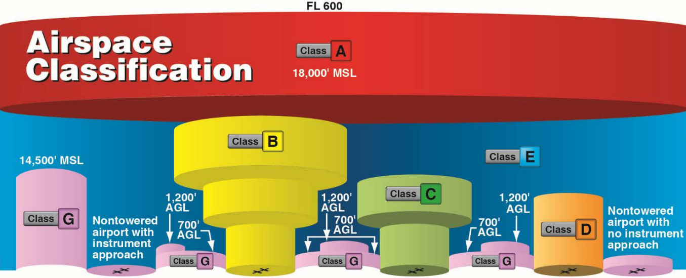
![U.S. Airspace Classes Guide (A to G) for Drone Pilots [2026]](https://www.thedroneu.com/wp-content/uploads/2025/05/Airspace-classification-1024x597.png)
Quick Answer: Airspace Classes for Drone PilotsThe FAA divides US airspace into six airspace classes: A, B, C, D, E, and G. Here is what drone pilots need to know:
|
Airspace classes are how the FAA divides the sky into zones, and they decide where you can fly your drone, how high you can go, and when you need permission first. If you’re flying drones, it’s one of the first things you’ll hear about. But what does it mean, and why should you care?
At first, it might sound like something only airline pilots or air traffic controllers need to worry about. However, as a drone pilot, understanding airspace is one of the most important aspects of your job. It’s also a big part of your Part 107 test, and starting October 26, 2026, the FAA will test it with images from current sectional charts.
It tells you where you can fly, what rules apply, and how to stay safe and legal in the sky. If you’re preparing for the exam, our Part 107 airspace lessons cover every class in short videos with quizzes.
This guide covers all six U.S. airspace classes from A to G, special use airspace, how airspace looks on a sectional chart, and how to get authorization when needed.
Let’s begin with the basics.
An airspace class is basically the sky divided into different zones. Each of these zones has its own set of rules. These zones are called airspace classes, and they tell you where your aircraft or drones can fly, how high you can go, and what rules to follow for communication with ATC.
Just like highways keep cars moving safely, airspace classes help aircraft and drones share the sky without chaos.
When you’re flying a drone, you’re not the only one in the sky. You’re sharing the air with helicopters, planes, and other drones. That’s why understanding airspace classes is essential to keeping everyone safe.
For example, if you plan to fly near a city and you are in Class C airspace near a regional airport, flying without authorization is illegal. It can lead to FAA fines or, in serious cases, criminal charges.
When you understand airspace classes, you gain more freedom. You know when and where you need permission, how to get it, and how to avoid mistakes.
Equipped with the basic understanding, let’s dive into the two main categories of airspace.
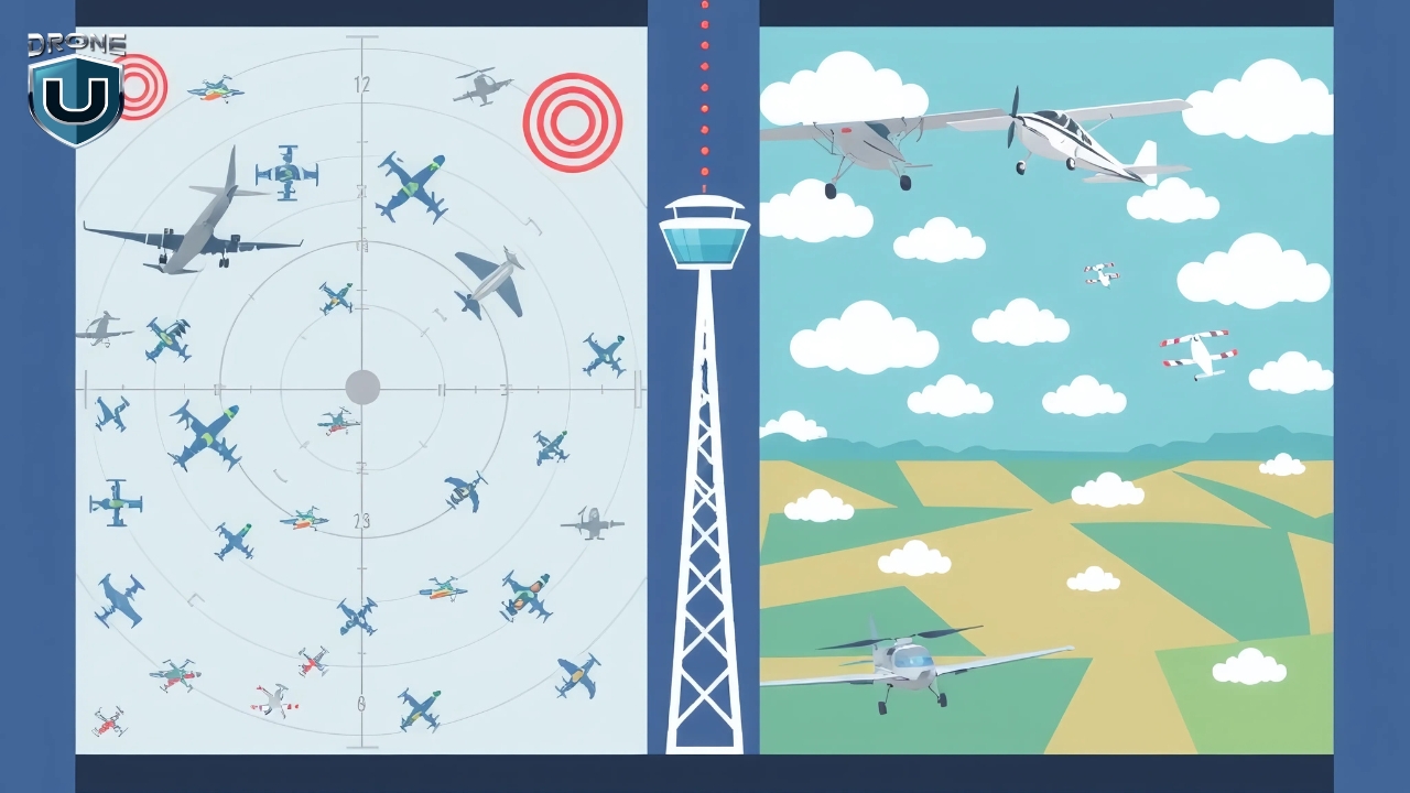
The FAA (Federal Aviation Administration) has divided the U.S. airspace into two main categories: controlled and uncontrolled.
In controlled airspace, air traffic controllers are actively communicating with, directing, and separating air traffic. There’s a strict set of rules to keep everyone safe.
Controlled airspace includes Class A, B, C, D, and E.
For drones, the rule is specific. Under 14 CFR 107.41, you need prior authorization to fly in Class B, C, or D airspace, or within the lateral boundaries of a Class E surface area designated for an airport. Class E that starts at 700 or 1,200 feet AGL sits well above your 400-foot limit, so it doesn’t require authorization.
For most drone pilots operating under Part 107 (the FAA’s rulebook for commercial drone operations), this usually means submitting a request through LAANC (Low Altitude Authorization and Notification Capability).
In uncontrolled airspace, you don’t need to talk to ATC or request permission to fly your drone, as long as you follow FAA rules.
Remember, uncontrolled doesn’t mean it isn’t regulated. As the FAA puts it, there’s no such thing as “unregulated” airspace.
Uncontrolled airspace is Class G. It is a good starting point for new pilots, with no special approvals required.
It’s beginner-friendly because there’s no need for special approvals, and you have more freedom to explore. Even though it’s called “uncontrolled,” you still need to follow basic FAA rules.
Now, let’s take a closer look at each of the six FAA airspace classes.
The FAA divides U.S. airspace into six main classes: A, B, C, D, E, and G. Each one has a different purpose, altitude range, and level of control. Some areas are tightly controlled with strict rules, while others are more relaxed and open, perfect for new drone pilots.
U.S. airspace is layered from the ground up. In general, the higher you go and the closer you get to a busy airport, the more controlled things get. The lower you stay and the farther you are from airports, the more likely you are to fly in uncontrolled airspace.
One rule applies in every class: the Part 107 weather minimums. You need at least 3 statute miles of visibility from your control station, and your drone must stay at least 500 feet below and 2,000 feet horizontally from clouds (14 CFR 107.51). The cloud and visibility numbers you’ll see listed for each class below are the VFR rules for manned aircraft. They’re useful context for the test, but your drone follows the Part 107 numbers.
Let’s take a closer look at each airspace class one by one:
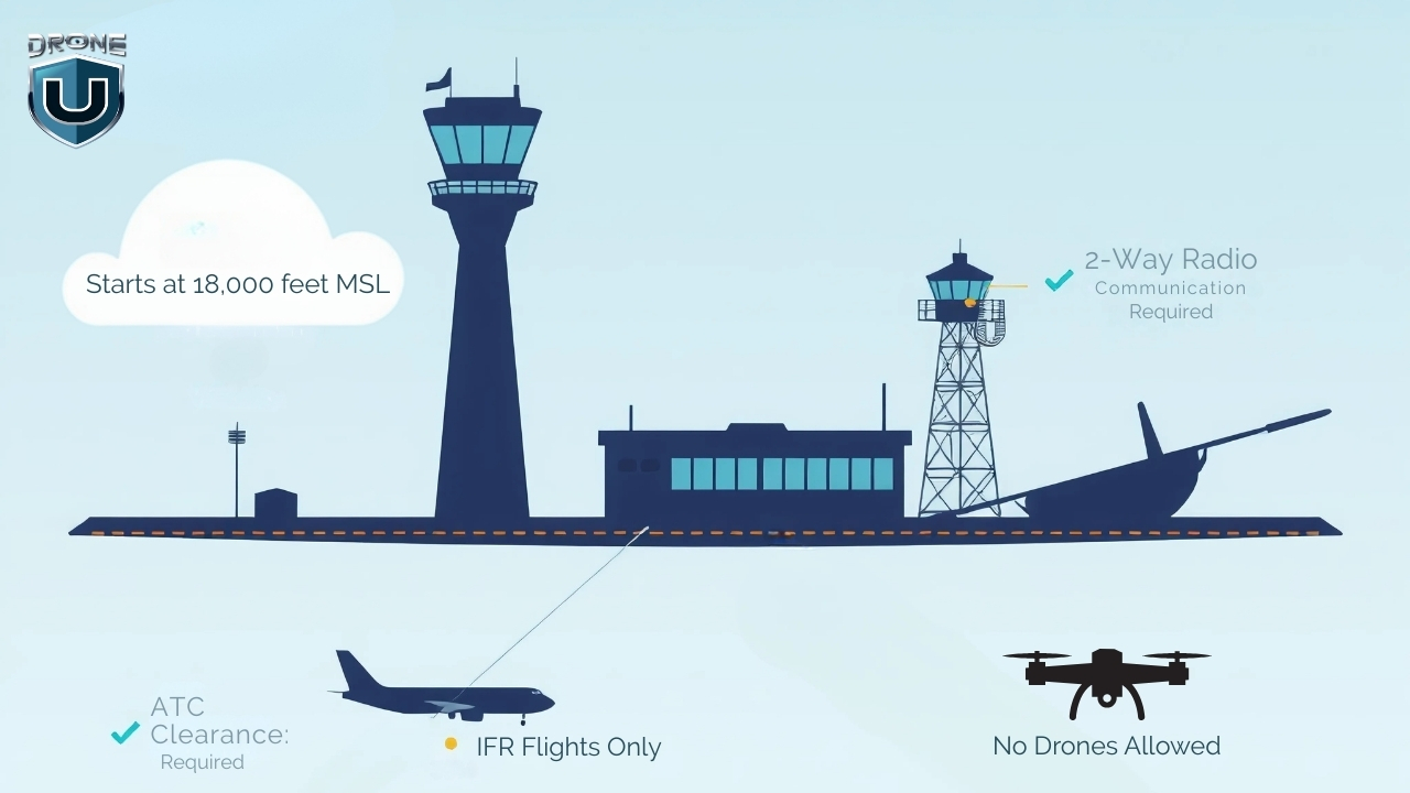
Class A is the most controlled airspace in the U.S. It begins at 18,000 feet MSL (Mean Sea Level) and extends up to and including FL600 (about 60,000 feet). This airspace is reserved for high-altitude operations like commercial airline flights, military jets, and long-haul cargo routes.
No matter where you are in the contiguous U.S. or Alaska, once you hit 18,000 feet MSL, you’re in Class A.
Every aircraft flying in Class A must follow Instrument Flight Rules (IFR) and stay in constant communication with Air Traffic Control (ATC). This airspace includes the waters within 12 nautical miles of the coast of the 48 contiguous states and Alaska.
Under FAA Part 107, drones are limited to flying at or below 400 feet AGL (Above Ground Level).
Since Class A starts at 18,000 feet MSL, it’s completely out of range for everyday drone operations. In practice, drone pilots don’t fly in Class A.
But even though you won’t fly your drone in Class A airspace, understanding how Class A fits into the bigger picture helps you visualize how the National Airspace System (NAS) works.
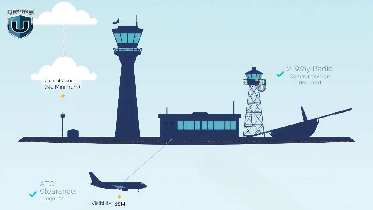
Class B airspace surrounds the country’s busiest airports, like LAX, JFK, ORD, and ATL.
It’s designed to manage large volumes of fast-moving aircraft, including commercial jets and cargo planes. Because of the traffic density and complexity, this airspace is tightly controlled by Air Traffic Control (ATC) at all times. This means drone pilots cannot fly here without FAA airspace authorization, usually through LAANC approval.
Class B airspace uses a layered structure that resembles an upside-down wedding cake:
On sectional charts, Class B is drawn with solid blue lines. Each shelf carries a ceiling-over-floor label in hundreds of feet MSL.
For manned VFR aircraft, Class B requires 3 statute miles of visibility and clear of clouds. Your drone still follows the Part 107 minimums above.
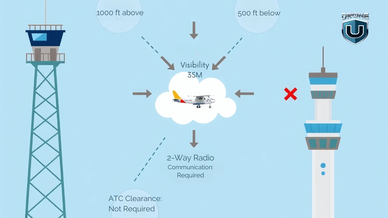
Class C airspace surrounds medium-sized airports that handle a mix of commercial, private, and charter flights. These airports are busy but not as congested as major hubs like those in Class B.
This airspace is controlled by Air Traffic Control (ATC) and requires all manned aircraft to maintain two-way communication. As a drone pilot, you won’t speak to ATC directly, but you must get FAA authorization before flying in Class C.
This airspace usually has a two-layer structure:
Each Class C airspace layout follows this general shape but can be modified based on local traffic needs.
On sectional charts, Class C airspace appears as solid magenta rings. These rings represent the inner core and the outer shelf.
Inside the rings, you’ll see altitude labels like this: 40/12. That means the ceiling is 4,000 feet MSL and the floor is 1,200 feet MSL. Charted altitudes are MSL, so subtract the ground elevation to find out how high the shelf is above you. If it says SFC instead of a number, the floor starts at the surface.
For manned VFR aircraft, Class C requires 3 statute miles of visibility and 500 feet below, 1,000 feet above, and 2,000 feet horizontally from clouds. Your drone follows the Part 107 minimums.
Drone pilots flying commercially must hold a Part 107 Remote Pilot Certificate. Recreational flyers don’t need a Part 107 certificate, but they must pass the free TRUST test, follow FAA rules, and get an authorization before entering Class C airspace.
To fly a drone in Class C airspace, you must get FAA authorization. If LAANC is available in the area, you can request approval in near-real time through an FAA-approved LAANC app. If not, you’ll need to submit a manual request through FAADroneZone, which takes longer.
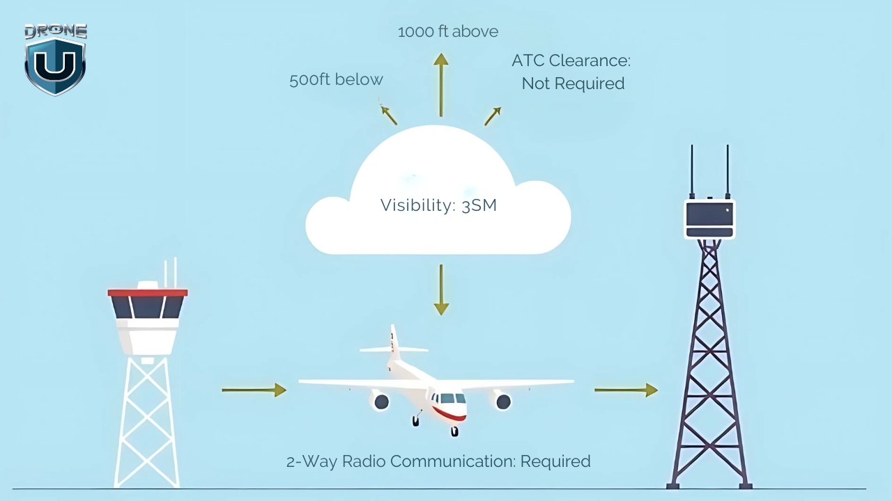
Class D airspace surrounds smaller towered airports that handle a mix of general aviation, commercial, and cargo aircraft traffic. It’s a controlled zone managed by ATC, designed to ensure safe takeoffs and landings at moderately busy airports.
Class D airspace generally extends from the surface up to 2,500 feet above the airport elevation. Its exact shape varies with the airport and its instrument procedures.
Unlike Class B and C, Class D has a simpler structure, typically a single tier starting at the surface.
Class D airspace is only in effect when the control tower is operating. If the tower closes, the airspace reverts to Class E or Class G, and the airport’s Chart Supplement entry tells you which.
On sectional charts, Class D airspace is marked with a blue dashed (segmented) line around the airport. Inside it, you’ll see the ceiling in brackets, in hundreds of feet MSL. For example, [25] means it extends to 2,500 feet MSL.
To fly a drone in Class D airspace, you’ll need prior FAA authorization through LAANC or FAADroneZone. For manned VFR aircraft, Class D requires 3 statute miles of visibility and 500 feet below, 1,000 feet above, and 2,000 feet horizontally from clouds. Your drone follows the Part 107 minimums.
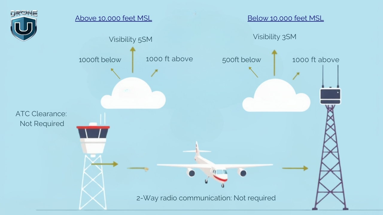
Class E airspace covers a huge portion of the U.S. sky and serves as the bridge between busy terminal airspace and uncontrolled airspace.
You’ll encounter it almost everywhere, especially above rural areas, between busy airports, and along airways used by manned aircraft.
For drone pilots, it’s one of the most important airspace classes to understand because of its varying boundaries.
Class E airspace doesn’t follow a one-size-fits-all structure. Its lower limit can start at the surface, 700 feet AGL, or 1,200 feet AGL, depending on the location. Where no lower floor is designated, it starts at 14,500 feet MSL. Its upper limit typically extends to 18,000 feet MSL, where Class A airspace begins. It also resumes above FL600.
There are five main types of Class E airspace that drone pilots should recognize:
Sectional charts show Class E in different ways based on its type:
To fly a drone in Class E airspace, you first need to know when FAA authorization is required. If you plan to fly in a Class E surface area, you must get approval through LAANC or FAADroneZone.
However, you don’t need authorization for Class E that begins at 700 or 1,200 feet AGL, or for en route corridors, as long as you stay at or below 400 feet AGL. Below those floors, you’re usually in Class G.
For manned VFR aircraft below 10,000 feet MSL, Class E requires 3 statute miles of visibility and 500 feet below, 1,000 feet above, and 2,000 feet horizontally from clouds. Again, your drone follows the Part 107 minimums.
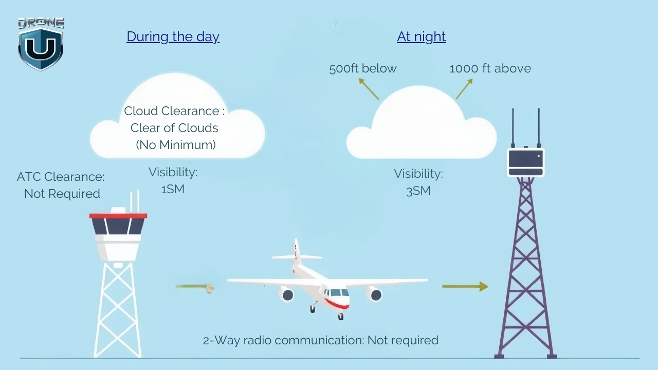
Class G airspace is the only uncontrolled airspace in the U.S., and it’s where drone pilots enjoy the most freedom. You don’t need FAA authorization or LAANC approval to fly here.
No ATC is directing traffic, and no flight clearance is required. But that doesn’t mean you can just wander in the skies without any rules.
Class G airspace fills in the gaps where controlled airspace doesn’t exist. You’ll mostly find it at lower altitudes near the ground, especially in rural areas, forests, farmland, mountains, and along coastlines.
Even without ATC oversight, you must still follow FAA Part 107 rules, fly at or below 400 feet AGL, and keep your drone in visual line of sight (VLOS) at all times.
You must also meet the Part 107 weather minimums: 3 statute miles of visibility from your control station, and at least 500 feet below and 2,000 feet horizontally from clouds.
Class G is not marked directly on sectional charts, but you can identify it by what’s not there. Below the floor of any overlying Class E (shown by those magenta or blue vignettes), and outside the B, C, D, and E surface boundaries, you’re usually in Class G.
You can also use an FAA-approved LAANC app or the FAA’s B4UFLY to confirm you’re flying in Class G before takeoff.
Now that you know what each airspace class looks like, let’s cover the restrictions that sit on top of them.
Special use airspace isn’t a seventh class. Instead, it’s a layer of restrictions that can sit on top of any class, even Class G. Here are the ones drone pilots need to know:
Besides these, there are other no-drone zones, including stadiums during events, certain national security sites, and national parks. For maps and apps that show all of it, see our guide on where you can fly a drone.
Here’s a quick legend for the airspace symbols you’ll use most:
| Airspace | How it’s charted | Altitude labels |
| Class B | Solid blue lines | Ceiling over floor, in hundreds of feet MSL |
| Class C | Solid magenta lines | Ceiling over floor, in hundreds of feet MSL (SFC = surface) |
| Class D | Dashed blue line | Ceiling in brackets, in hundreds of feet MSL |
| Class E surface area | Dashed magenta line | Starts at the surface |
| Class E from 700 ft AGL | Shaded magenta vignette | Floor is 700 ft AGL |
| Class E from 1,200 ft AGL | Shaded blue vignette | Floor is 1,200 ft AGL |
This matters more than ever for the test. Starting October 26, 2026, the FAA’s Part 107 knowledge test includes image-based questions from current sectional charts that aren’t in the testing supplement. In fact, one of the FAA’s own sample questions asks you to identify the airspace around an airport and whether you need authorization. Read more about the October 26 Part 107 test change.
For a full walkthrough of airport data blocks, obstacles, and special use areas, read our guide on how to read a sectional chart.
Once you know you’re in Class B, C, D, or a Class E surface area, you have two ways to get permission:
Recreational flyers can use LAANC for near-real-time authorizations too. For a step-by-step walkthrough, see our LAANC authorization guide.
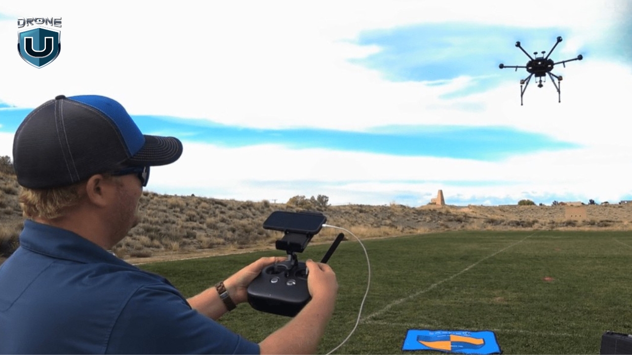
Before you launch your drone, you need to know what kind of airspace you’re flying in.
Controlled or uncontrolled? Restricted or open?
Getting this wrong could land you in serious trouble or worse, endanger manned aircraft. Here’s how to check your airspace in five easy steps:
Start by opening an airspace awareness app, such as an FAA-approved LAANC app or B4UFLY. These apps show your location on a map and highlight which airspace classes apply where you plan to fly.
If you’re flying near a city or airport, you’re likely in controlled airspace. These zones require FAA authorization before you fly.
If you’re out in a rural area, on farmland, or in the wilderness, and the app shows no controlled airspace, you’re probably in Class G, where you can fly without approval.
Look for Temporary Flight Restrictions (TFRs), prohibited and restricted areas, Military Operations Areas (MOAs), or national parks. These zones can add restrictions on top of normal airspace rules, even in Class G, and some prohibit drone flights entirely.
The FAA B4UFLY app or the FAA TFR Map will alert you to any active restrictions in your area.
Use your airspace mapping app or a current sectional to identify which class you’re in and find out if you need FAA authorization to fly.
LAANC is available at 726 airports with Class B, C, D, or surface-level Class E airspace. Most approvals arrive in near-real time.
If you’re in controlled airspace and LAANC is available, request FAA approval through your app. Just enter your flight details including location, altitude, and time, then submit.
If LAANC isn’t available, go to FAADroneZone and file a manual authorization request. These can take weeks to process, so apply early.
Once you confirm you’re in a specific airspace or receive FAA authorization, record your documents. Keep screenshots of your airspace status or LAANC approval handy in case you’re asked for proof during your flight.
How many airspace classes are there in the US?
Six: A, B, C, D, E, and G. There’s no Class F in the United States.
Which airspace classes need authorization for drones?
Class B, C, and D, plus Class E surface areas designated for an airport. Class A is far above the 400-foot limit, and Class G needs no authorization.
Can I fly a drone in Class E airspace without authorization?
Yes, if the Class E starts at 700 or 1,200 feet AGL and you stay at or below 400 feet. No, if you’re inside a Class E surface area that starts at the ground.
Are altitudes on a sectional chart MSL or AGL?
Airspace floors and ceilings for Class B, C, and D are charted in MSL. The Class E 700- and 1,200-foot floors are AGL. On obstacles, the top number is MSL and the number in parentheses is AGL.
Do airspace classes change when an airport tower closes?
Often, yes. A part-time Class C or D surface area can become Class E or Class G when the tower is closed. Check the airport’s Chart Supplement entry.
Flying in the wrong airspace without authorization can bring FAA civil penalties of up to $17,062 per violation for an individual, based on the FAA’s 2026 inflation-adjusted figures, and in serious cases, criminal charges. Beyond the legal risk, unauthorized drone flights near airports pose a genuine safety hazard to manned aircraft. See our breakdown of FAA drone fines and penalties.
The FAA has also stepped up enforcement in 2026, launching its DETER program to resolve first-time drone violations faster.
Understanding all six U.S. airspace classes is a major step toward becoming a safer, more confident drone pilot.
Whether you’re flying for fun, filming real estate, or launching a drone business, understanding how to read sectional charts, follow FAA rules, and request authorization gives you the confidence to fly legally and safely.
If you’re working toward your license, practice what you just learned with our free Part 107 practice test and study guide. Then, when you’re ready for structured prep, enroll in Drone U’s Part 107 course for $147 (regularly $197). It covers airspace, sectional charts, and weather—the toughest parts of the test—with lifetime access and a 14-day money-back guarantee.
Still deciding whether you need a license at all? Read do I need a license to fly a drone.
Sources
 3
3