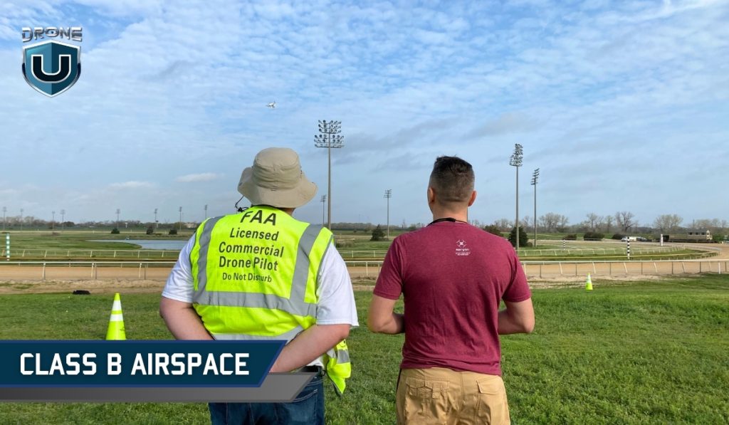
Class B Airspace: A Comprehensive Guide for Drone Pilots (2026)

June 2, 2026
Quick Answer: Class B Airspace for Drone PilotsClass B airspace surrounds the 37 busiest airports in the United States. It extends from the surface up to 10,000 feet MSL in a layered, upside-down wedding cake shape. All drone pilots, whether recreational or commercial, must obtain FAA authorization before flying in Class B. Authorization is not optional. How to get authorization: Use LAANC for near-instant approval in most areas. If LAANC is unavailable, submit a manual request through FAA DroneZone. Allow several days to weeks for approval. Altitude limit: 400 feet AGL for drones. Most drone operations in Class B will occur in the core area, the busiest layer closest to the airport. Visibility requirement: 3 statute miles. Stay clear of clouds. No specific cloud clearance distance is required in Class B. How to identify it: Look for solid blue circles on sectional charts or Terminal Area Charts (TAC). |
Class B airspace surrounds the 37 busiest airports in the United States. It extends from the surface up to 10,000 feet MSL and requires FAA authorization for all drone flights.
This comprehensive guide will cover everything you need to know about Class B airspace, from airspace structure to flying rules, requirements, and navigation tips.
Class B airspace is the most restricted airspace in the United States. It surrounds the 37 busiest commercial airports, such as Los Angeles International (LAX), John F. Kennedy International Airport (JFK), Chicago O’Hare (ORD), and Atlanta Hartsfield-Jackson (ATL).
Class B airspace is designed for high-speed commercial jet operations. This is why drone pilots must plan carefully before flying near any major commercial airport.
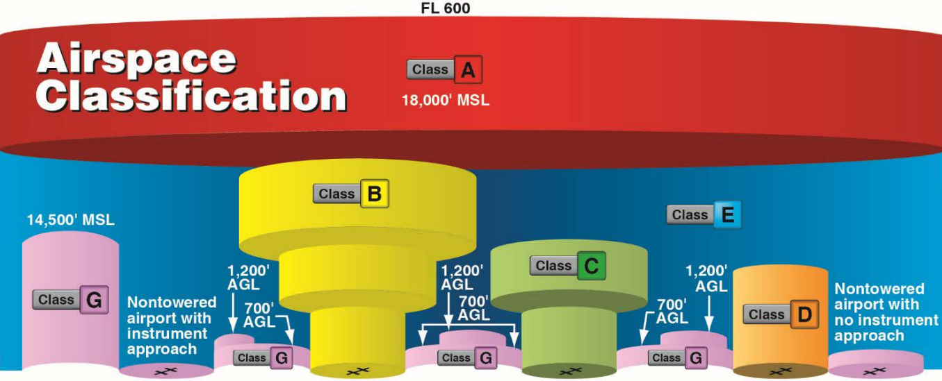
Class B airspace uses a layered structure to separate different types of aircraft and manage high-density traffic efficiently.
Unlike Class D airspace, which is shaped like a simple cylinder, Class Bravo airspace is designed in layers. It resembles an upside-down wedding cake. This tiered structure helps separate aircraft based on altitude and flight paths.
The central core part covers the primary airport area and extends from the surface up to the ceiling, with two or more layers of additional shelves for arrival and departure routes.
As you move toward the outward layers, each shelf’s base altitude or floor area increases.
Remember, Class B airspace has ‘no standard’ structure or shape.
Each airport has a unique structure, designed to meet the specific needs of the airport and its surrounding areas. Here’s a general breakdown of its structure:
1. Core area: It is the innermost layer, covering the area directly around the airport.
It extends from the ground up to a set altitude of 10,000 feet MSL (mean sea level), with a 10 NM (nautical miles) radius.
2. Middle shelves or layers: The middle layers expand outward as altitude increases. It typically begins at an altitude of 1,500 feet from surface area, and goes up to 10,000 feet MSL, covering a 10 to 20 NM radius from the airport.
Usually, aircraft use these layers to ascend or descend while approaching or departing from the airport.
3. Outer shelf: The final layer expands out to a 30 NM radius from the primary airport and begins at an altitude of 7,000 feet from surface area to 10,000 feet MSL.
At this altitude, drone pilots flying below 400 feet AGL (above ground level) will not encounter the outer shelf.
This means that if you’re flying your drone close to a Class B airspace airport, you’ll most likely be operating in the core area, which is the busiest layer of Class B airspace.
Class B airspace is represented using solid blue lines on a Terminal Area Chart (TAC), similar to sectional charts.
While sectional charts provide a broad overview, TACs give you a detailed view of Class B and Class C airspace, helping you navigate complex airspace structures.
The smallest circle in the center marks the core airport area, while the larger circles indicate the middle and outer layers of shelves.
Inside the central core, there’s a strange fraction with 100 on top and SFC at the bottom (100/SFC). However, this is not a fraction, these are labels representing the floor and the ceiling altitudes of each airspace segment.
The further you get from the central core, you’ll see different expanding circles, each with its own floor and ceiling fraction labels. These changing labels represent the different layers of the upside-down wedding cake.
Sometimes, you’ll see a + sign preceding the lower number (70/+50), this means the airspace floor starts above the altitude shown on the chart.
Lastly, you must be extra cautious about the magenta circle around the Class B airspace, also known as the edge of Mode C Veil, a 30 NM ring where all manned aircraft must carry altitude-reporting equipment.
To fly a drone in Class B airspace, you must meet the following requirements:
You cannot fly drones in Class B airspace without FAA approval.
The Low Altitude Authorization and Notification Capability (LAANC) system allows quick approvals for drone flights in certain areas of Class B airspace.
If LAANC is available in your area, you can request a near real-time authorization using apps like AirMap, Kittyhawk, UASidekick, or Airhub Portal.
In case LAANC is not available in your area, go for a manual request through the FAA DroneZone.
Tip: Manual FAA approvals can take several days or weeks to get approved, so plan your application in advance.
To fly drones for commercial projects, you must hold a Part 107 Remote Pilot Certificate issued by the FAA.
Whereas, if you are flying a drone just for recreational purposes, certification is not required.
Some Class B airspace require ATC clearance, because it’s a tightly controlled airspace with high-density air traffic, and ATC ensures safe separation of traffic.
Here are the two rules you have to consider while flying a drone in the Class Bravo Airspace:
Visual Flight Rules (VFR) is a set of weather condition regulations set by the FAA. These rules help aircraft and drone pilots to maintain proper visibility while flying to avoid mid-air collisions.
To fly per VFR in Class Bravo airspace you must have at least:
Tip: Always check real-time weather conditions before flying inside or near Class B airspace.
Class Bravo airspace has some strict speed limits to prevent collisions and buy more time for aircraft pilots to maneuver safely in a congested area.
The maximum speed inside Class B airspace is 250 Knots. This applies to all the altitudes, when inside Class B.
Whereas, if flying under the shelves of Class B airspace or VFR corridors, the maximum speed in these areas is 200 knots. This limit helps aircraft safely transition in and out of Class B airspace.
Navigating Class B airspace safely requires situational awareness and advance preparation. Here are some tips to navigate through this airspace safely:
If you already have an ATC clearance, radio communication with ATC is not mandatory for drone pilots during the flight.
However, you need to stay connected and be ready to communicate with ATC if required.
If ATC instructs you to move away from a path or land immediately, comply without any delays.
Class B airspace has clear rules. Knowing the structure, requirements, and authorization steps makes it manageable for any pilot.
In 2026, the FAA updated its enforcement policy to make legal action the default response for airspace violations. Flying in Class B without authorization is now more likely to result in fines or certificate action than a warning. Violations near restricted airspace like Mar-a-Lago resulted in a $20,371 fine in January 2025. The FAA published these cases publicly in February 2026. Getting authorization through LAANC before every flight is the most reliable way to protect your certificate and avoid enforcement action.
To learn more about airspace and drone operations:
Check out our drone pilot training programs here.

Add Your Comment