Drone Mapping Guide: Everything You Need to Know

May 17, 2026
Drone Mapping — Quick SummaryDrone mapping is the use of drones to fly autonomous missions, capture hundreds of overlapping aerial images, and process them into accurate 2D maps and 3D models. It is a form of photogrammetry, measuring from photos. With RTK or PPK positioning, drone mapping achieves centimeter-level accuracy and replaces days of traditional ground survey work with hours of flight time. It is used across construction, agriculture, mining, land surveying, public safety, and environmental monitoring. Commercial use in the United States requires an FAA Part 107 certificate. |
Drone mapping is the use of drones to capture overlapping aerial images and convert them into accurate 2D maps and 3D models that teams can measure from.
| Term | Plain-Language Definition |
| Orthomosaic | A high-resolution, geometrically corrected aerial map stitched from hundreds of overlapping drone images |
| GSD (Ground Sampling Distance) | The real world size each pixel in the map represents. At 2 cm/px GSD, one pixel covers 2 cm on the ground |
| Photogrammetry | The science of deriving measurements and 3D geometry from 2D photographs |
| Point Cloud | A dataset of millions of individual 3D points each with X, Y, Z coordinates, produced by LiDAR or photogrammetry |
| DEM (Digital Elevation Model) | A 3D representation of terrain elevation, produced from drone imagery or LiDAR |
| GCP (Ground Control Point) | A physical marker placed at a known real-world coordinate, used to improve positional accuracy during processing |
| RTK (Real-Time Kinematic) | GNSS correction applied during flight via a live link to a base station achieves 1–3 cm accuracy |
| PPK (Post-Processed Kinematic) | GNSS correction applied after flight using logged raw satellite data more resilient on remote sites |
| AGL (Above Ground Level) | Flight altitude measured relative to the terrain below the drone the key altitude figure for mapping |
| Overlap | The percentage of shared area between consecutive drone images. More overlap = more accurate reconstruction |
The world of drone mapping and surveying is evolving rapidly. When you are just starting it is crucial to have a solid understanding of the latest drone mapping tools, techniques, and trends.
In this article, you will get a first-hand understanding of how drone mapping works and the technology that makes it possible.
Moreover, you’ll discover the exciting applications of drone mapping and learn about how it provides a faster, more efficient, and cost-effective alternative to traditional aerial surveys.
We’ll also explore the basics of drone mapping, the types of drone mapping software used, and how to pick the right one for your purpose.
By the end of this guide, you’ll have a comprehensive understanding of drone mapping technology and how to get the most out of it.
In simple layman’s terms, Drone Mapping is all about measuring from photos. With drone mapping, we fly autonomous missions to capture a high overlap of images to create life-like maps and models.
Drones have revolutionized the way we survey and map our world. The efficiency, speed, and accuracy of drone mapping have revolutionized many industries.
First, let me give you a quick overview of drone mapping.
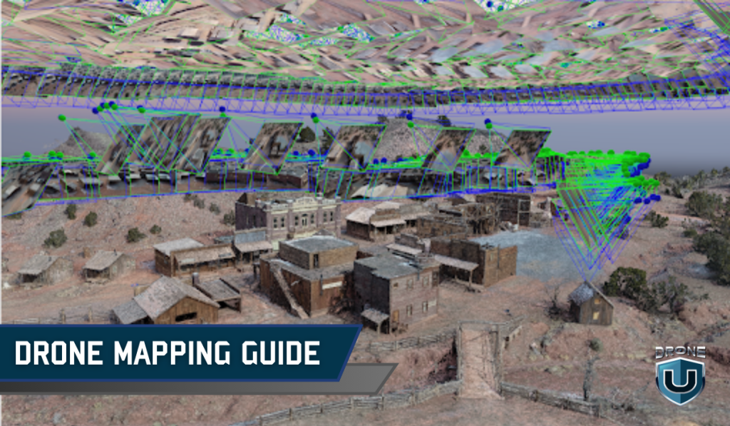
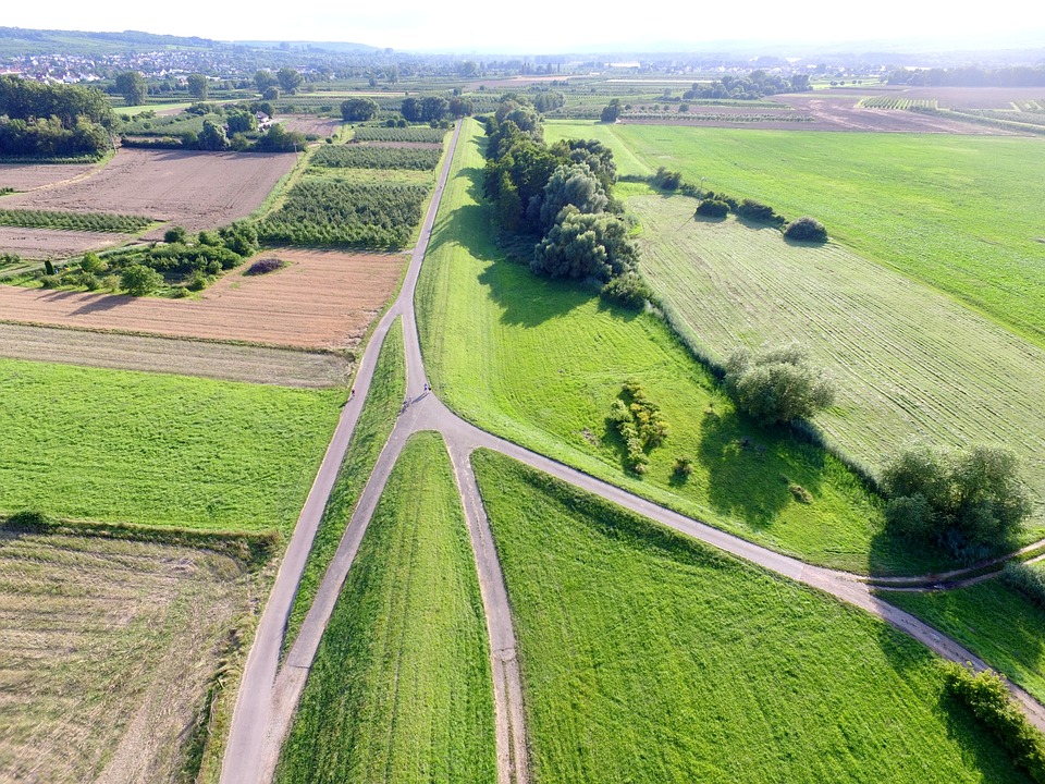
 Terrain Mapping
Drone mapping combines a range of technologies, including photogrammetry, LiDAR, and SLAM lidar, to produce high-resolution images and data that can be used for surveying, agriculture, construction, and environmental monitoring.
For underwater mapping, drones fly dual-band sonar to capture data sets below the water.
I know all this can sound a bit technical but stay with me here.
First things first – let’s understand the importance of drone mapping and why it is catching up so fast.
The report “The Economic Impact of Unmanned Aircraft Systems Integration in the United States” by AUVSI highlights the economic advantage of incorporating UAS technology.
According to Drone Industry Insights, drone mapping is the top commercial drone application worldwide and is projected to remain so through 2030.
The FAA currently tracks over 855,000 registered drones in the United States, the majority used for mapping and inspection work.
To fully appreciate the importance of drone mapping, it’s essential to understand how it differs from traditional mapping methods and the unique advantages it offers.
Simply put, drone mapping is faster, offers higher-quality data, and is cheaper to acquire.
Drone mapping is a game-changing alternative to traditional methods. The key advantages are covered in the Benefits section below.
Let’s delve a bit deeper into some of the specific benefits that mapping with drone technology offers.
Drone mapping technology has revolutionized the way surveyors and mappers collect, process, and analyze geographic data. Drone mapping has numerous benefits, including
Drone mapping is significantly faster and more efficient than traditional ground-based surveying and mapping methods. This can save time, reduce costs, and increase efficiency.
Mapping with drones provides high-resolution aerial imagery and data that can be used to create accurate maps and models of the terrain. This technology can also be integrated with other data sources, such as ground-based sensors, to provide even more accurate and detailed data.
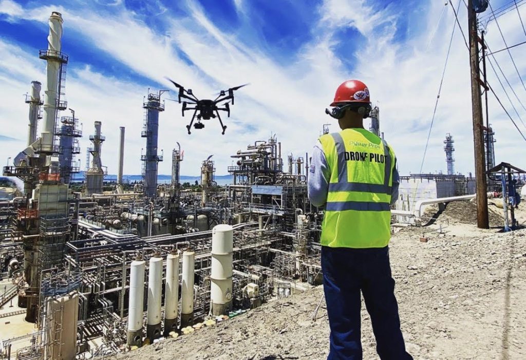
Using drones for surveying and mapping eliminates the need for surveyors and mappers to work in hazardous or difficult-to-access areas. This can improve safety and reduce the risk of injury or accidents.
With the proper certification, operators can employ unmanned aerial vehicles (UAVs) for security and surveillance purposes at private corporations, sporting events, public gatherings, and other venues. Additionally, UAVs can collect valuable information during and after natural disasters to assist in both security and recovery efforts.
Using drones for 3D mapping makes it possible to map remote or hard-to-reach areas that were previously difficult or impossible to survey.
3D drone mapping technology allows surveyors and mappers to collect large amounts of data in a short time, which can be used to create detailed maps and models of the terrain.
Drones provide exceptional capabilities for capturing top-notch aerial photos and videos and gathering large amounts of imaging data. The resulting high-resolution images can be utilized to produce 3D maps and interactive 3D models that have numerous practical applications.
Despite these benefits, there are some limitations to drone mapping technology.
Let us take a quick look at what the limitations are so that you are prudent about using this technology.
Now that you understand the benefits and limitations, here is how drone mapping works in practice step by step.
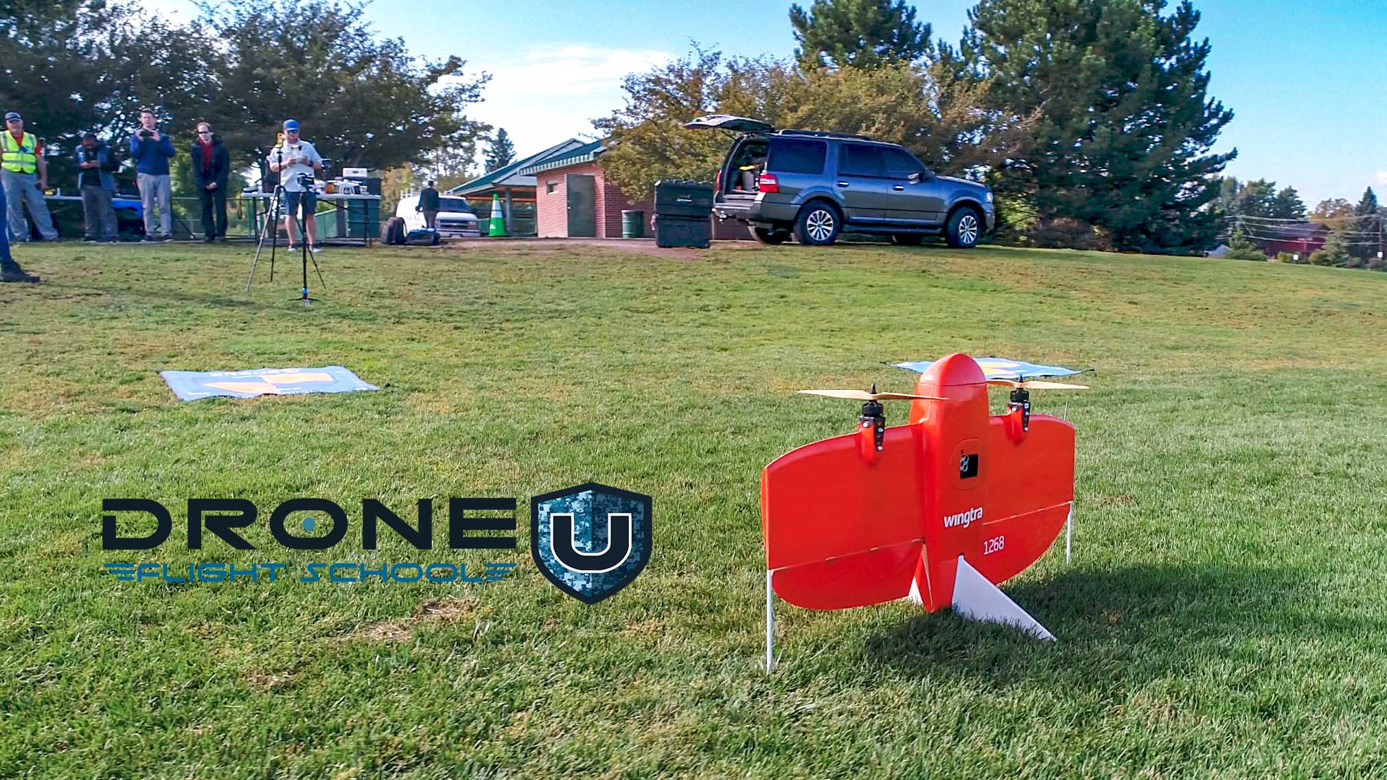 Wingtra Vertical Takeoff Drone
Define the area, set flight altitude, configure image overlap (75–85% frontal, 60–70% side overlap is standard), and calculate the Ground Sampling Distance (GSD) you need for the project’s accuracy requirements.
Standard overlap settings for most photogrammetry missions:
Place physical markers at known coordinates across the site. These anchor the map to real world coordinates and are critical for survey grade accuracy. For RTK equipped drones, GCPs can be reduced but not always eliminated.
The drone executes the pre-planned grid path autonomously, capturing overlapping images with GPS metadata embedded in each file.
Upload images to drone mapping software (Pix4D, DroneDeploy, Agisoft Metashape). The software uses photogrammetry Structure from Motion algorithms to reconstruct the scene into 2D and 3D outputs.
Export deliverables (orthomosaic, DEM, point cloud, 3D mesh) in client-specified formats. Run quality checks against GCP checkpoint errors before delivery.
Check out this video on How to do Drone Mapping for more details:
Drone mapping technology is versatile and can be used in a wide range of industries and applications.
Here are a few important ones:
 DJI Plant Protection Drone
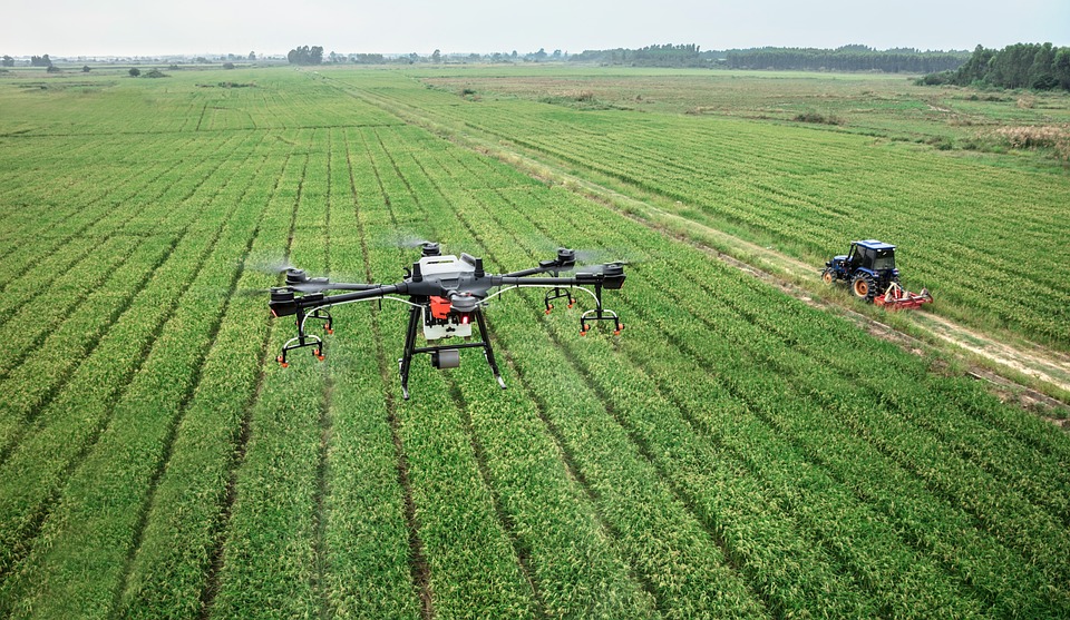
Monitor crop health with multispectral imaging, map field drainage patterns, generate variable rate application prescriptions, and track seasonal changes. Drone mapping reduces the need for manual field scouting at scale.
According to the United Nations, the world’s population is expected to reach 9.7 billion by 2050, resulting in a 69% increase in agricultural consumption from 2010 to 2050. Given that the majority of drone-using farmers and agriculture companies are large, corporate-owned farms, the potential for growth in the use of drones in agriculture is immense.
More specifically: Drone mapping is used in monitoring crop health, identifying areas of soil variability, and planning irrigation and fertilization programs.
Drone mapping is also used to index crops, meaning farms will build a highly detailed map to speed up the process of tending to crops at a micro-level.
Drone Mapping has also assisted Rice and Peanut farmers in the Southern United States. The water tables have been depleted so much that water distribution systems are not working properly anymore. The slope and grades of cropland have changed over time.
With Drone Maps and “digital terrain models,” farmers can determine the flow of water over a given field. With the Subsidence of the earth due to the water table, they can adjust slopes to change the flow of water into their fields. With such small changes in slope, drones provide astronomical value.
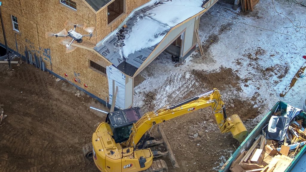
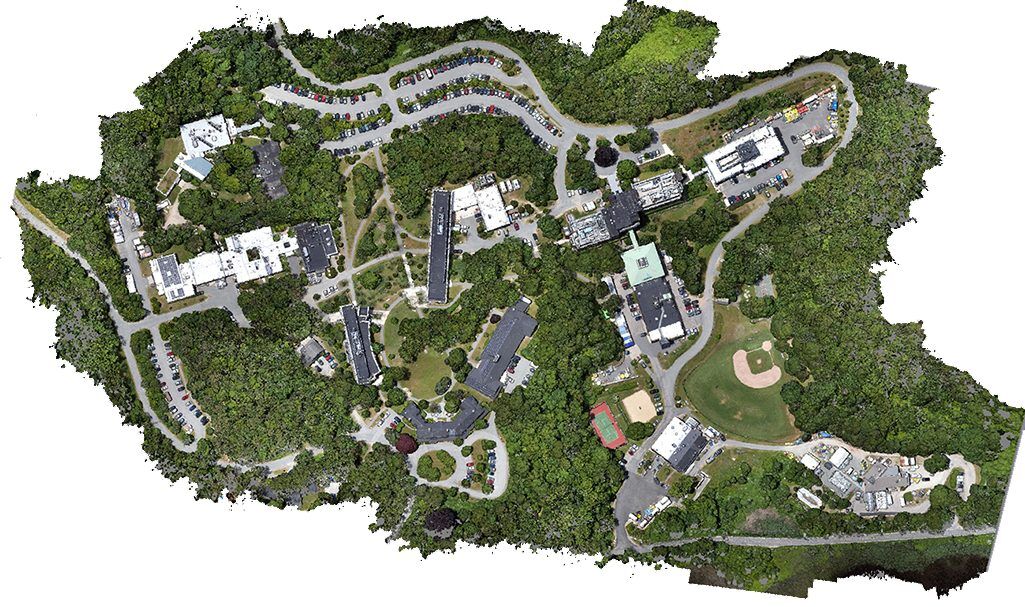
Track site progress, calculate earthwork volumes, generate cut and fill reports, and produce as-built comparisons. A drone can map a 100-acre construction site in a single morning and deliver an orthomosaic within hours.
In the construction industry, drone mapping is being used to create accurate topographic maps, survey job sites, and monitor progress on construction projects. Drone Mapping is also used to help set up site logistics. With drone maps and models, executive planners can showcase how each phase of the project will dictate the traffic of contractors, equipment, and materials.
According to PwC, the use of drones in construction and mining industries has the potential to become a multi-billion dollar global market worth $28.3 billion. Companies within these sectors are utilizing drones for effective compliance and adhering to strict worker safety regulations.
Drone mapping is also used to survey and map large mining sites, including open-pit mines and underground mines.
Recent evolution of drone mapping with construction… We have seen more and more construction companies using non-geo-reference orthomosaics Aka no ground control points. Construction companies are also using 3D models to help market potential projects, showcase the change over time and visualize the evolution of a project.
With these 3D Models and classical VDC software, construction companies can meticulously plan the implementation of every piece of construction into life-like 3d models.
For mining specifically, calculate stockpile volumes, monitor blast area safety, generate terrain models for planning, and inspect haul roads without placing personnel in hazardous zones.
As our world continues to move in a wireless direction, cellular companies are constantly improving their networks. Typically cellular companies are constantly upgrading antennas and replacing old antennas. Numerous companies are working on a “Zillow like,” app that would showcase a map of every tower and antenna in the country.
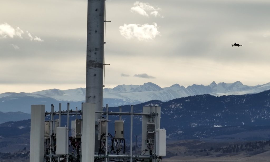
With drone mapping and modeling, cellular companies can index every tower to know which antennas are in what location providing how much coverage area to their clients. Drone models can showcase the angle of the antenna, which dictates how much coverage the antenna will provide.
Drones are capable of entering storms safely and gathering critical information such as temperature, pressure, humidity, and wind velocity. Scientists are exploring the use of drones in collecting research data.
This information can then be used to issue advanced storm warnings and with sufficient time to take protective measures or evacuate.
Produce georeferenced orthomosaics and elevation models for boundary surveys, utility corridor mapping, road design, and environmental assessments.
Drone mapping can be used to quickly and accurately survey large areas of land, including remote and difficult-to-access locations. Learning from surveying companies, a surveyor in Florida found that 1 in 3 surveys had some form of human error. Humans cannot always access areas from the ground, but they may be visible from the sky.
Drone mapping makes basic surveying much faster. With geo-referenced orthomosaics, surveyors can add “planimetric,” to each map and model to showcase elevations, infrastructure, and property lines. Drone pilots beware of offering surveying services without a surveying license.
Drone mapping can be used to create detailed maps and 3D models of real estate properties, including large estates and commercial properties. Typically drone maps and models are only used on luxury ranch properties, Airbnb’s, large campgrounds, and luxury waterfront properties.
 Environmental Monitoring | Source: Environmental Works
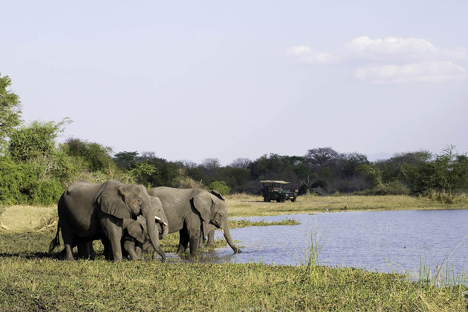
Drone mapping is used to monitor environmental conditions and changes, including land use changes, forest health, and coastal erosion. They can be used to quickly map disaster zones, identify critical infrastructure, and support rescue and recovery efforts.
Conservationists use drones equipped with night vision optics or thermal sensors to patrol parks and prevent poaching. Liwonde National Park in Malawi serves as a prime example, utilizing anti-poaching drones to detect illegal snares, keep tabs on park activity, and aid law enforcement in locating and apprehending poachers.
 Liwonde National Park in Malawi | Source: Malawian Style
These are just a few examples of the many applications of drone mapping. As drone technology continues to evolve, the range of applications will likely continue to increase.
The world of drone mapping is evolving rapidly, thanks to the relentless innovation in software and hardware.
Having understood the different applications of drone mapping, it’s time to learn about the essential equipment.
To capture aerial imagery and data for mapping and surveying, you need a variety of equipment and technologies. These equipment work together to enable the drone to capture, process, and deliver accurate and georeferenced mapping data for a wide range of applications.
Drone mapping equipment can vary depending on the project requirements, but the following items are often required:
For capturing good quality imagery, a high-resolution camera is the most important component. It is essential to see every detail in these photos to ensure accuracy. A RGB (Red, Green, Blue) camera is commonly used for visual mapping, while a hyperspectral or multispectral camera may be used for specific applications such as agricultural mapping.
GPS receivers or other satellite navigation systems are integrated into drones. GNSS receivers provide accurate positioning data for drones during flight. A high-precision GPS or satellite navigation system is essential for georeferencing the data collected accurately.
Software applications help pilots plan the drone flight, ensuring optimal coverage and data capture. These tools allow drone pilots to define waypoints, altitude, and other parameters to achieve desired mapping results.
A drone mapping mission requires a reliable communication system between the UAV and the ground control station. In addition to telemetry data, live video feeds, and remote control signals, the drone operator can monitor and control the drone during the mapping mission through this system. Wireless protocols and radio frequency (RF) technologies may be used for communication.
Since drone mapping is a complex, time-consuming process, drone batteries must be checked regularly. To keep the drone in the air for the maximum amount of time, it is recommended to carry a portable charger and spare batteries.
In drone mapping equipment, a gimbal enhances the quality of the captured data by minimizing blurriness and distortion caused by the drone’s motion in windy conditions, or during rapid maneuvers.
During flight, a drone’s camera or sensor needs to be stabilized using a gimbal, which compensates for the drone’s movement. Stabilization is essential to obtaining clear images or data.
The post-processing process allows a dataset to be georeferenced and stitched together, to create accurate and detailed maps, and software programs like Pix4D, Agisoft Metashape, and DroneDeploy are commonly used for this purpose.
Now let’s head towards the new emerging drone mapping verticals in recent times.
Many verticals of business enterprises are moving into mapping. Drone mapping simply provides highly detailed data-based decisions. Navigating decision making has literally never been easier.
In the next section, we will discuss various drone mapping software and drone platforms that are currently popular in the market.
Depending on the application, here are the three types of drone mapping software that are available in the market, and different processing methodologies.
People often get confused with the technical terms used in drone mapping software. So let’s understand how the Photogrammetry, LiDAR Mapping, and 3D modeling software are different from one another.
 Photogrammetry Point Cloud | Source: GISGeography
Photogrammetry software uses images captured by a drone to create 2D and 3D maps, models, and orthomosaics. Photogrammetry software creates realistic 3D depictions of topographic surfaces by merging geotagged images of the same features from multiple perspectives.
Photogrammetry software can be used for a range of applications, including point cloud construction, slope analysis, site indexing, and classification, taking linear measurements, taking volumetric measurements in a variety of industries like…agriculture, construction, and engineering.
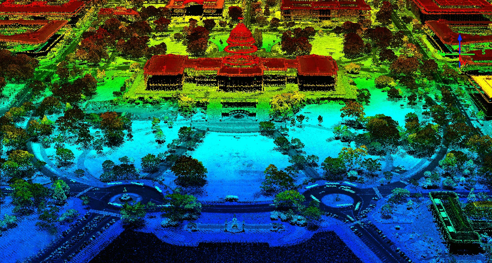 Capitol Building LiDAR | Source: GISGeography
LiDAR (Light Detection and Ranging) mapping software uses laser scanning technology to collect 3D data and generate detailed maps and models. LiDAR mapping software is typically used for more complex applications, such as large-scale mapping and engineering, as it provides high-resolution data and precise measurements.
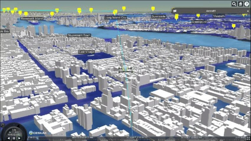 3D Model of New York City in Drone View | Source: ResearchGate | Note: Not a life like 3d model
3D modeling software is used to create 3D models of objects and environments, using data collected from a drone or other sources. 3D modeling software can be used for a variety of applications, including architecture, engineering, and construction, historical preservation, industrial design, and marketing.
Typically the best life-like 3D modeling software:
| Photogrammetry | LiDAR | |
| How it works | Reconstructs 3D geometry from overlapping 2D photos | Uses laser pulses to measure distances directly |
| Best for | Visual mapping, construction, agriculture, real estate | Forestry, flood modeling, terrain under canopy |
| Accuracy | 1–5 cm with RTK/GCPs | Sub centimeter in ideal conditions |
| Hardware cost | $1,500–$15,000 | $10,000–$50,000+ |
| Vegetation penetration | No, cannot see through tree canopy | Yes,lasers penetrate canopy to bare ground |
| Output | Orthomosaic, 3D mesh, DEM, point cloud | Point cloud, DTM, contours |
For most commercial drone mapping work like construction, real estate, agriculture monitoring and site surveys, photogrammetry is the correct and cost-effective choice.
LiDAR is required when the project demands ground level data under tree cover, or when bare earth terrain models are specifically needed.
To make it simpler for you and to help you choose the right software, here are three types of mapping software you need to know
Let me give you a quick overview of each of these software categories.
 Drone Aerial Shot
Acquisition Mapping Software helps drone pilots plan missions to fly highly-overlapping flight paths to acquire imagery. The acquisition software controls the drone to fly autonomous missions.
A few examples of acquisition software are
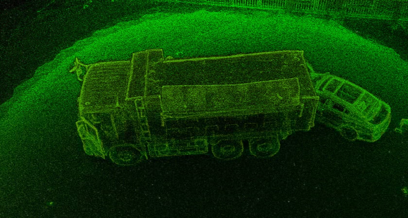 Point Cloud – Collision Reconstruction | Source: DJI
This software typically takes your imagery or data and creates a point cloud, which then other deliverables are created off of the point cloud. Eg. Digital Surface Model.
Desktop-based software requires a powerful computer but offers drone pilots the most options in customizing their data or customizing the process of their data.
With processing software, pilots have the most options for deliverables. Eg. Pix4d Mapper, Bentley, Metashape.
The processing software typically runs on a desktop PC or laptop and is compatible with any Windows-based computer.
It allows for the stitching together of numerous data points, resulting in the creation of a point cloud. This point cloud can then be transformed into a variety of deliverables such as a Digital Surface Model, digital terrain model, topographic map, 3D textured mesh, and other types of outputs.
With these processing capabilities, drone pilots have greater flexibility in handling their data. You can easily fix issues with the data and produce a variety of deliverables.
Cloud-based or all-in-one software, such as DroneDeploy, enables users to acquire and upload imagery to the cloud for processing. Typically this is cloud-based software that helps pilots plan missions, fly them, and autonomously upload the data to a cloud processor. Pilots then simply look up the results of this data on an internet browser later.
That being said – DroneDeploy may not be suitable for all missions.
DroneDeploy works well when there is a stable cellular connection, but it is not ideal for complex environments or 3D modeling.
Additionally, if you want full control over their data, DroneDeploy may not be the best option.
In the next section of this guide, we will take a closer look at each type of drone mapping software and provide recommendations on the best choice for your projects.
Don’t miss out on our exclusive video showcasing the best free software for drone mapping practice!
When comparing drone mapping software, you need to consider several factors such as accuracy, ease of use, cost, and compatibility with your drone and other hardware.
Here is a comparison of different types of drone mapping software based on the purpose:
 Source: Pix4D
If you are a drone pilot looking for the best software to create a myriad of deliverables then Pix4DMapper is an excellent choice. It offers the most flexibility in creating deliverables such as orthomosaics, point clouds, DSMs, DTMs, Topographic maps, 3D textured mesh, video animations, and video game environments.
Pix4D Mapper allows you to have full control over their data, enabling you to create marketing videos, construction plans, and 3D textured mesh models.
Overall, Pix4DMapper is the best desktop processing software, offering you the greatest value for your investment and flexibility in producing diverse deliverables.
Orthomosaics is a critical deliverable in many drone applications, from disaster assessment and public safety to construction and engineering. In fact, it is one of the top three deliverables in these industries.
When it comes to generating rapid orthomosaics without reliable internet access, the most efficient solution is Pix4D React. This software excels as the fastest orthomosaic generator and methodology for creating geo-referenced outputs.
However, it is important to note that Pix4D React does not allow for actual geo-referencing of the orthomosaic.
If you are flying a Wingtra drone, the fixed-wing vertical takeoff and landing drone, you can pre-georeference the photos and then use Pix4D React to produce the quickest, most scalable orthomosaic that is both geo-rectified and geo-referenced.
Alternatively, if you have a reliable internet connection, you can upload your photos from your drone directly to the cloud and use DroneDeploy, which has the fastest orthomosaic generator in the cloud, but without the ability to perform geo-referencing.
Pro Tips:
Drone U’s Rapid Orthomosaic class is probably one of the shortest and most valuable classes we offer.
 DroneDeploy Mapping Software | Source: DroneDeploy
DroneDeploy is a cloud-based mapping software that allows you to upload photos directly from your drone to generate orthomosaic without geo-referencing. The software is well known for its excellent mapping engine for volumetric measurements.
However, DroneDeploy has its limitations. Let us look at the limitations of DroneDeploy:
Despite its limitations, DroneDeploy remains an excellent mapping software for beginners and those looking to perform volumetric measurements.
When it comes to creating 3D models, Reality Capture is the best software in our opinion.
However, the user interface can be a little clunky and the point cloud construction isn’t great.
 Reality Capture Interface | Source: YouTube
On the other hand, Context Capture by Bentley is the absolute best 3D model generator on the planet, but it’s also extremely expensive. That’s why we use Optelos, which utilizes the Context Capture engine at a lower price point.
With Optelos, we can access the amazing 3D modeling capabilities of Context Capture for about half or even a third of the normal price of normal Bentley context capture.
Pro Tip: While Reality Capture is a great 3D modeling tool, there have been times when I’ve taken a point cloud generated in Pix4D mapper and merged it over to Reality Capture to create a 3D model.
 Source: Optelos
One significant development in the mapping industry is the shift from mere mapping and comprehending data to macro-level data organization.
And Optelos is leading the way.
This involves consolidating different data points such as 360 images, 360 Panos from the sky, and interior 3D models onto a single point cloud or 2D map. By doing so, it becomes possible to layer and integrate these diverse assets in a more cohesive and meaningful way.
Based on our experience, the absolute best executive-level mapping management software available today is Optelos.
Optelos also offers a unique feature that most of the other mapping software does not have, which is the “ortho compare feature.”
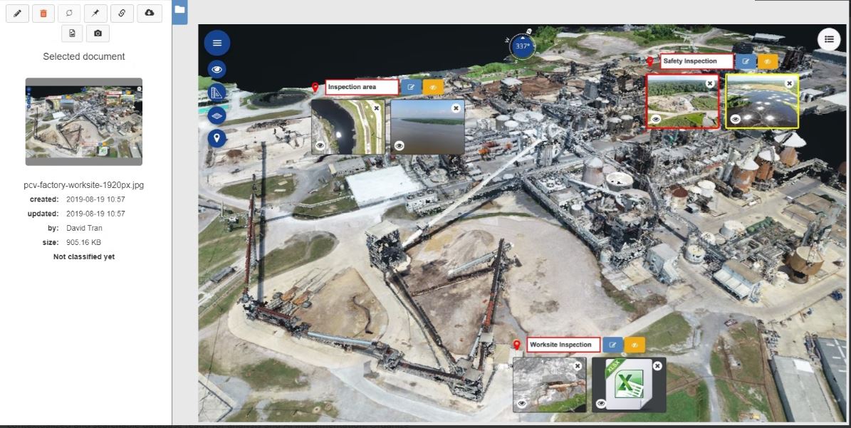 Optelo’s Ortho Compare Feature | Source: Getapp
This feature is particularly valuable in the construction industry, where orthomosaics are frequently used, to create high-level time maps of a construction site.
With the ortho compare feature, multiple orthomosaics can be overlaid on top of each other, and by swiping through the Orthomosaic, you can see the changes and deviations on the site over time. This can be done as long as you have datasets from week to week.
Overall, the ortho-compare feature can provide significant insights into the progress of a construction project and help identify potential issues early on.
 Source: Propeller Aero
Propeller Aero is a drone mapping software that offers Arrow Points, which is a simple and easy method for geo-referencing your data. Their processing software is probably the best for “cut and fill” efficiency calculation.
What does that mean?
Well, imagine you’re on a construction site and you need to move dirt from one area to another to level the ground. Propeller Aero’s software is the only mapping software that will measure the time it took and how much dirt was moved from one position to another.
It can help you determine if the job was done efficiently or if too much dirt was cut from one area and filled into another, which could cause problems down the line.
This information is crucial for construction sites because it can help identify and resolve potential issues early on.
Pro Tip: Propeller’s processing system is the best for Quarries and Large scale construction companies. The efficiency analysis from Propeller is top-notch, contractors can measure the efficiency of earthworks better than any other software. Imagine cut-and-fill volumetric measurements over time.
It is easy to feel overwhelmed with these mapping softwares, each offering different features and capabilities.
To help make things easier, we’ve put together a summary of the top picks for drone mapping software based on specific features.
| Feature | Our Recommendation |
| Cost-effective Mapping Software | Pix 4D Mapper |
| Orthomosaic Mapping Software (Without Internet) | Pix 4D React |
| Orthomosaic Mapping Software (With Internet) | DroneDeploy |
| Volumetric Measurement Software | DroneDeploy |
| 3D Mapping Software (Affordable) | Optelos |
| 3D Modeling Construction (Advance Features) | Capture Reality |
| Best Drone Software for Construction | Optelos/Propeller Aero |
Pro Tip: Pix4d Mapper offers drone pilots the ability to create any deliverable, change the processing parameters, and turn “crap” data into good data. Pilots can’t do that with cloud-based software.
Reporting functionality sucks on Pix4D, which is why we offer our “deliverables,” course with the Mapping Bootcamp and Online Mapping Class.
Between Optelos and Propeller Aero, I prefer Optelos for its next-level asset organization. DroneDeploy has done this too.
DroneDeploy has also stepped up its game with its recent acquisition of StructionSite, which can create a single data product by overlaying interior and exterior 3D models.
However, you can achieve this at a more affordable cost and better quality with “Kuula“, a processing software.
Ultimately, choosing the best drone mapping software depends on these two factors:
Now that you have a better understanding of what to consider when choosing drone mapping software, it’s time to look at the best drones that can help you capture the data you need to create accurate and detailed maps.
 DJI Phantom 4 Pro | Source: Unsplash
So far we have discussed drone mapping software and now it’s time to find out the best drones for mapping. After all, this is THE most critical element of the equation.
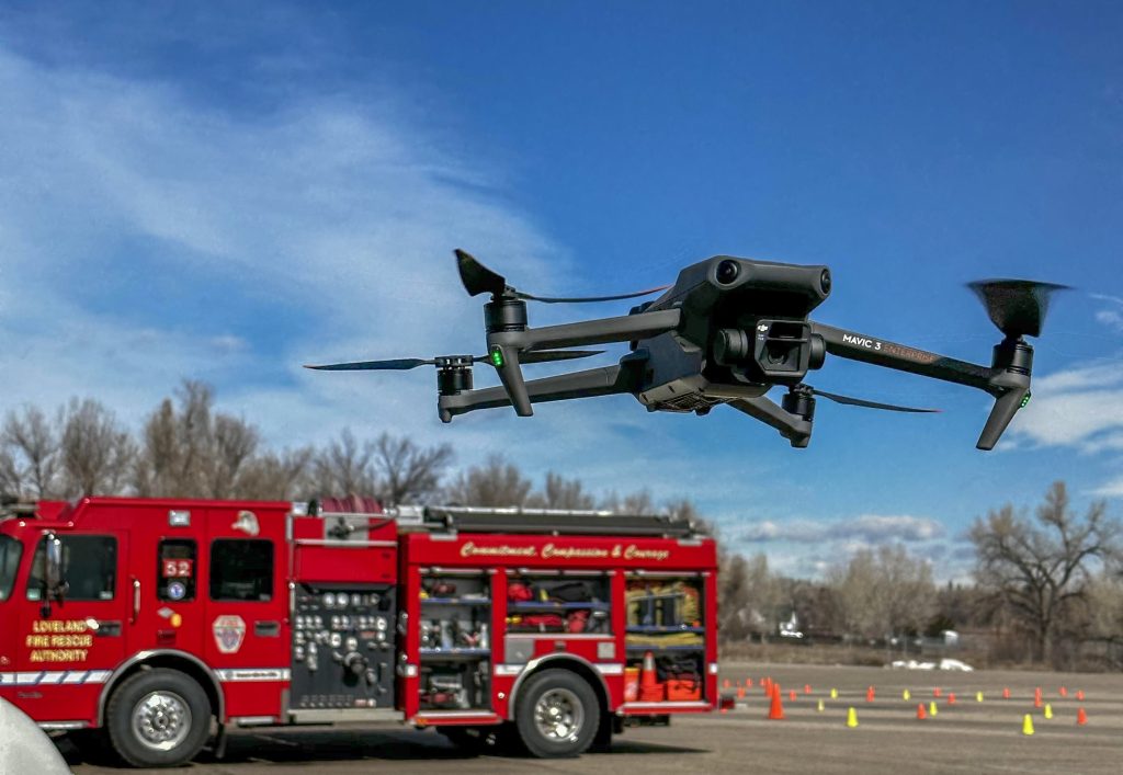
When it comes to choosing the best drone for mapping, two drones come to my mind – The DJI Mavic 3 Enterprise and the Phantom 4 Pro.
Let’s compare these two platforms and find out which one is better for your specific needs.
The Phantom 4 Pro drone is the most valuable DJI mapping drone ever made, and for good reason. It has doubled in price due to its impressive features, including the ability to shoot 4K videos and RAW photos.
Its open Software Development Kit (SDK) allows for the use of about three dozen different applications for mapping. The Phantom 4 Pro remains a powerhouse in the mapping industry. However, it can only be purchased refurbished. The Phantom 4 Pro is still more affordable than the Mavic three enterprise and is definitely worth the investment.
 DJI Mavic 3 Enterprise | Source: Drone U
The most up-to-date DJI mapping drone currently available is the Mavic 3 enterprise, but it has one major downside: it doesn’t have the same video quality as other Mavic models such as the Mavic 3 Cine, the Mavic 3 Classic, or the regular Mavic 3. These models offer 4K video and RAW photo capabilities. They all have these features that the Mavic 3 doesn’t have.
It seems that DJI is encouraging drone pilots to consider the Mavic 3 enterprise for autonomous missions. This drone offers unique features that are not available in other models of Mavic 3 drones such as the Mavic 3 classic.
This means that you have to spend triple the amount of money that the Phantom 4 Pro costs just to get all the features that the Phantom 4 Pro can offer. That’s why it still remains such a valuable drone.
However, it would be great if DJI could incorporate these features into other models to provide a wider range of options for drone pilots.
The question remains, which mapping drone should you buy?
If you’re looking for a great mapping drone for under $5,000 and buying DJI is an option, the Mavic 3 Enterprise is a solid choice, although it has limited capability with only DJI Pilot 2 and a few other available apps.
However, if you want to capture beautiful videos, perform mapping missions, and take raw photos, the Phantom 4 Pro drone is the best mapping drone. If you can’t find one, Mavic 3 Enterprise.
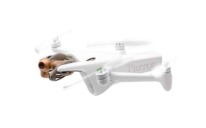 Parrot Anafi Ai | Source: Parrot
If you need a mapping drone that is not Chinese or from DJI, Parrot Anafi Ai is the best drone for mapping. It has Pix4D Capture acquisition software built right into the drone.
Additionally, it is NDA approved for flying in American airspace, making it a great option for those who require an approved drone for their work.
Cost depends on whether you are building an in-house mapping operation or hiring a service provider.
| Cost Item | Range |
| Entry level mapping drone (camera only) | $500–$2,000 |
| Professional mapping drone with RTK | $3,000–$15,000+ |
| Cloud mapping software (DroneDeploy) | $200–$500/month |
| Desktop software (Pix4D Mapper) | $350+/month or perpetual license |
| Third party drone mapping service | $150–$500 per acre |
| FAA Part 107 certification (required for commercial work) | $175 exam fee |
For organizations that map frequently, in house operations are typically more cost effective than hiring service providers after the first 6 to 12 months.
For one off projects, hiring an established provider eliminates equipment and software overhead.
 Mapping Training by DroneU
Here are a few techniques and best practices to keep in mind:
Effective drone mapping starts with proper planning. This includes determining the size and scope of the area to be mapped, selecting the right drone and hardware for the job, and determining the data that needs to be collected. You also need to consider weather conditions and any safety and regulatory requirements.
The quality of your drone mapping data is heavily dependent on the quality of the images captured by your drone. It’s important to understand the camera settings and how to optimize them for your specific mapping needs. This includes selecting the right resolution, image format, and camera position.
Effective drone mapping requires precise flight planning. This includes determining the optimal flight altitude and overlap, as well as the flight path and pattern. It’s important to consider the specific requirements of your mapping software, as well as the size and complexity of the area to be mapped.
Drone mapping data is typically processed using photogrammetry or LiDAR mapping software. It is important to understand the data processing workflow and how to optimize it for your specific mapping needs. This includes selecting the right algorithms, adjusting processing settings, and performing quality checks.
Effective drone mapping requires quality control checks to ensure the accuracy and reliability of the data. This includes checking the quality of the images captured by the drone, verifying the accuracy of the map or model, and ensuring that any errors or discrepancies are corrected.
The future of drone mapping looks promising.
Allied Market Research projects that the construction drone market will hit $11.96 billion by 2027.
Let us look at a few trends and developments in the drone mapping industry worth keeping an eye on.
Drone mapping technology is becoming more accessible, with lower costs, easier-to-use software, and smaller, more portable drones. This will enable more people and organizations to use drone mapping technology and benefit from it.
Drone mapping technology is likely to become increasingly integrated with other technologies, such as artificial intelligence, machine learning, and the Internet of Things (IoT). This will enable new and more advanced applications of drone mapping, such as real-time monitoring, predictive analytics, and autonomous flight.
As drone usage continues to increase, authorities are likely to regulate it more strictly, especially regarding data privacy. It’s important to stay informed about the latest regulations and best practices for drone usage, especially for commercial and industrial applications. You can learn more about drone regulations in this article.
As technology evolves and improves, new and innovative applications of drone mapping technology are likely to emerge. This includes everything from environmental monitoring to construction planning, and from search and rescue operations to autonomous flight.
With RTK positioning and well placed ground control points, drone mapping consistently achieves 1–3 cm horizontal accuracy and 3–5 cm vertical accuracy under good conditions.
Standard GPS without correction delivers 1–3 meter accuracy, suitable only for non-precision applications.
Accuracy is determined by four factors: positioning method (RTK, PPK, or standard GPS), ground control points, flight parameters (altitude and overlap), and processing workflow. Getting any one of these wrong can invalidate an otherwise well executed mission.
For a full breakdown of RTK vs PPK vs standard GPS and how each affects mapping accuracy, see the Drone Accuracy Guide: GPS vs RTK vs PPK.
Experts predict that the global surveying and mapping services market will experience a compound annual growth rate of 3.4% and reach a value of US$13 billion by 2032. Read the full report here.
The future of drone mapping is exciting, and it will be interesting to see how the technology continues to evolve and impact a wide range of industries and applications.
Do you have questions about drone mapping or need some guidance?
Drop your comment below to start the conversation.
Enhance your 3D drone mapping skills with this essential video!
Watch the video now and discover the secrets to achieving exceptional 3D drone maps!

Add Your Comment