The 7 Best Underwater Drones
Ever dreamed of swimming alongside coral reefs, exploring the beauty of shipwrecks, or the sea world – all from the comfort of dry land? Underwater drones, also known as Unmanned Underwater Vehicles (UUVs), are making this a reality. These innovative machines are shifting the way we experience the underwater world.
In this guide, we’ll dive deep into the world of underwater drones and uncover the top 7 drones in the market.
First, let’s take a look at the brief history of underwater drones.
History of Underwater Drones
Autonomous Underwater Vehicle (AUV) development began in the 1950s and has seen continuous advancements. Here’s a timeline of some key milestones:
1950s
The first AUV, classified as an unmanned underwater vehicle (UUV), emerged in the United States in 1957. The University of Washington designed the Special Purpose Underwater Research Vehicle (SPURV) to gather oceanographic data in Arctic waters.
1980s
The 1980s witnessed the merging of ROV (Remotely Operated Vehicle) technology with AUV capabilities. In 1983, ISE Ltd. and International Submarine Engineering collaborated to create the Autonomous and Remote Controlled Submarine (ARCS).
1990s
The 1990s marked a shift towards longer-term underwater exploration with the introduction of solar-powered AUVs. The credit goes to the Russian Institute of Marine Technology Problems, which introduced the Solar Autonomous Underwater Vehicle (SAUV) in 1987. Furthermore, the development of gliders in 1995 revolutionized AUV technology by allowing underwater submergence for weeks or even months at a time, thanks to extended battery life.
2000s
The 2000s saw a surge in AUV usage beyond mere testing tools. The growing international user base and increased funding for AUV development led to commercial sales. This shift expanded the scope of AUVs from research-based applications to industrial and commercial uses.
2010s and Beyond
In recent years, a renewed focus has been placed on the military applications of AUVs. Following the successful use of unmanned surface vehicles (USVs) by Ukraine in the Black Sea in 2022, the Ukrainian Navy adopted the Toloka TLK-150, a small robotic submarine, in early 2023.
In April 2024, Ukraine announced testing of an “unmanned submarine” capable of carrying divers, torpedoes, and missiles, and featuring extended range and endurance.
Types of Underwater Drones
Unmanned underwater vehicles (UUVs), also known as uncrewed underwater robots. They can navigate and operate underwater without requiring a human pilot on board.
These powerful vehicles come in two main categories: remotely operated underwater vehicles (ROVs) and autonomous underwater vehicles (AUVs).
1. Remotely Operated Underwater Vehicles
ROVs are connected to a control station or ship by a cable. This cable supplies power, allows for communication, and even transmits a live video feed to the operator. This tether allows for precise human control over the ROV’s movements and actions. situations requiring real-time decision-making, such as inspecting pipelines or conducting underwater search and rescue missions.
2. Autonomous Underwater Vehicles
AUVs are self-directed vehicles. They operate on their own, without a cable linking them to the surface. They are pre-programmed with specific mission instructions and rely on built-in sensors and computer systems to navigate, collect data, and complete tasks autonomously.
AUVs are valuable for gathering data over large areas or for venturing into deep or hazardous environments where human operation might be impractical or risky. They are increasingly being used for tasks like oceanographic mapping, environmental monitoring, and underwater exploration.
Key Components and Technology
A. Propulsion Systems
Underwater drones zip through the water using special engines. These engines, called thrusters, are like tiny propellers powered by electric motors. Thrusters can be positioned in different ways (think propellers on a boat vs. a jet ski) to push the drone in any direction, allowing for sharp turns and precise movements. Some underwater drones also have buoyancy engines, which act like underwater balloons. The drone can bob up and down by inflating or deflating these engines, controlling how deep it dives.
B. Navigation and Control Systems
Navigating and controlling an underwater drone is a complex task due to the challenges posed by the marine environment. Underwater drones employ a range of sensors to gather data about their surroundings and position, including:
- Inertial Navigation Systems (INS): Combining accelerometers and gyroscopes to track the drone’s movement and orientation.
- Depth Sensors: Measuring the drone’s depth using pressure or sonar-based sensors.
- Doppler Velocity Logs (DVLs): Using Doppler shift to measure the drone’s velocity relative to the seafloor or water.
- Acoustic Positioning Systems: Triangulating the drone’s position using acoustic signals from multiple reference points.
This sensor data is processed by onboard guidance systems, which use advanced algorithms and control systems to determine the drone’s position, plan its path, and issue commands to the propulsion systems.
C. Communication Systems
Radio waves don’t travel well underwater, so drones use special tools called acoustic modems. These modems are like underwater translators, turning information into sound waves that can travel far in the water. While acoustic modems are great for long-distance chats, they can be a bit slow.
For situations where a super strong connection is needed, some drones use tethered cables. Think of these cables as underwater lifelines – they provide a steady stream of power and crystal-clear communication, but they limit how far the drone can roam.
D. Payloads and Instruments
Underwater drones can be equipped with various payloads and instruments to perform specific tasks and gather data.
Common payloads include:
- Cameras: High-resolution cameras for visual inspection, mapping, and documentation.
- Sonar systems: For seafloor mapping, object detection, and underwater imaging.
- Sampling tools: Devices for collecting water, sediment, or biological samples.
- Manipulators: Robotic arms or grippers for interacting with and manipulating objects underwater.
- Scientific instruments: Sensors for measuring water properties (e.g., temperature, salinity, pH), as well as environmental monitoring equipment.
These payloads can be customized and integrated into the drone based on the specific mission requirements, enabling a wide range of applications in various domains.
Best Underwater Drones
From our research, we have curated these seven underwater drones that give you the most bang for your buck.
1. Deep Trekker REVOLUTION ROV
 Credit: Deep Treker
Deep Trekker’s REVOLUTION ROV is the ultimate deep-water explorer designed for underwater inspections and surveys, delicate target retrieval missions, and heavy-payload transportation under harsh conditions.
Specifications:
- Depth Rating: 305 meters (1,000 feet)
- Camera: 260° rotating 4k camera
- Live Viewing: Live video feed
- Tether Length: 300 meters (984 feet)
- Operating Temperature: -10°-50° Celsius (14°-122°Fahrenheit)
- Battery Life: 3-6 hours
- Control System: 7-inch LCD controller
- Movement: Six independent, reversible thrusters
- LED Lights: Four camera-facing LED lights
Pros:
- Unmatched Maneuverability: It can move vertically and laterally with precision, allowing it to navigate treacherous depths easily.
- Crystal Video Output: The REVOLUTION ROV’s 4k camera has powerful LED lights with a minimum illumination of 0.001 lux, a wide field of view, auto color correction, and enhanced clarity, making it the best underwater drone for murky water.
- Optional Features: Add-ons, including custom tether lengths, imaging sonar and water quality sensors, are available to let you soup up this underwater robot as needed.
Cons:
- Quote-Based Pricing: You must contact Deep Trekker to know how much it costs.
- Hefty construction: This drone weighs 26 kilograms in air (57 pounds).
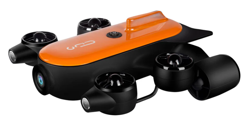
2. CHASING Dory Underwater Drone
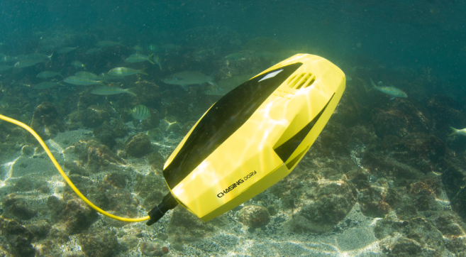 Credit: Chasing
The CHASING Dory is your compact, maneuverable diving buddy, ready to unveil the hidden wonders of the deep. This drone dives deep, letting you see a whole new world with its high-resolution camera. Powerful LED lights illuminate the underwater environment, bringing the vibrant details to life in stunning footage.
Specifications:
- Weight: 1.1kg
- Sensor: 1/2.9 inch
- Battery Life: Up to 60 mins
- Lights: 2 x 250 lumens
- 50 feet Tethered operation
Pros:
- Compact and maneuverable design ideal for exploring tight spaces
- Excellent depth rating for exploring deeper underwater environments
- Powerful LED lights illuminate underwater scenes
- Long battery life for extended underwater exploration
- Tethered operation provides a reliable connection and power source
- Can be controlled with a smartphone
Cons:
- Can’t shoot 4K photos or videos
- Tethered operation limits freedom of movement compared to untethered drones
- Not recommended for swift current waters.
3. QYSEA Fifish PRO W6
 Credit: QYSea
This industrial-grade ROV (Remotely Operated Vehicle) is built for professional use, capable of diving an impressive 1,148 feet (350 meters) underwater.
The Fifish PRO W6 is equipped with a high-tech 4K HDR camera, boasting a wide 166-degree field of view. Capture stunning, detailed footage of the underwater world in vibrant colors.
An advanced sonar system allows for 3D mapping and object detection, providing valuable data and a clear picture of your underwater environment.
Specifications:
- Depth Rating: 350 meters (1,148 feet)
- Motor System: Patented 6 Q-motor system for increased power, stability, and current-fighting performance
- Battery Life: Improved battery capacity for extended operation
- 3-axis robotic arm for object retrieval and manipulation
- Sonar array for obstacle avoidance and navigation
- Real-time underwater location tracking
Pros:
- Industrial-grade: Built for deep dives (350m) and demanding tasks.
- Powerful: Excellent maneuverability and current-fighting capabilities.
- 4K HDR camera with wide FOV: Great image quality for inspections and exploration.
- Sonar system: Enables 3D mapping and object detection for precise work.
- Modular design: Allows for adding accessories for specific needs.
Cons:
- Expensive: Pricier than most consumer drones.
- Bulkier and heavier: Less portable compared to some options.
- May be overkill: Feature-rich for casual users or basic underwater exploration.
4. PowerVision PowerRay Wizard
 Credit: Powervision
The PowerVision PowerRay Wizard is your underwater hunting buddy.
This easy-to-use drone dives deep, letting you explore and see what lurks beneath the surface with its stunning 4K UHD camera.
The PowerRay Wizard has a built-in sonar fish finder, making it easier to locate schools of fish. Plus, it comes with a bait drop line, letting you deploy bait directly from the drone, setting the perfect trap.
Specifications:
- Imaging: Equipped with a 4K Ultra HD camera for capturing stunning underwater videos and photos.
- Live Streaming: Allows you to share your underwater adventures with friends and family in real-time.
- Depth Rating: Reaches depths of up to 30 meters (98 feet).
- Tether Length: Operates with a tether up to 70 meters (230 feet) long, providing a good operational range.
- Battery Life: Offers up to 4 hours of operation time on a single charge.
- Portability: Compact and portable design makes it easy to carry on boats or while diving.
- Fish Finder: Built-in fish finding technology helps you locate and track fish with ease.
Pros:
- Ideal for fishing: Sonar fish finder and bait drop functionality.
- 4K UHD camera: Captures high-quality underwater footage of fish and environment.
- Easy to use: Designed for anglers with intuitive controls.
Cons:
- Pricier than some options: Not the most budget-friendly option.
- Focus on fishing: May not be ideal for general underwater exploration or photography.
- Limited depth: Dives to 100m, which might not be enough for deep-water fishing.
5. Geneinno Titan
The Geneinno Titan is a mini-ROV (Remotely Operated Vehicle) designed for recreational and light professional use. This drone is a good option for underwater photography and videography. It has a 4K HDR camera with a 162-degree field of view, as well as a gimbal that helps to stabilize footage. It can also dive up to 100 meters (328 feet).
Specifications:
- Depth Rating: Reaches depths of up to 150 meters (492 feet) for the standard model, with a deeper T1 Pro version reaching 200 meters (656 feet).
- Camera: Shoots in 4K resolution at 30fps (frames per second) and also offers 1080p photo resolution.
- Field of View: A wide 160-degree field of view allows you to capture a broader underwater scene.
- Battery Life: The embedded battery provides up to 4 hours of operation time.
- Control System: Connects wirelessly to your smartphone or tablet via the Geneinno app for iOS and Android, allowing for easy control and live video viewing.
- Movement: Six thrusters enable the Titan to achieve 360-degree omnidirectional movement, providing stability and maneuverability underwater.
Pros:
- Excellent for photography/videography: 4K HDR camera with gimbal for stabilized footage.
- Good depth: Dives to 100m, suitable for exploring various underwater environments.
- Portable: Easier to transport and deploy compared to bulkier drones.
Cons:
- Not for professional use: May not have the durability or features needed for industrial applications.
- Lacks advanced features: No sonar or object detection capabilities like the QYSEA Fifish.
- Price: Can be pricier than some beginner-friendly options.
6. CHASING Gladius Mini
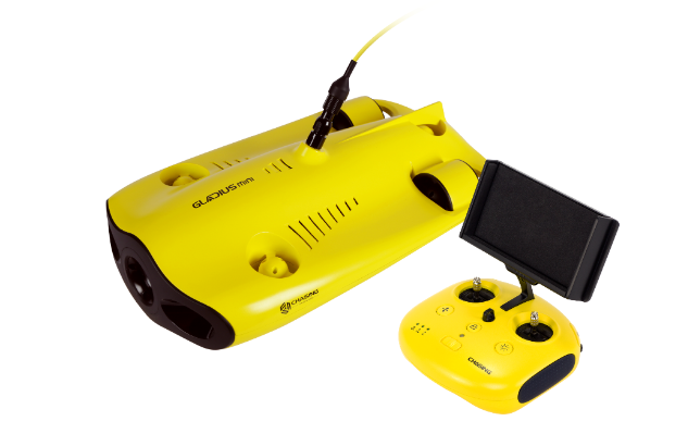
The CHASING Gladius Mini is a compact and affordable underwater drone designed for beginners and recreational use. This compact drone is easy to use and transport, making it perfect for recreational exploring. It boasts a 1080p camera that captures clear footage, and can dive as deep as 100 meters (328 feet) underwater.
Specifications:
- Depth Rating: Dives down to a maximum depth of 100 meters (328 feet), allowing you to explore a good range of underwater environments.
- Camera: Equipped with a 4K UHD camera for capturing high-resolution videos and photos of your underwater adventures.
- Live Viewing: Features a real-time viewing system that allows you to see what the drone sees directly on the controller or a connected device.
- Tether Length: Operates with a 100-meter (328 feet) tether, providing a decent operational range.
- Battery Life: Offers up to 2 hours of runtime on a single battery charge.
- Control System: Uses a wireless controller with an ergonomic design for easy and intuitive control of the drone.
- Portability: Lightweight and compact design makes it easy to transport and store.
- LED Lights: Built-in LED lights help illuminate the underwater environment for better visibility during dives.
Pros:
- Affordable: A good option for budget-conscious users.
- Compact and portable: Easy to carry and use for quick underwater exploration.
- Decent depth: Dives to 100m, suitable for exploring shallower areas.
Cons:
- Lower video quality: 1080p camera may not be ideal for professional photography.
- Limited features: No advanced functionalities like sonar or object detection.
- Might not be ideal for strong currents: Less powerful compared to some options.
7. ThorRobotics Mariana
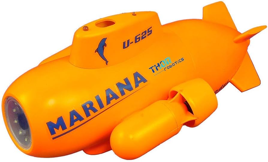
Compared to many underwater drones, the Mariana is a budget-friendly option. This makes it attractive for hobbyists or those new to exploring the underwater world.
The ThorRobotics Mariana is a mini Remote Operated Vehicle (ROV) designed for recreational use. It’s a good choice for casual exploration and underwater videography.
It boasts a 1080p HD camera, perfect for capturing crisp underwater footage. Infrared LED spotlights allow you to pierce through low-light conditions, revealing the hidden wonders of the deep. Two vector propellers provide good maneuverability, meaning you can navigate around reefs, wrecks, or other underwater structures with ease.
Specifications:
- Depth Rating: Reaches depths of up to 10 meters (33 feet), making it suitable for exploring shallow waters like pools, ponds, or calm bays.
- Camera: Equipped with a 720p HD camera for capturing underwater videos and photos.
- Live Viewing: Allows you to see what the camera sees in real-time through the included FPV goggles or a connected smartphone or tablet using the app.
- Control System: Wireless control via a 2.4 GHz remote control or your smartphone/tablet with the app.
- Portability: Compact and lightweight design makes it easy to carry around.
- Battery Life: The Ni-MH battery provides up to 1 hour of operation on a single charge.
- LED Lights: Built-in LED lights illuminate the underwater environment for better visibility.
Pros:
- Affordable: Compared to many underwater drones, the Mariana is a budget-friendly option, making it attractive for beginners or casual users.
- Good Camera: It boasts a 1080p HD camera, perfect for capturing clear underwater videos and photos.
- Low-Light Capability: Infrared LED spotlights allow you to see in low-light conditions, revealing more of the underwater world.
- Maneuverable: Two vector propellers provide good maneuverability, letting you navigate around reefs, wrecks, and other structures with ease.
- Reliable Connection: Being tethered ensures a reliable connection and steady power flow to the drone.
Cons:
- Tethered Design: Limited range due to the cable connecting the drone to the surface. If you want to explore further underwater, this might be restrictive.
- Durability: ABS plastic construction is good for recreational use, but not ideal for tougher environments. Consider sturdier materials like aluminium or titanium for professional needs.
- Limited for Professionals: The Mariana’s features and capabilities might not be sufficient for professional applications requiring high-end equipment.
Summary
Here is a summary to help you choose the perfect underwater drone based on your exploration needs:
Deep Trekker’s REVOLUTION ROV: Best drone for underwater inspections and surveys, delicate target retrieval missions, and heavy-payload transportation.
CHASING Gladius Mini: A great all-rounder for capturing high-quality footage with its versatile attachments and long range, perfect for detailed exploration.
Geneinno Titan: This option is ideal for professional use or serious underwater enthusiasts with its impressive depth capability.
PowerVision PowerRay Wizard: A top-of-the-line choice for stunning visuals, featuring a 4K camera and powerful lights to navigate even murky waters.
QYSEA Fifish PRO W6: This drone offers exceptional stability and control, making it a great pick for capturing smooth underwater videos.
CHASING Dory Underwater Drone: A user-friendly option with a good balance of features and affordability, perfect for beginners or casual explorers.
Consider the depth you want to reach, the type of footage you desire, and your piloting experience to make your choice. With the ever-evolving technology in this field, underwater drones promise to open even more doors to exploration and discovery in the years to come.
Happy diving!
Frequently Asked Questions
1. What are the disadvantages of underwater drones?
Underwater drones have the following disadvantages:
- They can be expensive.
- Battery life can limit mission duration.
- Operating in strong currents or murky water can be challenging.
- They require a tether in some cases, which can limit mobility.
2. Do waterproof drones exist?’
While some drones boast water resistance for brief splashes, drones specifically designed for sustained underwater operations don’t exist. Saltwater exposure poses a significant risk of corrosion and damage to electronic components.
3. How long do underwater drones last?
The operational lifespan of an underwater drone varies depending on the specific model and usage patterns. However, with proper care and maintenance, several years of service can be expected.
4. Does the US military have underwater drones?
The United States Navy and other military branches utilize underwater drones extensively for reconnaissance, search and rescue, and other critical missions. The recently unveiled Northrop Grumman Manta Ray exemplifies a next-generation autonomous underwater vehicle designed for extended-range military operations.
5. How deep can underwater drones go?
Underwater drones can reach impressive depths. High-performance research models can operate several kilometers below the surface. The maximum depth achievable by a particular drone depends on its design and construction materials.

Best Accessories for DJI Avata 2 to Elevate Your Drone Game
So, you’ve got your hands on the sleek DJI Avata 2? Congrats! You’re in for a wild ride through the skies.
Among the most advanced drones on the market is the DJI Avata 2, a powerhouse for hobbyists, professional filmmakers, and even public safety personnel.
To make the most of this amazing machine, you’ll need the right gear.
Investing in high-quality accessories can improve the performance and functionality of your drone.
In this article, we’re going to keep it simple and talk about the best DJI Avata 2 accessories that we’ve discovered make the biggest difference.
Best Accessories for DJI Avata 2
Below are the essential accessories for the DJI Avata 2:
1. DJI Avata 2 Remote Controller
Most DJI Avata 2 drones come bundled with a motion controller. It can be fun, but it’s not the best choice for those serious about their drone piloting skills.
Thus, the number one accessory you absolutely need is the DJI FPV Remote Controller 3.
It’s like your traditional remote controller, but with some extra oomph that’ll make your drone sing.
Why is it so great, you ask? Here are just a few of the ways:
- Lighter and longer battery time
- Tilt the camera to very specific positions
- Switch flight modes easier than the motion controller
These functionalities not only make flying smoother but also enhance your ability to capture the perfect shot, every time.
In three years, motion controllers might just be a fad, much like 3D TVs, whereas the tried-and-true remote controller will still be the go-to for precision flying.
Plus, there’s something satisfying about holding a proper controller in your hands. It makes you feel like a real pilot, not someone playing with a high-tech toy. And isn’t that what we’re all after?
2. Freewell ND Filter Set
Now, if we’re talking about making beautiful pictures, then you absolutely must get your hands on the Freewell ND filter set. The Freewell ND Filter Set is one of the best options available, offering ND 4, 8, 16, 32, and 64 filters.
But what exactly do ND filters do?
ND stands for Neutral Density. These filters are like sunglasses for your drone’s camera. They reduce the amount of light entering your camera lens without affecting the color. It allows you to slow down your shutter speed, even in bright conditions. This results in smoother, more cinematic footage that looks natural to the eye.
The Freewell ND filters are specifically designed to fit over the lens hood on the DJI Avata 2’s camera. While they might seem a bit tricky to install at first, once you get the hang of it, they’re a breeze to use.
Depending on your location and sky, you’ll likely find yourself sticking to an ND 8 or ND 16 filter. Two of the most versatile filters.
For example, if you’re in a high UV index area like Colorado, where the skies are incredibly bright and the UV Index is typically 10, an ND 16 will be your best bet for capturing epic fly-through shots with deep blue skies and rich shadow details.
Pro Tip: If you’re flying indoors or in low-light conditions, you probably don’t need an ND filter. In fact, it might make your footage too dark. ND filters are primarily for outdoor use.
3. Extra Batteries
The DJI Avata 2’s flight time of approximately 18 minutes per battery charge can be limiting for extended shooting sessions. Investing in additional Intelligent Flight Batteries ensures you can maximize your time in the field without interruptions. Keep in mind that it’s critical to use only OEM batteries. We’ve seen too many issues with non OEM over the decade plus we’ve been flying drones.
4. Carry Case
You’ve just dropped a pretty penny on your Avata 2 and these awesome accessories. The last thing you want is to damage them while lugging them around. That’s where a good quality carry case comes in.
Look for something that’s sturdy, water-resistant, and has customizable foam inserts. This way, you can create the perfect snug fit for your Avata 2, controller, batteries, and filters.
A couple of the examples we like are the GPC cases, which are great but quite a bit more expensive than most, and the Lekufee Hard Case, which is a more affordable option for protecting your Avata 2 investment.
5. SD Cards and SD Card Holder
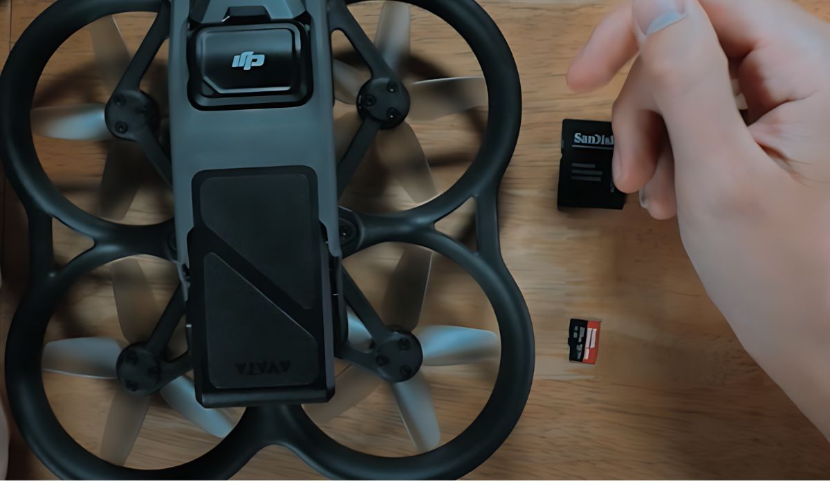
If you’re like us, you’ve found yourself in the position of not having enough SD card memory with you when you need it the most. To keep this from happening, always ensure you have plenty of cards in your Avata 2 case. As with most technology, there are tons of different types and sizes of SD cards to choose from. One of our favorites is the SanDisk Extreme 256GB. Solid performer with plenty of space and won’t break the bank.
When it comes to picking up an SD card holder, you’ll want to ensure it’s a hard case and that it is water proof. Again, there are literally thousands to choose from. We’ve absolutely loved using the PGYTECH CreateMate because it’s tough AND it doubles as a card reader. Brilliant!
6. Maintenance and Care
To keep your DJI Avata 2 in top condition, don’t overlook these maintenance accessories:
- Cleaning Kit: Regular cleaning of lenses and sensors ensures optimal image quality.
- Prop Balancer: Balanced propellers contribute to smoother flights and reduced vibration in the footage.
- Spare Parts: Having extra propellers, screws, and other small components on hand can prevent unnecessary downtime.
Wrapping It Up
So there you have it – the best accessories for your DJI Avata 2.
Selecting the right accessories for your DJI Avata 2 can significantly enhance your drone piloting experience and the quality of your aerial photography and videography.
Start with the essentials – the DJI FPV Remote Controller 3 and the Freewell ND filter set. These two accessories alone will dramatically improve your flying experience and the quality of your shots. From there, you can gradually add other accessories as you need them.
Remember, while accessories can greatly improve your capabilities, they’re no substitute for practice and experience.
Combine these tools with regular flight time and a commitment to improving your skills, and you’ll be well on your way to mastering the art of FPV drone piloting with your DJI Avata 2.
What has been your experience with DJI Avata 2? Do share your experience in the comment box below.

Top Budget-Friendly Travel Film Kits for High-Quality Videos
Eager to share your travel adventures with the world? Today, creating stunning videos doesn’t mean breaking the bank—it’s easier than ever.
Whether you’re a seasoned vlogger or just starting, the right gear can make a huge difference.
In this article, you will discover the best budget-friendly travel film kit to capture wide and vertical videos.
When we talk about the best affordable travel film kit, we’re looking at a setup that’s versatile, compact, and most importantly, delivers professional-quality results. The key is to find equipment that packs a punch without weighing down your luggage or emptying your wallet.
Let’s get started.
Best Budget Travel Film Kits
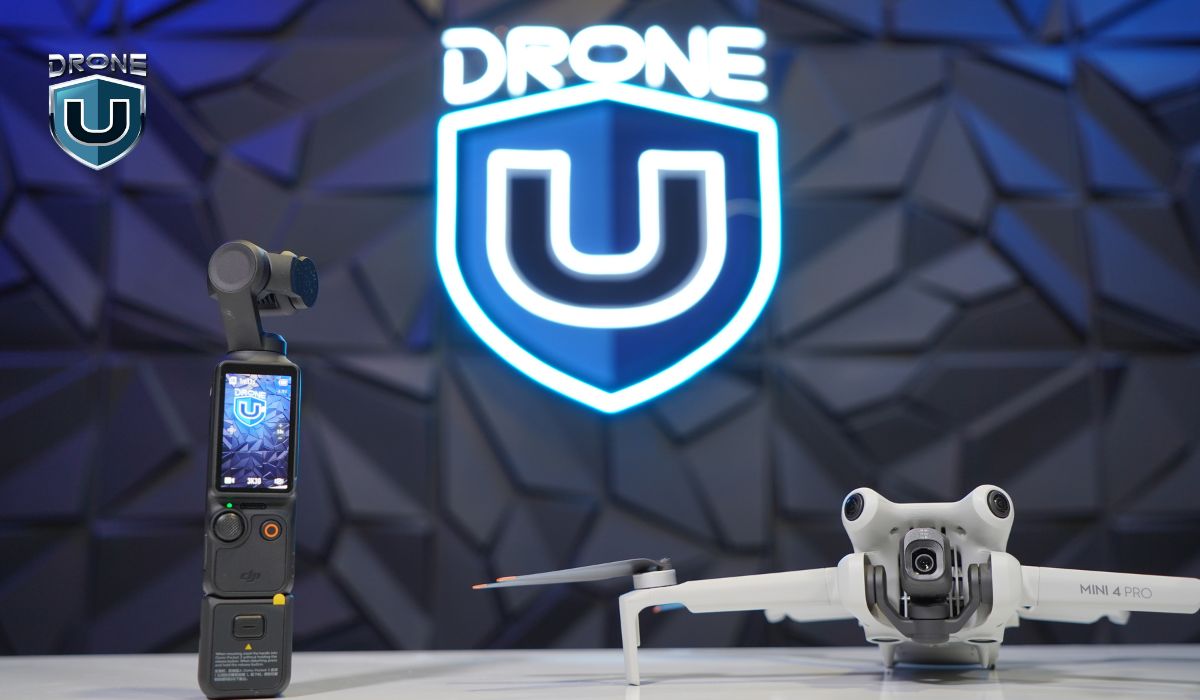
At the heart of our recommended kit are two game-changing devices: the DJI Pocket 3 and the DJI Mini 4 Pro.
Let’s break down why these are the stars of our show.
A. DJI Osmo Pocket 3: Your Ground Game Changer
The DJI Osmo Pocket 3 is a pocket-sized powerhouse revolutionizing how we capture ground-level footage. Here’s why it’s a must-have:
- Versatile Shooting Modes: One of the standout features of the Pocket 3 is its ability to shoot in both wide and vertical formats. This flexibility is crucial in today’s content landscape where platforms like Instagram and YouTube require different aspect ratios.
- Separated Video Files: Unlike some action cameras that capture in a single aspect ratio, forcing you to crop in post-production, the Pocket 3 creates separate files for wide and vertical formats. This feature reduces the amount of back-end editing, saving you precious time in post-production.
- Exceptional Image Quality: Equipped with a 1-inch sensor, this camera captures 4K video with exceptional detail and clarity that smartphones simply can’t match.
- Stabilization: As a handheld device, the Pocket 3 offers excellent stabilization, ensuring your footage is smooth and professional-looking, even when you’re on the move.
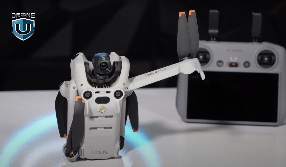
B. DJI Mini 4 Pro: Your Bird in the Sky
Complementing the ground-level footage from the Pocket 3, the DJI Mini 4 Pro brings an aerial perspective to your travel films.
Here’s why it’s an essential part of the kit:
- Compact and Lightweight: The Mini 4 Pro is known for its portability and compact design. This is crucial for travelers who need to pack light.
- Sub-250 Gram Weight: Both the Mini 4 Pro and its predecessor, the Mini 3 Pro, weigh less than 250 grams—a critical factor for international travel. While many countries have drone regulations, few have specific rules for drones under 250 grams.
- High-Quality Aerial Footage: The Mini 4 Pro offers slightly better resolution compared to the Mini 3 Pro, allowing you to capture stunning aerial shots that will elevate your travel films.
- Ease of Use: DJI drones are known for their user-friendly interfaces, making them accessible even for those new to aerial videography.
Choosing Your Drone: Mini 4 Pro vs. Mini 3 Pro

If you don’t want to invest in the Mini 4 Pro you can go for the Mini 3 Pro. It is a more budget-friendly alternative.
Since both drones offer similar benefits in terms of size and weight, the Mini 4 Pro edges out with slightly better resolution and potentially more advanced features.
Here are the features and specifications of the DJI Mini 3 Pro vs. DJI Mini 4 Pro:
| Specification | DJI Mini 3 Pro | DJI Mini 4 Pro |
| Weight | Under 249 gm | Under 249 gm (w/small battery) |
| Dimensions | Folded: 145×90×62 mm
Unfolded: 251×362×70 mm |
Folded:148×94×64 mm
Unfolded: 298×373×101 mm |
| Sensor | 1/1.3-inch CMOS | 1/1.3-inch CMOS |
| Photo Resolution | 48 MP | 48 MP |
| Video Resolution | 4K@60fps | 4K@100fps |
| Obstacle Sensing | Tridirectional | Omnidirectional |
| Price | $599 | $759 |
For a more detailed and in-depth comparison, check out this article on DJI Mini 3 vs DJI Mini 4 Pro.
Additional Considerations for Travel Film Kit
While the Pocket 3 and Mini 4 Pro form the core of our affordable travel film kit, there are a few additional elements to consider:
- Extra Batteries for an uninterrupted flying experience.
- High-capacity SD cards to ensure you never run out of space while filming.
- ND Filters: These filters can help you achieve that cinematic look, especially in bright conditions.
- A portable landing pad is your drone’s best friend, protecting take-offs and landings on unpredictable terrain.
- Drone props are vulnerable to damage, and it’s wise to pack 2-3 extra pairs.
- Protect your drone’s camera lens from scratches, dust, and fingerprints with a UV filter.
- A sturdy, well-padded carrying case is crucial for safeguarding your drone and accessories during travels.
- A remote controller with a built-in screen lets you view your live feed, adjust settings, and monitor your flight path in real-time without relying on a separate smartphone.
- Have drone insurance that protects your investment against accidental damage, loss, or theft.
Tips for Maximizing Your Travel Film Kit
- Master Your Gear: Before your trip, spend time getting familiar with both the Pocket 3 and the drone. Understanding their capabilities and limitations will help you make the most of them in the field.
- Plan Your Shots: While spontaneity is part of the travel experience, having a shot list can ensure you capture all the footage you need for your film.
- Sunrise Shoots: Capture the beauty of your resort or surroundings with a sunrise flight. The golden hour light is perfect for both drone and ground-level photography.
- Respect Local Regulations: Always research and adhere to local drone laws, even with a sub-250-gram drone.
- Experiment with Formats: Take advantage of the Pocket 3’s ability to shoot in both wide and vertical formats. This versatility allows you to create content optimized for different platforms without extra editing work.
- Pack Smart: Use a sturdy camera bag to protect your gear and keep it organized. Include a cleaning kit to maintain your equipment’s performance. Regularly check and clean your gear to prevent issues. Ensure batteries are charged and memory cards are empty before you set off.
Conclusion
The DJI Mini 4 Pro and Pocket 3 provide you with the tools to capture stunning ground-level footage, social media-ready vertical videos, and breathtaking aerial shots, all in a compact, travel-friendly package.
Even if you opt for the DJI Mini 3 Pro, rest assured it’s a remarkable drone. Ultimately, it’s your creativity, eye for composition, and storytelling skills that will bring your travel films to life.
Combining the DJI Pocket 3 with either the Mini 4 Pro or Mini 3 Pro provides a versatile and cost-effective solution for travel filmmaking.
So, embark on your journey, explore the world, and let your budget-friendly film kit transform your adventures into unforgettable cinematic memories.

DJI Osmo Pocket 3: The Game-Changer for Short Videos (Reels)
In the ever-evolving world of social media, short-form videos have taken center stage. Whether you’re scrolling through Instagram Reels or TikTok, it’s clear that bite-sized, engaging video content is the key to capturing audience attention.
According to video platform Vidico, short-form video content will claim a staggering 90% share of internet traffic.
What’s the secret weapon behind those eye-catching, professional-looking reels?
Well, creativity and a unique style are certainly very important; BUT, the equipment you’re using can also make a HUGE difference.
And when it comes to the best camera for short-form videos or reels, one standout is revolutionizing the game: the DJI Osmo Pocket 3.
Why the DJI Osmo Pocket 3 is Perfect for Short-Form Video
I’ve been in this game for a while, and I’ve seen cameras come and go. But the DJI Osmo Pocket 3? It’s a whole different beast.
Here’s why:
1. Video Quality: 4K and 1-inch Sensor
The DJI Osmo Pocket 3 is equipped with a 1-inch sensor, a significant upgrade over the small sensors found in most smartphones. This larger sensor allows the Osmo Pocket 3 to capture more light, resulting in better image quality.
Additionally, the camera shoots in 4K, providing crisp, detailed footage that far surpasses what smartphones can deliver. This is crucial for creators who want to ensure their reels look professional and stand out in crowded social media feeds.
2. Portability and Ease of Use
One of the biggest advantages of the DJI Osmo Pocket 3 is its portability. It is small enough to fit in your pocket, making it easy to carry around wherever you go.
Whether you’re filming on the streets, in nature, or at home, the Osmo Pocket 3 is always ready to capture the moment. Its user-friendly design allows you to flip the screen and switch into vertical mode with ease, ideal for shooting content specifically for reels. The intuitive controls make it simple to start recording in seconds, so you never miss a shot.
3. Built-In Gimbal for Stabilized Shots
The DJI Osmo Pocket 3’s standout feature is its built-in gimbal, which provides exceptional stabilization for your videos. This is particularly important for short-form content where dynamic, on-the-go shots are common.
The built-in gimbal works its magic as you run, bike, or move around, ensuring your footage stays smooth and stable. This level of stabilization is something that smartphones struggle to achieve, making the Osmo Pocket 3 a superior choice for capturing high-quality, professional-looking reels.
4. Autofocus and Image Stabilization
The Osmo Pocket 3 boasts advanced autofocus capabilities that keep your subject sharp and clear, even in fast-paced scenes. This is particularly useful when filming yourself, as the camera can automatically adjust to keep you in focus while you move.
5. Audio Quality With DJI Mic 2 Integration
Good audio is just as important as good video when it comes to creating engaging content. It integrates with DJI Mic 2, allowing you to capture crisp, clear audio that enhances overall quality.
6. Battery Life and Storage Capacity
The DJI Osmo Pocket 3 is designed to keep up with the demands of modern content creators. It offers a robust battery life, allowing you to shoot for extended periods without worrying about running out of power.
Additionally, the camera supports microSD cards, providing ample storage space for all your high-resolution footage.
The Final Cut
If you’re running around, filming action sports, or capturing activities like tubing, mountain biking, kayaking, and more, you need a camera that can keep up. That’s where the DJI Osmo Pocket 3 truly shines.
This little powerhouse isn’t just for static shots or controlled environments. It is packed with everything you need to create scroll-stopping content.
The Ultimate Guide to Drone Inspections [2024]
In recent years, drone inspections have become mainstream across many industries and verticals.
Research shows that the drone inspection market, currently valued at $9.94 billion in 2024, is expected to reach $18.94 billion by 2028! These statistics clearly show that the drone inspection market is thriving.
Eager to tap into his burgeoning field? This guide would be a great starting point.
In this guide, you’ll get a 360-degree understanding of Drone Inspection and how you can get started in this industry with a sense of clarity and ease.
Let’s get started.
What is Drone Inspection?
Drone inspection is the process of using unmanned aerial vehicles (a.k.a drones) equipped with cameras and sensors to inspect and evaluate structures, facilities, and infrastructure.
It provides a safe, cost-effective, and efficient alternative to traditional inspection methods. You can analyze the data collected from drone inspections to identify potential issues, track progress, and inform decision-making.
Before delving into the specifics of drone inspection, let us take a look at how drone inspection works.
How Does Drone Inspection Work?
The drone inspection can be broken down into three steps:
I. Preparing Drone Inspection Mission: Before any drone inspection, it’s important to properly understand and assess the terrain, local regulations, and required safety measures. You also need to identify the right drone for the mission.
II. Capturing Data: Drones collect data using payloads (e.g. camera sensors) suitable for the mission. This captured data is then sent for processing.
III. Analyzing and Interpreting Data: The final step is to analyze and process drone data using specialized software. This is where insights are garnered and communicated to the stakeholders.
Let’s check out what each step entails:
I. Preparing the Drone Inspection Mission

This involves FOUR simple steps:
- Obtaining necessary permits and permissions: Check with the FAA (through one of the various flight approval app options) and local authorities to ensure you have the proper permits and permissions to conduct your inspection.
- Conducting a site survey: Assess the inspection site for any potential hazards, obstacles, or challenging terrain.
- Planning the flight path: Determine the most efficient and safe flight path for the inspection.
- Conducting a pre-flight check: Ensure your drone is in good working order before taking off.
Now, picking the right drone is a crucial part of getting ready for a drone inspection mission. If you want to choose the perfect drone for your inspection work, here are some factors you should consider:
1. Range
The range of a drone is an essential factor to consider when purchasing one. If you need wider coverage and more varied shots during your inspection, a longer-range drone would be preferable.
Remember, though–the higher the flight range of a drone, the higher its price.
For example, the:
- DJI Air 2S has a range of 7.5 miles
- DJI Mavic 3 has a range of 9.3 miles
- DJI Mavic 2 Enterprise Advanced has a range of 6.2 miles
- DJI Matrice 30T has an operation range of 4.34 miles.
2. Camera
It’s also important to check the drone’s camera specifications, including shutter speed, frame rate, zoom options, aperture, and image stabilization. All of these factors can affect the quality of your photographs.
Pro Tip: You should settle for a high-resolution camera with a larger sensor and a 35mm equivalent focal length for your drone inspections. It will allow you to capture more detailed images of the object being inspected and improve image contrast, which helps generate accurate 3D models and point clouds.
3. Flight Time
A drone’s flight time is limited by its battery life. Cheaper models last only a few minutes, while more expensive ones typically have a flying time of around 25-40 minutes.
Here are the flight times of some popular drones:
- DJI Mavic Mini (up to 30 minutes)
- Autel Robotics EVO Lite+ (up to 40 minutes)
- DJI Mini 2 SE (up to 31 minutes)
- Autel Robotics EVO II (up to 40 minutes)
- DJI Matrice 30T (up to 41 minutes)
Pro Tip: Purchase additional batteries and charge them before leaving home to extend the flight time.
4. 3-Axis Gimbal
A three-axis gimbal is like a steadying hand for a drone’s camera. It helps to keep the camera steady while the drone moves around in different directions (such as up and down, tilting from side to side, and rotating.)
This is particularly important when using a drone for inspection, as the camera must remain level to capture accurate data and imagery.
Without a gimbal, the camera may shake or tilt, making it difficult–if not impossible–to capture the required data.
5. Payload Capacity
A drone’s payload capacity is the maximum weight it can carry in addition to its own weight. It’s vital to ensure that your drone has enough payload capacity to carry the necessary inspection equipment.
Having nailed the basic preparations of drone inspection, let us dive into the next section: Capturing Media.
II. Capturing High-Quality Data and Images
Since the data you collect from your inspection will form the basis of your analysis and reports, you need to ensure that you get the best possible visuals.
In this section, we’ll talk about how you can capture images that are clear, detailed, and useful.
A. Tips for Capturing Clear and Detailed Images
These tips will help you get high-quality visuals during your inspection.
1. Fly at the right altitude
First, it’s important to fly your drone at the right altitude. The optimal altitude for an inspection can vary depending on the size and nature of the area being inspected.
A good rule of thumb is to fly your drone low enough to capture the necessary detail, but high enough to avoid any obstacles.
For instance, while doing a roof inspection, you may need to fly closer to capture the details, but when inspecting a large property, you may need to fly higher to cover more ground.
Overall, try to experiment with different altitudes to find the sweet spot for your inspection.
2. Fly in good weather
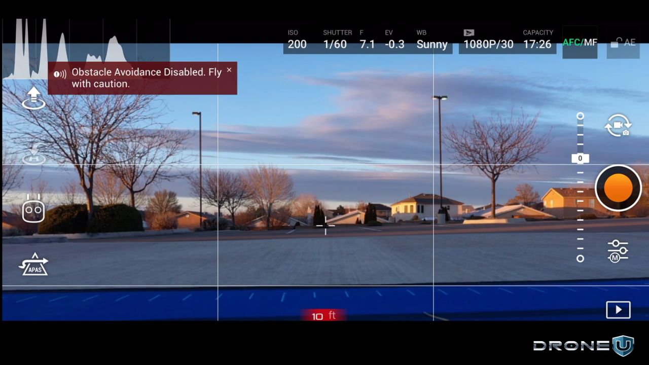
Weather conditions can have a big impact on the quality of your images. To capture good images, it’s best to be aware of the weather conditions beforehand.
Avoid flying in adverse weather conditions such as rain, fog, or high winds, as they can affect the quality of your images and even put your drone at risk. So, for best results, choose a day with clear skies and good lighting.
You can also take advantage of real-time weather monitoring apps designed for drone pilots (such as UAV Forecast) to get detailed weather insights before and during your flight.
3. Use a gimbal
A gimbal is a helpful tool that keeps the camera steady and minimizes unwanted camera movement during flight.
This can make a big difference in the quality of your images, especially when flying in windy conditions.
Invest in a good-quality gimbal (ideally one that offers 3-axis stabilization) to ensure your camera stays steady and gets smooth shots.
4. Camera angle
Adjusting the camera angle is another important step in capturing images. Test out different camera angles to find the best perspective for your inspection.
In the case of a roof inspection, for example, you may need to tilt the camera to capture the correct angle, whereas a cell tower inspection may require you to rotate the camera to capture a 360-degree view.
Don’t be afraid to play around with different camera angles to get the best shot.
5. Grid lines
The grid lines on your camera screen can help you align your shots and capture images that are level and straight. This is especially useful when inspecting structures or objects that require precise leveling.
Use the grid lines to make sure your images are straight and level, and make any necessary adjustments before taking the shot.
B. How to Use Different Camera Settings to Optimize Your Images
Here are some must-know camera settings tips to help you optimize your images:
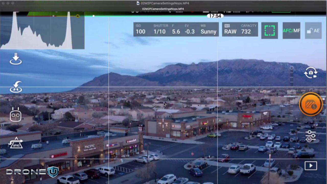
1. Adjust exposure settings for optimal image quality
Simply put, exposure determines how light or dark your images will appear.
You can use the histogram to analyze the exposure levels of your images and adjust accordingly to get a balanced image with details in the highlights and shadows.
2. Choose the right white balance for accurate colors
White balance balances the color temperature of your images to ensure that each color appears natural and true to life.
So, for a more accurate color representation, you can use the custom white balance function on your drone’s camera to match the environment’s lighting conditions.
3. Select the ideal shutter speed for clear images
Need a more cinematic look for your videos? You should preferably opt for a slower shutter speed.
However, if you’re looking to avoid blur caused by drone movement or wind in still images, you should use a faster shutter speed.
4. Use proper focus settings for sharp shots
Using the autofocus function is one of the best ways to keep your drone images sharp.
Better still, if you want to ensure that the focus is on the subject of interest, manual focus might be your best bet.
You can also try using focus stacking techniques for more detailed and clearer images.
Now, let’s discuss the third and most critical piece of the drone inspection process–Analyzing and Interpreting drone data.
III. Analyzing and Interpreting Drone Data
Capturing the media is half the battle won, as getting the right deliverables across to the client is what will make a real difference.
In this section, you’ll discover how to effectively do so without any hassles. We’ll cover:
A. Software that you can use for data processing and analysis
B. Analyzing drone inspection data
C. Creating reports from your drone inspection data
Let’s get started.
A. Software You Can Use for Data Processing and Analysis
Here are a few commonly used tools you can use to process and analyze drone inspection data:
- Pix4D: A comprehensive software suite that offers tools for photogrammetry, mapping, and data analysis.
- DroneDeploy: A cloud-based software platform that allows you to process, analyze, and share drone data.
- Agisoft Metashape: A photogrammetry software that generates 3D models and maps from drone images.
- ArcGIS Pro: A GIS application that allows you to manage, analyze, and share your drone data.
- Optelos: An AI-powered visual inspection data management platform that puts together different types of data, like 360 images and 3D models, onto a single point cloud or 2D map.
- LP360: A data processing software that maximizes LiDAR and imagery data with its visualization, QA/QC, classification, 3D editing, and analysis capabilities.
Unsure about choosing a drone mapping software? Check out our comprehensive guide on drone mapping here!
B. Analyzing Drone Inspection Data
This is where the rubber meets the road. Analyzing drone inspection data is a crucial step in the inspection process as it helps to identify and highlight areas of concern that may require further investigation or action.
Here are a few important techniques you can use to do so:
- Image comparison: Image comparison is a technique where drone images from different flights are compared to identify changes or anomalies, such as cracks or structural damage.
- Point cloud analysis: This involves creating a 3D model of the inspection site to identify areas of concern, such as changes in terrain or surface irregularities.
- Data clustering: Data clustering is a technique where similar data points are grouped to identify patterns and anomalies, such as hotspots or areas of potential risk. Machine learning algorithms can also be used to automatically identify and highlight areas of concern, such as corrosion or leakage.
These techniques can help you effectively analyze and interpret your drone inspection data to ensure accurate inspections.
C. Creating Useful Reports from Your Data
Creating useful reports and visualizations is an essential part of the drone inspection process, as it helps you communicate the findings to stakeholders effectively.
Here are some techniques to create these reports and visualizations:
1. 2D and 3D mapping
Creating maps and 3D models of the inspection site is an effective way to visualize the data. It allows stakeholders to get a better understanding of the site and identify areas of concern quickly. This technique also helps create a baseline for future inspections.
2. Heat maps
Using color coding to highlight areas of concern is an effective way to draw attention to potential issues.
Heat maps can be created by analyzing data such as temperature, humidity, or moisture levels. It’s particularly useful for identifying patterns or trends over time.
3. Reports
Creating detailed reports that summarize findings and recommendations is essential to communicating the results of the drone inspection to stakeholders. Reports should be easy to understand and include visual aids such as charts and graphs.
What’s more, the reports should highlight the areas of concern and provide actionable recommendations to address them.
With a grasp of drone inspection technology, let’s explore its diverse uses in different sectors.
Drone Inspections Across Industries
Just as we mentioned in the introduction, drones are being used for inspections across different industries today.
Some of these industries include:
1. Mining
In the mining industry, drones can be very helpful in surveying vast and often inaccessible areas, including unstable stopes.
For instance, since most drones are equipped with cameras and LiDAR sensors, they can collect visual data and create 3D models of stopes. This in turn allows for effective safety assessments without putting workers at risk.
Drones can also help in monitoring stockpile volumes and mapping out exploration sites.
2. Insurance
Drones are increasingly being used in the insurance sector to streamline processes like damage inspections, claims management, and property assessments.
By capturing high-resolution images and videos, drones allow insurance companies to effectively assess damage from natural disasters, fires, or other accidents.
3. Oil & Gas

Companies in the oil and gas industry that use drones for regular pipeline and oil rig inspections can keep inspectors out of harm’s way, save costs, and easily assess remote areas that are difficult to access.
Drones can also be used to inspect the equipment used in the production of materials in this industry.
4. Agriculture
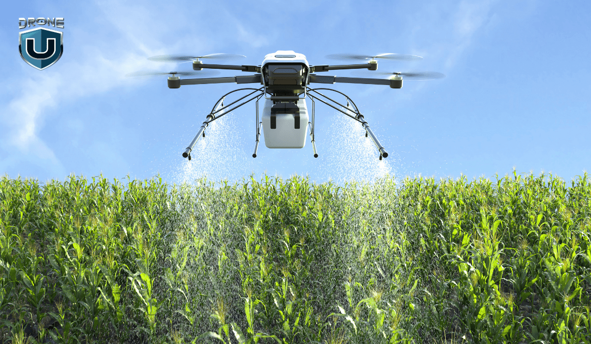
By leveraging drone inspection services, farmers can get detailed insights into crop health, soil conditions, and irrigation systems.
Aside from regular monitoring of crops (and livestock), inspection drones can also create 3D maps of farmlands to help farmers identify and address problems before they escalate.
This will empower them to make data-driven decisions that ultimately improve crop yield and optimize farming practices.
5. Chemicals

Drones can also be used to inspect facilities such as pipe racks, storage tanks, and processing plants.
The primary advantage of this is that it reduces the need for human inspectors to enter potentially dangerous environments where they can be exposed to hazardous materials.
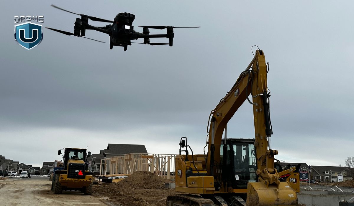
6. Construction
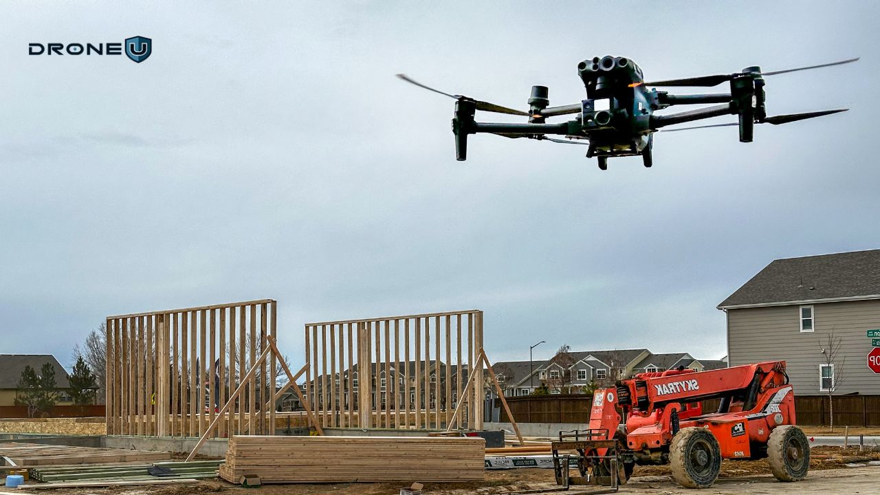
Drone construction inspections offer a safer and more efficient way to track project progress, inspect structures, and manage logistics.
They deliver valuable visual data that can aid effective site planning, identify potential safety hazards, and ensure accurate reporting to customers and stakeholders.
7. Public Safety
As time goes by, drones are proving to be invaluable in the public safety sector. They can be used for surveillance, damage assessment, search and rescue operations, and monitoring ongoing critical events.
The aerial intelligence captured by these drones can help public safety personnel make quick and informed decisions during emergencies.
8. Power Generation
Drones are improving the way power companies inspect assets like power lines, solar panels, wind turbines, chimneys, and hydropower plants.
With a power line drone inspection, for example, companies can safely assess the condition of electrical infrastructure and avoid the risks that come with manual inspections.
9. Infrastructure & Utilities
Through regular inspections of bridges, roads, railways, and other infrastructure, drones offer a quick and cost-effective way to maintain the integrity of public assets.
For instance, drone bridge inspections provide detailed visual data that can be used to detect structural issues early and allow for timely maintenance and/or repairs.
Since it doesn’t require heavy machinery, this type of inspection can minimize disruptions to traffic and reduce the time for the overall process.
Other Drone Inspection Applications
Drones are also used for inspections in these industries:
- maritime
- forestry
- real estate
- water and wastewater treatment
- telecommunications, etc.
Best Drones for Inspections

You may probably be wondering what the best drones for inspections are, right? Well, you’re about to find out!
In the table below, we’ve compiled a list of drones that we feel are the best for inspection.
| Industry | Drone model |
| Best drone for home inspections | Yuneec H520, DJI Matrice 300 RTK, Elios 3 |
| Best drones for roof inspections | Parrot ANAFI, Autel Evo 2 Pro RTK, DJI Mavic 2 Pro |
| Best drone for cell tower inspections | Phantom 4 Pro, DJI Matrice 30T, DJI Mavic 3 Enterprise, Skydio X10 |
| Best drone for bridge inspections | Elios 3, DJI Matrice 300 RTK, DJI Mavic Inspire 2, Parrot ANAFI |
| Best drone for powerline inspections | DJI Matrice 300 RTK, DJI Phantom 4 Pro, Prism Sky |
| Best wind turbine inspection drone | Mavic 2 Pro, DJI Mavic 3 Enterprise, Skydio X10 |
| Best drone for pipeline inspections | DJI Matrice 350 RTK, DJI Mavic 2 Enterprise, Parrot ANAFI |
| Best drone for construction inspections | DJI Mavic 3 Pro, DJI Mini 4 Pro, Autel EVO II Pro V3 |
Pros and Cons of Using Drones for Inspections
While there are a lot of benefits to using drones for inspections, it has some limitations too.
Here’s a breakdown of some of the pros and cons of drone inspections:
|
Pros |
Cons |
| 1. Cost-effective: Since they typically require fewer personnel and resources, drone inspections are often less expensive than traditional inspection methods.
Companies can achieve significant cost savings by limiting scaffolding construction to times when maintenance work is actually needed. |
1. Regulatory restrictions: There are strict regulations that govern where and how drones can be flown. For example, you can’t fly drones near airports, military bases, and other designated no-fly zones.
While these laws are crucial for safety and privacy, they place limits on where companies perform aerial inspections. |
| 2. Increased safety: Drones can access hard-to-reach, hazardous, or dangerous areas; this in turn lessens the risk of injury to personnel. | 2. High initial cost: The upfront investment in drones and related equipment and software is very high.
Since the operation of these drones requires technical expertise, companies also need to invest in training for their personnel. These costs can be prohibitive–especially for smaller businesses. |
| 3. Time-efficient: Drones can quickly (and efficiently) inspect large areas or structures which reduces the time needed for inspections. | 3. Limited range & battery life: Drones generally have limited flight range and battery life. This can be a challenge for companies that need more complex and large-scale inspections. |
| 4. High-quality data: Drones are equipped with high-resolution cameras and sensors that capture detailed and accurate data. This allows for a more comprehensive analysis.
Thanks to the real-time data they provide, drones also enable inspectors to identify issues immediately and take swift action. |
4. Weather dependence: Drones are very sensitive to extreme weather conditions–high winds, rain, or fog can severely impact their ability to fly safely and gather accurate data.
This dependence on good weather may cause unnecessary delays in inspections. |
| 5. Reduced environmental impact: Drone inspections produce less negative environmental impacts compared to traditional inspection methods that often involve the use of heavy machinery, manned aircraft, or vehicles. | 5. Accident-prone: Drones can easily crash due to factors like operator error or collisions with unexpected obstacles. And, given the high costs of these vehicles, a crash can result in significant financial losses. |
| 6. Better decision-making: Drone technology can capture precise and comprehensive records of an asset’s condition throughout its life.
By archiving the visual data obtained, companies can create a digital record of the asset’s complete history, which can be accessed and analyzed at any given time. Besides facilitating more informed decision-making, this also enables businesses to improve their asset management strategies for better overall outcomes. |
6. Detection limitations: Though drones are highly advanced, they may be unable to spot small or complex defects that a trained human inspector can easily spot. |
Legal and Regulatory Considerations for Drone Inspections
While drones can be incredibly useful in inspections and increase safety, companies should ensure that their users operate drones legally.
Untrained drone pilots can crash, cause damage to the environment, and even harm workers. According to a study by UF/IFAS, between 2015 and 2020, approximately 4,250 people were injured by drones. The study also showed that 21% of those injured were under the age of 18, and 84% of the patients were male.
What’s more, according to the European Union Aviation Safety Agency (EASA)’s 2024 Annual Safety Review, there was one fatality and one case of a serious injury caused by a drone in 2023.
Hence, it’s important to consider legal and regulatory compliance before flying inspection missions.
First, energy inspections are typically conducted under API (American Petroleum Institute) rules.
In contrast, the American Society of Mechanical Engineers (ASME) creates codes for the development, fabrication, and assessment of boilers and pressure vessels.
There are several institutions, including API and ASME, that design standards and educational resources to carry out examinations in various sectors. In most countries around the world, their standards are usually regulated by law.
Moreover, to operate a drone legally while performing inspections through drones, pilots must follow Occupational Safety and Health Administration (OSHA) drone regulations as well as laws put forth by the Federal Aviation Administration (FAA).
The Federal Aviation Administration (FAA) regulates all civil aircraft operations in the United States, whether they’re manned or unmanned. Staying updated on developments from this agency is crucial for any drone inspection company. For example, it may be helpful to know that, since 2023, the FAA has been exploring ways to expand BVLOS (beyond visual line-of-sight) operations–which could benefit industries that require drones to cover long distances.
As of May 2024, the agency had approved a BVLOS flight for a drone for the first time.
Click here for more information on FAA drone regulations. Also, keep in mind that regulations can vary depending on the industry, state, and type of drone mission being undertaken. Please check local regulations or consult an attorney before flying.
Future of Drone Inspections and Emerging Technologies
The use of drones for inspections has become a valuable tool across various industries such as infrastructure, agriculture, and energy.
With the continuous advancements in technology, the future of drone inspections looks promising.
Here’s what we think in terms of the future outlook of drone inspection:
1. Artificial Intelligence (AI) and Machine Learning (ML)
As drones become more refined, we can expect them to use AI and ML to automatically analyze images and data collected during inspections.
This will enable faster and more accurate identification of defects and other issues, subsequently reducing the need for human intervention.
2. LiDAR
Light Detection and Ranging (LiDAR) technology uses lasers to create 3D maps of structures and environments. LiDAR-equipped drones can be used for high-precision inspections of infrastructure, such as bridges and wind turbines, as well as for mapping and surveying.
3. Augmented Reality (AR)
AR technology allows for the overlaying of digital information in the real world. This can be used in drone inspections to provide real-time data and visualizations. It can also assist inspectors in identifying potential issues and making more informed decisions.
4. Swarm Technology
A swarm of drones can work together to cover larger areas or complete complex tasks. This technology can be particularly useful for large-scale inspections or in hard-to-reach areas.
Drone swarm technology enables the collaboration of multiple UAVs (unmanned aerial vehicles) to execute diverse tasks that are either too complex or too inefficient for a single drone to perform alone.
5. Energy Harvesting
The ability of drones to harvest energy from the environment, such as solar power or wind power, will enable longer flight times and reduce the need for manual charging or battery replacement.
6. 5G Technology
Drones also stand to benefit from the improvements in connectivity brought about by the rollout of 5G networks. The adoption of this technology is likely to allow drones to transmit data more quickly and reliably.
Overall, the future of drone inspections looks promising, with the emergence of new technologies that will enable faster, more accurate inspections with greater automation and reduced human intervention.
Drone Inspection Market: Bigger Than We Can Think
According to a report by the American Society of Civil Engineers (ASCE), a significant number of America’s bridges are aging, with 42% of all bridges at least 50 years old and 7.5% structurally deficient.
What’s more, the infrastructure in the United States is extensive and requires maintenance. Currently, it has:
- over 600,000 bridges
- 4 million miles of public roadways
- approximately 140,000 miles of rail
- 600,000 miles of backbone transmission lines
- 5.5 million miles of residential power lines
- over 190,000 miles of oil pipelines and 2.4 million miles of gas pipelines
From these numbers, it’s obvious that infrastructure maintenance and inspection can’t be done by traditional methods using fifty-year-old snooper trucks or workers climbing on ropes
Therefore, drones are a natural choice for inspecting and maintaining the country’s vast infrastructure network.
The good news is that the Biden administration’s infrastructure proposal promises to invest a historic amount of money in building and reinvigorating the country’s infrastructure and human capital.
Plus, with the introduction of the Drone Infrastructure Inspection Grant Act (DIIG), more drones will likely be deployed to inspect and maintain critical infrastructure across the United States.
As a result, America is not only fixing its outdated infrastructure but also advancing and modernizing it.
Final Thoughts
Drone inspection has emerged as a powerful and reliable solution for inspection and data analysis in different industries.
By mastering the art of drone inspections, you can help businesses improve their safety protocols, increase efficiency, and save time and money.
To get started in this burgeoning industry and learn from industry experts, be sure to check out Drone U’s membership.
Inside the Drone U membership, you will discover 40+ courses, from photography, videography, and mapping to surveying, 3D modeling, and inspections!
Frequently Asked Questions
1. What are the benefits of using drones for inspections?
Using drones for inspection helps businesses save money, keep their personnel safe, extract high-quality data, and make more informed decisions.
2. In which industries are drone inspections most commonly used?
Drone inspections are widely used in the construction, oil & gas, agriculture, power generation, and public safety sectors, among others.
3. What are the regulations for conducting drone inspections?
Regulations for conducting drone inspections may differ according to the country, state, or industry.
However, drone operators in the United States are typically mandated to:
- hold an FAA-issued Remote Pilot Certificate
- register their drones with the FAA
- adhere to airspace restriction
- comply with safety guidelines set by aviation authorities (such as the FAA)
4. How can I ensure the accuracy and safety of drone inspections?
If you want to ensure that your drone inspections are safe, here are some general guidelines you can follow:
- Ensure that your drone is within visual line-of-sight.
- Properly understand the drone’s capabilities and limitations.
- Take note of weather conditions before flying.
- Ensure that the drone weighs less than 55 pounds (including payload) at takeoff.
- Avoid flying in restricted zones like airports.
- Comply with local regulations.
- Conduct pre-flight checks.
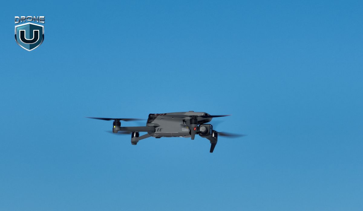
Countering CCP Drones Act: Understanding the Impact
In light of the proposed H.R.2864 bill, which could potentially ban DJI drones in the United States, a significant shift in drone regulations may be on the horizon. Although not yet passed into law, this Countering CCP Drones Act represents a pivotal moment in the evolving landscape of drone technology. It will impact how drones are integrated into our daily lives.
As we stand at the crossroads, we’d like to keep you informed and prepared for what lies ahead.
Let’s delve into the details and explore the future implications of the Countering CCP Drones Act.
Introduction to the Countering CCP Drones Act
Recently, the U.S. Congress voted on the Countering CCP Drones Act, a legislative move addressing national security concerns related to Chinese-made drones.
To reduce dependency on foreign technology and protect sensitive information, the act has further broadened the US-China technology conflict and brought it to light.
The act represents a federal initiative aimed at reducing the dominance of Chinese companies within the U.S. drone industry. Lawmakers have long expressed concerns that these drones, particularly DJI products, could be used by the Chinese Communist Party for surveillance purposes.
While the government has yet to provide definitive evidence supporting these claims, Chinese manufacturers have consistently denied the allegations.
This legislation seeks to curb the influence of Chinese companies, including DJI and Autel Robotics, by adding them to the Federal Communications Commission’s (FCC) Covered List. This designation identifies telecommunication equipment that may pose a risk to U.S. national security.
Notably, this action will not affect Chinese drones currently in use by hobbyists or private companies.
Historical Background and Development of the CCP Drones Act
The events unfolded on August 9, 2017, when a document from the Los Angeles office of the Immigration and Customs Enforcement Bureau was made public.
This document marked the end of extensive intelligence collection efforts involving specialists and external organizations.
The article was headlined, “Is DJI Possibly Sharing US Critical Infrastructure and Law Enforcement Information with the Chinese Government?” It explained that drones made by DJI in the United States, owned by unknown businesses and individuals, were sending data to DJI servers in China.
Soon, the U.S. Government and other agencies in the country began having apprehensions about the Chinese-manufactured drones as they could be altered for purposes of espionage. These concerns deepened further due to the strained relations between both countries regarding trade and technology.
In 2021, the Department of Treasury voiced concerns about the use of DJI drones in the surveillance of China’s Uyghur Muslim minority. The following year, the Department of Defense blacklisted the Chinese firm, making it hard for DJI to do business with the U.S. government.
In the same year, legislation seeking CCP drone regulations was introduced by Scott and Senators Tom Cotton (R-Ark.) and Marco Rubio (R-Fla.) in the Senate and by Representative Elise Stefanik (R-N.Y.) in the House, but it failed to move forward.
In 2023, Stefanik reintroduced the bill again in the House, paving the way for its inclusion in the House NDAA released in June. The same month, the legislation was also introduced in the Senate but it could not garner enough support to be included in the chamber’s version of the bill.
National Security Implications of the Act

The main focus of the Countering CCP Drones Act is to enhance the national security of the U.S. by safeguarding it against the usage of Chinese drones in the country. This act would help to reduce the risk and security threats posed by drones due to possible espionage, unauthorized data collection, and other possible threats.
Under this act, a review of the existing technologies is also made mandatory whilst the Department of Homeland Security is required to create strategies to manage and navigate the risks which are associated with such drones from foreign lands. Since this act restricts access to foreign drones, it would eventually help the U.S. government to mitigate and close possible vulnerabilities that may be caused to infrastructure and data systems.
Needless to say, a complete ban on the use of such drones would have far-reaching economic and technological implications. DJI is one of the top drone manufacturers extensively used in our country by commercial and hobbyist pilots. As per FAA records from August 2024, the total number of registered drones in the United States reached a substantial 785,827.
Currently, DJI drones are renowned for their unparalleled features and budget-friendly prices which make them a popular choice for leisurely flights and professional purposes. Hence, creating a ban on DJI would mean a disruption in the American drone market. There is a possibility of drone shortages resulting in spiked costs of drones for consumers and business owners.
On the other hand, the ban on Chinese drones could also encourage the growth of homegrown and alternative drone technologies in the United States. This could gradually lead to innovation and higher costs of drones in the long term.
US-China Technology Conflict: What to Expect Next
A potential Chinese drone ban means that the future looks bleak for the drone Industry. Even though the small players will gradually fill in the gap left by Chinese drone makers, the ban would lead to massive disruption.
However, it is pertinent to mention here that the government may allow a transition period of three years or more before the ban comes fully into effect. This transition would be time-consuming and expensive.
On the other hand, a ban could also lead to the rise of a more competitive drone market, leading to the development of new technologies and features. To mitigate the impact of the Chinese drone ban, the government could increase investment in domestic drone manufacturing, enhancing national security and reducing its reliance on foreign technology.
Before you go, I would love to hear your thoughts on the impending DJI ban. How do you see it impact your drone business and operations? Please share your thoughts in the comment box below.
The Stalled DJI Drone Ban: What It Means for You
The Senate Armed Services Committee has presented its version of the National Defense Authorization Act (NDAA), notably excluding the House’s proposal to ban DJI drones.
This decision signals a more cautious approach amidst national security concerns, particularly regarding data security associated with DJI, a Chinese company.
House vs. Senate Versions
The House version of the NDAA includes amendments from the Countering CCP Drones Act, mandating the Federal Communications Commission (FCC) to add DJI to its “Covered List.” This would prevent the FCC from issuing new equipment authorizations for DJI products, potentially disrupting the vast usage of DJI drones in sectors such as agriculture, infrastructure, and public safety. However, the Senate version omits this demand, reflecting concerns about the practical implications of such a ban.
This difference in stances between the House and Senate reflects the complex issue of balancing national security with the growing commercial and industrial applications of drone technology.
Security Concerns: A Cause for Pause
Security concerns have cast a shadow over DJI drones. Cybersecurity vulnerabilities raise fears of hacking for spying or attacks on critical infrastructure. Data privacy is a major point of contention, with anxieties that information gathered by drones is transmitted to China, potentially compromising national security.
Additionally, the closed nature of DJI’s software and systems limits independent evaluation of these security risks.
The Future of DJI Drones in the US
The future of DJI drones in the US remains uncertain. The House and Senate will need to reconcile their differing versions of the NDAA. This process could result in several outcomes:
Complete Ban: The House language on the ban could be reintroduced into the final NDAA.
Restrictions: A compromise solution might be reached, imposing limitations on the use of DJI drones in certain government or sensitive areas.
No Ban: The Senate’s position could prevail, allowing DJI drones to continue operating in the US without restrictions.
What This Means for You
The outcome of the NDAA negotiations will significantly impact both recreational and professional drone users in the US. Here’s a breakdown of how the different scenarios might play out:
Complete Ban: If a complete ban is implemented, it would be difficult or illegal to buy or operate a DJI drone in the US. Existing DJI drone owners might be subject to restrictions on use.
Restrictions: In the case of restrictions, certain government agencies or critical infrastructure sites might be off-limits for DJI drone use. Additionally, mandatory cybersecurity measures or data storage requirements could be imposed.
No Ban: If no ban is implemented, the status quo will remain, and DJI drones can continue to be used freely in the US.
Conclusion
While the Senate’s decision provides temporary relief for DJI, the broader conversation about national security and foreign technology remains unresolved. Stakeholders across various sectors are closely monitoring developments, preparing for a range of possible outcomes.
Stay Informed
The drone industry is constantly evolving, and the regulatory landscape surrounding DJI drones is fluid. It’s important to stay informed about the latest developments.
Sign up for Drone U’s updates to receive summaries of important industry association newsletters, keeping you informed about policy changes.
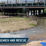
A Look at Drones in Search and Rescue: Finding Hope from Above
Whether a hiker lost in a treacherous mountain, a sailor adrift at sea, or a community devastated by natural disasters, the race to find and save lives is a monumental challenge for search and rescue (SAR) teams.
When disaster strikes, every second counts.
A 2023 report by the National Association for Search and Rescue (NASAR) reveals a sobering fact: the chances of finding someone alive plummets after just 72 hours.
But what if we could give these brave responders a bird’s-eye view of danger zones, covering vast areas in record time?
That’s where drones come in!
These unmanned aerial vehicles (UAVs) are revolutionizing the way we approach search and rescue operations.
Armed with cutting-edge technology, drones are becoming the eyes in the sky for SAR teams, dramatically increasing the odds of successful rescues and reuniting families.
In this article, we’ll explore how drones transform search and rescue efforts.
We’ll also examine the key advantages drones offer over traditional methods and showcase real-world examples where these high-tech helpers have made the difference between life and death.
From conquering geographic challenges to providing crucial data in record time, you’ll discover how drones are quickly becoming an indispensable tool in saving lives.
First, let’s take a look at the challenges and limitations of traditional SAR methods.
Limitations of Traditional Search and Rescue

While traditional search and rescue (SAR) methods play a vital role in locating missing persons, they are inherently subject to certain limitations:
Geographic Constraints: Rugged terrain, dense forests, and large bodies of water can significantly impede the ability of ground search teams to effectively cover expansive areas. This limited reach can lead to delays in locating missing individuals.
Time Sensitivity: The success rate of SAR missions is highly dependent on rapid deployment and comprehensive search coverage. Traditional methods can be time-consuming to deploy and execute, especially in large-scale operations.
Safety Concerns: The challenging environments encountered during SAR missions can pose a risk to the safety of search teams themselves. This necessitates additional resources and protocols, further complicating rescue efforts.
While traditional SAR methods have served valiantly, advancements in drone technology provide a promising solution to overcome these limitations.
This option focuses more on the problem-solving aspect of drones and how they directly address the limitations you just outlined.
How are Drones Used for Search and Rescue?
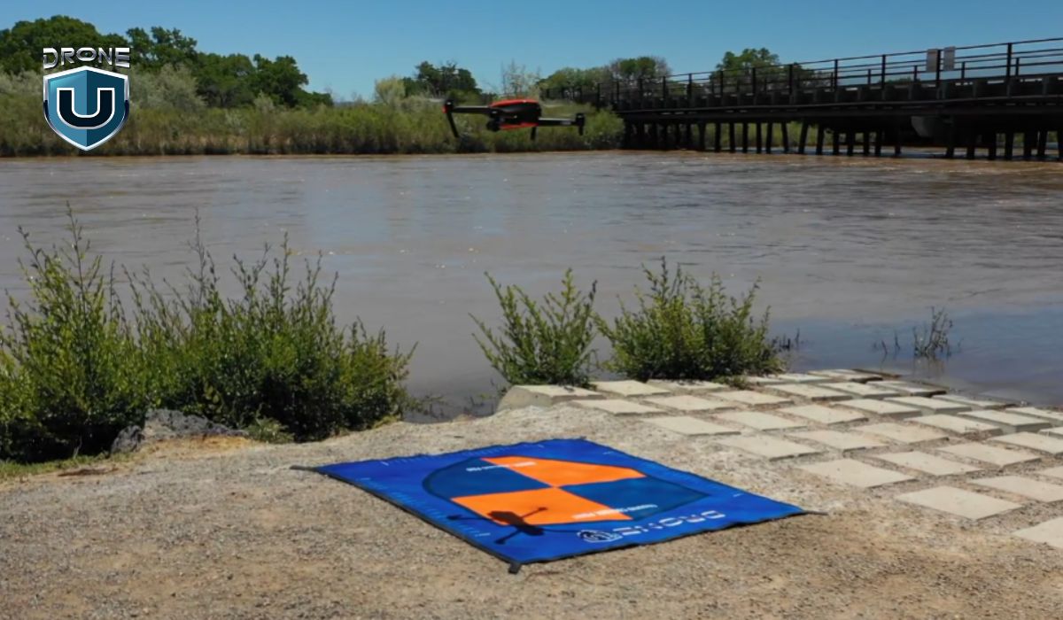
Traditional search and rescue methods have served us well, but drone technology offers a game-changing advantage. Let’s see how drones tackle the limitations we just discussed:
1. Speed
Search and rescue missions (SAR) are all about speed. Drones can be launched quickly and cover huge areas in a fraction of the time it takes people on foot. This is critical because every minute counts in these situations – the faster someone is found, the better their chances of survival.
2. Safety
Drones also keep search teams safe. They can fly over dangerous areas like avalanches or floods, giving rescuers a clear picture of the situation without risking their own lives.
3. Eagle Eyes in the Skye
Drones equipped with high-resolution cameras are like the eagle eyes in the sky. The sharp, high-quality images and video footage of the search area allow search teams to identify potential clues or signs of the missing person, such as footprints, disturbed ground, or brightly colored clothing. A high-resolution camera can zoom in on potential campsites or trails, helping to pinpoint their location.
4. Thermal Imaging
Thermal cameras don’t rely on visible light but instead detect heat signatures. This is a game-changer for search and rescue at night, during foggy or smoky conditions, or even under thick forest canopy. Thermal imaging can reveal the body heat of a lost person, even if they’re hidden from view. This is especially valuable in situations where a person might be injured and unable to call for help.
5. Long Flight Times
Traditional methods may require search teams to return for breaks or refuel vehicles, delaying the search. drones can stay airborne for extended periods, allowing for thorough searches of vast areas. This is particularly beneficial in large-scale search operations or situations where the missing person’s location is unknown. With longer flight times, drones can cover more ground and keep searching for longer, increasing the chances of finding someone who may have wandered far.
We’ve explored how drones offer a technological leap forward in search and rescue. Now, let’s see these advantages in action with some real-world examples of drones saving lives.
Real-World Examples: Drones Saving Lives
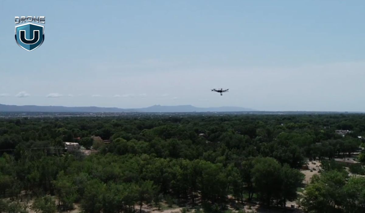
Drones aren’t just theoretical heroes; they’re making a tangible difference in search and rescue missions around the world. Here are a few inspiring examples:
1. Lost Hikers Found in the Swiss Alps
In 2022, a group of climbers caught in an avalanche were successfully located and rescued by the Swiss Alpine Rescue team using drones. The drones’ ability to navigate the treacherous mountain terrain and locate the climbers despite the harsh weather conditions proved invaluable.
2. Nepal Earthquake Rescue Efforts
Following the devastating earthquake in Nepal in 2015, traditional search and rescue efforts were hampered by widespread destruction and dangerous terrain. However, drones played a crucial role in locating survivors trapped under rubble and assessing damage to remote villages. The United Nations Office for the Coordination of Humanitarian Affairs (OCHA) deployed a fleet of drones, which provided invaluable aerial imagery for coordinating rescue efforts and identifying priority areas for assistance.
3. Drones Deliver Hope After Hurricanes
The devastating hurricanes of 2017 in the Caribbean and the United States showcased the versatility of drones in disaster response. Drones were used to assess damage to infrastructure, locate survivors stranded in flooded areas, and even deliver essential supplies to those in need
These are just a few examples, and as drone technology continues to evolve, their role in search and rescue is sure to become even more prominent.
How to Take an Edge in SAR Missions

Search and Rescue (SAR) missions are all about saving lives in challenging situations. Before you jump in, it’s important to be prepared. Here are three key areas to focus on:
1. Regulatory Considerations
Check with your local authorities about the legalities of SAR before you begin. This includes airspace restrictions for drones, permitting requirements for advanced medical interventions, and data privacy regulations for victim identification.
Following the rules ensures your actions are effective and legal. Learn how to report findings and understand any limitations on your specific role within the SAR team.
2. Training and expertise
While basic first aid and survival skills are essential for any SAR team member, consider taking your expertise further. In the US, for instance, the FAA requires a Remote Pilot Certificate (Part 107) for commercial drone operations, which includes most SAR activities.
Depending on your typical SAR environment, specialized training in areas like wilderness medicine, avalanche rescue, or swift water rescue can be invaluable. These advanced skills equip you to handle the specific challenges you’re most likely to encounter.
Beyond specialized training, regularly refreshing your core skills is vital. Participating in mock SAR scenarios offers a fantastic opportunity to refine your teamwork and decision-making under pressure.
Additionally, proficiency in operating specialized payloads, such as thermal imaging cameras for locating victims in low-light conditions, and interpreting collected data is also critical.
3. Ethical considerations
Maintaining the privacy and dignity of the missing person and their loved ones is paramount. Be mindful of the information you share publicly and handle any recovered personal belongings with care. Conduct SAR missions with minimal environmental impact by adhering to local guidelines for minimizing disruption to wildlife and ecosystems.
Open communication and clear decision-making within the SAR team are essential. Fostering a culture of mutual respect and ethical conduct builds trust and enhances overall mission effectiveness.
Conclusion
Drones have emerged as a transformative force in search and rescue operations, offering a unique combination of speed, efficiency, and safety. These unmanned aerial vehicles are not just complementing traditional SAR methods – they’re reshaping the entire landscape of emergency response.
The advantages are clear: drones can rapidly cover vast and treacherous terrains, provide real-time high-resolution imagery, and detect heat signatures in challenging conditions.
From locating lost hikers in the Swiss Alps to assisting in the aftermath of natural disasters, drones have already proven their worth in saving lives across the globe.
That being said, drone technology in SAR operations is still an evolving field.
As we look to the future, several key areas warrant attention:
- Continued technological advancements: Improvements in battery life, sensor capabilities, and AI-assisted analysis will further enhance the effectiveness of drones in SAR missions.
- Regulatory frameworks: The development of clear, standardized regulations for drone use in emergency situations will be crucial for widespread adoption.
- Training and expertise: Investing in comprehensive training programs for SAR teams will ensure the optimal use of drone technology in high-stakes situations.
- Public awareness: Educating communities about the role of drones in SAR efforts can foster acceptance and potentially aid in rescue operations.
- International collaboration: Sharing best practices and resources across borders can lead to more effective global SAR strategies.
As drone technology continues to advance, its role in search and rescue will undoubtedly expand.
While drones will never replace the bravery and expertise of human SAR teams, they amplify our ability to save lives. In the race against time that defines every search and rescue mission, drones offer more than just a technological edge – they offer hope.
The future of search and rescue is taking flight, and it’s clear that drones will play a pivotal role in writing the next chapter of this life-saving endeavor.
Frequently Asked Questions
1. What drone is used most often in search and rescue?
Search and rescue operations don’t rely on a single drone model, but rather on ones optimized for the mission. DJI’s Matrice series, like the M300 RTK and M30T, are popular for their long flight times and ability to carry various payloads like high-resolution cameras or thermal imagers, making them ideal for scanning vast areas.
2. How fast are search and rescue drones?
Modern SAR drones boast impressive cruising speeds, typically ranging from 40 to 100 kilometers per hour (25-62 mph). This vastly outpaces traditional ground-based search methods, allowing for rapid coverage of large search areas.
3. What are the limitations of drone technology in search and rescue?
Despite their advancements, drones in search and rescue missions are limited by battery life hindering coverage, dependence on good weather for stable flight, restricted payload capacity for sensors and supplies, challenges in pinpointing people with thermal cameras, and the inability to physically intervene beyond locating and communicating with those in need.
Remote ID : A Comprehensive Guide for Drone Pilots
The drone revolution has taken the world by storm, but with great flying power comes great responsibility, and sometimes, a few regulations. One of the latest additions to the drone pilot’s handbook is Remote ID.
As drones become increasingly embedded in our daily lives, from photography and delivery to agriculture and defense management, the need for the efficiency of the detection system has never been greater.
This guide will be your copilot, explaining what Remote ID is, why it matters, distinguishing features from Session ID, and how to ensure your drone is ready to take flight.
What is Remote ID?
Watch this video to learn how to legally bypass Remote ID requirements
Imagine a world where every car broadcasted its license plate information for everyone to see. That’s what Remote ID does for drones!
Remote ID refers to a system designed to provide identification and location information of drones in flight to other parties. It acts as a digital drone license plate, providing essential details like the drone’s ID, location, altitude, and operator information.
Drones with Remote ID capability transmit identification and location data via a broadcast signal, allowing reception by other parties.
In the next section, we’ll delve deeper into why Remote ID is important and how it contributes to a safer and more enjoyable drone flying experience for everyone.
Why Do We Need a Remote ID for Drones?
Remote ID establishes an essential safety and security framework required for advanced drone operations. It also assists the FAA, law enforcement, and other federal agencies in pinpointing the control station when a drone is observed flying in a hazardous manner or in restricted airspace.
The necessity for a Drone Remote ID arises from several key factors:
- Monitoring Air Traffic: Aids in monitoring and managing increasing drone traffic, reducing the risk of air collisions.
- Identifying Risks: Remote ID assists in identifying unauthorized or suspicious drone activities in sensitive areas.
- Promoting Accountability: By linking the drone’s ID to its registered owner, it encourages responsible drone use and adherence to regulations.
That being said, let’s dive into the background of Remote ID and how it came into existence.
Remote ID Background
The concept of Remote ID for drones didn’t emerge overnight. It’s the culmination of years of discussions, technological advancements, and a growing need for safer and more organized airspace.
Regulatory bodies like the Federal Aviation Administration (FAA) in the United States have been at the forefront of developing standards for Drone Remote ID. These regulations are designed to integrate drones safely into the national airspace, laying the groundwork for advanced drone applications like beyond visual line of sight (BVLOS) operations.
The FAA’s Notice of Proposed Rulemaking (NPRM) regarding the Remote Identification of Unmanned Aircraft Systems was issued on December 31, 2019.
Over the 60-day comment period that followed, the FAA received more than 53,000 comments on the NPRM. The FAA thoroughly reviewed all these comments, and they were taken into account in developing the final rule.
The final rule, available in PDF format, was officially published in the Federal Register on January 15, 2021, initially set to become effective on March 16, 2021.
However, corrections to the rule were made and published in the Federal Register on March 10, 2021, leading to a delayed effective date of April 21, 2021.
There has been some confusion surrounding Remote ID and Session ID in the Drone community. So, we’d like to clarify that in the section below and help you understand the nuances of each.
How Session ID is Different from Remote ID
Let’s begin by clarifying what Session ID is.
While the Remote ID is a broad concept for drone identification, Session ID is a specific type of Remote ID.
In the future, those operating Standard Remote ID drones might have the option to broadcast either their drone’s ID (Remote ID-compliant serial number) or a Session ID.
The FAA is in the process of formulating a plan for assigning Session IDs to drone pilots, taking into account current policies during the development of the Session ID policy.
The primary difference lies in the information shared and privacy considerations:
|
Remote ID |
Session ID |
| It includes persistent identification of the drone and its operator. This means that the drone’s ID is always linked to its registered owner. | Session ID offers more privacy by linking a unique identifier to each session, without revealing the long-term identity of the operator to the public. |
It is important to note that this Session ID still allows the drone to be tracked and identified during that session, but it doesn’t directly reveal the long-term identity of the operator to the public.
However, this capability won’t be accessible to the public. The FAA plans to gather public input on the Session ID policy before making it final.
The first step to becoming Remote ID ready is finding out if your drone is compliant or not.
How to Ensure Your Drone is Remote ID Compliant
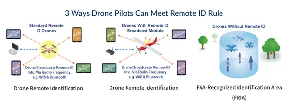
Source: FAA
With the importance of Remote ID established, let’s dive into the practical steps you can take to ensure your drone is compliant and ready for legal flight. Here’s what you need to know:
Step 1: Identify Your Drone
The first step is to determine if your drone is already Remote ID compliant. Many newer drone models, especially those weighing over 250 grams, come equipped with this technology.
Your drone’s user manual should explicitly mention if it has a built-in Remote ID or Broadcast ID.
Some manufacturers offer firmware updates that enable Remote ID on older drone models. Visit the manufacturer’s website and see if an update is available for your specific drone.
Step 2: Explore External Broadcast Modules
If your drone lacks a built-in Remote ID and cannot be updated, you might need an external Remote ID broadcast module. These handy devices attach to your drone and transmit the required identification and location data. Research compatible broadcast modules for your specific drone model and follow the installation instructions carefully.
Step 3: Register Your Drone
Drone registration is a separate requirement from Remote ID, but it’s still crucial.
Check out this link to learn the process of drone registration. This registration process links your drone’s unique ID with your personal information, ensuring traceability and accountability.
Step 4: Stay Informed
The world of drone regulations is constantly evolving. Stay informed by checking your local aviation authority’s website for any updates or changes to Remote ID regulations.
How to be Remote ID Ready
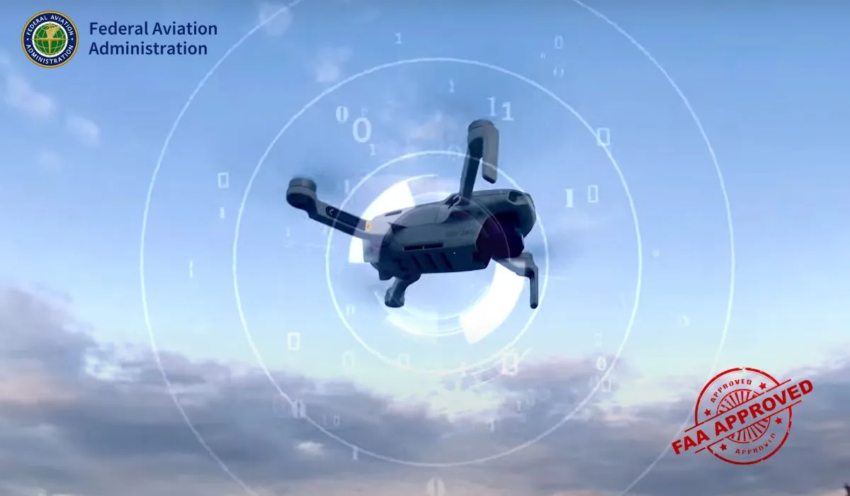
Drone pilots have three ways drone pilots can meet the identification requirements of the Remote ID rule:
1. Operate a Standard Remote ID Drone
Use a drone with built-in Remote ID broadcast capabilities that comply with the requirements of the Remote ID rule. It broadcasts identification and location information of the drone and control station. These Standard Remote ID drones come pre-equipped with the necessary features.
2. Operate a drone with a Remote ID broadcast module
The broadcast module can be added to a drone to retrofit it with Remote ID capabilities. A broadcast module is a device that broadcasts identification and location information about the drone and its take-off location in accordance with the Remote ID rule’s requirements. Pilots using a drone with a Remote ID broadcast module must maintain visual contact with their drone throughout the flight.
3. Operate without Remote ID equipment at FAA-recognized identification areas (FRIAs)
In areas sponsored by community-based organizations (CBOs) or educational institutions that are recognized by the FAA, drone pilots can operate without Remote ID equipment. These FAA-recognized identification areas (FRIAs) are the only locations where unmanned aircraft systems (UAS), including drones and radio-controlled airplanes, may operate without broadcasting Remote ID message elements.
Final Thoughts
Wrapping it up, Drone Remote ID is kind of a big deal in our increasingly crowded skies. As the air traffic gets busier, keeping tabs on who’s who up there is a necessity for our safety.
But, here’s the kicker – privacy is hanging in the balance. Will it be a win for drone pilots? Well, that’s the million-dollar question, and honestly, nobody’s got the crystal ball on this one.
Feel free to share your thoughts in the comments.
Frequently Asked Questions
1. Which Drones Must Comply With Remote ID?
All drones must adhere to the Remote ID rule if they are either required to be registered or have already been registered. This applies whether the drone is flown for recreation, business, or public safety purposes.
2. Where can I buy a Remote ID module? How much does it cost?
Remote ID modules are available in two types: Non-Self-Contained and Self-Contained.
Non-Self-Contained modules, which do not have a built-in power source and are designed to be integrated into the aircraft, start at around $40.
Self-Contained modules, which have built-in power sources and antennas, range from about $130 to $300. Examples of such modules include the AeroPing and the BlueMark DB120 Beacon for self-contained modules, and the Hex Cube ID for non-self-contained modules.
3. Can I fly without Remote ID in the United States?
In general, drones that need to be registered are required to comply with Remote ID requirements. However, drones can be flown without Remote ID equipment in defined geographic areas known as FAA-Recognized Identification Areas (FRIAs).
4. Who can see data broadcasted from my drone?
The data from Remote ID can be received by anyone with the proper equipment, such as a specific device or a mobile app, as long as they are within the range of the drone’s Remote ID broadcast.
5. Who is responsible for mandating Remote ID in the USA?
The Federal Aviation Administration (FAA) is responsible for mandating Remote ID in the United States. The FAA’s rule on Remote ID is part of their broader efforts to integrate drones safely and securely into the National Airspace System (NAS). Remote ID is essential for identifying drones in flight and locating their control stations, particularly when a drone is flying in an unsafe manner or restricted areas.
LiDAR Surveying – Revolutionizing Geospatial Data [2024]
LiDAR surveying is no longer a futuristic concept – it’s a powerful tool that has revolutionized the way we capture geospatial data. This cutting-edge technique utilizes rapid laser pulses to create incredibly detailed, three-dimensional models of landscapes and structures.
In a short time, LiDAR surveying has become essential across numerous industries. LiDAR propels us forward in a new era of exploration and innovation from construction and infrastructure management to archaeology and environmental monitoring.
This article will explore the details of LiDAR surveying, its functionalities, and exciting possibilities.
Watch this video to learn more about mapping areas with dense vegetation.
Let’s explore what LiDAR surveying is all about.
What is LiDAR Surveying?
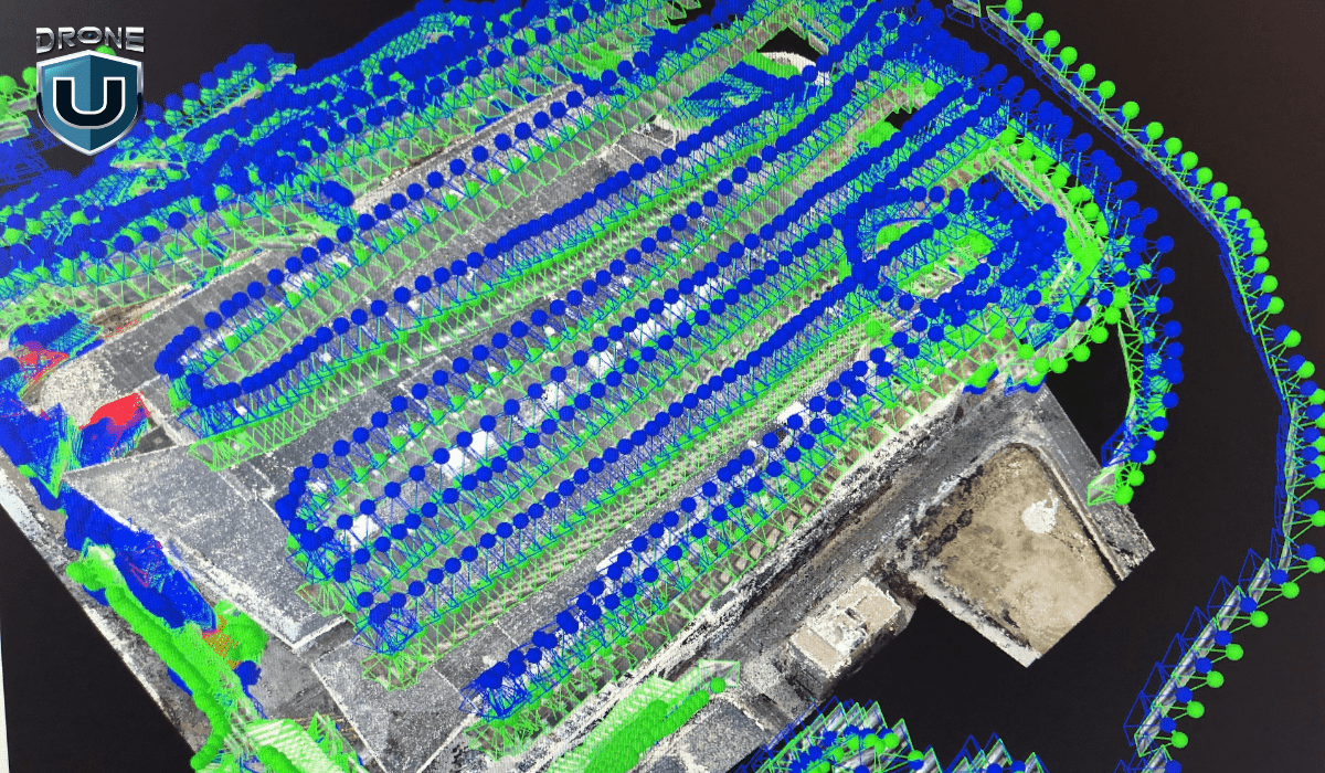
LiDAR, short for Light Detection and Ranging, is a powerful remote sensing technique that acts like a 3D laser tape measure. It works by emitting laser pulses and recording the time it takes for each pulse to reflect off surfaces and return to the sensor.
By measuring this time and knowing the speed of light, you can calculate the distance to the object with high precision. This process repeats millions of times per second. Thus, creating a dense point cloud – a massive dataset of 3D data points representing the surveyed area in incredible detail.
Unlike traditional surveying methods, LiDAR systems can capture data from multiple angles. This allows for comprehensive coverage of the surveyed area, including difficult or dangerous areas. This capability has made LiDAR surveying invaluable across industries.
With the basics established, let’s delve into the different types of LiDAR systems.
Types of LiDAR Systems
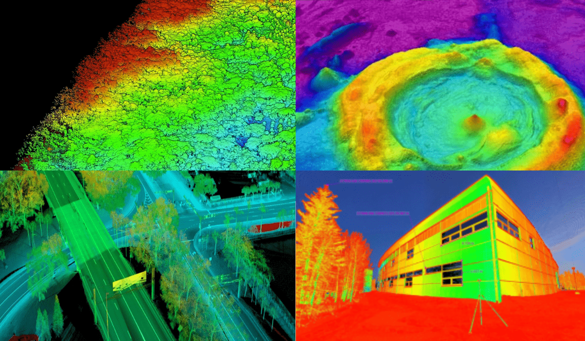
You can sort LiDAR systems by their use and the medium they work in.
Firstly, let’s talk about the common types:
1. Topographic LiDAR
This technology is built for land-based surveys and is effective at mapping the Earth’s surface. This includes from vegetation to buildings and everything in between. They’re like the off-road vehicles of the LiDAR world.
2. Bathymetric LiDAR
These specialized systems can penetrate water bodies like a hot laser through butter. Thus, maps out the seafloor, riverbeds, and any other submerged environments with mind-blowing precision.
However, other more uncommon types of LiDAR are as follows:
3. Mobile LiDAR
Mobile LiDAR systems mounted on moving vehicles or drones map and survey at a faster pace. They are ideal for projects requiring detailed 3D city models or large-scale infrastructure monitoring.
4. Terrestrial LiDAR
These ground-based systems are set up in a single location to capture data of the surrounding area. They are often used for surveying, construction planning, and creating 3D models of buildings or other structures.
5. Flash LiDAR
This technology is similar to taking a picture. Flash LiDAR illuminates the entire field of view with a single pulse of light. Thus, captures the reflected light from surfaces within that field. This technology is useful for close-range applications.
It is being explored for use in autonomous vehicles because of its ability to rapidly generate a 3D image of the environment.
Next, let’s solidify our understanding with important LiDAR surveying terms.
Glossary of Terms Related to LiDAR Surveying
Let’s take a quick look at some key terms before we understand the workings of LiDAR surveying.
| Term | Meaning |
| LiDAR (Light Detection and Ranging) | A remote sensing technology that uses laser pulses to measure distances and create 3D representations of the surveyed area. |
| Remote Sensing | The process of acquiring information about an object or area without making physical contact, typically from airborne or satellite-based platforms. |
| Pulse | The laser beam is emitted by a LiDAR system, which reflects off surfaces and returns to the sensor. |
| Pulse Rate | The number of laser pulses emitted per second by a LiDAR system is often measured in kilohertz (kHz) or megahertz (MHz). Higher pulse rates enable denser point cloud data collection. |
| Point Cloud | A collection of 3D data points representing the surveyed area, generated by LiDAR systems. Each point in the cloud has exact coordinates (x, y, z). Points can have extra data, like intensity values or classification codes. |
| Digital Elevation Model (DEM) | A 3D representation of the Earth’s surface, including buildings, vegetation, and other features. DEMs come from LiDAR point cloud data. They are widely used in urban planning, flood modeling, and infrastructure management. |
| Bare Earth Model | A DEM that represents the ground surface without any objects or vegetation. They create Bare Earth Models by removing non-ground points from LiDAR data. This gives a detailed view of the terrain. |
| Point Cloud Classification | The process classifies point cloud data into different categories. These include ground, vegetation, buildings, and water bodies. This classification is vital for many applications, such as extracting building footprints, estimating biomass, or identifying water bodies. |
| Orthomosaic | It is a seamless and corrected mosaic of aerial or satellite imagery. It is often used with LiDAR data for visualization and analysis. |
| Ground Control Point (GCP) | Precisely surveyed points on the ground were used to improve the accuracy of LiDAR data and georeferencing. GCPs ensure the LiDAR data is correctly aligned. They make sure it lines up with other geospatial datasets and real-world coordinates. |
| Digital Twin | It is a virtual representation of a physical object or environment, created using data from various sources, including LiDAR surveys. Digital twins are used for monitoring, simulation, and prediction. They are used in many industries, such as construction, manufacturing, and urban planning. |
| Line of Sight (LOS) | A line of sight is an unobstructed path between a LiDAR sensor and a target object or surface. LiDAR systems measure distances accurately when they are free of obstructions like dense vegetation or buildings. |
It is time to lift the veil and see how LiDAR surveys are conducted.
How Does LiDAR Surveying Work?
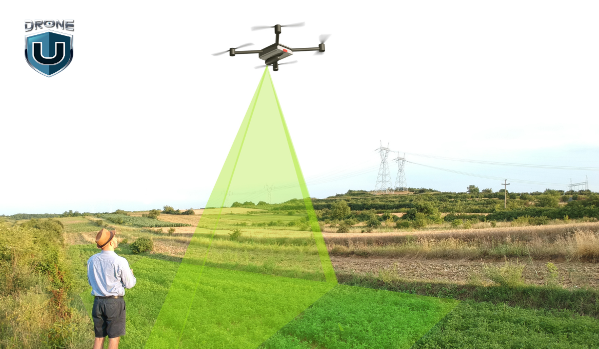
LiDAR surveying involves several key steps to capture and process the data. Here’s a step-by-step breakdown of how LiDAR surveying typically works:
Step 1: Plan Your Survey
Before you start, you’ll need to plan out your LiDAR survey. Determine the area you want to survey and the level of detail you need. Also, keep in mind any specific requirements for your project. This planning stage ensures you have the right equipment and resources to get the job done efficiently.
Step 2: Set Up Your Equipment
Once you’ve planned your survey, it’s time to set up your LiDAR system. This typically involves mounting the LiDAR sensor on a stable platform. This can include a tripod, vehicle, or aircraft, depending on the scale of your project. You’ll also need to calibrate and configure the system according to your survey requirements.
Step 3: Collect Data
Now it’s time for the fun part – data collection. A LiDAR sensor mounted on an aircraft, drone, or ground-based platform emits laser pulses. As you move the LiDAR sensor across the survey area, it emits rapid pulses of laser light. These laser pulses bounce off objects in the environment, and the LiDAR sensor precisely measures the time it takes for each pulse to return.
The system calculates the distance to each point, creating a dense point cloud of data using time-of-flight information.
Step 4: Process and Analyze Data
After collecting the data, you’ll need to process and analyze it. This typically involves combining the LiDAR point cloud with other data sources. Such as GPS and inertial measurement unit (IMU) data, to create accurate 3D models or maps of the surveyed area. You can then use specialized software to clean, filter, and classify the data, removing any noise or unwanted points.
Step 5: Visualize and Interpret Results
Once you’ve processed the data, you can visualize and interpret the results. LiDAR data can be displayed in various formats, such as 3D point clouds, digital terrain models (DTMs), or 3D meshes. You can use these visualizations to measure distances and volumes.
Additionally, you can detect changes over time, or make detailed maps and models for your project.
Step 6: Integrate and Share Data
Finally, you can integrate your LiDAR data with other geospatial technologies, such as Geographic Information Systems (GIS) or Building Information Modeling (BIM) software.
This integration lets you combine the LiDAR data with other sources.
These sources include aerial imagery and existing maps. You can use them to make complete and informative visuals. You can then share these visualizations and models to support decision-making and collaboration.
Remember, the specific steps may vary depending on the type of LiDAR system you’re using and the scale of your project. However, this general process gives you a good understanding of how LiDAR surveying works.
Now that we know how it works, let’s explore LiDAR’s advantages.
Benefits of LiDAR Surveying
LiDAR surveying offers numerous advantages over traditional surveying methods. That makes it a preferred choice for a wide range of applications.
Some of these benefits are discussed below.
1. High Accuracy and Precision
With LiDAR systems, you can measure distances with incredible centimeter-level accuracy and precision. This level of detail is essential for projects that need highly reliable measurements, especially in construction sites, infrastructure monitoring, or archaeological surveys.
2. Rapid Data Acquisition
These systems are rapid data acquisition machines. So, you can collect millions of data points per second, allowing you to survey large areas efficiently and cost-effectively. This capability is particularly valuable when you need to cover extensive ground. Such as mapping entire urban areas or massive infrastructure projects.
3. Remote Data Collection
LiDAR gives you the power of remote data collection. Thus, eliminates the risk and increases your efficiency. You can survey areas that are difficult or dangerous to access. This includes steep terrain, dense forests, or hazardous environments.
4. Comprehensive Data Collection
When you use LiDAR, you get comprehensive data collection. These systems capture information for both the ground surface and above-ground features. Hence, gives you a complete understanding of the surveyed area. This comprehensive data is invaluable for forestry management, and environmental monitoring.
5. Integration with Other Technologies
You can seamlessly integrate LiDAR data with Geographic Information Systems (GIS) and Building Information Modeling (BIM). This integration opens up a world of advanced analysis, visualization, and decision-making capabilities for you.
Time to shine a light on the top applications of LiDAR surveying across various fields.
Applications of LiDAR Surveying
LiDAR surveying is a versatile technology with a wide range of applications across various fields. It can produce precise, 3D images of the Earth’s surface and features. This ability makes it invaluable for many uses.
1. Construction
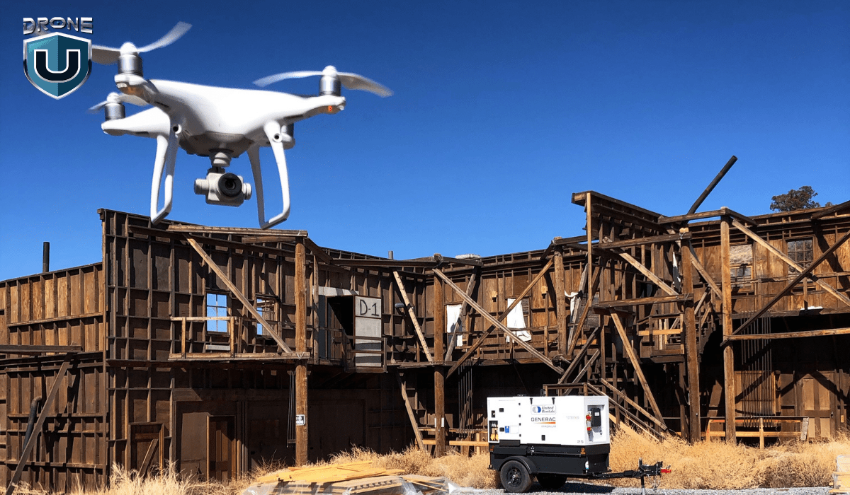
LiDAR is transforming the construction industry. It uses laser pulses to precisely calculate the amount of soil needed for earthworks, ensuring every inch is accounted for.
LiDAR data can also be combined with Building Information Modeling (BIM) systems. This creates incredibly detailed 3D models of construction sites, offering unmatched precision. Imagine having this level of control – you’ll feel like a construction mastermind!
Example: The Shanghai Tower is China’s tallest building and the world’s second tallest. Its construction used LiDAR data in Building Information Modeling (BIM) systems. This allowed for detailed modeling of the building’s complex structure. It also helped coordinate different construction disciplines.
2. Infrastructure Management
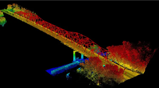 Source: Minnesota Department of Transportation
Imagine having a superpower that lets you see right through roads, bridges, and power lines. That’s what LiDAR technology offers. These advanced laser systems can map infrastructure with incredible accuracy, down to the centimeter.
This makes managing and planning maintenance a breeze. No more worrying about hidden problems or unexpected costs – LiDAR gives us a clear picture of our infrastructure’s health, allowing us to address issues proactively.
Example: The Minnesota Department of Transportation used mobile LiDAR systems to map over 14,000 miles of roadways. Thus, capturing data on signs, guardrails, and other assets with incredible precision.
3. Archaeology

You can observe mind-blowing applications of LiDAR in the archaeological sector. This technology is like having a high-tech time machine. That uncovers ancient structures and settlements that have been hidden beneath dense vegetation.
LiDAR’s laser pulses pierce through dense tree cover, uncovering the mysteries of the past. This technology creates incredibly detailed 3D maps of historical sites, offering archaeologists a glimpse into these forgotten worlds.
Example: Archaeologists in Cambodia used LiDAR to map the sprawling medieval city of Angkor Wat. Hence, revealing urban networks and hydraulic systems lost to time.
4. Environmental Monitoring
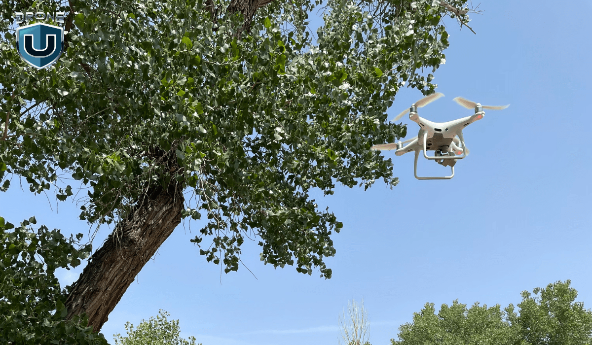
LiDAR systems are revolutionizing environmental monitoring. These systems use laser pulses to provide unparalleled insights into forests, floodplains, and coastal erosion.
LiDAR acts as a powerful ally in the fight against environmental threats, allowing us to proactively monitor and manage our precious ecosystems.
Example: The Federal Emergency Management Agency (FEMA) in the United States uses LiDAR to create more accurate floodplain maps. This technology aids in identifying areas at risk of flooding. Hence, improving emergency planning, and informing the development of infrastructure and communities.
Let’s also consider LiDAR’s limitations for a well-rounded view.
Limitations of LiDAR Surveying
While LiDAR surveying offers numerous advantages, it also has some limitations that need to be considered:
1. Line of Sight Requirement
LiDAR systems need a direct line of sight to the target surface. Dense vegetation, buildings, or other obstacles can block that line of sight. This leads to pesky data gaps or occlusions in your survey results. This can be a real challenge in areas with many obstructions, like heavily forested or urban environments.
2. Weather and Environmental Conditions
Certain weather conditions, like rain, fog, or high winds, can put a damper on your LiDAR survey. These conditions can scatter or absorb those laser pulses, reducing the accuracy and completeness of your data. So, you need to keep an eye on the forecast before scheduling your survey.
3. Initial Cost
LiDAR systems and the necessary software and hardware can be quite expensive, particularly high-end models with advanced features. This upfront cost can be a hurdle for smaller projects or organizations with limited budgets.
4. Data Processing and Storage
Processing and storing a massive amount of data requires significant computing power and storage capacity. If your organization lacks the IT infrastructure or data management expertise, this can be a significant hurdle.
5. Skilled Personnel
Skilled personnel are the key to unlocking LiDAR’s full potential. They can identify the best uses for your project and ensure data collection and analysis yield the most valuable information. Without this expertise, you might be using a powerful tool at a fraction of its capacity.
With a solid foundation, let’s set our sights on the exciting future of LiDAR surveying.
The Future of LiDAR Surveying

LiDAR surveying has a bright future ahead of it, with breakthroughs expected in several fields.
Here are five key trends that will shape the landscape of LiDAR technology:
1. Superpowered Data Fusion
Imagine LiDAR data teaming up with its fellow sensors like radar and photogrammetry. This dream team will create incredibly detailed and comprehensive datasets. To make things even better, AI and machine learning will jump in to supercharge data processing and analysis.
2. Shrinking Size, Shrinking Costs
The future holds smaller and more affordable LiDAR sensors thanks to breakthroughs in solid-state LiDAR and MEMS technology. These tiny powerhouses will open doors for more users and industries. From small drones to even personal devices, LiDAR could be everywhere!
3. Sharper Details, Wider Reach
Researchers are constantly pushing the boundaries of LiDAR resolution and range. Higher resolution means your 3D models will capture finer details, while extended range will allow you to survey vast areas or examine distant objects with incredible precision.
4. Guiding the Way for Autonomous Tech
As self-driving cars and drones become commonplace, LiDAR will play a crucial role in navigating their world and detecting obstacles. The auto industry’s demand for reliable and affordable LiDAR systems will drive innovation, leading to even more advanced LiDAR technology. These advancements could also benefit other autonomous applications in the future.
5. Real-Time Mapping on the Fly
Real-time LiDAR mapping capabilities are set to improve dramatically, allowing for immediate analysis and decision-making. This will be a game-changer for fast-paced environments and applications that require instant data, such as disaster response, military operations, and real-time environmental monitoring.
Conclusion
LiDAR surveying isn’t just a data collection method; it’s a revolution. It offers unparalleled accuracy, efficiency, and versatility. With unmatched accuracy, efficiency, and versatility, LiDAR has become an indispensable tool across a vast spectrum of industries.
The future of LiDAR surveying is brimming with potential. As the technology matures, we can expect even wider adoption and exciting integrations with cutting-edge advancements like machine learning, AI, and augmented reality.
These developments will undoubtedly unlock new applications and drive progress in fields we can only begin to imagine. LiDAR is poised to fundamentally change how we interact with and understand the world around us.
Frequently Asked Questions
1. What is LiDAR surveying used for?
LiDAR surveying has a wide range of applications in fields like construction (volume calculations, site planning), infrastructure management (bridge inspections, road repairs), archaeology (discovering buried structures, mapping ruins), environmental monitoring (forestry, floodplain analysis, coastal erosion), and even disaster response (damage assessment, search and rescue).
2. Who can perform LiDAR surveys?
LiDAR surveys are typically conducted by qualified professionals with experience in operating LiDAR equipment and processing the complex data it generates.
3. What factors should I consider when planning a LiDAR survey?
Here are some key factors to consider:
Project goals and desired deliverables: Clearly define what you want to achieve with the survey (e.g., volume calculations, 3D model creation, etc.) This will help determine the level of detail needed and the most suitable data collection method (ground-based, drone-based, etc.)
Site characteristics: The size, complexity, and accessibility of the survey area will influence the choice of LiDAR equipment and data collection strategy.
Budget and timeline: LiDAR surveying costs vary depending on project complexity. Be sure to factor in data processing costs as well. Discuss your budget and timeline with potential LiDAR service providers to ensure they can meet your needs.
4. Can LiDAR penetrate grass?
LiDAR can penetrate grass to some extent, but it depends on several factors like grass density and height, the wavelength of the LiDAR system, and moisture content.
LiDAR’s strength lies in its ability to see through gaps in vegetation and map the ground beneath. However, for very dense vegetation, alternative methods like ground-based surveying or other remote sensing techniques might be necessary.
5. What can LiDAR not detect?
LiDAR generally struggles with:
- Objects behind completely opaque surfaces
- Highly reflective surfaces
- Dense, Low-Lying Vegetation
- Transparent or Semi-Transparent Materials
- Objects moving very quickly within the scan area


More on Hot Topics