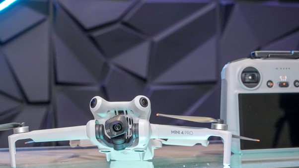
DJI Mini 4 Pro vs. DJI Mini 3 Pro – Which One is the Best?
Drones have become essential tools, offering a breathtaking bird’s-eye view of our world. With each new model promising to push the boundaries of aerial photography, choosing the right one can be both exciting and overwhelming.
This is especially true with DJI Mini 3 Pro and Mini 4 Pro.
This guide cuts through the clutter simplifying the often confusing features, capabilities, and subtle differences between these two mean machines.
Let’s begin by looking at the comparison criteria.
The Criteria We Choose to Compare DJI Mini 4 Pro vs. Mini 3 Pro
Our criteria cover a lot of ground, aiming to reflect how you’ll use and enjoy your drone. Here’s a breakdown of the key criteria we’ll be looking at:
1. Design and Portability
The physical footprint and mass of a drone determine its portability and the regulatory category it falls under.
According to the FAA, drones weighing less than 250 grams (0.55 lbs) are exempt from registration requirements.
The build material of a drone directly impacts its durability, weight, and cost.
Here’s a closer look at common materials:
- Plastic: If you’re on a budget, ABS plastic is a better alternative, offering better impact resistance.
- Fiberglass and Carbon Fiber: These materials strike a balance between lightweight and resilience. Thus, providing superior durability and performance.
2. Camera and Imaging Capabilities
Image quality is largely determined by sensor technology and camera technology. Both work hand-in-hand to deliver stunning visuals.
Larger sensors can capture more light, leading to improved low-light performance, dynamic range, and color accuracy. These factors contribute to richer, more vibrant images.
Whereas, advanced camera drones incorporate features like advanced lenses, stabilization systems, and intelligent processing algorithms. These work together to minimize distortions, ensure smooth footage, and enhance the overall image quality.
For image capabilities comparison, we considered the following factors:
- Shutter Speed: A higher Shutter Speed is ideal for capturing fast-moving subjects without blur. Lower Shutter Speed creates motion blur, which can convey a sense of speed or movement.
- Frame Rate: Higher Frame Rates allow for smooth slow-motion playback because more frames capture each moment of action. Standard Frame Rate is sufficient for standard video recording without slow-motion effects.
- Aperture: Aperture refers to the lens’ opening size, controlling the amount of light hitting the sensor. Wider Apertures allow more light in, facilitating low-light photography. The narrower the aperture, the deeper the depth of field will be, resulting in a sharper image.
- Image Stabilization: Image stabilization reduces the blur caused by camera shake during the exposure. It ensures clear images and smooth footage by balancing for movement.
- Resolution: Resolution refers to the number of pixels in an image or video. Higher resolutions provide more detail, allowing for significant cropping without losing quality. Standard Resolutions may suffice for everyday use, social media, or when storage space and processing power are limited.
3. Range
 The maximum height and distance from the controller significantly affect the drone’s versatility. A longer range gives you more flexibility in planning and executing drone missions.
4. Battery and Charging System
The battery and charging system are a critical component of any drone. It determines how long you can fly and how quickly you can get back into the air after a battery depletes.
Additionally, the charging time varies widely between models and is influenced by the charger’s power output and the battery’s capacity. Some drones offer fast-charging capabilities, significantly reducing downtime between flights.
5. Flight Time
A drone’s battery determines its maximum flying time. Longer flight times translate to longer sessions of photography and exploration.
6. Pricing and Value
Finding the “perfect” drone is about more than just features – it’s about fitting your budget and long-term needs.
If a pricier drone offers exceptional performance or unique features that truly matter to you, it might be worth the investment.
However, the cost doesn’t end there. Consider the long-term finances:
- Maintenance: Drones require occasional repairs and replacements. Consider the estimated cost of spare parts and potential repairs.
- Batteries: Drone batteries degrade over time. Consider the cost of additional batteries to keep you flying longer.
- Accessories: Do you need extra propellers, chargers, or other accessories? Add those to your budget.
Let’s dive into comparing these criteria for DJI Mini 3 Pro and Min 4 Pro.
7. The Remote
Find the perfect drone also includes having a remote with a built-in screen. Our phone batteries already deplete fast enough, having a good drone remote with a great battery makes a world of difference when flying any drone adventure.
A great remote will offer at least 10-15 full flights on one single charge. It will also have an easy and seamless remote screen that offers the ability to screen record, work well in high temperatures and offer significant range as we defined above.
DJI Mini 3 Pro vs. Mini 4 Pro Comparison
While the Mini 3 Pro has been a popular choice, the arrival of the Mini 4 Pro promises potential improvements. Let’s delve into what those advancements might be.
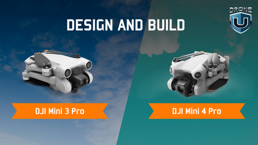
1. DJI Mini 3 Pro vs. Mini 4 Pro – Design and Build
| Specification | DJI Mini 3 Pro | DJI Mini 4 Pro |
| Weight | Under 249 gm | Under 249 gm (w/small battery) |
| Dimensions |
Folded: 145×90×62 mm Unfolded: 251×362×70 mm |
Folded:148×94×64 mm Unfolded: 298×373×101 mm |
When it comes to aerial photography with a lightweight drone, the DJI Mini 3 Pro and Mini 4 Pro are the reigning champions. But which one takes the crown for design and build quality?
Let’s find out.
Size and Weight: Both drones fall under the 250g weight limit, making them ideal for travel and hassle-free regulations in various countries. The Mini 4 Pro is slightly larger, with a slightly bulkier body and foldable arms. The Mini 3 Pro boasts a sleeker, more streamlined design with slimmer arms. Mini 3 Pro might feel more compact in your bag. The Mini 3 pro has become, for many, the disposable drone camera.
Materials and Durability: Both drones are constructed with lightweight yet durable plastic material. The Mini 4 Pro utilizes a combination of plastic and metal, while the Mini 3 Pro leans more towards plastic. Both are built to withstand mild bumps and scrapes, but the Mini 4 Pro might offer slightly more sturdiness due to its metal accents.
Folding Mechanism: Both drones fold down for easy portability, but the mechanisms differ. The Mini 3 Pro folds its propellers inwards, potentially offering better protection during transport. The Mini 4 Pro’s propellers fold outwards, requiring additional propeller guards for protection.
2. DJI Mini 3 Pro vs. Mini 4 Pro – Camera Capabilities
| Specification |
DJI Mini 3 Pro |
DJI Mini 4 Pro |
| Sensor |
1/1.3-inch CMOS |
1/1.3-inch CMOS |
| Photo Resolution |
Effective Pixels: 48 MP |
Effective Pixels: 48 MP |
| Video Resolution | 4K: 3840×2160@60fps
2.7K: 2720×1530@60fps FHD: 1920×1080@60fps |
4K: 3840×2160@60/100*fps
FHD: 1920×1080@60/100*/200*fps |
| Photo Format | JPEG/DNG (RAW) | JPEG/DNG (RAW) |
| Video Format | MP4/MOV (H.264/H.265) | MP4 (MPEG-4 AVC/H.264, HEVC/H.265) |
In terms of imaging capabilities, the DJI Mini 3 Pro and Mini 4 Pro stand apart in the world of small drones. Let’s discover which one has the best camera technology.
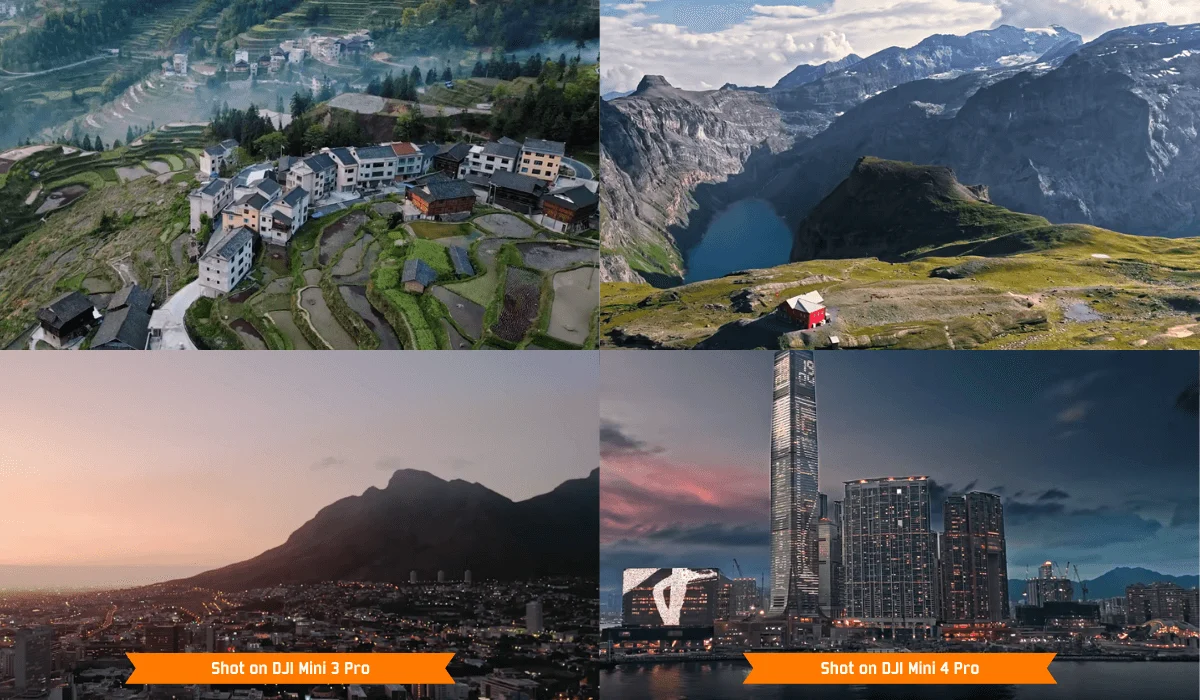
Camera and Imaging Technology: Both the DJI Mini 3 Pro and Mini 4 Pro are equipped with a 1/1.3” CMOS sensor. They deliver high-quality 48MP stills and 4K video at 60 fps, ensuring vivid details and dynamic range in your footage. HDR is absent from the Mini 3, despite its 4K/60p capability.
Video Quality: The DJI Mini 3 Pro has impressive 4K video at 60 fps quality. Whereas, the Mini 4 Pro offers 4K video at 60 fps quality and enhances these capabilities with HDR video recording and the addition of 4K at 100 fps for superior slow-motion videos. The DJI Mini 4 Pro has a night mode feature that enhances low-light performance, setting a new standard for imaging in compact drones.
3. DJI Mini 3 Pro vs. Mini 4 Pro – Range & Flight Performance
| Specification | DJI Mini 3 Pro | DJI Mini 4 Pro |
| Operating Temperature | -10° to 40° C (14° to 104° F) | -10° to 40° C (14° to 104° F) |
| Wind Resistance | 10.7 m/s (Level 5) | 10.7 m/s |
| Maximum Flight Distance | 18 km (with Intelligent Flight Battery and measured while flying at 43.2 kph in windless conditions)
25 km (with Intelligent Flight Battery Plus and measured while flying at 43.2 kph in windless conditions) |
18 km (with Intelligent Flight Battery and measured while flying at 40.7 kph in a windless environment at 20 meters above sea level)
25 km (with Intelligent Flight Battery Plus and measured while flying at 44.3 kph in a windless environment at 20 meters above sea level) |
With the DJI Mini 3 Pro and Mini 4 Pro, DJI is committed to enhancing the piloting experience, but which drone offers better agility, stability, and overall performance?
Range: Mini 3 Pro is engineered to maximize aerial time. The OcuSync 3.0 technology enables stable and reliable long-distance transmission up to 12 km.
DJI Mini 4 Pro provides an edge over its predecessor with its ActiveTrack 360° technology. The O4 transmission system allows up to 20 km of reliable range. Thus, providing a better range.
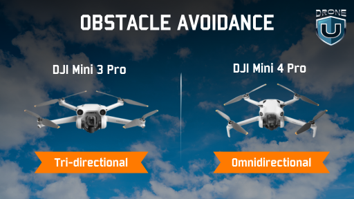
Obstacle Avoidance System: The Mini 3 Pro features a tri-directional obstacle-sensing system. This system covers forward, backward, and downward directions. Whereas, the Mini 4 Pro has an upgraded omnidirectional sensor system. That enhances flight safety by detecting obstacles and aiding in navigation.
4. DJI Mini 3 Pro vs. Mini 4 Pro – Battery and Charging
| Specification | DJI Mini 3 Pro | DJI Mini 4 Pro |
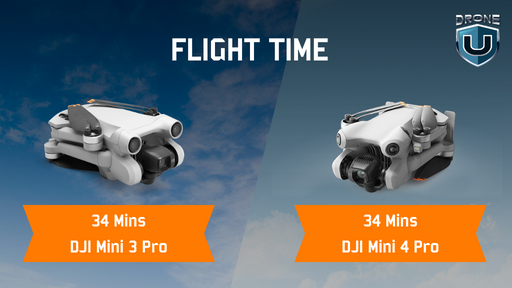
| Flight Time | 34 mins (with Intelligent Flight Battery)
47 mins (with Intelligent Flight Battery Plus) |
34 minutes (with Intelligent Flight Battery)
45 minutes (with Intelligent Flight Battery Plus) |
| Obstacle Sensing | Tridirectional (Forward, backward, and downward) | Omnidirectional |
Battery life and charging efficiency are crucial for uninterrupted flying. Both the DJI Mini 3 Pro and Mini 4 Pro aim to keep you flying longer with less downtime. How do their battery performances compare?
5. DJI Mini 3 Pro vs. Mini 4 Pro – Flight Time
Battery Life: Mini 3 Pro features intelligent battery management for its 34-minute flight time. Also, an optional larger battery that extends flight time to 47 minutes.
You can fly the Mini 4 Pro for up to 34 minutes with an extendable battery life of 45 minutes.
6. DJI Mini 3 Pro vs. Mini 4 Pro – Pricing and Packages
| Specification | DJI Mini 3 Pro | DJI Mini 4 Pro |
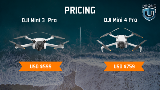
| Price | $599 | $759 |
Pricing and the variety of available packages play a significant role in choosing the right drone for your aerial photography needs. Let’s explore how DJI Mini 3 Pro and Mini 4 Pro stack up in terms of value for money and the options available.
Price Range: The Mini 3 Pro comes at a reasonable price point within the compact drone market. This reflects its advanced features and capabilities within the price range. The Mini 4 Pro becomes pricey to its predecessor. It falls beyond the price range in comparison to the advantages it brings along.
Combo Offer: Both DJI Mini 3 Pro and Mini 4 Pro are offered in various packages. DJI Mini 3 Pro comes with or without the DJI RC N-1 remote controller and bundles that include additional batteries and accessories.
You can purchase the Mini 4 Pro model with or without the DJI RC-2 OR DJI RC N-2 remote controller and other accessories offered.
Now let’s focus on the pros and cons of Mini 3 Pro and Mini 4 Pro.
Pros of DJI Mini 3 Pro vs. DJI Mini 4 Pro
The following are the pros of both models:
|
Pros of DJI Mini 3 Pro |
Pros of DJI Mini 4 Pro |
| 1. The Mini 3 Pro is more sleeker, making it highly portable. | 1. The Mini 4 Pro offers great 4K footage at 100 fps. |
| 2. It has a 1/1.3-inch sensor capable of 48MP photos and 4K video at 60fps. (better native color than m4p) | 2. It comes with omnidirectional obstacle sensors. |
| 3. It weighs less than 249 grams, making it regulation-friendly. | 3. The Mini 4 Pro offers night mode for clearer low-light shots. |
Cons of DJI Mini 3 Pro vs. DJI Mini 4 Pro
Here are the cons of both models:
|
Cons of DJI Mini 3 Pro |
Cons of DJI Mini 4 Pro |
| 1. It has Tri-directional obstacle sensing. | 1. Mini 4 Pro has only one focal length – not great for dynamic shots. |
| 2. Low-light shots can’t be captured well with it. | 2. Not great for shooting in strong winds <20mph |
| 3. Need a good set of lens filters to get the most out of the camera. | 3. Expensive in comparison to the Mini 3 Pro. |
Closing Thoughts
Choosing between the DJI Mini 3 Pro and the newer Mini 4 Pro can be tricky. Let’s break down the key factors to help you pick the perfect one:
Tech Enthusiast: If you prioritize cutting-edge features and crave a dramatic technological leap, the Mini 3 Pro might be your perfect companion.
Professional Pilots: If you need professional-grade image quality and low-light performance, the Mini 4 Pro might be worth considering.
Budget-conscious: If affordability is a key factor and you’re satisfied with the Mini 3 Pro’s solid performance, then sticking with it is a wise choice.
Ultimately, the choice depends on your needs and budget.
Mini 3 Pro: Ideal for casual enthusiasts, hobbyists, and those on a budget.
Mini 4 Pro: Suits professionals and those seeking top-notch image quality and low-light performance.
Conclusion
The DJI Mini 3 Pro and Mini 4 Pro showcase the exciting advancements in the DJI Mini series. While both offer impressive features, they cater to different needs.
For stunning visuals, the Mini 4 Pro shines with its higher resolution camera, smoother 4K HDR video, and night videography
However, the Mini 3 Pro remains a powerful option with its strengths. Its lighter weight and slightly lower price might appeal to budget-conscious users or those wanting a more portable drone.
No matter which one you choose, both the Mini 3 Pro and Mini 4 Pro represent cutting-edge technology and innovation in the drone industry.
Frequently Asked Questions
Q1. What is a good flight time for drones under the 250 category?
A good flight time for a mini drone ranges from 25 to 30 minutes. However, flight times can vary widely based on the drone model and usage conditions. For extended use, consider purchasing additional batteries.
Q2. Does the Mini 4 Pro offer better obstacle avoidance than the Mini 3 Pro?
The Mini 4 Pro features advanced omnidirectional obstacle avoidance technology. This offers pilots a more secure flying experience.
Q3. Does the price of Mini 4 Pro justify its technological changes?
Deciding whether to get the Mini 4 Pro or stick with the Mini 3 Pro is up to you. But if you look at how technology is getting better and the new features added, the Mini 4 Pro is more advanced. It does cost more than the Mini 3 Pro, but the price difference doesn’t completely show how much better the Mini 4 Pro is with its upgrades from DJI.

10 Best Drone Business Ideas for 2024
Are you dreaming of launching a drone business but not sure where to start? Maybe you’re looking for unique, profitable drone business ideas with less competition. If so, you’ve landed on the right page.
Drones, or Unmanned Aerial Vehicles (UAVs), are gaining popularity in many industries. According to Fortune Business Insight research, the drone industry is poised to grow at a remarkable 15.37% CAGR over the next five years.
As the utility of drones continues to expand, numerous untapped drone business opportunities await exploration. In this article, we’ll explore unique drone business ideas worth considering.
Let’s transition from the groundwork of drone entrepreneurship to the potential of the global drone market.
Global Drone Market Insights

The drone business is growing to new heights and continuing to influence a variety of industries.
According to a report by Mordor Intelligence, the drone market value will skyrocket from $35.28 billion in 2024 to $67.64 billion by 2029, growing at a lightning-fast 13.90% per year.
Having revealed the global market size of drones, let’s proceed to a curated list of ten innovative business ideas that will propel your drone venture forward.
List of Drone Business Ideas
Choosing the best drone business can be tricky if you are new to the scene. To simplify your decision and boost your chances of success, we’ve curated a list of unique drone business ideas tailored to different sectors. This way, you can find something that fits your interests and skills perfectly!
Check out this video to learn about scaling a drone business
1. Drone Event Photography Business

Event photography, enhanced by drones, stands out as one of the most lucrative ventures in the drone industry. Drones offer a unique perspective, allowing you to capture events in ways not easily achievable otherwise. Starting a drone-based event photography business can be a low-risk, high-return investment, with potential daily earnings of up to $1,200 or more.
Example: Consider the success of SkyPixel. This drone-centric photography platform has enabled photographers to showcase stunning aerial shots, capturing events and landscapes. Entrepreneurs can emulate this model by offering event photography services with a drone twist, creating visually captivating memories for clients.
2. Drone Training Business
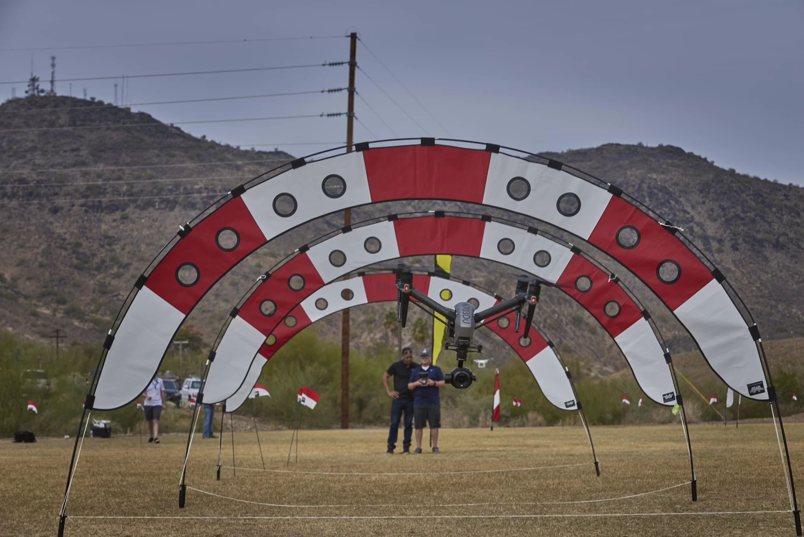
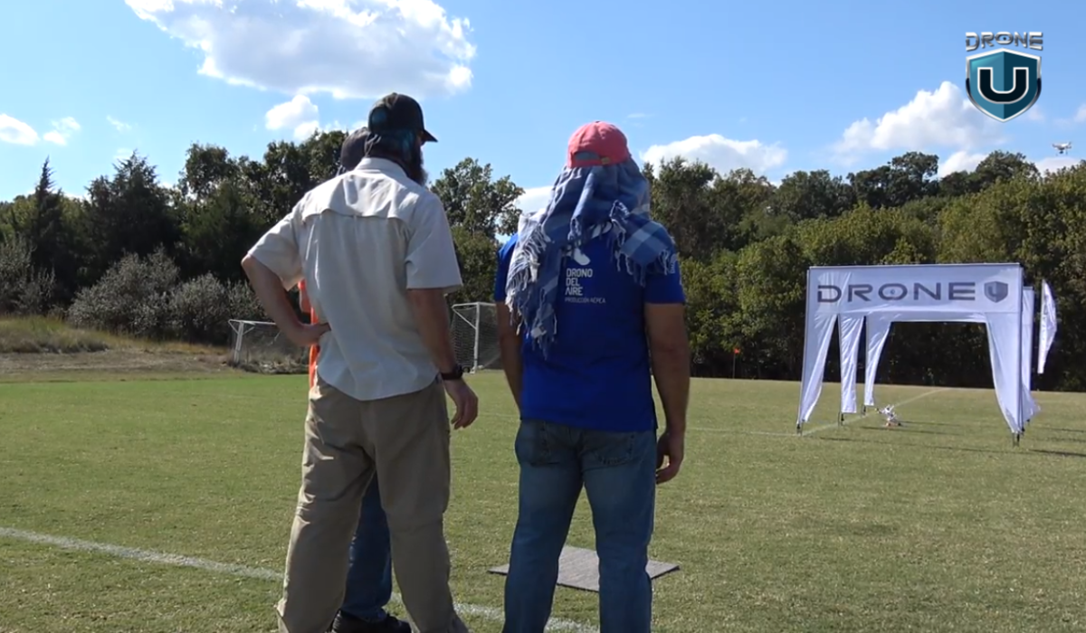
The increasing use of drones in various industries highlights a growing demand for drone training. If you possess a passion for drones and enjoy teaching, consider offering drone-based training and courses. Becoming a drone coach can help aspiring pilots enhance their skills, and you can join programs like the Drone U Elite Pilot for training and support to enhance your offerings and expertise in the drone business.
Example: Drone U stands out as a real-life example. Offering comprehensive training programs, including the Elite Pilot program, Drone U has empowered individuals to become skilled drone pilots and instructors. Entrepreneurs passionate about teaching and drones can follow this example, providing valuable training services.
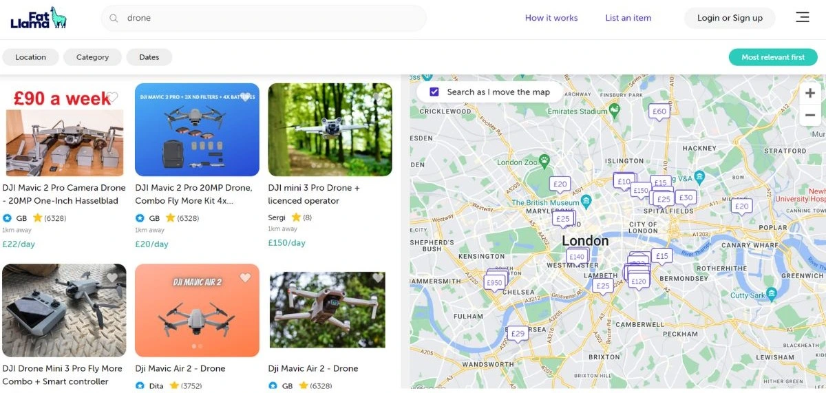
3. Drone Rental Business
 Source: LA Times
The hassle of purchasing and managing drone inventory prompts many individuals and businesses to seek drone rental services. Launching a drone rental business allows you to provide drones for specific events or purposes. Consider offering local businesses the option to test drones before making long-term commitments, and explore online platforms like Fat Llama or UpSonder for broader reach.
 Source: FatLlama
Example: Look at Fat Llama, a peer-to-peer rental marketplace. It facilitates the rental of various items, including drones. Entrepreneurs can create a localized drone rental service, allowing individuals and businesses to access drones for specific needs, just as Fat Lama has done on a broader scale.
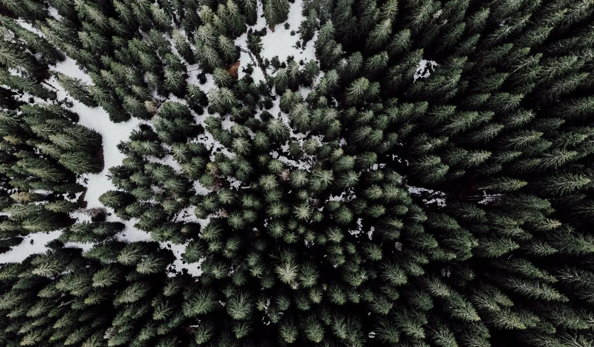
4. Drone Stock Photography Business
 Aerial Drone Stock Photo
If you have a knack for photography, consider starting a stock photography business using drones. Selling aerial photos to businesses and brands for advertising and marketing purposes can be highly profitable. Leverage popular stock video websites to showcase your high-quality drone imagery.
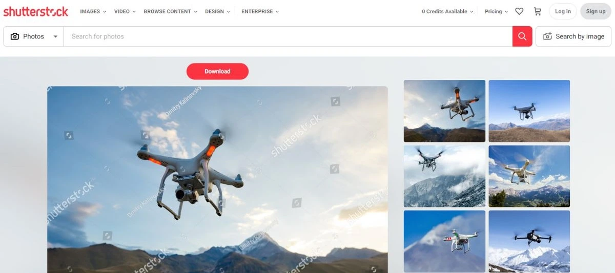 Source: Shutterstock
Example: Shutterstock, a leading stock photo platform, accepts and sells high-quality drone imagery. Entrepreneurs with a passion for photography can contribute to such platforms, earning money by licensing their drone photos to businesses and creative professionals globally.
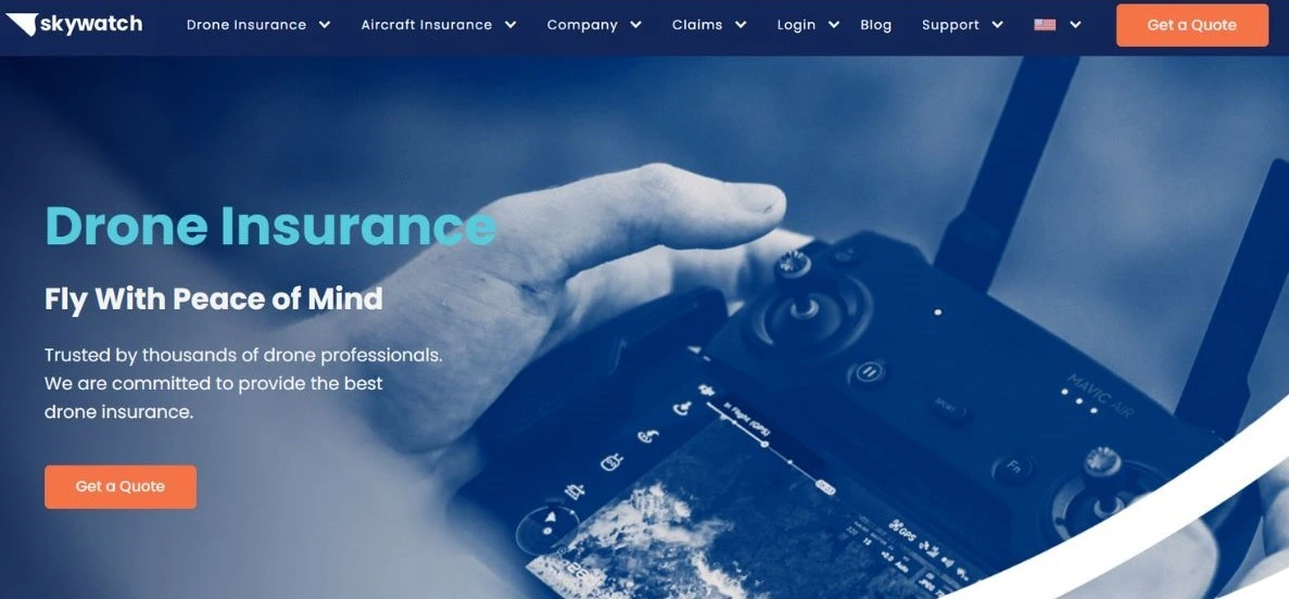
5. Drone Insurance & Licensing Consultancy

Offering insurance and licensing consultations for drone users is among the innovative drone business ideas that ensure compliance with regulations and mitigate liability risks. Forming strategic relationships with local insurance firms and adjusters allows you to tap into the 17% of commercial drones used specifically for insurance services, thereby expanding your market reach and providing valuable expertise to drone operators in need of regulatory guidance and risk management solutions.
 Source: Skywatch
Example: Explore SkyWatch.AI, a platform offering drone insurance solutions specifically tailored for drone operators. Entrepreneurs can establish consultancy services, guiding drone users on insurance and licensing matters, much like SkyWatch.AI does within the industry.
6. Drone Delivery Service Business
Utilize your drone for deliveries, ranging from food to packages. This service is convenient for customers and can be a lucrative venture. Explore opportunities in fast-food or package delivery, with examples like Amazon and Australia Post already employing drones for this purpose.
Example: Amazon Prime Air is a prime example of a company using drones for delivery. Entrepreneurs in densely populated areas can consider starting a fast-food or package delivery service using drones, drawing inspiration from the success of Amazon Prime Air.
7. Drone Repair Service Business

As with any electronic device, drones require maintenance and repair services to ensure their optimal functioning and longevity. You can generate income for yourself in the drone business ecosystem by starting a drone repair business that caters to this growing market demand.
Example: Look at Drone Nerds, a company providing drone repair services and maintenance. Entrepreneurs interested in the technical aspects of drones can establish similar repair businesses, ensuring that drone users have a reliable source for maintenance and repairs.
8. Mapping and Surveying
 Cell Tower Mapping
Drones equipped with geo-referencing technology can provide precise measurements for mapping and surveying. This growing demand for services in urban planning, mining, disasters, and geo-spatial projects makes mapping and surveying a solid drone business idea.
Example: PrecisionHawk is a real-life example of a company utilizing drones for mapping and surveying. Entrepreneurs can offer similar services to clients in urban planning, mining, and other industries, providing accurate and efficient data collection using drones.
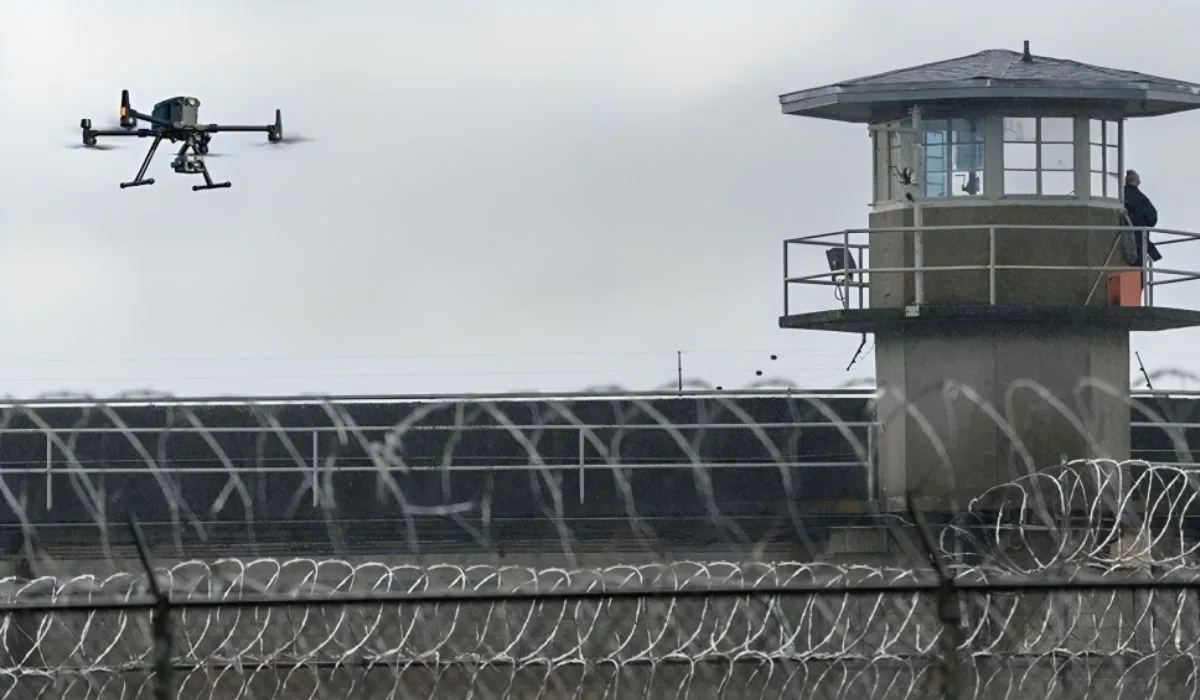
9. Drone Security Surveillance
 Source: DIY Drones
Drones offer versatile applications in surveillance, including law enforcement, wildlife monitoring, and industrial inspections. They can be crucial in responding to natural disasters and aiding in search and rescue operations.
Example: Consider the application of drones in security by Draganfly. They specialize in using drones for surveillance, including applications in law enforcement and public safety. Entrepreneurs can explore similar opportunities in providing drone-based security and surveillance services.
10. Media Coverage
One of the best drone business ideas is to use drones for media coverage. Drones equipped with cameras and sensors can capture unique perspectives for media coverage. This includes recording events, protests, parades, sports, and games, and providing aerial footage of breaking news events.
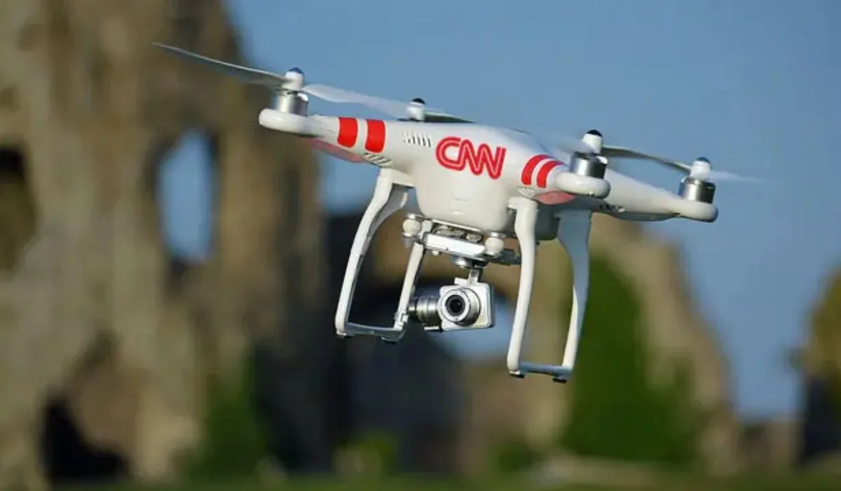 Source: Drone DJ
Example: CNN has used drones for news coverage, capturing unique perspectives during events and disasters. Entrepreneurs can offer their drone services for media coverage, providing aerial footage for news outlets and content creators.
After delving into a range of promising drone business ideas, the next step is to shift our focus toward the essential requirements of starting a drone business.
Requisites to Start a Drone Business
As the drone industry is highly competitive and highly dynamic, it is essential to consider some factors before starting a drone business. Here are some factors to consider:
Industry Analysis
To begin with, you need to thoroughly analyze your target market, your competitors, as well as market trends, and conduct in-depth market research to determine whether or not there is a market for your drone services.
Drone Technology Suitable For Your Business
Choose drones and gear that suit your industry. Consider things like carrying capacity, flight duration, and camera quality when making your purchase. Follow the relevant laws based on your location when conducting drone operations, such as pre-flight inspections and emergency plans.
Accounting for Finances
Keep track of your company’s financial health to ensure sustainability. Establish an appropriate budgeting, invoicing, and accounting system.
Adherence to the Law
Register your drone with the FAA to fly your drone in the USA. For commercial purposes, make sure you get the Part 107 license.
Insurance Coverage
Getting liability insurance is a very important part of protecting yourself against potential harm or mishap brought on by your drone activities. It is highly common for consumers to demand proof of insurance before using drone services from contractors.
Establishing a Network
If you want your drone business to flourish it is crucial to build a network of loyal clients. Thus, commit to providing competitive pricing and transparent contracts tailored to the specific needs of your clients. Networking helps to bring together potential clients, collaborators, and partnerships. This effort not only enhances your visibility but also opens doors to sustained growth and success.
Establishing a drone business requires a blend of technical expertise, financial sense, and regulatory compliance.
Now that we are aware of these factors let’s concentrate on turning the business ideas into successful enterprises i.e. Marketing.
Tips on Marketing Your Drone Business

One of the greatest hurdles in the early stages of drone entrepreneurship lies in capturing the attention of potential clients.
If you’re navigating the landscape of starting or already running a drone business, the pressing question may be: How do you attract customers?
With the right equipment and flying skills in place, the missing link is often a solid client base.
To turn your drone skills into a profitable venture, learning the art of marketing is essential.
While initiating the process can be challenging, here are some indispensable tips to guide you in securing the right clients and generating income through your drone services.
1. Identify Your Target Audience
To convert your drone skills into profits, identify those who stand to benefit most from your drone skills.
While industries like real estate, agriculture, and government agencies are known consumers of aerial footage, numerous other drone business opportunities exist.
Assess your unique skills and consider businesses that could leverage them.
If, for instance, you aim to work with car dealerships, compile a comprehensive list of potential clients to form the foundation of your marketing strategy.
2. Choose the Right Channels
To establish connections with your potential clients, employ a mix of online and offline marketing strategies.
Direct outreach methods, such as email outreach and cold calls, are as important as creating an online presence through a website and YouTube videos.
Maximizing exposure enhances your chances of reaching a broader audience.
Attend relevant in-person networking events frequented by your target audience.
3. Project Professionalism
Securing jobs and selling your drone services hinges on maintaining the highest level of professionalism.
Clients need assurance that their investment is in the hands of a legitimate and capable drone business. Cultivate a professional attitude, not only to satisfy your clients but to pave the way for future opportunities.
Building a network of clients who associate you with drone expertise requires organization, obtaining the necessary permits, and flying responsibly. Strive to be the go-to drone professional in your network, and your reputation will precede you in the industry.
After gaining knowledge about marketing your drone business let’s throw light on the existing competition in the drone industry.
Existing Competition in the Drone Industry
Across the globe, the drone industry has a wide range of businesses operating in distinct sectors. The drone industry is prone to major changes in the upcoming years. Here is a brief overview of the competition in several drone-related industries given in this table.
|
Industry Type |
Key Players |
Competition Overview |
| Drone Manufacturing | DJI | DJI is a dominant force in consumer and professional drone manufacturing, offering a wide range of products. |
| Parrot | Parrot competes by providing alternatives with unique features and pricing strategies. | |
| Yuneec | Yuneec competes by providing alternatives with unique features and pricing strategies. | |
| Autel Robotics | Autel Robotics competes by providing alternatives with unique features and pricing strategies. | |
| Drone Software and Analytics | PrecisionHawk | PrecisionHawk focuses on providing software solutions for drone data analysis, mapping, and workflow management. |
| DroneDeploy | DroneDeploy offers platforms catering to various industries, including agriculture, construction, and mining, for drone data analysis. | |
| Kespry | Kespry provides drone data analysis solutions, particularly in agriculture, construction, and mining. | |
| Drone Services and Consulting | Measure | Measure specializes in drone services and consulting, offering solutions ranging from surveying and inspection to regulatory compliance. |
| AirMap | AirMap provides drone services and consulting solutions, with a focus on airspace management and regulatory compliance. | |
| Aerodyne Group | Aerodyne Group offers drone services and consulting solutions, covering areas like infrastructure inspection and environmental monitoring. | |
| Delivery Services | Amazon Prime Air | Amazon Prime Air is exploring drone delivery solutions for transporting goods. |
| Wing (Alphabet) | Wing, a subsidiary of Alphabet, is actively involved in the drone delivery space, aiming to transport goods efficiently. | |
| UPS Flight Forward | UPS Flight Forward is a notable player in the drone delivery space, exploring and implementing solutions for transporting goods. |
Now, let’s guide you in choosing the drone business idea that aligns best with your skills, interests, and entrepreneurial aspirations.
Which Drone Business Idea is Best For You?
Choosing the right drone business idea depends on your experience, interests, and skills.
If you’re curious about how things operate, you might find the drone repair business idea appealing. But if you’re one of the creative types who land an extrovert who loves to travel, event photography or drone videography might be a good option.
And if you’re left-brained and like attention to detail, go for mapping and inspections.
No matter which drone business opportunity you choose, always learn to fly. One of the best ways to hone your flying skills is to be part of the Drone U membership Inside the membership area, you will discover 40+ courses and get guidance from link-minded pilots who have been there.
Join in today and get trained by the best drone pilots in the country.
Frequently Answered Questions
1. How can I identify the right drone business idea for me?
Consider your interests, skills, and background to identify the right drone business. If you enjoy photography, drone event photography or stock photography might be suitable for you. Individuals with technical expertise may explore drone repair services or training businesses. Align your choice with your passion and expertise.
2. How can I effectively market my drone business?
Identify your target audience and use a mix of online and offline channels for marketing your products and services. Attend relevant networking events, create a professional online presence, and consider direct outreach methods such as email and cold calls to expand your client base.
3. How to turn my drone business idea into a successful enterprise?
If you are keen to transform your drone business idea into a successful venture then evaluate your competitors. It is also crucial to know about regulatory requirements and the long-term viability of the chosen business idea. Your positive approach towards networking, and continuous learning are crucial in making an informed decision.
Drone Mapping Guide: Everything You Need to Know
Are you curious to learn about drone mapping and how it works? Want to build a career in this burgeoning field? If so, you have come to the right place.
This guide will be a great starting point to learn everything you need to know about drone mapping.
The world of drone mapping and surveying is evolving rapidly. When you are just starting it is crucial to have a solid understanding of the latest drone mapping tools, techniques, and trends.
In this article, you will get a first-hand understanding of how drone mapping works and the technology that makes it possible.
Moreover, you’ll discover the exciting applications of drone mapping and learn about how it provides a faster, more efficient, and cost-effective alternative to traditional aerial surveys.
We’ll also explore the basics of drone mapping, the types of drone mapping software used, and how to pick the right one for your purpose.
By the end of this guide, you’ll have a comprehensive understanding of drone mapping technology and how to get the most out of it.
What is Drone Mapping?
In simple layman’s terms, Drone Mapping is all about measuring from photos. With drone mapping, we fly autonomous missions to capture a high overlap of images to create life-like maps and models.
Drones have revolutionized the way we survey and map our world. The efficiency, speed, and accuracy of drone mapping have revolutionized many industries.
First, let me give you a quick overview of drone mapping.
Drone mapping refers to the use of unmanned aerial vehicles (UAVs) to collect aerial data and generate maps, models, and other types of visual representations of a worksite. Drone Mapping is a form of photogrammetry or measuring from images.
In simple terms, drone mapping can be defined as the ability to fly autonomous missions with your drone to create 2D maps and 3D models.
 Terrain Mapping
Drone mapping combines a range of technologies, including photogrammetry, LiDAR, and SLAM lidar, to produce high-resolution images and data that can be used for surveying, agriculture, construction, and environmental monitoring.
Typically drone mapping’s core technology is photogrammetry or measurements from photos.
For underwater mapping, drones fly dual-band sonar to capture data sets below the water.
I know all this can sound a bit technical but stay with me here.
First things first – let’s understand the importance of drone mapping and why it is catching up so fast.
The Importance of Drone Mapping
The report “The Economic Impact of Unmanned Aircraft Systems Integration in the United States” by AUVSI highlights the economic advantage of incorporating UAS technology.
According to AUVSI’s research, within the first three years of integration, over 70,000 new jobs will be generated in the United States, with a positive economic impact of over $13.6 billion.
This positive trend is expected to continue to grow until 2025, with projections of creating over 100,000 jobs and an economic impact of $82 billion.
To fully appreciate the importance of drone mapping, it’s essential to understand how it differs from traditional mapping methods and the unique advantages it offers.
How Does Drone Mapping Differ From Traditional Mapping Methods?
Simply put, drone mapping is faster, offers higher-quality data, and is cheaper to acquire.
Drone mapping is a game-changing alternative to traditional mapping methods, offering numerous advantages over traditional mapping and surveying methods such as
- Drone mapping provides high-resolution aerial data that is more accurate and detailed than traditional survey methods. This increased accuracy can lead to better decision-making and more informed planning and analysis.
- Drone mapping eliminates the need for manual data collection, and provides real-time data that can be processed and analyzed quickly. This saves time and resources compared to traditional survey methods.
- Drones can fly to areas that are difficult or impossible for humans to reach, such as high-rise buildings, dense forests, or dangerous disaster zones. This allows for data collection and mapping in places that were previously inaccessible.
- Drone mapping eliminates the need for expensive equipment and reduces the need for large teams of surveyors.
- Drone mapping eliminates the need for people to work in dangerous or hazardous environments, improving safety and reducing the risk of injury or harm.
Let’s delve a bit deeper into some of the specific benefits that mapping with drone technology offers.
Additional Benefits of Using Drones for Surveying and Mapping
Drone mapping technology has revolutionized the way surveyors and mappers collect, process, and analyze geographic data. Drone mapping has numerous benefits, including
Increased Efficiency
Drone mapping is significantly faster and more efficient than traditional ground-based surveying and mapping methods. This can save time, reduce costs, and increase efficiency.
Enhanced Accuracy
Mapping with drones provides high-resolution aerial imagery and data that can be used to create accurate maps and models of the terrain. This technology can also be integrated with other data sources, such as ground-based sensors, to provide even more accurate and detailed data.
Improved Safety
Using drones for surveying and mapping eliminates the need for surveyors and mappers to work in hazardous or difficult-to-access areas. This can improve safety and reduce the risk of injury or accidents.
With the proper certification, operators can employ unmanned aerial vehicles (UAVs) for security and surveillance purposes at private corporations, sporting events, public gatherings, and other venues. Additionally, UAVs can collect valuable information during and after natural disasters to assist in both security and recovery efforts.
Increased Accessibility
Using drones for 3D mapping makes it possible to map remote or hard-to-reach areas that were previously difficult or impossible to survey.
Improved Data Collection
3D drone mapping technology allows surveyors and mappers to collect large amounts of data in a short time, which can be used to create detailed maps and models of the terrain.
High-Quality Aerial Images
Drones provide exceptional capabilities for capturing top-notch aerial photos and videos and gathering large amounts of imaging data. The resulting high-resolution images can be utilized to produce 3D maps and interactive 3D models that have numerous practical applications.
Despite these benefits, there are some limitations to drone mapping technology.
Let us take a quick look at what the limitations are so that you are prudent about using this technology.
Limitations of Drone Mapping
- Cost: Drone mapping technology can be expensive, particularly for smaller organizations or projects. This may limit the widespread adoption of drone mapping technology.
- Technical Skills: Drone mapping requires specialized technical skills to operate and maintain the equipment. This can limit the pool of people who can use this technology effectively. However, this limitation can be significantly reduced by taking the Comprehensive Mapping Course with the Drone U membership.
- Privacy and Regulatory Issues: Drone mapping technology can raise privacy and regulatory concerns, particularly about data collection and use. The Federal Aviation Administration (FAA) has established regulations for small unmanned aircraft that apply to both commercial and recreational use. The FAA communicates that Airspace is a dual-purpose space, homeowners have rights to their airspace up to the trees, but airspace is also a public domain. Does Southwest Airlines call you every time they fly over your house? No… Because it is a public thoroughfare. The FAA has also not done a good job explaining this to people. In rural areas, you may run into civilians who fear you’re spying on them, albeit you have every right to fly as the only controlling agency of the airspace is the FAA.
- Weather Limitations: Using drones for mapping is limited by weather conditions, such as heavy rain or high winds, which can prevent the drone from flying safely.
- Equipment Limitations: Mapping with drones is limited by the range and endurance of the drone equipment, as well as the availability of spare parts and maintenance services. Essentially very large areas of mapping may require a fixed-wing drone over a multi-copter.
Now that you are aware of the benefits and limitations of drone mapping, let us dive into how drone mapping actually works.
How Drone Mapping Works?
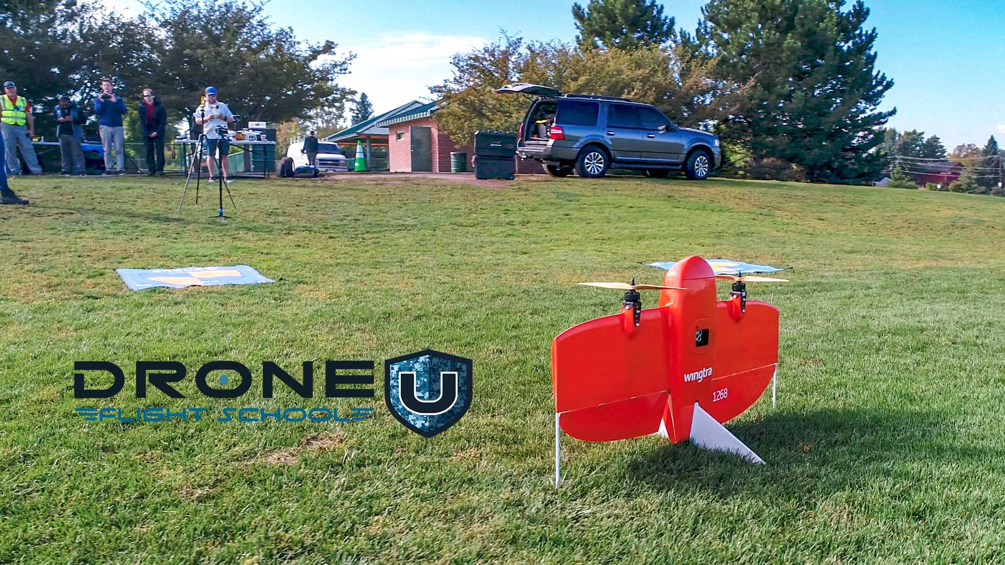 Wingtra Vertical Takeoff Drone
Drone mapping involves three important steps:
- Mission Planning: This involves determining the right type of drones for the mission, choosing the right acquisition software, selecting a mapping solution that is a drone mapping application and a web platform that helps to plan the flight accurately, identifying data needs, creating a flight plan for the area to be mapped, and ensuring airspace authorization from local and federal agencies. (Recently with DJI drones, many third-party apps that were commonplace just last year… won’t work anymore. Pilots have to get creative in mission planning with the Mavic 3 Enterprise using DJI Pilot 2.)
- Most Common Flight Plan is a double grid over your site, typically at a 75/75 overlap with a 70-degree camera tilt. This flight plan allows pilots to create the most deliverables.
- Capturing Media: The second step in drone mapping is all about capturing media at the site location. Pilots activate the autonomous mission and collect data over and around the area they wish to map. Acquisition strategies are different depending on the deliverable a pilot wants to create.
- Processing Drone Data: This is the third and final step of the drone mapping process. Using specialized software applications, you turn this data into 2d maps or 3d models, generate insights and provide deliverables to the client.
So far so good. You have understood how drone technology works and now it’s time to learn more about the applications of drone technology. Drone mapping is a relatively new technology and we are only scratching the surface.
Check out this video on How to do Drone Mapping for more details:
Applications of Drone Mapping
Drone mapping technology is versatile and can be used in a wide range of industries and applications.
Here are a few important ones:
Agriculture
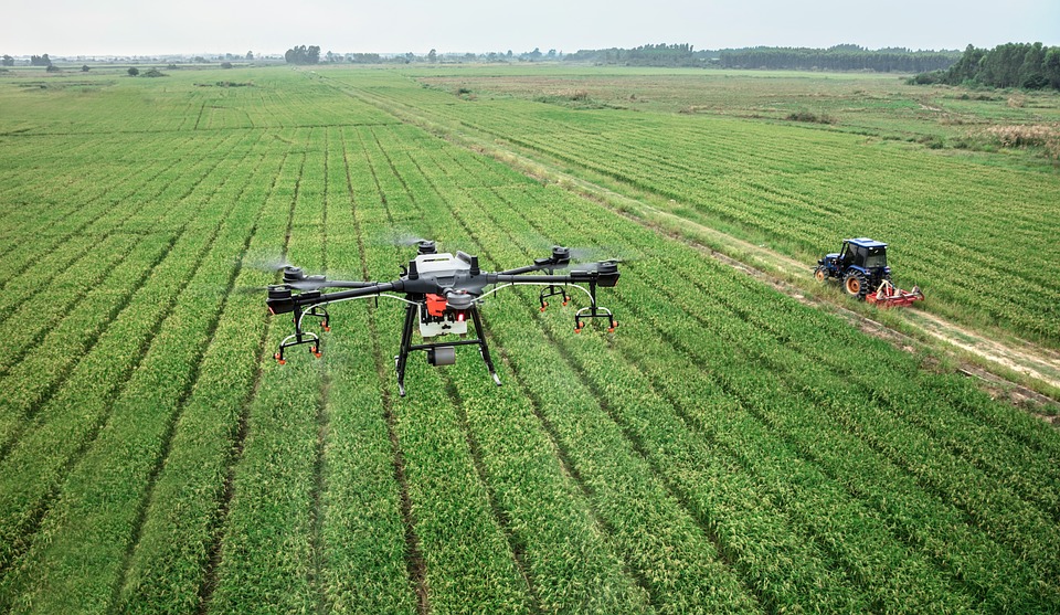 DJI Plant Protection Drone
According to the United Nations, the world’s population is expected to reach 9.7 billion by 2050, resulting in a 69% increase in agricultural consumption from 2010 to 2050. Given that the majority of drone-using farmers and agriculture companies are large, corporate-owned farms, the potential for growth in the use of drones in agriculture is immense.
Drone mapping is used in monitoring crop health, identifying areas of soil variability, and planning irrigation and fertilization programs. Drone mapping is also used to index crops, meaning farms will build a highly detailed map to speed up the process of tending to crops at a micro-level.
Drone Mapping has also assisted Rice and Peanut farmers in the Southern United States. The water tables have been depleted so much that water distribution systems are not working properly anymore. The slope and grades of cropland have changed over time.
With Drone Maps and “digital terrain models,” farmers can determine the flow of water over a given field. With the Subsidence of the earth due to the water table, they can adjust slopes to change the flow of water into their fields. With such small changes in slope, drones provide astronomical value.
Construction and Mining
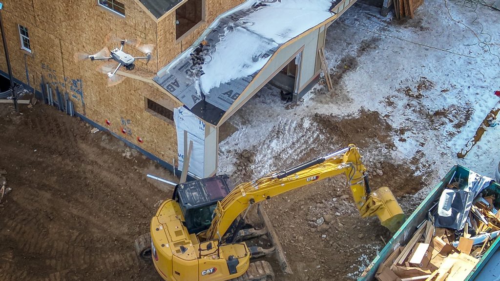
In the construction industry, drone mapping is being used to create accurate topographic maps, survey job sites, and monitor progress on construction projects. Drone Mapping is also used to help set up site logistics. With drone maps and models, executive planners can showcase how each phase of the project will dictate the traffic of contractors, equipment, and materials.
According to PwC, the use of drones in construction and mining industries has the potential to become a multi-billion dollar global market worth $28.3 billion. Companies within these sectors are utilizing drones for effective compliance and adhering to strict worker safety regulations.
Drone mapping is also used to survey and map large mining sites, including open-pit mines and underground mines.
Recent evolution of drone mapping with construction… We have seen more and more construction companies using non-geo-reference orthomosaics Aka no ground control points. Construction companies are also using 3D models to help market potential projects, showcase the change over time and visualize the evolution of a project.
With these 3D Models and classical VDC software, construction companies can meticulously plan the implementation of every piece of construction into life-like 3d models.
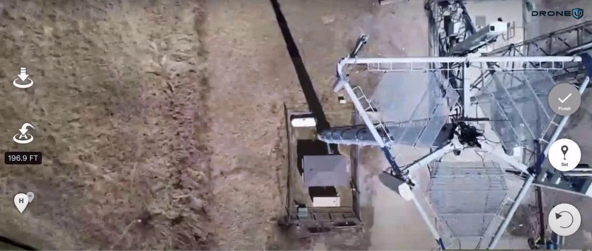
Utility Inspections: Cell Tower & Power
As our world continues to move in a wireless direction, cellular companies are constantly improving their networks. Typically cellular companies are constantly upgrading antennas and replacing old antennas. Numerous companies are working on a “Zillow like,” app that would showcase a map of every tower and antenna in the country.
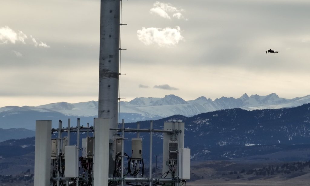
With drone mapping and modeling, cellular companies can index every tower to know which antennas are in what location providing how much coverage area to their clients. Drone models can showcase the angle of the antenna, which dictates how much coverage the antenna will provide.
Weather Forecasting
Drones are capable of entering storms safely and gathering critical information such as temperature, pressure, humidity, and wind velocity. Scientists are exploring the use of drones in collecting research data.
This information can then be used to issue advanced storm warnings and with sufficient time to take protective measures or evacuate.
Surveying
Drone mapping can be used to quickly and accurately survey large areas of land, including remote and difficult-to-access locations. Learning from surveying companies, a surveyor in Florida found that 1 in 3 surveys had some form of human error. Humans cannot always access areas from the ground, but they may be visible from the sky.
Drone mapping makes basic surveying much faster. With geo-referenced orthomosaics, surveyors can add “planimetric,” to each map and model to showcase elevations, infrastructure, and property lines. Drone pilots beware of offering surveying services without a surveying license.
Real Estate
Drone mapping can be used to create detailed maps and 3D models of real estate properties, including large estates and commercial properties. Typically drone maps and models are only used on luxury ranch properties, Airbnb’s, large campgrounds, and luxury waterfront properties.
Environmental Monitoring
 Environmental Monitoring | Source: Environmental Works
Drone mapping is used to monitor environmental conditions and changes, including land use changes, forest health, and coastal erosion. They can be used to quickly map disaster zones, identify critical infrastructure, and support rescue and recovery efforts.
Protecting Wildlife
Conservationists use drones equipped with night vision optics or thermal sensors to patrol parks and prevent poaching. Liwonde National Park in Malawi serves as a prime example, utilizing anti-poaching drones to detect illegal snares, keep tabs on park activity, and aid law enforcement in locating and apprehending poachers.
 Liwonde National Park in Malawi | Source: Malawian Style
These are just a few examples of the many applications of drone mapping. As drone technology continues to evolve, the range of applications will likely continue to increase.
The world of drone mapping is evolving rapidly, thanks to the relentless innovation in software and hardware.
Having understood the different applications of drone mapping, it’s time to learn about the essential equipment.
Drone Mapping Equipment
To capture aerial imagery and data for mapping and surveying, you need a variety of equipment and technologies. These equipment work together to enable the drone to capture, process, and deliver accurate and georeferenced mapping data for a wide range of applications.
Drone mapping equipment can vary depending on the project requirements, but the following items are often required:
High-Quality Camera
For capturing good quality imagery, a high-resolution camera is the most important component. It is essential to see every detail in these photos to ensure accuracy. A RGB (Red, Green, Blue) camera is commonly used for visual mapping, while a hyperspectral or multispectral camera may be used for specific applications such as agricultural mapping.
GNSS (Global Navigation Satellite System)
GPS receivers or other satellite navigation systems are integrated into drones. GNSS receivers provide accurate positioning data for drones during flight. A high-precision GPS or satellite navigation system is essential for georeferencing the data collected accurately.
Flight Planning Software
Software applications help pilots plan the drone flight, ensuring optimal coverage and data capture. These tools allow drone pilots to define waypoints, altitude, and other parameters to achieve desired mapping results.
Communication System
A drone mapping mission requires a reliable communication system between the UAV and the ground control station. In addition to telemetry data, live video feeds, and remote control signals, the drone operator can monitor and control the drone during the mapping mission through this system. Wireless protocols and radio frequency (RF) technologies may be used for communication.
Long-lasting Batteries
Since drone mapping is a complex, time-consuming process, drone batteries must be checked regularly. To keep the drone in the air for the maximum amount of time, it is recommended to carry a portable charger and spare batteries.
Gimbal Stabilization
In drone mapping equipment, a gimbal enhances the quality of the captured data by minimizing blurriness and distortion caused by the drone’s motion in windy conditions, or during rapid maneuvers.
During flight, a drone’s camera or sensor needs to be stabilized using a gimbal, which compensates for the drone’s movement. Stabilization is essential to obtaining clear images or data.
Post-Processing Software
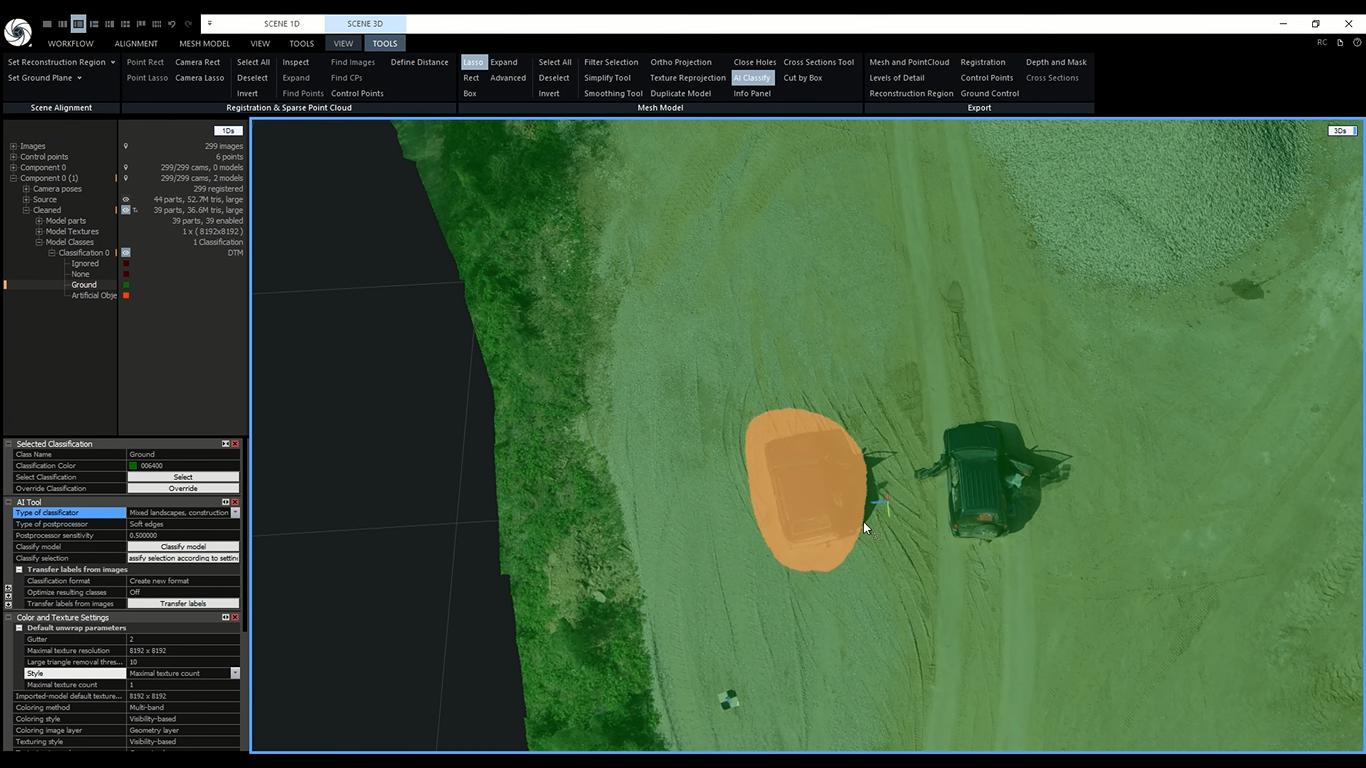
The post-processing process allows a dataset to be georeferenced and stitched together, to create accurate and detailed maps, and software programs like Pix4D, Agisoft Metashape, and DroneDeploy are commonly used for this purpose.
Now let’s head towards the new emerging drone mapping verticals in recent times.
Emerging Drone Mapping Verticals
Many verticals of business enterprises are moving into mapping. Drone mapping simply provides highly detailed data-based decisions. Navigating decision making has literally never been easier.
- Landscape Architecture
- HOAs and Metro Districts
- Parks and Recreational Departments for More Efficient Maintenance
- Event Planning, Event Management
- Emergency Management
- Zoning
- Civil Engineering
- Community and Regional Planning Departments
In the next section, we will discuss various drone mapping software and drone platforms that are currently popular in the market.
Types of Drone Mapping Software
Depending on the application, here are the three types of drone mapping software that are available in the market, and different processing methodologies.
- Photogrammetry Software
- LiDAR Mapping Software
- 3D Modeling Software
People often get confused with the technical terms used in drone mapping software. So let’s understand how the Photogrammetry, LiDAR Mapping, and 3D modeling software are different from one another.
Photogrammetry Software
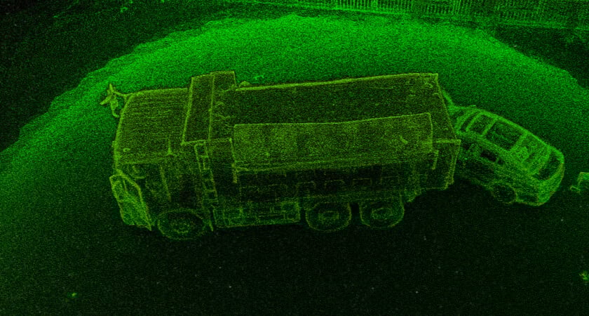
 Photogrammetry Point Cloud | Source: GISGeography
Photogrammetry software uses images captured by a drone to create 2D and 3D maps, models, and orthomosaics. Photogrammetry software creates realistic 3D depictions of topographic surfaces by merging geotagged images of the same features from multiple perspectives.
Photogrammetry software can be used for a range of applications, including point cloud construction, slope analysis, site indexing, and classification, taking linear measurements, taking volumetric measurements in a variety of industries like…agriculture, construction, and engineering.
LiDAR Mapping Software
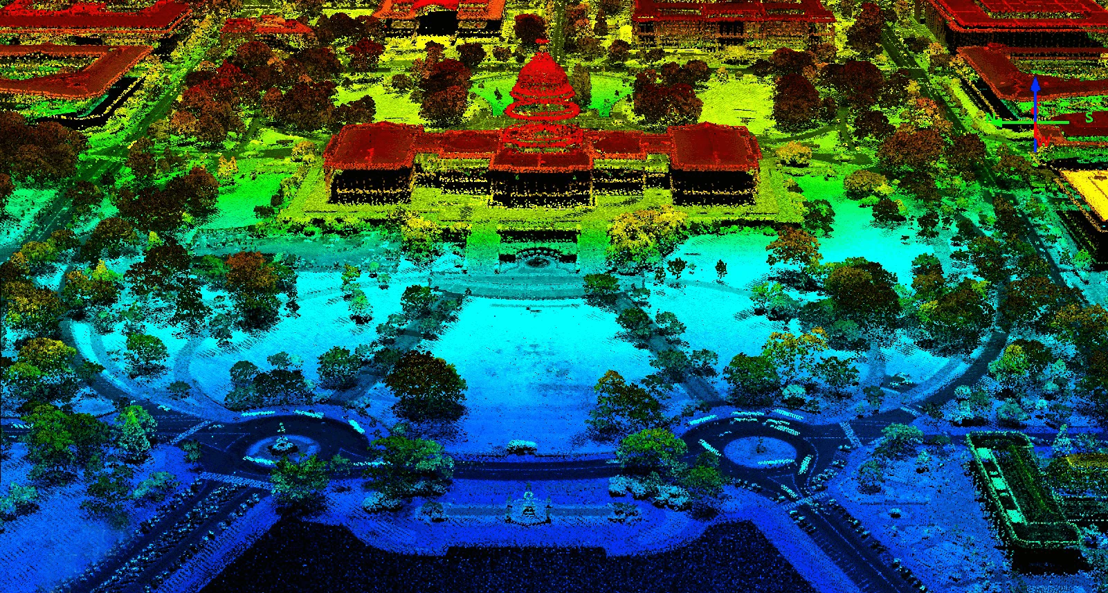 Capitol Building LiDAR | Source: GISGeography
LiDAR (Light Detection and Ranging) mapping software uses laser scanning technology to collect 3D data and generate detailed maps and models. LiDAR mapping software is typically used for more complex applications, such as large-scale mapping and engineering, as it provides high-resolution data and precise measurements.
3D Modeling Software
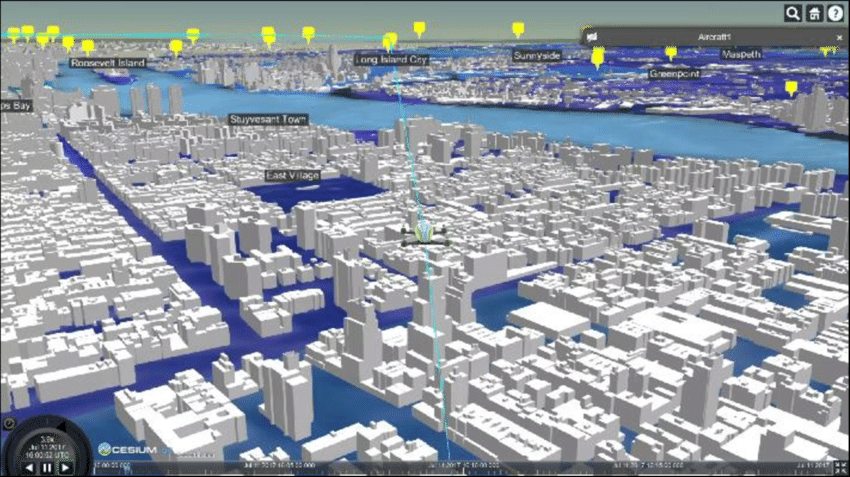 3D Model of New York City in Drone View | Source: ResearchGate | Note: Not a life like 3d model
3D modeling software is used to create 3D models of objects and environments, using data collected from a drone or other sources. 3D modeling software can be used for a variety of applications, including architecture, engineering, and construction, historical preservation, industrial design, and marketing.
Typically the best life-like 3D modeling software:
- Capture Reality
- Bentley [Or Optelos, which uses the Bentley engine]
- Pix4D (Lowest quality)
How To Pick The Right Drone Mapping Software?
To make it simpler for you and to help you choose the right software, here are three types of mapping software you need to know
- Acquisition Software
- Processing Software
- Cloud-based or All-in-one Software
Let me give you a quick overview of each of these software categories.
Acquisition Software
 Drone Aerial Shot
Acquisition Mapping Software helps drone pilots plan missions to fly highly-overlapping flight paths to acquire imagery. The acquisition software controls the drone to fly autonomous missions.
A few examples of acquisition software are
- DJI Pilot 2: Used for All DJI Enterprise Drones
- Maps Made Easy: A web application
- Pix4D Capture: Can be installed on a computer
- UCGS: Desktop-based image/video stitching software
Processing Software
 Point Cloud – Collision Reconstruction | Source: DJI
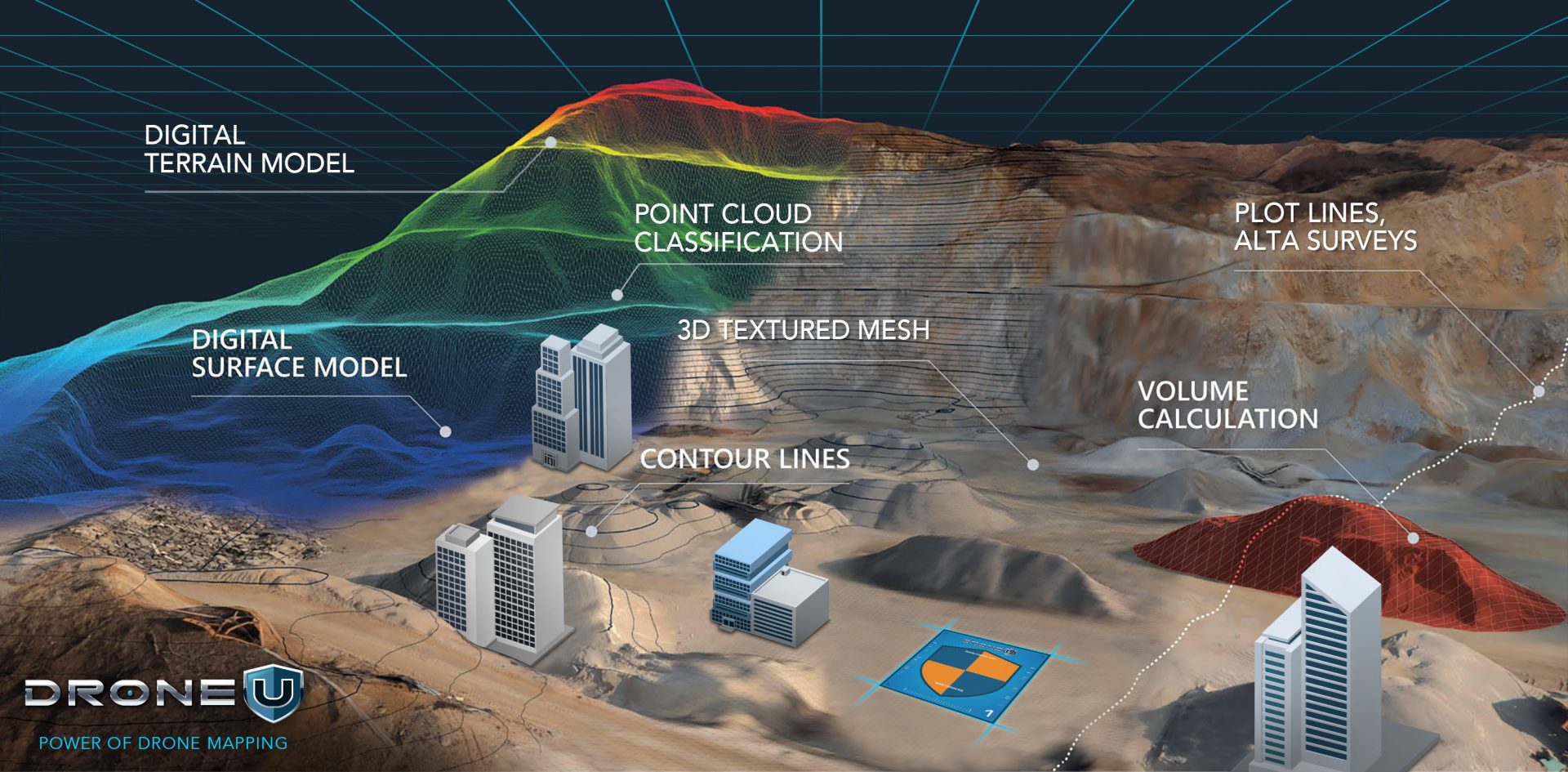
This software typically takes your imagery or data and creates a point cloud, which then other deliverables are created off of the point cloud. Eg. Digital Surface Model.
Desktop-based software requires a powerful computer but offers drone pilots the most options in customizing their data or customizing the process of their data.
With processing software, pilots have the most options for deliverables. Eg. Pix4d Mapper, Bentley, Metashape.
The processing software typically runs on a desktop PC or laptop and is compatible with any Windows-based computer.
It allows for the stitching together of numerous data points, resulting in the creation of a point cloud. This point cloud can then be transformed into a variety of deliverables such as a Digital Surface Model, digital terrain model, topographic map, 3D textured mesh, and other types of outputs.
With these processing capabilities, drone pilots have greater flexibility in handling their data. You can easily fix issues with the data and produce a variety of deliverables.
All-in-One Cloud-based Software
Cloud-based or all-in-one software, such as DroneDeploy, enables users to acquire and upload imagery to the cloud for processing. Typically this is cloud-based software that helps pilots plan missions, fly them, and autonomously upload the data to a cloud processor. Pilots then simply look up the results of this data on an internet browser later.
That being said – DroneDeploy may not be suitable for all missions.
DroneDeploy works well when there is a stable cellular connection, but it is not ideal for complex environments or 3D modeling.
Additionally, if you want full control over their data, DroneDeploy may not be the best option.
In the next section of this guide, we will take a closer look at each type of drone mapping software and provide recommendations on the best choice for your projects.
Don’t miss out on our exclusive video showcasing the best free software for drone mapping practice!
Comparison of Different Types of Drone Mapping Software Available in the Market
When comparing drone mapping software, you need to consider several factors such as accuracy, ease of use, cost, and compatibility with your drone and other hardware.
Here is a comparison of different types of drone mapping software based on the purpose:
Pix4DMapper
 Source: Pix4D
If you are a drone pilot looking for the best software to create a myriad of deliverables then Pix4DMapper is an excellent choice. It offers the most flexibility in creating deliverables such as orthomosaics, point clouds, DSMs, DTMs, Topographic maps, 3D textured mesh, video animations, and video game environments.
Pix4D Mapper allows you to have full control over their data, enabling you to create marketing videos, construction plans, and 3D textured mesh models.
Overall, Pix4DMapper is the best desktop processing software, offering you the greatest value for your investment and flexibility in producing diverse deliverables.
Pix 4D React
Orthomosaics is a critical deliverable in many drone applications, from disaster assessment and public safety to construction and engineering. In fact, it is one of the top three deliverables in these industries.
When it comes to generating rapid orthomosaics without reliable internet access, the most efficient solution is Pix4D React. This software excels as the fastest orthomosaic generator and methodology for creating geo-referenced outputs.
However, it is important to note that Pix4D React does not allow for actual geo-referencing of the orthomosaic.
If you are flying a Wingtra drone, the fixed-wing vertical takeoff and landing drone, you can pre-georeference the photos and then use Pix4D React to produce the quickest, most scalable orthomosaic that is both geo-rectified and geo-referenced.
Alternatively, if you have a reliable internet connection, you can upload your photos from your drone directly to the cloud and use DroneDeploy, which has the fastest orthomosaic generator in the cloud, but without the ability to perform geo-referencing.
Pro Tips:
- If your goal is to generate the fastest geo-referenced orthomosaic, then you must have a Wingtra drone and use Pix4D React.
- Most search-and-rescue outfits use React to check their photo collection to ensure they flew the entire search area. Doesn’t require internet, so works in most desolate places like hiking trails.
- Due to the cost of software going up, many construction companies have been using Pix4D react to create “Rapid Orthos,” within a few minutes of completing the flight.
Drone U’s Rapid Orthomosaic class is probably one of the shortest and most valuable classes we offer.
DroneDeploy
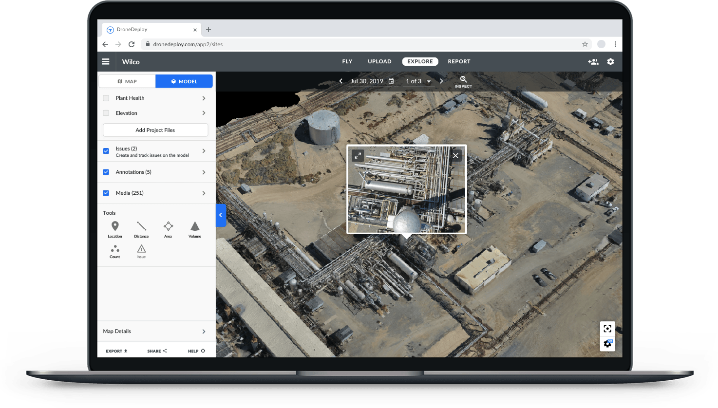 DroneDeploy Mapping Software | Source: DroneDeploy
DroneDeploy is a cloud-based mapping software that allows you to upload photos directly from your drone to generate orthomosaic without geo-referencing. The software is well known for its excellent mapping engine for volumetric measurements.
However, DroneDeploy has its limitations. Let us look at the limitations of DroneDeploy:
- It is not suitable for creating complex 3D models or environments that require multiple flight plans.
- The platform lacks the ability to merge data from different flight plans, such as when one subject is shot with orbits and another with a double grid.
- There is no MTP construction or aligning of the data.
- DroneDeploy does not offer high-level organization, and users do not own their data.
- Furthermore, the volumetric measurements on the platform are based on the digital surface model rather than the point cloud.
- Absolute accuracy is EXTREMELY limited on this software, the rules of map quality do not change, in order to accurately geo-reference drone data, pilots must be able to zoom all the way into pixel level on photos to mark GCPs. Without that functionality, map accuracy is extremely limited. In layman’s terms, would you look at a tape measure from 20 feet away to discern the length of a wall? No… you would be up close looking at the exact measurement.
Despite its limitations, DroneDeploy remains an excellent mapping software for beginners and those looking to perform volumetric measurements.
Reality Capture vs Context Capture
When it comes to creating 3D models, Reality Capture is the best software in our opinion.
However, the user interface can be a little clunky and the point cloud construction isn’t great.
 Reality Capture Interface | Source: YouTube
On the other hand, Context Capture by Bentley is the absolute best 3D model generator on the planet, but it’s also extremely expensive. That’s why we use Optelos, which utilizes the Context Capture engine at a lower price point.
With Optelos, we can access the amazing 3D modeling capabilities of Context Capture for about half or even a third of the normal price of normal Bentley context capture.
Pro Tip: While Reality Capture is a great 3D modeling tool, there have been times when I’ve taken a point cloud generated in Pix4D mapper and merged it over to Reality Capture to create a 3D model.
Optelos
 Source: Optelos
One significant development in the mapping industry is the shift from mere mapping and comprehending data to macro-level data organization.
And Optelos is leading the way.
This involves consolidating different data points such as 360 images, 360 Panos from the sky, and interior 3D models onto a single point cloud or 2D map. By doing so, it becomes possible to layer and integrate these diverse assets in a more cohesive and meaningful way.
Based on our experience, the absolute best executive-level mapping management software available today is Optelos.
Optelos also offers a unique feature that most of the other mapping software does not have, which is the “ortho compare feature.”
 Optelo’s Ortho Compare Feature | Source: Getapp
This feature is particularly valuable in the construction industry, where orthomosaics are frequently used, to create high-level time maps of a construction site.
With the ortho compare feature, multiple orthomosaics can be overlaid on top of each other, and by swiping through the Orthomosaic, you can see the changes and deviations on the site over time. This can be done as long as you have datasets from week to week.
Overall, the ortho-compare feature can provide significant insights into the progress of a construction project and help identify potential issues early on.
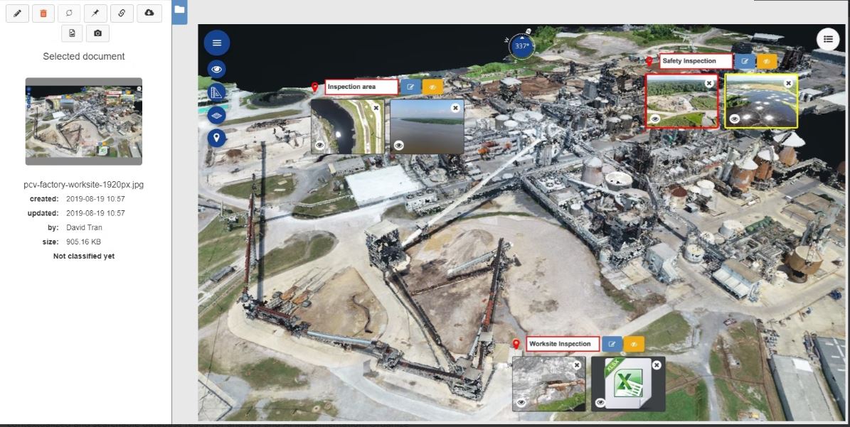
Propeller Aero
 Source: Propeller Aero
Propeller Aero is a drone mapping software that offers Arrow Points, which is a simple and easy method for geo-referencing your data. Their processing software is probably the best for “cut and fill” efficiency calculation.
What does that mean?
Well, imagine you’re on a construction site and you need to move dirt from one area to another to level the ground. Propeller Aero’s software is the only mapping software that will measure the time it took and how much dirt was moved from one position to another.
It can help you determine if the job was done efficiently or if too much dirt was cut from one area and filled into another, which could cause problems down the line.
This information is crucial for construction sites because it can help identify and resolve potential issues early on.
Pro Tip: Propeller’s processing system is the best for Quarries and Large scale construction companies. The efficiency analysis from Propeller is top-notch, contractors can measure the efficiency of earthworks better than any other software. Imagine cut-and-fill volumetric measurements over time.
Best Drone Mapping Software: Our Top Picks
It is easy to feel overwhelmed with these mapping softwares, each offering different features and capabilities.
To help make things easier, we’ve put together a summary of the top picks for drone mapping software based on specific features.
| Feature | Our Recommendation |
| Cost-effective Mapping Software | Pix 4D Mapper |
| Orthomosaic Mapping Software (Without Internet) | Pix 4D React |
| Orthomosaic Mapping Software (With Internet) | DroneDeploy |
| Volumetric Measurement Software | DroneDeploy |
| 3D Mapping Software (Affordable) | Optelos |
| 3D Modeling Construction (Advance Features) | Capture Reality |
| Best Drone Software for Construction | Optelos/Propeller Aero |
Pro Tip: Pix4d Mapper offers drone pilots the ability to create any deliverable, change the processing parameters, and turn “crap” data into good data. Pilots can’t do that with cloud-based software.
Reporting functionality sucks on Pix4D, which is why we offer our “deliverables,” course with the Mapping Bootcamp and Online Mapping Class.
Between Optelos and Propeller Aero, I prefer Optelos for its next-level asset organization. DroneDeploy has done this too.
DroneDeploy has also stepped up its game with its recent acquisition of StructionSite, which can create a single data product by overlaying interior and exterior 3D models.
However, you can achieve this at a more affordable cost and better quality with “Kuula“, a processing software.
Ultimately, choosing the best drone mapping software depends on these two factors:
- Specific deliverable you want to create, the problem you want to solve with your drone.
- How you will interpret the data and make decisions.
Now that you have a better understanding of what to consider when choosing drone mapping software, it’s time to look at the best drones that can help you capture the data you need to create accurate and detailed maps.
Best Drones For Mapping
 DJI Phantom 4 Pro | Source: Unsplash
So far we have discussed drone mapping software and now it’s time to find out the best drones for mapping. After all, this is THE most critical element of the equation.
When it comes to choosing the best drone for mapping, two drones come to my mind – The DJI Mavic 3 Enterprise and the Phantom 4 Pro.
Let’s compare these two platforms and find out which one is better for your specific needs.
DJI Mavic 3 vs Phantom 4 Pro
The Phantom 4 Pro drone is the most valuable DJI mapping drone ever made, and for good reason. It has doubled in price due to its impressive features, including the ability to shoot 4K videos and RAW photos.
Its open Software Development Kit (SDK) allows for the use of about three dozen different applications for mapping. The Phantom 4 Pro remains a powerhouse in the mapping industry. However, it can only be purchased refurbished. The Phantom 4 Pro is still more affordable than the Mavic three enterprise and is definitely worth the investment.
 DJI Mavic 3 Enterprise | Source: Drone U
The most up-to-date DJI mapping drone currently available is the Mavic 3 enterprise, but it has one major downside: it doesn’t have the same video quality as other Mavic models such as the Mavic 3 Cine, the Mavic 3 Classic, or the regular Mavic 3. These models offer 4K video and RAW photo capabilities. They all have these features that the Mavic 3 doesn’t have.
It seems that DJI is encouraging drone pilots to consider the Mavic 3 enterprise for autonomous missions. This drone offers unique features that are not available in other models of Mavic 3 drones such as the Mavic 3 classic.
This means that you have to spend triple the amount of money that the Phantom 4 Pro costs just to get all the features that the Phantom 4 Pro can offer. That’s why it still remains such a valuable drone.
However, it would be great if DJI could incorporate these features into other models to provide a wider range of options for drone pilots.
The question remains, which mapping drone should you buy?
Which Mapping Drone Should You Buy?
If you’re looking for a great mapping drone for under $5,000 and buying DJI is an option, the Mavic 3 Enterprise is a solid choice, although it has limited capability with only DJI Pilot 2 and a few other available apps.
However, if you want to capture beautiful videos, perform mapping missions, and take raw photos, the Phantom 4 Pro drone is the best mapping drone. If you can’t find one, Mavic 3 Enterprise.
Best Non-Chinese Drone For 3D Mapping: Parrot Anafi Ai
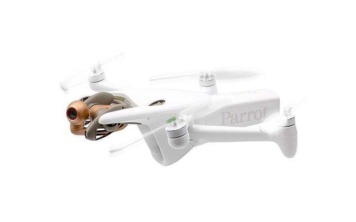 Parrot Anafi Ai | Source: Parrot
If you need a mapping drone that is not Chinese or from DJI, Parrot Anafi Ai is the best drone for mapping. It has Pix4D Capture acquisition software built right into the drone.
Additionally, it is NDA approved for flying in American airspace, making it a great option for those who require an approved drone for their work.
Techniques for Effective Drone Mapping
 Mapping Training by DroneU
Here are a few techniques and best practices to keep in mind:
Proper Planning
Effective drone mapping starts with proper planning. This includes determining the size and scope of the area to be mapped, selecting the right drone and hardware for the job, and determining the data that needs to be collected. You also need to consider weather conditions and any safety and regulatory requirements.
Camera Settings
The quality of your drone mapping data is heavily dependent on the quality of the images captured by your drone. It’s important to understand the camera settings and how to optimize them for your specific mapping needs. This includes selecting the right resolution, image format, and camera position.
Flight Planning
Effective drone mapping requires precise flight planning. This includes determining the optimal flight altitude and overlap, as well as the flight path and pattern. It’s important to consider the specific requirements of your mapping software, as well as the size and complexity of the area to be mapped.
Data Processing
Drone mapping data is typically processed using photogrammetry or LiDAR mapping software. It is important to understand the data processing workflow and how to optimize it for your specific mapping needs. This includes selecting the right algorithms, adjusting processing settings, and performing quality checks.
Quality Control
Effective drone mapping requires quality control checks to ensure the accuracy and reliability of the data. This includes checking the quality of the images captured by the drone, verifying the accuracy of the map or model, and ensuring that any errors or discrepancies are corrected.
The Future of Drone Mapping
The future of drone mapping looks promising.
Allied Market Research projects that the construction drone market will hit $11.96 billion by 2027.
Let us look at a few trends and developments in the drone mapping industry worth keeping an eye on.
Greater Accessibility
Drone mapping technology is becoming more accessible, with lower costs, easier-to-use software, and smaller, more portable drones. This will enable more people and organizations to use drone mapping technology and benefit from it.
Integration with Other Technologies
Drone mapping technology is likely to become increasingly integrated with other technologies, such as artificial intelligence, machine learning, and the Internet of Things (IoT). This will enable new and more advanced applications of drone mapping, such as real-time monitoring, predictive analytics, and autonomous flight.
Increased Regulation
As drone usage continues to increase, authorities are likely to regulate it more strictly, especially regarding data privacy. It’s important to stay informed about the latest regulations and best practices for drone usage, especially for commercial and industrial applications. You can learn more about drone regulations in this article.
New Applications
As technology evolves and improves, new and innovative applications of drone mapping technology are likely to emerge. This includes everything from environmental monitoring to construction planning, and from search and rescue operations to autonomous flight.
Emergency Response Enhanced by Improved Technology
As the quality of media produced by drone cameras improves, emergency response teams can use them to locate and identify victims more quickly. This increased efficiency has the potential to improve the survival rate of victims. Moreover, drones enable response teams to survey the aftermath of a natural disaster, directing disaster relief and aid effectively to the most vulnerable areas affected.
Construction
Professionals in the construction industry can greatly benefit from the use of drones equipped with imaging technology.
The speed and efficiency with which drones can cover large areas, combined with the ability to produce 3D images, can provide valuable data at the start of a project and help monitor progress throughout the construction process.
This information can lead to the creation of safer and more structurally sound buildings, raise the probability of meeting critical deadlines, and achieve budgetary goals.
Conclusion
Experts predict that the global surveying and mapping services market will experience a compound annual growth rate of 3.4% and reach a value of US$13 billion by 2032. Read the full report here.
The future of drone mapping is exciting, and it will be interesting to see how the technology continues to evolve and impact a wide range of industries and applications.
Do you have questions about drone mapping or need some guidance?
Drop your comment below to start the conversation.
Enhance your 3D drone mapping skills with this essential video!
Watch the video now and discover the secrets to achieving exceptional 3D drone maps!
Further Reading
- How Drones are Future-proofing the Construction Industry
- First Responders Assess Drones for Search and Rescue Missions

Trouble with the FAA | The True Enforcement Rate for Drone Pilots
How often do drone pilots actually get in trouble with the Federal Aviation Administration (FAA)? Surprisingly, the answer points to a remarkably low enforcement rate for drone pilots. Continue reading
Best Drone Kits and Gimbal for Travel Vloggers
In the age of smartphones and drones, you can capture stunning travel footage and make your trip a lot more exciting. The good news is – you don’t have to carry a bulky arsenal of gear to create cinematic slides, smooth Steadicam shots, and breathtaking aerial videos.
With just two critical pieces of equipment, you can transform your travel filmmaking, all while minimizing weight and maximizing convenience.
In this article, we’ll reveal the perfect drone kit for you. So you can tell an awe-inspiring story with utmost safety and efficiency.
While the Mavic 2 Pro drone was once the go-to choice for 4K video and panoramic shots, today’s drone pilots can use a single case.
The ideal travel drone film kit should effortlessly fit your hiking backpack with your go-to adventure items. That is why we have broken down the best travel drone kit into two essential things with a few backups.
Let’s get started.
Best Travel Drone Kits and Gimbal
A good travel film kit provides the utmost shooting flexibility and ensures that you get the most bang for your buck. Every piece of equipment included in the kit is designed to accompany you on long hikes, catering to travel vloggers and bloggers seeking accessories to turn their adventures into social media gold.
The travel drone kit already takes advantage of the fantastic cameras you already have on your iPhone, Sony, or Google Phone. We are just minimizing the gear because everyone watches their media on the phone anyway.
Now, let’s explore the top DJI drone kit options:
1. DJI Mavic 3 Pro: High-End Option
This drone offers the best image quality of any consumer drone, with a Hasselblad camera that shoots stunning 5.4K video and 20MP photos. It also has a 46-minute flight time, omnidirectional obstacle avoidance, and a built-in gimbal for smooth footage. However, its Fly More Combo with DJI RC costs you around USD 2,999.
2. DJI Mini 3 Pro: Your Aerial Storytelling Companion
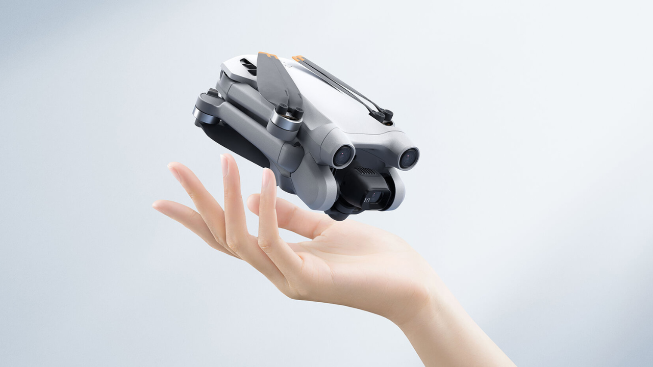
This compact drone is a game-changer for aerial videography. Its 3-axis gimbal stabilizes the camera, producing stunningly smooth footage from the sky. Intelligent flight modes like ActiveTrack and QuickShots let you capture cinematic shots with just a tap.
This pocket-sized drone packs a powerful punch. Weighing under 249 grams, it falls under the FAA’s “drone under 250 grams” category, meaning you can fly freely in most places without a license. The Mini 3 Pro captures stunning 4K video and breathtaking panoramic shots, taking your travel videos to new heights. Its compact size and foldable design make it perfect for slipping into your backpack and taking on any adventure.
The DJI Mini 3 Pro with RC-N1 drone kit costs you around USD 759.
3. DJI Air 2S: Budget-Friendly Option
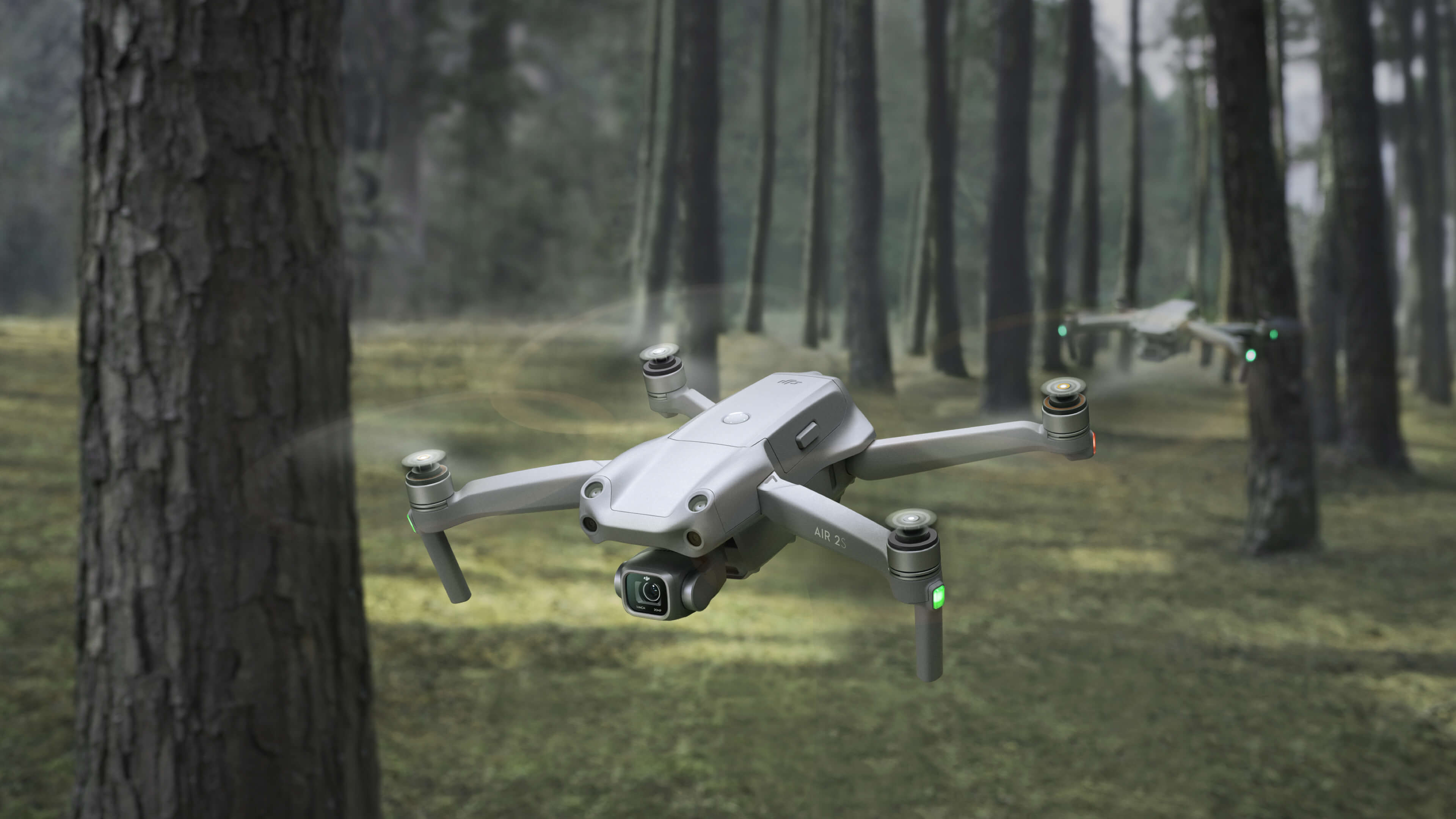
This drone has a good balance of price and performance, with a 5.4K camera, a 34-minute flight time, and obstacle avoidance. It’s also relatively compact and easy to transport. However, it doesn’t have the same image quality as the Mavic 3 Pro or Mini 3 Pro, and the gimbal isn’t quite as good. The Air 2S Fly More combo costs around USD 1,039.
4. DJI Osmo Mobile 6 Gimbal
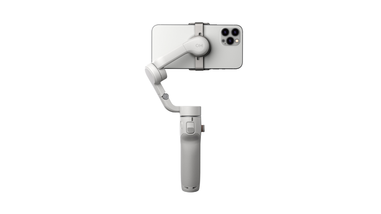 Credit: DJI
The Osmo Mobile 6 is a lightweight, handheld gimbal that transforms your smartphone into a professional-grade filmmaking tool. Its 3-axis stabilization smoothes out bumps and shakes, ensuring consistently clear and crisp footage, even when you’re on the move.
This handheld gimbal stabilizer is a game-changer for mobile filmmakers. It transforms your smartphone into a professional vlogging camera, eliminating shaky footage and delivering buttery-smooth cinematic shots. Whether you’re capturing cityscapes, nature walks, or spontaneous adventures, the Osmo Mobile 6 ensures you get high-quality footage that wows your viewers.
Now, transition to the next section to discover the essential accessories for your drone.
Best Drone Kit’s Accessories for Travel Vloggers
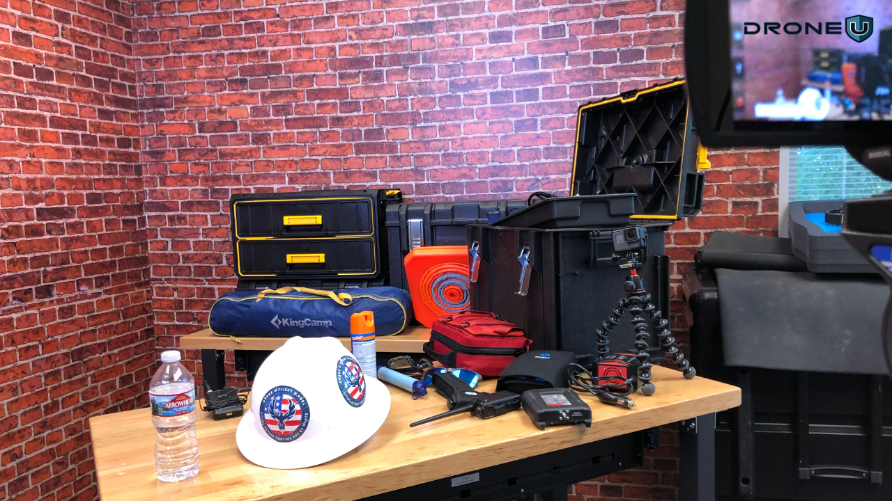
Traveling with your drone opens up breathtaking aerial photography and videography possibilities. But packing the right accessories is crucial to capturing the magic and ensuring a smooth journey.
Here’s a rundown of must-have items for drone travel:
Extra Batteries (3-5)
Your drone’s battery life is like liquid gold, especially during travel. Packaging at least 3-5 extra batteries is advisable to ensure prolonged aerial adventures. Considering external factors such as windy conditions and complex maneuvers is essential, as they can significantly impact battery consumption.
High-Endurance SD Cards (2x 128GB+)
To capture hours of breathtaking footage in great detail, invest in high-capacity, high-speed SD cards. Opt for at least two 128GB cards, allowing ample storage for extended flights. Additionally, carrying a card reader facilitates easy footage transfer to your devices.
Landing Pad
A portable landing pad is your drone’s best friend, protecting take-offs and landings on unpredictable terrain. Choose a lightweight, foldable pad that can be easily carried and deployed anywhere, providing a stable surface for take-offs and landings.
Spare Props
Drone props are vulnerable to damage, and it’s wise to pack 2-3 extra pairs. This precaution ensures a broken blade mid-flight never grounds you. Consider the specific demands of different environments and pack accordingly.
ND Filters
Neutral Density (ND) filters are essential for overcoming bright and harsh lighting conditions. These filters reduce the amount of light entering the camera sensor, resulting in smoother footage and capturing details often lost in overexposed shots.
Polarizing Filters
Elevate your footage quality with polarizing filters, which reduce glare and reflections. This versatile tool enhances the appearance of water, deepens skies, and brings out vibrant colors in foliage, providing a professional touch to your aerial photography.
UV Filters
Protect your drone’s camera lens from scratches, dust, and fingerprints with a UV filter. Beyond its protective function, it is also a primary shield against stray sunlight, ensuring optimal image quality in various shooting conditions.
Compact Carrying Case
A sturdy, well-padded carrying case is crucial for safeguarding your drone and accessories during travels. Opt for a lightweight option with compartments to keep everything organized and easily accessible, minimizing the risk of damage.
Gimbal
Elevate your footage to cinematic levels with a 3-axis gimbal. This motorized mount stabilizes your camera, eliminating shakes and jitters, resulting in smooth and professional-looking video content.
Remote Controller with Built-in Screen
Enhance your piloting experience with a remote controller featuring an integrated screen. It allows you to view your live feed, adjust settings, and monitor your flight path in real-time without relying on a separate smartphone.
Drone Insurance
Prioritize peace of mind by securing drone insurance. This coverage protects your investment against accidental damage, loss, or theft, ensuring worry-free aerial adventures and safeguarding your financial investment in the equipment.
The following section discusses some tips that can save time and help you make informed decisions about drone filming.
Additional Tips For Drone Vloggers
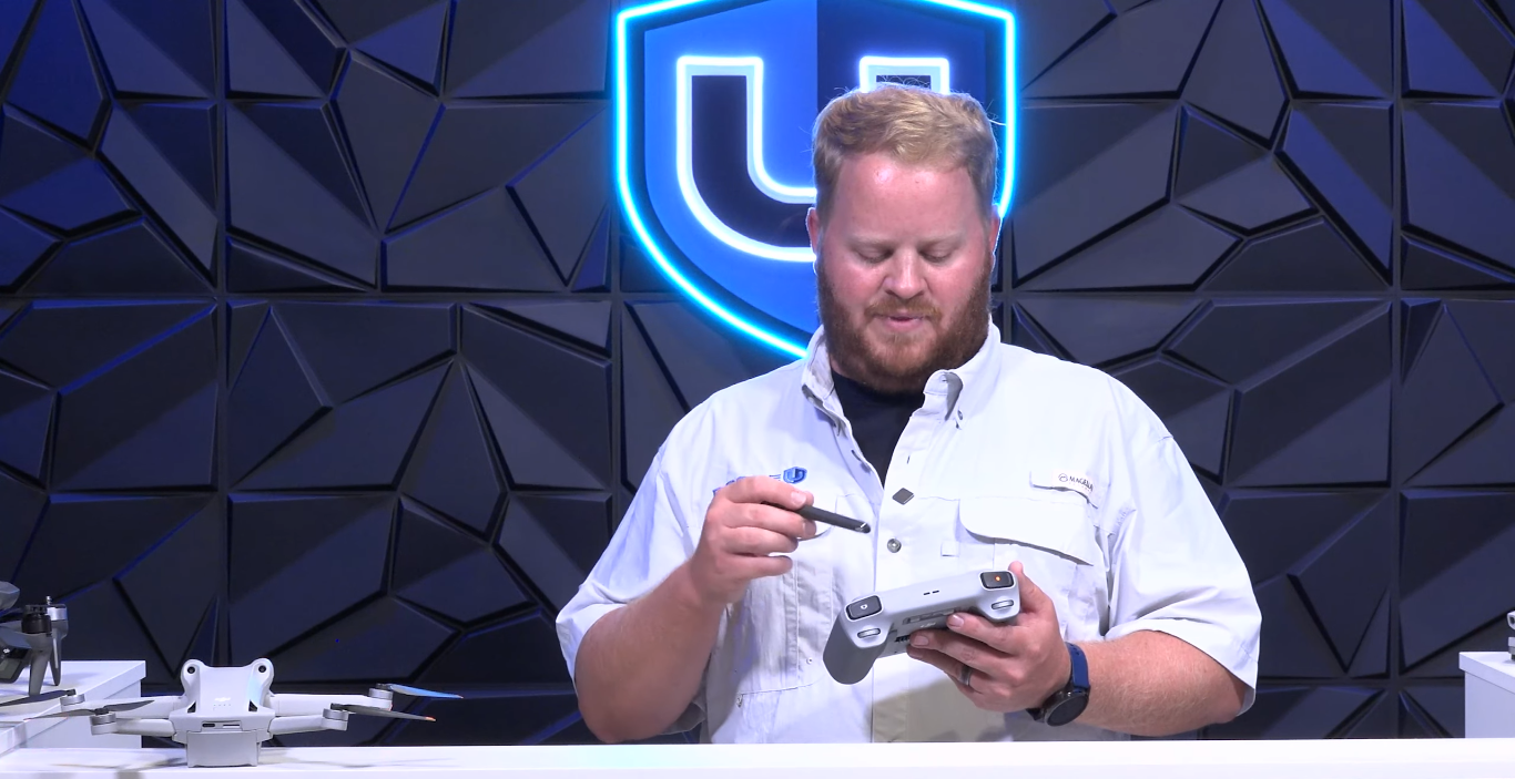
Here are some additional tips for travel drone vloggers:
1. Research Drone Regulations
Drone laws vary widely from country to country, so be sure to research the specific regulations of your destination before you travel. You may need to obtain a permit or license to fly your drone.
2. Fly Safely
Always be aware of your surroundings and fly in open areas away from people, buildings, and other obstacles. Never fly in inclement weather or near airports.
3. Respect Privacy
Be mindful of people’s privacy when flying your drone. Don’t fly over private property or film people without their permission.
4. Be a Good Ambassador for Drone Pilots
Your actions reflect on the entire drone community. Be responsible and respectful when flying your drone.
5. Use Different Camera Angles
Don’t just shoot everything from straight overhead. Try using different camera angles and movements to add interest to your footage.
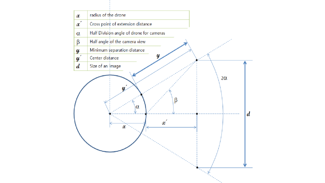 Credit: ResearchGate
We’ve given you the best drone and gimbal suggestions, along with essential accessories and some tips, so you’ll be well-equipped to capture stunning aerial footage, navigate any terrain, and ensure a safe and enjoyable drone travel experience.
Remember, this is just a starting point. Tailor your list based on your specific drone model, destination, and shooting style.
Happy Flying!

DJI Mini 3 Vs. Mini 3 Pro: Which Drone Is Better?
The drone industry is experiencing a stratospheric rise. And it isn’t limited to capturing breathtaking aerial photos or videos. Drones are revolutionizing entire industries – ranging from agricultural and surveying to public safety and grocery delivery.
From longer flight times to crystal-clear cameras and autonomous flight, drone technology has also seen a remarkable evolution. Talking about innovation in drone tech, the DJI Mini 3 has recently garnered a lot of attention from the drone world.
The two variants, DJI Mini 3 and Min 3 Pro stand out in terms of versatility, flight time, and ease of use.
Hence, the Drone U team decided to take a closer look at these two models to see how they stack up against each other.
In this article, we dive into comparing these two highly capable drones – DJI Mini 3 vs. Mini 3 Pro. Hopefully, it will help you choose a bird that’s more suitable to your specific needs and use cases.
First, let’s take a look at the performance criteria we took into consideration when comparing these birds.
The Criteria We Choose to Compare DJI Mini 3 vs. Mini 3 Pro
Here are the criteria we took into consideration when comparing these two models:
- Purpose: Understanding the intended use of the drone’s capabilities ensures you’re on the path to success.
- Skill Level and Experience: Consider your pilot’s license. Novices may lean towards user-friendly models with intuitive controls and helpful flight modes, while trained drone pilots look for advanced features.
- Portability: Consider the drone’s size and weight, especially if you’re a frequent traveler or regularly change your flight locations.
- Camera and Imaging Requirements: Professional drone photographers pursuing high-resolution masterpieces may prefer powerful lenses and intricate settings, while casual drone enthusiasts might find simpler setups entirely satisfactory.
- Battery Life and Flight Time: It’s essential to grasp the drone’s battery life and flight time to plan your aerial adventures effectively.
- Legal and Regulatory Compliance: Familiarize yourself with local regulations, weight limits, registration requirements, and no-fly zones to avoid unwanted turbulence.
DJI Mini 3 vs. Mini 3 Pro Comparison
This section compares the design and build, flight performance, remote controller, battery, pricing, and packaging of both drones.
Let’s start with the design and build.
1. DJI Mini 3 vs. Mini 3 Pro – Design and Build
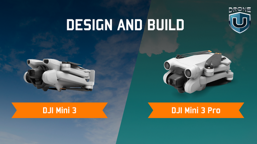
| Specification | DJI Mini 3 | DJI Mini 3 Pro |
| Dimensions (L x W x H) | Folded: 148 x 90 x 62 mm;
Unfolded (with propellers): 251 x 362 x 72 mm |
Folded: 145 x 90 x 62 mm;
Unfolded (with propellers): 251 x 362 x 70 mm |
| Weight | 248g | Less than 249g |
The DJI Mini 3 and Mini 3 Pro, much like their predecessors, are renowned for their compact and lightweight designs.
While both models share the signature compact and lightweight design of the Mini series, there are subtle differences in dimensions and weight. It’s crucial to consider these factors based on individual preferences and specific use cases.
The Mini 3 places a premium on minimalist weight and portability. Its sleek design and lighter materials make it exceptionally travel-friendly and easy to deploy, making it an ideal choice for casual flight enthusiasts and photographers searching for a highly portable aerial platform.
Conversely, the Mini 3 Pro boasts a sturdier and more refined construction. Enhanced materials contribute to increased durability and improved wind resistance, making it suitable for more challenging flight conditions and professional applications. However, this comes at the cost of a slightly heavier frame than the Mini 3.
2. DJI Mini 3 vs. Mini 3 Pro – Camera Capabilities
 Credit: DJI
| Specification | DJI Mini 3 | DJI Mini 3 Pro |
| Sensor | 1/1.3-inch CMOS
Effective Pixels: 12 MP |
1/1.3-inch CMOS
Effective Pixels: 48 MP |
| Shutter Speed | Electronic Shutter: 2-1/8000 s | Electronic Shutter: 2-1/8000 s |
| ISO Range | Video: 100-3200
Photo: 100-3200 |
Video: 100-6400 (Auto), 100-6400 (Manual)
Photo: 100-6400 (Auto), 100-6400 (Manual) |
| Max Image Size | 4000 x 3000 | 4:3: 8064 x 6048 (48 MP), 4032 x 3024 (12 MP)
16:9: 4032 x 2268 (12 MP) |
| Photo Format | JPEG/DNG (RAW | JPEG/DNG (RAW |
| Video Format | MP4 (H.264) | MP4/MOV (H.264/H.265) |
| Max Video Bitrate | 100 Mbps | 150 Mbps |
| Image Quality | 4K/30fps HDR | 4K/30fps HDR
4K/60fps |
| Live View Quality | 720p/30fps | 1080p/30fps |
| Still Photography Modes | Single Shot: 12 MP
Timed: 12 MP Panorama: Sphere, 180°, Wide Angle |
Single Shot: 12 MP
Burst Shooting: 12 MP, 3/5/7 frames Timed: 12 MP Panorama: Sphere, 180°, Wide Angle, Vertical |
Resolution and image quality are paramount for drone pilots who prioritize capturing stunning visuals and crisp details in their aerial shots.
Considering these factors might help you in making the right decision.
| Features | Mini 3 | Mini 3 Pro |
| Sensor Resolution | 1/2.3-inch CMOS sensor with 12 megapixels. It is a respectable resolution for everyday use, but you might need help with detail in complex scenes or zooming. | 1/1.3-inch CMOS sensor with 48 megapixels. This significantly larger sensor and higher resolution capture superior detail, allowing for zooming and cropping without significant sharpness loss. |
| Video Recording | 4K and 1080p recording at 25/30/50 fps with a bitrate of 100 Mbps. Suitable for general videography but lacks options for high-bitrate or slow-motion capture. | Shoots stunning 4K at 60 fps and 1080p at 240 fps with a bitrate of 150 Mbps. It opens up options for smooth slow-motion and cinematic capture. |
| Low-light Performance | Maximum ISO of 6400. While decent for basic low-light situations, you might encounter noise and softness in heavily shaded areas or nighttime shots. | It has a much higher maximum ISO of 12800. It significantly improves low-light performance, allowing cleaner capture in challenging lighting conditions. |
Additional Features
- Mini 3: Lacks advanced shooting modes like QuickShots or MasterShots.
- Mini 3 Pro: Offers an array of intelligent shooting modes for creative and automated capture, including QuickShots, MasterShots, and FocusTrack.
3. DJI Mini 3 vs. Mini 3 Pro – Flight Performance
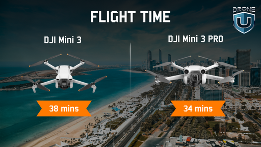
Flight range is crucial for drone pilots who wish to explore larger areas or capture footage from a distance.
While both the DJI Mini 3 and Mini 3 Pro promise extended aerial adventures, their flight performance takes slightly different routes:
| Specification | DJI Mini 3 | DJI Mini 3 Pro |
| Max Flight Time | 38 mins | 34 mins |
| Operating Temperature | -10°C to 40°C (14° to 104° F) | -10°C to 40°C (14° to 104° F) |
| Max Hovering Time | 33 mins | 30 mins |
| Max Speed (at sea level, no wind) | 16 m/s | 16 m/s (S Mode)
10 m/s (N Mode) 6 m/s (C Mode) |
| Max Wind Speed Resistance | 10.7 m/s (Level 5) | 10.7 m/s (Level 5) |
| Sensing System | Downward | Forward, Backward, &
Downward |
| Video Transmission (CE) | DJI O2 | DJI O3 |
| Latency | Approx. 200 ms | Approx. 120 ms |
These factors might help you in making an informed decision:
| Features |
Mini 3 |
Mini 3 Pro |
| Maximum Flight Time | Up to 38 minutes with the standard Intelligent Flight Battery. It is already quite impressive for a drone in its weight class and allows for capturing a good amount of footage on a single charge. | Slightly shorter flight time of 34 minutes with the standard Intelligent Flight Battery. However, the Mini 3 Pro has an advantage with the optional Intelligent Flight Battery Plus, which boosts its airtime to a whopping 47 minutes! |
| Speed and Maneuverability | It is slightly faster, with a maximum speed of 58 km/h, compared to the Mini 3 Pro’s 57 km/h. | It is more agile and responsive due to its upgraded propeller design and slightly higher weight. |
| Transmission Range | Utilizes the DJI O2 transmission system, offering a decent range of up to 6 km (4.3 mi) in ideal conditions. | Equipped with the upgraded DJI O3 transmission, it boasts a significantly extended range of up to 15 km (9.3 mi) for a more robust connection and worry-free flight experience. |
Wind Resistance
Both drones, The Mini 3 and Mini 3 Pro, boast a Level 5 wind resistance rating, meaning they can handle moderate wind speeds of up to 29-38 km/h. It makes them suitable for flying in most outdoor conditions.
The DJI Mini 3 takes the lead over the Mini 3 Pro regarding the base flight time, but the Mini 3 Pro offers an extended optional flight time and a longer transmission range. If you prioritize longer flights right out of the box, the Mini 3 might be better for you.
4. DJI RC vs. RC-N1: Remote Controller
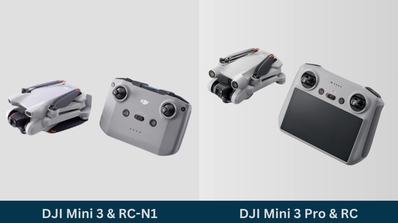
| Specification | DJI RC | RC-N1 |
| Built-in Screen | Yes | No |
| Screen Size | 5.5 inches | Supports devices up to 180mm (L) x 86mm (W) x 10mm (H).
& Compatible with tablet holder. |
| Weight | 390 g | 387 g |
| Battery Life | 4 hours | 6 hours |
| Antennas | 2 | 2 |
DJI is renowned for crafting intuitive and user-friendly controllers, and the controllers for the DJI Mini 3 and Mini 3 Pro are expected to uphold this reputation.
The range and connectivity features of the remote controller dictate how far and under what conditions the user can maintain control of the drone. Choosing a suitable remote controller can significantly impact your drone flying experience.
Both the DJI Mini 3 and Mini 3 Pro have two options: the dedicated DJI RC and the smartphone-based RC-N1.
Let’s delve into their key differences to help you choose the perfect pilot’s companion:
Built-in Screen vs. Mount
- DJI RC: This dedicated controller boasts a built-in 5.5-inch 1080p display, eliminating the need for a smartphone. It offers superior brightness and clarity, especially in direct sunlight, and provides a seamless, distraction-free flying experience.
- RC-N1: This budget-friendly option requires mounting your smartphone onto the remote. While offering some flexibility in screen size, it can be cumbersome and susceptible to glare in bright conditions. Additionally, battery drain on your phone can become an issue during longer flights.
Controls and Ergonomics
- DJI RC: Features dedicated physical buttons and joysticks, providing precise control and tactile feedback for a more immersive flying experience. It’s also lighter and more comfortable to hold for extended periods.
- RC-N1: Relies on touchscreen controls on your smartphone, which can be less responsive and require more attention. The added weight of the phone can also make it less ergonomic for longer flights.
Battery Life
- DJI RC: A long-lasting internal battery offers up to 4 hours of flight time on a single charge. It eliminates the need for additional batteries or cables for your phone.
- RC-N1: Drains your smartphone’s battery, so you must carry power banks or consider the battery life limitations when planning longer flights.
5. DJI Mini 3 vs. Mini 3 Pro – Battery and Charging
Charging time is crucial for drone pilots who want to minimize downtime between flights. And when it comes to the Mini 3 and Mini 3 Pro, there are subtle differences in battery charging that deserve a closer look:
| Specification | DJI Mini 3 | DJI Mini 3 Pro |
| Capacity | Intelligent Flight Battery: 2453 mAh | Intelligent Flight Battery: 2453 mAh |
| Weight | Intelligent Flight Battery: Approx. 80.5 g | Intelligent Flight Battery: Approx. 80.5 g |
| Nominal Voltage | 7.38 V | 7.38 V |
| Type | Li-ion | Li-ion |
| Charging Temperature | 5° to 40° C (41° to 104° F) | 5° to 40° C (41° to 104° F) |
| Charging Time | Approx. 64 minutes (with the DJI 30W USB-C Charger) | Approx. 64 minutes (with the DJI 30W USB-C Charger) |
Standard Battery Charging
DJI Mini 3: Charges its standard Intelligent Flight Battery in just 38 minutes using a 30W charger. It translates to a quick turnaround time between flights, allowing you to capture more footage or explore further without lengthy idle periods.
DJI Mini 3 Pro: It takes slightly longer, at 47 minutes, to charge its standard Intelligent Flight Battery with a 30W charger. While not a significant difference, it’s worth noting if maximizing efficiency is your top priority.
Intelligent Flight Battery Plus Charging
Both drones offer optional Intelligent Flight Battery Plus upgrades for extended flight times, but their charging times differ:
- Mini 3: It takes 52 minutes to charge the Plus battery with a 30W charger—this slightly longer charging time balances well with the extended flight time of the larger battery.
- Mini 3 Pro: It takes 65 minutes to charge the Plus battery with a 30W charger. The longer charging time reflects the significantly higher capacity of the Pro’s Plus battery.
Fast Charging Options
Watch this video to learn – how pilots can check their drone batteries to ensure a safe flight
- Mini 3: Supports fast charging with a 65W charger, reducing its standard battery charging time to just 25 minutes. It is a significant bonus for pilots who prioritize minimal downtime and rapid battery replenishment.
- Mini 3 Pro: Unfortunately, it lacks a dedicated fast-charging option and remains limited to 47 minutes with a 30W charger for its standard battery. However, some users report achieving slightly faster charging with higher-wattage chargers (although not officially supported by DJI).
6. DJI Mini 3 vs. Mini 3 Pro – Pricing and Packages
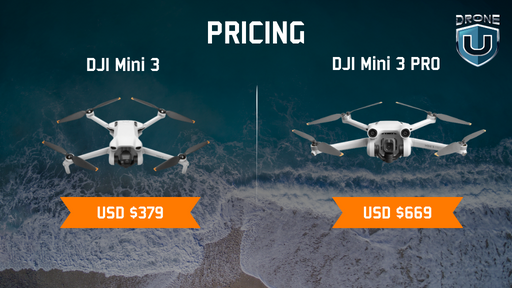
| Package | Cost (Dynamic) |
| DJI Mini 3 Pro with DJI RC-N1 | USD 759 |
| DJI Mini 3 Pro with DJI RC | USD 909 |
| DJI Mini 3 Pro without Remote Controller | USD 669 |
| DJI Mini 3 with DJI RC-N1 | USD 469 |
| DJI Mini 3 with DJI RC | USD 609 |
| DJI Mini 3 without Remote Controller | USD 379 |
Along with price, there are some key points to consider:
Pricing Disparities
The price difference between the Mini 3 and Mini 3 Pro stems from several significant differences. The Pro model features a substantially upgraded camera, including a larger sensor, higher resolution, and enhanced low-light performance. Moreover, it excels in flight performance, offering a more extended range and advanced obstacle avoidance capabilities.
Lastly, the Pro has professional-grade features like the Cinelike D-Log profile, vertical shooting mode, and intelligent flight modes like QuickShots and MasterShots. Assess if these advanced functionalities justify the higher price tag based on your needs.
Professional-grade Features
The Mini 3 Pro is tailored for professionals and dedicated enthusiasts, offering a comprehensive array of cutting-edge features. Its improved camera specifications, prolonged flight time, and extra intelligent flight modes open creative possibilities and yield cinematic-quality footage.
While these advanced capabilities come with a higher price tag, the investment can be well justified for content creators in search of a robust aerial platform.
Accessories and Upgrades
To enhance your drone experience further, consider exploring optional accessories like ND filters for precise light control, spare batteries for extended flight times, or propeller guards for added protection. Remember, these add-ons come at an additional cost, so factor them into your purchasing budget.
Warranty and Care Plans
DJI offers various warranty and care plans extending coverage and protection for your drone. These plans provide peace of mind, especially for professional users or those worried about potential accidents or damage. Consider investing in one of these plans if you want extra security and support for your valuable aerial investment.
After reviewing the features comparison, let’s examine the pros and cons of mini 3 and mini 3 Pro.
Pros and Cons of DJI Mini 3 vs. Mini 3 Pro
Considering the pros and cons of the DJI Mini 3 and Mini 3 Pro is essential for potential buyers to make an informed decision based on their specific needs and preferences.
Here’s a breakdown of the positives and negatives:
| Feature | DJI Mini 3 | DJI Mini 3 Pro |
| Price | Affordable | More expensive |
| Weight | Ultra-lightweight (249g) | Slightly heavier (249g) |
| Flight Time | Up to 38 minutes | Up to 34 minutes |
| Camera | 12MP sensor, 2.7K video | 48MP sensor, 4K 60fps video |
| Basic, beginner-friendly | Advanced, including obstacle avoidance, Cinelike D-Log, vertical shooting | |
| Range | Up to 2 km | Up to 6 km |
| Wind Resistance | Moderate | Improved |
| Ideal for | Budget-conscious beginners, casual users | Professional and serious hobbyists, those needing advanced features |
| Pros | Super lightweight and portable, affordable, good flight time, easy to fly | Superior camera quality, advanced features, longer range, improved wind resistance |
| Cons | Lower camera quality, limited features, shorter range | Higher price tag, slightly heavier, shorter battery life |
Now that you’ve explored the features and weighed the pros and cons, here are our recommendations for purchasing the drone based on specific user needs.
Recommendations Based on Specific User Needs
Choosing between the Mini 3 and Mini 3 Pro ultimately depends on individual user needs and priorities. Recommendations can be tailored to different user profiles:
For Recreational drone pilots: The DJI Mini 3 may be more suitable, providing a balance of portability, camera capabilities, and flight performance at a more accessible price point.
For Enthusiasts and Professionals: The Mini 3 Pro, with its enhanced camera features, extended flight capabilities, and potentially advanced functionalities, is recommended for drone pilots seeking professional-grade performance.
Budget Considerations: Drone pilots with budget constraints may find the Mini 3 appealing, as it is expected to deliver solid performance without the premium price tag associated with the Pro model.
Versatility Seekers: drone pilots who desire a versatile drone for recreational and semi-professional use may find value in the Pro variant, as it offers a broader range of features.
Closing Thoughts on the DJI Mini 3 vs. Mini 3 Pro
The comparison between the DJI Mini 3 and Mini 3 Pro showcases the evolution of the Mini series, providing drone pilots with options that cater to different needs and preferences. The Mini 3 continues the tradition of a compact and user-friendly drone, while the Mini 3 Pro elevates the experience with enhanced camera capabilities and extended flight performance.
Before you lift off take a moment to check your priorities:
- Consider your budget
- Consider intended use and the features you can’t live without.
To break it down even further:
If you’re craving an easy-to-fly budget buddy, go for the Mini 3.
If you’re longing for pro-level features and extended airtime, go for Mini 3 Pro.
Best Drones in Construction [2024]
The United States construction landscape is witnessing a remarkable transformation. And this time around, it is driven by drones. These high-tech aerial wonders are not just enhancing operational efficiency and precision in construction projects but are redefining them.
As we stand at the brink of a new chapter in construction, it’s clear that drones are establishing new benchmarks in operational excellence.
Be it providing exact material measurements, continuous monitoring of site progress, overseeing permanent installations, or executing comprehensive materials audits, drones have become an indispensable part of the construction industry.
The evolution of construction drones in 2024 marks a significant departure from the traditional models we once knew. Construction firms nationwide are rapidly adopting such specialised drones unlocking innovative solutions to longstanding challenges on construction sites.
With the arrival of spring and its accompanying surge of activity on construction sites, crews are preparing to welcome a new generation of drones.
These drones transcend beyond mere tools. They are game-changers, each meticulously engineered to tackle the diverse and complex tasks found on construction sites.
The era where drones were perceived merely as floating cameras for aerial snapshots is long gone.
In fact, construction drones are now indispensable members of engineering teams, capable of capturing intricate, multi-perspective views of sites, unveiling aspects and details that are invisible from the ground.
In this article, we delve into the burgeoning use of drones in construction, highlighting the best drones that are reshaping the industry.
The Role of Drones in Construction
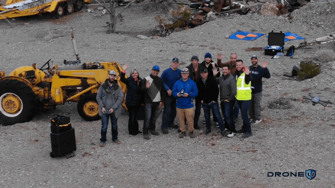
The application of drones is constantly evolving in construction settings. Their role becoming increasingly versatile and integral. Project managers are now using these aerial platforms for comprehensive site assessments, including navigating through sites for immersive 360-degree photography and employing orthomosaics to track site-wide progress with a high degree of efficiency.
Drones, with their versatility, are playing an increasingly critical role in modern construction practices. Their applications range from surveying and mapping to inspections, safety enhancements, and improving project management and communication.
Let’s begin with the role of drones in surveying and mapping.
Surveying and Mapping
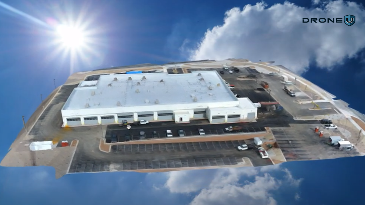
It is no surprise that drones have revolutionized surveying and mapping in construction.
Equipped with high-resolution cameras and GPS technology, drones can quickly and efficiently capture aerial images of construction sites. These images are then used to create detailed 3D maps and models. This capability is particularly beneficial in planning and designing phases, allowing construction teams to assess the terrain, plan site layouts, and identify potential obstacles with unprecedented precision. The speed and accuracy of drone-based surveying reduce the time and labor costs associated with traditional ground-based survey methods.
Inspection and Monitoring
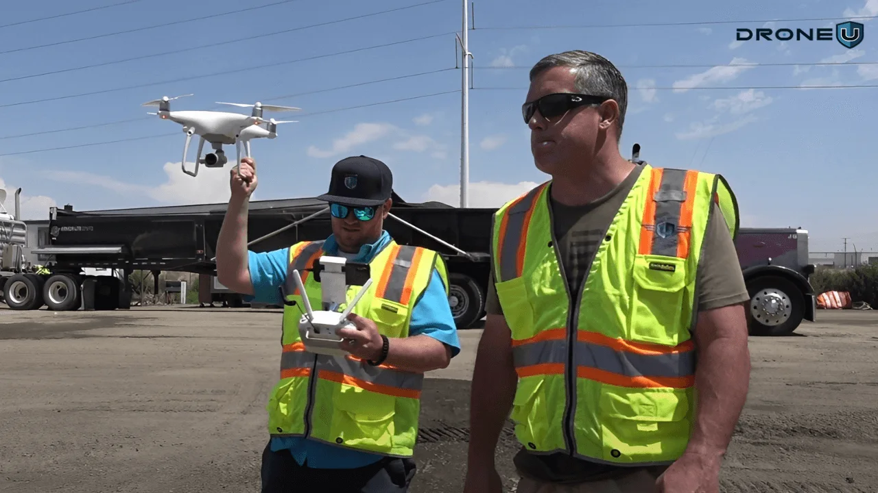
Regular inspections are vital for ensuring adherence to project timelines and standards.
Drones offer a unique advantage in this area by providing aerial views that are not possible with ground inspections. They can easily access hard-to-reach areas, like high-rise structures, towers, and large-scale infrastructure, capturing detailed images that help in identifying structural issues, construction deviations, or potential hazards. For progress monitoring, drones offer an efficient way to track the development of a project over time, providing stakeholders with a clear view of the ongoing work and helping in making timely decisions.
Safety Enhancements

Construction sites are inherently risky environments, and safety is a top priority. Drones contribute significantly to safety enhancements on sites. They can be used for hazardous area inspections, minimizing the need for workers to enter potentially dangerous zones. Drones also help in monitoring compliance with safety regulations and can quickly identify issues like unstable structures, unsafe working practices, or equipment malfunctions. In emergencies, drones can provide critical real-time information to response teams.
Communication and Project Management
Effective communication and project management are key to the success of any construction project. Drones aid in this by providing updated visual documentation of the construction progress, which can be shared with project managers, investors, and clients. This visual data helps in keeping all parties informed, aligning expectations, and facilitating transparent and effective communication. Additionally, the integration of drone-captured data into project management software allows for better resource allocation, timeline management, and overall project efficiency.
In summary, drones are proving to be invaluable assets in the construction industry.
That being said, let’s dive into the key features of construction drones and the aspects you need to consider when buying one.
Key Features of Construction Drones
Construction drones are designed to cater to the unique demands of the construction industry. These drones are equipped with several key features that make them suitable for various tasks on construction sites, from surveying to monitoring and safety inspections.
1. High-Resolution Cameras:
The quality of the camera on a construction drone is crucial. High-resolution cameras are essential for capturing detailed imagery that is required for accurate mapping, inspection, and monitoring of construction sites. These cameras enable the creation of high-quality, detailed photographs and videos, which are vital for identifying structural issues, assessing work progress, and ensuring that the project adheres to its specifications. The clarity and precision of these images allow for better analysis and decision-making.
2. Flight Time and Battery Life:
Long flight times are essential in construction drones due to the extensive areas they need to cover. Construction projects often span large areas, and longer flight times mean drones can survey or inspect a site in a single flight, increasing efficiency and reducing the need for multiple trips. Extended battery life is key to achieving longer flight times, ensuring drones can operate for extended periods without the need for frequent recharging.
3. Durability and Weather Resistance:
Construction environments can be harsh, with various elements like dust, debris, and varying weather conditions. Drones used in construction need to be durable and weather-resistant. They must be able to operate reliably in a range of environmental conditions, including high winds and temperatures, to ensure consistent performance. Rugged construction and weatherproofing are therefore critical features of these drones.
4. GPS and Mapping Capabilities:
Advanced GPS and mapping capabilities are fundamental for construction drones. These features enable precise navigation and accurate mapping of construction sites. Drones equipped with GPS can autonomously navigate and reach specific locations, which is vital for consistent and accurate data collection. Moreover, advanced mapping capabilities allow for the creation of detailed 3D site models, which are crucial for planning and monitoring construction progress.
5. Payload Capacity:
The ability to carry additional equipment, such as different types of sensors or cameras, is important in construction drones. A higher payload capacity means that drones can be equipped with various tools necessary for specific tasks like thermal imaging, LiDAR sensors, or additional photographic equipment. This versatility makes drones adaptable to a wide range of applications on a construction site.
6. Data Processing and Integration:
The ease with which drone data can be processed and integrated with construction management software is a vital feature. Drones generate large amounts of data, and the ability to quickly process this data into usable forms is crucial. Integration capabilities mean that the information collected by drones can be easily fed into construction project management systems, aiding in real-time decision-making, progress tracking, and comprehensive project analysis.
In summary, construction drones are equipped with features tailored to the specific demands of the industry. High-resolution cameras, extended flight times, durability, advanced GPS and mapping capabilities, payload capacity, and data integration functionalities combine to make these drones indispensable tools in modern construction practices.
With this understanding in mind, we researched and evaluated a few drones that are a great fit for the construction industry.
Best Drones For Construction In 2024
Here is a list of top-tier drones, each uniquely equipped to meet the evolving demands of the modern construction landscape.
- DJI’s Phantom 4 Pro Version 2.0: Overall Performance
- DJI’s Inspire 2 with X7 camera: High-End Performance
- Freefly’s Astro Drone: American Made
- Wingtra One Drone: Large Scale | Enterprise Grade
- DJI Mini 2: Interior Fly-Throughs
1. DJI’s Phantom 4 Pro
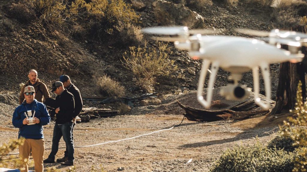
DJI’s Phantom 4 Pro drone has been and remains the powerhouse mapping drone for construction. The Phantom 4 Pro V2.0 offers a wide variety of 3rd party apps that can control the drone for construction mapping and modeling.
These same applications allow pilots to set and save waypoints. Allowing drone pilots to fly pre-planned missions that snap progression photos from the same position over time.
The Phantom drone is one of the rare drones that offers a mechanical shutter for faster acquisition of photos for mapping. The Phantom has a large 1? sensor that is reliable and offers great color depth and detail. Pair all of these features with the Phantom’s ease of use, and no other drone has ever come close to matching the Phantom’s offering. Drone pilots love the simplicity of the Phantom, which has less complexity and can therefore make it much easier to ensure routine and reliable flights. The Phantom is hands down, the very best drone for construction in 2024 and, most likely, for years to come.
Drone programs love the Phantom drone as managers can literally watch flights in real time through applications like Measure. The Phantoms, along with great training, can make the lives of program managers much easier. Even better news for veteran drone pilots is DJI has re-initiated production of the Phantom 4 Advanced drone, which is the most valuable drone for the money…. If you map and model in addition to using your drone for capturing images and video.
Specifications of DJI Phantom 4 Pro
| Feature | DJI Phantom 4 Pro |
| Camera Resolution | 20 megapixels, 1-inch CMOS sensor |
| Video Resolution | 4K at 60fps |
| Gimbal | 3-axis stabilization |
| Flight Time | Approximately 30 minutes |
| Obstacle Sensing | 5-direction obstacle sensing |
| Intelligent Flight Modes | ActiveTrack, TapFly, Draw, Gesture Control, among others |
| Maximum Speed | 72 km/h (S-mode) |
| Internal Storage | 8 GB, expandable with a microSD card |
| GPS and GLONASS | Dual GPS for enhanced positioning |
| Remote Controller | With screen or connect your own mobile device |
| Flight Autonomy System | Advanced system for precise hovering and better flight performance |
| Weight | 1388 g |
| Dimensions | Diagonal Size (excluding propellers): 350 mm |
| Battery | High-capacity 5870 mAh LiPo battery |
| Live View Quality | 720p at 30fps, 1080p at 30fps (remote controller), 720p at 30fps, 1080p at 30fps (DJI Goggles) |
| Operating Temperature | 0° to 40°C (32° to 104°F) |
2. Inspire 2 with the X7 camera
As more companies look to digitize their environments, many drone pilots are turning to the Inspire 2 with the X7 camera. At a much cheaper cost than an M300, the Inspire 2 offers increased safety features and flexibility.
Are your construction sites in cold environments that face windy conditions?
Chances are you’ll love the Inspire 2’s dual self-heating batteries. The Inspire 2 also offers high-altitude props to help those mountain towns build up their new ski-lifts. The real power of the Inspire 2 comes with the addition of the X7 camera. The X7 camera allows pilots to take extremely high-quality imagery with various lenses.
2024 means construction companies are using drones for more than just photos. This is why the list of the best drones in construction had to include the Inspire 2 X7. Construction companies are often creating life-like 3D models of a site.
Whether the company wants to earn a bid by animating these 3D models or create a historical 3D record of the site pre-construction…the Inspire 2 X7 offers the most flexibility to get the job done. Simply put, the larger (all-in-one) camera paired with a more robust airframe = takes flight on more days of the year.
Specifications of Inspire 2 with the X7 Camera
| Feature | Inspire 2 with Zenmuse X7 |
| Maximum Takeoff Weight | Approx. 4,000 g |
| Maximum Speed | 94 km/h (Sport mode) |
| Flight Time | Approx. 23-27 minutes (varies with payload) |
| Transmission System | Lightbridge technology, up to 7 km range |
| Obstacle Sensing | Forward and downward vision systems |
| Intelligent Flight Modes | Spotlight Pro, TapFly, ActiveTrack, QuickSpin, among others |
| Battery | Dual battery system, TB50 Intelligent Flight Battery |
| Operating Temperature Range | -20° to 40°C (-4° to 104°F) |
| GPS | GPS and GLONASS for enhanced positioning |
| Sensor Type | Super 35 sensor |
| Resolution | 24 megapixels |
| Video Resolution | 6K CinemaDNG, 5.2K Apple ProRes, and more |
| Lens Mount | DL-Mount (compatible with a range of lenses) |
| Dynamic Range | 14 stops |
| Bitrate | Up to 4.44 Gbps (CinemaDNG) |
| Photo Formats | JPEG, DNG (RAW) |
| Video Formats | CinemaDNG, Apple ProRes, H.264, H.265 |
3. Freefly Astro
Many construction sites are now operating in sensitive areas, forcing pilots to fly American made aircraft. While we haven’t tested the Freefly Astro, we have seen the aircraft run autonomous missions.
The Astro drone sports a Sony A7R4 camera shooting 60mp photos. This particular setup can offer extreme value to construction companies. This larger sensor means the drone will have a much shorter flight time to complete any autonomous mission.
The larger camera also means pilots can fly much higher than normal to acquire the same resolution or Ground Sampling Distance. (Want to learn more about drone mapping: see this guide.)
Pilots will need to consider that applications to control the Astro will be limited. Again, without direct hands-on experience, we cannot speak to the reliability of the aircraft or the flight characteristics. Albeit, of all the American made drones, the Freefly Astro is our current favorite. Though we are excited to get our hands on the Sony Airpeak when it hits American markets.
Specifications of Freefly Astro
| Feature | Freefly Astro |
| Maximum Takeoff Weight | Approximately 12 kg (26.5 lbs) |
| Maximum Speed | Up to 100 km/h (62 mph) |
| Flight Time | Up to 30 minutes depending on payload and conditions |
| Payload Capacity | Up to 5 kg (11 lbs) |
| Transmission System | Secure, high-bandwidth, low-latency digital video link |
| Battery | High-capacity intelligent LiPo battery, swappable in the field |
| Operating Temperature Range | -20° to 50°C (-4° to 122°F) |
| GPS and RTK | Dual GPS for enhanced accuracy, with optional RTK for centimeter-level precision |
| Foldable Design | Foldable arms for easy transportation and deployment |
4. Wingtra One

For serious construction companies needing to map large sites or long roads, look no further than the Wingtra One drone. Hands down the most capable fixed-wing drone offered to drone pilots. While this drone may be vastly different from the multi-rotor drones you’ve seen, it is much more capable.
The Wingtra drone is one of the few fixed-wing aircraft that has reliable vertical take-off and landing (VTOL) capability. This VTOL feature ensures that the drone can take off and land in urban environments or near tall trees.
Unlike the Ebee X which needs a large area for takeoff, the Wingtra elegantly rotates her wings to transfer from vertical flight to horizontal. Frankly, it is almost like viewing a work of art for the first time.
Besides the complex flight features, the Wingtra has proven to be a practical solution for construction and engineering companies worldwide. The bird has seen continued success abroad and fast implementation domestically. For any construction site looking to map vast swaths of land, look no further than the Wingtra One Drone. The Wingtra drone is by far the best large-scale mapping drone for construction.
Specifications of Wingtra One
| Feature | Wingtra One |
| Aircraft Type | Fixed-wing VTOL (Vertical Take-Off and Landing) |
| Maximum Takeoff Weight | Approximately 3.7 kg (8.16 lbs) |
| Flight Speed | 16 m/s (35.8 mph) |
| Flight Time | Up to 59 minutes depending on payload and conditions |
| Battery | Two 99 Wh batteries (a pair of batteries required) |
| Operating Temperature Range | -10°C to 40°C (14°F to 104°F) |
| Software Compatibility | WingtraPilot |
| Takeoff and Landing | Vertical takeoff and landing for operation in confined spaces |
5. DJI Mini 2
The last drone on our list may surprise you. As many of our clients are using drones in new ways in construction, one of the best construction related drones now includes the Mini 2 drone.
While pilots will not be using the Mini 2 to map or model construction sites, they might use it to fly through the construction site. That’s right, some project managers are using the Mini 2 to simply fly through an interior to check progress or identify potential safety hazards.
While the Mini 2 offers very limited functionality, with such a cheap price point…the drone is easy to replace. One recent construction engineer told me he believes the Mini 2 drone is the next disposable camera. It just happens to fly.
Over the years of teaching drone pilots mapping and modeling, the Toyota of drones (in construction) has been and will remain the Phantom 4 Pro.
Until you have to map extremely large sites across various environments, you’ll end up skipping most enterprise solutions and going right to Wingtra. That is if you like mitigating headaches on-site.
Specifications of DJI Mini 2
| Feature | DJI Mini 2 |
| Weight | Less than 250 grams |
| Operating Temperature | 0° to 40°C (32° to 104°F) |
| Camera Resolution | 12 megapixels |
| Video Resolution | 4K/30fps |
| Gimbal | 3-axis motorized gimbal |
| Maximum Flight Time | Up to 31 minutes |
| Transmission System | OcuSync 2.0, up to 10 km transmission range |
| Wind Resistance | Level 5 (up to 29-38 km/h winds) |
| Intelligent Flight Modes | QuickShot modes (Dronie, Helix, Rocket, Circle, Boomerang) |
| Zoom Capability | 4x digital zoom |
| Battery | Intelligent Flight Battery |
| QuickTransfer | Quick and easy downloading of content directly to your mobile device |
| Panorama Mode | Wide-angle, 180°, and Sphere panoramas |
Conclusion
In summary, drones have profoundly transformed the construction industry in the United States. These advanced aerial tools have revolutionized traditional practices, significantly enhancing efficiency, accuracy, and safety. From detailed surveying and mapping to conducting comprehensive site inspections, drones offer an unmatched level of precision and versatility.
When it comes to choosing the best drone for construction, consider the scope of your project, the budget constraints as well as intended usage.
If you are looking to learn specific skills for utilizing drones in the construction industry, check out Drone U’s extensive training resources.
The Best Black Friday Drone Deals: Soar into Savings
The excitement surrounding Black Friday 2023 is palpable, especially for drone enthusiasts. This year, the Black Friday drone deals are exceptional, offering a unique opportunity to dive into the world of aerial photography and FPV (First Person View) flying.
Alongside unbeatable discounts on top-notch drones, drone enthusiasts can expect something special this year. Whether you’re a seasoned pilot or looking to explore the world of aerial photography and FPV flying, the Black Friday drone deals for 2023 are shaping up to be fantastic.
Black Friday isn’t just about the drones themselves; it’s also an ideal time to stock up on essential accessories.
Shoppers can expect great deals on:
- SD cards: Crucial for storing high-resolution footage.
- Hard drives: Providing the necessary storage capacity for editing and archiving video files.
- ND filters: Another must-have accessory for drone enthusiasts, help manage light exposure and enhance the quality of the footage.
If you want a quick look at the deals on drones and drone-related accessories, just scroll down to the bottom.
1. DJI Avata: Best Black Friday Drone Deal
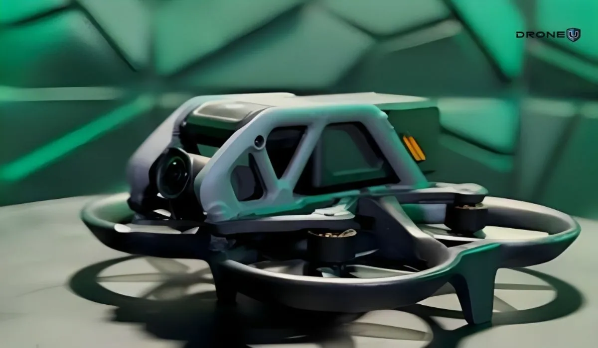
Topping our list of Black Friday drone deals is the phenomenal DJI Avata, a drone that has taken the market by storm.
The DJI Avata is renowned for its advanced features, user-friendly interface, and exceptional camera quality, making it a top pick in the drone market.
A $500 discount on the DJI Avata, is a significant reduction, making it a prime choice for both experienced pilots and newcomers to drone flying.
Why the DJI Avata is a Must-Buy
As a perfect drone flying experience enhancer, the DJI Avata stands out for the following reasons:
1. Ideal for FPV Beginners and Experts
The DJI Avata stands out for its user-friendly design, making it the easiest drone to learn FPV flying. This feature is a game-changer for beginners, reducing the learning curve and making the transition to FPV flying smoother. Simultaneously, its advanced capabilities cater to seasoned pilots looking for a high-performing FPV drone.
2. Cutting-Edge Technology
The Avata is equipped with state-of-the-art technology, including a high-quality camera system, intuitive controls, and robust flight stability features. These technologies come together to create a seamless and enjoyable flying experience.
3. Unmatched Creative Freedom
With the DJI Avata, pilots can create stunning FPV fly-throughs, capturing footage from unique angles and perspectives. This capability opens up new avenues for creativity, allowing users to explore and capture the world in ways they never thought possible.
4. Enhanced Safety Features
The drone comes with enhanced safety features, including obstacle sensing and avoidance systems. These features provide peace of mind, especially for new pilots, ensuring a safe flying experience.
For those interested in FPV flying, there are special deals on FPV kits, which include DJI Goggles 2, controllers, and other accessories needed for an immersive flying experience. These kits are designed to offer a first-person view from the drone, making flying a more thrilling and engaging experience.
However, the most budget-friendly option is the DJI Mini 2 SE.
2. DJI Mini 2 SE: The Most Economical Deal
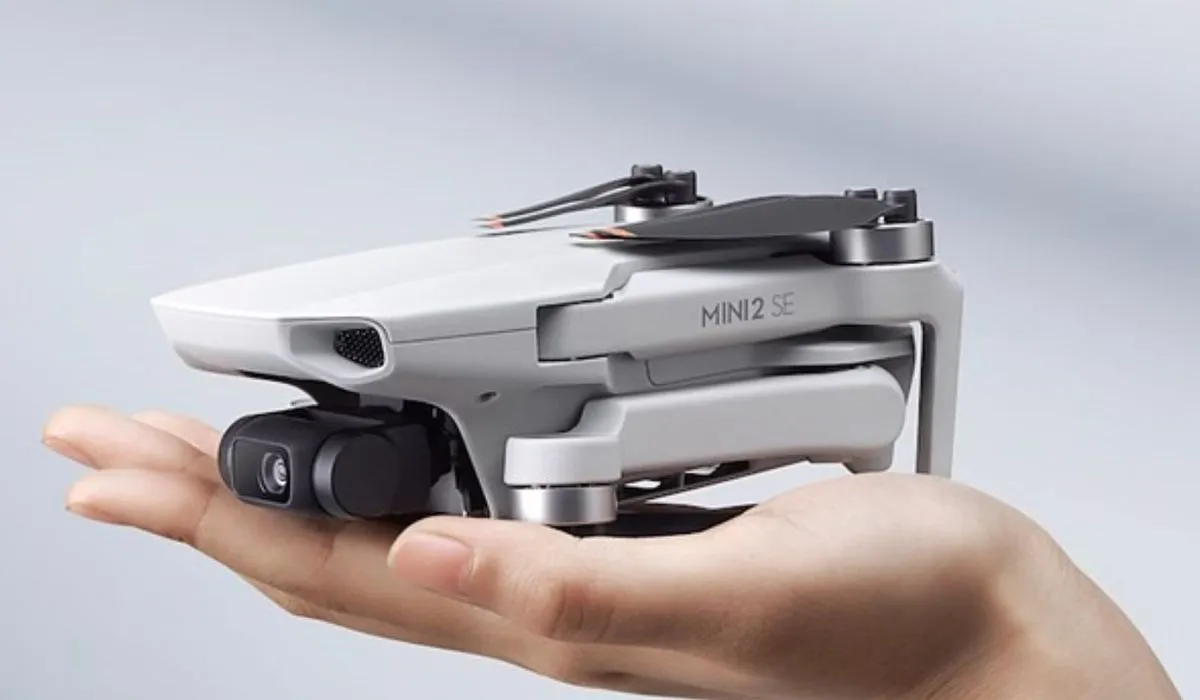
The DJI Mini 2 SE stands out as the most affordable deal this Black Friday. It’s an excellent choice for beginners or those looking for a compact, lightweight drone that doesn’t compromise on quality. It comes with a remote, making it ready to fly right out of the box.
The Mini 2 SE is known for its ease of use, stable flight performance, and decent camera quality, making it a great entry-level drone.
3. Consumable Accessories: Load Up on Essentials
Black Friday extends far beyond just the drones themselves, encompassing a wide range of essential accessories that every drone pilot needs to optimize their experience. This is the ideal time to invest in those often overlooked but crucial items that enhance the functionality and longevity of your drone adventures.
a) Reliable SD Cards and Hard Drives:
- Sandisk 1TB SSD ($50 off): This compact and durable SSD is perfect for backing up large amounts of high-resolution drone footage quickly and securely.
- 256GB PNY Micro SD Card: Essential for capturing high-quality video without worrying about running out of space.
- 256GB Sandisk SD Card: Known for its reliability and speed, this is a great choice for drone cameras requiring SD cards.
b) Fast Charging Cables
These are a must-have for any drone pilot. Fast charging cables reduce downtime between flights, ensuring you’re always ready to capture the moment.
c) Anker Backup Battery Charger ($63 for a 40,000 mAh battery)
This high-capacity portable charger is a lifesaver for long days out in the field, allowing you to charge your drone’s batteries, phone, or other devices on the go.
d) ND Filters
 Mini 3 Pro ND Filter
- Mini 3 Pro ND Filters ($35, $13 off): These filters are essential for controlling light exposure, which is crucial for capturing high-quality footage in various lighting conditions.
- Mavic 3 Enterprise ND Filters (50% off, now $45): A great deal for professional-grade drones, these filters help in achieving cinematic effects.
- Mavic 3 Pro ND Filters (20% off): These are perfect for professional photographers and videographers looking to enhance their aerial footage.
e) PGY Tech SD Card Holder (20% off)
This isn’t just an SD card holder; it’s also a card reader. What makes it our favorite is its ability to plug directly into a computer, enabling easy and quick access to your footage.
Why Should You Buy Drone Accessories?
- Data Storage and Protection: Reliable SD cards and hard drives are essential for safely storing and transferring the large files that drones typically produce.
- Improved Flight Experience: Accessories like fast charging cables and backup battery chargers ensure that you spend more time flying and less time waiting for batteries to charge.
- Enhanced Image Quality: ND filters are crucial for managing light exposure, which can dramatically improve the quality of the footage captured by your drone.
- Convenience and Efficiency: Tools like the PGY Tech SD Card Holder streamline the process of managing and accessing your data, making your drone flying experience more efficient.
- Long-term Investment: Investing in high-quality accessories can extend the lifespan and enhance the functionality of your drone, making it a wise long-term investment.
4. Drone Training: Investing in Yourself
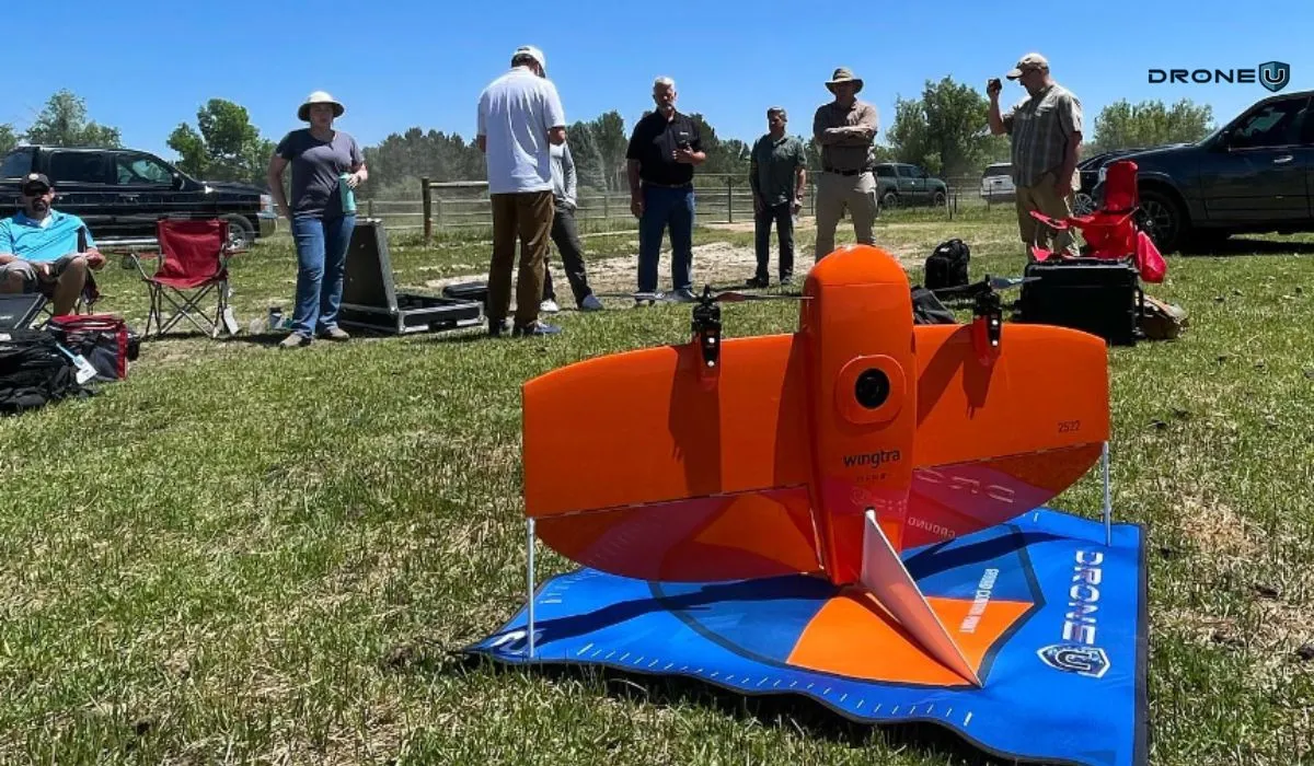
The emphasis on self-investment through drone training during Black Friday is more than just an opportunity; it’s a transformative step for anyone serious about drone piloting. This isn’t merely about learning to operate a drone but about mastering a skill that can open up a plethora of opportunities in various sectors.
The Importance of Drone Training
1. Gaining Confidence and Competence
Comprehensive training programs build confidence in handling a drone under various conditions, ensuring you’re prepared for diverse flying scenarios. This confidence is key in executing complex projects or navigating challenging environments.
2. Earning Certification (Part 107)
For those in the U.S., obtaining the FAA’s Part 107 certification is a critical step in becoming a professional drone pilot. Training helps you navigate the legalities and requirements of drone operation, which is crucial for commercial ventures.
3. Handling Real-World Scenarios
Advanced training covers emergencies, low and close flying techniques, and methods to capture smooth, professional-grade footage. These skills are indispensable for real-world applications, setting you apart from amateur operators.
4. Access to Experienced Instructors
Programs like those offered by Drone U provide access to seasoned drone pilots. Learning from experts not only imparts practical skills but also provides insights into the industry, tips for handling clients, and guidance on building a drone business.
5. Investment in a Growing Industry
The drone industry is rapidly expanding into areas like surveying, real estate, filmmaking, agricultural inspection, and more. By investing in training, you’re equipping yourself with the skills to tap into these markets.
6. Networking Opportunities
Training sessions often bring together like-minded individuals. These environments are perfect for networking, sharing experiences, and potentially collaborating on future projects.
7. Blending Theory with Practice
Unlike traditional education, drone training emphasizes practical skills. This hands-on approach is crucial for understanding the nuances of drone operation and developing a more intuitive control of your equipment.
Black Friday Deals from Drone U
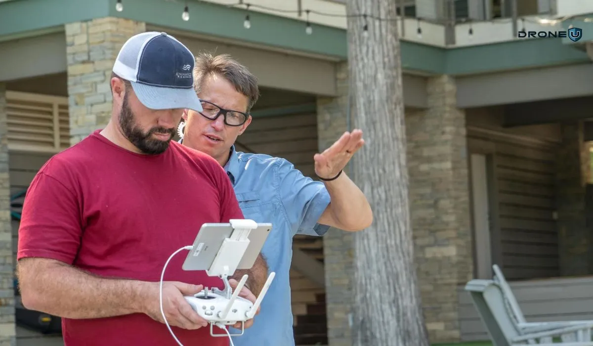
Drone U, a leading name in drone education, is making this investment easier with their extraordinary Black Friday deals at DroneUBlackfriday.com. For the first time ever, Drone U is offering in-person training deals that provide a unique opportunity to learn from experienced drone pilots. These deals are a game-changer, offering a blend of theoretical knowledge and practical insights that traditional education often lacks.
- In-Person Training Deals: These deals are particularly valuable as they offer direct, hands-on experience under the guidance of professional drone pilots. This is a rare opportunity to get real-time feedback and learn in a dynamic environment.
- Comprehensive Curriculum: The courses cover a wide range of topics, from basic flight mechanics to advanced cinematography techniques, ensuring a well-rounded education.
- Lifetime Investment: The skills and knowledge gained from these training programs last a lifetime, continually benefiting your drone piloting journey, whether it’s a hobby or a professional career.
Training is not just about earning a certificate; it’s about acquiring skills that empower you to pursue drone jobs you love and cherish. So, this Black Friday, consider making the investment that lasts a lifetime – invest in yourself, invest in your skills, and explore the exciting world of drone piloting with confidence and expertise.
For more details and to explore these Drone U Black Friday Drone Training offers.
Summarizing All Black Friday Drone Deals
This Black Friday offers a range of deals on drone accessories and storage solutions, perfect for both drone enthusiasts and professionals.
Here’s a summary of the key deals:
DJI Avata ($429 off)
Tailored for cinematic creators and thrill-seekers alike. The Avata’s distinctive FPV perspective delivers an exhilarating and immersive flying experience, perfect for capturing dynamic cinematic footage. This discount on DJI Avata makes it more accessible for aspiring filmmakers and hobbyists.
DJI Goggles 2 ($101 off)
These aren’t just FPV goggles; they serve as a portal to experiencing flight in a new dimension. With a high-resolution display and comfortable design, DJI Goggles 2 are perfect for extended flying sessions, offering an unparalleled, immersive view of your drone’s journey.
DJI Mini 3 Pro Fly More Combo ($143 off)
Especially enticing for travel enthusiasts and vloggers. The compact size of the Mini 3 Pro, combined with the additional batteries and accessories in the Mini 3 Pro Fly More Combo, makes it ideal for capturing high-quality content on the go.
DJI Mini 2 SE
Perfect for beginners and casual users. Its ease of use, combined with DJI’s renowned stability and image quality, makes DJI Mini 2 SE a great starting point for those exploring drone photography or looking for a reliable, affordable aerial camera.
Drone U Drone Training
This offering goes beyond merely learning to fly a drone; it’s about unlocking a new skill set. The drone training enhances users’ understanding of aerial photography techniques, and safety protocols, and can even pave the way for obtaining commercial drone piloting certifications.
Fast Charging Cables
Essential for quick recharging of drone batteries, these cables are a must-have for any drone pilot.
Anker Backup Battery Charger
Priced at $63, this 40,000 mAh backup battery (with a $20 discount) is ideal for extended outdoor shoots, allowing you to recharge your drone batteries on the go.
ND Filters for Mini 3 Pro and Mavic 3
These Neutral Density filters, available for both the Mini 3 Pro and Mavic 3 drones, are crucial for controlling light exposure during flights, enhancing the quality of your footage. The Mini 3 Pro filters are available at a $13 discount, while Mavic 3 Enterprise and Mavic 3 Pro ND filters are offered at 50% and 20% off, respectively.
PGY Tech SD Card Holder
Now 20% off, this holder is not just for storage; it also functions as a card reader, making it a practical accessory for managing and transferring your drone footage.
Sandisk 1TB SSD
Get $50 off on this high-capacity, reliable SSD, perfect for storing and backing up large video files from your drone.
Micro SD Cards
The 256GB PNY Micro SD card, essential for high-resolution video recording, is now available for only $16.
SD Cards
A 256GB Sandisk SD card, known for its durability and speed, is also on sale, providing ample storage for your aerial footage.
These Black Friday drone deals represent an excellent opportunity for drone pilots to upgrade their accessory kits and storage solutions, ensuring they are well-equipped for their drone adventures.
Camera Drones: The Best Drones for Photos and Videos
If you’re aspiring to take flight as an aerial photographer or videographer, camera drones are your ticket to overcome your fear of heights.
In not so distant past, drones with cameras didn’t exist and aerial shots came at an extreme expense to production companies.
Fast forward to the era of social media and camera drones have become mainstream.
Drones make acquiring a myriad of aerial and ground shots attainable, without having to buy expensive equipment.
Expensive shots are now cheaper, but it is just about the equipment alone. The best aerial photos are a culmination of cinematic skills made easy by cameras stabilized on gimbals hanging in the air.
And it’s important to choose the right equipment in the first place.
When it comes to finding the right drone model, it is important to know that a good pilot can create epic stories no matter what drone they are flying.
More advanced drones typically have better obstacle avoidance, automated flight paths, and insane camera features. Don’t confuse obstacle avoidance and these features with safety.
The safest of the drones are going to be enterprise drones. These drones offer sensor-denied flight modes, and emergency health information, and provide additional support to keep batteries healthy for long periods.
After test-flying these drones and working with many of them on real-life drone jobs, we can provide experienced-based insight into the best drone with a camera on the market.
How To Choose The Best Drone With Camera

Camera Quality
The quality of the camera is vital for achieving exceptional results in aerial photography and videography.
First, consider the sensor size; a larger sensor captures more light, resulting in superior image quality, especially in low-light situations.
Second, take into account the camera’s resolution, which determines the level of detail in your photos and videos. Higher resolutions like 4K, 6K, or 8K offer greater clarity and creative flexibility.
Lastly, gimbal stabilization is crucial for ensuring that your footage remains smooth and steady.
A well-stabilized gimbal compensates for the drone’s movements, keeping your shots jitter-free and professional.
Flight Time
Extended flight times are advantageous in photography and videography, allowing you to capture more content before needing to land and recharge.
Keep in mind that actual flight time can vary based on factors like wind conditions and payload.
Portability
Portability is a critical consideration, particularly if you plan to travel with your drone.
The size and weight of the drone will impact how easily you can transport it to different locations.
Smaller, more compact drones are often preferred for their ease of handling and storage, although they may sacrifice some features compared to larger, less portable models.
Assess your needs and consider the trade-off between portability and the capabilities required for your needs.
Obstacle Avoidance
Safety is of utmost importance when flying a drone for photography and videography, and obstacle avoidance technology can significantly enhance it.
Drones equipped with obstacle avoidance sensors use cameras and other sensors to detect and avoid obstacles in their flight path.
This feature not only safeguards the drone from collisions but also provides peace of mind, allowing you to focus on capturing your content without the constant worry of environmental obstacles.
Range
The control range of a drone is a crucial factor in achieving dynamic and captivating shots.
A longer control range allows you to fly the drone further from your location while maintaining a stable connection to the remote controller.
This increased range offers more flexibility for exploring different perspectives and capturing shots from greater distances, which can be particularly valuable in aerial photography and videography.
Controller and App
The remote controller and accompanying app play a pivotal role in your overall flying and shooting experience.
Evaluate the quality of the remote controller, including its ergonomics, ease of use, and the range of controls it provides.
The accompanying app should offer features such as live video streaming, waypoint planning, camera settings adjustment, and a user-friendly interface.
A well-designed controller and app can make your drone operations more efficient and enjoyable.
Price
Your budget is a key factor in choosing the right drone for your photography and videography needs.
Establish a budget range and look for a drone that offers the best features and capabilities within that range.
While high-end drones typically offer superior camera quality and advanced features, there are excellent options available at various price points.
Consider the trade-offs between cost and the specific features that matter most to you to make an informed decision aligned with your financial resources.
Before we delve into our list of the best camera drones, let’s introduce you to our top picks that can assist you in selecting the most suitable drone for your needs.
List of 8 Best Camera Drones

Here is the list of the best drones with cameras:
- DJI Air 3: All-around Option for Photographers and Videographers.
- DJI Mini 4 Pro: Best Travel Drone.
- DJI Avata: An FPV Drone – Perfect for Racing and Freestyle Flying.
- DJI Inspire 2: Professional-grade Drone – Popular Choice for Filmmakers and Photographers.
- Freefly Astro: Great for Professional Cinematographers and Content Creators.
- DJI Mavic 3 Enterprise: Made for Industrial and Commercial Applications.
- DJI Mavic 3 Pro: High-end Consumer Drone with Excellent Camera Quality.
- DJI Mini 3 Pro: Small, Lightweight & Budget-Friendly Drone.
We’ll dive into each drone and tell you more about the features, capabilities, and limitations of each.
1. DJI Air 3
 DJI Air 3
The DJI Mavic Air 3 is incredibly easy to fly, struts dual cameras, offers portrait video and has a long battery life. As with any drone, we would recommend the Fly More Combo option to provide enough batteries for a fun afternoon of flight.
Moreover, the Mavic Air 3 can sense and avoid obstacles approaching from any direction, and while it may not cover super small twig branches, it can be relied on for more flights.
Additionally, the drone will hover and hold its position even in moderate winds.
With dual cameras and the ability to shoot in vertical or portrait mode, creators can capture multiple perspectives from the sky. This drone even has hyper-lapse mode, allowing creators to create epic time-lapses that move, showcasing their favorite cityscape.
Furthermore, the Mavic Air 3 offers a suite of features that allows pilots to create unreal panos, and epic landscape pictures, capture stunning aerial video, and even create hyperlapses. It is very small, portable, and foldable, making it a versatile choice.
If you’re looking for a drone with 4K camera with the latest automated flight paths, obstacle avoidance, and a camera that shoots in portrait (social media) mode, look no further than the Mavic Air 3, which comes in at under $1,500 for the drone, remote, and multiple batteries (typically you buy more than 1 battery).
Features of DJI Air 3
| Features | DJI Air 3 |
| Takeoff Weight | 720 grams |
| Max Flight Time | 46 Mins |
| Max Flight Distance | 32 Km |
| Camera | 1/1.3-inch CMOS Wide-Angle Camera &
1/1.3-inch CMOS Medium-Tele Camera |
| Max Video Resolution | 4K/60fps HDR
4K/100fps |
| Video Format | MP4 |
| Obstacle Sensing | Omnidirectional |
| Transmission System | DJI O4 |
2. DJI Mini 4 Pro
 DJI Mini 4 Pro
Ah, behold the DJI Mini 4 Pro drone – the triple treat of the drone world. It’s not just good; it’s the golden child of social media, the wanderlust companion of travelers, and the featherweight champ of the skies.
Let’s start with its social game. – This little whiz kid is the maestro of capturing those trendy vertical videos.
Its camera gimbal twirls around like a pro dancer, ensuring your social media content is as smooth as butter.
Say goodbye to awkward cropping – this drone is here to make your posts pop!
Now, when wanderlust calls, the DJI Mini 4 Pro has the answers.
Clocking in at less than 250 grams, it’s the travel buddy you’ve always dreamed of.
Want to fly this darling in Mexico?
No worries about permits or registrations!
Canada calling?
Fly in most spots without batting an eye.
Even in the good ol’ USA, it doesn’t need registration unless you’re using it for commercial gigs.
And hey, it’s not just its weight that’s light; the DJI Mini 4 Pro is a mini drone with 4K camera and flight time that’s more dependable than your morning coffee, and the ability to slip under the radar in most places.
So, if you’re the kind who loves making your social media shine, has a globe-trotting soul, and craves a drone that’s more portable than a pocketful of sunshine, the Mini 4 Pro is your match made in drone heaven.
Now, if you’re traveling a lot throughout the world, and you want a drone that won’t get you in trouble with the local aviation authority, buy a sub 250 grams drone.
In the US, Part 107 Pilots, the Mini 4 Pro is RID compliant and can be flown over people.
In Mexico, sub 250 grams drones don’t have to be registered.
Tourists flying sub 250 gram drones can take flight in most parts of Canadian skies without certification or permits.
That’s why the DJI Mini 4 Pro is the best travel drone we recommend.
However, if you’re on a budget, and vertical videos are a must, check out the budget-friendly small drone with camera Mini 3 Pro.
Features of DJI Mini 4 Pro
| Features | Mini 4 Pro |
| Takeoff Weight | < 249 grams |
| Max Flight Time | 34 Mins |
| Max Flight Distance | 18 Km |
| Camera | 1/1.3-inch CMOS Wide-Angle Camera |
| Max Video Resolution | 4K/60fps HDR
4K/100fps |
| Video Format | MP4 |
| Obstacle Sensing | Omnidirectional |
| Transmission System | DJI O4 |
3. DJI Avata
 DJI Avata
Meet the DJI Avata, a small 4K camera drone that comes with Motion Controller.
DJI Avata is the James Bond of the FPV drone world – sleek, sophisticated, and the pioneer of GPS in the wild, wild world of FPV.
You know, FPV drones used to be like renegade cowboys without a compass, but enter the Avata, the game-changer with a GPS and the ability to do something unheard of in the FPV realm – hover.
It’s like bringing a bit of zen to the adrenaline-pumping world of FPV.
Now, imagine this: An ultra-compact drone that can shimmy its way through indoors and effortlessly fly around capturing breathtaking fly-through footage of buildings, businesses, and national treasures. It’s like that daredevil acrobat, somersaulting through the sky and capturing all the beauty in its path.
This drone isn’t just a flying machine; it’s the friendly mentor at FPV flight school.
If you’re looking to dip your toes (or dive headfirst) into the exhilarating world of FPV, the Avata is your genie in a bottle.
It’s the easy-peasy, lemon-squeezy way to learn the ropes of FPV flight – perfect for anyone seeking a new, thrilling challenge up in the air.
Now, here’s the twist: this isn’t your regular drone that captures your average footage. Oh no, this baby records the world through the eyes of its pilot – it’s all about the First Person View.
So, if you’re ready to swap your aerial view for the pilot’s seat and experience the world from a whole new perspective, the Avata is your golden ticket to an exhilarating FPV adventure.
If you’re ready to fly through buildings, real estate shots, and wedding videos… the easiest FPV or cinewhoop drone on the market is DJI’s Avata.
The Avata is an easy-to-learn FPV drone with a camera, capable of capturing stunning one-take-wonder videos.
Features of DJI Avata
| Features | DJI Avata |
| Takeoff Weight | 410 grams |
| Max Flight Time | 18 Mins |
| Max Flight Distance | 11.6 Km |
| Camera | 1/1.7-inch CMOS Wide-Angle Camera |
| Max Video Resolution | 4K/60fps |
| Video Format | MP4 |
| Obstacle Sensing | Downward only with DJI FPV Remote Controller 2 or DJI Motion Controller in N Mode and S Mode |
| Transmission System | DJI O3+ |
4. DJI Inspire 2
 DJI Inspire 2
Inspire 2 Drone is the ‘Ford Raptor’ of the DJI skies.
It’s not just an RC drone with camera; it’s the adrenaline junkie’s dream ride, ready to conquer the wild and capture the most electrifying shots in the air.
Picture this: Wind that could sweep Dorothy off to Oz doesn’t faze this bird. It’s the Maverick of stability, owning the high winds like it’s a leisurely stroll in the park.
And when it comes to payload, it’s like that friend who’s always ready to lend a hand.
Multiple large format cameras?
No problem, it’ll carry them with a swagger.
Action sports?
Cue the dramatic music!
The Inspire 2 is the aerial daredevil that zooms through the skies like it’s on a mission, smoothly tracking high-speed action and edging closer to the subjects like a seasoned pro.
But hey, let’s be real – it’s like handing the keys of a Ferrari to a professional race car driver.
Only a top-tier pilot can truly unleash its full potential.
And here’s the golden nugget: the Super 35mm x7 camera.
This isn’t just a camera; it’s a wizard behind the lens.
Shooting native anamorphic 4K video at an aspect ratio that screams “blockbuster”, it’s the MVP when you’re aiming for that Netflix-level filming.
So, if you’re ready to embark on a film-making journey, where the sky’s the limit and every shot is a cinematic masterpiece waiting to happen, the Inspire 2 isn’t just a drone; it’s your passport to Hollywood-worthy aerial footage.
And yes, we know the Inspire 3 is out… save yourself 14,000 and buy an Inspire 2.

If you’re into action sports, shooting for production houses like Netflix, or you simply want to make some noise as a drone pilot, check out the Inspire 2.
The Inspire 2 shoots an ultra-wide 4K at the anamorphic or 2.44:1 aspect ratio natively on the X7 camera.
While we know the newer Inspire 3 is out for consumers to purchase, they’ll have to pay significantly more for a few feature gains.
To understand how different the flight experience is with an Inspire, you would compare the Inspire to a Ferrari. All of the other drones would be some model of Toyota, especially if they’re made by DJI.
DJI Inspire 2 Review
Features of DJI Inspire 2
| Features | Inspire 2 |
| Takeoff Weight | 4250 grams |
| Max Flight Time | 27 Mins (with Zenmuse X4S) & 23 Mins (with Zenmuse X7) |
| Max Video Resolution | 6K in CinemaDNG/RAW & 5.2K in Apple ProRes both @ 30fps |
| Operating Temperature | -20° to 40° C |
| Obstacle Sensing | Upward & Downward |
| Transmission System | DJI Lightbridge 2 |
| App | DJI Go 4 |
5. Freefly Astro
 Freefly Astro | Source: Freefly
The Freefly Astro is a lightweight and portable drone, making it easy to transport and deploy. It is one of the best drones that comes with a 61 MP camera. It has a maximum payload of 1,500 grams, which is enough to carry a variety of cameras and sensors.
The Astro also has a long flight time of up to 30 minutes, which means you can get a lot of work done in a single flight.
The Astro is controlled using the Freefly Pilot Pro controller, which features a long-range radio link and a variety of features that make it easy to fly the drone precisely. The controller also has a built-in screen that displays real-time telemetry data from the drone.
If you’re trying to get serious about Videography and drone mapping and would like to support domestic manufacturers, look no further than the Freefly Astro.
Features of Freely Astro
| Features | Freefly Astro |
| Takeoff Weight | 6,665 grams |
| Max Flight Time | 37 Mins (Without Payload) |
| Camera | 61 MP |
| Operating Temperature | -20 to 50 C |
| Connectivity | BLE, Wifi, USB C, LTE (North America) |
6. DJI Mavic 3 Enterprise
 DJI Mavic 3 Enterprise
Here comes the DJI Mavic 3 Enterprise, where the sky isn’t a limit, but rather, your playing field.
Picture the Mavic 3’s sophisticated capabilities combined with a strong dose of safety enhancements, and you’ve got the Enterprise version, akin to your standard Mavic 3 but equipped with a superhero’s cape and an array of advanced safety features.
Its Attitude Mode is your key to becoming a master of the skies. This mode enables you to capture smooth shots, approach your subjects up close (because sometimes distance is overrated), and land the drone gracefully without its sensors causing any trouble.
Say goodbye to worries about flyaways with this mode – nothing escapes your watchful eye.
Ever dreamed of becoming a digital cartographer?
The Mavic 3 Enterprise empowers you to create 3D maps and models effortlessly.
Its suite of autonomous software turns you into a mapping virtuoso.
Moreover, the Mavic 3 Enterprise isn’t just a drone; it’s a versatile platform for your aspirations.
Need additional applications? No problem!
You can enhance the remote control with extra apps to expand its capabilities. Think of it as equipping your drone with a toolbelt and saying, “Let’s get to work!”
Wondering who this exceptional device is designed for?
Think of the professionals – those soaring high in utility inspections, the architects of construction projects, and the engineers shaping the future.
This drone is far from being a mere toy; it’s crafted for professionals who are earning lucrative incomes in technical fields.
If you belong to that league, the Mavic 3 Enterprise might just become your trusted partner in the skies.
However, the Mavic 3T, a variant of the Mavic 3 series, is a best-buy drone with a thermal camera. This thermal version makes it ideal for various applications, including firefighting, search and rescue, inspection, and night operations.
Features of Mavic 3 Enterprise
| Features | Mavic 3 Enterprise |
| Takeoff Weight | 1,050 grams |
| Max Flight Time | 45 Mins (No wind) |
| Max Flight Distance | 32 Km |
| Camera | 4/3 CMOS 20 MP Wide Camera, 1/2-inch CMOS 12 MP Tele Camera |
| Max Video Resolution | 4K @30fps |
| Video Format | MP4 |
| Obstacle Sensing | Omnidirectional |
| Transmission System | DJI O3 Enterprise |
7. DJI Mavic 3 Pro
 DJI Mavic 3 Pro
Ah, behold the Mavic 3 Pro – the director’s cut of drones, the Spielberg of the skies.
It’s not just a drone; it’s the MVP for any videographer out there.
Imagine three cameras at variable zooms. It’s like having a trio of cinematographers at your beck and call.
You want those jaw-dropping shots?
This camera drone has got you covered, offering the best possible choices for your cinematic dreams.
And let’s talk about its flight capabilities – this bad boy is basically an aerial Picasso.
Hyperlapses, panoramas, and those stylish dronie shots?
Oh yeah, it’s got the moves to make your footage dance in the skies.
But here’s the showstopper: With 48 megapixels of pure photographic magic and the ability to capture videos in up to 5.1K, it goes beyond your expectations.
And it doesn’t stop there.
It dives into the world of slow-mo with the grace of a ballet dancer. From 4K at 120 frames per second, it dishes out cinema-quality slow motions that would make a snail jealous.
Features of DJI Mavic 3 Pro
| Features | Mavic 3 Pro |
| Takeoff Weight | 958 grams |
| Max Flight Time | 43 Mins |
| Max Flight Distance | 28 Km |
| Camera | Hasselblad Camera: 4/3 CMOS, Effective Pixels: 20 MP
Medium Tele Camera: 1/1.3? CMOS, Effective Pixels: 48 MP Tele Camera: 1/2? CMOS, Effective Pixels: 12 MP |
| Max Video Resolution | 5.1K @50fps, DCI 4K @120fps, 4K @120fps |
| Video Format | MP4/MOV |
| Obstacle Sensing | Omnidirectional |
| Transmission System | DJI O3+ |
8. DJI Mini 3 Pro
 DJI Mini 3 Pro | Source: DJI
Enter the stage, the Mini 3 Pro drone – your penny-saving pal and the genie granting your social media wishes.
It might be mini, but it’s majorly cool.
Calling all budget-conscious content creators, this drone is your wingman for that high-end portrait or snazzy vertical video.
It’s like having your director whispering, “Lights, camera, action!”
Clocking in at less than 250 grams, this featherweight champ doesn’t just fly high; it can soar over people too.
With a nifty wide-angle camera, it’s the David ready to take on Goliath in the social media influencer world.
Now, it’s got its remote, its little control center, making it a boss in its own right. But, fair warning:
While it’s got all these fantastic features, it’s like that daredevil friend who jumps into things headfirst – it’s missing the obstacle avoidance superpowers that the Mini 4 Pro flaunts.
So, for those who want an affordable buddy to capture their social media glitz without breaking the bank, the Mini 3 Pro is the MVP.
It might not have all the bells and whistles, but it’s like that charming buddy who surprises you with its hidden talents.
Here’s the kicker: Forget your slider, jib, crane, and gimbal. This drone doesn’t just step up the game; it IS the game. It’s the Swiss Army knife of videography, slicing through the need for multiple gears.
So, if you’re a videographer dreaming of that perfect shot, aiming for the kind of footage that makes jaws drop, the Mavic 3 Pro would be the most useful camera drone for you. It will be your new favorite colleague in the art of capturing visual masterpieces.
Features of Mini 3 Pro
| Features | DJI Mini 3 Pro |
| Takeoff Weight | < 249 grams |
| Max Flight Time | 34 Mins |
| Max Flight Distance | 18 Km |
| Camera | 1/1.3-inch CMOS Wide-Angle Camera |
| Max Video Resolution | 4K/60fps |
| Video Format | MP4/MOV |
| Obstacle Sensing | Forward, backward, and downward |
| Transmission System | DJI O3 |
Summary
Here is a table that compares all camera drones with some important factors to consider:
| Drone | Camera quality | Flight performance | Portability | Ease of Use | Website Price | On Amazon
(Dynamic) |
| DJI Air 3 | 4K/60fps | 46 minutes | Foldable | Easy to use | $1,549 | $1,425 |
| DJI Mini 4 Pro | 4K/60fps | 34 minutes | Foldable | Easy to use | $759 | $759 |
| DJI Avata | 4K/60fps | 18 minutes | Not foldable | Difficult to use | $1,428 | $1,187 |
| DJI Inspire 2 | 5.2K/30fps | 27 minutes | Not foldable | Difficult to use | $3,299 | $2,979 |
| Freefly Astro | 6K/40fps | 37 minutes | Not foldable | Difficult to use | $25,255 | Unavailable |
| DJI Mavic 3 Enterprise | 4K/30fps | 45 minutes | Foldable | Difficult to use | $3,628 | Unavailable |
| DJI Mavic 3 Pro | 5.1K/50fps | 43 minutes | Foldable | Easy to use | $2,199 | $2,068 |
| DJI Mini 3 Pro | 4K/60fps | 34 minutes | Foldable | Easy to use | $909 | $775 |
Our Pick: Which Camera Drone Is Right For You?

| Drone | Best For |
| DJI Air 3 | All-around Drone |
| DJI Mini 4 Pro | Social Media Content Creators |
| DJI Avata | Fly-Through Drone |
| DJI Inspire 2 | Best Action Sports and Cinema Drone |
| Freefly Astro (US Manufacturer) | Videography & Drone Mapping |
| DJI Mavic 3 Enterprise | Professional Drone Mappers |
| DJI Mavic 3 Pro | Full-Time Videographers |
| DJI Mini 3 Pro | Budget-friendly Drone |
Ready to learn how to fly, check out our Course List to gain confidence in flight. Master operations or learn how to turn your passion into profit with our courses, designed and built from experience.
Frequently Asked Questions
1. What is the best American made drone with a camera?
The Freefly Astro is one of the best American-made drones, known for its creative mapping capabilities. This exceptional drone is highly regarded for its ability to provide creative solutions in the field of mapping and surveying.
On the other hand, the Wingtra One is a superb selection among fixed-wing drones. The Wingtra One offers a unique blend of long-range capabilities and the ability to cover large areas swiftly. Its fixed-wing design enables extended flight times and exceptional stability, making it an ideal choice for applications that demand extensive coverage and high-quality aerial data collection.
2. What cameras do drones use?
Drones typically use built-in cameras or attachable camera gimbals. These cameras can range from basic, lower-resolution cameras for recreational use to high-end, professional-grade cameras for aerial photography and videography. Some popular drone camera brands include Hasselblad, Sony, and Zenmuse (DJI’s camera line). Many drones also support the attachment of action cameras like GoPro.
3. How far can camera drones fly?
The maximum range a drone can fly largely depends on its design and capabilities. Consumer drones typically have a range of 5-12 kilometers, while professional-grade drones may have longer ranges. Keep in mind that drone regulations may require you to keep the drone within visual line of sight in many countries.
4. How high can drones fly?
The maximum altitude a drone can reach also depends on its design and regulations. In many countries, including the United States, the maximum legal altitude for drones is 400 feet (120 meters) above ground level. However, some professional drones may be capable of flying higher, subject to specific permits and regulations.
Please note that drone laws and regulations are subject to change, so it’s crucial to check the latest rules and guidelines from your local aviation authority or government before flying a drone.

Drone Cinematography: How to Create Cinematic Masterpieces
Drone cinematography has become a game-changer in the world of filmmaking. Drones have fundamentally changed how stories are told.
And if you are someone who is looking to kickstart a career in drone cinematography, you’ve arrived at the right place.
Over the last decade, the United States has seen a huge increase in the use of drones to capture once-impossible aerial shots. We have even seen the magic of drone cinematography in recent years on the big screen.
From wide, breathtaking views to thrilling chase scenes to capturing sprawling landscapes, drones have completely changed how filmmakers tell stories.
With the ever-growing appeal of drone cinematography, mastering this skill has become crucial for filmmakers. This article will be your guide to drone cinematography and how you can carve out your space in this burgeoning field.
To start with, let’s talk about the difference between aerial cinematography and drone cinematography.
Aerial Cinematography vs. Drone Cinematography
 Mission Impossible: Behind the Scenes | Source: Paramount Picture
A lot of people confuse aerial cinematography with drone cinematography. The reality is that there’s a subtle yet significant distinction between the two.
Aerial cinematography involves the skill of capturing video or film footage from an elevated position using specialized equipment like helicopters, balloons, or other aerial platforms, which may include drones.
In drone cinematography, only unmanned aerial vehicles equipped with cameras are used to capture aerial footage from an aerial vantage point.
Using drones in cinematography enables filmmakers to record unique and sweeping views from above, adding depth and visual impact to their projects. Be it movies, documentaries, commercials, or various forms of visual media.
Just to be clear, this article is all about drone-based aerial cinematography.
First, let’s delve into the benefits of drone cinematography.
Benefits of Drones in Cinematography

Drones are not just about capturing stunning aerial views; they are the tools that reshape how stories are told and visuals are crafted.
Drones offer filmmakers a diverse range of real benefits that go beyond traditional cinematography. From cost-effectiveness to the ability to capture previously impossible angles, UAVs have become an essential and authentic asset in modern filmmaking.
In the upcoming section, we will discuss the primary benefits of using drones in cinematography and how they aid in the filmmaking process:
Aerial Shots and Cinematic Perspectives
Drones played a pivotal role in the opening sequence of the 2012 James Bond film “Skyfall.” The breathtaking aerial shots of Istanbul’s rooftops and the ensuing motorcycle chase through the Grand Bazaar showcased the stunning visuals that drones can deliver, setting the tone for the film’s action-packed story.
Watch the video from 55 seconds to 1 minute and 40 seconds:
Cost-Effective Filmmaking
The critically acclaimed documentary “The Eagle Huntress” (2016) used drones to capture intimate and immersive footage of a young Kazakh girl’s journey to become an eagle huntress. Drones allowed the filmmakers to capture the remote and rugged landscapes of Mongolia’s Altai Mountains without the need for expensive helicopter support.
Watch the video from 10 seconds to 20 seconds:
Flexibility and Mobility
In the movie “Jurassic World” (2015), drones were used for location scouting and assessing the safety of the fictional park’s dinosaur enclosures. This use of drones within the film mirrored their real-world applications, showcasing their ability to access and survey challenging and potentially dangerous terrain.
Watch the video from 2 minutes to 2 minutes and 27 seconds:
Stability and Smoothness
“The Revenant” (2015) is known for its visually stunning and immersive cinematography. Drones were used to capture several of the film’s sweeping tracking shots, providing stable and smooth footage even in rugged and remote wilderness settings.
Watch the video from 13 seconds to 17 seconds:
Creative Freedom
In “La La Land” (2016), drones were used to capture the film’s iconic opening sequence, which featured a musical number set in a traffic jam on an L.A. freeway. The drone shots allowed the filmmakers to achieve dynamic and visually captivating choreography that would have been difficult with traditional equipment.
Watch the video from 1 minute and 47 seconds to 2 minutes:
Time Efficiency
Director Christopher Nolan’s “Dunkirk” (2017) incorporated drones to capture sweeping aerial shots of the massive evacuation scene efficiently. The time saved by using drones allowed the crew to focus on other complex aspects of the production.
Watch the video from 1 minute and 10 seconds to 1 minute and 17 seconds:
Safety and Accessibility
The environmental documentary “Planet Earth II” (2016) featured stunning aerial shots of various ecosystems worldwide, including remote islands and dense jungles. Drones provided the accessibility required to capture these shots safely, without disrupting the natural environment.
Watch the video from 2 minutes and 15 seconds to 2 minutes and 30 seconds:
Unique Angles and Seamless Transitions
The action film “Mad Max: Fury Road” (2015) used drones to seamlessly transition between high-speed vehicle chases in the post-apocalyptic desert wasteland. These shots provided a visceral and immersive viewing experience, showcasing the unique angles and perspectives drones offer.
Watch the video from 1 minute and 30 seconds to 2 minutes:
Incorporating drones into these notable films not only enhanced their visual appeal but also expanded the creative possibilities for filmmakers. These examples highlight how drones have become indispensable tools in modern cinematography, contributing to the storytelling process and helping to create memorable cinematic experiences for audiences across the United States.
How Much Do Cinematographers Make?
As per Glassdoor, the average salary range of cinematographers lies between 64K-108K annually.
| Role | Average Salary |
| Entry level Cinematographer | $50,000 per year |
| Mid-level Cinematographer | $82,987 per year |
| High-level Cinematographer | $137,000 per year |
However, the salary of an aerial cinematographer can vary widely based on several factors, including:
- Geographical Location
- Industry Standards
- Experience
- Type of Production
However, according to Payscale, the average income of a drone cinematographer increases gradually with experience as shown in the graph below:

Entry-Level Drone Cinematographers
Those just starting, especially in smaller markets or on independent productions, might earn anywhere from $25,000 to $40,000 annually.
Early Career Drone Cinematographers
The salary of an aerial cinematographer having experience of 1-3 years can expect salaries between $45,000 to $ 55,000 annually.
Mid-Career Drone Cinematographers
After gaining experience of more than 4 years and building a portfolio, a cinematographer might earn between $60,000 and $75,000 annually. Of course, these figures can fluctuate based on the factors mentioned earlier.
Top Cinematographers in Hollywood
The top-tier cinematographers working on big-budget Hollywood films can earn significantly more. Their earnings can range from $250,000 to $2 million per project. In some cases, they might also negotiate a percentage of the film’s profits, which can further increase their earnings.
Television & Commercials
For TV shows, a cinematographer might earn between $5,000 and $10,000 per episode, depending on the budget and prestige of the show. Commercials can also be lucrative, especially for well-established cinematographers, with earnings ranging from $10,000 to $50,000 for a few days’ work.
Music Videos
These can vary widely, from a few hundred dollars for indie projects to tens of thousands for big-label artists.
Remember, while these figures provide a general idea, individual earnings can vary based on negotiations, the scale of the project, and other specific possibilities. If you’re considering a career as a cinematographer, it’s a good idea to research current rates in your specific region or industry niche.
How To Become a Drone Cinematographer

Cinematography requires dedication, perseverance, and zeal for visual storytelling. While the path can be competitive, your commitment to continuous learning and growth will help you carve out a successful career in cinematography.
If you’re aspiring to become a professional drone cinematographer, here are a few important pointers to keep in mind:
- Build Your Knowledge Base
- Learn the Craft & Techniques
- Gain hands-on Experience
- Build a Portfolio
- Learn from Professionals
- Stay Updated with Industry Trends
- Pursue Entry-level Opportunities in Drone Cinematography
1. Build Your Knowledge Base
Becoming a drone cinematographer requires a blend of technical prowess, artistic vision, industry knowledge, and strategic networking. To begin this journey, establishing a strong educational foundation is essential.
One of the best ways to achieve this is by considering enrollment in film schools, universities, or online courses that offer comprehensive cinematography programs. Look for curricula that combine theoretical knowledge with practical experience, ensuring you have hands-on access to industry-standard equipment. This foundational education will serve as your launchpad into the world of drone cinematography.
2. Learn the Craft and Techniques
In addition to this foundational knowledge, learning the craft of cinematography involves delving into the intricacies of visual storytelling. Analyzing films from various genres will deepen your understanding of how visual choices contribute to narrative impact.
Study the language of cinema, encompassing shot composition, camera movements, lighting techniques, and color theory. These essential elements are also covered comprehensively in our aerial photography course.
It is equally important to stay up-to-date with the latest advancements in technology in the ever-evolving landscape of cinematography.
3. Hands-On Experience
Gaining hands-on experience is a cornerstone in your journey. To put your knowledge into action, start by practicing your shooting skills. Engage in creating short films, music videos, or commercials that challenge you to experiment with diverse genres and styles.
However, it’s equally crucial to understand the collaborative nature of filmmaking and the importance of effective communication and teamwork. Collaborating with fellow filmmakers, including directors, producers, and editors, is an invaluable way to gain this insight.
By working together on projects, you’ll not only improve your technical skills but also develop the interpersonal and collaborative abilities necessary for success in the dynamic world of cinematography.
This might interest you: Join us on a project where we guide you through each essential step for capturing and editing light painting photos.
4. Build a Portfolio
Building a strong portfolio is a pivotal step towards establishing yourself as a cinematographer. Assemble a professional demo reel that showcases your best work and illustrates your range and expertise.
To ensure your work reaches a broader audience, consider creating a dedicated online portfolio. With this online presence, you can showcase your reel as well as describe your creative process and projects.
Having an accessible digital platform makes it easy for potential employers and clients to view your work and gain a comprehensive understanding of your capabilities.
5. Learn from Professionals
Gaining practical experience by working as an assistant on film sets can provide invaluable insights into the professional workflow.
Starting as a camera assistant or a grip allows you to observe seasoned professionals and learn from their methods of lighting, camera setups, and decision-making.
As you progress in your journey, embrace opportunities to shadow experienced cinematographers, absorbing their techniques and approaches to various aspects of cinematography.
This hands-on experience as part of a film crew will accelerate your learning and help you establish valuable connections in the industry.
6. Stay up-to-date with Industry Trends
The filmmaking landscape is dynamic, with constant advancements in camera technology, lighting innovations, and industry practices.
To stay on the cutting edge and remain relevant in the field, it’s essential to engage in continuing education. This can be achieved through advanced courses, workshops, or online resources that refine your skills and knowledge.
One such resource is the Drone U community, which provides valuable insights and updates on the world of drones.
7. Freelance Opportunities in Drone Cinematography
Many cinematographers start their careers as freelancers. Freelancing offers the advantage of working on a variety of projects and gaining experience in different roles. To kickstart your freelance journey, consider joining platforms like Upwork and collaborating with production companies to secure opportunities.
Furthermore, if you have specific creative aspirations and career goals, it’s a good idea to apply to production companies that align with your vision. Leverage your connections to uncover job openings and receive recommendations.
Now that you understand how to pursue a career in drone cinematography, let’s explore the best cinematography camera drones.
Best Camera Drones For Aerial Cinematography
Drone Cinematography has come a long way, thanks to the incredible technological advancements in drone technology. There are plenty of incredible drones available in the market with different payloads.
Here are our top picks for best camera drones for aerial drone cinematography:
- DJI Inspire 3
- Autel Robotics EVO II PRO 6K Drone
- DJI Mini 3
- Freefly Astro
- DJI Air 3
DJI Inspire 3
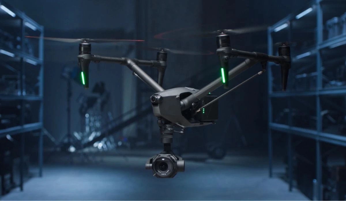 Source: DJI
The DJI Inspire 3 is the most powerful drone for aerial cinematography. The Inspire 3 is a professional camera drone with a sleek, aerodynamic design that reduces air resistance. It has an extended flight time of up to 28 minutes.
This all-in-one 8K camera drone gives professional filmmakers the power to fully maximize the potential of any shot and capture even the most elusive moments. However, it’s also the most expensive and least portable drone in this comparison.
Autel Robotics EVO II PRO 6K Drone
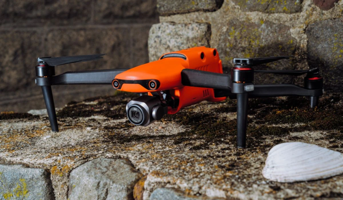 Source: PC Mag
The Autel Robotics EVO II PRO 6K Drone is a high-end drone that offers excellent image quality. It offers 360-degree obstacle avoidance and shoots 6K video at 30fps or 4K video at 60fps. It is great for night photography. The EVO II PRO has a flight time of about 40 minutes.
DJI Mini 3 Pro
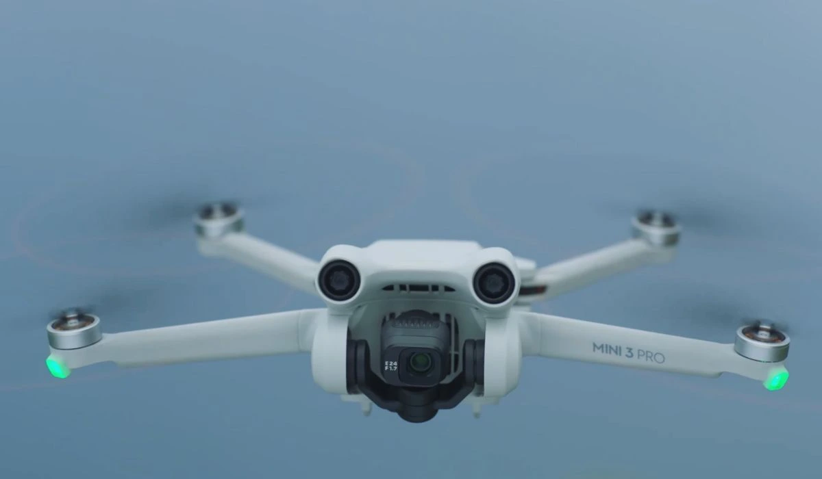 Source: DJI
The DJI Mini 3 Pro is one of the smallest and lightest drones, making it very portable and easy to travel with. It weighs under 249 grams and offers tri-directional sensing. It has an extended flight time of up to 34 minutes. With a higher dynamic range, this drone captures more detail in highlights and shadows.
DJI has recently introduced the latest addition to its lineup, the DJI Mini 4 Pro.
Here’s a concise comparison between the Mini 3 Pro and the Mini 4 Pro:
| Feature | DJI Mini 3 Pro | DJI Mini 4 Pro |
| Weight | Under 249 Grams | Under 249 Grams |
| Camera Sensor | 1/1.3-inch CMOS | 1/1.3-inch CMOS |
| Obstacle Avoidance | Tri-directional | Omnidirectional |
| Remote Controller | DJI RC-N1 | DJI RC |
| Flight time | 34 minutes | 34 minutes |
| Camera Resolution | 4K/60fps, 4K/30fps HDR
Slow Motion: 1080p/120fps |
4K/60fps HDR
Slow Motion: 4K/100fps & Night Shots Video |
| Color Mode | D-Cinelike | 10-bit D-Log M, HLG |
| Supports | DJI O3: Up to 12 km
1080p/30fps Live Feed |
DJI O4: Up to 20 km
1080p/60fps Live Feed |
Freefly Systems Astro
 Source: Auterion
Freefly Astro is a compact, rugged industrial drone that is designed for a variety of applications, including aerial photography, videography, inspection, and mapping. It features a stabilized gimbal that can support a variety of payloads, up to 1.5 kg. The efficient propulsion system of Astro allows the aircraft to fly for up to 37 minutes.
One of the unique features of Astro is its LTE connectivity. This allows the drone to transmit data directly to the cloud, so you can easily access your images and videos from anywhere.
Astro also has a variety of sensors, including an RTK system, which ensures accurate positioning and mapping, which will come in handy if you end up working the location scouting aspects of the industry.
DJI Air 3
 Source: DJI
The DJI Air 3 is a good compromise between portability and performance. It is small enough to be easily portable, but it has a larger camera sensor and more powerful motors than the Mini 3. It can produce better image quality and fly faster and farther.
The DJI Air 3 is a compact, foldable drone with a maximum flight time of 46 minutes. It has omnidirectional obstacle sensing to help it avoid obstacles in all directions (though you may find yourself turning these off more often than not). The Air 3 has two cameras that can capture 48MP photos with superior detail. It can also record 4K/60fps HDR videos, resulting in stunning and vibrant visuals.
How Different Industries Use Drone Cinematography
Drones have completely transformed how various industries capture breathtaking aerial shots. These versatile devices offer cost-effective and flexible solutions for obtaining stunning and dynamic footage from unique angles.
Now, let’s take a closer look at how different sectors harness the power of drones for aerial shots, accompanied by some standout examples.
Film and Television Industry
 Mission Impossible Behind the Scenes | Source: Paramount Pictures
Drones have reshaped the landscape of filmmaking and television production. They’re used to capture breathtaking landscapes, intense chase scenes, establishing shots, and dynamic action sequences.
With drones, filmmakers now have the creative freedom to achieve shots that were once only possible with expensive helicopters or complex cranes. This technology allows for intricate movements and perspectives that greatly enrich storytelling possibilities.
Example: Pepsi – “Drone Football” (2014)
In this memorable commercial, drones are cleverly integrated to film a lively and unique football match. The drones inject energy and excitement, effectively showcasing the product while highlighting Pepsi’s technological innovation.
Real Estate Industry
Drones are at the forefront of transforming real estate marketing. By providing aerial perspectives, they offer potential buyers a comprehensive view of properties. These shots not only reveal property features but also provide insights into the surrounding neighborhood and landscape. This dynamic footage significantly enhances the buying experience, assisting potential buyers in making well-informed decisions.
Example: RE/MAX – “Above the Crowd” (2015)
This commercial showcases the impact of drone technology on the real estate market. Through captivating drone shots, the commercial effectively communicates the advantages of viewing properties from above, making the properties themselves more appealing and distinct.
 Source: Pinterest
Tourism and Hospitality
Drones have become a staple in travel and hospitality marketing, playing a crucial role in enticing travelers with visually appealing content. They capture stunning aerial shots of destinations, resorts, and attractions, offering potential tourists a sneak peek into the experiences that await them. These captivating visuals inspire travelers to plan their trips and explore the world.
Example: Expedia – “New Zealand in a Minute” (2016)
This commercial uses drone shots to showcase diverse travel experiences, encouraging viewers to explore new horizons. The inclusion of aerial footage adds depth to the storytelling, emphasizing the potential for discovery and understanding through travel.
Sports Broadcasting
Drones have injected an exciting new dimension into sports broadcasting. By capturing high-energy action from above, drones provide viewers with a fresh perspective on games and events. These shots capture the intensity of the action, the size of the venues, and the excitement of the crowd, enhancing the overall viewing experience.
Example: GoPro – “Karma: The Launch in 4K” (2016)
While not a traditional commercial, this GoPro video showcases the capabilities of the Karma drone. The footage captures various sports and outdoor activities from captivating aerial angles, effectively showcasing the potential of drones in sports coverage.
Advertising and Marketing
 Intel Drone Light Show | Source: Intel
Drones have emerged as powerful instruments for advertisers and marketers. They allow for the creation of visually captivating content that stands out in today’s crowded digital landscape.
With aerial shots produced by drones, a unique viewpoint is offered, one that captures attention and effectively conveys brand messages, making them more memorable and engaging for the audience.
Example: Lexus – “Amazing in Motion: Swarm” (2014)
This Lexus commercial combines real and CGI drones to create a visually stunning display. The drones’ choreographed movements embody the brand’s innovative spirit, showcasing the endless creative possibilities enabled by drone technology.
While drones offer incredible possibilities, it’s important to note that their use is subject to regulatory guidelines that vary by location. To fully harness the benefits of drones for capturing aerial shots, adherence to local drone laws and regulations is essential.
Frequently Asked Questions
1. Are there specific movements or maneuvers that will help enhance the storytelling?
To boost storytelling through drone cinematography, it’s important to consider particular movements and maneuvers. Using techniques like tracking shots, aerial pans, and revealing shots can actively engage the audience and evoke emotions.
For example, a slow, sweeping drone movement can create a sense of calm or wonder, while quick and sudden changes in altitude or direction can convey tension or excitement. The key is to align these movements with the story’s rhythm and emotional moments to enhance the overall storytelling experience.
2. How can the aerial shots be integrated seamlessly with ground-based footage?
Achieving smooth integration between aerial shots and ground-based footage is crucial for a unified cinematic experience. To do this, careful planning and attention to detail are necessary.
Begin by establishing a consistent visual style, such as matching color grading and composition, between the aerial and ground shots.
Transitions between these shots can be facilitated through editing techniques like match cuts or using natural objects (e.g., trees or buildings) as visual connections. Additionally, using smooth and gradual camera movements during drone shots can make transitions easier and create a more seamless blend between the two perspectives.
3. How are drones used in cinematography?
Drones have a wide range of applications in cinematography. They are used to capture stunning aerial views, dynamic tracking shots, and intricate overhead perspectives that were previously challenging to achieve.
Moreover, they’re also used in opening shots, revealing important locations, and conveying a sense of scale.


More on Hot Topics