Top 6 Follow Me Drones To Elevate Your Aerial Adventures (2025)
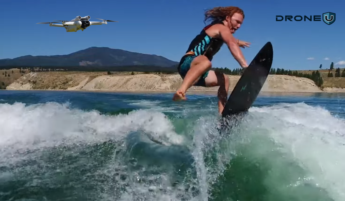
Ever dreamed of capturing your mountain bike ride from a breathtaking bird’s-eye view or filming your solo adventure hands-free? With follow-me drones, you can redefine your outdoor experiences. Gone are the days when you had to control your drone manually while trying to capture action shots.
Follow-me drones now handle the complex flight paths, framing, and obstacle avoidance automatically, so you can focus on the moment.
Whether you’re riding trails, shooting content, or exploring new places, these drones allow you to capture professional-quality videos, hands-free.
But not all follow-me drones are created equal. From intelligent tracking systems and stunning 4K/5.7K video to reliable obstacle sensors, finding the perfect drone can be a daunting task.
That’s why we’ve done the legwork for you.
In this article, we’ll explore the six best follow-me drones of 2025, comparing their specs, flight features, stats, and real-world applications. So that you can confidently choose the one that fits your lifestyle and budget.
Disclaimer: Always follow local drone regulations and respect privacy and safety guidelines when flying your drone.
Let’s dive in and understand the concept of follow-me drones and how they work.
What Are Follow-Me Drones?
Drones That Follow You, also known as follow-me drones, are autonomous unmanned aerial vehicles (UAVs) equipped with advanced subject-tracking systems. These drones are designed to lock onto a moving target, usually a person, vehicle, or object, and autonomously follow their path from the air.
Think of them as your flying cameraman, only smarter, faster, and trained to keep you in perfect frame.
Why should you consider purchasing a drone that follows you? The answer lies in the section.
We’ll explore some great follow-me drone options for you. But you might wonder, how did we choose these drones? Here’s what we looked at.
How We Chose the Drones on this List
We didn’t pick these drones based on just their popularity. We reviewed dozens of drones and tested how well they perform in follow-me mode, their camera quality, flight time, obstacle avoidance, and overall reliability in real-world conditions.
Our process includes:
- Hands-on testing in multiple environments (urban, rural, coastal).
- Spec verification using official manufacturer documentation.
- Feature comparison against competing models in the same price range.
- User feedback review from experienced drone pilots and hobbyists.
Our Experience – Why Trust Our Opinion?
We’ve spent over a decade flying and testing drones. We’ve worked with everything from budget hobby drones to high-end aerial rigs used in professional shoots. Since 2013, we’ve tested almost every major consumer drone and even worked directly with brands like DJI, Autel, and Skydio.
Why Follow-Me Drones Are Game-Changers
The rise of follow-me drones has redefined aerial photography and videography. Here’s why they’ve become indispensable:
- Hands-Free Operation: Perfect for activities like biking, skiing, or hiking, you can focus on your adventure while the drone takes care of filming.
- Creative Freedom: These drones offer cinematic tracking shots that were once impossible without a large crew.
- Built-in Safety and Precision: Most follow-me drones come with built-in multidirectional sensors and advanced obstacle-avoidance systems. These features help prevent collisions and ensure smooth flights even in challenging environments.
- Intelligent Subject Tracking: Equipped with advanced tracking systems, these drones use AI vision systems and machine learning to recognize and stay locked onto you, even in a crowd.
- Versatile Shooting Modes: From drone selfies to time-lapses, hyper lapses, and panoramic orbits, most follow-me drones support a wide variety of automated shooting modes.
Let’s now take a closer look at some of the top picks of follow-me drones.
6 Best Drones That Follow You
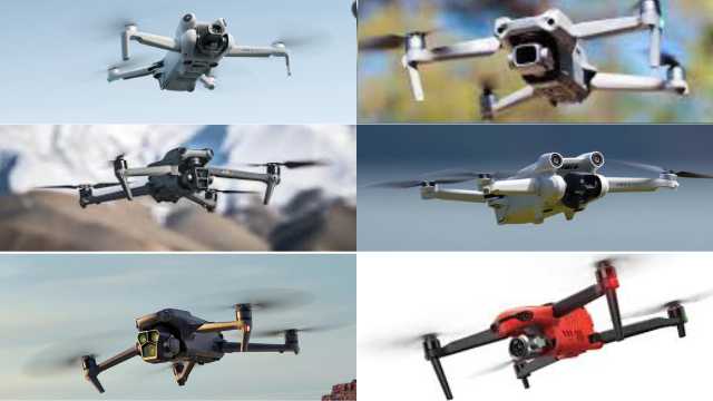
Among the myriad options available today, only a few offer a combination of intelligent tracking, reliable obstacle avoidance, and high-quality cameras in follow-me mode.
To make it easier for you, we’ve included 6 of the best follow-me drones in 2025.
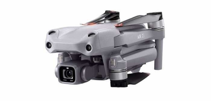
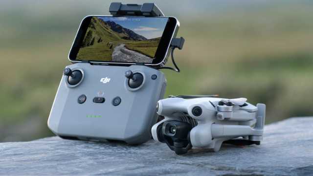
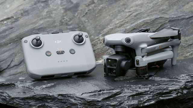
1. DJI Air 2S
 Credit: DJI
The DJI Air 2S is a powerful drone packed with impressive features. This drone is equipped with a 1-inch CMOS sensor, allowing it to capture stunning 20-megapixel photos and record 5.4K videos.
With its ActiveTrack 4.0 technology, the DJI Air 2S can intelligently track and follow subjects with great precision. Whether you are hiking, biking, or simply exploring the great outdoors, this drone will seamlessly capture every moment.
Specifications
| Feature | DJI Air 2S |
| Camera | 1-inch CMOS Sensor, 20MP |
| Video Resolution | 5.4K @ 30fps, 4K @ 60fps |
| Photo Resolution | 20MP |
| Gimbal | 3-axis gimbal stabilization |
| Obstacle Sensing | Forward, Backward, Upward, Downward Vision Systems, Infrared Sensing System |
| Maximum Flight Time | 31 minutes |
| Maximum Flight Speed | 42 mph (68.4 kph) |
| Transmission Range | 12km (7.5 mi) |
| Transmission Technology | O3 (OCUSYNCTM 3.0) |
| Intelligent Flight Modes | MasterShots, QuickShots, FocusTrack, ActiveTrack |
| Remote Controller | DJI RC-N1 |
| Mobile Device Compatibility | DJI Fly App |
| Weight | 595g (1.31 lbs) |
Best For: High-quality imaging with reliable tracking
2. DJI Mini 3 Pro
 Credit: DJI
For those seeking a more portable option, the DJI Mini 3 Pro is a perfect choice. This lightweight drone is small enough to fit in the palm of your hand, yet it offers advanced features that make it a powerhouse in the sky.
With its upgraded motors and enhanced flight performance, the DJI Mini 3 Pro can effortlessly keep up with fast-paced activities. Whether you are racing down a mountain trail or participating in extreme sports, this drone will document every exhilarating moment.
Specifications
| Feature | DJI Mini 3 Pro |
| Weight | Less than 249g |
| Camera | 1/1.3-inch CMOS sensor |
| Video Resolution | Up to 4K/60fps |
| HDR Video | Yes |
| Still Photo Resolution | Up to 48MP |
| FocusTrack | ActiveTrack, Spotlight, Point of Interest |
| MasterShots | Create automated cinematic sequences |
| Timelapse | Create hyperlapse or timelapse videos |
| True Vertical Shooting | Native portrait mode filming |
| Tri-Directional Obstacle Sensing | Forward, backward, and downward sensors |
| APAS 4.0 (Advanced Pilot Assistance Systems) | Obstacle avoidance and automatic flight assistance |
| DJI O3 Digital Video Transmission | Up to 12km range (DJI RC-N1) |
| Max Flight Time | 34 minutes (Standard Battery) |
| Remote Controller Options | DJI RC-N1 or DJI RC |
| Max Video Bitrate | 18 Mbps |
| Latency | 120 ms |
Best For: Travel-friendly drone with serious power
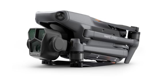
3. DJI Mavic 3 Pro
 Credit: DJI
The DJI Mavic 3 Pro with DJI RC is a top-of-the-line drone that offers unparalleled performance and versatility. Equipped with an impressive Hasselblad camera and a 4/3-inch CMOS sensor, this drone captures breathtaking 20-megapixel photos and records cinematic 4K videos.
With its advanced flight modes, including Spotlight 2.0 and ActiveTrack 5.0, the DJI Mavic 3 Pro, paired with the DJI RC, ensures that you can effortlessly capture stunning footage from every angle.
Specifications
| Feature | DJI Mavic 3 Pro with DJI RC |
| Weight | 998g (drone + DJI RC) |
| Camera | Hasselblad L2D-20c 4/3 CMOS sensor |
| Video Resolution | Up to 5.7K/60fps, 4K/120fps |
| HDR Video | Yes (10-bit D-Log) |
| Still Photo Resolution | Up to 20MP |
| FocusTrack | ActiveTrack, Spotlight, Point of Interest |
| MasterShots | Create automated cinematic sequences |
| Timelapse | Create hyperlapse or timelapse videos |
| True Vertical Shooting | Native portrait mode filming |
| Tri-Directional Obstacle Sensing | Forward, backward, and downward sensors |
| APAS 4.0 (Advanced Pilot Assistance Systems) | Obstacle avoidance and automatic flight assistance |
| DJI O3 Digital Video Transmission | Up to 15km range (DJI RC) |
| Max Flight Time | 46 minutes (Standard Battery) |
| Remote Controller | DJI RC |
| Max Video Bitrate | 200 Mbps |
| Latency | 120 ms |
Best For: Professional filmmakers and cinematic tracking
4. DJI Mini 4 Pro
Credit: DJI
A top choice for beginners and solo content creators. The DJI Mini 4 Pro features DJI’s latest ActiveTrack 360 technology, allowing for smooth and precise subject tracking in all directions.
It also includes omnidirectional obstacle sensing and 4K/60fps HDR video. It weighs under 249g, so you don’t need FAA registration.
Mini 4 Pro is a great pick if you want smart tracking in a lightweight, portable drone.
Specifications
| Feature | DJI Mini 4 Pro |
| Weight | <249g |
| Camera | 1/1.3-inch CMOS sensor |
| Video Resolution | Up to 4K/100fps, 4K/60fps HDR |
| HDR Video | Yes (10-bit D-Log M and HLG) |
| Still Photo Resolution | Up to 48MP |
| FocusTrack | ActiveTrack 360°, Spotlight, Point of Interest |
| MasterShots | Create automated cinematic sequences |
| Timelapse | Create hyperlapse or timelapse videos |
| True Vertical Shooting | Native vertical video mode |
| Omnidirectional Obstacle Sensing | Forward, backward, sides, top, and bottom |
| APAS | APAS 5.0 for smoother obstacle avoidance |
| Transmission | DJI O4 (up to 20km range) |
| Max Flight Time | 34 minutes (Standard Battery), 45 minutes (Plus Battery) |
| Remote Controller Options | DJI RC 2 or DJI RC-N2 |
| Max Video Bitrate | 150 Mbps |
| Latency | 120 ms |
Best For: Ultra-light, feature-rich follow-me performance under 250g
5. DJI Air 3
Credit: DJI
The DJI Air 3 is one of the most versatile follow-me drones in 2025. It features a dual-camera setup, a wide-angle lens, and a 3x medium telephoto, both powered by 1/1.3-inch CMOS sensors. This gives you more framing flexibility when tracking subjects, whether you want dramatic close-ups or sweeping wide shots.
With ActiveTrack 5.0, it can smoothly follow subjects from the front, side, or rear, and even switch perspectives mid-flight. It also includes omnidirectional obstacle sensing, so it can navigate safely through complex environments.
This drone also offers 46 minutes of flight time, Waypoint tracking support, and the new OcuSync 4.0 transmission system, which boosts range up to 20 km.
In short, the Air 3 delivers high-end tracking and flight features in a compact frame, making it perfect for content creators, adventurers, and sports users alike.
Specifications:
| Feature | DJI Air 3 |
| Weight | Approx. 720g (drone + DJI RC 2) |
| Camera | Dual-camera system:
• 1/1.3? CMOS Wide-Angle • 1/1.3? CMOS 3x Medium Tele |
| Video Resolution | Up to 4K/100fps, 4K/60fps HDR, 1080p/120fps |
| HDR Video | 10-bit D-Log M and HLG |
| Still Photo Resolution | Up to 48MP |
| FocusTrack | ActiveTrack 5.0, Spotlight 2.0, Point of Interest 3.0 |
| MasterShots | Create automated cinematic sequences |
| Timelapse | Hyperlapse, Timelapse, and Waypoint Time Capture |
| Omnidirectional Obstacle Sensing | forward, backward, sides, top, bottom |
| APAS (Advanced Pilot Assistance Systems) | APAS 5.0: enhanced obstacle avoidance and rerouting |
| Transmission | DJI O4 up to 20 km range (DJI RC 2) |
| Max Flight Time | Up to 46 minutes (with Intelligent Flight Battery) |
| Remote Controller | DJI RC 2 (plus RC-N2) |
| Max Video Bitrate | 150 Mbps |
| Latency | Approx. 120 ms (depending on environment and device) |
Best For: Dual-camera tracking with long flight time
6. Autel EVO II Pro V3
Credit: Autel
If you’re looking for a follow-me drone that can follow you accurately and also capture high-quality footage, the Autel EVO II Pro V3 is a reliable companion.
It packs a 1-inch CMOS sensor capable of shooting 6K video. You also get a variable aperture of f/2.8 to f/11, which is rare in consumer drones. This is a rare feature in drones that gives you creative control even in bright or low-light conditions.
The EVO II Pro uses Dynamic Track 2.1, an advanced AI system that follows moving subjects smoothly. It can follow from the side or front, depending on how you’re moving. With 360-degree coverage, it can detect and avoid obstacles in every direction.
You also get up to 40 minutes of flight time, a 15km range, and a rugged build that stands up to wind better than smaller drones.
If you want more manual control and plan to shoot fast-moving action, the EVO II Pro is the solid choice.
Specifications:
| Feature | Autel EVO II Pro V3 |
| Weight | 1191g (drone only) |
| Camera | 1-inch CMOS Sensor (Sony) |
| Video Resolution | Up to 6K/30fps, 4K/60fps |
| HDR Video | Yes (10-bit Log and HDR supported) |
| Still Photo Resolution | Up to 20MP |
| Focus Tracking | Dynamic Track 2.1, Tripod Track, Parallel Track |
| Smart Flight Modes | Orbit, Waypoint, Follow Me (Dynamic Track 2.1), Precision Flight |
| Timelapse | Supported ((including Hyperlapse) |
| Vertical Shooting | No true vertical, but can crop or rotate |
| Omnidirectional Obstacle Sensing | Front, rear, top, bottom, and lateral sensors |
| Autel Autonomy Engine | Obstacle avoidance, auto-return, precision hover |
| Transmission | SkyLink 2.0 up to 15km range |
| Max Flight Time | 40 minutes |
| Remote Controller | Autel Smart Controller SE / Standard RC |
| Max Video Bitrate | 120 Mbps |
Best For: Professionals who want long-range tracking with advanced camera control
We’ve shared our top picks and how we chose them. But that still leaves one big question: Which one is right for you?
Let’s take a closer look at factors to consider before buying a follow-me drone.
What to Look for While Choosing a Follow Me Drone
When it comes to choosing the best drone that follows you, here are the key factors to get a drone that meets your needs:
1. Camera Quality: 4K is the New Minimum
The whole point of having a drone that follows you is to capture stunning aerial footage. Look for a drone that has a high-resolution camera capable of shooting in 4K or even higher. The drone’s camera sensor size and resolution determine the detail and clarity of your photos and videos. Larger sensors (like 1” or 1/1.3”) and higher resolutions generally produce better results, especially in low-light conditions.
Also, ensure the drone offers image stabilization, either Electronic Image Stabilization (EIS) or a 3-axis gimbal. This helps to capture smooth and steady footage while the drone is in motion.
2. Flight Time
Since follow-me drones are often used for capturing action-packed moments, you’ll want a drone that can stay in the air for a decent amount of time. Look for a drone that offers a flight time of at least 25 minutes or more. Also, check if extra batteries are included.
This will ensure that you have enough time to capture the shots you want without constantly having to return to base for a battery change.
3. Follow Me Technology: GPS Tracking or Vision-Based (ActiveTrack)
The follow-me drone relies on advanced tracking technology. There are two main types of follow-me technology: GPS tracking and ActiveTrack.
GPS tracking uses satellite positioning to track and follow the GPS coordinates of a target. This technology is more accurate and reliable, making it ideal for areas with an open sky and good satellite reception. Drones that use GPS tracking are great for outdoor activities such as hiking, cycling, and skiing.
On the other hand, ActiveTrack technology uses computer vision algorithms to detect and track a target in real time. Vision-based drones offer frame-aware following, meaning they don’t just chase your signal. They understand how you move in the shot.
This technology is ideal for scenarios where GPS signals might be weak or obstructed, such as indoor activities or in dense urban environments. Drones with ActiveTrack technology are perfect for capturing fast-paced action sports or filming in crowded areas.
4. Obstacle Sensing
Obstacle sensing is an essential safety feature to consider when choosing a drone that follows you. This technology allows the drone to detect and avoid obstacles in its path, preventing collisions and accidents.
Look for a drone that has obstacle sensors on multiple sides, including the front, back, sides, and bottom. This will provide maximum protection against obstacles during autonomous flight.
With these factors in mind, here is a quick comparison table that will allow you to choose the best follow-me drone:
| Drone | Camera | Flight Time | Follow me Technology | Obstacle Sensing | Base Price |
| DJI Air 2S | 1-inch CMOS, 20 MP | 31 minutes | ActiveTrack | 4 Directions | USD 825 |
| DJI Mini 3 Pro | 1/1.3-inch CMOS, 48 MP | 34 minutes | ActiveTrack | Tri-Directional | USD 702 |
| DJI Mavic 3 Pro with DJI RC | Hasselblad Camera: 4/3 CMOS, 20 MP
Medium Tele Camera: 1/1.3? CMOS, 48 MP |
43 minutes | GPS + Galileo + BeiDou | Omnidirectional | USD 2,199 |
| DJI Air 3 | Dual 1/1.3-inch, 48MP | 46?minutes | ActiveTrack 5.0 | Omnidirectional | USD 1,099 |
| Autel EVO II Pro | 6K, 48?MP | 40 minutes | DynamicTrack 2.0 | Omnidirectional | USD 2,199 |
| DJI Mini 4 Pro | 1/1.3-inch CMOS, 48 MP | 34 minutes (45 max) | ActiveTrack 360° | Omnidirectional | USD 759 |
Conclusion
Follow-me drones have transformed how content creators, adventurers, and professionals capture their stories.
They’re now smarter and more capable. Most of these drones now pack AI-powered tracking, advanced obstacle avoidance, and built-in cinematic flight modes as standard features.
This technology continues to push boundaries, unlocking creative shots and practical aerial views that weren’t possible just a few years ago.
With options ranging from beginner-friendly models like the DJI Mini 4 Pro to flagship drones like the DJI Mavic 3 Pro, there’s a perfect follow-me drone for every pilot.
With the right combination of features such as a high-quality camera, long flight time, advanced tracking technology, and obstacle-sensing capabilities, you can capture breathtaking footage from a unique perspective.
So, which one will you choose to take your adventures to the skies? Let us know in the comments!
Frequently Asked Questions
1. What Are Active Track And Sensors In Follow Me Drones?
Active Track and Sensors are the core of modern follow-me systems. These advanced tracking and sensing technologies enable the drone to follow its subject accurately and safely, even in challenging environments and at high speeds.
2. What is the “Follow Me” Option on Drones?
The “Follow Me” feature on drones allows the aircraft to autonomously track and film a moving subject without any manual control.
This is accomplished through a combination of advanced GPS technology, real-time AI recognition, computer vision, and multi-directional tracking, these drones. These drones offer a hands-free experience, allowing you to focus on your activities while capturing mesmerizing footage from unique perspectives.
3. How Does a Drone Follow Me?
Drones with the follow-me function use various methods to track and follow a person. Most commonly, they utilize the GPS signal from your smartphone or a dedicated tracking device. By connecting to the drone’s app, the aircraft receives real-time information about your location, ensuring accurate tracking.
Additionally, some advanced drones employ object recognition and computer vision algorithms to precisely follow a subject, even in complex environments.
4. How Long Can a Drone Follow You?
The duration a drone can follow you depends on several factors, including its battery life and the specific model’s capabilities. Now, many drones offer 30 to 46 minutes of continuous flight per charge, depending on tracking mode and speed.
Modern drones offer return-to-home features, automatically returning to their take-off point when the battery is running low. This ensures your drone won’t get stranded in the sky while following you.
Also, swapping batteries or using portable chargers is now common for extended outdoor filming sessions.
5. What is it Called When a Drone Follows You?
When a drone actively follows you, it is commonly referred to as “ActiveTrack” or “DynamicTrack”. These terms embody the ability of the drone to independently track your movements and adjust its flight path to keep you in focus.
The follow-me function enables the drone to act as your aerial cameraman, smartly capturing your adventures from stunning angles while you remain completely engrossed in the moment.
Class E Airspace: A Comprehensive Guide for Drone Pilots (2025)
You’re setting up for the perfect drone shot when your app flashes a warning: “Controlled airspace ahead.” You check your altimeter, and you’re well under 400 feet.
So, you wonder how that could be possible?
The answer lies in Class E airspace, one of the most common yet misunderstood FAA airspace categories.
Unlike Class D or B, the boundaries of Class E airspace shift depending on location, its visibility requirements change with altitude, and it doesn’t always start at the same height. It can start at the surface, at 700 feet, or even at 1,200 feet AGL, depending on where you are.
For drone pilots, that means you could be in Class E without even realizing it.
This guide clears up that confusion.
In this article, we will dive deep into Class E Airspace—from where it begins, to when you need FAA authorization, and how it affects your daily flights. We’ll also examine the different types of Class E, visibility requirements, and exactly when and where you can fly.
Let’s start by understanding exactly what Class E airspace is.
What is Class E Airspace?
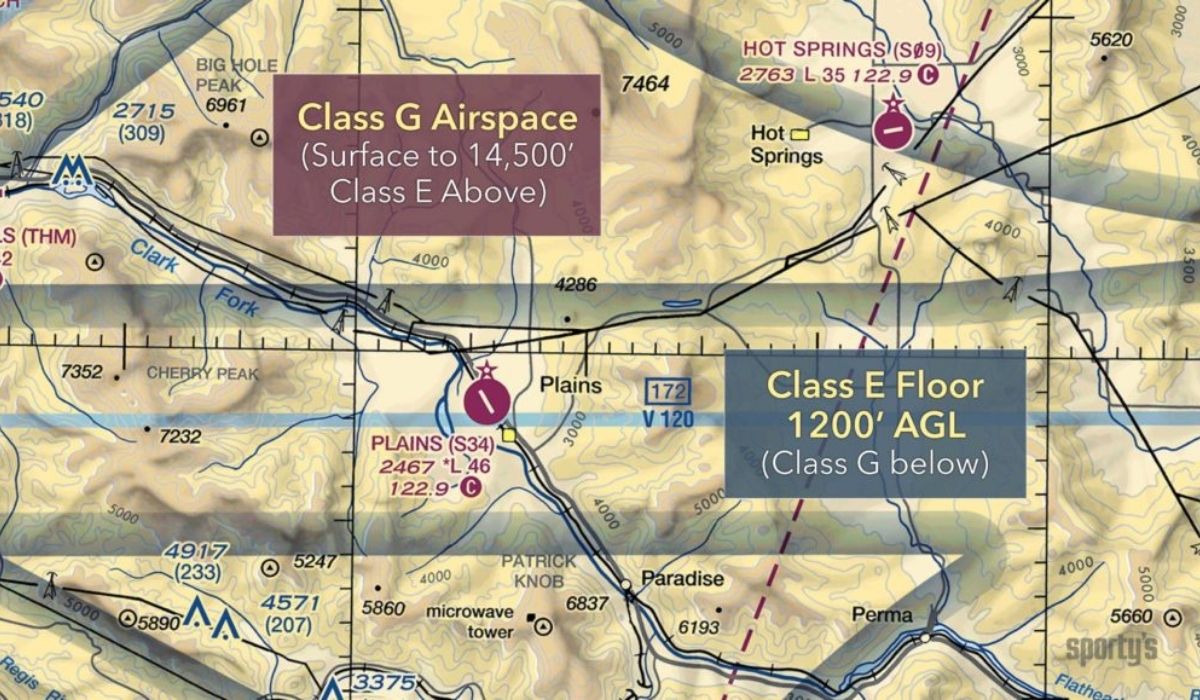
Class E airspace is one of the six FAA-designated controlled airspace classes in the U.S. It’s often informally referred to as “Class Everywhere” or “Class Eco” due to its widespread presence in the United States.
Class E covers most of the airspace between higher-altitude commercial traffic and lower-level recreational flights. Think of it as the bridge between controlled and uncontrolled airspace.
While Class E may be less restrictive than Class A, B, C, or D airspace, it still maintains specific FAA rules, especially regarding weather minimums, pilot certifications, and ATC services.
Understanding these rules is essential for safe and legal drone operations.
So, what are the key characteristics of this Class Eco airspace, and what should drone pilots keep in mind?
Let’s find out.
Understanding Class E Airspace Altitudes
One of the most confusing aspects of Class E airspace is where it begins. That’s because it doesn’t have a single, fixed starting altitude. The base of Class E airspace varies depending on its location, terrain, and purpose.
In certain areas, there is also Class E airspace above Flight Level 600 (approximately 60,000 feet MSL).
Class E airspace operates at different altitudes depending on its use.
| Boundary Type | Typical Limit | Purpose |
| Vertical limits (Altitude Boundaries)
Upper Limit |
Up to but not including 18,000 ft MSL |
Marks the top of Class E before Class A begins (FL180) |
| Lower Limit | 1,200 ft AGL | Standard floor in remote/rural areas for en route IFR traffic |
| 700 ft AGL | Common near non-towered airports to support published IFR approach and departure procedures | |
| 0 ft AGL (Surface) | Found only at some non-towered airports with Class E Surface Areas (E2) and published IFR operations | |
| Horizontal Limits | Varies by location and airspace structure | May form circular zones around airports, follow IFR airways, or extend across wide rural regions |
Class E Airspace Types
Before diving into the different types of Class E Airspace, let’s start with why this airspace exists in the first place.
Class E airspace was designed to manage and separate IFR (Instrument Flight Rules) and VFR (Visual Flight Rules) traffic. It allows Air Traffic Control (ATC) to maintain a level of oversight, even when you are outside the controlled zones of Class A, B, C, and D airspace.
Let’s take a closer look at the different types of Class E Airspace:
1. Class E Surface Areas (E2)
This type of airspace usually begins at the surface and is usually found around non-towered airports with published IFR procedures.
These surface areas provide controlled airspace from the ground up, allowing for safe takeoffs, landings, and maneuvering near airports.
If you’re flying drones in an E2 surface area under Part 107, you need FAA authorization (via LAANC or DroneZone), just like you would in Class D airspace.
2. Class E Transitional Areas (E3)
This type of airspace begins at 700 or 1,200 feet above ground level (AGL) and is positioned around airports. It typically allows a safe transition between the airport and higher altitudes to stay within controlled airspace.
Most of this airspace sits above your 400 ft flight ceiling. Flying drones in these areas sometimes requires additional caution and authorization.
3. Class E Extensions to a Surface Area (E4)
E4 airspace consists of narrow extensions stretching out from Class D or Class C airspace to facilitate safe arrivals and departures on a specific route.
Basically, these extensions allow for controlled space in specific directions without expanding the Class D or C airspace.
If you’re flying drones in these extensions at or above surface level, you’ll likely need LAANC approval.
4. Class E Enroute Airspace
En route airspace is designed to form safe travel corridors when flying at cruising altitudes.
This airspace stretches across the country alongside established airways and provides a safe zone when flying long distances.
It usually starts at 1,200 ft AGL and fills the space between Class G and Class A.
5. High Altitude Class E (Above FL 600)
This airspace extends from Flight Level 600 (approximately 60,000 feet) and above. This controlled airspace is used for specialized operations, including military testing and space operations. It ensures separation from commercial and general aviation traffic at lower altitudes.
This airspace is far above the altitude at which drones can operate. Still, it’s helpful to know it exists, especially as drone technology, high-altitude balloons, and near-space platforms continue to develop.
Here’s a table summarizing the Class E Airspace types:
| Class E Airspace Type | Description | Purpose |
| Class E Surface Areas (E2) | Begins at ground level around airports without control towers. | Provides controlled airspace for safe takeoffs, landings, and maneuvering near airports. |
| Class E Transition Areas (E3) | Starts at 700 or 1,200 feet AGL around airports. | Allows aircraft to transition safely between the airport and higher altitudes. |
| Class E Extensions to a Surface Area (E4) | Extensions of Class D or C airspace | Facilitates controlled arrivals and departures along specific routes without expanding Class D or C boundaries. |
| Class E En route Airspace | Covers extensive corridors at cruising altitudes across the country. | Provides safe zones for long-distance flights along established airways. |
| High Altitude Class E (Above FL 600) | Extends from 60,000 feet and higher. | Supports high-altitude operations, space activities, and military testing, keeping them separate from lower traffic. |
How Class E Airspace is Depicted on Sectional Charts
Three important Class E Airspace types are depicted on sectional charts using different color shades and patterns, indicating their boundaries and altitude levels.
1. Class E Surface Area (E2)
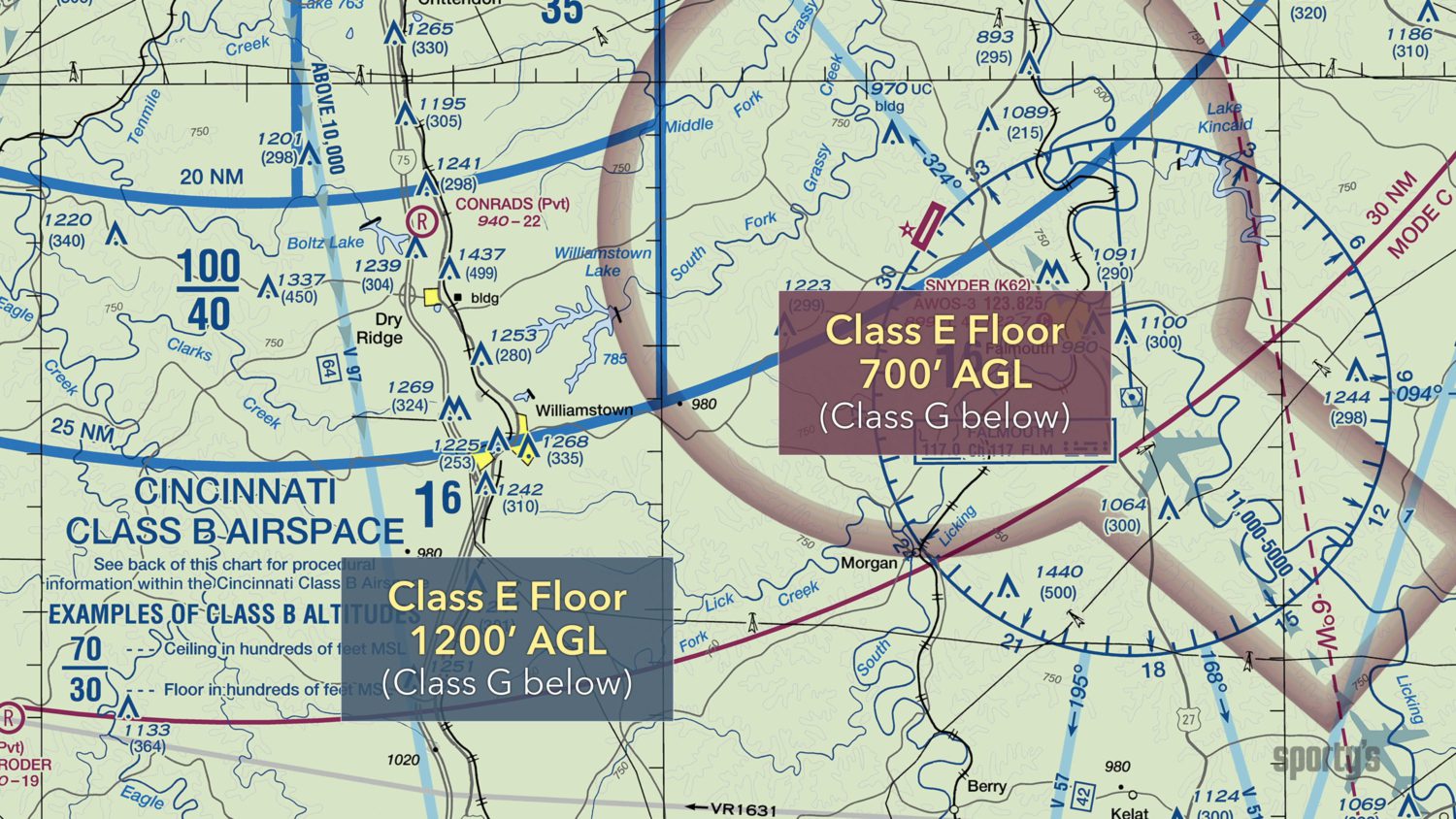
Sectional charts symbolize this airspace as dashed magenta lines, indicating that this area is controlled from the ground up.
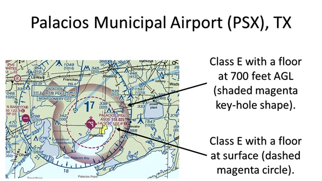
2. Class E Transition Areas (E3)
This one can begin from 700 to 1,200 feet above AGL, so it’s depicted in two ways.
| 700 feet AGL | The thick shaded magenta band represents this area, indicating that Class E Airspace starts at 700 feet AGL around near-towered airports. |
| 1,200 feet AGL | The thick shaded blue band represents this area, indicating that Class E Airspace starts at this altitude in areas away from airports. |
3. Class E En route Airspace and Airspaces Above FL 600
No specific boundaries are used, as it often extends across wide airways and has no marked limits.
Class E Airspace Requirements for Drone Pilots
According to the FAA, Class E Airspace drone pilots must follow weather and visibility requirements to ensure safe flying operations.
As of September 2023, all Part 107 and recreational pilots must operate drones equipped with Remote ID or fly within an FAA-Recognized identification Area (FRIA). This requirement applies even in Class E airspace.
1. Class E Airspace Visibility Requirements and Weather Minimums
| Altitude | Visibility | Cloud Clearance |
| Below 10,000 feet MSL | 3 statute miles | Must remain 500 feet below, 1,000 feet above, and 2,000 feet horizontally from clouds. |
| At or above 10,000 feet MSL | 5 statute miles | Must remain 1,000 feet below, 1,000 feet above, and 1 statute mile horizontally from clouds. |
2. Drone Flying Authorization Requirements for Class E Airspace
In controlled Class E Airspace near airports, drone pilots may need prior flying authorization through the LAANC (Low Altitude Authorization and Notification Capability).
LAANC provides access to certain Class E surface areas (E2), but only at participating airports listed in the FAA’s LAANC facility map. Not all Class E airports are LAANC-enabled, so availability depends on the specific location.
Most flight planning apps automatically check your Remote ID status and display live weather, NOTAMs, and airspace restrictions in real time. This makes preflight planning faster, but FAA rules still require you to confirm all conditions yourself before flying.
The following are the requirements:
- For Class E starting at 700 or 1,200 feet AGL, no prior authorization is required for drone operations.
- For surface Class E Airspace (E2), you must obtain prior authorization from Air Traffic Control (ATC) before operating within this airspace.
- For Class En Route and transition areas (including E3 and E4), you don’t need prior authorization because they are long distances or used only for high-altitude aircraft.
- Night operations in Class E airspace: Drone pilots must follow additional requirements for night operations, including:
– Aircraft must be equipped with anti-collision lighting visible for 3 statute miles
– Pilots must complete additional night operations training under Part 107
– All other Class E weather minimums still apply
Note: Most drone operations occur below Class E airspace in many areas, as the typical 400-foot AGL ceiling for drone operations often places them in Class G (uncontrolled) airspace.
Conclusion
Class E Airspace might seem complex at first, but once you understand how its altitudes, types, and boundaries work, it becomes a part of your smart flight planning.
In 2025, the FAA has tightened drone regulations, and the skies are now shared by more crewed and uncrewed aircraft than ever. Whether you’re flying near a rural airport or operating in a surface Class E zone, understanding the limits is essential for legal and responsible operations.
With smarter tools like the FAA B4UFLY app, SkyGrid, and AirMap, staying compliant in Class E airspace is easier than ever. But it’s your knowledge that ensures every flight is planned and executed correctly
Want to learn more about airspaces, FAA regulations, and essential piloting skills to fly safely near controlled zones?
Explore our drone pilot training programs here.
FAQs
1. Do I need authorization to fly in all types of Class E Airspace?
No, you don’t need authorization to fly drones in all types of Class E Airspaces.
Just the surface Class E2 airspace with towered airports usually requires authorization from ATC because this airspace serves active airport operations.
2. What should I do if I need to fly in Class E Airspace near an airport?
If you want to fly a drone in a Class E Airspace type near airports, you must first verify the type of Class E Airspace you are in. Use the FAA’s B4UFLY app or Airmap to understand the exact authorization requirements.
Once confirmed that authorization is required in a specific area, you can quickly obtain approval for the LAANC-enabled areas by applying online.
If the area is not LAANC-enabled, visit the FAA’s Drone Zone to register and apply for airspace authorization.
3. What is the floor of Class E Airspace when designated in conjunction with an airway?
When Class E Airspace is designated in conjunction with an airway, the floor will typically start at 1,200 feet AGL.
However, in some populated or complex airspaces, the floor of Class E Airspace may begin at 700 feet AGL. This lower floor allows safe transitions when flying near airports.
4. Can I fly in Class E airspace at night?
Yes, but there are two important requirements.
Your drone must be equipped with anti-collision lights visible from at least 3 statute miles.
You must have completed the FAA’s night operations training, which became part of the updated Part 107 rules in 2021.
This applies to all controlled airspace, including Class E, and ensures safer operations after dark.
Future of Airspace & Airspace Link Coverage
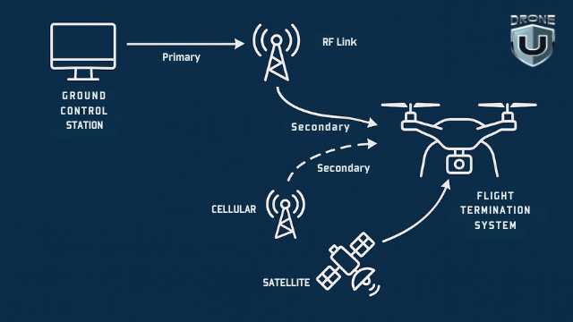
Ever looked up and thought, what if we could fly routes the way we drive them? No roads, no traffic. Just a drone, following a clean path through the sky to deliver a package, inspect a substation, or support a rescue team.
Drones are no longer just toys. They’re essential tools in construction, inspection, mining, logistics, public safety, and so much more.
But with more and more commercial drones in the air, the need for an organized, connected airspace has never been more pressing.
Right now, most drone pilots are still using fragmented systems, separate tools for monitoring airspace and mission planning. These disconnected systems tend to slow operations down and often create chaos.
That’s where Airspace Link comes in.
Airspace Link is building a digital pathway to guide drones, air taxis, and autonomous aircraft safely in the sky.
In this article, we’ll look at what that infrastructure looks like, how Airspace Link is building it, and what it means for drone operators.
Let’s get started.
The Missing Infrastructure
Autonomous drones are advanced, but the systems guiding them are antiquated. From flight planning to real-time coordination, operators are still using fragmented tools that slow down even the simplest missions.
Why Drone Operations Feel Disconnected
To plan a simple drone flight today, you have to check an LAANC-enabled app, review NOTAMs, and sometimes request waivers or authorizations. This is time-consuming and prone to human error. For commercial or public safety operators managing multiple drones, this is difficult to scale and can quickly become limiting.
Even when all protocols are followed, there is no centralized way to manage airspace in real time.
If a delivery drone needs to reroute because of a nearby police drone, there is no system in place to notify either party. This lack of shared visibility makes coordination between public agencies and commercial pilots impossible at scale.
What Airspace Link Is Building
Airspace Link is building the missing digital infrastructure for drones. The platform connects drone pilots, flight planners, regulatory bodies, and public agencies in one system. This allows for real-time coordination and data sharing.
Instead of using separate tools and manual approvals, Airspace Link offers integrated services that manage airspace rules, flight paths, and situational awareness all in one place. The result is a safer, more predictable environment for drone operators and public stakeholders.
A New Standard for Shared Airspace
With this kind of infrastructure in place, multiple operators can coordinate drone flights in the same region without conflict.
For example, emergency response drones and commercial delivery drones can fly in the same region with full visibility into each other’s flight paths.
This shared airspace model enables large-scale operations and future growth in sectors like logistics, healthcare delivery, infrastructure inspection, and public safety.
By modernizing how drones access and use airspace, Airspace Link is laying the foundation for a scalable and connected drone ecosystem. And with the recent release of the Part 108 NPRM, this is going to be essentially a requirement for more complex missions. Particularly those that include BVLOS operations.
How Airspace Link Helps
How Airspace Link Helps
Airspace Link functions like an internet service provider – only for drones. It connects individual drone flights to a broader digital infrastructure that manages compliance, coordinates traffic, and improves airspace safety.
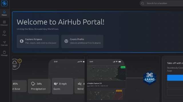
At the center of this system is AirHub, a platform with regulatory tools, live airspace data, and integration capabilities.
Instead of building complex internal systems, drone operators can use AirHub for a faster, safer, and more efficient flight experience.
Here’s how Airspace Link works across three operational layers: compliance, live mission management, and integrations.
Simplifying Compliance With the AirHub Portal
Drone operators often spend more time managing regulations than flying. The AirHub Portal changes that by combining all compliance tools into one dashboard.
Instead of jumping between FAA websites, submitting repetitive forms, or manually tracking approvals, users can manage everything in one place. The portal handles flight authorizations, pilot certifications, risk assessments, and regulatory changes in real time.
When you plan a mission, the system checks your proposed flight path, validates it against current restrictions, and confirms your pilot’s credentials. If a regulation changes, your parameters update automatically. If you’re missing a permit, the portal walks you through the application and tracks its status.
Over time, AirHub gets smarter. It learns your flight history, preferred regions, and common workflows, making future planning faster and more efficient.
Managing Live Flights With the Operations Center
Once a drone mission is active, the Operations Center becomes your control tower. This dashboard provides live visibility into drone flights, crewed aircraft, weather conditions, and no-fly zones in a single unified interface.
The system displays:
- Real-time drone telemetry from supported platforms
- ADS-B signals from crewed aircraft
- Temporary flight restrictions or emergency corridors
- Weather patterns and geofenced alerts
Public agencies and private operators can coordinate in real time. If a medevac helicopter enters the area, the system sends an immediate alert so you can adjust or pause your flight.
This live infrastructure transforms unstructured airspace into a manageable, coordinated system, ultimately reducing risks and delays during complex operations.
Connecting Systems With the Partner Integration Stack
Airspace Link’s third layer is the Partner Integration Stack, which connects external tools and services to AirHub.
Through the AirHub Marketplace, drone operators can access pre-integrated services tailored to specific locations. It functions like an app store for drone workflows. Once added, partner tools sync with your dashboard and handle billing, contracts, and data flow automatically.
The API Stack simplifies development. Partners only need to build an integration once to connect with the entire Airspace Link network. This removes the need for custom work each time a new service is introduced.
For hardware manufacturers, software providers, and drone service companies, this shared infrastructure supports collaboration without technical complexity. Each company can focus on its strengths while delivering seamless user experiences to customers.
Security, Privacy, and Compliance
As drone operations move into infrastructure inspection, emergency response, and delivery, data security becomes key. Airspace Link gets this and has security protocols throughout the platform. All data, including real-time video feeds, telemetry, and pilot credentials, is encrypted in transit and at rest to prevent unauthorized access.
The system is enterprise-grade and compliant with industry standards, SOC 2 Type II and ISO 27001, where applicable. Role-based access controls, audit trails, and strict authentication protocols allow agencies and operators to control who can access mission data.
Public agencies can define their own data sharing policies within the AirHub platform so sensitive information is only retained as needed and never shared with third parties without consent. Continuous system monitoring and timely patching reduce vulnerabilities and help protect against emerging threats.
By building compliance and security into every layer of the infrastructure, Airspace Link provides a trusted foundation for cities, operators, and developers. So they can scale drone operations with confidence, without compromising data integrity, privacy, or regulatory requirements.
The Data Infrastructure Layer
Airspace Link-Data Infrastructure Layer
Every mission starts with one thing: data. Before you take off, you need to know where you can fly, what altitude is allowed, and what airspace rules apply.
Today, that means checking a patchwork of systems, including LAANC, NOTAMs, B4UFLY, UAS Facility Maps, and city-specific restrictions that may not even be published online.
Airspace Link brings all of that together into one data layer that simplifies pre-flight planning and supports real-time decision making.
One Unified Airspace Layer
The platform combines FAA-approved sources like LAANC, NOTAMs, and B4UFLY with local restrictions from state and municipal governments.
It layers in live ADS-B aircraft data, weather feeds, obstacle databases, and dynamic geofences to give you complete situational awareness in one place.
No more switching between multiple systems and no more chance of error or non-compliance.
Smarter Planning with Predictive Tools
Airspace Link predicts conflicts and congestion before they happen. The system models airspace use and highlights areas of overlap so you can adjust your flight path proactively.
This is especially useful for multi-drone operations or shared airspace with manned aircraft.
Compliance Built In
With automated alerts and built-in rulesets, the platform supports regulatory compliance throughout the planning process. If a proposed flight enters restricted airspace or exceeds altitude limits, the system flags it and offers options such as alternate routes or permit workflows.
By turning scattered data into one single source of truth, Airspace Link removes complexity from the flight planning process. It gives both private operators and public agencies a smarter way to manage the skies.
Scaling Drone Ops: How Airspace Link Enables BVLOS
How Airspace Link Enables BVLOS Drone Operations
Most drone operations in the U.S. are limited to Visual Line of Sight or VLOS. This means the pilot must always keep the drone within view. While it’s a safety requirement, it severely limits what drones can do.
Whether you want to inspect 20 miles of power lines, deliver emergency supplies across a city, or run a search and rescue operation in a challenging environment, none of it is possible if you’re limited to VLOS.
To gain access to these capabilities, operators need Beyond Visual Line of Sight (BVLOS). With BVLOS, drones can fly autonomously for longer durations and cover more areas.
To run safe BVLOS flights, you need more than just FAA waivers. You need infrastructure.
This is where Airspace Link makes the difference.
How Airspace Link Enables it
Airspace Link makes BVLOS operations practical and scalable by creating a digital airspace apt for safe missions.
Their platform combines FAA data with live drone telemetry, weather, NOTAMs, and local geofences. Its Uncrewed Traffic Management(UTM) tools provide real-time conflict detection and separation of overlapping routes, even in crowded and fast-changing environments.
Instead of proving safety for every flight, you can use the automated network to show that your flights are coordinated, monitored in real-time, and operating within safety parameters.
As a result, adding new routes, new aircraft, or new operational corridors becomes simple.
The platform can automatically adjust your flight plans in response to weather changes or temporary restrictions. In emergencies, it prioritizes medical or government operations in real time, without any human input.
For drone operators, the system offers a unique advantage where they can provide drone services that their customers want.
Airspace Link proved this with BVLOS pilot programs in cities like Detroit. It coordinated with local agencies, the FAA, and drone operators to test safe, BVLOS corridor-based missions over real neighborhoods.
Airspace Link in Action: Real-World Use Cases
Airspace Link is not just a concept or a future roadmap. Several cities across the U.S. are already using Airspace Link to plan and monitor scalable drone operations.
Each city shows how digital airspace tools support different needs, from public safety and delivery to smarter flight approvals.
1. Detroit, Michigan – Corridor-Based BVLOS in an Urban Grid
Detroit served as the first major test city for Airspace Link’s corridor-based BVLOS operations. Working with local agencies and the FAA, it supported long-range flights over populated neighborhoods. This proves that cities can host scalable drone infrastructure without affecting public safety or airspace integrity.
2. Las Vegas FLYSAFE program
Las Vegas launched the FLYSAFE program using Airspace Link to build a dynamic airspace planning system. City officials can now upload local zoning laws, event restrictions, and no-fly zones directly into the AirHub Portal.
This helps them control when and where drones can operate. This approach opens the door to new drone opportunities like emergency response, infrastructure inspection, and event monitoring.
3. Ontario, California: Connecting Airspace to Public Safety
Airspace Link partnered with the City of Ontario to help design the safest and efficient drone delivery routes.
Local agencies can now define safe zones, track drone activities in real-time, and respond faster during emergencies. This collaboration highlights how public safety teams can integrate drone operations without adding more manual work.
Together, these cities show that the vision of a connected airspace is real, and it’s the local governments that make it possible.
4. North Dakota – Statewide BVLOS Operations
North Dakota is yet another leader in BVLOS drone operations. Airspace Link supports the state’s efforts by integrating its tools into North Dakota’s statewide UAS network known as Vantis. Thanks to this, North Dakota can now coordinate long-distance drone flights across rural and urban areas. These missions include infrastructure monitoring, emergency response, and environmental surveys.
The Unified Sky and What’s Next
Airspace Link is not only improving how drones operate today, but it’s actively shaping the future of low-altitude airspace. It proves that drone operations can be managed more efficiently in shared environments.
By connecting pilots, planners, and public agencies through one digital ecosystem, it proves that large-scale drone operations can run smoothly, even in busy urban skies.
And this is just the beginning.
As urban air mobility expands, Airspace Link lays the groundwork for a world where drones, air taxis, and autonomous aircraft move safely through the shared skyways.
Cities can now manage air traffic just like roads, and adjust for real-time events. They can coordinate everything from emergency flights to package deliveries with a few clicks.
This is the future of airspace: connected, automated, and built to scale.
Want to fly confidently in this ever-changing airspace?
Join Drone U for hands-on training in airspace awareness, BVLOS readiness, and real-world flight planning.
Complete Guide to BVLOS and Remote Drone Operations (2025)
Air-based operations such as surveying miles of pipelines or traffic patterns would require multiple pilots, weeks of coordination, and ample training to fly a drone far beyond your line of sight. That’s a liberty that most operators simply don’t have.
However, it is now possible to fly a drone much further than your line of sight from a single location. This is thanks to Beyond Visual Line of Sight (BVLOS) and remote operations, the next development in drone operations within the United States.
A new executive order signed by President Trump directs federal agencies to prioritize U.S.-made drones and invest in technologies that support automated, long-range operations.
With the Federal Aviation Administration (FAA) finalizing a dedicated BVLOS rule and Remote ID being active nationwide, BVLOS is now the standard for industries relying on aerial data, including energy, infrastructure, emergency response, and environmental science.
If you’re a drone pilot, team leader, or decision-maker, you must be familiar with BVLOS and how this changes your operations. It takes the right drone, knowledge, and training to fly in today’s skies, and these aspects are what we’re here to discuss today.
In this article, we’ll learn how BVLOS works and what its rules are, examine the technology behind it, and discuss how to obtain the necessary training. We’ll also cover the common mistakes that trip people up, so you don’t make them.
Key Takeaways
- BVLOS (Beyond Visual Line of Sight) operations enable drones to conduct large-scale missions such as pipeline inspections and disaster monitoring without multiple pilots or constant visual contact.
- FAA Part 107 currently governs visual line of sight operations, but BVLOS requires special waivers until the upcoming Part 108 rule sets nationwide standards for pilot training and aircraft performance.
- Remote ID now acts as a digital license plate for drones in the U.S., providing regulators and law enforcement with real-time location and identification data and aligning with similar rules in Canada and Europe.
- A June 2025 executive order prioritizes U.S.-made drones and components, accelerates BVLOS waiver processing, and directs funding to domestic technologies like Detect and Avoid systems and fleet management tools.
- BVLOS readiness demands advanced training, strong flight skills, and reliable technology such as backup communication links and GPS-independent navigation for safe operations in complex environments.
- Industries already adopting BVLOS include energy utilities, public safety agencies, construction firms, and delivery companies, proving its value for efficiency and scalability.
- Build the skills you need for BVLOS missions with DroneU’s Flight Mastery Course, designed to prepare pilots for real-world challenges and upcoming FAA certification requirements.
The Regulatory Landscape Behind BVLOS
FAA Waiver for BVLOS & Remote Operations
The rules for flying BVLOS are not fully established, but that doesn’t mean you can ignore them. Instead, staying ahead of these changing rules is one of the smartest things you can do right now.
Let’s first take a closer look at the existing rules, starting with Part 107.
1. Part 107
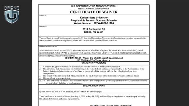
Under Part 107 regulations, the FAA requires drone pilots or a visual observer positioned further out to keep their aircraft within visual line of sight at all times. However, BVLOS flights, where the drone is beyond the line of sight of either the operator or observer, require a special waiver from the FAA.
Obtaining a BVLOS Waiver
To obtain a BVLOS waiver, you need to show that your aircraft has Detect and Avoid (DAA) capability, meaning that it can detect and avoid other aircraft. You also need to demonstrate that your drone can handle communication loss and emergency procedures.
Overall, the FAA expects a detailed safety case and real-world flight data to prove your aircraft is ready to fly.
2. Part 108
The FAA is working on Part 108, a new rule made specifically for BVLOS operations. It’s designed to create national standards and outline safety requirements, pilot certifications, and performance thresholds for aircraft used in long-range flights.
While the rule isn’t final yet, it’s already in motion.
Update: FAA Issues Part 108 Draft (Notice of Proposed Rulemaking)
On August 5, 2025, the FAA released the much-awaited draft of Part 108, the new set of rules that will define how BVLOS flights work in the U.S.
Right now, most BVLOS missions require a special FAA waiver, which can take months to approve. Part 108 is meant to replace that process with clear, national standard rules so more pilots and companies can fly long-range drone missions.
Here are the key elements from the draft:
- Two approval paths: Lower-risk operations can get a simpler operating permit. Higher risk flights, such as over-crowded areas or with larger drones, will require a full operating certificate.
- Required technology: Drones must have DAA systems, Remote ID, and use approved drone traffic-management services to stay safe and avoid collisions.
- Airworthiness rules: Drones weighing up to 1,320 lbs can be approved if they meet industry safety standards, without going through the full aircraft certification process.
- Flight limits: You must keep BVLOS flights under 400 feet above ground level and follow stricter rules for flying over people or events.
- Safety management: You must assign trained staff to oversee flights, keep safety logs, and report incidents like signal loss or emergency landings.
The FAA invites public feedback on the draft. The comment period is open for 60 days from August 5, ending around October 4, 2025.
3. Remote ID
In the U.S., Remote ID works like a digital license plate for drones. It allows regulators, law enforcement, and other airspace users to see who’s flying, where they’re flying, and what drone they’re using.
It broadcasts real-time information about your drone’s identification, location, and altitude, along with the pilot’s location and emergency status.
For any BVLOS operations, Remote ID is very important. It creates transparency and accountability when drones are flying beyond the pilot’s line of sight.
If you’re wondering how these regulations compare globally, then the United States isn’t alone.
Remote ID Outside of the U.S
In Canada, certain BVLOS operations are allowed with the right training and equipment. The European Union, under EASA, uses a risk-based framework that includes BVLOS as part of its “specific” and “certified” categories.
The bottom line is that BVLOS is becoming the global standard, and the U.S. is actively working to catch up.
4. The LIFT Act
While the FAA continues to work on the Part 108 rule, a new bill called the LIFT (Leading innovation in Future Technologies) Act was introduced in Congress on 25 July 2025.
This legislation aims to speed up the approval process and integration of routine BVLOS operations across the United States.
Although the bill is yet to be passed as a law, this act reflects the growing awareness that BVLOS is the key to unlocking the next era of drone innovation.
So, What Does This Mean for You?
If you’re just flying VLOS today, but your long-term goals include remote operations or autonomous operations, now is the time to start looking into Part 108 and what will be required of you to fly BVLOS operations.
- Pro Tip: Track the updates and make sure everything, starting from hardware to pilot skills, is built to scale into BVLOS as soon as it becomes accessible.
How the Executive Order Reshapes BVLOS in the U.S.
The executive order signed in June 2025 marks the most significant policy shift in American drone operations since Part 107. It addresses three priorities, including BVLOS, eVTOLs, and domestic drone production, creating both new requirements and new opportunities for operators.
1. Buy American Mandate Extends Beyond Airframes
Federal agencies must now prioritize drones, software, and supporting hardware built in the United States. That mandate covers Detect and Avoid systems, command and control links, and fleet management tools, strengthening domestic supply chains and reducing reliance on foreign components.
2. Faster BVLOS Approvals
A key outcome is the expected streamlining of BVLOS waivers. Historically slow waiver processing has limited adoption; the order directs agencies to remove bottlenecks, making it easier for qualified operators to secure long-range flight permissions.
3. Funding That Fuels Innovation
More federal contracts and grants will flow to U.S. manufacturers, encouraging development of secure, scalable platforms purpose-built for remote and BVLOS missions. Operators can expect rapid improvements in aircraft performance and automation.
4. Regulatory Ripple Effects
When agencies such as the Department of the Interior or NOAA expand BVLOS operations, the FAA must adjust regulations to keep pace. This momentum accelerates work on the forthcoming Part 108 rule, supports investment in national Uncrewed Traffic Management systems, and invites new public-private partnerships.
What This Means for Pilots and Program Leads:
The order effectively clears a path for automated, long-range drone flights across multiple sectors. Pilots, fleet managers, and decision-makers who prepare now by upgrading equipment, refining safety cases, and pursuing advanced training will be ready to capitalize on the next era of BVLOS operations.
Skills & Training for BVLOS Readiness
For operators getting ready for BVLOS flights, there are several factors to keep in mind, including skills and training that are required. Let’s take a look.
1. Essential Onboard Technology
Flying BVLOS does involve getting authorization, but more so, it’s about understanding your drone and how to keep it safe.
Your drone needs more than just a good camera or GPS for this. It should have a reliable DAA System. This technology is the foundation of safe BVLOS operations.
2. Redundant Communication and Navigation
Your drone also needs a backup communication system in case the main signal fails during the flight. Moreover, if you’re flying in complex environments, like around buildings, under trees, or over bridges, it should be equipped to navigate without GPS.
3. Smart Operational Planning
Even with all this technology, you need a smart operational plan.
Before starting the mission, always carry out a pre-flight risk check. Review the airspace for changing weather conditions and nearby traffic. If you’re working with visual observers, make sure they understand and follow the communication protocols, especially your signals.
4. Managing Remote Flight Operations
Remember: When flying BVLOS, you’re not just operating a drone. You’re managing a remote flight operation. And since you cannot see the drone, every decision counts.
5. Advanced Flight Skills
And here’s the part many overlook – you still need strong flight skills.
BVLOS doesn’t mean the drone flies itself. It means you need to be even more prepared to handle unpredictable weather, software glitches, or signal loss. You need to know how to read telemetry data and spot a system failure. If you don’t know how to safely bring a drone home in an emergency, then you’re not ready for BVLOS.
Key Takeaway: In simple terms, BVLOS operations require a combination of good technology, smart planning, and strong piloting skills for a safe and successful operation beyond the horizon.
Training From Remote Pilot to BVLOS-Capable
Command and Control Link for BVLOS Drones
So, how do you go from flying short-range visual missions to safe, legal BVLOS flights? It may seem like a lengthy process, but it can be completed in five relatively simple steps. Let’s take a look.
Step 1: Master the Basics
Start by getting your Part 107 Remote Pilot Certificate or equivalent license in your region – training must be done every 24 months to remain current. Spend time flying as much as you can, within visual line of sight (VLOS).
Make sure you really understand the basics. Know how your drone works, the airspace rules, how weather affects flights, and what to do in an emergency.
Step 2: Familiarize With BVLOS Essentials
Understand how DAA systems work. Also, learn to read and interpret your drone’s telemetry and system health data, like battery levels, GPS signal strength, and warning alerts.
Next, you can try flying Extended Visual Line of Sight (EVLOS) missions with the help of trained visual observers. This is the best way to practice longer-range flights while staying within legal and safe operating limits.
Operators should also understand Command-and-Control (C2) link performance definitions (RTCA DO-377, DO-362A) because waiver reviewers focus heavily on C2 reliability.
Step 3: Use Simulators and Field Testing
Many BVLOS waivers require real flight data, either from actual test flights or high-quality simulators. Practice key scenarios like how your drone reacts in lost-link situations, or how it responds to other aircraft using DAA systems.
You can practice this safely in a simulator or during controlled test flights to build experience and collect the data for future approvals.
Step 4: Get Formal BVLOS Training
Some of the best programs are operated by specialized Remotely Piloted Aircraft System (RPAS) training centers in Canada, Australia, and a few advanced U.S. providers, such as DroneU.
These programs walk you through full BVLOS mission planning, system checks, risk assessments, and post-flight reviews. You’ll not only learn how to fly but also how to document and defend every decision you make.
Step 5: Prepare for Part 108 & Beyond
When the FAA finalizes Part 108, make sure you update your certification with the required training. This may include scenario-based evaluations, refresher courses, or even endorsements for new equipment.
The goal is to stay focused and fully aligned with the new rules, so you’re ready to fly BVLOS with confidence once it officially goes live.
Hiring Inexperienced Remote Pilots
One of the common issues in remote operations programs is relying on inexperienced or undertrained drone pilots to handle complex BVLOS missions. Even with automation, BVLOS operations require strong skills and quick decision-making to keep flights safe and compliant.
The decision could be something small, like adjusting the path for the weather, or something serious, like safely recovering a drone that’s lost its connection and drifting into restricted airspace. In both cases, the outcome depends on the person in control.
The safety of the entire BVLOS operations depends on that human element. If your pilot doesn’t understand telemetry, can’t troubleshoot quickly, or hasn’t experienced real-time risks, they’re not ready to manage these flights.
Such inexperience puts your operation, your clients, and your compliance status at risk.
In BVLOS, unexpected things always happen. So, if you’re leading a drone program or building a team, make sure your pilots are more than just certified. Look for their real qualification, experience, and capability.
Why Flight Mastery Training Makes the Difference
If you’re planning to operate BVLOS or lead others who do, you need more than a license. You need good judgment, fast reflexes, and the ability to remain confident under pressure. These skills don’t come from reading a manual – they come from flying.
That’s why flight mastery training matters.
The BVLOS course isn’t for beginners. It is designed for working pilots who want to sharpen their control, problem-solving, and recovery skills – which means that you must already have well-refined drone-piloting skills.
In flight mastery, you don’t just study theory – you practice quick decision-making, emergency landings, advanced stick control, and working under pressure, without relying on GPS or automation.
The Flight Mastery Course from DroneU does exactly this – it builds real instincts for real-world flying.
You might ask: “Why is it important for remote operations?”
Because in BVLOS, you’re not always watching the drone. You’re also watching the data it sends back. You’re reading telemetry, tracking trends, and catching issues before they turn into problems.
But this setup only works if the person in charge understands what these small changes mean and how to respond before things go sideways.
The best remote operators are the ones who’ve already flown through failure. They’ve lost GPS, smartly handled disconnects, and brought the drone home manually. They don’t panic. They act quickly and finish the mission safely.
The DroneU Flight Mastery Course turns licensed pilots into reliable remote operators. It’s the difference between passing the test and being ready to fly one. If you’re serious about BVLOS, start with DroneU’s Flight Mastery.
Real-World BVLOS Use Cases Across Industries
Solar Tower Inspection Using BVLOS Drones
Some of the most exciting and fast-growing drone applications today depend on BVLOS, and in many cases, it’s the only way to get the job done.
Let’s look at where it’s already happening – and why.
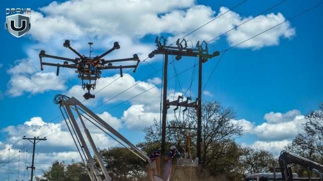
1. Energy & Utility Inspections
Power lines, pipelines, and solar farms stretch for miles, often through remote or rugged terrain. VLOS simply doesn’t seem practical over such great distances.
BVLOS allows drone teams to inspect large linear infrastructure quickly. Companies like Xcel Energy and Southern Company have already secured BVLOS waivers to save time, reduce risk to personnel, and improve coverage.
2. Public Safety & Emergency Response
In disaster zones or search-and-rescue missions, speed and reach matter. Agencies like Chula Vista PD and the NOAA Office of Marine & Aviation Operations use BVLOS operations to support firefighting, hurricane response, and missing person searches.
They do so by deploying drones from central command and monitoring missions remotely over LTE or satellite links.
3. Drone Delivery
Companies like Zipline, Wing, and Amazon Prime Air are already flying long-range delivery missions under BVLOS rules. They carry out these missions to safely transport medical supplies, food, and packages across towns and rural areas.
4. Infrastructure & Construction
BVLOS operations allow construction firms and engineering teams to collect data across wide areas. With AI-based mapping and modeling software, this data can be processed into 3D models or real-time progress reports.
In every case, BVLOS is both a technical upgrade and a chance to improve how drone operations work. It unlocks longer missions, increases efficiency, and makes large-scale operations possible.
The demand is already here. The real question is: are your teams ready to handle it?
Conclusion
The drone industry is quickly headed towards BVLOS operations, especially in the USA. So, pilots and program leads need to prepare, train, and level up their skills.
The skills you build today around flight control, strong airspace awareness, and remote decision-making will shape your ability to lead tomorrow’s flight operations.
Make sure to invest in training today that goes beyond the basics. This means training for unexpected moments, not just relying on automation.
To that end, courses like DroneU’s Flight Mastery give you the real-world edge to lead BVLOS missions with confidence and control.
The future of flight is remote. Make sure you’re ready to fly it!
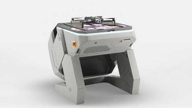
Drone in the Box Systems in 2025: Deep Dive
As drones have improved, their autonomous capabilities have reached a new level. Today, you can have one (or a swarm of drones) launch itself from a sealed rooftop station, scan a transmission line for damage, return to its box, and upload the data while recharging. These are known as Drone-in-the-Box (DIB) systems.
In the real world, they enable utility giants like Florida Power and Light (FPL) to transform infrastructure inspections.
In 2025, DIB systems are reshaping how we approach surveillance, inspections, and incident response, from remote oil fields to city utilities. Autonomous platforms slash labor costs and response time by removing the need for human pilots.
Coherent Market Insights projects that the global DIB market is expected to reach $3.38 billion by 2032 at an annual growth rate of 13.7%. In 2025, thermal imaging leads the pack with 28.9% of the market share and is a clear indicator of the demand surge for industrial-grade, autonomous drones.
Adoption of this technology remains an issue, though. Regulations like FAA’s Part 107 restrict Beyond Visual Line of Sight (BVLOS) operations without waivers (though there are efforts to fast-track BVLOS opportunities with proposals like the LIFT Act).
Additionally, hardware capabilities are not standardized across manufacturers, and security concerns abound, complicating procurement.
Choosing the right DIB system allows you to balance autonomy, compliance, integration, and ROI. In this guide, we’ll break down:
- What Drone-in-the-Box systems are and how they work
- The top DIB systems available in 2025
- Use cases by industry
- Key compliance issues (FAA, CCP Drone Act, NDAA)
- How to choose the right solution for your needs.
Let’s take flight.
What Are Drone-in-the-Box Systems?
A DIB system refers to a fully autonomous drone designed for industrial-grade operations. Unlike traditional drones that need pilots, DIBs operate from a weatherproof docking station (the box), which houses, charges, and communicates with the drone.
Each DIB system typically has three main components, composed of the drone itself, the dock/base station, and the software managing all aspects of the mission.
After installation, a DIB system can carry out scheduled missions or respond to triggers, like motion sensors, alarms, or weather events, without a human director. These systems are used across industries for perimeter security, asset inspection, emergency response, and mapping.
How Drone-in-the-Box Systems Work
Unlike traditional operations that require certified pilots, visual line of sight, and manual takeoff and landing, DIB systems automate the workflow, making it remote, repeatable, and enabling Beyond Visual Line of Sight missions.
Let’s break down how a typical DIB workflow operates.
1. Pre-flight System Check
When a mission is triggered, the system begins by running automated checks on the battery and system health, GPS and network connectivity, and weather and airspace data.
2. Mission Planning and Launch
Missions are pre-configured using a dashboard that shows the important parameters, including flight paths, areas of interest, and no-fly zones, and the payload behaviors (thermal scan zones, camera angles, etc.).
After validation, the dock opens and the drone launches autonomously.
3. Autonomous Flight and Data Collection
The drone is guided by a programmed route while collecting real-time data using onboard sensors to adjust itself accordingly mid-flight. If it detects intruders, hazards, or defects, it can capture additional footage, change course, and send real-time alerts to the command center.
4. Return, Landing, and Charging
Once the mission is done, the drone flies back to the dock using precision landing systems (RTK and visual markers). It lands, shuts down, and automatically starts recharging to be ready for subsequent missions.
5. Data Upload and Integration
During or after charging, the drone offloads mission data (maps, photos, logs, video) to a local server or cloud platform. The teams in charge can review footage live or after the fact for documentation, reporting, or real-time decision-making.
Core Components of a Drone-in-the-Box System
A DIB system, as we mentioned, combines drone hardware, intelligent docking infrastructure, and mission control software. Let’s break down what each component does:
1. The Drone
The autonomous drone is the first step and is typically a rugged, multi-motor UAV built for repeatable missions in specific environments. Its key features include:
- High resolution imaging- Including visible light cameras, thermal sensors, multispectral imaging, LiDAR, etc.
- Durable build- The drone is weather-resistant and hardened against certain extremes, including heat, wind, and rain.
- Navigational capabilities- RTK/GNSS positioning is fitted for centimeter-level accuracy.
- Obstacle avoidance- Aided by computer vision and AI-powered flight controls, it can navigate complex environments.
Advanced models are capable of logging thousands of flight hours with minimal human involvement.
2. The Dock
Sometimes called the nest or base station, this piece of infrastructure automates the drone launch, recovery, battery management, and more. Some of its main abilities include:
- Automated doors that open or close for takeoff or landing.
- Precision landing aids, including RTK, VSLAM, or visual markers, to guide the drone back.
- A rapid, contact-based charging system that juices the drone between flights.
- Climate controls that regulate temperature and humidity and keep the sensitive electronics safe.
- Built-in network modules for continuous drone communication.
The docks, depending on their capabilities, can be installed on rooftops, vehicles, or remote sites.
3. The Software Platform
The software stack is the brain of the operations and is responsible for route planning, data analysis, and remote control. The core functions enabling this include:
- Flight planning and automation
- Real-time video and telemetry
- Notifications and triggered responses
- Integration with maps, sensors, and third-party systems
- Remote access via mobile app or web dashboard.
Most DIB systems use Wi-Fi, LTE, or 5G to stay connected. With an enterprise-grade platform, you may get radio and satellite uplinks for more remote or closed-off environments.
Some vendors may provide AI features to detect objects in real time, tag intruders, or help predict maintenance, further enhancing autonomous UAV operations.
Comparison: Top Drone-in-the-Box Systems in 2025
| System | Country | Autonomy | NDAA/CCP Compliance | Payloads | Connectivity | Ideal For |
| Skydio Dock | USA | Full | ? NDAA | 4K RGB, thermal, 8K zoom, multi-camera array | LTE, Wi-Fi, secure mesh: offline-capable | Critical infrastructure, defense, utilities, campus security. |
| Hextronics Global | USA | Full | ? NDAA
? CCP Act |
Modular, RGB, thermal | LTE, Wi-Fi, optional Sat | Industrial inspection, enterprise security. |
| Sunflower Labs Beehive | USA | Event-triggered and schedules missions with sensor fusion. | ? NDAA
?CCP Act |
1080p stabilized cam, IR, basic object tracking | Wi-Fi, LTE (opt.), edge + cloud | Smart security, campuses, early-stage UTM pilots |
| Percepto Air Max | Israel | Full | ?NDAA
?CCP Act |
RGB, thermal, AI analytics | LTE, 5G, private networks | Critical infrastructure, utilities |
| Easy Aerial SAMS-T | USA | Full | ?NDAA
?CCP Act |
RGB, IR, EO/IR gimbals | Mesh, LTE, SatLink | Military, perimeter security |
| Dronematrix YACOB | Belgium | Full | ? NDAA
?CCP Act |
RGB, thermal, LiDAR | Wi-Fi, LTE | Smart cities, emergency response |
| H3 Dynamics DBX G7 | Singapore/France | Semi | ?NDAA
?CCP Act |
Custom pods incl. hydrogen | 4G/5G, LoRa, Wi-Fi | Environmental inspections, airports |
| DJI DOCK (M30 Series) | China | Full (limited regionally) | ? NDAA
? CCP Act |
RGB, thermal, laser range | LTE, Wi-Fi | Facility surveillance (LatAm, Asia) |
Key:
NDAA– Meets US procurement security standards.
CCP Act– US Federal legal compliance for defense and public safety applications.
“Autonomy” means a drone that can launch, land, recharge, and share data without on-site operators.
Let’s look at the vendors’ offerings up close to discover what else to expect.
Skydio Dock
Skydio Dock X10
Skydio Dock is what happens when you combine powerful AI flight autonomy with compact remote deployment. The platform is built around Skydio’s renowned vision-based navigation technology with a tightly integrated system (that includes the dock) aimed at perimeter checks, commercial inspections, and remote monitoring, especially for customers with strict US-origin or NDAA-compliance requirements.
Skydio sets itself apart by making the dock less about drone housing and more about enabling AI-powered autonomy in a seamless and scalable box.
Core Features and Capabilities
- Vision-based navigation- Skydock developed a proprietary Visual SLAM engine capable of GPS-denied flight and obstacle avoidance, even in tight, dynamic environments.
- Skydio X10 integration- The dock supports Skydio’s flagship X10 drone, which comes with superior AI capabilities, thermal and optical zoom payloads, and diverse lighting adaptability.
- Compact- The dock is field-hardened and small enough to be mounted in hard-to-reach areas, rooftops and pole-top locations, giving you deployment flexibility.
- Fast charging and auto launch/recovery- A full recharge cycle takes just over 45 minutes, with high-speed turnaround for repeat missions.
US Compliance Strengths
- The product is NDAA-compliant, designed, and manufactured in the US.
- Supported for use in the U.S., in the Department of Defense, federal infrastructure, and critical enterprise applications.
- Encrypted comms, enterprise-grade access controls, and SOC 2 Type II certified cloud services.
The Software Ecosystem
Another part of Skydio that makes it appealing is the software stack, which includes:
- Skydio Remote Ops- Allows live streaming, fleet management, automated patrol scheduling, incident tagging, and more, from a single dashboard.
- Real-time AI anomaly detection is built into the drone and not offloaded to cloud services.
- Offline model allows direct control, which is valuable in air-gapped environments.
Key Use Cases
- Inspections- Across utilities and infrastructure projects, Skydio is deployed for bridge, substation, power line, and general infrastructure inspections in confined areas.
- North Carolina Department of Transportation used it for GPS-denied indoor and outdoor construction monitoring to track progress and conduct safety checks.
- Campus security- In schools and across corporate settings, major tech firms conduct perimeter sweeps and respond to incidents.
- Defense and federal- The system has seen adoption under DIU contracts for base security and autonomous ISR.
Skydio itself highlights that this is the most advanced autonomous drone dock ever built, with a tight U.S. regulatory and security posture for enterprise and government, and that it integrates with a wider ecosystem, including 3D Scan, Remote Ops, and Skydio Cloud.
Hextronics Global
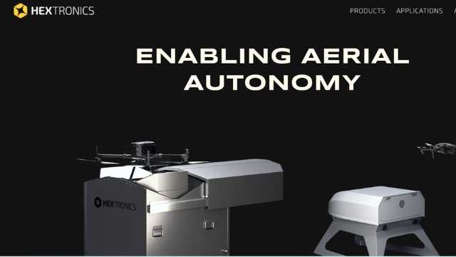
Hextronics Global
Hextronics Global is an outstanding company known for its hardware-first engineering approach and versatility. At the core of its offering is a robotic arm capable of swapping out batteries for you, drastically reducing downtime compared to traditional recharge-based stations.
Key technical features
- The battery swapping arm- This star of the system allows drones to dock and swap batteries in under 90 seconds from a 6-pack battery magazine. That delivers extended operational capacity without human intervention, making true 24/7 coverage feasible.
- Drone-agnostic support- While it is optimized for the DJI Mavic series, Hextronics also includes support for other sUAS platforms via partnerships, such as with ModalAI or Blue UAS ecosystem members.
- Modular construction- The dock is field-serviceable and designed with swappable components for faster repairs and upgrades, a highly valuable trait in remote or rugged locations
- Edge-processing options- The dock supports onboard NVIDIA Jetson modules or external AI processors to analyze data locally and reduce reliance on cloud bandwidth.
Practical use cases of the Hexatronics Platform
- Smart Cities- Hextronics is being used in municipal surveillance teams that monitor traffic and maintain situational awareness, especially when used in tandem with real-time analytics capabilities.
- Enterprise Inspection- In the energy and telecom sectors, for instance, Hextronics steps in to reduce the need for site visits by enabling automated inspection routines, especially where frequent daily flights are necessary.
- Logistics and warehousing- Some early adopters are using Hextronics systems in large yards and port security management to provide eyes-in-the-sky without on-site pilots.
Manufacturer-Highlighted Selling Points
Hexatronics points to several key points as particularly unique, including that the system has:
- The lowest cost per flight hour in the industry, due to the swappable batteries
- Made and designed in the USA for maximum NDAA compliance with approved drones
- Scalable with fleet orchestration software, allowing one operator to manage multiple docks.
- Integration with Auterion, DroneDeploy, and SkySense for easier connection to existing drone workflows.
Compatibility With Different Aircraft Types
Instead of building its own aircraft, Hextronics takes an ecosystem-friendly approach. The Global station is compatible with a range of DJI drones (Mavic 2, Mavic 3 Enterprise, and M30 Series- using special mounts).
This allows you to add other sensors and operate flexibly while tapping into DJI’s trusted flight systems and camera technology.
Open API and Third-Party Integrations
The open architecture, with its APIs and SDKs, allows users to integrate the dock into custom software stacks, automate flight missions, ingest telemetry, and even trigger flights via external systems such as alarms, sensors, or scheduling platforms.
It is also compatible with FlightOps.io, a cloud-based autonomous flight management platform that handles BVLOS workflows, multi-dock orchestration, real-time video streams, and airspace awareness, making the station enterprise-ready at an affordable price.
Sunflower Labs Beehive
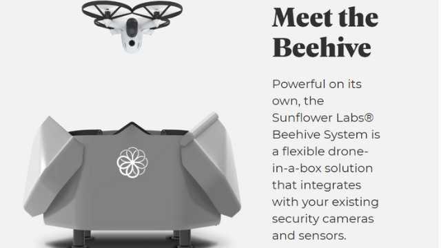
Sunflower Labs Beehive
Sunflower Labs’ Beehive system brings a unique approach to the autonomous aerial security arena. It positions itself at the intersection of smart home technology, AI-powered surveillance, and lightweight, responsive drone operations.
While it is still an emerging player compared to the industrial giants, Sunflower Labs has gained recognition by focusing on smart perimeter awareness, responsive autonomy, and ease of deployment, especially in private estates, municipal projects, and commercial properties.
The compact dock and lightweight drone make the system attractive to key partners, including Airspace Link, as they explore scalable UTM-integrated deployments.
The Key Features
Some of the standout features of the Sunflower Labs product include:
Lightweight Autonomy with AI
The company uses:
- A hive-based dock that is compact and weather-sealed for charging and storage. This quick-launch platform is used in reactive patrols or scheduled missions.
- The Bee Drone– This lightweight quadcopter is designed for short-range flights of 10 to 15 minutes and is equipped with a stabilized 1080p video, infrared vision, and object tracking
- Smart sensor integration in the form of ground-based motion and vibration sensors (Sunflowers) allows you to triangulate any suspicious activity and initiate an event-triggered launch instead of constantly patrolling.
System Architecture
You will experience this in the form of:
- A cloud-based control panel- An intuitive web and mobile dashboard for mission logs, livestream, and historical review.
- Security- The video data is stored locally and in the cloud with encryption.
- Geofencing and no-fly zone detection- Compliance is built into the basic UTM parameters, with deeper U-space integrations in development through partners.
Charging and Turnaround
The battery recharge takes 30 to 40 minutes. Swappable batteries are not supported, and on that charge, you can only run short-duty cycles.
Ideal Use Cases
- Residential security and smart homes- This is particularly useful for high-net-worth homeowners and private estate owners.
- Corporate campuses- For scheduled rounds and responsive launches tied to ground sensor events.
- Airspace Link Pilot sites- Used in early-stage municipal projects where lightweight, non-intrusive aerial monitoring is crucial to plan and ensure the project is going according to plan.
Sunflower Labs likes to emphasize that it is “the world’s first residential drone security system. Even though it does not come with autonomous battery swapping tech, it does have a handy ground-based sensor that ensures it only flies when it needs to.
Easy Aerial SAMS-T
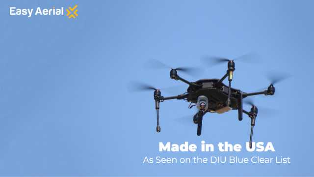
Easy Aerial SAMS-T
The Easy Aerial’s Smart Aerial Monitoring Systems – Tethered is engineered for defense, emergency response, and industrial security missions where compliance, durability, and autonomy matter. Unlike most DIB platforms, Easy Aerial builds both the drone and the dock to ensure tight system integration and performance predictability.
SAMS-T is built for ruggedness and easy deployment. It can be mounted on rooftops, trailers, trucks, and ground installations and is one of a few docked offerings rated for use in moving vehicles or rapid, redeployable field kits.
It is also:
- MIL-STD-810 tested- Able to withstand extreme heat, cold, shock, vibration, and electromagnetic interference.
- Full NDAA and CCP Compliant- Design and manufacture are in the US, using approved components.
- Encrypted for data links- Uploads are secure for defense, border patrol, and homeland security missions.
Technical Highlights
The SAMS-T appeals to users because of its:
- Dual Operation Modes- It can use the Tethered (SAMS-T) mode to conduct persistent surveillance with unlimited flight time and encrypted data links or switch to Untethered (SAMS-FW or SAMS-MC) mode for autonomous patrol or triggered missions.
- Edge AI Processing- The dock and drone support real-time analysis powered by an NVIDIA chip to detect objects, perimeter breaches, etc.
- Quick Charging and Hardened Build- The dock is rated IP65+ to support a quick turnaround when flying untethered.
- Autonomous Launch and Recovery- Once configured, no humans are needed in the loop.
Use Cases
- Military and tactical ISR- The SAMS-T is in active use by the US and allied defense forces, typically in perimeter monitoring and rapid aerial deployment.
- Emergency and disaster response- Fire departments and national emergency organizations use it in search-and-rescue, smoke monitoring, chemical spill reconnaissance, etc.
- Mobile convoy protection- Mounted on vehicles to offer continuous overwatch of convoys and troop movements.
What Makes the SAMS-T Stand Out?
- It is the only US-made DIB system with fully integrated tether and free-flight modes.
- It focuses on multi-mission readiness with swappable drone models and quick turnaround.
- Comes with Easy Remote Monitoring Software (ERMS) for full control of entire fleets.
- Payload integration allows customization of fittings like loudspeakers, gas sensors, spotlights, etc.
Percepto Air Max
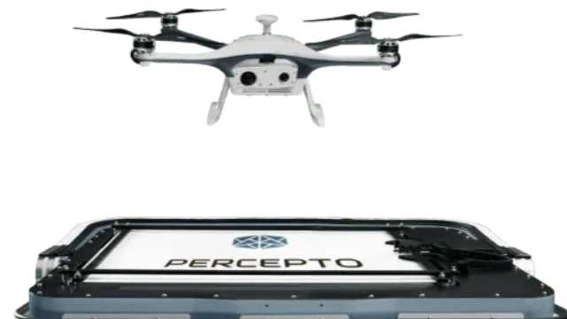
Percepto Air Max
Percepto’s field-tested DIB system is widely regarded as one of the most enterprise-ready options you can get. It is known for its deep integrations, a strong compliance framework, and AI-powered autonomy, which make it perfect for industrial-grade remote operations at scale.
Going beyond the drone or box, Percepto provides a full-stack inspection and monitoring platform trusted by multinationals in energy, utilities, mining, and heavy industry.
Industrial-grade technology
For industry buyers, here is what stands out:
- Fully autonomous flight and missions- The drone operates BVLOS with no pilot in the loop after takeoff is authorized or triggered.
- Smart AI inspection- Features built-in tools for anomaly detection, environmental surveys, asset tracking, etc., to enable exception-based reporting instead of hours of raw footage.
- Integrated edge processing- Video streams are processed in real time using onboard AI, with alerts and asset status streamed or pushed into SCADA systems, ERPs, or digital twins to surface even better insights.
- Percepto Base (Dock)- The dock itself is ruggedized for extreme weather (IP55+), has a precision landing system, secure charging, and environmental sensors. It also receives firmware updates and diagnostics remotely.
Percepto’s Regulatory Wins and Global Presence
Percepto is one of the first companies to get FAA waivers for remote BVLOS operations without ground observers. This gives them a significant competitive edge. Additionally, it is built around global compliance regulations, as evidenced by its deployment in over 15 countries with regulatory alignment tools baked into its Percepto AIM software.
Percepto AIM
Their proprietary software platform, Percepto Autonomous Inspection & Monitoring (AIM), is perhaps the most valuable part of this DIB suite. It turns data into insights in the following ways:
- AI-powered change detection on key assets
- Anomaly tracking timeline creation, spanning thermal, RGB, and customizable multispectral inputs, including OGI for gas-emission detection.
- Automated report generation and stakeholder involvement
- Integrates via API with IBM Maximo, SAP OSlsoft, and other platforms.
Use Cases
- Energy and utilities- Percepto Air Max has been deployed for pipeline monitoring, transformer inspection, flare stack analytics, and methane emission detection.
- Mining- You can conduct environmental compliance checks, tailings dam surveillance, dust monitoring, etc.
- Heavy industry- Given the importance of predictive maintenance, thermal loss detection, and perimeter security to such operations, the Air Max fits in perfectly with its industry-ready features and build.
By combining all these capabilities with the integrations, cloud, and digital twin platforms, Percepto delivers a powerful product with proven experience.
DroneMatrix YACOB
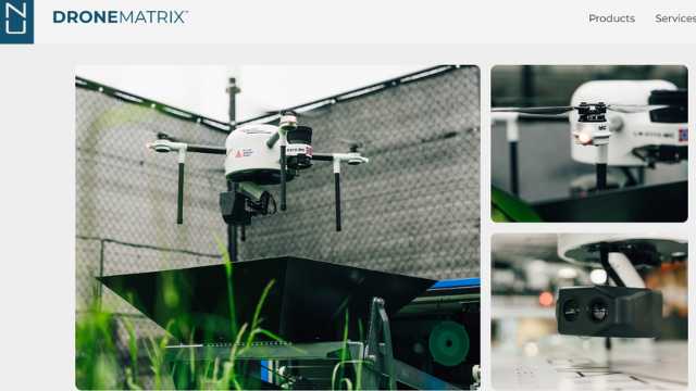
DroneMatrix YACOB
The cheekily named DroneMatrix YACOB (Yet Another Cell On the Box) is a compact, modular drone docking system designed with public safety, smart cities, and European airspace integration in mind. It is developed in Belgium and is built from the ground up to focus on emergency response, first-responder support, and compliance with European U-space standards.
While it is less known globally, European municipalities and airport authorities looking for rapid deployments for surveillance, crowd safety, and traffic monitoring tools have adopted it.
What’s In The Package
1. YACOB and YETI(The Drone)
The YACOB is a small-sized fully autonomous drone that can perform many of the same missions its larger brother, the YETI, including inspection, mapping, surveillance, transport, and logistics.
The YETI is the medium-sized fully autonomous version of the YACOB, designed to be larger in all aspects, with the same trusted internals of the YACOB DIAB system. The YETI DIAB system includes the YETI drone and the YEDO docking station.
2. The docking stations (YEDO and YADO)
The YEDO is an air-conditioned box that protects from the weather and environmental wear. It can also upload data, charge the drone wirelessly, and house the drone in stand-by mode, ready for mission triggers.
It is built with an extendible funnel featuring a special shape and location beacon to allow for smooth takeoff and landing.
YADO is much the same and is connected to a weather station and fog sensors to check if flights can be conducted safely.
3. ARWS (software)
The Aerial Robotic Work System is the software environment within which you can interact with the drones and make sense of the data they send back. It acts as a mission control center where orders can be input, information gathered, and communication supported for both the user and the UTM.
The Payloads
DroneMatrix drones are made to be customizable and capable of carrying sensors in different configurations. These include:
- LWIR
- High definition mapping camera
- 4K RGB 20x zoom camera
- Hyperspectral camera
- Sniffer
- Speaker attachment
- Spectrometer
- Pyranometer
- Multispectral camera
The platform can also integrate with compatible off-the-shelf UAVs depending on local policy.
EU-Centric Compliance and Connectivity
The DroneMatrix is U-Space ready with deep integration with European UTM frameworks and digital flight approval systems. It is developed in line with European airworthiness and risk-based regulations and with 5G, LTE, and edge computing features, allowing real-time connection to command centers or public safety networks.
Use in Public Safety
The drone is built for law enforcement and event monitoring. It is used by Belgian police and municipalities for crowd oversight and traffic control. Fire and rescue crews can deploy it during building inspections and support scene commanders with aerial views.
It was also used at Brussels Airport as part of drone-integration pilot programs.
Its modular, open architecture supports rapid upgrades and policy shifts, allowing users to future-proof their investment and get the best ROI.
The website states that DroneMatrix is Europe’s leading end-to-end autonomous DIB solution deployable across Europe within 30 days.
H3 Dynamics DBX G7
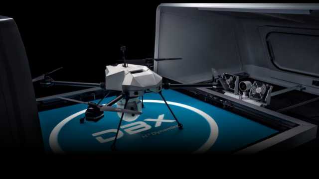
H3 Dynamics DBX G7
This is a flexible DIB platform designed for industrial-scale operations and capable of accommodating a range of drone types and sensor payloads. The intention behind its design is to offer users an automated on-site drone pilot, ideal for remote, harsh, or evolving environments.
Drone-Agnostic and Mission-Flexible Platform
- Drone Agnostic– Supports several UAV models and enables multiple payloads, including LiDAR, thermal, RGB, and multispectral, for different missions.
- Open Architecture– Offers API integration, real-time streaming, AI analytics, and trigger-based workflows through a command center screen.
- Fast Deployments– A fully enclosed dock that can be installed and start operating in under a minute.
- Rugged Build– IP66 weatherproofing, built-in environmental sensors (barometer, anemometer, hygrometer), and reliable communications via RF, GSM/LAN, and 4G/5G streaming.
- Power and Charging– The system has an external power input of 110-230 VAC, automatic contact-based charging at 10A constant current, and is designed to handle standard Li-ion and LiPo drone battery packs.
Edge Computing and Data Handling
The onboard edge-computing capabilities provide local data processing, minimizing latency before forwarding analytics or video streams.
You get live video at 1080p, 720p, or 480p resolutions, pre-processing of imagery and sensor data for AI models, and bidirectional data transmission to cloud or on-premise video management workflows.
Connectivity and Communications
The system is well-prepared to communicate and uses the following technologies to achieve this:
- 5G cellular link for high-bandwidth, low-latency uplinks
- 4G LTE backup network
- Satellite uplink for remote areas
- RF/GSM control channel between the station and the drone
- Standard VMS integration over IP
Use Cases
- The DBX saw usage in Perth, Australia, for conducting aerial search and disaster response.
- It has been used to monitor large solar farms and linked seamlessly with AI analytics to make inspections more insightful.
- The DBX is also part of a strategic partnership with Ripper Corporation in Australia, where it is used for autonomous drone operations and has played an instrumental role in securing BVLOS approval from the Australian Civil Aviation Safety Authority.
Why It Stands Out
The DBX-G7 is often described as the most advanced autonomous drone system in its class. The modular, scalable design and compatibility with various drones make it a future-proof choice for most enterprise or organization needs.
Additionally, the DBX G7 team works with SAP for automated repair work orders and THALES for real-time airspace integration, showing a strong and reassuring commitment to scalable enterprise solutions.
DJI Dock (M30 Series)
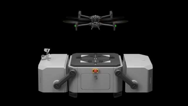
DJI Dock (M30 Series Dock Version)
DJI Dock (M30 Series Dock Version) brings military-grade drone technology to a widespread commercial user base. It is built for robustness, ease of integration, and cost-effective use. It is a worthy foundation to build an enterprise drone ecosystem around, especially because of the DJI Matrice 30 platform.
Let’s break down its standout features.
An Ecosystem In a Box
DJI doubles down on vertical integration instead of open and flexible support. The Dock is custom-made for the M30 Series, ensuring tight coordination, from landing to payload control.
Measuring under 1 square meter and 90kg in weight, the fully weatherproofed box is sealed to IP55 standards and engineered to operate in extreme conditions (35°C to 50°C). This makes it viable in emergency response, telecom, energy, etc.
The drones inside come with a 48MP zoom camera, a 12MP wide-angle camera, a laser rangefinder, and an optional thermal sensor on the M30T version.
Connectivity and Communications
- Ethernet- 10/100/1000 Mbps adaptive port
- Video link- Enterprise dual band, 4 antennas, and up to 15 km LOS.
- Optional 4G LTE via external USB dongle for cellular backup.
- Full integration with DJI FlightHub 2 and extensible via DJI Cloud API for third-party software.
Charging, Cooling, and Turnaround Time
One of the standout features of the DJI Dock is its charging system, which uses DJI’s proprietary TEC (thermoelectric cooling) to cool the batteries when the drone lands actively.
This translates to 10% to 90% recharge in just 25 minutes, allowing for frequent sorties even in long operational windows.
The emergency power backup lasts up to 5 hours, ensuring that critical missions can be finished or drones safely landed during brief power outages. There is also lightning protection and built-in network redundancy.
FlightHub 2: Software Integration
All mission control runs through DJI’s cloud-based FlightHub 2 platform, which provides remote scheduling, real-time video streams, data syncing, and fleet health monitoring from anywhere in the world.
Operators can plan recurring missions, set waypoints based on sensor triggers, and integrate third-party workflows through the SDK.
The closed nature of this system does come with limitations, notably in terms of payload customizability and regulatory flexibility. BVLOS waivers can be harder to achieve, for instance, compared to more open platforms like Hextronics and Percepto.
Use Cases
- Oil and gas operations have used it for automated leak detection, fault identification, and damage monitoring.
- Construction and infrastructure companies leverage it to check site progress, safety compliance, and logistics with persistent data streams. It is also good for remote inspection of power lines, bridges, and critical infrastructure.
- Utility companies fly them over areas for incident response in power outages and inspecting assets.
- US Pearland PD used it for routine patrols and incident response.
Safety and Redundancy
Emergency stop buttons, power backup, and hatch position sensors allow you to abort missions safely and land securely in the event of fault scenarios. Modularity and a built-in health management system mean an easy biannual maintenance schedule and rapid in-field repairs, critical for round-the-clock operations.
Conclusion
DIB systems are now standard tools for fast and reliable aerial missions. Choosing the right one for you depends on your missions, technical needs, and security requirements. For example, if you operate in public safety or infrastructure sectors, prioritize NDAA compliance.
Whether you’re inspecting infrastructure, mapping or surveying sites, or supporting first responders, choose a DIB solution that fits into your specific workflow and offers maximum control over the collected data.
The future of autonomous drone operations is already here, poised for launch. Become a DroneU member or talk to our drone experts to learn about the latest DIB systems.
4 Best Waterproof Drones in 2025
Do you want to capture waterfalls from above or dive into underwater adventures? Waterproof drones are changing the way we explore the world, from misty cliffs to open oceans.
Most traditional drones can’t handle rain, splashes, or submersion. One wrong move near water, and you could lose your gear. However, waterproof drones are built for these moments. They’re tough, reliable, and ready for conditions that ground regular drones.
In this article, we will introduce you to the best waterproof drones available in 2025.
We’ve thoroughly researched and evaluated these drones based on their waterproof ratings, camera quality, flight time, and overall performance.
Let’s get started.
What Is a Waterproof Drone?
A waterproof drone is designed to fly in wet conditions without getting damaged. It can handle rain, splashes, and in some cases, full submersion.
Unlike regular drones, it won’t shut down the moment water hits it. The internal components are sealed. The materials are corrosion-resistant. Some even float or flip themselves upright if they land in water.
There are two main types:
- Water-resistant drones: Safe in light rain or around splashes.
- Fully waterproof drones: Can land on water or dive below the surface.
These drones are built with corrosion-proof materials, tightly sealed electronic components, and often feature waterproof cameras or modular parts designed for marine use. Some even have buoyant frames or self-righting systems that help them recover after landing in water.
Why does this matter?
Because it removes a huge limitation, you can now fly during unpredictable weather or launch from a kayak. You can also capture footage right above the waves or inspect underwater infrastructure without risking your gear.
What Makes a Drone Waterproof?
Waterproof drones achieve their water resistance through a combination of design features and materials.
The IP rating system indicates a drone’s level of protection against dust and water. For most waterproof drones, an IP67 rating or higher is recommended. This signifies the drone can withstand sustained water immersion.
Here’s a breakdown of the key elements:
1. Sealing and Gaskets
Similar to how your smartphone might be water-resistant, waterproof drones utilize tight seals and gaskets. These are placed around critical components such as the battery compartment, motor housings, and camera gimbal. These seals prevent water from entering and causing electrical shorts or damage.
2. Corrosion-Resistant Materials
Instead of traditional metals that can rust, waterproof drones often use lightweight and corrosion-resistant materials like high-grade plastics, composites, and treated metals. These materials can withstand exposure to water, salt water, and even humidity without degrading.
3. Coating Techniques
For added protection, some manufacturers apply a conformal coating to the drone’s electronics. This thin, transparent layer acts as a barrier, repelling water and moisture that could potentially damage delicate circuit boards and components.
4. Drainage Holes
While water resistance is crucial, it’s not always about complete water exclusion. Some drones have strategically placed drainage holes that allow water to escape after a splash or landing on water. This prevents water from accumulating and potentially causing issues.
5. Motor Design
Waterproof drones often utilize specially sealed motors to prevent water from entering and shorting the electrical components. In some cases, hydrophobic coatings may be applied to repel water from the motor windings.
Apart from all these, streamlined shapes with minimal openings help minimize water ingress. Also, features like upward-facing air intakes can help prevent water from being sucked into the motors during takeoff and landing.
Choosing the Perfect Waterproof Drone
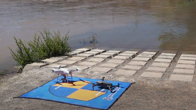
With so many waterproof drones available, it can be challenging to choose one that meets your needs. Here are the key factors to consider:
1. Camera Quality
To capture breathtaking visuals, prioritize a drone with a high-resolution camera. Look for models that capture 4K or even 6K footage, ensuring crisp details in both photos and videos.
Gimbal stabilization is equally important. This integrated system compensates for shakes and vibrations, delivering smooth and cinematic footage even in windy conditions.
2. Flight Time & Range
Choose a drone that offers a decent flight duration, allowing you ample time to explore and capture your desired footage.
Range is another important factor. It is the distance your drone can travel from the controller. A longer range provides greater freedom in exploring vast landscapes or venturing further out over water.
3. Durability & Waterproofing
Check the IP rating, which indicates the level of water resistance. Generally, an IP67 rating or higher is recommended, signifying the drone can withstand sustained water immersion.
Look for a drone with a robust construction that can handle minor bumps and potential landings on uneven terrain. Corrosion-resistant materials are also a plus, especially for saltwater environments.
4. Ease of Use & Control
A user-friendly drone makes your adventures more enjoyable. Consider your piloting experience. Drones designed for beginners generally offer intuitive controls and flight modes.
More advanced options may provide greater control and customization for experienced pilots.
5. Additional Features (Payload Capacity, AI Features)
Some waterproof drones boast additional features that enhance their capabilities. Payload capacity allows you to carry additional equipment.
AI features, like obstacle avoidance or automated flight paths, can simplify piloting and add an extra layer of safety.
That being said, let us find out which drones pass these criteria and come out as a true winner.
Top 4 Contenders for Best Waterproof Drones
Here’s a breakdown of the top contenders categorized by their strengths:
1. SwellPRO SplashDrone 4
 Source: SwellPRO
The SwellPRO Splashhdrone 4 stands out for its exceptional camera quality and impressive durability. Boasting a 1/2.3-inch CMOS sensor capable of capturing stunning 4K HDR footage, it delivers professional-grade results. The integrated gimbal ensures smooth stabilization, even in windy conditions. This drone is built with a corrosion-resistant body and a waterproof design. It is made to withstand the elements, making it a reliable companion for demanding aerial adventures.
- Waterproof Rating: IP67
- Drone Weight: 2.18 kg
- Max Flight Time: 30 mins
- Max Flight Distance: 5 km
- Working Temperature: -10? ~ 40?
- Satellite Positioning Systems: GPS/GLONASS
Pros:
- Exceptional camera quality with 4K HDR recording
- Integrated 3-axis gimbal for smooth, stable footage
- Long flight time and impressive range
- Durable construction and IP67 waterproofing
- Multiple intelligent flight modes for hassle-free operation
Cons:
- Higher price point compared to some competitors
- Relatively heavy compared to some compact options
Best For: Professional videographers, photographers, and experienced drone pilots seeking exceptional image quality and performance.
2. SwellPRO Fisherman Drone FD1
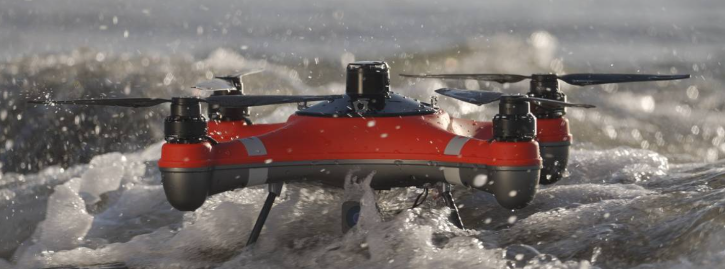 Source: SwellPRO
For fishing enthusiasts, the SwellPRO Fisherman Drone FD1 is a dream come true. This feature-packed drone boasts a unique payload capacity, allowing you to carry your fishing bait or line directly to your target spot. The integrated bait release mechanism ensures precise delivery, while the high-resolution camera helps you locate fish with ease. The rugged construction and waterproof design make the FD1 ideal for handling the challenges of saltwater environments.
Specifications:
- Waterproof Rating: IP67
- Drone Weight: 2050g
- Max Flight Time: 28 mins
- Working Temperature: -10? ~ 40?
- Satellite Positioning Systems: GPS/GLONASS
Pros:
- Specifically designed for fishing with a dedicated payload capacity for bait or fishing line
- Integrated bait release mechanism for precise delivery
- High-resolution camera helps locate fish with ease
- Durable construction and IP67 waterproofing for saltwater environments
- User-friendly controls and flight modes
Cons:
- Camera gimbal stabilization is not as advanced as some high-end options
- Slightly shorter flight time compared to some competitors
Best For: Fishing enthusiasts and anglers looking for a drone specifically designed to enhance their fishing experience.
3. PowerVision PowerDolphin
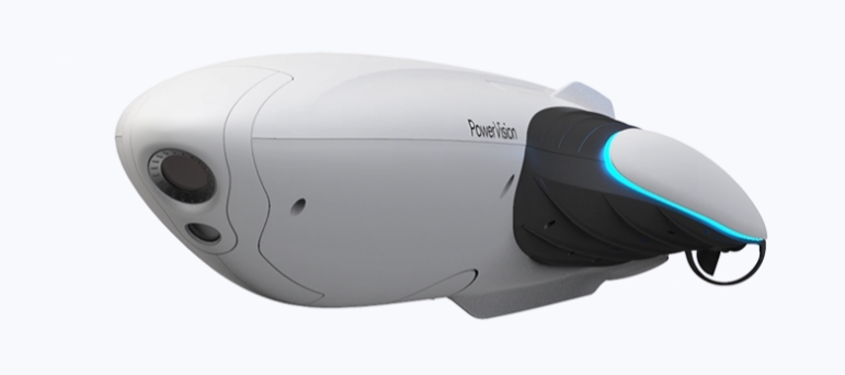 Source: PowerVision
If exploring the surface of the water is your passion, the PowerVision PowerDolphin is a compelling choice. This innovative drone is designed specifically for surface exploration, featuring a unique catamaran hull that provides exceptional stability and maneuverability. The 4K camera captures stunning footage of the water’s surface, while the integrated sonar allows you to see what lies beneath.
Specifications:
- Weight: 2267 grams
- Waterproof Rating: IPX8
- Sensor: 1/2.3 inch CMOS
- Operating Temperature Range: 32°F – 104°F
- Sonar Technology: Integrated sonar for underwater object detection
Pros:
- Unique catamaran hull design for excellent stability on water
- 4K camera captures stunning surface footage
- Integrated sonar helps locate fish and underwater objects
- Long battery life for extended surface exploration
- Relatively user-friendly controls
Cons:
- The camera doesn’t offer the same level of gimbal stabilization as some aerial drones
- Not ideal for deep-underwater exploration
Best For: Recreational boaters, fishermen, and water sports enthusiasts looking for a stable platform to capture surface footage and explore underwater environments.
4. PowerVision PowerEgg X Wizard
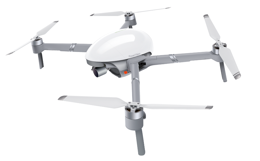 Source: PowerVision
This versatile PowerVision drone combines a waterproof aerial drone with a handheld gimbal camera, offering a unique two-in-one solution for capturing stunning footage from both the air and ground. The Wizard package specifically includes a full waterproof kit that allows the drone to fly in rain and even take off and land on water. This makes it suitable for capturing footage in challenging weather conditions or over water bodies.
Specifications:
- Weight: 544 grams
- Camera: 1/2.8 inch CMOS Effective Pixels 12MP+
- Gimbal: 3-axis mechanical gimbal
- Flight Time: Up to 30 minutes
- Waterproofing: can fly in the rain and take off and land on water with waterproof accessories.
Pros:
- Waterproof aerial drone and handheld gimbal camera
- The detachable camera allows for interchangeable lenses, including a waterproof option
- 3-axis gimbal for smooth footage in both aerial and handheld modes
- Long flight time and impressive range (aerial mode)
- Compact and portable design
Cons:
- Requires purchasing a separate waterproof camera lens for underwater operation
- May not be as durable as some dedicated waterproof drones
Best For: Content creators, travelers, and adventurers seeking a versatile drone for capturing footage from both air and ground.
Which Waterproof Drone is Right For You?
Here is a quick comparison table to help you determine the winner.
| Model | Camera | Flight Time | Waterproofing | Price |
| SwellPRO SplashDrone 4 | 4K (Waterproof) | 30 minutes | IP67 | $2,498 |
| SwellPRO Fisherman Drone FD1 | 720 px | 28 minutes | IP67 | $1,147 |
| PowerVision PowerDolphin | 4K UHD | 20 minutes | IPX8 | $500 |
| PowerVision PowerEgg X Wizard | 4K UHD | 30 minutes | Available in All-Weather and Wizard Combo | $600 |
How to Choose the Best Waterproof Drone?
By now, you probably have a clearer idea of what waterproof drones can do and why they’re worth considering. But choosing the right one still depends on your specific needs.
Start by thinking about how and where you’ll use it.
If your goal is to capture stunning content near or over water, focus on drones with high-resolution cameras, stable flight performance, and smooth gimbal systems.
Filmmakers and photographers should look for 4K video, waterproof lens housing, and steady hover capability even in wind.
If you are planning to use a drone for fishing? Look for models that offer bait release attachments, sonar integration, and solid floatation. Some even allow live underwater scouting to find fish before you cast.
For those in search and rescue or inspection work, range, durability, and GPS precision matter more than anything else.
A waterproof drone with strong signal stability and a loudspeaker can be a literal lifesaver in tough environments.
Interested in underwater exploration? Then you can check out this article on Best Underwater Drones.
Whatever your use case, the right drone isn’t the most expensive one; it’s the one that does what you need it to do. So, define your goals, set your budget, and pick a model that matches both.
Frequently Asked Questions
1. Can waterproof drones be submerged?
It depends on the specific waterproof drone and its IP rating. While waterproof drones are designed to handle water exposure, not all are created equal for submersion.
Submersible drones are specifically designed to operate underwater. They typically boast a higher IP rating (IP68 or higher), indicating they can withstand complete and continuous submersion for extended periods. Examples include the CHASING Dory, designed for deep underwater exploration.
2. How long do waterproof drones last?
With proper care, a well-maintained waterproof drone can last for several years (3-5 years or more).
3. Are waterproof drones more expensive?
Generally, yes, waterproof drones tend to be more expensive than their non-waterproof counterparts. Waterproof drones require additional engineering considerations to ensure water resistance. Sealing techniques, corrosion-resistant materials, and specialized motor designs all contribute to the increased cost.
4. Who Uses Waterproof Drones?
Waterproof drones are more than just cool tech; they serve real-world purposes across a wide range of activities:
- Photographers & Videographers: Capture dramatic coastal shots or surf scenes that regular drones can’t reach.
- Fishermen: Spot schools of fish or drop bait with accuracy using specialized drone attachments.
- Emergency Responders: Locate stranded people, deliver supplies, or survey flood zones safely.
- Researchers: Study marine life and underwater habitats without expensive dive teams.
- Inspectors: Check underwater pipelines, offshore rigs, and bridge supports quickly and safely.
5. Are there any drones that can fly in the rain?
Yes, there are drones specifically designed to fly in the rain. You can use drones like the SwellPro SplashDrone 4 and PowerVision
PowerEgg X (with waterproof accessories) is also built to handle rainy conditions, ocean spray, and wet environments without damage.
6. Are drones usually waterproof?
No, most consumer drones are not waterproof. Even light rain or water splashes can damage standard drones, as they lack sealed electronics and waterproofing materials.
Waterproof drones are a specialized category. They’re more rugged, often heavier, and built for tasks like marine filming, rescue missions, or fishing.
If you plan to fly near water often, it’s best to invest in a drone that’s rated as waterproof or weather-resistant with a proper IP rating (like IP67 or higher).
How to Choose the Right Drone School for Your Career
The commercial drone industry is booming, and choosing the right drone school plays an important role in shaping your success as a drone pilot.
The global commercial drone market is expected to reach USD 54.64 billion by 2030, with pilots needed for all sorts of scenarios, from infrastructure inspection and surveying to real estate and emergency services.
But here’s what most people miss:
The most successful drone pilots, the ones earning six figures, do not get their edge simply from having flown more. They also trained smarter and learned from the right instructors in the right programs, with a clear focus from the start.
In this guide, you’ll learn exactly how to choose a drone school that aligns with your goals. We’ll cover:
- Career paths and industry demands
- What makes a great prep course
- Hands-on flight training requirements
- Instructor quality and teaching approach
- Real-world applications and certifications
- Pricing breakdowns and true Return on Investment (ROI)
- Career support and job placement
Make drones more than just a hobby! This guide will help you invest in the right school, starting with defining your career path.
Define Your Career Path First
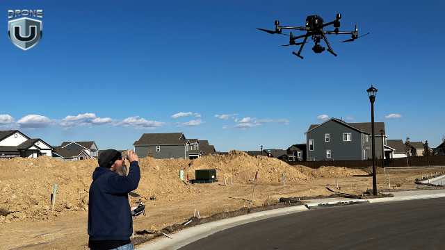
Define Your Career Path Before Choosing Drone School
The drone industry is diverse, and so are the skills required to succeed in each niche. A course that’s perfect for an aspiring real-estate photographer might fall short of the expectations of someone planning to support search-and-rescue missions or map utilities.
Take a few minutes to clarify what path you want to follow so you can work your way to it from the word ‘go.’
List of High-Demand Career Paths in the Drone Industry
Here’s a breakdown of in-demand drone careers, including what they pay and what skills are needed:
- Commercial Photography & Videography
Typical earnings: $50,000-$90,000 annually
Requires creative vision, advanced camera operation, and post-production expertise. Focus on cinematic composition, gimbal control, and software like Adobe Premiere Pro or DaVinci Resolve.
- Infrastructure Inspection
Typical earnings: $70,000-$105,000 annually
Requires technical precision and a thorough understanding of construction principles. Acquire knowledge of thermal imaging, structural analysis, and specialized sensors.
Typical earnings: $65,000-$95,000 annually
Calls for data expertise and precision. Essential skills include knowledge of GIS platforms such as ArcGIS and QGIS, photogrammetry software like Pix4D and Agisoft Metashape, and an understanding of survey-grade accuracy requirements.
Typical earnings: $55,000-$90,000 annually
Focuses on life-saving missions and public safety agencies. This path emphasizes emergency protocols, thermal imaging interpretation, and coordination with first responders.
Typical earnings: $50,000-$90,000 annually
Centers on precision agriculture and crop monitoring. It involves crop health assessment, NDVI analysis, specialized spraying techniques, and the use of agricultural software platforms.
- Drone Delivery & Advanced Air Mobility
Typical earnings: $75,000-$120,000 annually
This is an emerging sector with companies like Amazon Prime Air and Wing. It requires an understanding of Beyond Visual Line of Sight (BVLOS) operations, automated flight systems, and advanced traffic management.
Your Turn: Write Down Your Goals
Take five minutes right now and write down the following:
- What kind of drone work excites you?
- What industries do you want to work in?
- Do you see yourself freelancing, joining a team, or starting a business?
- Do you want to stay closer to home or travel for work?
This simple step could shape every decision you make, from the school to the gear you’ll eventually purchase.
FAA Part 107 (or Equivalent) Prep Quality
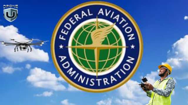
Get Your FAA Part 107 certification
In the US, every commercial drone pilot needs an FAA Remote Pilot Certificate under Part 107 regulations. On paper, it’s not a hard test; over 92% of people pass it on their first attempt.
But here’s what many don’t realize:
Passing the exam doesn’t mean you’re ready to fly commercially. Plenty of new pilots freeze up on their first paid gig because their training stops at memorizing answers. To make it in the industry and have a solid drone career, you need a program that teaches real aviation knowledge, not just test prep.
What Sets Top-Tier Part 107 Programs Apart?
1. Comprehensive Understanding Over Memorization
The FAA test gauges your ability to make smart decisions in real-world flight conditions. To prep for that, look for a course that:
- Explains concepts like weather systems, emergency procedures, airspace classes, and other technical aspects.
- Uses real-world examples to make the rules stick.
- Avoids relying too much on brain dumps and flashcards.
You can ask the school if you’ll read sectional charts, TAFs, and METARs, concepts that many pilots struggle with.
2. Current Content
The FAA updates its testing material frequently, and real-world regulations change perhaps even more. If your course doesn’t keep you, you could be operating under outdated assumptions.
Example: Since January 2023, Remote ID has become mandatory, which shifts how drones are tracked and identified in the national airspace. A good program should teach you:
- The difference between built-in Remote ID and add-on modules
- Where Remote ID is not required (e.g., FRIA zones)
- What happens when your internet connection drops mid-flight
- How to read NOTAMs and understand temporary flight restrictions.
When shopping for schools, ask about when they last updated Part 107 prep materials.
3. Real Practice Opportunities
Quality programs offer multiple practice exams using questions similar to actual FAA test questions. That includes:
- Multiple full-length practice exams.
- Detailed explorations for why each answer is incorrect or correct.
- Feedback that helps focus on weak areas.
If you can, request access to a sample quiz before enrolling. It’s a great preview of how they actually teach.
4. Check Pass Rates
Good schools know how their students perform, and they’re not afraid to share the stats. To help with this, you can ask:
- What their first-time pass rate is.
- How many students have taken the test in the past 6 months?
- What kind of support is offered for students who fail the test?
It is wise to avoid programs that promise ‘guaranteed passing’ without sharing real data. It highlights a focus on selling, not teaching.
5. Ongoing Training Support
Remote Pilot Certificates require renewal every 24 months. Look for schools that offer:
- Online recurrent training courses
- Regulatory update notifications
- Advanced continuing education credits
Your goal with Part 107 is to build a foundation that will make you a safer pilot, better decision-maker, and valuable in the field. Next up, we dive into the one thing that separates amateurs from pros: hands-on training.
Hands-On Flight Training
Hands-on Flight Training with Top Drone School
Hands-on training is where confident, capable drone pilots are made. It helps you build muscle memory, master real-world conditions, and learn how to troubleshoot under pressure. This is how you avoid freezing up on a windy day or fumbling the bag during a client inspection.
The best drone schools don’t treat flight training as an afterthought. They make it the core of your education, with an emphasis on structured, repeatable, and career-relevant skills.
Here’s what to look for in a flight training program worth your time and money:
1. Structured Skill Building
Before they let you go out and fly, great schools take you through a logical progression of skills, starting with the basics and working up to complex maneuvers.
This stage should teach you how to:
- Hover and maintain GPS lock.
- Take off and land in tight areas.
- Perform emergency stop procedures.
- Navigate obstacles and confined spaces.
- Maintain smooth and cinematic camera movement.
To find out more, you can ask what specific maneuvers you are required to demonstrate before graduating and how many solo flight hours are included. If they can’t answer clearly, that’s a red flag.
2. Multi-Platform Experience
Different drones serve different purposes. Learning to fly just one craft limits your experience and job opportunities.
The best programs expose you to:
- FPV drones (DJI Avata / Cinewhoop drones) for compelling fly-throughs and mission critical indoor flights
- Small drones (DJI Mini Series / DJI Air 3 Series) for indoor or close-up missions.
- Camera drones (DJI Air 3 / Inspire) for media and content creation.Enterprise drones (DJI
- Matrice / Freefly drones / Skydio X10) for inspections and mapping.
- Fixed-wing drones for agriculture and large-scale surveying.
It’s important to learn from an organization that has solid experience with drones manufactured outside the US, as well as domestically manufactured drones.
Here’s a pro-tip: Ask if you’ll fly any drones with RTK/GNSS positioning, which is often required for precision work like mapping.
3. Real-World Mission Training
Quality training programs simulate actual work conditions. This may include inspecting a bridge, mapping a construction site, or filming a wedding, depending on your career focus. These scenarios teach you how to plan flights, manage your battery capacity, communicate with collaborators or crew, and adapt to changes in the environment.
4. Weather and Challenging Conditions
Apart from unpreparedness, the weather is one of your biggest foes. You might be dealing with unclear skies or fast winds. Your training programs to prepare for this should cover:
- Wind management (surface winds up to 35mph allowed under part 107)
- Go/no-go decision-making based on weather and visibility.
- How temperature affects battery life and flight time
- Managing light rain, humidity, fog, and knowing when to call it off.
It is a great bonus point if your training includes night flying scenarios and the use of anti-collision lighting, both of which are valuable skills in real-world applications.
5. Supervised Solo Flight Time
One of the most valuable ways to build experience is to rack up hours of hands-on, independent flying time with an instructor nearby to offer guidance or step in as needed.
The best schools offer:
- At least 5 hours of supervised solo flight time.
- Performance evaluations and progress tracking of flights.
- Structured debriefs after each flight.
The more hours you have, the more precise and confident your flights are.
Instructor Experience and Teaching Quality
The strength of your drone education should combine a good curriculum with a skilled instructor. The best teachers can help refine your skills, offer professional feedback, and impart confidence that tutorials may not provide.
How do you evaluate the instructor quality at a drone school? Let’s break it down:
1. Professional Flight Experience
Choose instructors who aren’t just certified but who actively work in the drone industry. Look for:
- FAA Part 107 certified pilots with at least 5+ years of commercial operations experience.
- Experience in your target field, whether that is mapping, agriculture, real estate, etc.
- Recent/ongoing commercial missions, such as surveys or inspections, to ensure their skills and knowledge are current.
Experience in real-world scenarios not only adds credibility but also facilitates real-world troubleshooting and incorporates scenario training into the lessons.
2. Teaching Ability
Skilled instructors hone specific, crucial skills that make them effective at teaching what they know. Patience, empathy, and clear communication are essential, especially for beginners, to advance realistically.
They also tweak their teaching methods to adapt to individual learning styles, ensuring information learned is retained. You’ll learn how they problem-solve on-site, especially with issues such as wind management, tech glitches, or unforeseen weather.
3. Current Industry Involvement
The drone industry evolves rapidly, giving instructors who remain active in commercial operations and bring current market knowledge to their teaching the edge. Ask your instructor, “What commercial work are you currently performing?” Those who still fly professionally bring real-world insights that go beyond the textbook.
4. Student-to-Instructor Ratios
In drone training, personal attention can make a big difference, whether you’re practicing maneuvers or reviewing mission plans. Increased access to your instructor means you can quickly and confidently improve.
Look for programs that have a low student-to-instructor ratio to get more time on the controls, a more focused practice session, and personalized feedback. If the class is too large, the experience might be rushed and shallow.
5. Ongoing Professional Development
The best instructors keep learning. They grow with the industry. That means taking new certifications in diverse scenarios such as photogrammetry and thermal imaging, flying with the latest tools and platforms, and staying engaged in professional organizations like FAASTeam and AUVSI, among other efforts.
Look for instructors who are up-to-date on the tech and best practices.
Not all drone pilots fly for the same reason. Whether you’re inspecting cell towers or filming real estate, ensure your training aligns with your objectives.
Course Content and Specialization Options
Master Industry-Specific skills like Pix4D for Photogrammetry
Getting your FAA Part 107 certification is a critical first step, but it is just that: a starting point. The real value of a drone school lies in what it offers beyond the basics. Matching your training to the kind of work you do involves industry-ready specialization across fields such as agriculture, inspections, mapping, media production, etc
Here’s what to look for:
1. Advanced Flight Techniques
Flying well is about having precision, control, and confidence under pressure. A solid training program should teach you how to:
- Operate in confined or complex spaces.
- Maintain smooth camera movements for cinematic shots.
- Perform emergency landings when failures happen.
- Adapt quickly to tricky conditions like GPS drift or wind.
- Use RTK and GNSS systems for accurate pinpoint flight.
You should be able to get a list of what you will learn from a school before signing up to evaluate the depth of learning.
2. Industry-Specific Applications
Every drone career has its own technical demands. If you have figured out your preferred niche, look for a school that provides specialists in the field you want to enter. For example:
- Survey and mapping require learning photogrammetry, GCP setup, and how to process data in tools like Agisoft Metashape or Pix4D.
- Media production requires skills in composition, motion shots, lighting, and editing with tools like DaVinci Resolve or Premiere Pro.
Specialized skills make you far more competitive and dramatically increase your earning potential.
3. Business and Legal Training
Over 60% of successful drone pilots eventually work as contractors or start their own companies. If you plan to freelance or run your own drone business, you’ll need to understand the business side of the industry. Look for programs that teach you how to:
- Price your services competitively without undercutting yourself.
- Draft basic contracts and manage clients professionally.
- Get the right insurance and liability coverage.
- Avoid common legal mistakes that could get you in trouble.
- Apply for waivers and maintain regulatory compliance.
Many new pilots striking out on their own may fail if they don’t properly handle the business and maintain sustainable, long-term income.
4. Technology Integration
Good pilots learn how to integrate flight planning, data capture, and post-processing into their workflows. Strong programs will teach you how to:
- Use mission-planning software like DroneDeploy, DJI Pilot, Litchi, etc.
- Select the best hardware (drone, computer, GPS equipment, etc.) and software for the specific application and/or deliverable you’re working with.
- Implement ‘detect and avoid’ systems and safety procedures.
- Read and respond to NOTAMs and airspace notifications.
- Process flight data for clients (from raw files to deliverables.)
- Coordinate with teams, communicate with ATC (as needed), and document your work professionally.
5. Tools, Templates, and Repeatable Systems
In some cases, you may get more than skills. Templates, tools, and repeatable systems are important for making price sheets, flight logs, client reports, checklists, and so much more. These provisions save time and help you quickly establish your professional standing.
Remember: general skills get you started, and specialized skills get you paid.
A strong resume starts with a respected name. Let’s find out how a drone school’s reputation can impact your job opportunities.
Industry Recognition and Credentials

Look for Drone School with Strong Industry Recognition
Not all drone schools carry the same weight when it comes to your resume or future opportunities. While your skills and professionalism make the difference, it can be beneficial to find schools that have a strong reputation in the industry. They could offer more than a certificate of completion, including:
1. Accreditation and Partnerships
When researching drone schools, accreditation, industry affiliation, and certification carry weight in some settings. However, how much they matter depends on your goals.
If your goal is to work in a government or corporate role, as an industrial designer or GIS analyst, then formal recognition may be important. Having credentials from an accredited institution could give you an edge.
Some key affiliations to keep an eye out for include:
- Accrediting Commission of Career Schools and Colleges (ACCSC): One of the gold standards for career training programs.
- Association for Unmanned Vehicle Systems International (AUVSI)- The largest global association for drones, robotics, and autonomy.
- State aviation or transportation department recognition programs.
Also, look for schools with manufacturer partnerships with companies like DJI, Autel, or Parrot. These indicate that the school is up to date with what the workforce needs and can transfer that to their course.
But if your goal is to do paid drone work like mapping, inspections, or construction deliverables, then hands-on flight experience, real-world practice, and dealing with clients matter far more than formal school credentials.
Most drone clients and companies want to know:
- Can you fly safely and deliver accurate results?
- Do you understand the client’s needs?
- Can you prove your value with real-world results?
This is where schools like Drone U specialize. From real flight skills, workflows, and real clients, the school helps you become a capable and confident drone operator.
2. Employer Preferences
Check out the major employers in your specific industry to find out if they have preferences you can meet. You could find out if:
- Target employers recognize your training.
- They regularly hire graduates from certain schools.
- Where graduates from a certain school are working now.
You can find information like this on LinkedIn and other networking connections that plug you into the zeitgeist.
3. Professional Certifications Beyond Part 107
Beyond Part 107, there are additional industry-recognized credentials to consider. Some examples include:
- Pix4D Certified Instructors
- DJI Enterprise Specialist: For pilots using DJI’s Matrice or other industrial platforms.
- Autel Certified Pilot: Specialized training for Autel systems.
- FLIR Thermal Imaging Certification: Useful for inspections, utility work, and public safety work.
- AUVSI TOP Certification (Trusted Operator Program): A respected credential in the field.
While not necessary for every job, they can make the difference when a hiring manager is comparing you with another pilot of similar skills.
4. Alumni Success Stories
Strong programs produce successful graduates. If you can find out what the students go on to do, it can help you make the decision. Read any case studies or testimonials and talk to the school about what information they can offer.
Good schools are happy to showcase their graduates. You can verify claims through LinkedIn research, direct contact (within reason), or industry placement data.
Let’s take a closer look at what you’re paying for in drone training.
Cost vs. Value Analysis
Drone school prices vary widely. You can find online courses for under $500, and full professional programs that go into five figures per year. However, do not make the mistake of focusing on just the price tag. What matters is the value you get for what you spend.
Let’s break it down:
1. Understanding Drone School Pricing Tiers
Drone schools typically fall into four pricing categories. Each tier benefits you differently and is suited to different types of learning:
| Tier | Price Range | Key Features |
| Basic Online | $300-$800 |
|
| Intermediate Hybrid | $1,500-$4,000 |
|
| Premium | $5,000-$10,000 |
|
| Elite Specialized | $10,000-$15,000+ |
|
2. Calculate Your True Investment
It is important to factor in everything that goes into your training experience. Here’s what to include:
- Tuition fees
- Books or course materials
- Part 107 exam fee ($175)
- Travel and lodging (for in-person training)
- Equipment purchases or rental fees
- Insurance (if needed during training)
- Remote ID module (if not built-in, buy one for $100 to $300)
- Time spent away from work (where applicable)
Keep an eye out for hidden fees. Some low-cost programs add charges for things like simulator access, practice tests, or certificate printing, which can add to your bill.
3. ROI Timeframe
The right drone school should pay for itself within the first few months of paid work and set you up for long-term growth.
Let’s say you spend $6,000 on training. If your first few jobs net you $1,200 – $2,000 each (a doable sum in real estate or inspections), you could recoup your investment in just a few projects.
Here’s what affects your ROI and drone pilot salary:
- How quickly you start working after graduation.
- The kind of work you’re certified to do.
- Your niche
- Whether the school helps you build a portfolio or find a network that yields clients.
- Your level of specialization.
One of the first questions to ask when you start is, ‘How soon can this course help me start earning, and how much will it help me grow?’
Next, let’s explore how the best drone schools support your career beyond the classroom.
Career Support
Training Schools like Drone U offer Real Job Connections
When it comes to drone education, ’career support’ can mean different things depending on the type of institution. A university or technical school offering a degree or certification may provide structured job placement services, such as internships, career centers, and alumni networks that connect you to full-time jobs.
On the contrary, specialized drone programs and hands-on drone training platforms usually offer practical rather than formal support. They focus on helping students build in-demand skills, understand workflows, and connect with active professionals.
Whichever path you choose, the kind of career support a program offers can have a big impact on how quickly and successfully you transition into paid drone work.
One of the most practical forms of that support is access to real job connections.
1. Real Job Connections
Some top-tier training programs go a step further and actively work with industries using drones as standard tools. These include:
- Utility companies
- Construction firms
- Agricultural tech providers
- Surveying and mapping forms
- Real estate agencies and content creators,
- Public sector and emergency services
Look for programs that have job boards with fresh listings, direct referral pipelines, or have alumni working successfully in your target field. Even when there is no guarantee for formal placement, access to a strong professional network can be equally valuable in the long term.
2. Portfolio Development
It is possible to be an excellent pilot and struggle to showcase your skills, which ultimately impacts your hirability. That is where portfolio building is essential. Top drone schools help you visualize your professional story by helping you prep:
- Mission-based footage exploring tooling, response in the field, shot-taking ability, etc.
- Projects relevant to your chosen field.
- Edited clips, annotations, or reports that show technical skills.
- A clean, professional resume that appeals to employers.
Some programs have options to learn editing and use these skills later to build a portfolio on your own.
3. Verified Success Stories
This is the strongest indicator of quality career support. Ask to speak with three graduates who found jobs in your chosen specialty within the past year. If they can’t arrange that conversation, keep looking.
Conclusion
A high-quality drone school is a launchpad that makes a difference when you are trying to become a professional pilot. As such, due diligence should lead your actions. Take your time, research, ask tough questions, talk to graduates, and choose a school that respects your ambition and can help you build a base that lasts.
Flying is fun, and it can be even more so when you build a future with drones.
Ready to Start Your Drone Career Journey?
Learn the basics of drone operations with Drone U’s beginner-friendly courses.
Do you still have questions about choosing the right drone school?
Schedule a free consultation with our career advisors for personalized guidance and expert advice on choosing the right drone school.

Part 107 License 101: How to Get a Commercial Drone License
Thinking about launching a career as a commercial drone pilot? This guide will show you the way to get your FAA Part 107 drone license, a key requirement for flying drones professionally in the U.S.
Drones, also known as unmanned aerial systems (UAVs), are rapidly transforming countless industries, including media, agriculture, and real estate.
Getting your drone pilot certification will open doors to the numerous opportunities available in the market.
While passing the Part 107 exam has a high pass rate, it requires solid preparation. You will need a strong grasp of safe flight procedures, drone regulations, and making decisions in real-world situations.
This is where drone certification comes in.
If you are serious about becoming a professional drone pilot, the Part 107 Certification opens the doors to opportunities for you.
Quick Overview: FAA Part 107 Drone License
The Part 107 license, officially known as the Remote Pilot Certificate, is required by the Federal Aviation Administration (FAA) for anyone using a drone for commercial purposes in the United States.
Here’s what you need to know:
- Commercial Use: Required for any revenue-generating or business-related drone activities like photography, inspections, or real estate.
- Certification Process: Pilots must pass the Part 107 exam to receive the Remote Pilot Certificate.
- Exam Details: Multiple-choice test covering regulations, airspace, weather, and emergency procedures; taken at an FAA-approved testing center.
- Eligibility: Must be 16 or older and able to read, write, speak, and understand English.
- Recurrent Training: Ongoing aeronautical knowledge updates are required every 24 months to stay current.
- Remote ID Requirement: Drones must broadcast identifying information as part of the FAA safety regulations.
- Cost: The exam typically costs around $175, with optional expenses for prep materials or training courses.
Let’s take a quick look at the importance of Part 107 certification and what it means for you as a certified drone pilot.
Why FAA Part 107 License?
According to Precedence Research, the Drone Service Industry will be 87.02 billion dollars by 2032.
As businesses discover the incredible efficiency and cost savings drones offer, the demand for certified drone pilots is skyrocketing.
The opportunities are endless – right from mapping, surveying, and photography to videography, inspections, security, and 3D modeling, just to name a few.
But drones aren’t just about cool jobs.
They are increasingly used for critical life-saving missions like search and rescue, assessing disaster damage, and identifying potential hazards.
To capitalize on these opportunities, earning your part 107 license is the ideal first step.
Let’s jump right in and learn the fundamentals of the Part 107 Drone License.
What is Drone Certification?
Drone certification, also known as a Remote Pilot Certificate or Part 107 license, is an official designation for drone pilots from the Federal Aviation Administration (FAA). You need to pass the Part 107 drone certification exam to get the license.
 FAA Part 107 License | Source: Medium.com
Earning this certification allows you to fly drones for commercial purposes in the United States legally.
Passing the Part 107 exam demonstrates that you have a good understanding of airspace regulations and safety protocols. This prepares you to fly safely within the acceptable use of FAA policy.
Learn what certification you need for drone mapping in this video:
Understanding Terminology: Definitions in 14 CFR Part 107
1. Control Station
An interface used by the remote pilot to control the flight path of the small unmanned aircraft.
2. Corrective Lenses
This means spectacles or contact lenses.
3. Small Unmanned Aircraft
An unmanned aircraft weighs less than 55 lbs. on takeoff, including everything that is on board or otherwise attached to the aircraft.
4. Small Unmanned Aircraft System
A small unmanned aircraft and its associated elements are required for the safe and efficient operation of small unmanned aircraft in the national airspace system.
5. Unmanned Aircraft
An aircraft operated without the possibility of direct human intervention from within or on the aircraft.
6. Visual Observer
A person designated by the Remote Pilot in Command (RPIC) to help maintain visual awareness of the drone. They assist in spotting other aircraft or obstacles in the air or on the ground to ensure safe operation.
7. Person Manipulating the Controls
A person, other than the remote pilot in command, who is controlling the flight of an sUAS under the supervision of the remote PIC.
8. Remote Pilot in Command (RPIC)
A person who holds a remote pilot certificate with an sUAS rating and has the final authority and responsibility for the operation and safety of an sUAS operation conducted under Part 107.
Let’s uncover the steps of getting a commercial drone pilot license.
How to Get an FAA Part 107 License: Step-by-Step Guide
Here are the steps you’ll need to take to earn your drone license:
Step 1: Meet the Eligibility Criteria
Step 2: Meet the Basic Requirements
Step 3: Prepare Exam Topics and Question Types
Step 4: Follow the Application Process and Take the Test
Step 1. Eligibility Criteria for Commercial Drone Certification
To earn a commercial drone pilot license under 14 CFR Part 107, here are the eligibility criteria.
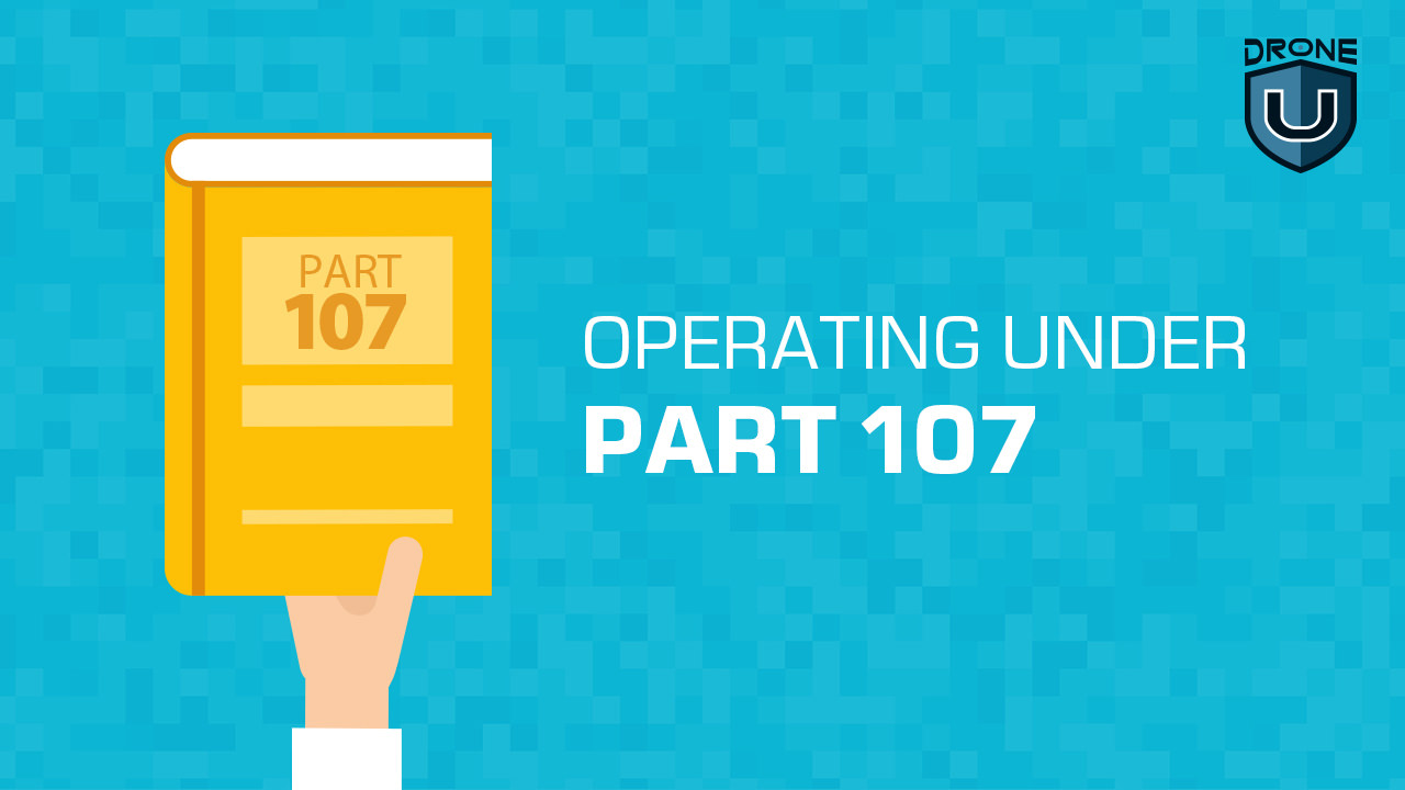
For First-Time Pilots
You must:
- Be at least 16 years old
- Be able to read, speak, write, and understand English
- Be in a physical and mental condition to safely fly a drone
- Pass the initial aeronautical knowledge exam: “Unmanned Aircraft General – Small (UAG)”
For Existing Part 61 Certificate Holders
- Must hold a pilot certificate issued under 14 CFR part 61
- Must have completed a flight review within the previous 24 months
Step 2. Basic Requirements for Drone Certification
Remote Pilot Certificate for First-Time Pilots:
- Must be easily accessible by the remote pilot during all UAS operations
- Certificate holders must complete an online recurrent training every 24 calendar months to maintain aeronautical knowledge recency
Remote Pilot Certificate for Existing Part 61 Certificate Holders:
- Must be easily accessible by the remote pilot during all UAS operations
- Certificate holders must complete an online recurrent training every 24 calendar months to maintain aeronautical knowledge recency
Step 3. Exam Topics and Question Types Related to the FAA Part 107 License Exam
The Part 107 exam consists of multiple-choice questions covering the following topics:
Initial Aeronautical Knowledge Test Topic Areas – For First-Time Pilots Include:
- Applicable regulations relating to small unmanned aircraft system rating privileges, limitations, and flight operations
- Airspace classification and operating requirements, and flight restrictions affecting small unmanned aircraft operation
- Radio communication procedures
- Determining the performance of small unmanned aircraft
- Aviation weather sources and effects of weather on small unmanned aircraft performance
- Small unmanned aircraft loading and performance
- Emergency procedures
- Crew resource management
- Physiological effects of drugs and alcohol
- Aeronautical decision-making and judgment
- Airport operations
- Maintenance and preflight inspection procedures
- Operation at night
Part 107 Small UAS Initial (Alc-451) Online Training Course – For Existing Part 61 Certificate Holders Will Cover These Topic Areas:
- Emergency procedures
- Crew resource management
- Maintenance and preflight inspection procedures
- Operation at night
- Applicable regulations relating to small unmanned aircraft system rating privileges, limitations, and flight operations
- Effects of Weather on Small Unmanned Aircraft Performance
- Determining the performance of small unmanned aircraft
- Small unmanned aircraft loading and performance
Step 4. Drone Certification Application Process
Here are the steps to obtain your commercial drone pilot certificate from the Federal Aviation Administration (FAA).
A: Gather the Required Documents and Forms
Prepare the necessary documents and forms for your application. This typically includes
- Remote Pilot Certificate Application Form: This is the FAA Form 8710-13
- Proof of Identity: You must provide valid government-issued photo identification proof
- Proof of your current flight review (For Existing Part 61 Certificate Holders)
- Online course completion certificate (For Existing Part 61 Certificate Holders)
B: Apply for the FAA Part 107 License
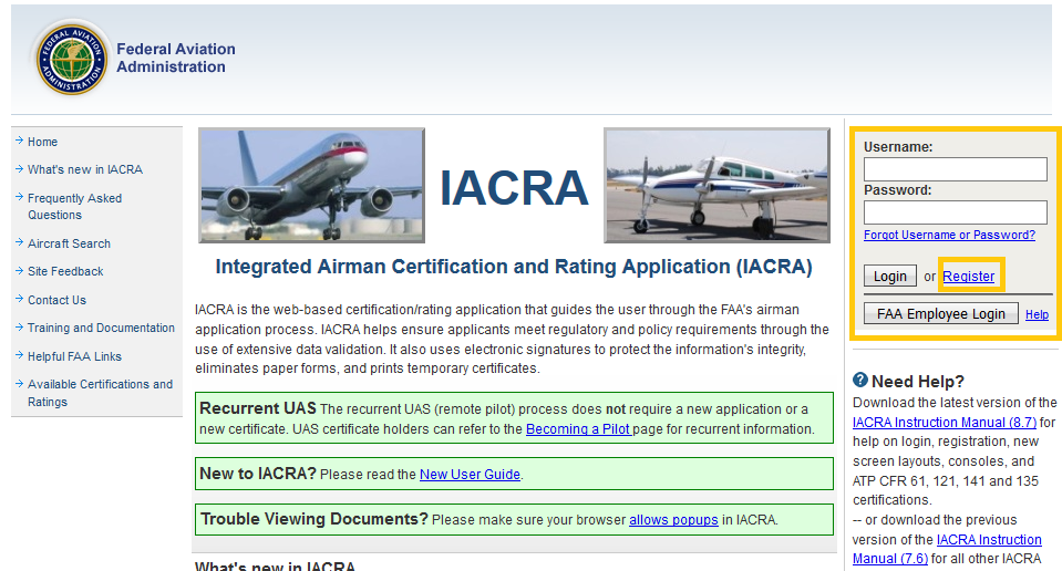 IACRA Login Page
Process for First-Time Pilots
Step 1: Obtain an FAA Tracking Number (FTN) by creating an Integrated Airman Certification and Rating Application (IACRA) profile before registering for a knowledge test.
Step 2: Schedule an appointment with an FAA-approved Knowledge Testing Center. Be sure to bring a government-issued photo ID to your test.
Step 3: Pass the initial aeronautical knowledge test: “Unmanned Aircraft General – Small (UAG)”.
Step 4: Complete FAA Form 8710-13 for a remote pilot certificate (FAA Airman Certificate and/or Rating Application) using the electronic FAA Integrated Airman Certificate and/or Rating Application System (IACRA)*
- Log in with your username and password
- Click on “Start New Application” and 1) Application Type “Pilot”, 2) Certifications “Remote Pilot”, 3) Other Path Information, 4) Start Application
- Follow application prompts
- When prompted, enter the 17-digit Knowledge Test Exam ID (Note: it may take up to 48 hours from the test date for the knowledge test to appear in IACRA)
- Sign the application electronically and submit it for processing.
Process for Existing Part 61 Certificate Holders
Step 1: Create an account or log into your existing account on the FAA Safety Team (FAASTeam) website.
Step 2: Complete the Part 107 Small UAS Initial (ALC-451) online training course.
Step 3: Create an account or log into your existing account in IACRA.
Step 4: Complete Form 8710-13 for a remote pilot certificate (FAA Airman Certificate and/or Rating Application) in IACRA.
- Log in with your username and password
- Click on “Start New Application” and 1) Application Type “Pilot”, 2) Certifications “Remote Pilot”, 3) Other Path Information, 4) Start Application
- Follow application prompts
- Sign the application electronically and submit it for processing.
Step 5: Make an appointment with one of the following entities to validate your identity. Bring your completed Form 8710-13, proof of your current flight review, photo ID, and your online course completion certificate.
- At an FAA Flight Standards District Office (FSDO)
- With an FAA-designated pilot examiner (DPE)
- An airman certification representative (ACR)
- An FAA-certified flight instructor (CFI)*
Please note: * CFIs cannot issue temporary certificates. They can process applications for applicants who do not want a temporary certificate.
C: Waiting Period and Processing Time For Acquiring a Remote Pilot Certificate
After submitting the form as a first-time pilot, you will receive a confirmation email once your TSA security background check is complete. This email will contain instructions for printing a temporary remote pilot certificate from IACRA.
Typically, you’ll receive your temporary remote pilot certificate within a week.
Your permanent remote pilot certificate will be mailed once all other FAA-internal processing is complete. It will take approximately 6-10 weeks to process and send your permanent certificate.
If you hold a Part 61 certificate, you can have a representative sign your application and issue you a temporary airman certificate. You will get your permanent certificate via U.S. mail within a few weeks.
Make sure to have your Remote Pilot Certificate readily available whenever you operate your drone.
Obtaining your commercial drone pilot certificate is a significant milestone that involves navigating a formal application process with the FAA.
By diligently following the outlined steps and submitting a complete and accurate application, you can become a certified commercial drone pilot, enabling you to safely and legally operate drones for commercial purposes in full compliance with FAA regulations.
The Guidelines You Need to Follow as a Commercial Drone Pilot
Earning your part 107 is just the beginning. The onus is upon you to fly responsibly, complying with local, state, and federal regulations.
Check out our Safe Drone Operations course to learn flying skills that will take you from a beginner to an expert drone pilot.
Here are the guidelines for drone operators under Part 107:
- You can fly during daylight (30 minutes before official sunrise to 30 minutes after official sunset, local time) or in twilight if your drone has anti-collision lighting.
- Minimum weather visibility is three miles from your control station.
- Do not operate your drone from a moving vehicle unless you are flying your drone over a sparsely populated area, and it does not involve the transportation of property for compensation or hire.
- Always avoid manned aircraft.
- Never operate your drone carelessly or recklessly.
- Keep your drone within sight. If you use First Person View or similar technology, you must have a visual observer and always keep your drone within unaided sight (for example, no binoculars).
- You cannot be a pilot or visual observer for more than one drone operation at a time.
- Do not fly a drone over people unless they are directly participating in the operation.
- Do not operate your drone from a moving aircraft.
Related Reading: Check out “New Drone Laws in the USA” to get more information on the regulations for unmanned aerial vehicles (UAVs)
NOTE: If you are a recreational drone pilot, you need to pass The Recreational UAS Safety Test (TRUST).
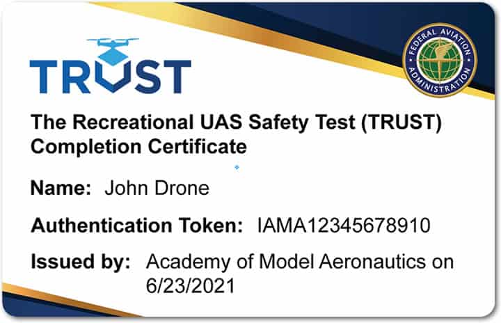 TRUST Certificate | Source: Reclaimdrone.com
Essential Considerations for Commercial Drone Pilots
As a commercial drone operator, it’s crucial to be aware of the special considerations that come with the territory. From insurance requirements to airspace restrictions, these factors can significantly impact your operations.
Let’s take a closer look at a few of these considerations to ensure safe and compliant drone operations.
1. Part 107 Waivers and exemptions for specific operations:
Note: You do not need a waiver to fly a drone following Part 107 rules. You do need a waiver when you want to operate a drone contrary to the rules in Part 107 under the waivable operations listed below.
| To | You need a waiver from |
| Fly a small UAS from a moving aircraft or a vehicle in populated areas | § 107.25 – Operation from a Moving Vehicle or Aircraft |
| Fly a small UAS at night without anti-collision lighting | § 107.29(a)(2) – Operation at night |
| Fly a small UAS during periods of civil twilight without anti-collision lighting | § 107.29(b) – Operation at Night |
| Fly a small UAS beyond your ability to determine the position, altitude, attitude, and movement of the sUA, with unaided vision. | § 107.31 – Visual Line of Sight Aircraft Operation |
| Use a visual observer without following all visual observer requirements | § 107.33 – Visual Observer |
| Fly multiple small UAS with only one remote pilot | § 107.35 – Operation of Multiple Small UAS |
| Fly over a person with a small UAS that does not meet the conditions of operational categories 1, 2, 3, or 4 | § 107.39 – Operation over human beings. |
Fly a small UAS:
|
§ 107.51 – Operating Limitations for Small Unmanned Aircraft |
| Fly over moving vehicles with a small UAS that does not meet the conditions of operational categories 1, 2, 3, or 4 | § 107.145 – Operations Over Moving Vehicles |
Request a waiver for only what you need to fly your mission. Additionally, you can review the criteria to evaluate waiver applications: Part 107 Waiver – Section Specific Evaluation Information (PDF)
2. Airspace Authorizations
Operations in Class G airspace are allowed without air traffic control (ATC) permission. Class B, C, D, and E airspace operations need ATC authorization.
The Low Altitude Authorization and Notification Capability (LAANC) uses desktop and mobile apps designed to support the volume of drone operations with almost real-time airspace authorizations. It is now live at more than 530 FAA ATC facilities covering over 726 airports throughout the country. Any authorizations are granted within seconds of being submitted.
Currently, LAANC only applies to FAA ATC facilities and does not yet include contract or Department of Defense ATC facilities.
3. FAADroneZone
FAADroneZone is a one-stop, online shop for drone registration and for requesting waivers or airspace authorizations (where LAANC is not available).
 FAADroneZone Drone Registration
4. B4UFLY App
The B4UFLY app provides situational awareness to recreational flyers and other drone users, including interactive maps that show where recreational flyers can and cannot fly.
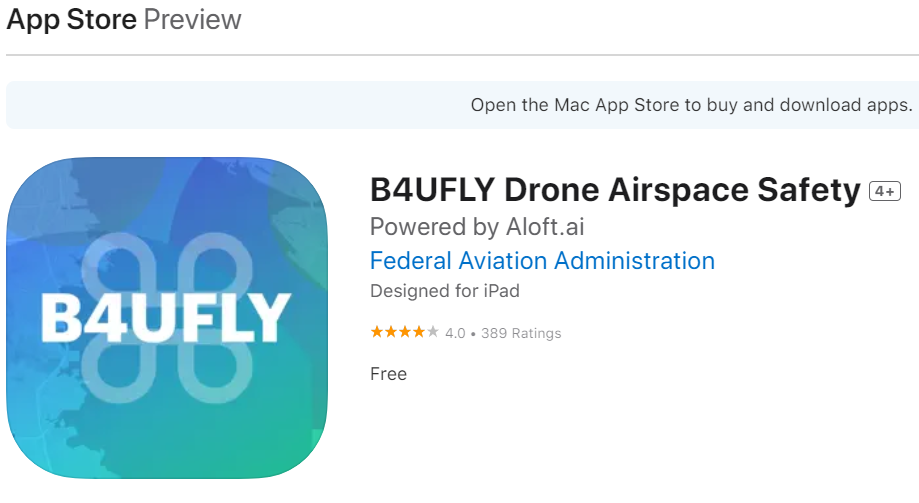
The B4UFLY app is available for free download on the App Store for iOS and the Google Play Store for Android. In addition to the mobile app, B4UFLY also offers a desktop version for preflight planning and research.
Check out this video to address any concerns and get clarification about the FAA Part 107 certification:
Frequently Asked Questions
1. Do you need a drone pilot license to fly a drone in the USA?
To operate your drone under the FAA’s Small UAS Rule (Part 107), you must obtain a Remote Pilot Certificate from the FAA. If you intend to fly for recreational purposes, you must pass The Recreational UAS Safety Test (TRUST).
2. How do I get FAA approval for drones?
To fly under Part 107 rules, there are 3 main steps.
Step 1: Learn the Rules
Step 2: Become an FAA-Certified Drone Pilot by Passing the Knowledge Test
Step 3: Register your Drone with the FAA
3. What is the validity of a remote pilot certificate?
The Remote Pilot Certificate is valid for two years. After that, you’ll need to complete a recurrent training course and pass a knowledge test to renew your certificate.
4. What should I study for the Part 107 aeronautical knowledge test?
Study materials are available online. Applicants can review the Airman Certification Standards (ACS) for Unmanned Aircraft Systems (PDF), the Remote Pilot Study Guide (PDF), and the online sample questions (PDF) available on the FAA website.
You can also take our comprehensive Part 107 Certification course that guarantees passing your exam on the first attempt.
Why “Train the Trainer” Fails in Drone Programs and What Works
It’s easy to assume that launching a drone program is as easy as investing in hardware, clearing regulatory hurdles, and adopting the ‘train the trainer’ approach. However, unlike other departments where skills can be passed down easily, flying drones is different.
It merges aviation, tech, and a bit of artistry. No two missions are flown the same; the variables and risks change constantly.
In this article, we break down why the ‘train the trainer’ model often doesn’t measure up, and what a smarter, safer alternative might look like.
The Part-Time Pilot Problem
This is where most internal drone programs start to fail. Instead of hiring full-time instructors, organizations often assign training responsibilities to someone who already has a full-time job, perhaps in a completely different role.
These part-time pilots are not immersed in aviation regulations, they often fly very little, and they are not instructors by trade. This creates a dangerous gap: you’re not just asking them to teach a complex tool, but often to train others in a high-risk environment.
This combination of real-time flight decision-making, technical systems, Federal Aviation Administration (FAA) compliance, and environmental uncertainty requires a frequent flyer to stay sharp and create structured training programs.
Since they’re stretched thin, these pilots cannot transfer skills they have not truly mastered. And even if they are proficient fliers, they are still unlikely to be able to thoroughly convey the intricacies of real flight to other pilots.
When “Train the Trainer” Might Work
To be fair, there are exceptions where internal training models work.
An example would be an organization that has a full-time drone instructor who does only that. Their job revolves around staying updated on best practices and honing instructional skills. However, most companies don’t have a specialized pilot on staff.
We have seen this play out firsthand with a major utility provider managing over 135 certified drone pilots. With that kind of scale, you would think they might be able to run internal training programs, but they don’t. Why?
Companies have to confront the fact that only a small number of those pilots (maybe 20) fly frequently enough to build real-world fluency and have the requisite instructional skills to impart that experience.
These 20 pilots are busy flying actual missions. Additionally, there is at least an opportunity for preferential treatment based on relationships.
So, they bring in professional trainers.
The lesson they impart with this decision is that competence in the sky doesn’t automatically translate to instructional expertise, and you shouldn’t roll the dice on safety.
The Four Fatal Flaws of Internal Drone Training
1. The Lost-in-Translation Effect
Internal trainers without an instructional background will often teach the way they fly, relying on shortcuts, gut instinct, maneuvers jargon, etc. The problem with this is that what is intuitive to one person is often unclear or incomplete for beginners with no experience.
Important safety procedures may be shrunk into a checklist, risk management may be a few bullet points, and critical flight decisions relayed in a few steps. This provides no reliable framework for the diverse flight conditions one might experience.
This approach, though well-intentioned and seemingly more fun, oversimplifies the job and the nuances that experienced pilots rely on. That is when accidents happen.
2. The Memory Myth
Many organizations assume that once someone finishes their train-the-trainer course, they can simply memorize the material and pass it on. This assumption fails to account for the many layers of airspace regulation, equipment specs, weather analysis, operational judgment, and other skills required to fly reliably.
Professional instructors aren’t working off memory but through internalized protocols. This deeper understanding allows them to adjust to different learning styles, spot gaps in training, and intervene before errors compound.
Absorbing that kind of proficiency in a week-long certification is just not possible.
3. The Overconfidence Trap
Train-the-trainer programs sometimes create a false sense of authority. Freshly certified trainers might leave with confidence that hasn’t been tested in the field. This mindset is a known safety hazard, and the FAA would probably classify it as somewhere between ‘Macho’ and ‘Invulnerability.’
Overconfident trainers might:
- Skip safety checks they deem ‘redundant.’
- Assume students will catch on without explaining things fully.
- Underestimate their gaps and blind spots
- Dismiss external feedback or continued education
- Over Rely on automation
These habits can be passed down to every trainee, multiplying the risk across an entire program.
4. Experience Can’t Be Summarized
Organizations often think technical knowledge + presentation skills = training ability.
However, teaching someone to fly a drone isn’t about transferring just information but also judgment. It is about knowing when a student is anxious and slowing down the pace, or noticing early signs of panic and adjusting the approach.
This helps build confidence and develop instincts. You can’t get those from an instructional manual and need years of in-field experience flying and teaching. There is no shortcut to it.
The Hidden Cost of Getting Training Wrong
You run an internal training program, you save money, right? Well, yeah, until something goes wrong. When instruction is rushed, under-resourced, or improperly shared, it can lead to:
1. Equipment Damage
Skipping protocols, misjudging the weather, misconfiguring an app, etc., can all lead to crashes. These are not theoretical. We have seen single-incident costs climb into the tens of thousands, since the drone could damage more than just itself.
2. Operational Delays
A serious incident can easily delay operations for weeks and impact confidence, which takes time to rebuild, as do regulatory relationships.
Regulatory Exposure
If your training is not up to FAA standards, you’re not just risking a warning. You could be audited, fined, or suspended from flying.
3. Legal Liability
In cases where injury or property damage happens, your training program could come under scrutiny. Mistakes like weak internal documentation or a lack of oversight can mean legal and financial exposure.
4. Reputation Damage
One bad incident can undercut your credibility, something that takes years to build. For clients, the public, and even employees, perception matters.
The Smart Alternative: Professional Training as Strategic Investment
So, what do successful drone programs do differently?
1. They Bring in Dedicated Experts
Full-time trainers live and breathe aviation safety. They stay updated, sharp on the job, and know how to relay complex topics clearly.
2. They Use Refined Systems
Teaching on the fly may sound like a hoot, but external programs recognize the importance of structure and build on thousands of student-hours across use-cases and industries. This allows you to plug into a system that already works.
3. They Remove Internal Blind Spots
Outside trainers have no stake in internal politics, production goals, or convenience. Their only priority is safety and competence.
4. They Offer Better Resources
Over the years, good external programs collect all kinds of gear and operational knowledge, including how to comply with safety, insurance, and the like–Less for you to worry about.
5. They Support Continued Growth
From refresher to advanced courses, external partners grow with you. Training doesn’t have to be an event; it can be a system.
Don’t Cut Corners on Competence!
Drone flight is more than just pressing buttons. It requires real-time judgment, risk management, and building confidence based on experience. The ‘train the trainer’ model can work, but only if your trainer is a full-time pilot with instructional skills that are constantly honed, updated, and deployed.
This is rarely true. Therefore, for a sustainable drone program, go beyond mere compliance; invest in enduring training solutions.
Every seasoned instructor has a near-miss story, a flight that seared safety and humility into their minds and reminds them, to date, why safety is mandatory. That is where real teaching begins, and it’s the mindset you cultivate for a program to have staying power and a record of competence.
Are you ready to build a drone training program that actually works?
[Book a free consultation]
Learn to Fly a Drone if You Want a Flying Car
Flying cars are no longer science fiction. If you know how to fly a drone, you’re closer to flying one.
Companies like Joby Aviation, Archer, Beta Technologies, and international players like Jetson and EHang are actively working to make personal flying vehicles a reality.
What’s surprising is that the skills required to fly these vehicles have much in common with flying a drone.
Learning to fly a drone can be one of the smartest steps you can take today, as it helps prepare you to operate a flying car in the future. The controls, coordination, and spatial awareness you build flying a drone are essentially the same skills you’ll need to ride an electric Vertical Take-Off and Landing aircraft (eVTOLs).
In this article, we’ll explore how drone flight prepares you to pilot a flying car. You’ll learn how motion controllers bridge the gap between drones and flying cars, and why drone training could be your launchpad into the skies.
Flying Cars Are Real
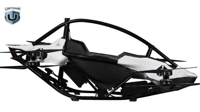
Jetson One- a Personal eVTOL
The Jetson One is one such example of a personal eVTOL that flies like a drone. It operates with eight electric motors and can reach speeds of 63 mph with a flight time of 20 minutes.
It uses a simple joystick system with drone-style stabilization. Pilots typically require only a few hours of basic flight training.
But here’s the reality: even with built-in automation, you still need fundamental piloting skills. You need to understand:
- The fundamental motion axes like throttle, yaw, pitch, and roll.
- Wind compensation, altitude control, and GPS interference
- Visual line-of-sight flight, airspace regulations, and risk management.
- Pre-flight checklists, telemetry monitoring, and emergency procedures
These aviation skills develop the muscle memory and mindset required to fly something larger, more expensive, and potentially passenger-carrying flying cars.
However, the stakes are entirely different. A crashed drone might cost $500, but a failed eVTOL could result in injury or death. So, understanding the basic concepts of drone piloting is non-negotiable.
Regulatory Landscape: From Ultralight to Powered-Lift
What these aircraft have in common is that they’re designed for people who already understand drone flight. But that doesn’t mean anyone can hop on and start flying.
Some lightweight, single-seat models, like the Jetson One, fall under the FAA’s ultralight rules. They don’t require a pilot’s license as long as they meet the speed and fuel limits.
However, most passenger-carrying flying cars are considered powered-lift aircraft, which is a new category that the FAA is developing. These aircraft don’t fit into the current helicopter or airplane category.
The new certification framework is expected to be introduced later this year. This training is built on rotorcraft experience and adds eVTOL-specific systems, urban flight planning, and traffic integration.
Drone Controls = eVTOL Controls
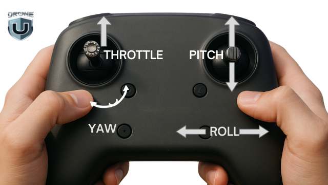
Learn Drone Controls to Learn eVTOL
Understanding drone flight controls gives you a sneak peek into how you can fly a personal aircraft. When you learn to fly a drone, you’re training on the same core principles. The way drones move through the air is surprisingly similar to how flying cars are designed to move.
Let’s explore what drone flights teach you.
The Core Controls
Most drones, especially quadcopters, are controlled with a two-stick transmitter, which maps directly to the four axes of motion used by eVTOLs and helicopters.
Pitch controls forward and backward movement. When you push the right stick forward on your drone controller, the aircraft tilts forward and moves ahead. In a flying car, this accelerates you forward through three-dimensional space.
Roll manages side-to-side movement. Banking left or right with your drone using the right stick translates directly to shifting sideways maneuvers in an eVTOL. This is perhaps the most intuitive control for new pilots to master.
Yaw rotates the aircraft around its vertical axis. It is controlled by the horizontal movement of the left stick. In a flying car, this lets you change your heading without banking. This helps in navigating the eVTOLs in tight urban environments.
Throttle controls altitude through the vertical movement of the left stick. This is where drone pilots have a huge advantage over traditional pilots. Drone pilots are used to controlling altitude directly, without needing the complex parts planes use, like flaps or engines.
The beauty of these controls is their universality. Whether you’re flying a $500 DJI Mini or a $250,000 Jetson One, the fundamental inputs remain the same.
Spatial Awareness and Situational Judgement
Flying a drone is not like playing a video game because your environment is real, dynamic, and often unpredictable. As a drone pilot, you develop real-world instincts, such as judging height and distance, avoiding obstacles, adjusting flight patterns, and carefully managing battery life.
Your muscle memory, spatial awareness, and intuitive understanding of three-dimensional movement transfer directly to more advanced aerial systems, including flying cars. These best practices train you to think like a pilot, not a casual user.
You also become familiar with advanced drone features, such as obstacle avoidance, GPS hold, and return-to-home functions, which are also standard in eVTOLs. The more you understand these core systems, the more confident and capable you’ll be when operating a flying car.
The Motion Controller Is Your Future Joystick
DJI Motion Controller
DJI’s Motion Controller represents the evolutionary leap from traditional dual-stick controllers to intuitive flight interfaces. This device lets you control a drone through natural hand movements. It shows how complex flight operations can be simplified into intuitive gestures.
The Jetson One uses a simplified joystick that operates on the same principles as the Motion Controller. The goal is to make flying as intuitive as driving by using the Motion controller.
Training with both traditional controllers and motion controllers gives you the complete skill set. Even gesture-based flying becomes easier when you’ve already learned to fly a drone with traditional controls. Traditional controllers teach precision and technical proficiency, while motion controllers help develop the intuitive spatial awareness that makes flying feel natural rather than mechanical.
Professional Pathway: Certification and Specialization
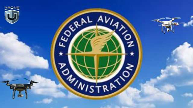
Learn to fly a Drone and get FAA Pilot Certificate
To turn your drone skills into future aviation roles, you need certification. This is where drone licensing comes in.
In most countries, drones are treated as real aircraft, and to fly one, pilots must follow the aviation rules. A drone license is a certificate that says you’re trained and trusted to fly drones safely and responsibly under government rules.
For example, in the U.S., you need the FAA part 107 Remote Pilot certificate to fly a drone for commercial purposes. To qualify, you must be at least 16 years old and pass a 60-question knowledge exam at an FAA-approved center.
Once you pass, you’ll receive a Remote Pilot Certificate, which must be kept current through free online recurrent training every 24 months.
Once you’re certified, you can keep growing your skills in specialized areas like thermal imaging & inspections, aerial mapping & photogrammetry, drone cinematography, and so on. Each of these areas has its own certifications, software, and best practices.
So, if you’re serious about aviation, start by getting certified. Learn to fly a drone today with real training and safety skills.
Common Global Rules for Drone Pilots
While each country has its specifics, most drone rules worldwide share a few basics:
| Rule | Why It Matters |
| Stay below 400 feet (120 meters) | To avoid conflict with manned aircraft |
| Keep a visual line of sight | So you always know where your drone is and can react quickly |
| Avoid flying over people | For safety in case of malfunction or crash |
| Register your drone | Helps authorities track usage and ensure compliance |
| No flying near airports or military zones | These are high-risk, high-security zones |
Always check your local aviation authority (FAA, DGCA, EASA, CASA, etc.) for region-specific updates.
Training Program: From Drones to eVTOLs
Regulators are updating drone and aviation rules to include eVTOLs as the flying car industry grows.
For example:
The FAA classifies eVTOLs as powered-lift aircraft and will be treated as a cross between helicopters and planes. Pilot licensing for flying cars now requires advanced certification, built specifically for drones or rotorcraft.
Companies like Joby Aviation, Archer, and Volocopter are working closely with regulators to define safe air corridors, digital traffic systems (UTMs), and vertiport access.
In short, drone pilots who understand the basics and rules will be well-equipped for the more complex airspace of tomorrow.
Drone Training to Fly a Flying Car
Learn to fly a Drone with Flight Simulator Software
Imagine a comprehensive training program that bridges the gap between today’s drones and tomorrow’s eVTOLs. This is the logical next step for flight training institutions.
Module 1: Simulator Foundation
Students begin with flight simulator software that replicates both drone and eVTOL physics. Microsoft Flight Simulator 2024 now features eVTOL aircraft, giving students a fun and realistic way to explore vehicles like the Joby S4 and Lilium Jet.
Module 2: Drone Mastery
Students start with hands-on training using professional-grade drones, learning basic flight operations before advancing to complex maneuvers. They master line-of-sight flying, FPV operations, and advanced flight modes. The goal is to develop muscle memory and spatial awareness through real flying rather than just technical knowledge.
Module 3: Motion Control Integration
Training with DJI Motion Controllers or similar devices to develop intuitive flight control. Students learn to fly through gesture and natural movement. This module focuses on preparing students for the simplified control systems of consumer eVTOLs.
Module 4: Scenario-Based Training
Students engage in real-world scenarios where drones are used to simulate flying car operations. This includes urban navigation, emergency procedures, weather considerations, and integration with air traffic systems. This approach bridges the gap between hobby flying and practical transportation use.
Module 5: Regulatory and Safety
Students gain a clear understanding of the evolving regulations surrounding personal aviation and the integration of eVTOLs into existing airspace. Training also covers safety protocols and emergency procedures specific to electric aircraft, as well as the challenges of urban flight operations.
The course prepares students to go beyond drone piloting, but as strong candidates for early eVTOL training programs. As eVTOLs become commercially available, graduates would need minimal additional training to make the transition to personal air mobility.
Why Starting Now Gives You an Edge
The Advanced Air Mobility market is projected to reach $1 trillion by 2040. This means thousands of new jobs for skilled pilots, instructors, technicians, and airspace managers. All the roles that didn’t exist a decade ago.
eVTOL manufacturers are designing their aircraft and training programs specifically for people with drone experience.
Major companies like Joby Aviation, Archer, and even Uber, through their former Elevate division, have already developed eVTOL training programs that prioritize drone skills. These programs teach experienced drone pilots the extra skills they need to fly passengers and handle commercial flights.
While becoming a commercial airplane pilot can take years and cost over $100,000, many drone pilots could transition into eVTOL flight with minimal extra training.
Starting now means you won’t need to start from the basics all over again. You’ll already have the flight experience and mindset that tomorrow’s aviation industry requires.
Conclusion
Drone flight is not just a hobby; it’s the foundation for real aviation skills. The same companies pioneering consumer drones are creating the flying cars of tomorrow. They’re designing these aircraft specifically for people who already understand drone operations.
So, the question isn’t whether flying cars will become a reality, because they already are. The question is whether you’ll be ready when they arrive. By starting with drones today, you’re positioning yourself at the forefront of a transportation revolution that will define the next century.
The future of flight starts with the technology in your hands today. When you learn to fly a drone, you’re not only gaining a new skill, you’re preparing for a new era of personal air travel. Every lesson learned with a drone brings you one step closer to piloting the aircraft of the future.
Ready to start your journey into the future of flight?
Explore Drone courses or an all-access pass to start building the skills that future aviation requires.
-
 Brinc Admits, We Caused the DJI Drone Ban! EXCLUSIVE
-
 Brinc Admits they're behind DJI Ban | Auterion Creates Drone Swarm Brain
-
 Trump Card on the DJI Ban, May be Best drone news of 2025. Will he tiktok DJI?
-
 This Drone Trick Makes Real Estate Videos Awesome!
-
 Exploring Drone Security: Opportunities and Challenges
More on Hot Topics