The Best Entry-Level Drone in 2025
Ever wondered why so many professional pilots still fly “beginner” drones?
Turns out, you don’t need a flagship drone to fly like a pro. Many experienced pilots grab entry-level drones to practice, test new moves, or train their crews. Modern beginner drones are compact, capable, and loaded with smart tech that used to cost thousands.
If you’re a professional pilot looking for a lightweight, affordable, and dependable drone that still delivers solid performance, this guide is for you. We’ll break down what features actually matter, what to avoid, and which beginner models offer the best mix of value and reliability in 2025.
Alright, let’s dig into which entry-level drones deserve a spot in your flight bag.
Why Choose an Entry-Level Drone?
You might think entry-level drones are just for beginners, but even experienced pilots can benefit from keeping one in their kit. Sure, high-end models come with bigger sensors, longer range, and advanced flight systems, but sometimes simpler really is better.
Here are some practical reasons to keep a beginner-friendly drone in your lineup.
-
Low-Risk Training and Experimentation
When you’re testing a new camera angle, teaching an assistant pilot, or trying out a creative shot, it’s comforting to know that a mishap won’t cost thousands. Entry-level drones are lightweight, resilient, and forgiving of small mistakes. They’re ideal for skill-building, flight drills, and experimental shoots.
-
Perfect for Scouting and Quick Checks
A compact sub-250 g drone can legally fly in more places with fewer regulatory restrictions. That means you can scout filming locations, check lighting conditions, or plan your route without hauling your main rig. It’s a practical way to prepare for professional shoots while staying compliant.
-
Cost-Efficient Backup Option
Having a reliable backup drone is essential. Entry-level drones are affordable, quick to deploy, and easy to maintain, perfect when your main drone is charging or in for service. Since spare parts and batteries are inexpensive, they make great secondary tools in the field.
-
Small but Surprisingly Capable
Today’s entry-level drones aren’t toys. Many now shoot in 4K, offer GPS stabilization, and come packed with smart flight modes like QuickShots, Follow Me, and Return-to-Home. You can use them for client previews, social content, or smaller projects without sacrificing quality.
What to Look For in a Beginner Drone
Choosing a “beginner” drone isn’t about finding something basic, but rather about practicality. While performance metrics are essential, you also have to identify the right balance between simplicity, safety, and smart design.
Here’s what to look for when evaluating an entry-level drone.
1. Weight and Portability
Drones weighing under 250 grams, such as the DJI Mini 4 Pro or Autel EVO Nano+, don’t require registration in many regions, including the U.S. and parts of the EU. That’s a huge advantage when you’re traveling or working on short notice. These ultra-light drones offer sufficient stability in windy conditions while staying nimble enough for tight spaces.
2. Flight Time and Battery Swappability
No one likes cutting a shot short because of battery limits. Look for drones offering at least 25 minutes of flight time per battery and quick-swap designs.
For example, the DJI Mini 2 SE can stay in the air for around 31 minutes and recharges quickly. Also, ensure that spare batteries are affordable and easy to find.
3. Camera Quality and Sensor Performance
Even for practice or scouting, you’ll need good visuals. Go for 4K recording with at least a 1/2.3-inch CMOS sensor. Drones like the Potensic Atom SE and DJI Mini 3 produce crisp footage for social content or quick client previews.
4. Stability and Control Precision
Modern beginner drones are incredibly stable. Make sure your drone supports GPS and GLONASS for steady hovering and accurate control. Even simple models like the Ryze Tello demonstrate how reliable stabilization can help you focus on creative framing rather than constant corrections.
5. Built-In Safety Features
You know how easily things can go wrong in the field. Look for smart safety systems like Return-to-Home, auto takeoff and landing, and geofencing. Drones like the Mini 4 Pro even include omnidirectional obstacle avoidance, giving you an extra layer of protection in tight spaces.
6. Expandability and Upgrade Path
A great entry-level drone should grow with you. Check for accessory compatibility (ND filters, extended range controllers), firmware support, and third-party app integration. That way, even as you upgrade, your beginner drone still serves as a capable backup or training unit.
7. Price-to-Value Ratio
Don’t just look at the price tag; look at what you’re getting for it.
A $400 drone with stable software, solid imaging, and easy repairs is worth more than a $250 model that drops signal every flight.
Reliability should always be your bottom line, even when you’re buying a “starter” drone.
Entry-level doesn’t mean entry-quality. When chosen wisely, a beginner drone can become a dependable training partner, a reliable scouting tool, and even a creative backup for commercial work.
Wondering which beginner drones actually live up to the hype? Let’s explore some of the best entry-level drones worth adding to your toolkit.
Top Picks for Entry-Level Drones
Choosing the right entry-level drone may start with checking out the specs, but more importantly, you need a model that fits your workflow, environment, and expectations.
Here are the top 5 entry-level drones that professionals frequently recommend for training, scouting, or light commercial work.
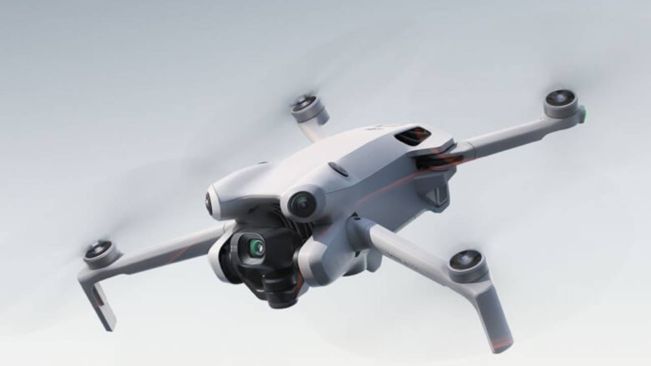
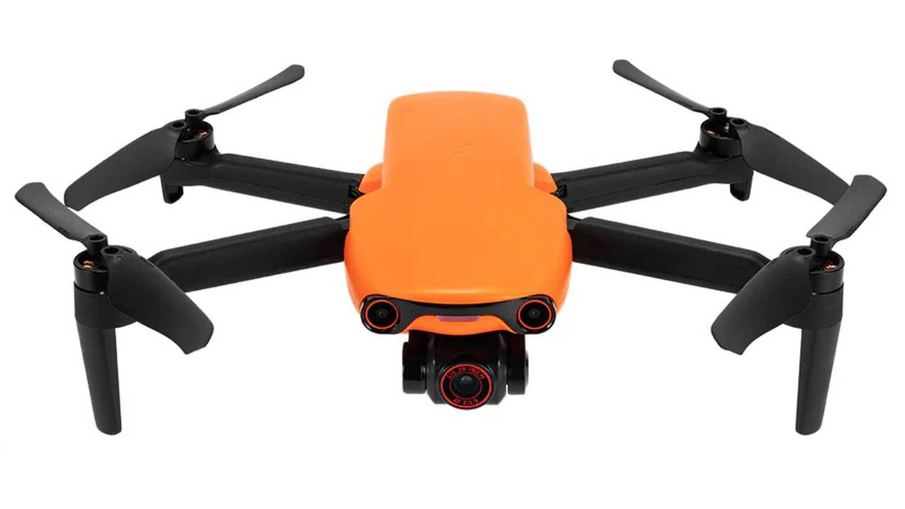
1. DJI Mini 4 Pro: The All-Round Performer
Source: DJI
If there’s one drone that redefines what “entry-level” can do, it’s the DJI Mini 4 Pro. Weighing just under 249 grams, you can fly it freely in many regions without registration hassles.
It comes with a 1/1.3-inch CMOS sensor, shoots 4K at 100fps, and offers 48MP stills, features that used to be reserved for much larger models. Its omnidirectional obstacle sensing and advanced Return-to-Home (RTH) make flying feel effortless, even in tricky environments. Whether you’re scouting locations or shooting quick client previews, the Mini 4 Pro is a dependable travel-ready companion.
Key Features:
- Omnidirectional obstacle sensing
- ActiveTrack 360° and MasterShots
- HDR video capture and night mode
- Smart RTH and precise hovering
Best for: Professionals needing a highly portable yet powerful secondary drone.
2. DJI Mini 5 Pro: The Premium “Mini” Upgrade
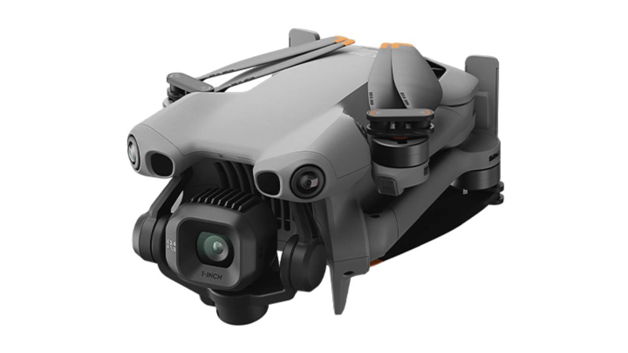
Source: DJI
If you love the Mini 4 Pro but crave more power, the Mini 5 Pro is your next step up. Still under 250 g, it packs a 1-inch CMOS sensor, 4K/120fps video, and stunning low-light performance. These features make it the most capable sub-250g drone on the market in 2025.
The redesigned gimbal lets you shoot from more creative angles while holding steady in strong winds. It also includes an upgraded AI tracking and richer color profiles that make your footage look straight out of a cinema-grade rig.
Key Features:
- 1-inch CMOS sensor for better dynamic range
- 4K/120fps and 10-bit D-Log video
- Enhanced wind resistance
- Upgraded AI subject tracking
Best for: Professionals who want the smallest drone that can still deliver cinematic results without licensing hassles.
3. Autel EVO Nano+: The Sensor King
Source: Autelpilot
The Autel EVO Nano+ proves that small can still mean powerful. Its 1/1.28-inch 50MP sensor uses an RYYB color filter, giving you more light and better detail than most small drones. You’ll notice the difference, especially in dawn or dusk shots.
Autel’s Sky app feels polished and gives you complete manual control, letting you fine-tune exposure and color like you would on a DSLR. And since it shoots RAW photos, you can push the edits in post without losing quality.
Key Features:
- 50MP RYYB sensor for enhanced light capture
- RAW photo support and dynamic tracking
- 3-way obstacle avoidance
- Autel Sky app with pro-grade controls
Best for: Pilots who prioritize color accuracy and want to stand out from DJI’s ecosystem.
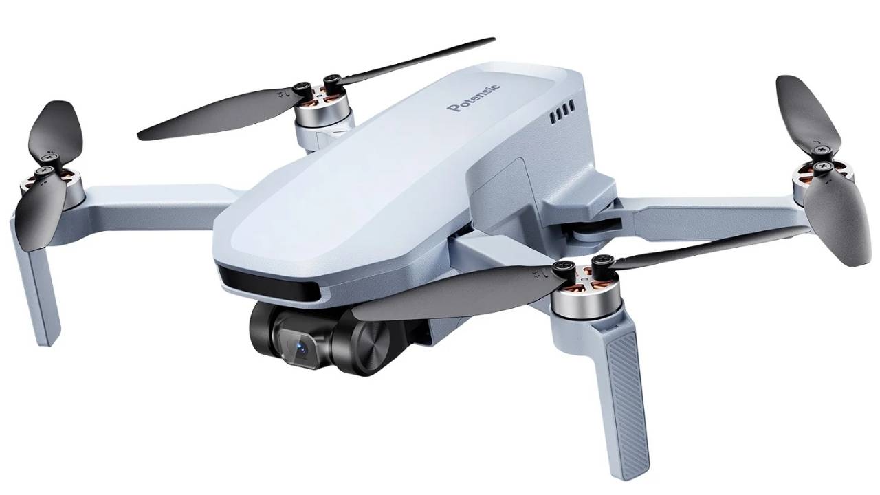
4. Potensic Atom SE: The Budget Workhorse
Source: Potensic
For professionals who want something affordable yet reliable, the Potensic Atom SE delivers exceptional value. It folds compactly, flies steadily, and records 4K/30fps video, making it perfect for quick scouting, training sessions, or secondary shoots.
Its 31-minute flight time and GPS-assisted stabilization make it surprisingly capable for its price. It doesn’t have obstacle sensors, so you’ll want open airspace, but for the cost, it’s an unbeatable value for routine practice or backup use.
Key Features:
- 4K/30fps camera with EIS Stabilization
- 31-minute flight time
- Return-to-home and GPS lock
- Compact, foldable design under 249 g
Best for: Professionals on a budget who need a rugged, no-fuss practice or scouting drone.
5. DJI Air 3S: The Step-Up Hybrid
Source: DJI
Though technically above the “beginner” category, the DJI Air 3S deserves mention for pros seeking an all-purpose aircraft that’s easy to transition into. It features dual cameras (1-inch and 1/1.3-inch sensors), 45-minute flight time, and powerful image processing.
This makes it an ideal upgrade once you’ve outgrown sub-250g drones or need something for semi-commercial projects. The Air 3S offers a taste of professional performance without the intimidating complexity of enterprise drones, such as the Mavic 3 Pro or Inspire series.
Key Features:
- Dual-camera system (wide + medium tele)
- 45-minute battery life
- Omnidirectional obstacle sensing
- 10-bit D-Log M and HLG color profiles
Best for: Pilots who want to transition from entry-level to full professional use without a steep learning curve.
Side-By-Side Comparison of Best Entry-Level Drones (2025)
| Drone model | Max Flight Time | Camera Sensor | Video Resolution | Ideal Use | Price Range |
| DJI Mini 4 Pro | ~34 min | 1/1.3” CMOS, 48MP | 4K/100fps | Scouting, training, quick pro shots | $629-$949 |
| DJI Mini 5 Pro | ~36 min | 1” CMOS, 50MP | 4K/120fps | Cinematic work, pro-grade output | $759 – $1,749.99 |
| Autel EVO Nano+ | ~28 min | 1/1.28” CMOS, 50MP | 4K/30fps | Color-accurate aerials | $679 |
| Potensic Atom SE | ~31 min | 1/3” CMOS, 12MP | 4K/30fps | Training, practice, scouting | $279.99 |
| DJI Air 3S | ~41 min | Dual: 1” + 1/1.3” CMOS | 4K/60fps | Semi-pro and transitional use | $1,029 – $ 1,469 |
Next, let’s determine which drone best fits your flying style and goals.
How to Choose the Right Entry-Level Drone for Your Needs
Choosing the right entry-level drone isn’t about hunting for the “best” specs; it’s about matching the drone to how you actually fly. Once you understand your flying style and goals, the right choice usually becomes obvious. Here’s a quick framework to help you decide.
1. Think About Your Purpose
Ask yourself what you need the drone for.
- Training & practice? Go for a light, forgiving model like the Mini 2 SE or Ryze Tello.
- Content creation or travel? Pick something portable but capable, like the Mini 4 Pro or Mini 5 Pro.
- Client jobs or site scouting? Choose a model with longer flight time and obstacle sensors, like the DJI Air 3S.
Your goal determines your gear, not the other way around.
2. Stay Within a Familiar Brand
If you’re familiar with flying DJI, Autel, or Skydio drones, staying within that brand saves you time and avoids confusion.
The app interface, flight modes, and maintenance routines feel second nature, so you can focus on flying, not re-learning controls.
3. Balance Budget and Growth
You don’t need to overspend to get great results. Instead, think of your beginner drone as an investment in flight time. Choose a model that gives you confidence now but also grows with you. One with accessory support, software updates, and repair options.
Think of it as your training platform, where you can fly confidently and replace or upgrade later.
4. Check Legal Requirements
Before buying a drone, check the drone’s weight and the FAA rules that apply to you. In the U.S., drones weighing less than 250 g (like the Mini 4 Pro and Mini 5 Pro) don’t require FAA registration for recreational use. They’re easier to travel with and perfect for quick setups.
If you plan to fly commercially, you’ll need a Part 107 Remote Pilot Certificate.
In short, choose a drone that matches what you need right now and helps you fly more often, learn faster, and stay confident in the air.
Conclusion: Pick Smart, Fly Smarter
Choosing your first drone isn’t about getting the most features. It’s about finding a drone that helps you build fundamental flying skills. Models like the DJI Mini 4 Pro, Mini 5 Pro, or Autel EVO Nano+ give you enough control to learn while maintaining simplicity and safety.
Start small, learn fast, and fly often. Every professional pilot begins with a drone that teaches them the ropes. Make yours the one that helps you grow with every flight.
Ready to Level Up Your Skills?
The right drone is just the beginning. Take your flying to the next level with Drone U’s hands-on training and online courses, built by pilots, for pilots.
Explore courses here: Drone U Training Programs
FPV vs Thermal Drones: Which One Should You Choose?
If you are contemplating choosing between FPV drones versus Thermal Drones, you’ve come to the right place. In this guide, we take a deep dive into both these drone categories and help you choose the right one based on a well-researched and logical approach.
First, let’s talk about why these two categories of drones exist and the purpose of each.
Let’s begin our analysis with FPV drones.
FPV Drones: Purpose and Core Functionality
FPV technology has taken off in a significant way worldwide. FPV (First Person View) enables drone pilots to navigate their drones in real-time via goggles. This allows the pilot to enjoy an immersive flying experience and greater control over the drone.
FPV drones are being increasingly used for immersive aerial cinematography, drone racing, shooting marketing videos, freestyle acrobatic performances, and filming action sports.
Thermal Drones: Purpose and Core Functionality
On the other hand, thermal drones are built for industrial applications. They are equipped with thermal imaging cameras that create heat-based images, revealing aerial data invisible to the naked eye.
Thermal drones are now a standard part of the tooling used in a variety of industries and applications, such as:
- Infrastructure inspection
- Energy & utility monitoring
- Search and rescue operations
- Building diagnostics
- Precision agriculture
- Public safety operations
Also, read our detailed guide on the Top 10 Thermal Drone Applications to see how they’re used in real-world scenarios.
Now that we’re clear about what each of these drone types is capable of doing, let us explore the commercial aspects.
FPV Drone: How Much Can You Expect to Earn?
As you can see, FPV drones are great for creative production and filmmaking. The FPV drone market is valued at $139-558 million in 2024-2025, and is expected to grow at a 13.7-19.06% CAGR. That’s a fraction of the market size of Thermal Drones.
While the opportunities in commercial video products using drones are vast, the barrier to entry is relatively low. We’ll address that later, but first, let’s examine the opportunities and income potential.
The most interesting (rewarding) career using FPV drones is film and content creation. There is almost always someone in need of a shot worthy of the algorithm’s attention.
1. Film & Content Creation
FPV drones have already revolutionized cinematography and are actively used in movie production, action sports, and music videos. One can expect to earn anywhere from $500 to over $6,000 per day. Not bad if you really enjoy the creative aspect.
2. Real Estate & Commercial Marketing
Real Estate is another industry where FPV drone pilots can expect to earn anywhere from $75 to $400 per listing. If you venture into Commercial Real Estate, you’ll go higher up the value chain and can make up to or even more than $1,200-$1,500 per project. Then you can go even higher up with Luxury Real Estate, which can be a gratifying and fulfilling career as a drone pilot.
3. Events & Entertainment
Drones are now an integrated part of events and the entertainment industry. Whether it’s a wedding or a sports event, filming through drones is becoming increasingly common. Drone light shows have gained so much popularity globally. For drone light shows, you can command $15,000-$150,000+ per event, depending on the size of the fleet.
However, the FPV drone market comes with its own limitations. Firstly, it is primarily a B2C market with an extremely low entry barrier. As a result, the demand-supply gap favors the customer, resulting in increased competition and subsequently lower profit margins.
That being said, you can still carve out your unique positioning and command premium rates if you properly market yourself and target high-value areas such as commercial/luxury real estate.
Now, let’s examine the commercial aspects and marketing opportunities for Thermal Drones.
Thermal Drones: How Much Can You Expect to Earn?
The opportunities in Thermal drone-related applications are exploding. The thermal drone inspection market is valued at $362.7 million in 2025. It is projected to reach $1.2 billion by 2035, growing at a 13.4% CAGR.
The first and foremost in the list is our favorite – energy and utilities.
1. Energy & Utilities
The energy and utilities sector is the highest revenue-generating industry in terms of drone services. It holds the largest market share of the global market at around 35%. Drone pilots performing utility and infrastructure inspections charge between $1,500 and $4,000 per day. The opportunities are wide open in areas such as solar inspections, powerline monitoring, and substation assessments.
2. Infrastructure Inspection
The infrastructure sector is the second-largest consumer of drone inspection services, and it is expected to reach $34.4 billion by 2031, growing at a 16.8% CAGR. America’s aging infrastructure presents significant opportunities in bridge inspections, tower assessment, and pipeline inspection. Moreover, the FAA increased approvals for BVLOS operations from 1,229 in 2020 to 26,870 in 2023. This has fueled a demand for drone pilots in this industry.
3. Construction & Real Estate
Drones are already an integral part of the construction industry. Construction progression videos are one of the most lucrative opportunities in this market, with drone pilots charging $600-$800 per month, typically over an 18-24 month contract. Building energy audits and insulation inspections are also emerging as new areas with strong growth potential.
4. Public Safety & Emergency Response
In the public safety and emergency response field, drones have already proven their life-saving capabilities. Firefighters use thermal drones to identify hotspots in burning buildings and monitor wildfire perimeters without entering unsafe areas. Drones are proving to be a valuable addition to search and rescue operations as well as law enforcement surveillance.
5. Agriculture
Thermal drones are used in farming to fine-tune watering schedules, improve fertilizer usage, and monitor crop health. They can also be used to detect the presence of pests and irrigation system leaks. Catching some of these issues early proves to be cheaper for farmers as they can adjust quickly before too much damage is done.
Think of locusts and how quickly they can go from a disparate group of grasshoppers into a large swarm capable of upending your entire year.
In 2024, the US drone inspection market alone was valued at $4.3 billion. It goes without saying that we’re perhaps in the most exciting times when it comes to exploring opportunities related to Thermal Drones.
Monthly Revenue Potential
- In the case of FVP drones, a small local operator can expect to earn $5,000/month offering basic services.
- The revenue potential for Thermal Drone services is 3-10x higher. Mid-range operations can earn ~$25,000/month with a wider service range, while drone services businesses can generate $5,000 to $50,000/month depending on services.
FPV Vs. Thermal Drones: Cost Comparison
Both FPV and thermal drones have a wide range of options, right from entry-level to professional tiers. Let’s begin by looking at the cost of FPV drones as it stands.
FPV Drone Cost
- Entry-level FPV drones such as the DJI Neo start at $199 and range up to $418 for the Fly More combo.
- In the mid-range, quality FPV drones can cost you anywhere from $140 to $850, depending on your configuration. These are typically read-to-fly kits that include googles.
- When we talk about a professional-tier drone meant for racing, cinematography, and commercial work, be prepared to fork out between $1,000 and $2,000. Additional costs include a radio set, goggles, and a charger for $150. Spare batteries would cost anywhere from $50 to $200 a piece.
Thermal Drone Cost
- Entry-level thermal drones, such as Autel EVO Lite 640T Enterprise, can cost you around $3,359. This is the most cost-effective drone in this category. However, if you are looking for a reliable thermal drone setup (drone + sensor + software), the cost can range from $7,000-$25,000.
- Professional mid-range drones start at $5,000 and can go up to $15,000. In this range, we’ve several options to choose from, such as the DJI Mavic 3 Thermal, priced at $5,748-$5,998, and the DJI Matrice 4T, which costs $8,499-$10,899.
- Industrial-grade, heavy-duty Thermal drones can cost between $15,000 and $30,000 or more. This category is again dominated by DJI with its Matrice 30t costing $10,999-$14,499 and the DJI Matrice 300 RTK with thermal cameras priced at $12,000 – $20,000.
- Additional Costs include replacement batteries every 1-2 years. The battery cost ranges from $50 to $300. Moreover, you’ll pay for insurance, software subscriptions, and maintenance.
Commercial Requirements (Both Drone Types)
Both FPV and thermal drones require identical licensing. To operate drones commercially under Part 107, pilots need a remote pilot certificate with a small UAS
Most Part 107 restrictions can be waived, including operations from moving vehicles, beyond visual line of sight, during nighttime, and over people.
For more information on US Drone laws, click here.
To learn more about Part 107 certification, click here.
Our Recommendation
Choose THERMAL DRONES if:
- You want maximum earning potential – Thermal inspections command $1,500-$4,000/day vs $600-$1,200 for FPV
- You prefer B2B clients – Utilities, construction firms, and energy companies pay reliably and at higher rates.
- You can invest $10,000-$20,000 upfront – Higher barrier to entry = less competition
- You want recurring revenue – Annual inspection contracts, long-term relationships
- You’re near infrastructure/energy hubs – Texas (oil/gas), California (solar), Midwest (utilities), Northeast (aging infrastructure)
ROI Timeline: 12-18 months with active marketing
Choose FPV DRONES if:
- Lower initial capital ($2,000-$5,000 startup)
- Creative/artistic focus – You enjoy content creation and cinematography
- Flexible lifestyle – Event-based work, varied projects
- Quick market entry – Easier to start small and scale
- You have existing filmmaking/photography skills
- You’re near entertainment hubs – LA, NYC, Nashville, Atlanta
ROI Timeline: 6-12 months, but lower ceiling
The Bottomline
If you have $15,000 to $25,000 and want to build a sustainable, high-revenue drone business, consider investing in thermal drones. The US market is experiencing explosive growth in inspection services, with supportive FAA regulations, BVLOS approvals increasing dramatically, and market value projected to grow from $362.7M (2025) to $1.26B (2035). The US market rewards thermal drone operators with 3-10x higher rates, recurring B2B contracts, and less competition.
If you have between $2,000 and $5,000 and a passion for creative work, start with FPV. Build your skills, portfolio, and client base. The creative market is competitive but accessible, allowing you a smoother transition to thermal inspection as your flying skills sharpen.
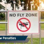
Drone Law Penalties, Fines, and Lawsuits With Risk Reduction Playbook: A Comprehensive Guide
In the past decade, drone usage has grown exponentially in the United States. As of 2025, over 1.1 million recreational drones are registered with the FAA. Apart from that, millions more operate in commercial, government, and hobbyist sectors.
This widespread usage has also created safety challenges for the government. As a result, the federal and state agencies have substantially increased enforcement efforts.
With the FAA Reauthorization Act of 2024, there was a new turning point in drone regulations. This legislation introduced stricter penalties, and the FAA gained authority to suspend or revoke a drone operator’s license for non-compliance.
These regulations also emphasized operator accountability with maximum penalties up to $75,000 per violation.
From October 2022 to June 2024, the FAA reported 27 violations and levied $341,413 in civil penalties. This strong (relatively speaking) enforcement signals a clear message: the government is taking enforcement more seriously than they ever have..
This guide will provide a comprehensive and in-depth understanding of drone violations and how to avoid them through real cases and actions taken against the violators.
That way, you’ll have a deeper understanding to stay compliant and avoid legal trouble.
Note: If you are looking to gain a deeper understanding of US Drone Laws, this article goes into the most updated drone laws as of 2025.
Avoid Penalties and Fly Safely With the Safe Drone Operations CourseCheck out the Safe Drone Operations Course and learn how to fly safely in any condition and remain compliant. |
The Legal Framework: FAA Authority, Part 107 vs §44809
Before we dive into drone law violations and penalties, it is important to get a first-hand understanding of the legal framework.
In the United States, the FAA (Federal Aviation Administration holds exclusive jurisdiction over the U.S. airspace. It is the authority to regulate the operation of all types of aircraft and UAVs from the ground up.
The FAA has provided two operating categories for flying drones:
1. Part 107 (Commercial Operations)
All commercial drone pilots require a valid Part 107 remote pilot certificate. People who fly for commercial or government purposes must operate under this rule (with just a few exceptions not covered in this article).
This includes:
- Any operation where you’re compensated (including monetized YouTube videos)
- Professional photography/videography
- Real estate marketing
- Agricultural surveys
- Infrastructure inspections
You can learn more about FAA Part 107 in this article.
2. §44809 (Recreational Flying)
According to the FAA, recreational flights cannot generate any income. This is a critical distinction. The moment you monetize footage or accept payment, you’re operating commercially and need Part 107 certification.
Under this rule, drone pilots must follow these 9 rules:
- Pass an aeronautical knowledge test
- Fly only for recreational purposes
- Follow community-based safety guidelines
- Keep the drone in visual line-of-sight
- Give way to manned aircraft
- Fly in Class G airspace or get authorization
- Register the drone and mark it with the registration number
- Do not fly under substance influence
- Do not carry hazardous materials
Another key element of the FAA’s legal framework is the Remote ID requirement.
Remote ID Requirement (2024)
Remote ID is like the electronic license plate with each drone, broadcasting your drone’s identification and location to the FAA. The Remote ID rule was effective in 2021. All pilots were required to comply with this rule by September 16, 2023.
But there are a few exceptions to this rule, such as:
- Drones under 0.55 pounds (250 grams) do not require Remote ID
- Operations within FAA-Recognized Identification Areas (FRIAs) also won’t need Remote ID
- Older drones equipped with Remote ID broadcast modules
Equipped with the understanding of the legal framework, let’s dive into the Civil Penalties associated with drone law violations.
Civil Penalties: Common FAA Fines and Their Triggers
As discussed earlier, the FAA Reauthorization Act of 2024 has stricter regulations. Drone operators who conduct unsafe or unauthorized operations face fines up to $75,000 per violation.
If the violations are less severe, the enforcement includes warnings, civil fines up to $27,500 per violation, as well as suspension or revocation of the Part 107 license.
Let’s take a look at common violations and typical penalties associated with them.
- Operating Without Certification: Two operators were fined $16,000 and $4,000 for flying drones near SoFi Stadium during Super Bowl LVI without the necessary Remote Pilot Certificates.
- Flying in Restricted Airspace: An operator in Wesley Chapel, Florida, flew dangerously close to a sheriff’s helicopter, forcing them to halt the operation to avoid a mid-air collision. A $32,700 penalty was imposed on the pilot.
- Stadium and Major Event Violations: A person operating an unregistered drone using first-person view inside Paul Brown Stadium during an NFL playoff game received a $7,760 penalty. He was flying over the crowd beyond the visual line of sight within a Temporary Flight Restriction.
- Near-Miss with Aircraft: A person flying a drone close to a helicopter in Little Rock, Arkansas, caused a serious collision hazard. The drone crashed to the ground after experiencing rotor wash from the helicopter. A $5,000 fine was proposed against the pilot.
- Failure to register: The civil penalties for failure to register can go up to $27,500, and criminal penalties for egregious, knowing violations could include fines up to $250,000 and even imprisonment.
What Triggers an FAA Investigation?
There are several ways through which the FAA is notified of a potential violation, such as:
- Public complaints through local Flight Standards District Offices
- Law enforcement reports
- Pilot reports of near-misses
- Visible violations (especially near airports or emergency operations)
- Self-documentation (social media posts, YouTube videos)
- Remote ID tracking and identification
Criminal Exposure: When Violations Become Crimes
In many instances, the FAA can constitute a violation as a crime. When a civil violation becomes criminal, it can attract criminal penalties such as:
- Up to 1 year in federal prison
- Fines up to $100,000
- Restitution for damages
- Probation and community service
- Permanent loss of flying privileges
Here are some key federal criminal statutes:
- 18 U.S. Code §32 (Destruction of Aircraft or Aircraft Facilities), which prohibits destroying, damaging, or disabling aircraft.
- 18 U.S. Code §39B (Unsafe Operation of Unmanned Aircraft), which prohibits knowingly or recklessly interfering with aircraft operations.
- 18 U.S. Code §40A (Operation of Unauthorized Unmanned Aircraft over Wildfires), which prohibits interfering with wildfire suppression or emergency response.
- 18 US Code §32 (Felony Offenses): Penalties for interference with aircraft include potential fines up to $250,000 and/or 3 years in prison.
When does civil violation become criminal?
Here are a few thresholds outlined by the FAA:
- Intentional interference with aircraft operations
- Interference with emergency response (firefighting, law enforcement, medical)
- Operation in national defense airspace
- Repeated willful violations after FAA warnings
- Purposefully causing actual damage or injury
- Operating under the influence
State Criminal Laws
Apart from these, several states have their own regulations that constitute a violation as criminal. Here are a couple of notable ones:
California Regulation: California also makes this a crime under state law to interfere with firefighting operations and can face fines up to $20,000 per violation.
Texas Regulation: Texas Chapter 423 of the Government Code imposes criminal penalties for violations, including flying over critical infrastructure like chemical plants and correctional facilities. It also prohibits drone use to capture images of private property with the intent to conduct surveillance.
Civil Lawsuits: Private Legal Actions
Drone operators also face substantial civil liability through private lawsuits. Here are a few examples of such cases:
Personal Injury Claims
- A California production company flew a drone too low, taking wedding pictures, and hit a lady in the eye, causing blindness.
- A small drone shooting a Fourth of July fireworks video crashed into a crowd, severely cutting a man’s arm and leg.
Potential Damages:
- Medical expenses
- Lost wages
- Pain and suffering
- Permanent disability
- Punitive damages (for reckless conduct)
Property Damage
A drone flying too low or that gets out of control can crash into other aircraft, homes, buildings, cars, and other property, causing property damage.
Common scenarios include crashes into vehicles, damage to roofs and structures, crop damage, and collisions with other aircraft, to name a few.
Trespass Claims
Airspace Rights: Property owners have rights to airspace above their land. The FAA claims jurisdiction over navigable airspace (typically 400+ feet), but lower altitudes involve complex property rights questions.
One such notable case is Bogg vs Meredith in the federal Western District Court of Kentucky. Boggs’ drone was shot down by Meredith. Boggs sued in federal court, claiming the drone was in navigable airspace and was entitled to compensation.
Inside FAA Enforcement: LOI Process, Rights, and Outcomes
The FAA typically follows a progressive enforcement approach to ensure that law-abiding drone pilots do not suffer unnecessarily:
Level 1: Education and Warning The FAA sends a warning letter stating that the operator was flying a drone in violation of FAA regulations. The FAA also provides counseling and education regarding requirements for safe drone operations.
Level 2: Letter of Investigation (LOI) If the violations are more serious, a Letter of Investigation is issued by the FAA requiring a written response.
Level 3: Civil Penalty Proposal: In case of documented violations, a formal notice proposing specific fines
Level 4: Legal Action: For serious or unresolved cases, the FAA refers matters to the U.S. Attorney’s Office for litigation.
Your Rights During Investigation
In case you receive a notice from the FAA or state authorities for drone law violation, you are entitled to several rights. Here they are:
- Right to Respond: You have a time period of 30 days to submit a written response to any LOI or civil penalty letter.
- Right to Informal Conference: According to court documents, DiCiurcio attended an informal conference with FAA officials, stating that he couldn’t afford to pay the penalty.
- Right to Appeal: You can appeal FAA decisions to the National Transportation Safety Board (NTSB).
- Right to Legal Representation: You have the right to attorney representation at all stages.
Enforcement Outcomes
Possible Resolutions:
- Case Closure: No penalty if the explanation is satisfactory
- Warning Letter: No fine, but the violation is documented
- Counseling/Education: Required training or safety briefing
- Civil Penalty: Monetary fine (may be negotiated down)
- Certificate Action: Suspension or revocation
- Criminal Referral: Transfer to DOJ for prosecution
Settlement Considerations:
The FAA may negotiate reduced penalties in exchange for:
- Admission of violations
- Completion of safety training
- Surrender of equipment
- Agreement not to fly
Risk-Reduction Playbook: Preventive Best Practices
While it is good to know the violations and corresponding regulator actions, it is even more important to prevent them. By implementing safe drone operation best practices, you can avoid these legal troubles and stay compliant.
Pre-Flight Planning
1. Check Airspace Restrictions
- Use the FAA B4UFLY app or AirMap
- Review NOTAMs (Notices to Airmen)
- Check for TFRs at https://tfr.faa.gov
- Identify controlled airspace requiring authorization
2. Weather Assessment
- Avoid wind speeds above your drone’s specifications
- No flying in precipitation (most consumer drones aren’t weatherproof)
- Visibility must allow a visual line of sight
- Consider temperature effects on battery performance
3. Site Survey
- Identify hazards (power lines, towers, buildings)
- Assess population density
- Locate emergency landing zones
- Plan for equipment failure scenarios
Equipment Compliance
Registration:
- All drones over 0.55 lbs (250g) must be registered
- Mark registration number on exterior
- Keep registration current (3-year renewal)
- Cost: $5 for recreational, $5 per drone for commercial
Remote ID:
- Ensure built-in Remote ID or add-on module
- Verify functionality before each flight
- Exception: FRIA zones or <250g drones
Maintenance:
- Regular propeller inspections
- Battery health checks
- Firmware updates
- Compass calibration
Operational Best Practices: Do’s and Don’ts
Do’s:
- Maintain visual line of sight
- Yield right-of-way to manned aircraft
- Stay below 400 feet AGL
- Keep away from people not involved in operation
- Have a visual observer for complex operations
- Carry proof of registration and certification
Don’ts:
- Never fly over crowds or stadiums
- Never operate near emergency response scenes
- Do not fly under the influence
- Never try to exceed your skill level
- Do not ignore Low Battery warnings
- Never fly in controlled airspace without authorization
Documentation
Maintain Records:
- Flight logs (date, time, location, duration)
- Pre-flight checklists
- Maintenance records
- Authorization approvals
- Insurance certificates
- Part 107 certificate (if applicable)
Insurance Protection:
- Personal liability coverage: $1M minimum recommended
- Hull coverage for equipment
- Commercial operators: Business insurance with aviation rider
- Verify no “aircraft exclusions”
Special Scenarios
Night Operations (Part 107):
- Requires Part 107 training or waiver
- Anti-collision lighting visible 3 statute miles
- Increased visual observer requirements
Beyond Visual Line of Sight:
- Requires FAA waiver
- Extensive safety case
- Observer network or tracking technology
- Insurance requirements
Events and Gatherings:
- Assume TFR (Temporary Flight Restriction) exists during events
- Check 3 nautical miles from the stadiums
- Presidential movements create broad no-fly zones
Conclusion
The drone regulation and enforcement landscape has fundamentally shifted after the FAA Reauthorization Act of 2024.
As a drone pilot, you need to be more vigilant and careful to ensure that you’re fully prepared and fly safely. Here are a few critical points you need to remember:
- Enforcement is Real and Increasing – The FAA is signaling aggressive enforcement of drone regulations. It can be clearly seen that $341,413 in civil penalties were levied against 27 operators between October 2022 and June 2024.
- Documentation is Evidence – Your social media posts, YouTube videos, and live streams provide ready-made evidence of violations to the FAA.
- Ignorance is No Defense – As FBI officials stated: “Lack of common sense and ignorance of your duty as a drone pilot will not shield you from criminal charges”.
- Zero-Tolerance on Violating Emergency Operations – Flying drones near wildfires or emergency operations is a federal crime. The FAA is cracking down on such offenses with up to 12 months in prison and civil penalties up to $75,000.
- Consequences Extend Beyond Fines – Remember, the consequences for non-compliance can be far-reaching and can permanently impact your drone career. Penalties can include criminal convictions, equipment forfeiture, lifetime flying bans, substantial restitution, and civil liability for damages.
The message from regulators is unambiguous…the rules will be enforced.
That being said, compliance isn’t difficult.
The vast majority of drone operators fly responsibly, follow regulations, and never face enforcement action.
By understanding the legal framework and implementing safe drone operations, you can enjoy the benefits of drone technology while avoiding the consequences of violation.
Fly Like the Real Pros, Avoid Penalties, and Fly SafelyCheck out the Safe Drone Operations Course. |
Additional Resources:
- FAA DroneZone: https://faadronezone.faa.gov
- B4UFLY App: Download from app stores
- Part 107 Study Materials: https://www.faa.gov/uas
- TFR Information: https://tfr.faa.gov
- Report Unsafe Drone Operations: Contact the local FAA Flight Standards District Office
This guide is for informational purposes only and does not constitute legal advice. Consult with a qualified aviation attorney for specific legal questions regarding drone operations and enforcement actions.
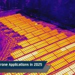
Top 10 Thermal Drone Applications in 2025
What if you could see heat, not just light? What if you could see a failing solar cell, a hidden fire hotspot, or a missing person in total darkness before anyone else can?
It is the magic of a thermal drone. Instead of relying on what your eyes can see, it uses infrared sensors to capture temperature differences and reveal critical details you’d otherwise miss.
From mapping solar farms and inspecting power lines to monitoring crops or supporting emergency crews, a thermal drone helps you make faster, smarter, and safer decisions in the field.
In this guide, we’ll walk you through the top 10 real-world applications of thermal drones and explore the various ways each one is changing how industries operate today.
Let’s first understand how a thermal drone works.
How Thermal Imaging Drones Work
Where a normal camera captures light, a thermal camera captures heat.
Every object emits heat energy, known as infrared radiation. The drone’s sensor detects this energy and turns it into a thermal image. Warmer areas appear in red or orange, and cooler zones in blue or purple.
This “heat map” highlights patterns you can’t see with the naked eye, like a hot electrical connection, a weak solar panel, a missing person at night, or creatures running around.
If it gives off heat, you can see it.
Mounted on drones, these sensors scan large areas in minutes. You can inspect roofs, power lines, or fields without stepping into dangerous or hard-to-reach places.
Modern thermal drones also include a regular camera. You can switch between visual and thermal views or combine them to get a clearer picture of the problem.
Advanced models take the capabilities further with radiometric sensors and AI tools that record accurate temperatures for each pixel. This lets you measure and analyze the data later to create highly detailed inspection reports.
In short, a thermal drone turns invisible heat into useful information. It helps you find issues early, save time, and make safer decisions whenever you fly.
Why Thermal Drones Matter in Modern Workflows
If you already use drones in your operations, adding a thermal drone can completely change how you see and solve problems. With one flight, you can spot electrical faults, insulation leaks, or overheating equipment without sending crews into risky areas.
Instead of climbing towers or walking long stretches of solar panels, a thermal drone can scan the entire site in minutes and pinpoint precisely where attention is needed.
Thermal drones make operations safer. In high-risk areas like fires, disaster zones, or industrial sites, they help you spot danger before entering. From helping search teams find missing people through vegetation cover to plant operators being able to detect overheating machines before they fail, these insights save lives and time.
They also improve data accuracy. Modern thermal drones sync with mapping and AI tools to generate reports, track temperature trends, and plan maintenance automatically. In industries where downtime is costly, that foresight quickly pays off.
According to a Market Research Future report, the global thermal drone market is expected to grow at a CAGR of 11.48% from 2025 to 2035. That growth reflects a simple truth: when you can see the unseen, your entire workflow improves.
With these advantages, it’s easy to see why more industries are adopting thermal drones. Let’s look at the top real-world applications where thermal drones are making the most significant impact.
Top 10 Applications of Thermal Drones
Thermal drones are transforming how professionals work across industries. From emergency response to industrial inspections, these drones use thermal data to give operators a new layer of intelligence.
Here are 10 real-world applications where they’re making a measurable difference:
1. Search and Rescue
When lives are on the line, time is everything. Thermal drones help rescuers locate missing people more quickly and with reduced risk.
Poor visibility, whether due to darkness, smoke, or dense terrain, often slows traditional searches. A thermal drone detects body heat instead of light, allowing teams to spot people that would otherwise remain hidden.
Imagine trying to find a lost hiker in a wooded area after sunset. The trees block most of the view, and flashlights don’t reach far. A thermal drone can fly overhead, scanning the terrain and instantly flagging warm spots that could indicate a human presence. Operators can then zoom in, confirm with a visual feed, and guide ground teams to the exact location.
Agencies like the Los Angeles County Sheriff’s Department now deploy thermal drones in search and rescue missions across mountainous regions at night. They first scan large areas using thermal drones before sending ground teams in.
Thermal drones are also effective in disaster zones, especially after earthquakes, floods, or building collapses. When survivors are trapped under debris, their body heat can still register on a thermal camera. Combined with AI-powered detection, the drone helps rescuers quickly identify human heat signatures and direct resources precisely where needed.
Consequently, responders can better avoid unstable or dangerous areas, speed up searches, and reduce the risks rescue teams face.
2. Firefighting and Hotspot Detection
Fire is unpredictable. It spreads fast, changes direction with the wind, and can hide danger beneath the surface. Thermal drones give firefighters a clear view through smoke and heat, improving safety and response speed.
They detect temperature differences across burning or smoldering areas, helping crews identify where a fire is spreading.
Departments across the U.S. are integrating thermal imaging into standard operations. The Austin Fire Department uses thermal drones to monitor warehouse fires to enhance firefighter safety and situational awareness. Similarly, California’s Department of Forestry and Fire Protection (CAL FIRE) uses thermal drones to map wildfire perimeters and detect hidden hotspots.
Beyond suppression, thermal data support post-fire analysis and investigation. Radiometric readings reveal how a blaze moved and where it started, information essential for insurance and safety audits.
Pairing thermal imaging with GIS mapping in wildland fires gives teams a clear aerial view of fire lines and heat zones. What once took hours in a helicopter can now be done in minutes with a thermal drone. It’s faster, cheaper, and much safer for the crew.
Thermal drones give fire crews faster insight and safer working conditions. They also provide a clearer view of the situation while cutting the cost and time needed compared to manned aircraft.
3. Disaster Response and Recovery
After a disaster, roads are blocked, buildings collapse, and conditions for rescuers become unsafe. A thermal drone can launch immediately, giving teams a clear view from above. When communication lines fail or visibility is poor, these drones detect body heat under rubble, locate survivors in floods or landslides, and spot hidden fire zones.
During the 2023 Turkey–Syria earthquake, rescue teams used thermal drones to scan collapsed buildings. The drones helped locate survivors trapped beneath debris and allowed rescue teams to focus their efforts where they mattered most.
Thermal drones are also vital during recovery. After floods or hurricanes, they detect moisture in buildings and find damaged transformers or power lines faster than ground crews. Aid agencies use them to see which areas still have power or heat at night, ensuring relief reaches those in need.
By reducing risk to responders and giving real-time data, thermal drones turn confusion into clarity, helping teams save lives, assess damage, and rebuild faster.
4. Law Enforcement and Security Surveillance
Thermal drones provide police and security teams with visibility that the human eye can’t achieve. When it’s dark, foggy, or smoky, these drones detect heat signatures that stand out sharply against their surroundings.
During pursuits, officers can fly a thermal drone overhead to spot suspects hiding behind fences, open fields, or under vehicles. Instead of searching blindly, ground teams receive live coordinates and can move in with precision and safety.
Police departments across the U.S., such as the Chula Vista Police Department, now use drones as first responders. They use thermal imaging to monitor unfolding situations before officers arrive, cutting response times and reducing risk.
The Pasco County Sheriff’s Office in Florida used thermal drones to find a burglary suspect hidden in dense woods at night.
Thermal drones also monitor large crowds and events, identifying hotspots that may signal congestion or medical distress. For border patrol and facility security, they offer 24/7 surveillance, even during blackouts.
Some departments also use them in hazardous zones, such as chemical plants, to detect intruders or leaks without risking officers’ safety.
Used responsibly, thermal drones improve public safety, giving law enforcement real-time awareness and control in critical moments.
5. Powerline and Utility Inspections
Inspecting powerlines is risky and slow. Workers must climb towers and operate near live electricity. Thermal drones make this process safer and faster by spotting heat differences that show faults, such as loose connections or overheating.
Utilities in California, such as Southern California Edison (SCE), use thermal drones to inspect power lines in high-fire-risk areas. These drones capture detailed images of poles, wires, and other components to identify potential ignition sources before they cause damage.
By replacing manual inspections with aerial surveys, utility teams can assess more infrastructure faster and more accurately. The data collected helps maintenance crews prioritize repairs and prevent outages or wildfires. This proactive approach reduces inspection time and strengthens safety for field workers and surrounding communities.
With AI-powered analysis, utilities now predict and prevent faults before outages occur.
In short, thermal drones are transforming the power sector by improving safety, reducing downtime, and cutting inspection costs.
6. Solar Farm Inspections
Solar farms cover vast areas with thousands of panels. Inspecting them manually takes days. Thermal drones make this process quick and accurate. Every panel gives off heat, and any malfunction creates a discernible temperature pattern.
Drones like the DJI Mavic 3T scan entire solar fields in minutes, highlighting hotspots, cracks, and faulty connections. Software such as DroneDeploy or Pix4D converts this data into thermal maps, helping crews fix problems immediately.
Thermal scans are also used during installation to verify panel performance and damage checks after storms.
Regular drone inspections are crucial in helping energy providers track long-term efficiency and prevent costly energy loss.
7. Roof and Building Inspections
Inspecting roofs is dangerous and time-consuming. A thermal drone makes it safer and more efficient. It detects heat loss, leaks, and insulation issues that can’t be seen with the naked eye.
A DJI Mavic 3 Thermal can scan a commercial roof in minutes, producing a detailed thermogram highlighting problem areas. We produced a guide on the best drones for roof inspection that you may find helpful when picking out the right machine for the job.
Warm spots may show trapped moisture or leaks, while cool spots can reveal missing insulation. Contractors use this data to plan precise repairs, saving money and avoiding unnecessary roof replacements. Building managers find them convenient for checking energy efficiency through walls, windows, and doors.
Likewise, insurance companies use them to assess roof damage safely after storms. The thermal images provide solid proof for claims while speeding up the assessment process. By offering clear, measurable proof of damage, they reduce risks for inspectors while minimizing disputes between policyholders and insurance providers.
8. Mining and Industrial Operations
Mining and industrial sites are some of the most challenging environments to work in, with extreme heat, heavy machinery, and ongoing safety risks. Thermal drones help teams see what’s happening in these harsh environments without putting anyone in danger.
In mining, they’re used to spot overheating in machinery, conveyor belts, and motors before failures occur. After an explosion or blasting event, drones can scan for leftover heat spots or unspent explosives, keeping crews safely out of harm’s way. Subtle temperature differences in the ground can even reveal water seepage or movement that signals potential instability.
Thermal drones inspect flare stacks, boilers, and pipelines in refineries and factories while production continues. For example, an oil refinery might deploy a DJI Matrice 350 RTK to monitor flare stacks and detect leaks before they escalate.
When paired with AI analytics, thermal data can provide actionable insights such as highlighting abnormal temperatures, automating maintenance alerts, and improving uptime.
By catching minor issues early, thermal drones help industries cut risks, reduce downtime, and extend the life of expensive equipment.
9. Agriculture and Crop Health Monitoring
Thermal drones are now essential tools in modern farming. They detect temperature differences in crops that reveal stress, disease, or poor irrigation, long before visible damage appears.
Healthy plants release moisture, keeping their leaves cool, while stressed plants tend to retain heat. By mapping these temperature changes, drones help farmers identify dry or unhealthy zones.
In drought-prone areas like California or Texas, thermal drones guide irrigation and water use. They’ve also found applications in vineyards and orchards, where they monitor canopy temperature and plan harvest timing.
If you’re exploring drone options for precision farming, check out our guide on the best agricultural drones to find models suited for your needs.
Livestock farmers use them too, as changes in body heat can reveal early signs of illness or heat stress.
Using platforms like Pix4Dfields or DroneDeploy, farmers can process drone data the same day and take quick action.
Thermal drones save water, increase yield, and make farming smarter, and have become a necessity for modern precision agriculture.
10. Wildlife and Environmental Monitoring
Thermal drones help scientists and conservationists monitor wildlife and ecosystems, even in darkness or thick vegetation. They detect body heat, allowing researchers to track animals without disturbing them.
In Florida, biologists use thermal drones to track manatees and alligators. In Montana, they monitor elk herds during migration. Rangers in national parks use them to spot poachers by detecting human heat signatures at night.
Thermal drones also monitor habitat health. They detect temperature changes in rivers and forests that signal pollution, drought, or deforestation. After wildfires, they locate surviving animals and hidden hotspots that could reignite fires.
Even in cities, they help rescue teams find lost pets or injured animals in hard-to-reach places.
When matched with its intended task, a thermal drone can be non-invasive, safe, and efficient. It’s become a vital tool in conservation, turning invisible life and heat into visible, actionable data.
Next, let’s explore some of the best thermal drones available today.
Recommended Thermal Drone Models
Choosing the right thermal drone comes down to your workflow, not just specs. The best model for a home inspector isn’t the same as what a utility engineer or firefighter might need. The key is matching performance, payload, and portability with your mission goals.
For compact and quick-deployment operations, drones like the DJI Mavic 3 Thermal or Autel EVO II Dual 640T V3 are solid choices. They’re easy to transport and deploy, and deliver high-resolution thermal imagery that works well for inspections, firefighting, and search-and-rescue tasks.
If you’re working in industrial or large-scale environments, the DJI Matrice 350 RTK or DJI Matrice 30T offer longer flight times, interchangeable payloads, and rock-solid performance even in harsh weather. These enterprise platforms are designed for powerline, solar, and utility inspections where uptime and precision matter most.
If you’re new to thermal operations, you don’t need to start with high-end gear. Affordable dual-sensor drones can still deliver reliable results. Just choose one with radiometric capability, so it measures actual temperatures. Also, ensure it works with software like DroneDeploy or Pix4D for smooth post-flight analysis.
For a complete comparison of the latest models, take a look at our guide on the 7 best thermal drones to buy in 2025.
All things considered, the “best” thermal drone is the one that integrates smoothly into your workflow, delivers precise, actionable data, and fits your operational scale.
Conclusion
The world runs on data, but not all data is visible. That’s where thermal drones make the difference. They turn invisible heat into actionable insight, helping save time, reduce costs, and, in many cases, even save lives.
As technology improves, thermal drones are getting smarter and easier to use. In real-world applications, they have showcased their ability to spot unusual heat patterns, scan solar farms in minutes, and even locate people through smoke or debris, sometimes without direct human control.
Soon, they won’t just detect problems; they’ll predict them. With AI, a thermal drone can recognize what a temperature change means and alert teams before something breaks or fails.
From agriculture and construction to public safety and inspection work, these drones are changing how we see and solve problems. The future of thermal imaging is about working smarter, not harder, and it starts with the proper training.
Want to master thermal drone operations?
Join DroneU training and learn to capture, analyze, and deliver accurate thermal data confidently.
How to Use Drones for Powerline Inspections
Drones have the potential to revolutionize the way we inspect our power lines and transmission towers. Studies and industry reports show utilities can cut inspection costs by up to 70% while improving data accuracy and worker safety.
From rural cooperatives to large-scale utilities, drones are now a routine part of inspection and maintenance workflows. They’re faster, safer, and deliver data that traditional inspection teams can’t match.
In this article, you’ll learn how drones are used for powerline inspections, what equipment professionals use, and the challenges of flying near high-voltage lines. We’ll also cover key safety and compliance standards that every operator should be aware of.
Let’s first understand why drones have become such an important part of powerline inspections.
Why Powerline Inspections Need Drones?
Every year, power outages cost U.S. utilities billions of dollars. The Department of Energy reports that nationwide outage losses now exceed $150–200 billion annually, driven by extreme weather and ageing infrastructure.
Traditional inspection methods which use helicopters, climbing crews, and manual reporting are slow, expensive, and often hazardous.
That’s where drones come in.
Modern inspection fleets use AI-assisted flight planning and BVLOS (Beyond Visual Line of Sight) operations to cover hundreds of miles in a single mission.
They enable predictive maintenance instead of reactive repairs, helping utilities prevent outages before they happen.
By combining thermal, LiDAR, and visual data, utilities can now build digital twins of their transmission systems to identify faults and weak spots weeks in advance.
Many utilities have already seen major improvements. For instance, Dominion Energy in Virginia uses BVLOS drones for regular inspections, reducing the need for manual fieldwork. Similarly, PG&E in California uses LiDAR and thermal drones to monitor wildfire-prone lines and detect faults early.
While drones make inspections faster and safer, flying close to high-voltage infrastructure brings its own set of challenges. Here’s what operators need to watch out for.
Risks of Using Drones Near Powerlines
A small error near high-voltage infrastructure can damage your equipment, cause accidents, or worse.
Flying close to live powerlines is one of the most difficult operations for any drone pilot. Even minor issues like GPS drift, magnetic interference, or temporary signal loss can quickly escalate.
Think of it like Wi-Fi interference: the closer you get to the power line, the stronger the electromagnetic interference (EMI). Ultra High Voltage (UHV) lines exceeding 765 kV can disrupt compass readings, GNSS signals, and flight controllers, even in advanced drones.
How Modern Drones Combat EMI
Modern inspection drones, such as the DJI Matrice 350 RTK, Skydio X10, or Autel Dragonfish, feature EMI shielding, redundant navigation systems, and visual navigation backups.
Despite these protections, flight planning is still essential.
Consumer drones without ferromagnetic protection can malfunction near power lines. Retrofitting shielding or using Faraday-style housings can reduce interference. Some operators also map EMI zones using spectrum analyzers or heatmaps before autonomous flights.
Best Practices for Flight Paths
Where you fly makes a big difference.
Always fly above or beside powerlines, not between them. Maintain at least 100–150 feet of horizontal clearance and 50 feet of vertical distance.
Before launching, run pre-flight simulations and set fail-safes like “Return-to-Home” or “Hover-on-Loss-of-Signal.”
Compliance and Safety Standards
Before every grid flight, ensure you:
- Follow FAA UAS Facility Map restrictions
- Meet EMI safety certifications
- Comply with local and federal regulations
These steps keep your operations safe, compliant, and professional.
Having the right drone is just the start. The right tools, sensors, and support gear make all the difference in successful inspections.
Let’s explore this in the next section.
What Equipment Do You Need for Powerline Inspections?
With high-voltage interference and long-distance flight paths, standard drones often struggle to perform reliably. That’s why professional inspections require industrial-grade drones built for superior stability, long endurance, and precise data capture.
1. Drone Platforms
Leading inspection drones like the DJI Matrice 350 RTK, Skydio X10, and Autel Dragonfish dominate utility inspections in 2025. These platforms support multi-sensor payloads that capture thermal, LiDAR, and RGB data simultaneously.
For larger transmission networks, hybrid or fixed-wing drones like the Autel Dragonfish or Xer X8 Hybrid offer longer flight times and broader coverage. Automated systems such as the DJI Dock 3 enable remote or fully autonomous BVLOS inspections.
2. Cameras and Sensors
Payloads convert flight data into meaningful insights. Dual-sensor cameras like the Zenmuse H30T or FLIR Vue TZ20-R combine thermal and visual imaging to detect overheating components or structural faults.
LiDAR sensors are increasingly used to create 3D models of power corridors. They help identify vegetation encroachment and measure line sag, which can be difficult to spot visually.
3. Supporting Equipment
Supporting tools are just as important as the drone itself.
- RTK ground stations ensure centimeter-level accuracy in high-interference zones.
- Spectrometers or Spectrum analyzers help identify EMI hotspots before flying, improving mission safety.
- Faraday Cages or EMI shielding kits safeguard drone electronics from interference caused by high-voltage lines.
- Automated docking stations and remote hubs streamline continuous operations by enabling recharging and data upload between missions.
4. Workflow Additions: Data Collection & Processing
Once data is captured, most inspection teams now rely on AI-driven post-processing to reduce manual review time.
Platforms like DroneDeploy, Pix4D, and Sharper Shape can automatically detect anomalies, such as flagging thermal hotspots, corrosion, and vegetation encroachment.
Utilities integrate this data into GIS systems and digital twins of transmission corridors to prioritize maintenance and optimize budgets.
For example, PG&E uses drone-based 3D mapping to identify and monitor high-risk lines in wildfire-prone regions, which has become an industry best practice.
Even with the best gear, compliance is non-negotiable. Let’s examine the key rules that ensure your power-line inspections are safe and legal.
Know the Rules Before You Fly
Line-of-sight restrictions remain a key challenge for drone-based power-line inspections. Since 2023, the FAA has steadily approved BVLOS waivers for qualified operators.
Regulations now emphasize risk-based safety cases using Detect-and-Avoid (DAA) systems and Remote ID compliance.
Utility contractors looking to expand their drone operations can refer to the ASTM F3548-21 standard for UAS traffic management and operational safety. They can also stay updated on the FAA’s proposed Part 108 BVLOS rule, which outlines new requirements for BVLOS operations.
Always verify local restrictions when operating near critical energy infrastructure or protected corridors. Fines and legal penalties for violations can be severe.
Beyond flying and equipment, your success depends on how well you manage contracts and risk.
Contracting and Risk Management
Before taking on utility work, ensure you:
- Hold a valid FAA Part 107 certification
- Have $1M to $5M liability insurance
- Clearly define data ownership and liability clauses in contracts
Standardized deliverables such as thermal anomaly reports, orthomosaic maps, and defect summaries help clients integrate your results into their asset management systems.
Pro Tip: When bidding for contracts, always list your drone platforms and payload capabilities. Many utilities now require proof of RTK-enabled, EMI-shielded, and thermal radiometric systems, along with pilot certification and insurance coverage.
Conclusion
Conducting powerline inspections with drones is like walking on a fine wire. You CANNOT afford to make a mistake. One wrong move can have costly consequences.
Before you start, ask yourself if you have the right skills, equipment, and safeguards in place.
Read every contract carefully and make sure your interests are protected.
But the opportunity has never been greater. As the industry shifts toward AI-powered and BVLOS-enabled inspections, skilled drone pilots who can combine flight expertise with data analysis are in high demand.
Ready to specialize in powerline inspections?
Become a Drone U Member.
Do not forget to subscribe and listen to Ask Drone U, the #1 drone podcast on iTunes!
Frequently Asked Questions
1. What type of drone is best for power-line inspections?
Industrial drones like the DJI Matrice 350 RTK, Skydio X10, and Autel Dragonfish are ideal. These drones offer long flight times, strong EMI resistance, and support multiple payloads, including thermal, LiDAR, and visual cameras.
2. Can I perform powerline inspections with a regular consumer drone?
No, it is not recommended to use regular consumer drones. Consumer drones often lack shielding against electromagnetic interference and lack the endurance or precision needed for utility work. Industrial-grade drones are built for these conditions and comply with FAA and utility standards.
3. Do I need FAA approval for BVLOS power-line inspections?
Yes. BVLOS (Beyond Visual Line of Sight) operations require FAA waivers or authorization under the proposed Part 108 rule. Operators must also follow ASTM F3548-21 standards for safety and traffic management.
4. How do utilities use drone data from inspections?
Utilities use drone data to create 3D models, detect faults, and schedule maintenance before issues lead to outages. AI-powered software helps identify vegetation encroachment, corrosion, and thermal anomalies more efficiently than manual inspections.
Drone Insurance Guide [2025]: The Most Up-to-Date Information
Ever feel like drones are suddenly everywhere? From Hollywood movie sets to Midwestern farms, Silicon Valley offices, and even New York City real estate tours, these flying cameras are transforming many industries. One aerial shot at a time.
But with every flight comes risk, and that’s exactly where drone insurance becomes essential. Even the most skilled drone pilots face unpredictable situations: technical malfunctions, sudden weather changes, or simple human error. In the best-case scenario, these issues might only damage your drone; in the worst case, they could harm others or their property.
Drone insurance isn’t just about protecting your hardware. It also covers legal and financial liabilities unique to drone operations.
As drone tech evolves, so do the risks and the insurance landscape. In 2025, new FAA enforcement rules and rising concerns about cyber liability are prompting pilots to rethink their coverage strategy.
That’s exactly why we’ve updated this guide.
Whether you’re a commercial pilot flying under Part 107 or a hobbyist capturing landscapes, the right insurance gives you critical protection. It safeguards your gear, your reputation, and most importantly, your wallet.
This guide will help you navigate through the various aspects of UAV insurance in the United States. We will break down the different policies available and show you how to choose the right one.
First, let’s take a look at why drone insurance is important.
Why Do You Need Drone Insurance?
With drones, you can take stunning photos, capture smooth videos, conduct inspections, deliver consumer products, and much more.
However, with great power comes potential danger, and therefore, greater responsibility.
Having drone insurance is one of the best ways to get peace of mind and financial protection from drone risks.
Here’s why drone insurance is an essential investment:
1. Liability Shield
Imagine your drone malfunctioning and falling onto someone, injuring them or damaging property. The resulting medical bills or repair costs could be substantial. This is where drone insurance with third-party liability coverage comes to the rescue. It acts as a safety net, covering these unexpected expenses and saving you from financial hardship. This is especially important if you fly your drone near populated areas or sensitive infrastructure.
2. Crash Protection
Accidents happen, even to the most skilled pilots. A gust of wind, a miscalculation, or a sudden obstacle can send your drone tumbling. Drone insurance has your back in these situations, helping you recover the costs of repairs or even replacing your damaged drone. This can save you a significant amount of money, especially for high-end drones.
3. Client / Employer Requirements
If you’re using drones for commercial purposes, many employers or clients will require you to have drone insurance. It’s a standard prerequisite for working on certain projects or flying in specific areas. Drone insurance demonstrates your professionalism and readiness to handle potential risks, making you a more attractive candidate for job opportunities. This requirement not only helps protect your clients but also boosts your credibility and reliability as a drone operator.
4. Legal Necessity
In many regions, drone insurance is mandatory, particularly for commercial operations. Having a valid policy shows you’re following the rules and helps you avoid fines or penalties. It shows you’re a responsible drone operator who prioritizes safety.
In 2024, the FAA began enforcing Remote ID compliance. If your drone doesn’t meet these requirements, your insurance provider can reject a claim, even if you have an active policy.
So, it’s important that you install a Remote ID module or fly a compliant drone to stay covered.
5. Peace of Mind
Drone insurance is more than just following the law. It’s an investment in peace of mind. Knowing you’re covered allows you to relax and focus on capturing stunning aerial footage or completing your mission. You don’t have to constantly worry about the potential financial burden of an accident. This lets you fly with confidence and enjoy your drone to its fullest potential.
But which drone insurance should you choose? Let’s break it down.
Types of Drone Insurance Coverage
Similar to other insurance types, drone insurance also provides a wide range of coverage areas.
Let’s take a look at some of them:
1. Hull Insurance
Hull insurance covers damage to the actual drone. Physical damage that affects your drone itself. If your drone crashes, malfunctions, or has an accident, this insurance can help with the repair or replacement costs. With some Insurance providers, such as SkyWatch.ai, it will also cover theft, flyaway, and disappearance. Keep in mind this does not cover the payloads – sensors, etc. These ancillary items must be listed separately on your policy to be covered (See “Payload Insurance” below).
2. Liability Insurance
If your drone causes harm to other people or damages their property, this insurance will protect you from financial responsibility. This is especially important for commercial drone operators who fly in populated areas where the risk of injury or property damage is higher.
Pro Tip: Always verify that your policy covers third-party property damage and privacy claims, the two areas that many basic liability plans exclude.
3. Payload Insurance
If you have special equipment like cameras, sensors, LiDAR, or mapping tools attached to your drone, this insurance covers damage, loss, or theft of that payload.
Note that payload coverage isn’t automatically included; you must specifically list each payload item in your policy.
4. Ground Equipment Insurance
This insurance covers the equipment you use on the ground to control your drone, like extra remote controls, base stations, cameras, and any other equipment you add to your policy. Some companies, such as SkyWatch.ai, will include these items with Payload insurance under ”Equipment Insurance”.
5. Personal Injury Insurance
Personal and Advertising Injury Coverage protects drone operators against claims related to libel, slander, defamation, wrongful eviction, or false advertising.
This coverage is especially important for pilots involved in aerial photography, videography, or surveillance, where footage might inadvertently capture private property or individuals.
Providers like SkyWatch.AI also include protection against privacy violations, helping you avoid costly legal exposure tied to how your drone content is used or shared.
6. Cyber Liability Insurance
Drone missions now involve cloud-based data processing, especially for mapping and inspection. When you store or transmit this data, you expose yourself to cyber risk.
Cyber liability coverage protects you if a client’s data is breached, hacked, or accessed without authorization during drone operations. Some policies now include this coverage as an optional add-on.
7. Non-Owned Coverage
Drone pilots may find themselves in a position in which they are flying another drone pilot’s drone, i.e., a drone they do not own. While most carriers that we’re aware of do not offer insurance dedicated to non-owned drones, you can usually still cover them as you do with one of the drones you own.
Pro Tip: If you fly multiple drones for commercial work, ask your insurer about fleet coverage. It often costs less than insuring each aircraft individually.
Before choosing a drone insurance policy, consider what kind of coverage you need based on how you use your drone. For example, if you own a business, you must look for drone business insurance that provides extensive coverage.
If you’re just starting or planning to turn your flying skills into a business, check out our detailed guide on How to Start a Drone Business. It walks you through registration, compliance, client management, and choosing the right insurance for commercial operations.
As always, policies and coverage can vary from provider to provider, so it’s recommended to compare multiple options. You can also talk to an insurance agent or attorney who knows about UAV insurance to help you with the process. For a deeper look at FAA rules and compliance tips, check out our guide on New Drone Laws in the USA.
Cost is another important factor to consider when choosing drone insurance.
How Much Does Drone Insurance Cost in 2025?
| Coverage Type | Typical Cost Range | Details |
| Liability Insurance | $500 – $1,000/year for $1M coverage | Can go higher for riskier jobs. For example, $5M+ CSL for film or construction |
| Hull Insurance | 8% – 12% of drone value per year | Covers physical damage to the drone; may require an itemized list |
| Payload Insurance | Varies based on equipment value | Covers gimbals, cameras, sensors; not always included by default |
| Ground Equipment | Add-on, often bundled with Payload | Includes remotes, tablets, and field gear; varies by provider |
| Cyber Liability | Add-on, quoted separately | Required for mapping or inspection jobs with data risks |
| Hourly Insurance | $5 – $15/hour | Offered by SkyWatch, AirModo. Also, rates vary by location and risk |
| Monthly Insurance | From $62/month for $1M liability | Best for pilots with light to moderate flight frequency |
| Annual Plans | ~$650/year (liability only) | Bundles liability and hull for regular commercial operators |
The cost of drone insurance varies significantly depending on several factors, including:
- Type of coverage
- Amount of liability coverage selected
- Value of the drone and related ancillary equipment included in the policy
- The purpose for which the drone is being used (for example, basic marketing videos vs inspections of complex infrastructure assets)
- Pilot experience
- Geographical location where the drone will be flown.
1. Liability Insurance
Drone liability insurance is usually the most expensive insurance. It can start from $500 to $1,000 per year for $500,000 to $1 million coverage, but it may go up if your drone operations are considered riskier.
Clients such as large production houses and big construction companies may even ask drone pilots to purchase coverage with a $5 million CSL (Combined Single Limit) or even more.
Combined Single Limit is the total of bodily injury liability coverage and property damage liability coverage.
2. Hull Insurance
It is often around 8-12% of your drone’s value per year. For example, if your drone is worth $1,500, hull insurance might cost around $120 to $180 per year.
Invasion of Privacy, Personal Injury, and Cyber Liability Insurance can be added to a drone liability policy, but the cost depends on the insurance company and the specifics of your drone use.
3. Monthly and On-Demand Insurance
Some companies offer short-term insurance options. For example, with SkyWatch.ai, you can cover your drone by the hour, with rates ranging from $5 to $15. These rates can increase depending on the details of the flight and the drone risk involved in the area. Another good choice for those who don’t fly a lot is to go with a monthly coverage starting at $62 for $1M coverage.
Insurance companies are prone to considering the depreciated value and not the actual market value when settling a claim. So, avoid inflating your drone’s value when buying insurance.
Typically, liability-only drone insurance costs for coverage of $1 million is around $650 per year. If the cost of your Hull insurance amounts to 10% of the cost of the drone, you’d be looking at a total insurance invoice of $750 for the year.
Your UAV insurance cost will further increase if you opt for any add-ons like ground equipment coverage and payload coverage. We strongly recommend purchasing a higher drone liability insurance limit if you are taking on risky drone jobs.
How Can You Save on Your Drone Insurance Cost?
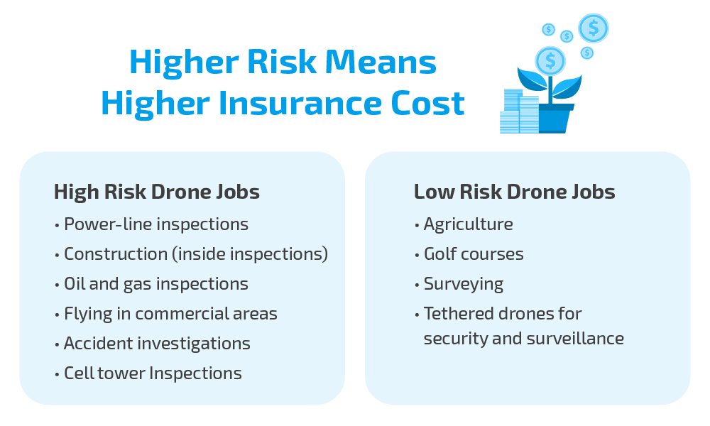
First, insurance is negotiable. So do not be afraid to haggle. After all, a penny saved is a penny earned. Secondly, your experience and training will be taken into account. Remember, your insurance policy is often reviewed by an underwriter.
Many of the providers drone pilots choose to purchase from have fairly fixed pricing for the standard types of usage, which most drone pilots fall into. So, there may be fewer opportunities for haggling in these cases. But it never hurts to ask.
If you have a long, accident-free flying history and have undergone drone training from an organization of repute, these factors will work in your favor. Your drone crash insurance cost also depends on the nature of the job and the associated risk.
So, if you are using your drone for agricultural mapping, your insurance cost is likely to be lower compared to someone who is flying in areas of heavy interference.
Next, if you are an established player with a fleet of drones, you are likely to be offered a better deal. Your per-unit drone crash insurance cost is likely to be lower.
You can also save on insurance costs by uploading your flight logs to insurers like SkyWatch. This helps prove safe flying and earn a Safety Score. Based on your score and track record, they offer premium discounts of up to 30%.
Also, for extremely small damages, it is not worthwhile to file a claim. Typically, deductibles are pegged at 5% of the insured value. So, for small damages, it would be financially prudent to bear the cost yourself. Moreover, the lower number of claims filed will result in lower insurance costs in the future.
Finally, do not hide any information from your broker in a bid to get lower coverage. This is a strict no-no.
Validity Periods of Drone Insurance Policy
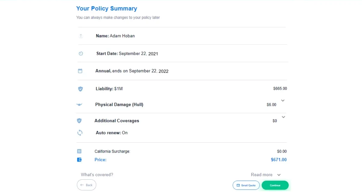 Source: Skywatch
It’s important to know how long your policy will be valid before you buy it. Generally, UAV insurance policies are offered for specific durations.
|
Short-Term Policies |
Annual Policies |
| These policies might cover your drone for a single flight or a limited period, such as a day, a week, or a month. These policies are often used by individuals or businesses that need coverage for a specific event, project, or short-term activity. | Many insurance companies offer annual policies that provide coverage for an entire year. These policies are suitable for drone operators who fly their drones regularly and want continuous coverage without the need to purchase insurance for each flight. It will also offer the best value for money compared to short-term policies. |
Best Drone Insurance Providers
In the vast market of drone insurance providers, each company has its unique strengths and specialties. Here is a quick comparison of the top drone insurance companies so you can make an informed decision.
| Provider | Liability | Hull | Payload | Ground Equipment | On-Demand Options | Best for |
|---|---|---|---|---|---|---|
| SkyWatch.AI | Yes | Yes | Yes | Yes | Hourly/Monthly/Annual | Customizable plans, usage-based discounts |
| AirModo | Yes | No | No | No | Hourly/Annual | Fast, app-based liability coverage |
| Bullock Agency | Yes | Yes | Optional | Optional | Not advertised | Personalized policy consultation |
| Avion Insurance | Yes | Yes | Optional | Optional | Not available | Recreational pilots looking for low-cost coverage |
| State Farm | Yes (for Recreational use only) | Yes | No | No | No | Recreational pilots looking for low-cost coverage |
| Global Aerospace | Yes | Yes | Yes | Yes | Not advertised | Enterprise and global operations |
| DJI Care Refresh | No | Yes | DJI Payloads | No | No | DJI owners seeking replacement coverage |
| BWI | Yes | Yes | Yes | Yes | Not advertised | High-limit liability, complex commercial jobs, and pilots needing direct agent support |
| Avalon Risk | Yes | Yes | Yes | Yes | Not advertised | Enterprise, high-value, RPAS operators |
| AIG | Yes | Yes | Yes | Ground crew covered | Not advertised | Public sector, BVLOS, anti-spoofing coverage |
SkyWatch.AI is one of the most popular drone insurance providers for both recreational and commercial pilots. It offers comprehensive insurance policies that you can customize based on what you need with a few clicks online. You can choose how much coverage you want for liability, hull damage to your drone, third-party property damage, and even coverage for the risk of invasion of privacy. Once you purchase a policy, the Certificate of Insurance (COI) will be emailed to you, so you’re ready for your next mission in minutes.
With SkyWatch, you can buy coverage by the hour, month, or year directly through their mobile app. The company holds a 4.9-star score on reviews and is considered to have some of the best customer support in the market.
Coverage Highlights:
- Liability: up to $10 million
- Hull and equipment: full replacement value
- Optional coverage for non-owned drones and payloads
- Available in all U.S. states
Enroll in our ‘Don’t Crash Course’ to become a safer pilot and save money on an insurance policy.
2. AirModo
AirModo offers drone operators fast, simple, and affordable drone insurance in a single, easy-to-use app. They state: “We are committed to providing you with a best-in-class insurance solution that costs less than the other drone insurance providers.”
They offer policies from hourly to annual, depending on your specific needs, including whether you’re flying for recreational or commercial purposes.
AirModo is available in all 50 states, as well as D.C. and Puerto Rico.
Airmodo offers only liability coverage for incidents that occur while using the unmanned aircraft system noted on your policy. It does not pay out for hull, physical damage, or replacement of your drone or payload.
3. Bullock Agency, Inc.
Bullock Agency has been a trusted insurance company for more than 30 years. They are experts in aviation insurance and offer different types of drone insurance policies to both businesses and individuals.
One of the great things about getting drone insurance from Bullock Agency is that they have a team of experienced professionals who are experienced in the field of aviation insurance, including drone coverage. They can guide you to identify the drone insurance policy elements that fit your specific needs.
4. Avion Insurance
Avion Insurance is a well-known company with a long history of insuring aircraft. They understand the potential risks that come with drones. Avion’s UAV insurance policies offer coverage for both liability and physical damage. Their policies are also customizable, so you can choose the coverage that best meets your needs.
5. State Farm Drone Insurance

State Farm Drone Insurance Policy is like a solid protection plan for your drone if you are a recreational pilot. It covers your drone if it gets stolen, accidentally damaged, or faces certain dangers. It is one of the best recreational drone insurance options.
If your drone suffers physical damage or goes missing because of an accident or theft, you can ask State Farm for help. The good thing is that it’s reasonably priced, and in most cases, you won’t have to pay any deductibles. Isn’t that cool?
Check out our comprehensive State Farm Insurance Review to learn more.
6. Global Aerospace
Global Aerospace Drone Insurance is the Underwriting entity for many, if not most, of the policies that are written for UAS pilots in the US. They also provide policies directly if you prefer that option. Their comprehensive plans include all the usual coverages. These cover damage to the drone, liability for any harm or property damage caused to others, and risks such as invasion of privacy.
They also provide coverage for non-owned drones. The insurance is quite inclusive, safeguarding against third-party liability, damage to the drone, its contents, and related equipment, as well as privacy invasion and medical expenses.
Their policies are available for both recreational and commercial drone users. One other great feature of a policy direct from Global is that you are covered anywhere around the world.
7. DJI Drone Insurance
For those of you who are flying DJI drones, the coverage offered by DJI can be a good option. Depending on the age and type of DJI drone you’re flying, your options will include:
DJI Care – This is the coverage that was offered for what are now older drones, like the older Phantoms and Inspires. It covers damage to your DJI aircraft, gimbal, or camera during either normal use or accidental damage.
DJI Care Refresh – This is a 12-month service plan that provides complete and comprehensive coverage in the event your DJI product is damaged during normal use. This product offers the pilot up to two product replacements in one year or four in two years (requires an additional fee for the second year). Covered situations include Collisions, Water Damage, and even Normal wear and tear.
DJI discontinued Care Refresh Plus in July 2023. However, this change came with some helpful upgrades to the standard Care Refresh plan. Pilots can now extend coverage to a third year and purchase specific protection for flyaways.
As with any insurance coverage, it’s important to review the fine print to ensure the product meets your needs.
8. BWI | FLY
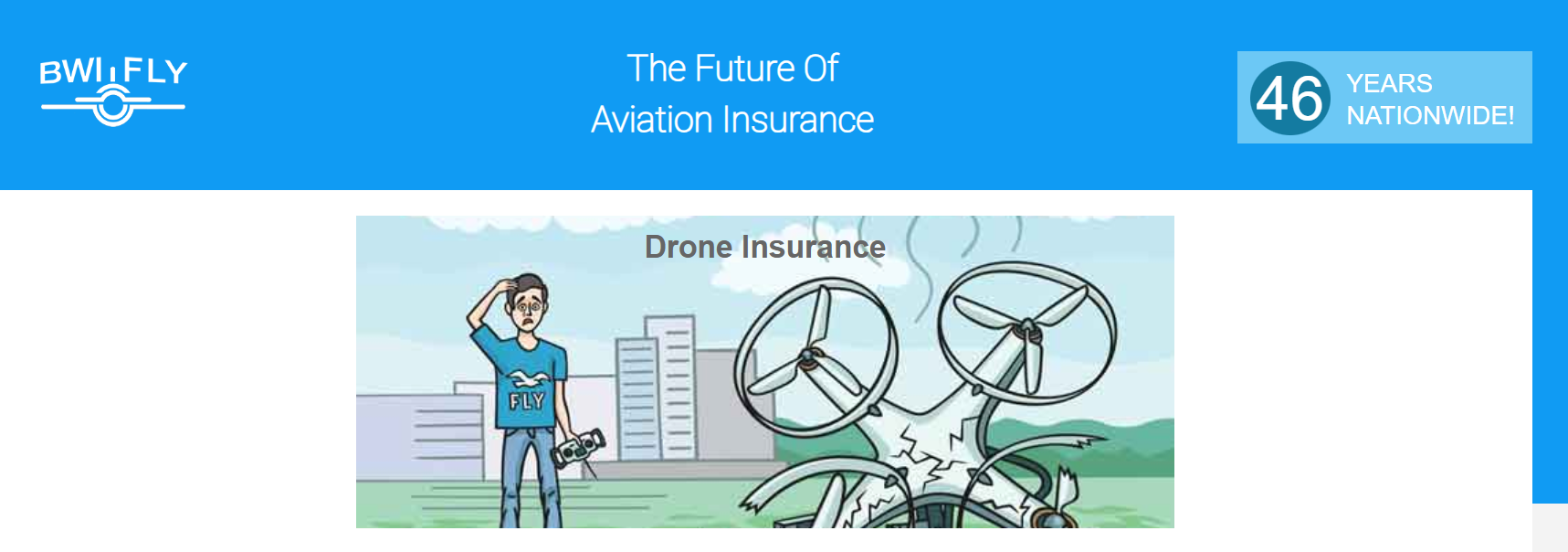
BWI has been providing aviation insurance since 1977 and has been a proactive and innovative contributor to the aviation industry since it began. This culture transitioned smoothly into drone insurance as the UAS industry began to grow and the needs of drone pilots became more profound.
They offer a wide range of products, including liability coverage up to $25,000,000, physical damage (Hull coverage), and payload coverage. They also cover what are considered to be more risky operations, such as drone delivery.
9. Avalon Risk Management
Avalon Risk Management offers drone insurance policies designed for both individual pilots and enterprise operations. Their coverage includes:
- Third-party liability
- Physical damage (hull) coverage
- Payload or property coverage
- Ground station and launch system protection
- Transit and in-storage coverage
- Optional add-ons for war risk, like hijacking or terrorism
Avalon issues an all-in-one Remotely Piloted Aviation System (RPAS) to manage your entire risk portfolio. It is a good fit for operators who fly internationally, handle expensive drones, sensitive missions, or critical infrastructure clients.
10. AIG – Unmanned Aircraft Systems
AIG offers a dedicated insurance program for unmanned aircraft systems. In addition to this, their policies cover both physical damage and third-party liability.
Their policy includes:
- Physical damage coverage, including electronics failure.
- Coverage for non-pilot operators and ground crew under the same policy terms.
- Optional extensions for hijacking or spoofing, protecting against unlawful seizure or signal manipulation.
The UAS team uses AIG’s global aerospace underwriting expertise, claims support, and loss-control services. This policy is a great choice for public entities, municipalities, or companies flying in high-risk or tech-sensitive environments.
Still not sure which drone insurance to choose? Let us help.
How to Choose the Right Drone Insurance Plan?
Choosing the right drone insurance depends on multiple factors, including the kind of flying you do, the value of your equipment, and the potential risks you face.
Here’s a step-by-step guide to help you pick the best drone insurance for your needs:
1. Determine Your Needs
The first and most important element to consider when beginning your search is to determine if you’ll be flying for fun or business. Generally, commercial pilots will need beefier coverage. If you’re flying recreationally, your risks are likely to be much lower. In many cases, as a recreational pilot, your homeowner’s policy may be all you need. It’s always best to check with them first.
As a commercial pilot, you’ve likely got business interests to consider, such as assets, employees, the types of work you’re doing, and many other considerations.
How often you fly also matters: if you’re an occasional flier, think short-term insurance. Terms like monthly or even hourly if that fits your paradigm.
If you fly more frequently, a longer-term plan (usually annual) will save you a fairly substantial amount of money compared to paying for multiple short-term policies. If you’re jetting off abroad, double-check that your coverage includes international flying.
Some providers, like Global Aerospace via SkyWatch.AI, include worldwide coverage by default. But they exclude certain restricted countries. So, always confirm the exact territory before flying overseas.
And remember, flying downtown versus out in the country can come with its own set of risks, so choose accordingly.
2. Types of Coverage
We touched upon this topic earlier in this article. You need to be aware of the options available in the market, such as liability insurance, hull insurance, and ground equipment insurance. This knowledge will help you pick the best one for your needs.
If you fly BVLOS (Beyond Visual Line of Sight), conduct inspections on complex infrastructure, or operate in sensitive areas, check with your provider about specific coverage. Most policies don’t include high-risk flights by default.
High-risk operations that often require special coverage include:
- Flights near airports or stadiums
- Tower, bridge, or utility inspections
- Downtown city flights
- Events with large crowds
- Drone delivery trials or BVLOS tests
Note: Most policies will have exclusions. Make sure you are aware of what isn’t covered.
3. Shop Around
When you’re on the hunt for UAV insurance, don’t just jump on the first deal that comes your way. Always play the field by getting multiple quotes. Different providers often have their own spins on rates and what they’ll cover.
While you’re comparing, it’s a smart move to research reviews and see what folks are saying about a provider. This is your inside scoop on how they handle things, especially when it comes to filing a claim. A low rate will feel a lot less fabulous if the insurance company is difficult to work with when you need to make a claim.
Understand what you’re signing up for, check what’s covered, and keep an eye out for any sneaky costs or conditions. Doing your homework now can save you a whole lot of headaches later.
4. Understand What Drone Insurance Doesn’t Cover
- Damaged add-on equipment: Standard hull coverage for drones usually excludes damage to non-drone accessories. For example, Skywatch.AI does not cover computers, mobile phones, non-drone cameras, or tablets. You can protect these items by purchasing extra coverage, such as payload insurance.
- Incidents caused by unlicensed or unregistered drone operators: Commercial drone pilots must hold an FAA license, and all operators must appear on the insurance policy. If you fail to meet these requirements, the insurer may deny your claim.
- Injuries to employees: Workers’ compensation insurance usually covers injuries your employees suffer while working.
- Political or terrorist acts: Insurers do not cover losses that involve political or terrorist activities.
- Reckless or illegal activity: Insurers can deny claims if you fly your drone recklessly, break the law, or intentionally invade someone’s privacy.
- Strikes, riots, civil commotions, or labor disturbances: Insurers typically exclude claims that arise from strikes, riots, or other civil unrest.
- War and rebellion: Insurers do not cover losses caused by war, invasion, rebellion, revolution, insurrection, or martial law.
UAV Insurance: Our Pick
We, at Drone U, switched to SkyWatch.AI several years ago and have been using it since. Skywatch has been a consistent performer and has done a nice job of continually improving. With the size of our fleet, it’s been important that our policy be fairly nimble, as we may have several drones that don’t see the air for months at a time.
With its customizable pricing mechanism, ease of use, and outstanding customer support, we think there’s a pretty good chance SkyWatch.AI drone insurance will be a good solution for many other drone pilots.
Skywatch.ai is backed by the aviation insurance giant, Global Aerospace, a company with more than 100 years of experience in the insurance sector, with an A.M. Best rating of “A” (Excellent).
Conclusion
Whether you’re flying drones as a hobby or for work, getting drone insurance is a smart move.
When choosing UAV insurance, think about what coverage you need based on how you use the drone, your experience, and how much the insurance costs.
Liability coverage is important to cover legal claims and costs if your drone causes accidents. Physical damage coverage protects your drone if it gets damaged in a crash or collision.
If you follow safe flying rules, keep detailed flight records, and get proper safety training, you might be able to get lower insurance costs.
One of the best ways to hone your skills and fly safely is to attend our flight mastery in-person training. This training will help you become a safe and confident drone pilot. Click here to learn more about our Flight Mastery training.
Frequently Asked Questions
1. Is Drone Insurance Mandatory or Required by the FAA in 2025?
The FAA does not currently require drone pilots, commercial or recreational, to carry insurance. However, some states, municipalities, and clients have made it mandatory, especially for commercial pilots. Whereas, in other states, Part 107 pilots can still fly legally without purchasing insurance.
So, should you fly without insurance? No!
Absolutely not.
If a drone flown by an uninsured pilot causes bodily harm or property damage, all of the financial liability will fall on the pilot. By not getting insurance, a pilot risks losing all his assets.
We’re aware of several drone-related incidents, but one in particular stands out. A professional Part 107 pilot we know well lost control of his drone, which flew through a 27th-floor window. Luckily for the pilot, the floor was unoccupied, so fortunately, there were no injuries. There was property damage, of course, which thankfully was taken care of by his insurance coverage. The incident could have been much worse, especially if he had not had insurance coverage.
Remember – If you are buying commercial on-demand insurance, your provider assumes that you have a Part 107 certification. You CANNOT claim damages without a valid Part 107 certificate. Certainly, another strong reason to get your Part 107 license.
2. Are UAVs Covered by Homeowners Insurance?
Probably not if you are a commercial pilot. There are exceptions to this, but most Part 107 pilots will have to purchase a separate insurance policy. If you are a recreational pilot, your drone might be covered under your homeowner’s insurance. However, we strongly recommend that you check the exact nature of coverage with your insurance provider.
3. Does Insurance for Drones Cover Theft?
Some drone insurance policies may include coverage for theft or loss of your drone. It’s essential to review the policy details to confirm this coverage.
4. Can I Get Insurance for My Recreational Drone?
Yes, recreational drone insurance is available to protect your drone from damage and provide liability coverage.
5. Does Drone Insurance Cover Damage to Someone Else’s Property?
Yes, it typically includes liability coverage, which protects you if your drone damages someone else’s property.
6. What Factors Affect Drone Insurance Premiums?
Your insurance premiums depend on several factors, including your coverage type, drone specifications, experience level, and flight history. More experience and a clean flying record usually result in lower premiums.
7. Why Should You Choose Admitted Insurance Carriers?
Admitted insurance carriers hold licenses from the State Department of Insurance where they operate. This status matters because it gives you two major advantages.
Two Reasons to Purchase Insurance from an Admitted Insurance Carrier:
Reason No. 1 – The State Acts as a Regulator
An Admitted Insurance Carrier must comply with all state insurance regulations. That means that Skywatch, for example, obtains the state’s approval before increasing insurance premiums.
Reason No. 2 – The State Protects You if the Carrier Fails
If an Admitted Insurance Carrier goes bankrupt, the state steps in to pay all claims. So coverage from an admitted insurance carrier comes with added protection and ensures peace of mind.
8. When Is It Okay to Use a Non-Admitted Insurance Carrier?
If an insurance company is a non-admitted carrier, it doesn’t mean they are bad or nefarious. Many carriers do business through wholesale brokers in states where they are not licensed. It could be that they aren’t doing enough business in the state.
One primary benefit of a non-admitted carrier is that you will likely have more flexibility when you’re choosing your coverage. For a drone pilot, this could help if you’re seeing coverage to fly treacherous or abnormally dangerous missions, for example.
9. Does My Drone Need to Be Registered with the FAA to Get Coverage?
Each user must agree to the terms and conditions of the carrier they choose to work with. In almost all cases, the T&C’s will require compliance with any Federal, State, Provincial, and/or local regulations. The 2018 FAA Reauthorization Act requires that both U.S. recreational or hobby drones, as well as U.S. commercial drones, be registered and marked.
10. Are Drone Policies Considered Commercial General Liability (CGL) Policies?
No. They are NOT CGL policies. CGL policies are quite different, covering risks such as injury at your place of work, equipment theft, fire damage, and much more. You’ll need to talk to your agent (which may need to be different from your drone insurance provider) about this type of policy. We do recommend you have a CGL policy in addition to your drone policy. We here at Drone U have our CGL and related policies through NEXT Insurance and have been happy with the relationship.
Top 5 Utility Drone Program Challenges
Ever wondered why some utility drone programs fail while others thrive?
Power lines stretch for miles, and wind farms cover vast coastlines. Inspecting them manually is slow, risky, and expensive. Drones make inspections faster and safer. They can reach hard-to-access equipment and provide live data to help teams make better decisions.
The reality, however, can be challenging. Many utility drone programs struggle with high costs, strict regulations, and limited flight capabilities. Some teams even encounter resistance within their own organizations. Others deal with public mistrust or concerns about privacy.
Still, when done right, drones transform how utilities work. They cut inspection time, improve safety, and reduce downtime.
In this article, we’ll explore the five most common problems utility drone programs face and learn the practical steps to solve them.
Problem #1: High Upfront Costs and Capital Barriers
Starting a drone program can feel expensive. The drones, sensors, and cameras alone can cost tens of thousands of dollars. When you factor in software for data management, licenses, and specialized training for pilots, the costs climb higher than you expect.
For utilities, the challenge isn’t just buying drones. It’s managing capital expenditure (CAPEX) versus ongoing operational costs (OPEX).
Should you purchase drones outright or subscribe to a UAS-as-a-Service (UaaS) model? Leasing or using managed services spreads costs over time and often includes maintenance, insurance, and software updates.
Maintenance and lifecycle costs also add up. Batteries need replacement, sensors wear out, and drones themselves require periodic inspections. Planning helps avoid unexpected expenses and delays.
Here’s a simple example of the Total Cost of Ownership:
- Drone purchase: $15,000
- Software license: $5,000 per year
- Training for pilots: $3,000
- Monthly savings from inspections: $1,500
To calculate break-even, divide total cost by monthly savings:
(15,000+5,000+3,000) ÷ 1,500 =15 months
This means the program would pay for itself in about 15 months. Adding extra drones or sensors changes the calculation, but understanding the full cost helps you plan budgets and justify investment.
These costs can quickly overwhelm a drone program. You need clear strategies to control spending and get the best return on investment.
Steps to keep costs under control:
- Start with a pilot program using one or two drones to measure actual savings.
- Consider UaaS or leasing to reduce upfront costs.
- Budget for maintenance, software updates, and battery replacements.
- Build ROI models to justify future expansion.
Once you’ve handled the budget challenge, the next major obstacle is staying compliant with airspace and safety regulations.
Problem #2: Drone Regulations for Utility Operators in 2025
If you manage or fly drones for a utility, regulations are probably your biggest headache. The rules exist for safety, but they often don’t match the way real inspections work.
The main problem is that the existing rules are complex, slow to change, and rarely fit how your operations actually work.
You might need to inspect miles of power lines or pipelines, but long-range flights usually require Beyond Visual Line of Sight (BVLOS) approval. Getting that waiver can take months, and delays often slow down your entire program.
Even after approval, compliance is ongoing. You need certified pilots, Remote ID-ready drones, and detailed safety documentation. Miss one requirement, and your operation could be grounded.
For example, when you inspect transmission lines in rural areas, the rules limit you to 400 feet in altitude and visual line-of-sight flights. That means multiple launches and landings just to cover short sections, costing time and resources.
Rules also vary by region, which complicates cross-border or multi-state projects. What’s legal in one area might need special approval in another.
Here’s how to stay compliant without losing momentum:
- Start small. Begin with visual line-of-sight missions to build a solid safety record.
- Engage regulators early. Build trust and get faster approvals.
- Work with experts. Partnering with drone service providers who already hold BVLOS or night-flight approvals can save months of waiting.
- Automate compliance. Use software to manage pilot certifications, flight logs, and maintenance records so nothing slips through the cracks.
When you grow your operations gradually and maintain transparency, regulators gain confidence in your program. That trust gives you more flexibility to scale safely and legally.
And once you’ve cleared regulatory hurdles, the next challenge lies in the technology itself.
Problem #3: Technical & Operational Limitations
Even when you’ve handled budgets and regulations, technology can still hold you back. Drones are powerful tools, but they still have limits. These physical and digital limits directly affect inspection quality, safety, and efficiency.
-
Limited Flight Time
Most utility drones have limited flight durations per battery cycle. If you’re inspecting long transmission lines or solar panels, you’ll need to land and relaunch often. Every extra takeoff wastes time and increases wear on your equipment.
-
Payload Capacity
Heavier payloads mean shorter flights. When you add sensors such as thermal cameras, LiDAR, or zoom lenses, the drone burns more power. You often have to choose between flight time and data quality.
-
Connectivity
In remote valleys, dense forests, or near substations, drones can lose GPS or communication links. Without a stable connection, live data streams can fail, forcing you to redo flights. Using redundant communication systems or dual-band controllers can reduce these risks.
-
Data Overload
Each mission can generate gigabytes of data, 3D models, or video. Sorting, storing, and analyzing all that data can overwhelm your team. LiDAR and thermal imaging each require different data-processing workflows, which adds complexity.
How to manage these technical limits:
- Match drone type to task (fixed-wing for long routes, multirotor for close-up detail).
- Use modular payloads to swap sensors instead of flying separate drones.
- Adopt edge computing for faster on-site analysis.
- Manage battery swaps and pre-charged backups to minimize downtime.
- Automate data workflows using cloud platforms to tag, store, and share inspection data.
Once your technology is optimized, the next barrier is often internal: getting your team on board.
Problem #4: Organizational Resistance, Culture & Expectations
The people you recruit can make or break a drone program.
Some field crews worry that drones will replace their jobs, while managers expect instant results, assuming that drones will solve all inspection challenges overnight. When expectations don’t match reality, programs lose momentum before they even begin.
Skills gaps worsen the situation. Drone programs need trained pilots, analysts, and coordinators who understand both aviation and utility operations. Without collaboration, teams operate in silos. The operations crew flies the drones, the engineering team analyzes the data, and no one owns the final results.
How to overcome resistance:
- Start small. Run pilot missions and show measurable results.
- Create internal champions. Identify team members who embrace drones and encourage them to spread the word.
- Communicate clearly. Emphasize that drones are there to assist, not replace, fieldwork.
- Integrate with existing workflows. Connect drone data with maintenance and asset systems.
- Train across departments. Ensure pilots, engineers, and IT staff all understand how drone data supports their goals.
When your team sees drones as an ally, not a threat, adoption grows faster and performance improves.
After your internal culture adapts, one final challenge remains, i.e., public perception.
Problem #5: Public Perception & Privacy
Many people still associate drones with surveillance, not safety. Rumors spread quickly, and communities can resist even legitimate inspection flights.
For utilities, public distrust is more than just bad PR. It can shut down operations entirely. Residents might call regulators, post complaints online, or block access to areas where drones are essential for safety inspections.
When you fly near residential zones to inspect power lines, people may worry about cameras. Instead of ignoring their concerns, organize open days or live demonstrations. Show them how drones prevent outages and improve safety.
Here’s how to build trust:
- Communicate early. Inform communities before flights, explaining when and why you’re flying drones.
- Be transparent. Share what data is collected and how you use it, making sure privacy is respected.
- Engage local leaders. Partner with municipalities, neighborhood associations, or community groups to build trust.
- Comply with privacy laws. Follow FAA Part 107 and local data-protection regulations to show accountability.
- Share success stories. Highlight real examples of how your drones prevent outages or enhance safety, making the benefits clear and tangible.
By addressing privacy concerns directly and involving your community, you turn skepticism into support and build trust. Make community partnerships part of your program’s strength.
Conclusion
Running a utility drone program is not just about buying drones. You also have to manage costs, meet regulations, handle technical limits, overcome internal resistance, and build public trust. Each of these can slow your progress if ignored.
The key is to combine technology with good processes. Start small and show quick results. Involve your team, regulators, and community from the beginning. With a clear plan and steady improvements, drones can help you inspect faster. You can operate more safely and make smarter data-driven decisions.
Looking ahead, drones are becoming more capable and autonomous. AI-assisted analytics will keep expanding what’s possible. Smarter sensors, stronger batteries, and automated flight paths will push inspection efficiency even further.
By focusing on practical solutions and steady improvement, you can build a drone program that overcomes today’s problems and grows safely for the future.
Strengthen your team with utility drone inspection training to ensure everyone is prepared for safe, efficient operations.
Ready to tackle the challenges of utility drone operations?
Join Drone U today and learn advanced drone operations, AI-assisted inspections, and practical strategies.

Keys for Success in Utility Drone Inspection Training
Have you ever wondered what it takes to fly a drone safely just inches from a live high-voltage power line? One wrong move could cost you time, money, or even result in a serious injury. That’s why utility drone inspection training is no longer optional. It’s essential for every mission.
Flying a drone isn’t just about controlling it. You also need to master safety protocols, follow FAA regulations, and collect accurate data under pressure.
The best programs go beyond teaching controls. They motivate you, enforce disciplined workflows, gamify learning, and help you develop the exact skills needed for real-world missions.
In this guide, you’ll discover the five keys to successful utility drone training. We’ll also learn how the right approach can turn you into a safety-conscious, data-savvy, mission-ready pilot.
Before we jump into the first key, let’s quickly cover what utility drone training really is.
What is Utility Drone Inspection Training?
Utility drone inspection training teaches you how to fly drones safely for industrial tasks. These tasks include inspecting power lines, monitoring pipelines, and surveying infrastructure.
In addition to flying skills, you’ll learn safety protocols, accurate data collection, and how to maintain disciplined workflows. Training also covers all FAA regulations and industry standards you need to follow.
The goal is simple: prepare you to handle real-world utility missions with confidence and precision.
In this guide, you’ll discover five keys to successful utility drone training. Each one will help you become a safer, smarter, and more capable pilot.
Let’s start with the first key.
#1 — Motivation Through Accreditation & Recognition
Training feels meaningful when it advances your career. That’s where accreditation and certification come in.
Some programs offer PE-certified continuing education credits (for Professional Engineer) or FAA-recognized credentials. That means your training hours can count toward your professional development and give you recognition across the industry. These certificates can help you land promotions, secure higher pay, or qualify for specialized missions.
When your training is tied to professional growth and real-world opportunities, you’ll naturally stay focused, retain safety procedures, and take pride in your skills.
Always look for programs that partner with accrediting bodies so that the certificate you earn carries weight both inside and outside your company.
With the basics covered, the next key is to keep the training engaging while maintaining its serious/core aspects..
#2 — Make Training Fun Without Losing Focus
Long hours of slides and lectures can make even the most motivated pilots tune out. You need hands-on training that keeps you engaged while preparing you for serious challenges.
Practical exercises such as flight labs, obstacle courses, and simulation challenges enable you to practice real-world skills. At the same time, drills for handling equipment failures or navigating tight spaces prepare you for emergencies and responding under pressure.
Active learning is key. Instead of just reading about thermal inspections or LiDAR protocols, you perform them. You make mistakes in a safe setting and learn to correct them.
Adding friendly competition makes a big difference. Timed drills, accuracy tests, or team-based exercises encourage focus and help you retain knowledge.
With the right balance of engagement and seriousness, you’ll walk away ready to handle critical missions with confidence.
Next, let’s see how practicing these skills can produce clean, reliable data and establish disciplined workflows for every inspection mission.
#3 — Master Data Management & Workflow Discipline
Flying the drone is only half your job. The other half is ensuring that the data you collect is reliable, well-organized, and actionable.
If you mislabel a thermal image or skip metadata, you risk slowing down inspections or making critical errors. That’s why data management and strict workflows are just as important as mastering flight controls.
A strong training program teaches you not only what to capture, but why it matters. You’ll practice organizing files, documenting metadata, and verifying quality. Every photo or dataset you collect needs to fit seamlessly into the utility’s asset management system.
Once you see how your data prevents outages and supports compliance, following the correct workflows and quality checks comes naturally to you.
With your data and workflows in place, the next step is making training more engaging through gamification.
#4 — Use Gamification to Sharpen Your Skills
Training doesn’t have to feel like a chore. When you add elements of entertainment, you naturally push yourself to improve.
Leaderboards, point systems, and achievement badges turn routine drills into challenges. A timed inspection task or a flight obstacle course feels less like work and more like a game.
Each exercise strengthens the skills you’ll need in the field while making training more engaging.
Digital dashboards and performance tracking, along with micro-incentives, provide an additional layer of motivation. You earn points for completing scenario-based missions accurately.
Gamification keeps you motivated and shows you exactly where you stand. It’s not just about competition; it’s about improving your own performance with every session.
This approach helps you stay sharp and committed, even when training gets repetitive.
The final step in successful utility drone training is to use it to assess which pilots are ready for real-world missions.
#5 — Using Training as a Filter for Pilot Quality
Not everyone who picks up a drone is ready to fly critical utility operations, and that’s okay. Training is also a way to identify when you’re fully prepared for live missions.
Structured assessments help identify which pilots are ready for real-world missions.
The right program makes it clear who has the discipline, focus, and skill to fly safely near high-voltage lines.
In advanced training, you’ll face stress-test scenarios that simulate real-world pressure. You may need to navigate through confined corridors, troubleshoot mid-flight data failures, or respond to unexpected equipment malfunctions.
Your performance in these exercises shows where you excel and where you need retraining. Clear scoring systems and progression levels give you honest feedback, so when you do move forward, you’ll know you’re ready.
This filtering process ensures you and your team can handle high-voltage environments with competence and confidence.
Key Takeaway: Building a Sustainable Training Routine
Training is the foundation of a safe and effective drone inspection training program. When it’s designed with purpose, it becomes a driver of both personal growth and organizational success.
By focusing on motivation, engagement, data discipline, gamification, and readiness testing, you prepare yourself for evolving FAA regulations, including BVLOS operations. Each element builds on the next, shaping a program that delivers consistent results and long-term value.
When your training checks all the right boxes, you’ll reduce errors, speed up inspections, and boost confidence on every flight.
Here’s a checklist you can use:
- Does your training count toward accreditation or certification?
- Are you getting interactive, hands-on practice?
- Do you know how to manage data and workflows correctly?
- Is gamification helping you stay sharp?
- Are you tested and evaluated for readiness?
If you can answer “yes” to these, you’re not just flying drones; you’re building a sustainable, high-performance career in utility drone inspections.
Ready to advance your career in utility drone inspections?
Enroll in Drone U’s training programs and learn real-world techniques to confidently handle the demands of utility missions.
Part 108: BVLOS Comments to Consider
Why We Need Your Voice on Part 108: BVLOS Comments to Consider and the Future of Small Drone Businesses Continue reading
The Top 36 Drone Companies in 2025
Which are the top drone companies in 2025, and how are the manufacturers of drones shaping the UAV landscape?
The drone industry is growing rapidly. Better hardware, smarter software, and new services are changing the way businesses use drones for filming, mapping, security, and deliveries.
However, with numerous players in the field, it can be challenging to identify the innovators and key players behind the most advanced drone solutions.
In this article, we’ll take a look at the best drone companies that are expected to dominate the market in 2025 and beyond.
Evaluation Methodology: How we selected the Top Drone Companies
Choosing the top 36 drone companies for 2025 required a clear and consistent process. We focused on the companies driving real progress in UAV hardware and software, the two areas that push the entire drone industry forward.
Our evaluation included these key factors:
- Market presence: Revenue, funding, and global reach
- Innovation: Product launches, patents, and pace of development
- Technology: Hardware quality, software capabilities, and compliance (like NDAA readiness)
- Adoption: Enterprise use, government contracts, and user community strength
- Vision: How well each company is positioned to shape the future of drones
By combining these criteria, we built a balanced list that represents both established industry leaders and rising innovators.
First, let’s take a closer look at the factors we have considered in evaluating top drone companies.
Factors Used in Evaluating the Top Drone Companies
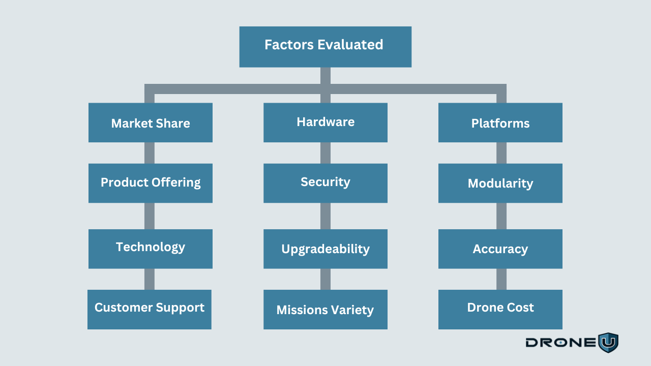
1. Market Share
Market share is a crucial metric for investors and consumers alike. The best drone companies demonstrate higher market share and remain at the forefront of innovation. For instance, DJI, the Chinese tech giant, is currently the top drone manufacturer with a staggering 74.3% market share, followed by Parrot, Autel Robotics, and Ehang.
2. Product Offering
Diversity in product offerings is what we mean here. The top drone companies offer a wide range of drones. Some examples include aerial photography, delivery, drone mapping, public safety agency work, and aerial surveying.
Some companies also manufacture key components for drones. These include airframes, motors, sensors, cameras, and batteries.
Our research also found manufacturers focused on specific domains or operations, such as agriculture or surveying. Many others tend to offer a lot more versatility with a variety of applications and usage. The best example is DJI, which brings a lot of diversity to its product offerings.
3. Technology
The top drone manufacturers invest heavily in research and development. They are at the forefront of drone innovation using cutting-edge technology. This includes GPS, obstacle avoidance systems, and advanced imaging systems. These companies also create software that supports multiple use cases, from data collection to automated missions.
4. Customer Support
Outstanding customer support is a distinguishing characteristic of a great company. The principle also applies to the best drone brands.
The best drone companies understand the importance of offering technical support, training, and maintenance services. For this reason, they prioritize providing top-notch customer support to meet the needs and expectations of their consumers.
5. Hardware
High-quality hardware is a hallmark of top drone brands. They use premium materials to ensure durability against harsh weather conditions, rough handling, and prolonged flights. They focus on creating user-friendly drones that are easy to assemble and dismantle, with excellent transportation capabilities. This is an area where a lot of American-made drones shine.
6. Security
Security is a top priority for leading drone companies, including both the drones and the sensitive data they collect. Leading companies implement advanced encryption technology to safeguard drones against hacking and unauthorized access. Some drone companies even develop software to help users regulate access to their drones. This software also allows users to manage data collection while providing additional security.
7. Upgradeability
Upgradeability plays a crucial role in maximizing the return on investment. This includes offering firmware updates and hardware upgrades to improve the performance and capabilities of the drones. Many manufacturers provide flexibility, allowing drone users to customize drones for their specific needs and applications.
8. Variety of Missions
Versatility and adaptability are key characteristics we consider when evaluating drone manufacturers. The drone design must be capable of seamlessly navigating different environments and adapting to different situations. Add-ons and accessories further enhance mission-specific capabilities, allowing pilots to tailor drones to specific requirements.
9. Platforms
Prominent drone companies offer user-friendly platforms for the smooth control and management of drones. The software is designed to be simple to operate, making it easy for pilots to control the drones. With mobile apps, you can collect valuable data from your drones no matter where you are. You can also monitor their improving efficiency, both hobbyists and enterprise users.
10. Modularity
The best drone manufacturers create modular drones, allowing operators to easily change parts and add accessories. This makes it easy to upgrade the drone or customize it for specific missions.
11. Accuracy
Top drone manufacturing companies focus on accuracy as a crucial aspect. Advanced imaging systems and sensors are used to collect data with high precision. The accompanying software allows consumers to analyze and interpret the data collected by drones accurately.
12. Cost of Drone
Top drone brands aim to offer value for money in their product offerings. They ensure competitive pricing while maintaining high-quality standards and optimal performance. Some drone companies provide financing options and leasing programs to make drones more accessible to a wider audience.
With this understanding, let’s dive into the top drone companies in 2025. We’ll examine each drone company, its product offerings, and key specialties.
The Top 36 Drone Companies in 2025
Here are the best drone companies to watch out for in 2025. In this list, we have categorized the drone companies into two major segments:
A. Drone Hardware Companies
B. Drone Software Companies
Let’s get familiar with the drone hardware companies first.
A. Drone Hardware Companies
The drone hardware industry consists of companies that produce, distribute, and create tangible parts for unmanned aerial vehicles (UAVs).
Here are some popular drone hardware companies:
1. DJI
- Headquarters: Shenzhen, China
- Founders: Frank Wang
- Founded in: 2006
- Categories: Consumer, Agriculture, Enterprise, Video Production, Public Safety
- Website: https://www.dji.com/global
DJI is the world’s largest drone manufacturer, commanding a market share of over 70% worldwide. The company offers a wide range of drones for both professional and consumer use. It is well-known for its high-quality products, advanced features, and excellent customer service.
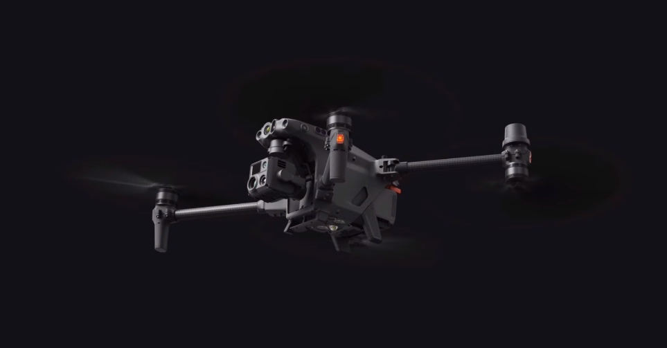 M30T | Credit: DJI
DJI’s drones are equipped with advanced features such as obstacle avoidance, 4K cameras, and GPS. The company also offers a range of accessories and add-ons to enhance the performance of its drones.
DJI is best known for its Mavic series, including the M30T and Mini 2. These drones are popular among new and intermediate pilots, as well as videographers.
DJI’s impact on the drone industry has been significant, leading the way with its unique and groundbreaking solutions. They have revolutionized the construction industry, saved lives with emergency medical deliveries, and captured stunning aerial footage for movies and commercials.
2. Orqa International
- Headquarters: Osijek, Croatia
- Founders: Srdjan, Vlatko and Ivan
- Founded in: 2018
- Category: FPV, Industrial, Enterprise
- Website: https://orqafpv.com/about
Orqa FPV, proudly headquartered in Osijek, Croatia, has established itself as the top drone manufacturer with a history of innovation.
As UAS restrictions against Chinese technologies expand, they have emerged as a leading supplier of mission-critical components for Blue UAS companies.
Orqa first unveiled its flagship FPV goggles prototype at CES in Las Vegas in January 2019. This move positioned the company as a competitor in the FPV racing market. Beyond its initial focus, Orqa has significantly expanded its product lineup and market influence following a merger with Immersion RC.
The company has become the leading manufacturer in the education sector with its product design for Drone Soccer. This rapidly growing career readiness program has gained popularity in high school and collegiate programs worldwide.
Available in the United States, the Drone Soccer Academy showcases Orqa’s commitment to fostering new and engaging ways to experience drone technology.
Orqa is dedicated to in-house full-stack engineering and manufacturing. They focus on electronics, optics, radio systems, and cameras. This commitment highlights their emphasis on quality and innovation.
Positioned to fill the gap for government and enterprise platforms, Orqa has established itself as a versatile and forward-thinking player in the global drone industry.
3. AeroVironment
- Headquarters: Simi Valley, California, United States
- Founders: Dr. Paul MacCready Jr.
- Founded in: 1971
- Category: Defense, Public Safety
- Website: https://www.avinc.com/
AeroVironment Inc. is a California-based technology solutions company that has been developing and manufacturing drones for over four decades.
 Puma 3 AE | Credit: Business Wire
Its key products include the Switchblade Series, Puma 3AE, Raven, and Wasp drones, designed for tactical operations. These drones are primarily used in military, defense, public safety, and commercial industries.
What makes AeroVironment stand out is its reputation for innovation and the numerous awards it has received for its technology solutions. AeroVironment has also established notable partnerships and collaborations in the drone industry. The company supplies its drones to the U.S. Army, supporting military operations with advanced unmanned systems. It has also expanded its presence in the Asia-Pacific region.
AeroVironment develops advanced drones and other technologies, positioning itself as a leading drone technology solution company in 2025.
4. PowerVision
- Headquarters: Beijing, China
- Founders: Wally Zheng
- Founded in: 2009
- Category: Aerial, Water-surface, & Underwater Robotic Devices
- Website: https://www.powervision.me/en/
PowerVision has been at the forefront of cutting-edge research, development, and design. The company has continuously pushed the boundaries of technology, revolutionizing industry research and development.
 Power Ray Drone | Credit: PowerVision
Currently, PowerVision stands out as the only company in the world that manufactures aerial, water-surface, and underwater robotic devices. It has also achieved mass production of underwater AI robotic devices, establishing itself as a unique player in the robotics industry.
PowerVision primarily focuses on research, development, and manufacturing. It specializes in industrial UAVs, consumer UAVs, and robotic devices for both water-surface and underwater operations. PowerVision also provides sales and after-sales services for these products.
Its commitment to independent innovation has led to the creation of several groundbreaking products. These include:
- PowerEgg- The first egg-shaped drone
- PowerRay- the underwater drone
- PowerDolphin- the water-surface drone
- PowerSeeker – an intelligent fish-finding drone
- PowerEgg X- the world’s first full-platform AI camera
These products highlight PowerVision’s focus on developing cutting-edge technology across various fields, such as robotics, drones, and AI applications.
5. Parrot
- Headquarters: Paris, France
- Founders: Henri Seydoux
- Founded in: 1994
- Category: Professional, Enterprise
- Website: https://www.parrot.com/us/
Parrot is a well-known French drone company that has established itself as a significant player in the drone industry. Parrot provides a wide range of drones for various applications, including aerial photography, videography, racing, agriculture, construction, and public safety.
 Parrot Anafi UKR | Credit: Parrot
The company’s notable products include ANAFI UKR, ANAFI USA, ANAFI Thermal, and ANAFI Ai, which are known for their portability, advanced features, and affordability.
Parrot is committed to innovation and user-friendly drone technology, with a focus on developing new products and expanding its market reach. This company has the largest partner ecosystem for professional drones, from enterprise drone platforms to public safety programs.
With its strong presence in the European market and recognition for its advanced technologies, Parrot plans to remain a leading player in consumer drone innovation and cybersecurity.
6. Autel Robotics
- Headquarters: Shenzhen, China
- Founders: Li Hongjing
- Founded in: 2014
- Category: Commercial and Consumer
- Website: https://www.autelrobotics.com/
Autel Robotics is a leading drone company known for producing high-quality drones catering to both consumers and professionals. The company offers a range of drones equipped with advanced features such as obstacle avoidance, 360-degree cameras, and intuitive flight controls. Some of their popular drones include the X-Star Premium, Evo Nano+, and Evo Lite+.
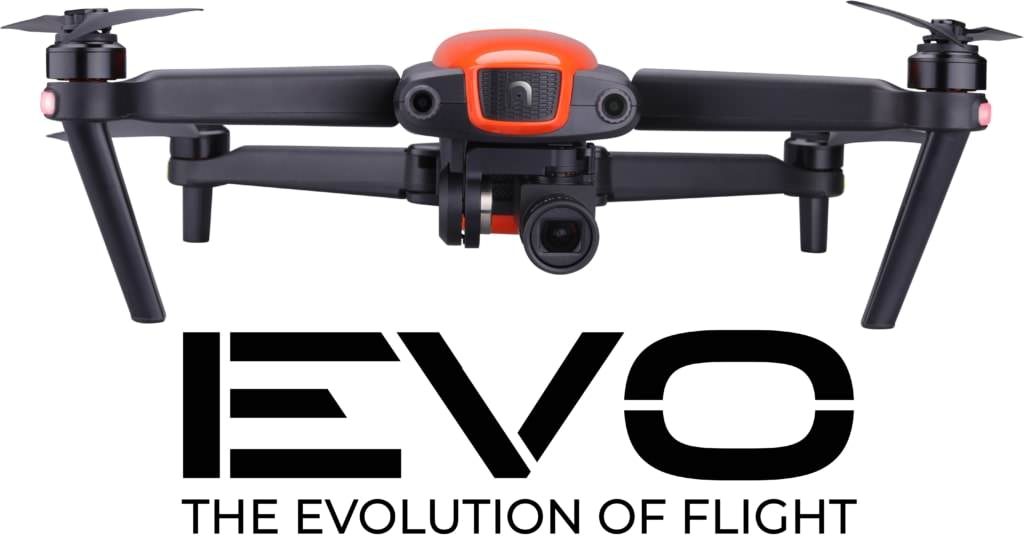
The Evo Nano+ is a lightweight drone that doesn’t require registration with the FAA and features three-way obstacle detection for safer flight, while the Evo Lite+ uses a Type 1 sensor camera for competitive picture quality.
Autel Robotics’ drones are popular among photographers and videographers due to their stabilized cameras that record 4K30 video and snap sharp photos at up to 50MP.
The company’s products are known for long battery life, with the Evo Lite+ offering a flight time of around 40 minutes on a full battery.
Autel Robotics stands out for its unique features and advantages. With its strong commitment to innovation and quality, the company continues to be an important player in the drone industry.
7. Skydio
- Headquarters: Redwood City, California
- Founders: Adam Bry, Abe Bachrach, and Matt Donahoe
- Founded in: 2014
- Category: Public Safety, Defense, Enterprise, Cinematic Creators
- Website: https://www.skydio.com/
Skydio’s innovation in the drone world, specifically with autonomous flight missions, has created a lot of buzz. High-speed manual flight and obstacle avoidance capabilities have made Skydio drones popular in the sports and entertainment industries.
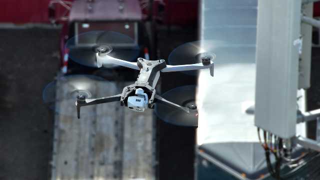 Skydio X10
The company manufactures intelligent drones powered by machine learning for consumer, enterprise, and government customers.
Their flagship products are the Skydio X10 and Skydio X10D, designed for commercial and superior video purposes, respectively.
Another innovative solution by this company includes the Skydio Dock. The Skydio Dock combines with Skydio drones, allowing remote operations for emergency response and critical infrastructure monitoring.
Skydio’s products have also set a new standard for supply chain and manufacturing security by designing, assembling, and providing support for all its products in the USA.
8. Delair
- Headquarters: Toulouse, France
- Founders: Michaël de Lagarde, Benjamin Benharrosh, Benjamin Michel, and Bastien Mancini
- Founded in: 2011
- Category: Commercial, Military, and Security
- Website: https://delair.aero/
Delair is one of the top drone manufacturing companies in the world, providing innovative drone technology and services for commercial and industrial use.
 DT26 | Credit: Delair
Delair has been at the forefront of drone technology since its establishment in 2011. The company offers a wide range of advanced drones for surveying, inspection, and security applications, like the UX11, DT26X LiDAR, and DT46.
Delair specializes in fixed-wing UAVs and drone software analytics. Using these valuable data, the company serves different industries, including oil and gas, transportation, agriculture, and emergency services.
The company’s competitive advantage lies in long-range drones. These drones can fly for several hours, covering large areas. Some models are equipped with thermal imaging sensors and other advanced payloads for inspection and surveillance applications.
9. Ehang
- Headquarters: Guangzhou, China
- Founders: Huazhi Hu, Yifang (Derrick) Xiong
- Founded in: 2014
- Category: AAV products, Commercial solutions
- Website: https://www.ehang.com/
Ehang is one of the leading companies in the development of autonomous aerial vehicles (AAVs). With its strong track record of innovation, the company is well-positioned as a major player in the urban air mobility market.
 EHang 216L | Credit: EHang
EHang’s AAVs are designed to be safe, easy to operate, and environmentally friendly. The company’s flagship product is the EHang 184, which is a passenger-grade AAV that can carry up to two people. The EHang’s EH216 has been certified by the Civil Aviation Administration of China (CAAC) and is currently in commercial operation in China.
EHang is also developing many other AAVs, including the EH216, which is a larger AAV that can carry up to six people, and the EHang 216L cargo drone that can carry up to 200 kg of payload.
EHang’s AAVs are used for a variety of purposes, including passenger transportation, logistics, and aerial photography. The company is also working on developing AAVs for emergency response and medical delivery applications.
10. Freefly
- Headquarters: Woodinville, Washington, USA
- Founders: Tabb Firchau, David Bloomfield, Hugh Bell
- Founded: 2011
- Category: Cinematography, Film Industry
- Website: https://freeflysystems.com/
Freefly Systems is a leading American drone manufacturer. It is known for its high-quality aerial platforms, including camera movement systems, unique camera drones, and camera stabilizers for cinematography. The Freefly products are used by professional filmmakers and videographers all over the world to create stunning, smooth, and mesmerizing shots.
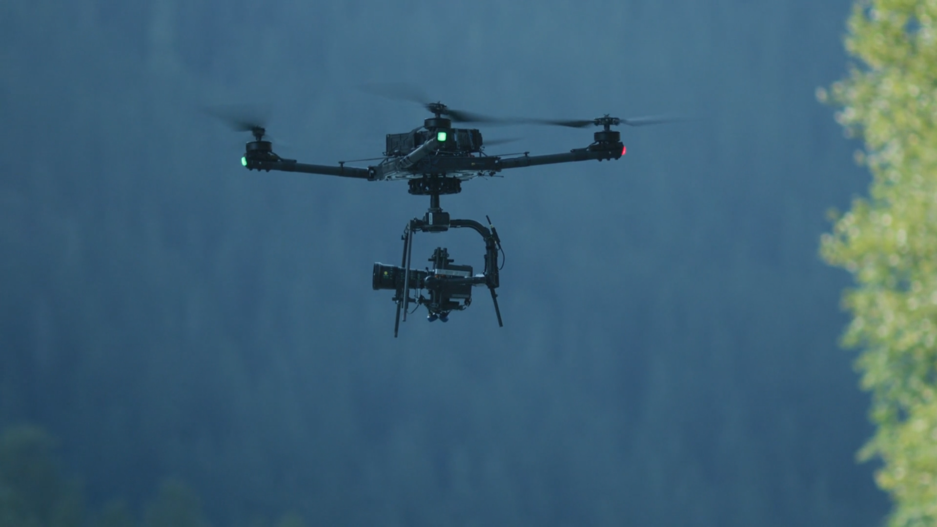 Alta X | Credit: Freefly
Freefly Systems’ products are known for their high quality, innovative design, and ease of use.
Movi Carbon stands as a pioneering 5-axis camera stabilizer that sets itself apart as a handheld and drone-mountable stabilizer.
Movi Carbon features two high-bandwidth inner axes, known for its smooth, fluid movements and its ability to withstand even the most demanding shooting conditions. This means you can effortlessly capture smooth shots, even when using the full 240mm zoom.
Other popular Freefly Systems products include the Alta X drone, the Wave high-speed camera, and the SL Series batteries.
Freefly Systems is a rapidly growing drone company and is constantly innovating new products and technologies. The company is committed to providing filmmakers with reliable and adaptable drone systems.
11. Flyability
- Headquarters: Lausanne, Switzerland
- Founders: Patrick Thévoz and Adrien Briod
- Founded in: 2014
- Category: Indoor Inspection
- Website: https://www.flyability.com/
Flyability is a Swiss drone company that specializes in collision-resistant drones for indoor inspection and exploration.
 Elios 2
Flyability’s drone is enclosed in a protective cage that enables it to remain stable when bumping into obstacles. This makes the drone ideal for inspections and surveys in remote and hard-to-reach areas such as underground mines, nuclear power plants, and oil rigs.
The company provides various solutions to different sectors, such as power generation, oil and gas, mining, and infrastructure, among others. The company is looking to expand its services in Latin America by partnering with local companies to meet growing customer demands.
Flyability’s unique selling points include the drones being inexpensive, easy to fly, programmable via Scratch, Bluetooth remote control compatibility, and automated flight modes.
The company’s potential impact on the drone industry is enormous. Their collision-resistant drones solve some of the significant challenges in industries such as energy, mining, and construction.
12. Insitu
- Headquarters: Bingen, Washington
- Founders: Tad McGeer and Matthew Finnie
- Founded in: 1994
- Category: Defense and Government
- Website: https://www.insitu.com/
Insitu is a prominent drone company that has been making waves in the industry with its innovative drone solutions. The company’s main focus is on providing unmanned aerial systems (UAS) for military and commercial applications.
 ScanEagle | Credit: Insitu
Insitu’s drones are designed to provide real-time data and intelligence, making them ideal for applications such as search and rescue, surveillance, and environmental monitoring.
Insitu’s drone products and services are solving some of the most pressing problems in the drone industry.
For example, the ScanEagle, a flagship drone product that is designed for military applications, and the Integrator drones are versatile, modular drones that can be customized to meet the needs of the drone user.
Insitu has established a partnership with Pacific Aerospace, a leading aerospace company in New Zealand, to provide drone solutions for the Asia-Pacific region.
Insitu has the potential for continued growth in the coming years. Its innovative drone solutions and partnerships make it one of the top drone companies to watch in 2025 and beyond.
13. Wingtra
- Headquarters: Zurich, Switzerland
- Founders: Basil Weibel, Maximilian Boosfeld, Elias Kleimann
- Founded in: 2016
- Categories: Surveying, GIS, Mining, Construction, Agriculture, Environmental Monitoring
- Website: https://wingtra.com/
Wingtra is a Swiss company that manufactures heavy-lift drones for industrial applications. Wingtra drones are capable of carrying up to 60 kg of payload, making them ideal for surveying, mapping, and inspection.
 Credit: Wingtra
Wingtra drones are also known for their high-precision aerial surveying capabilities and their long flight times. Equipped with high-resolution cameras and sensors, these drones can be used to collect data on a variety of features.
Wingtra drones also have a vertical takeoff and landing (VTOL) capability, which means the drones can take off and land in tight spaces even without a runway.
Their flagship product, the WIngtraOne Gen II, is famous for its precision and efficiency. Industries like construction, mining, and environmental monitoring actively use these drones for detailed topographic surveys.
The company recently launched a software solution – WingtraCLOUD, designed to simplify drone data planning and collaboration. With a strong commitment to sustainability and innovation, the company aims to promote environmental and humanitarian projects.
14. Airobotics
- Headquarters: Tel Aviv, Israel
- Founders: Meir Kliner
- Founded in: 2014
- Category: Precision Agriculture, Insurance, and Commercial Services
- Website: https://www.airoboticsdrones.com/
Airobotics is a leading drone manufacturer that specializes in fully automated drone systems and solutions. It is renowned for developing government-grade, tier-1 autonomous drone systems and solutions. The company has developed a wide range of advanced drone technologies designed for industrial, commercial, and public safety applications.
Credit: Aerobotics
Airobotics has a portfolio of drones, including the Iron Drone system, which is an advanced technology used to protect against enemy drones. It is designed to defend important assets in complex environments without causing much damage. The system can automatically intercept and disable small drones without relying on GPS or RF jamming.
Airobotics drones have revolutionized the agricultural industry, enabling farmers to make data-driven decisions regarding fertilizer application, irrigation, and other farming practices.
The impact of Airobotics drones on the agriculture industry has been significant, resulting in increased efficiency and profitability for farmers.
Airobotics drones are designed to be easy to operate and deploy, even in complex and challenging environments. These drones can be utilized in various applications, including security, inspection, and mapping.
15. JOUAV
- Headquarters: Chengdu, China
- Founders: Ren Bin, Wang Chen, Chen Peng
- Founded in: 2010
- Category: Industrial, Agricultural
- Website: https://www.jouav.com/
JOUAV manufactures high-quality drones, including heavy-lift drones, agricultural drones, and racing drones.
 CW-007 | Credit: JOUAV
One of their noteworthy products is the CW series of fixed-wing UAVs. These drones are recognized for their extended flight duration and their ability to carry various types of payloads.
JOUAV drones are equipped with advanced sensors and cameras that provide accurate data and high-resolution images.
These drones are extensively used in industries such as agriculture, construction, and public safety. JOUAV’s commitment to innovation and advanced technology makes it a key player in the global drone market.
16. Draganfly
- Headquarters: Saskatoon, Canada
- Founders: Zenon Dragan and Christina Dragan
- Founded in: 1998
- Category: Enterprise drone solutions, Custom software, Professional UAV services
- Website: https://draganfly.com/
Draganfly is a pioneering drone company that specializes in the design and development of advanced unmanned aerial systems. This company was the first to use drones for life-saving missions and to develop quadcopter drones.
Draganflyer Commander2 | Credit: Draganfly
The company offers a wide range of drone platforms and technologies that cater to diverse applications, including aerial photography, videography, public safety, industrial inspections, and agricultural surveys.
With a strong focus on high-end engineering, Draganfly has continuously pushed the boundaries of drone technology. The company drones are equipped with state-of-the-art features such as advanced flight control systems, high-resolution cameras, thermal imaging capabilities, and autonomous flight modes. These features enable users to capture high-quality imagery and data for a wide range of professional and commercial purposes.
Draganfly’s commitment to innovation, reliability, and customer satisfaction has garnered recognition and partnerships with numerous organizations across different sectors. As the drone industry continues to evolve, Draganfly remains at the forefront, leveraging cutting-edge technology to deliver advanced drone solutions to its clients.
17. Brinc
- Headquarters: Seattle, Washington
- Founders: Blake Resnick
- Founded in: 2017
- Category: Law Enforcement, Public Safety, SWAT
- Website: https://brincdrones.com/
BRINC Drones is a rapidly growing startup dedicated to developing technology that enhances public safety. Trusted by over 500 public safety agencies across all 50 states, BRINC’s drones play a critical role in reducing risks and improving outcomes during emergencies.
 Credit: Brinc
With an innovative two-way communication system, their drones act as flying phones, enabling negotiators to communicate safely and avoid confrontations. These drones also assist first responders by assessing collision severity, detecting potential hazards like overturned vehicles, and identifying risks such as fuel leaks. BRINC Drones provides public safety professionals with tools that prioritize safety and efficiency in high-stakes situations.
18. Guardian
- Headquarters: Woburn, Massachusetts
- Founders: Adam Bercu
- Founded in: 2017
- Category: eVTOL, Logistics, Robotics, and Crop Protection
- Website: https://guardian.ag
Guardian Agriculture develops FAA-approved automated eVTOL systems to revolutionize sustainable farming on a commercial scale. Their mission is to empower farmers with precise, safe, and efficient aerial application, helping them optimize chemical use and increase yields while reducing environmental impact.
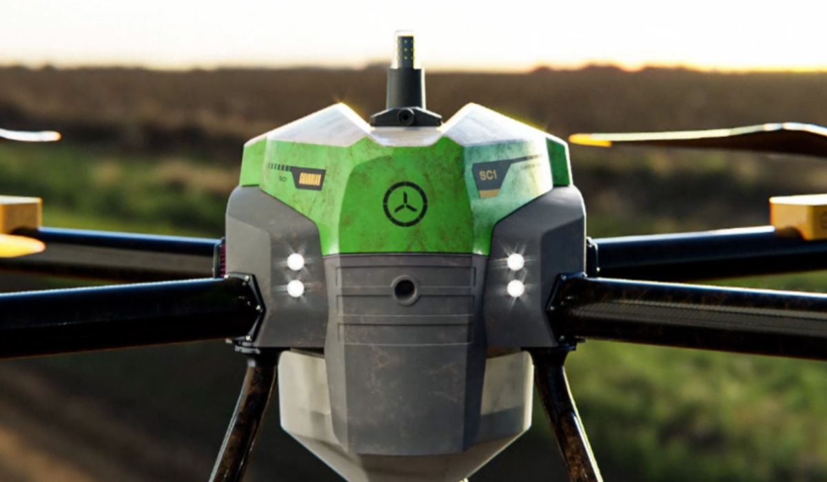 SC1 Drone | Credit: Guardian
The Guardian SC1, proudly designed and built in the USA, is engineered specifically for farming. It’s a professional-grade machine crafted from high-performance carbon fiber and aerospace-grade aluminum, offering durability and long-term value. With lower pesticide use, reduced costs, and a smaller environmental footprint, the SC1 sets a new standard for advanced agricultural technology.
19. Flyby Robotics
- Headquarters: Los Angeles, California
- Founders: Jason Lu and Cat Orman
- Founded in: 2020
- Category: ISR, Photogrammetry, Mapping
- Website: https://www.flybyrobotics.com/
Flyby Robotics is a rising player in the American drone market, known for building developer-friendly UAVs. The company focuses on building drones with strong onboard computing power, allowing real-time edge processing and AI applications.
Flyby F-11 | Credit: Flyby Robotics
Its flagship F?11 series drones are NDAA-compliant, making them a great choice for government and enterprise clients. These drones feature both top and bottom payload mounting options, giving operators flexibility for sensors, cameras, and mission-specific equipment.
Flyby drones are commonly used for ISR (Intelligence, Surveillance, and Reconnaissance), photogrammetry, and mapping applications. Increasingly, these missions are enhanced with machine learning(ML) capabilities, which allow drones to process and analyze data in real-time.
The company’s approach combines secure, flexible hardware with developer tools that make integration and customization easy.
20. Vantage Robotics
- Headquarters: San Leandro, California, USA
- Founders: Tobin Fisher and Joe van Niekerk
- Founded in: 2013
- Category: ISR, Surveillance, Tactical Operations
- Website: https://vantagerobotics.com/
Vantage Robotics is best known for its rugged, field-ready drones built for surveillance and ISR missions. Its flagship product, Vesper, carries a tri-sensor stabilized payload that delivers high-quality imagery, even in low light.
Vesper UAS | Credit: Vantage Robotics
The company also makes the Trace, a small and affordable nano-drone designed for tactical reconnaissance. These compact systems are lightweight, easy to deploy, and built for real-world field conditions.
Vantage Robotics focuses on reliability and simplicity, making its drones a trusted option for first responders, security teams, and defense agencies.
21. Ascent AeroSystems
- Headquarters: Wilmington, Massachusetts, USA
- Founders: Peter Fuchs, Jonathan Meringer, and Nathaniel Meringer
- Founded in: 2014
- Category: Industrial, Public Safety, Military Operations
- Website: https://ascentaerosystems.com/
Ascent AeroSystems specializes in building compact, rugged, and weather-resistant coaxial-rotor drones. Its Spirit and Spartan models are known for their cylindrical design that makes them quick to deploy and easy to carry. These drones excel in challenging environments, providing stable flight even in windy, rainy, and dusty conditions.
Ascent Spirit UAV | Credit: Ascent AeroSystems
Ascent AeroSystems serves industries such as public safety, defense, and industrial inspection, where reliability and rapid deployment are essential. The company focuses on durable, high-performance drones to meet the needs of field operators.
In April 2024, Ascent was acquired by Robinson Helicopter Company (RHC) of Torrance, California. RHC is a leading aerospace manufacturer with over 50 years of FAA-certified experience and has built over 14,000 aircraft worldwide.
22. ACSL Inc.
- Headquarters: Edogawa-ku, Tokyo
- Founders: ACSL Ltd. with Cynthia Huang as Board director
- Founded in: 2013
- Category: Infrastructure Inspection, Disaster Response, Public Safety
- Website: https://acsl-usa.com/
ACSL is a Japanese drone manufacturer that focuses on developing secure, NDAA-compliant UAVs for critical operations. Its flagship model, SOTEN, features a swappable camera system that supports thermal, zoom, and wide-angle imaging.
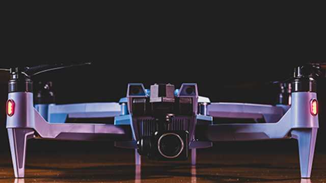
SOTEN | Credit: ACSL Inc.
To serve the U.S. market, the company established ACSL Inc., a subsidiary incorporated in California in January 2023. Through this expansion, ACSL aims to bridge the needs of American commercial drone users with Japan’s growing ecosystem of advanced drone technologies.
The company’s primary focus is on building drones for infrastructure inspection, disaster response, and public safety missions.
ACSL prioritizes cybersecurity and data protection. It offers solutions for government and enterprise clients that need secure operations and continues to invest in R&D.
This shows ACSL’s strong commitment to building next-generation drones for industrial and emergency applications.
23. Censys Technologies
- Headquarters: Daytona Beach, Florida, USA
- Founded in: 2017
- Category: Mapping, Inspection, BVLOS Operations
- Website: https://censystech.com/
Censys builds long-range, fixed-wing VTOL drones designed for BVLOS (Beyond Visual Line of Sight) operations. Its Sentaero series combines vertical takeoff with efficient forward flight, offering extended endurance and large-area coverage.
Sentaero 5 | Credit: Censys Technologies
The hardware really shines when paired with their CensWise Platform. This software handles flight planning, ensures regulatory compliance, and processes all the data the drones collect.
Censys is well-known for securing FAA waivers for complex operations, making it a leader in BVLOS compliance and operations.
24. Hylio
- Headquarters: Texas, USA
- Founders: Arthur Erickson, Nikhil Dixit, and Mike Oda
- Founded in: 2015
- Category: Agriculture, Precision Spraying
- Website: https://www.hyl.io/
Hylio creates large agricultural spraying drones designed to make precision farming easy and scalable. Its ARES series drones can carry large payloads, making them ideal for large-scale farming operations.
Hylio AG-272 | Credit: Hylio
Its AgroSol GCS software simplifies mission planning and automates spraying operations. It lets farmers draw field maps, set spray parameters, and run fully autonomous missions in one smooth workflow. This combination of hardware and software helps farmers reduce chemical use and boost farm efficiency.
Hylio is committed to making advanced precision agriculture tools accessible and user-friendly, empowering farmers to boost yield and efficiency.
25. Anduril Industries
- Headquarters: Costa Mesa, California, USA
- Founders: Palmer Luckey and Trae Stephens
- Founded in: 2017
- Category: ISR, Defense, Border Security
- Website: https://www.anduril.com/
Anduril Industries develops a wide range of advanced autonomous drone systems for defense and security. Its air systems include the Ghost and Altius platforms, which are used for ISR and defense missions.
Altius| Credit: Anduril Industries
Ghost drones are multirotors, best for short-range surveillance and quick reconnaissance missions. They are quiet, easy to deploy, and can carry different sensors. On the other hand, the Altius drones are fixed-wing drones, built for long-range missions where endurance and coverage matter.
A distinguishing feature of Anduril’s systems is their integration with Lattice OS, their own mission control software. Lattice enables operators to control multiple drones simultaneously and process real-time sensor data. It also allows drones to run autonomous missions with minimal manual control.
By combining strong hardware with this advanced software, Anduril provides a complete system. This helps government agencies monitor borders, protect infrastructure, and respond quickly to threats.
Let’s uncover the best software companies in the next part.
B. Drone Software Companies
The businesses that focus on developing software technology and systems that control, manage, and enhance the functionality of unmanned aerial vehicles (UAVs) or drones are defined as drone hardware companies.
The following are the best drone software companies:
1. Airspace Link
- Headquarters: Detroit, Michigan, USA
- Founders: Michael Healander, Ana Healander, and Daniel Bradshaw
- Founded in: 2018
- Category: Software solutions for drone operations and airspace management
- Website: https://airspacelink.com/
Airspace Link focuses on enabling the safe integration of drones into national airspace and communities through its AirHub platform—a low-altitude digital infrastructure.
Their mission is to enhance public safety and advance social equity, the environment, and the economy via drone technology. The team brings expertise to their platform and helps with things like flight planning, obtaining airspace authorizations (LAANC), managing drone fleets, and engaging with communities.
2. AgEagle Aerial Sys
- Headquarters: Wichita, Kansas, USA
- Founders: Bret Chilcott
- Founded in: 2012
- Category: Energy, Construction, Agriculture, and Public Safety
- Website: https://www.ageagle.com//
AgEagle Aerial Sys is a globally recognized UAV industry pioneer that offers a unified line of high-performance flight hardware, sensors, and software.
eBee TAC | Credit: AgEagle
AgEagle drones are equipped with advanced imaging systems, ensuring high accuracy in data capture. They also offer real-time data processing capabilities. These features make AgEagle drones highly effective for precision agriculture and crop management tasks.
These drones serve a wide range of industries, including agriculture, environmental conservation, and sustainability.
AgEagle Aerial Systems has formed notable partnerships and collaborations to strengthen its position in the drone industry. One notable collaboration is with Agribotix, focusing on precision agriculture through advanced drone technology. This partnership aims to provide valuable aerial imagery and data analytics for improved crop management.
Additionally, AgEagle has worked with the Kansas Department of Transportation to deploy drone solutions for infrastructure inspections and other transportation-related applications.
3. Trimble
- Headquarters: Westminster, Colorado, U.S.
- Founders: Charlie Trimble
- Founded in: 1978
- Category: Agriculture, Construction, Government, Transportation
- Website: https://www.trimble.com/en
Trimble is a company that focuses on industrial technology. Their goal is to help improve how things work in the world.
 Credit: Trimble
Trimble’s drones are widely used for capturing geospatial data and supporting applications such as reality capture, asset management, and monitoring.
Trimble’s partnerships, such as the one with DroneDeploy, focus on boosting the accuracy of drone positioning systems. These collaborations aim to streamline workflows, which is particularly important for projects that demand precise data collection and analysis.
The company integrates its drone technology with robust data analysis platforms, which enhance the operational efficiency of industries like construction, agriculture, and infrastructure.
4. Bentley Systems
- Headquarters: Exton, Pennsylvania
- Founders: Keith Bentley and Barry Bentley
- Founded in: 1984
- Category: Infrastructure Software
- Website: https://www.bentley.com/
Bentley Systems is a prominent company specializing in software solutions that integrate with drone technology for various applications. This company caters to customers in the fields of infrastructure design, construction, and urban planning. Bentley Systems has emerged as a global leader in providing innovative technologies to improve the efficiency and effectiveness of infrastructure projects.

Bentley Pointools | Credit: Bentley Systems
Bentley Systems offers a comprehensive suite of software products that cater to the needs of various industries, including architecture, engineering, construction, and operations. The company’s software solutions enable professionals to design, analyze, visualize, and simulate infrastructure projects. The software incorporates advanced technologies like drones, reality modeling, and artificial intelligence to offer professionals a unique experience.
You can combine drone imagery with their software’s capabilities to gain accurate geospatial information and enhance decision-making during every phase of infrastructure projects.
The company’s commitment to advancing digital workflows and intelligent infrastructure solutions has positioned Bentley Systems as a trusted partner for organizations worldwide.
Bentley Systems empowers the infrastructure industry with cutting-edge technology, driving innovation and improving the way projects are planned, designed, and operated.
5. Pix4D
- Headquarters: Prilly, Switzerland
- Founders: Dr. Christoph Strecha
- Founded in: 2011
- Category: Surveying & Mapping
- Website: https://www.pix4d.com/
Pix4D is a renowned drone company that specializes in developing cutting-edge photogrammetry software for aerial mapping and surveying purposes.
Pix4D has revolutionized the way professionals and industries capture, process, and analyze geospatial data using drones.
Pix4D is a global leader in the drone mapping industry. The company’s software allows users to transform images captured by drones into accurate and detailed 3D models, orthomosaics, and point clouds.
These outputs are used in various sectors, including agriculture, construction, mining, surveying, and environmental conservation.
6. DroneDeploy
- Headquarters: San Francisco, California
- Founders: Mike Winn, Jono Millin, and Nicholas Pilkington
- Founded in: 2013
- Category: Data Analysis, Mapping
- Website: https://www.dronedeploy.com/
DroneDeploy is a leading provider of cloud-based software solutions for drone mapping and aerial data analysis.
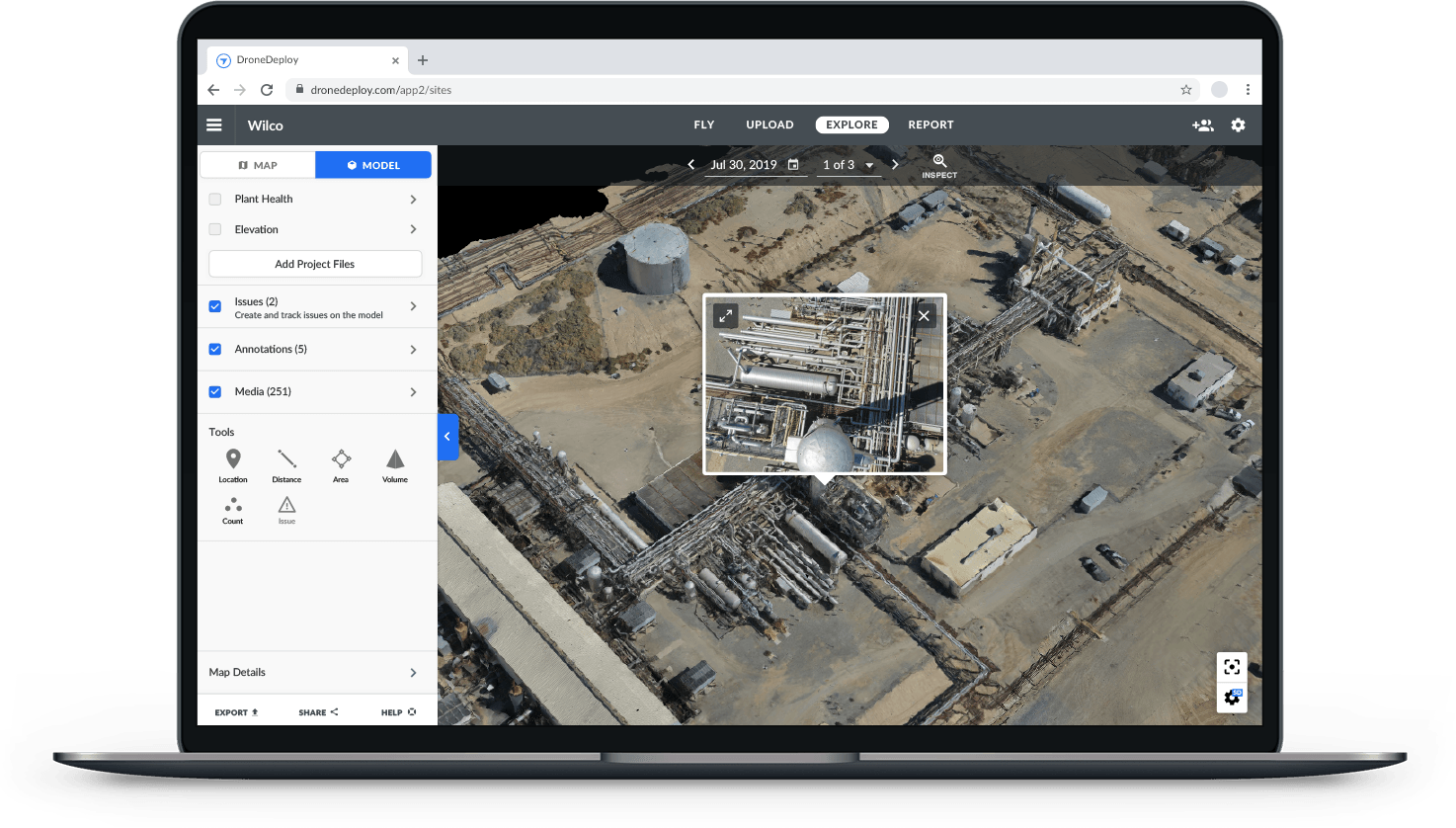 DroneDeploy Mapping Software
DroneDeploy offers a comprehensive platform that enables users to plan, capture, and analyze aerial data using drones, robots, and 360 cameras. Their software utilizes advanced image processing algorithms and machine learning techniques to create high-resolution maps, 3D models, and real-time insights.
These capabilities find applications in industries such as agriculture, construction, mining, inspection, and insurance.
7. Propeller
- Headquarters: Sydney, Australia,
- Founders: Rory San Miguel and Francis Vierboom
- Founded in: 2014
- Category: GIS, 3D mapping, and photogrammetry
- Website: https://www.propelleraero.com/
Propeller Aero is an innovative drone technology company that focuses on providing end-to-end solutions for aerial data collection and analysis in the construction and mining industries.
Propeller offers a combination of hardware and software solutions that enable easy drone data collection, cloud-based processing, and actionable analytics. Their platform allows construction and mining professionals to visualize, measure, and compare site progress, track inventory, and perform volumetric calculations.
Propeller empowers its clients to make informed decisions, mitigate risks, and streamline their operations by utilizing accurate and up-to-date aerial data.
8. ESRI
- Headquarters: Redlands, California
- Founders: Jack Dangermond and Laura Dangermond
- Founded in: 1969
- Category: Data Management, GIS, Mapping
- Website: https://www.esri.com/en-us/home
ESRI is the driving force behind ArcGIS, a world-renowned mapping software. ArcGIS seamlessly connects people with maps, data, and apps through geographic information systems (GIS). It is a versatile location platform accessible to individuals and organizations worldwide.
![]()
From Fortune 500 companies to governments and startups, Esri’s software empowers diverse industries to leverage geospatial information for informed decision-making.
ESRI (Environmental Systems Research Institute) is a renowned company that specializes in developing geographic information systems (GIS) software and solutions for drones.
The company has established itself as a global leader in the field of spatial analytics.
It offers a wide range of software products and tools that enable organizations to effectively capture, analyze, and visualize geospatial data. Their solutions are used for various applications in industries, including government, urban planning, natural resource management, transportation, and emergency response.
ESRI’s GIS software integrates seamlessly with drones, allowing users to collect high-quality aerial imagery and combine it with other geospatial data layers. Through its powerful software, Esri helps organizations manage drone imagery, streamline workflows, and perform complex analyses.
9. Maps Made Easy
- Headquarters: San Diego, California, United States
- Team Members: Tudor Thomas, Dylan Shackelford
- Founded in: 2014
- Category: 3-D Model, Data Collection, Mapping
- Website: https://www.mapsmadeeasy.com/
Maps Made Easy is primarily focused on providing user-friendly mapping solutions for both individuals and businesses. It has revolutionized the world of drone mapping with cutting-edge software. Designed specifically for drone pilots, their powerful mapping solution enables users to create accurate, high-resolution maps.
![]()
With features like 3D stitching, stockpile volume measurement, and web-based georeferencing, Maps Made Easy empowers drone pilots to unlock the full potential of aerial imagery and take their mapping projects to new heights.
The company aims to simplify the process of aerial mapping and data analysis by providing user-friendly tools and streamlined workflows. These features allow efficient image processing, accurate geospatial insights, and seamless integration with various platforms and applications.
It provides a cloud platform that lets users plan drone flights, capture aerial images, and turn the data into clear maps and 3D models.
Maps Made Easy’s platform employs advanced algorithms to stitch together overlapping images captured by drones to generate accurate and detailed maps. These maps can be further used for visualization, measurement, and analysis.
10. VOTIX
- Headquarters: Syracuse, New York, United States
- Founders: Edwin Sanchez, Eduardo Boucas, Daniel Echeverri
- Founded in: 2022
- Category: Drone automation, Orchestration, and Remote operation
- Website: https://votix.com/
VOTIX is an American drone software company that has built a game-changing platform for complete drone automation, orchestration, and remote operation. It’s hardware-agnostic, meaning it works seamlessly with any drone.
The VOTIX platform simplifies the entire drone ecosystem, connecting all the moving parts and making operations easier and fully scalable. It supports a wide range of applications, including inspections, surveillance, mapping, deliveries, emergency response, and more. VOTIX is designed for advanced operations like Beyond Visual Line of Sight (BVLOS) and Drone-in-a-Box (DIB) solutions, pushing the boundaries of what drones can achieve.
11. Airdata
- Headquarters: El Dorado Hills, California, United States
- Founder: Eran Steiner
- Founded in: 2015
- Category: Drone fleet data management
- Website: https://airdata.com/
AirData is the drone fleet data management and real-time flight streaming.. It offers a comprehensive solution for drone fleet operations, catering to businesses of all sizes.
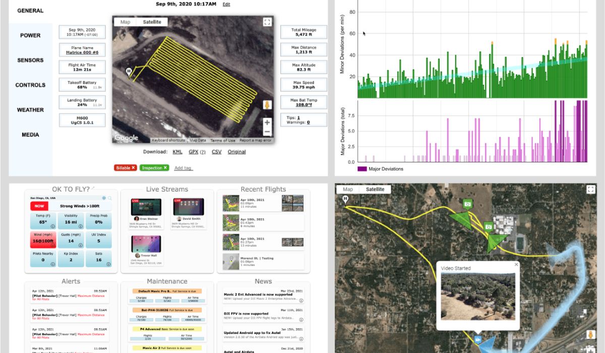 Credit: AirData
With extensive expertise in cloud virtualization, data automation, and advanced analytics, AirData simplifies operations with features like automatic data capture, live streaming, and end-to-end compliance. It enhances safety with crash prevention tools, risk mitigation, and maintenance tracking, while also supporting mission planning and managing pilot skills and certifications. AirData streamlines drone fleet management for safer and more efficient operations.
With these companies leading the way, let’s take a look at how drones are impacting different industries.
Drone Companies Revolutionizing the Global Market
According to the Drone Market Report, the global drone market is projected to reach $42.8 billion by 2025, growing at a CAGR of 13.8%.
The drone industry has experienced remarkable growth in recent years, and this growth is expected to continue.
So if you are associated with the drone industry in any capacity, there’s good reason to feel optimistic about its growth and potential future.
Several factors have contributed to this growth:
- Technological advancements in sensors, batteries, and materials are making drones more versatile, reliable, and efficient.
- Expanding applications of drones across industries, such as agriculture, construction, logistics, and mining, have also driven growth.
- The growing demand for different types of drones, such as fixed-wing drones, rotary-wing drones, and hybrid drones, among others, has also contributed to the industry’s growth.
The drone industry is set for a bright future. Advances in artificial intelligence (AI), machine learning (ML), and computer vision are increasingly integrated into drones. These technologies improve drone efficiency and expand their capabilities.
At the same time, the development of regulations and guidelines ensures safe and responsible drone use, opening new opportunities for drones in a variety of industries.
Here is an industry-wise breakdown of the estimated global drone market size in 2025.
| Industry | Estimated Global Drone Market Size in 2025 |
| Construction | USD 7.91 Billion |
| Agriculture | USD 3.36 Million |
| Logistics | USD 2.1 Billion |
| Energy | USD 148 Million |
| Real Estate | USD 398 Million |
| Military Technology | USD 15.88 Billion |
| Medical | USD 1.73 Billion |
| Utilities | USD 1.86 billion |
Frequently Asked Questions
1. How does the drone manufacturers’ market differ in different regions?
The drone market differs in various regions, and these differences can be classified into three main regions: Asia-Pacific, the Middle East and Africa (MEA), and Latin America.
- Asia-Pacific: This region is home to some of the top drone manufacturers, operators, and service providers in the world. The drone industry is growing rapidly here, and there are numerous companies to choose from.
- MEA: The use of drones in the MEA region has increased substantially in recent years, with businesses, individuals, and governments recognizing the potential of drones to revolutionize various industries. The region presents boundless opportunities for the drone market, and there is a growing demand for drone-related services.
- Latin America: This region is quickly emerging as one of the fastest-growing drone markets globally, with increasing demand from a range of industries, including agriculture, mining, and construction. The top drone manufacturers in Latin America are leading the way in innovation and catering to the needs of their customers.
Each region has its unique strengths and opportunities for growth, and the demand for drone-related services is increasing across all industries.
2. What are the safety regulations for drone operations?
When operating a drone, it is crucial to adhere to safety regulations to prevent harm to people and property. To ensure safe and responsible drone operations, drone operators must follow certain drone regulations.
3. What drone services are available?
There are many small drone service companies in the US, with single drone pilots offering services to clients. In addition, there are large marketplaces where drone pilots can find work, serving as a one-stop shop for clients.
Here are some of the drone services available in the market:
- Aerial inspection, surveying, and mapping services
- Aerial photography & Videography
- Customized drone solutions for agriculture, mining, and construction industries
- Drone delivery services for last-mile deliveries
- Industrial inspection services
- Surveillance operations
- Exploration and mining operations
- High-resolution imagery and data collection services
4. How do drone companies make money?
Drone companies make money through various revenue streams, including:
- Drone Sales: Selling consumer, industrial, and commercial drones.
- Software & Services: Offering subscription-based tools for mapping, surveying, and analytics.
- Data Collection: Providing aerial surveys and data insights for industries like agriculture and construction.
- Repairs & Maintenance: Servicing and upgrading drones.
- Leasing: Renting drones for short or long-term use.
- Training: Running programs to certify drone operators.
- Consulting: Helping businesses integrate drone technology.
- Accessories: Selling add-ons like batteries and cameras.
The companies can generate revenue through a combination of direct sales, services, and ongoing support. Explore our guide on the best drone business ideas to know more.


More on Hot Topics